16-19 Aug 2025
Fortunately the weather was dry and sunny. Even more fortunately, there wasn’t much wind. We boarded the passenger ferry at Arisaig; our luggage was stowed under cover and we sat in the stern, exposed to the elements. Most of the passengers appeared to be day visitors, a few with dogs, but we had booked to stay on the island for three nights.

We enjoyed excellent views and were excited to see many seals on the rocks in addition to a few cormorants and shearwaters as we sailed out of the harbour area.

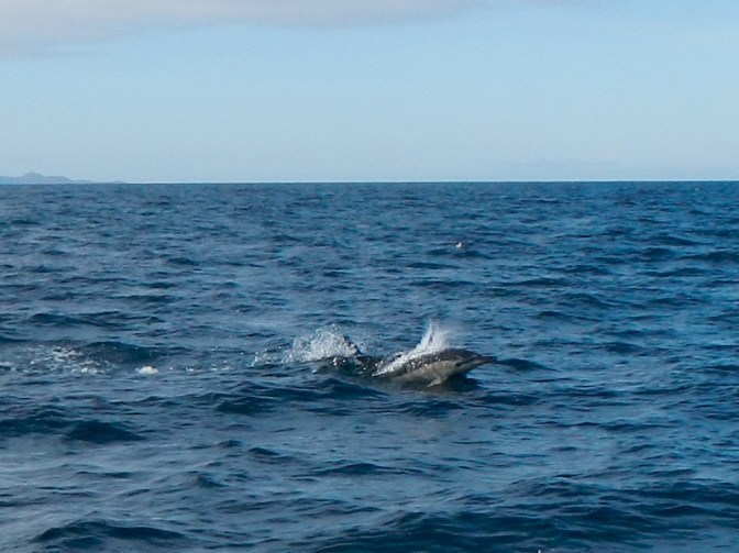
However, as we crossed the open water, there was great excitement. First one dolphin was spotted but soon there were dolphins appearing on both sides of the boat.
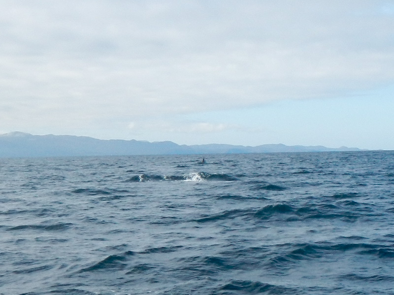
It wasn’t long before there was another shout – someone had spotted a minke whale! I managed to point my camera in the right direction as I saw a huge uneven patch of water. my photo when magnified, appears to show the dorsal fin of a killer whale as well! I wasn’t on the best side of the boat to get an unobstructed view as many people stood up and I only had a fleeting glimpse before my view was obscured.
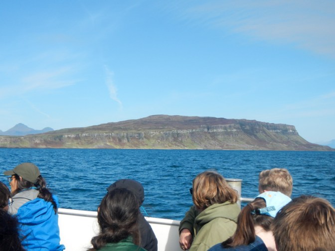
Eventually we saw the long line of cliffs on Eigg and the small harbour with slipway near the south end .
Dougal was looking after our accommodation at Eigg Organics while the owner, Sue, was away off the island. He met us on the slipway and we gave him our large bags to be transported in the pick-up to our booked bothy. We just carried our small day rucksacks and decided to take our time walking up to Eigg Organics at Cleadale on the north of the island.
There was lots of food available in the well-stocked shop, so we hadn’t really needed to bring all that we had from the mainland. In the same modern building there was also a gift shop and a café; of course we had to have coffee and cake before we started walking.
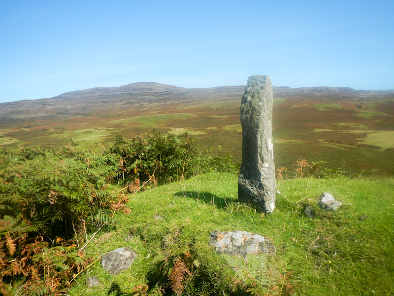
We passed a standing stone, proudly commemorating the purchase of the island by the community in 1997.
We turned off the “main” road and walked past a grand building; The Lodge built by the owner of the island in 1927 is now an eco centre offering education, accommodation and outdoor courses with an emphasis on sustainability and the environment. Actually the entire island population attempts to follow eco-friendly practices – in 2008, it was the World’s first community to launch an off-grid electric system powered by just wind, water and the sun.

Soon we were back on the “main” road. However the only people with vehicles on the island are residents, tradespeople and blue badge holders so there isn’t much traffic to worry about.
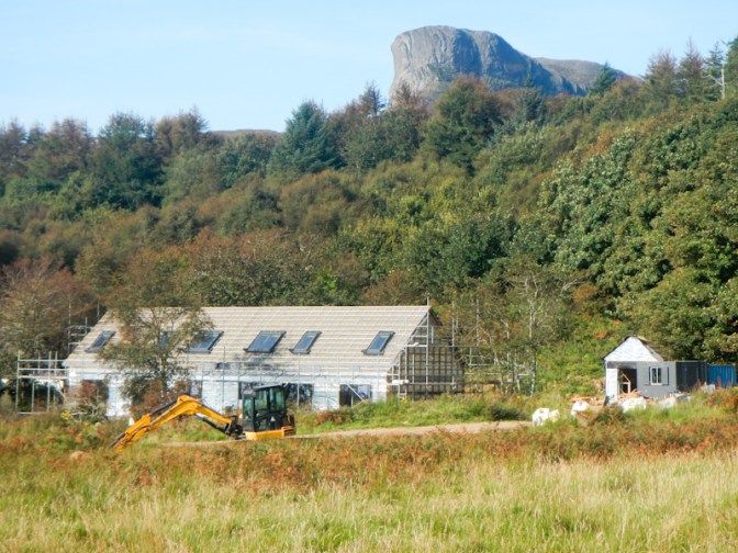
We passed the island health centre, noting that there is building work adjacent to it. This will be rented eco-friendly housing for people already resident on Eigg and in need of adequate living accommodation.
Our next stop was the Church of Scotland Church featuring an exhibition outlining the history of crofting on Eigg including explanations about the clearances.
We passed the small island primary school.
We reached a building housing an exhibition for visitors. This included information on the history of the ownership of Eigg including some potential purchases that didn’t complete. At one stage Pavarotti was looking at buying the island and transforming it into a centre of excellence for education of singers. There was also information about wildlife that might be seen both on the island and in the surrounding sea as well as displays of various artefacts from Eigg.
We popped into the brewery as it had just opened and bought a couple of cans of local beer for later. We also found out that there would be a barbecue there the following evening.
Our slow progress continued as we walked uphill to the appropriately named “Rest and be thankful”. This was an open air café, purveying coffee / tea and cakes in return for donations as well as selling tubs of homemade ice cream at a fixed price. Charlie, the husband of the lady running the café is the island taxi driver; we had been passed earlier by a rickety looking minibus which was the said taxi.
It wasn’t far from there to Eigg Organics. We soon unpacked and settled into the bothy.

I was keen to continue exploring the island as soon as possible.
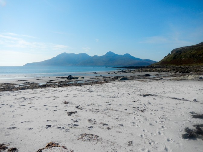
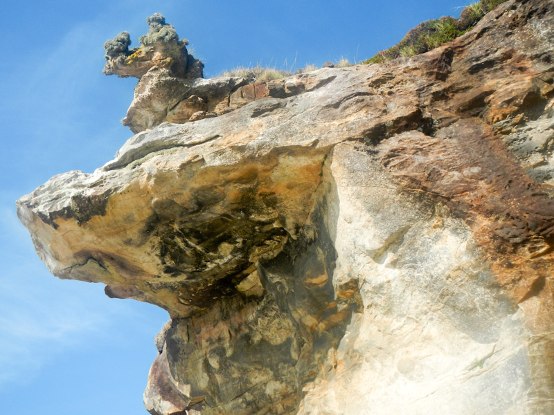
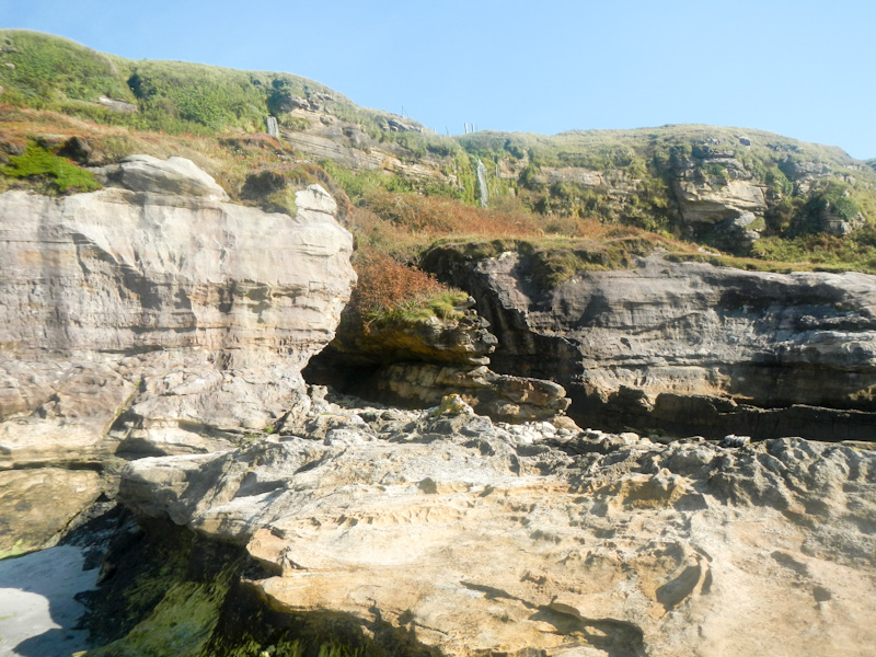
We walked through fields and along tracks to reach Singing Sands, where there were just two people swimming and a deserted beach. We explored rock pools, sandstone slabs, beach caves and the intricate shapes of rocks carved out by the tide. Waterfalls plunged over cliffs to the sands below. We could see the larger and more mountainous island of Rum across the sound.
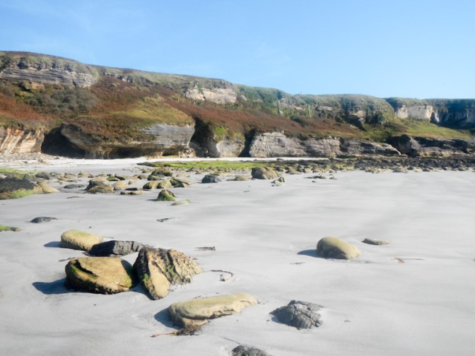
Singing Sands? – the dry sand makes a squeaky sound which is the “singing”. It’s a natural phenomenon generated by the friction and compression of air as the grains move against each other when a person walks or wind blows over the surface. The sand grains must be uniform 0.1-0.5 mm in diameter, spherical, and contain a high percentage of silica, like quartz as well as being at a certain level of humidity.
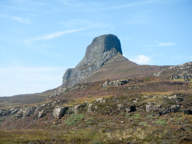
The next day was warm, sunny and dry. We had decided to walk up on to the plateau on the east side of the island. It has cliffs to its east, west and north. We could see the cliffs and the tall thin rock formation nicknamed “Finger of God” from the bothy.
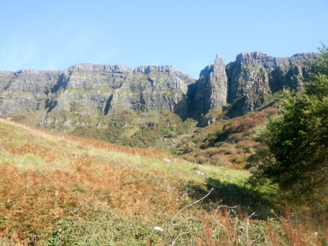
Dougal explained that if we walked down the road we would see a path under a washing line, over a stile then up the hill to the cliffs. The indistinct path continued up the steep slope and towards the cliffs. We took the wrong turning at one point but realised that the gully wasn’t the best place to go up. We retraced our steps a short way and found a path which traversed the slope before ascending further and reaching a stile.
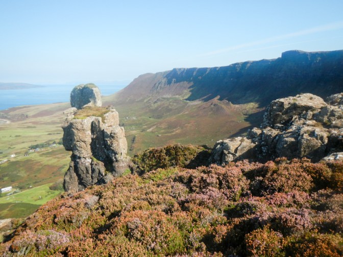
There was only a little further to ascend and we were on the plateau; the land cliff was on our left and the plateau spread to our right, ending at the sea cliffs.

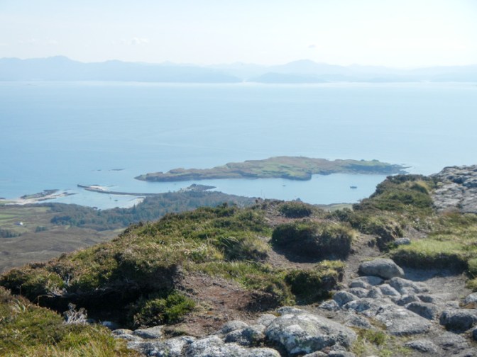
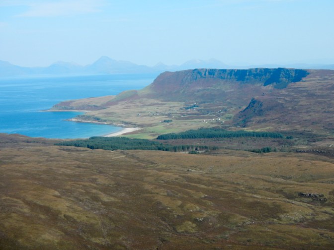
There were tremendous views down to Cleadale – houses, fields, evidence of old strip farming – and across the Sound to Rum.

We continued to walk north along the plateau, keeping close to the land cliff. There was a gradual ascent to the trig point (336m). We could see the Cuillins of Skye as well as the Knoydart peninsula and the Mallaig area ahead. Behind us were views of the rest of Eigg and, further afield, of mainland Scotland. To our left we could see Rum and the north west of Eigg.

There is a route off at this end – indeed we had seen the zig zag path the previous day when we were at Singing Sands. It seemed a long way to get down! There was some rough ground to traverse before we reached a track and then the “main” road at its north end.
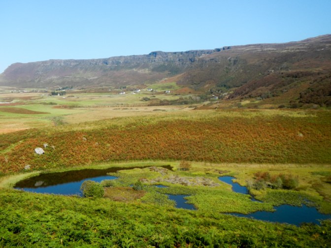
I was keen to go out again in the afternoon and explore another part of the island. My husband stayed at the bothy while I went out walking. I strolled over to the beautiful bay of Laig, where there were people swimming and children playing on the beach.

I headed inland to the small settlement at Laig. From there, I walked up hill. I passed the Giant’s Footprint -a footprint shaped lake. Folklore says that it was left by a giant who roamed the area but in fact it’s a product of ancient volcanic and ice-age activity.
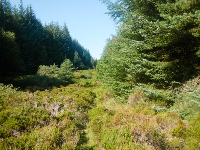
I continued through forest and over heathland on paths which were overgrown with lots of heather and bracken. A part of the forest is temperate rain forest, but it was hard to believe this in the dry conditions. The island is running a sustainable forestry project felling trees to provide firewood for the islanders and timber for export while simultaneously replanting and expanding woodland. I walked past the tree nursery set up to grow new native trees to replant where the old trees are cut down. This is helping the plans for Eigg to be carbon-neutral by 2030.
Eventually I arrived back on the main road and walked north towards Cleadale. I arrived at the brewery in plenty of time to attend the barbecue where burritos were on offer in addition to local beer. My husband met me there and we enjoyed chatting to some other visitors sharing our experiences of exploring the island.
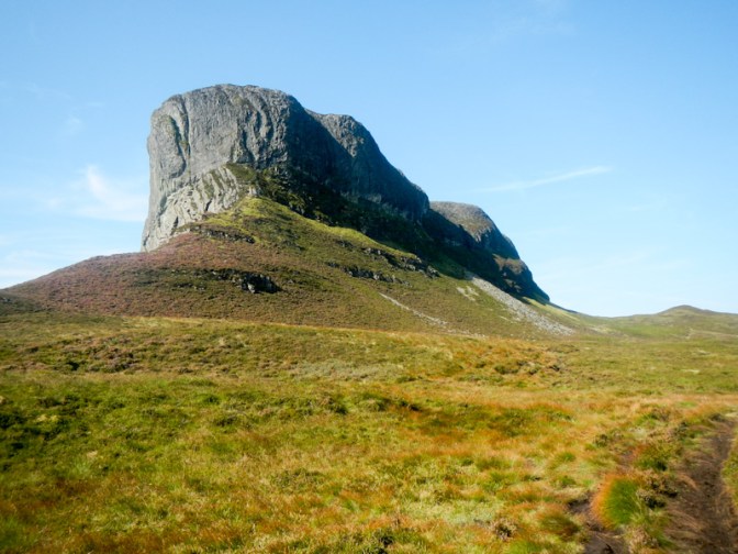
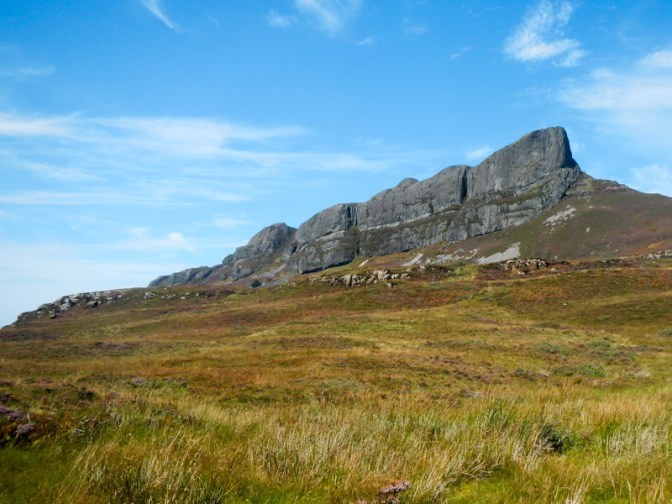
It was still warm, dry and sunny the next morning. I had decided to walk to the highest point of the island – An Sgurr – formed in a volcanic eruption 58 million years ago. This is the largest pitch stone ridge in Britain. Sheer cliffs of black stone tower from the moor; on approaching from the east the summit doesn’t look attainable except by rock climbers. However there is a route up by circumnavigating the summit to the north and west before following a path up more gradually ascending rock and grass to the highest point (394m).

As I approached the summit, I overtook a mother with her two daughters. They were from the Yorkshire Wolds but have visited Eigg regularly and now know many of the residents. It was warm enough for us to sit at the summit to eat lunch. Close to the summit are the remains of an Iron Age hill fort.
I left the summit first as I had more plans for the afternoon. I enjoyed fine views on the descent. As I followed the path having descended from the rocky section, I met several walkers ascending. They seemed surprised that I had already reached the summit – I realised later that they were probably day visitors who had arrived on the Shearwater from Arisaig and set off immediately to climb An Sgurr which was why a few groups were quite near to each other. Staying on the island, I had started walking much earlier.
I reached the track and turned right (west) below the south face of An Sgurr.
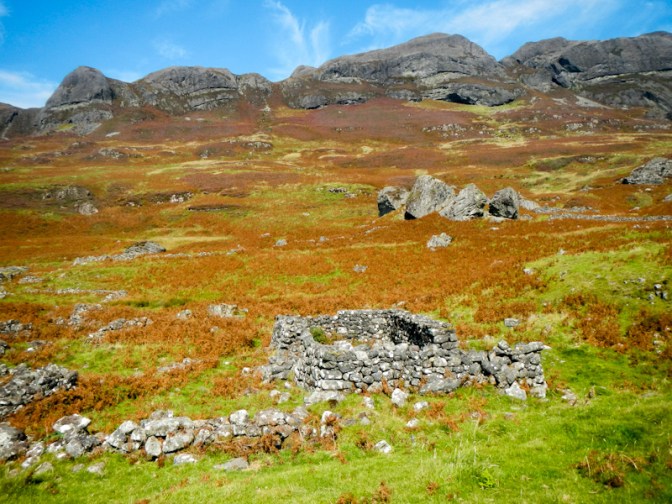
I reached Grulin Bothy and the extensive ruined crofting settlement.
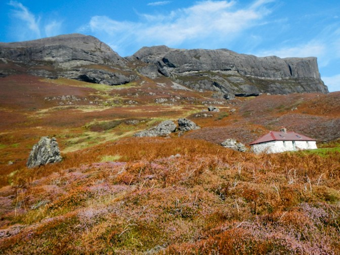
Historic Environment Scotland states that the visible remains comprise at least forty-two buildings, a kiln barn, a corn-drying kiln, three small huts, a well and several enclosures: https://www.trove.scot/place/22191.
I walked further to some field enclosures. I would have been keen to extend my walk around the coast, but I wanted to explore some caves nearer the ferry terminal.
I met a lady who had just descended to the south from An Sgurr. That would have been much less further to walk than my route but she explained that it had been an ankle wrenching descent and had taken a lot of time as there wasn’t a path. Perhaps my route had been quicker despite being longer. Like the three I had met near the summit she was from Yorkshire (but the Dales rather than the Wolds), and had visited Eigg on many occasions bringing secondary school children to Eigg Organics campsite and bothy in her professional capacity as a teacher. We walked together and parted where she had a bike stashed further down the track.
I took the turning for the caves.
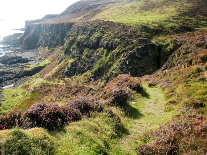
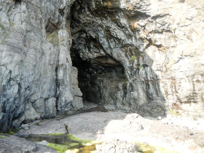
The tide was fairly low and still going out. The access to the Cathedral Cave was straightforward as the rocks approaching it were dry on this sunny day. In 1843 over 400 ministers left the Church of Scotland and formed the Free Church. The new Free Church ministers and congregations were not allowed to use Church of Scotland property and so services were held where there was available space – on Eigg this was in the cave.
I also went to the narrow entrance of Massacre Cave. Apparently it widens out and extends for 79 metres. I had remembered my torch and was ready to clamber in except a notice at the entrance warned of falling rocks. As I was on my own, I decided against venturing in – my Garmin Inreach wouldn’t have worked in there if I did get injured.
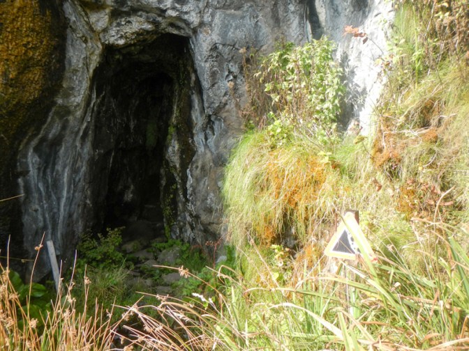
In 1577 a group of Macleods from Skye landed on Eigg seeking revenge as part of a long running feud with the Macdonalds. The entire population of Eigg hid in the cave for three days and the Macleods were unable to find them. However as they sailed away they spotted a lookout and were able to follow his footsteps in the snow which led them to the cave. The Macleods built a huge fire and the smoke killed 395 people trapped inside the cave, hence its gruesome name.
It was an easy walk from the caves to the harbour and then an hour or so of brisk walking up the road to Cleadale.
The next day we had to take the boat back to the mainland in the early afternoon. However, Dougal transported our heavy bags to the ferry leaving us only with day packs. There was time to explore one further section of Eigg. This was to visit the ruined chapel and graveyard of Kildonan. It’s named after St Donnan who established a monastery on Eigg in the 7th century.
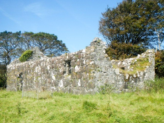
We saw an eighth century carved stone cross, the top of which is broken off at the base.

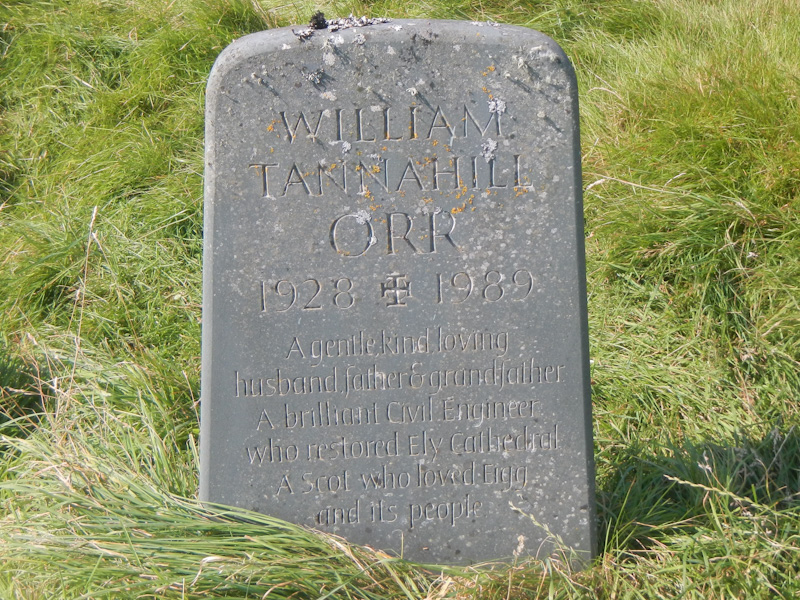
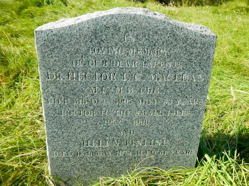
There are also some interesting gravestones.
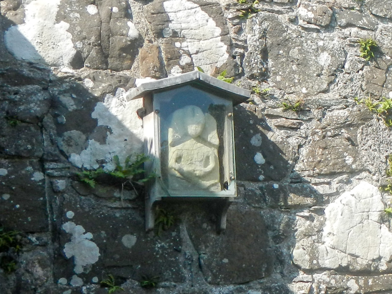
The gateway to access the chapel was locked but it was possible to see a sculpture of a figure protected by a closed glass fronted box. The significance of the figure is unconfirmed – at one stage it was thought to be a medieval fertility symbol (sheela na gig) but doubts have been raised.
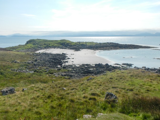
We continued past an idyllic sandy beach towards a rocky headland with Iron Age fort and to a chambered cairn.
We realised that it was time to head for the café for lunch before returning by ferry to the mainland. Our short visit to this remarkable community-owned and eco-conscious island containing so much interesting history, geology and wildlife was almost over. I wonder whether we will return – certainly many of those people staying on the island had visited previously and are drawn back year after year.

What a fascinating little island!
LikeLiked by 1 person
Definitely a good place to visit. Child friendly too.
LikeLiked by 1 person
I tthink my boys would really enjoy it from your photos. Thanks for sharing 😊
LikeLiked by 1 person
Amazing that you managed to see some dolphins.
LikeLiked by 1 person
Yes we were very fortunate and even more lucky to see whales!
LikeLiked by 1 person