7-8 August 2025
When I completed my long walk in 2013, the John O’Groats Trail hadn’t been developed. I had headed east on the Great Glen Way after reaching Fort William as there had been a lot of rain so I had been advised not to attempt my planned route across the north west Highlands as it included tricky river crossings. I reached Drumnadrochit then headed north. At times I tried to walk along the east coast, for example to the north of Golspie where there was a good path but it petered out between Brora and Helmsdale. By the time I arrived at Lybster, I was totally fed up with walking along the side and verge of trunk roads, so I struck out due north towards Watten and eventually arrived at the north coast at Huna. I didn’t want to arrive at John O’Groats from the road so I walked to Duncansby Stacks then followed the coastline past Duncansby Head.
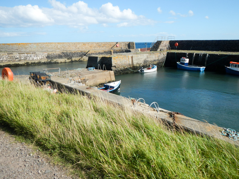
I was keen to walk at least a section of the new trail and the section from Wick (where we were staying in an apartment) to John O’Groats over two days looked attractive.
I didn’t leave the apartment on the first day until 10am as I wanted to delay reaching the River of Wester until low tide, so as to give me the best chance of fording it.
Walk Highlands suggest a walk along the road all the way to Broadhaven, omitting North Head. I did follow that route although I made a short diversion to look at North Head and that was when I realised that I could have taken a coastal path out of Wick. I’ll describe the more coastal way as I walked it in the evening to North Head and it’s a more scenic route.
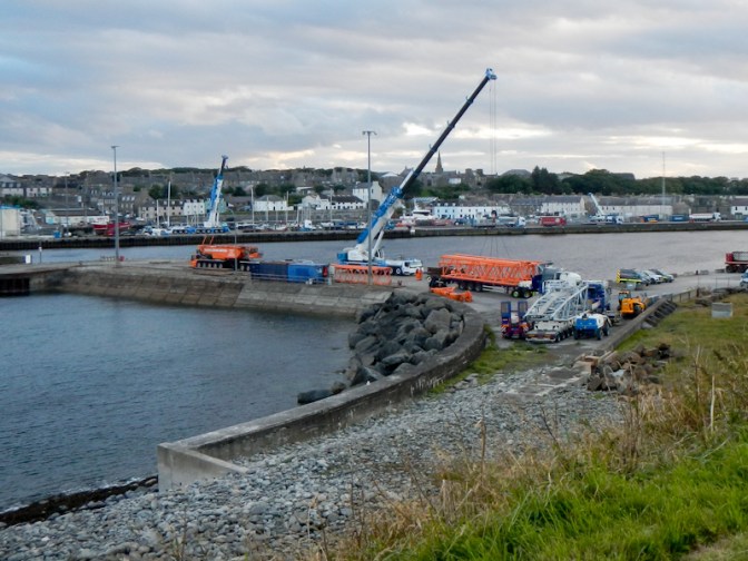
If I’d gone that way in the morning I would have seen the huge towhead destined to be transported to the Subsea 7 fabrication plant about 6.5 miles away. However by the evening it had already been moved just over a mile on the first and most difficult part of its logistically incredible journey from Wick Harbour. The youtube is definitely worth watching! https://www.youtube.com/watch?v=dSBFTZ3HkFA. By the evening the only signs left at the harbour were some of the enormous crane parts which had been used to lift the towhead on to a very large vehicle.
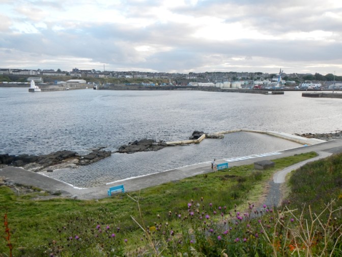
I left the road to follow a path past the North Baths salt water pool, a tidal swimming pool built in 1904 and recently restored for use by cold water swimmers.
Heading out towards North Head, I also passed some World War 2 defences, some sites of previous shipwrecks and a memorial tower commemorating nineteenth century wars including the Crimean war, Waterloo, Napoleonic and Boer Wars.


In the morning, I had arrived at Broadhaven along the minor road and then walked along the lane and the footpath (past the sewage works) as far as North Head where I enjoyed a superb view of Wick Bay.
I returned to Broadhaven for more road walking to Staxigoe as there was no path next to the cliffs. Staxigoe was an important herring fishery and port after the Highland clearances, when people moved to the area to try to rebuild their lives. It was also the largest herring salting station in Europe. The old day mark and the eighteenth century grain store where grain would have been kept prior to shipment are reminders of those times.
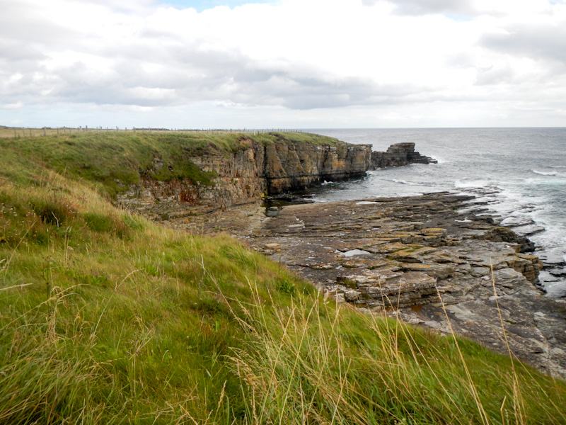
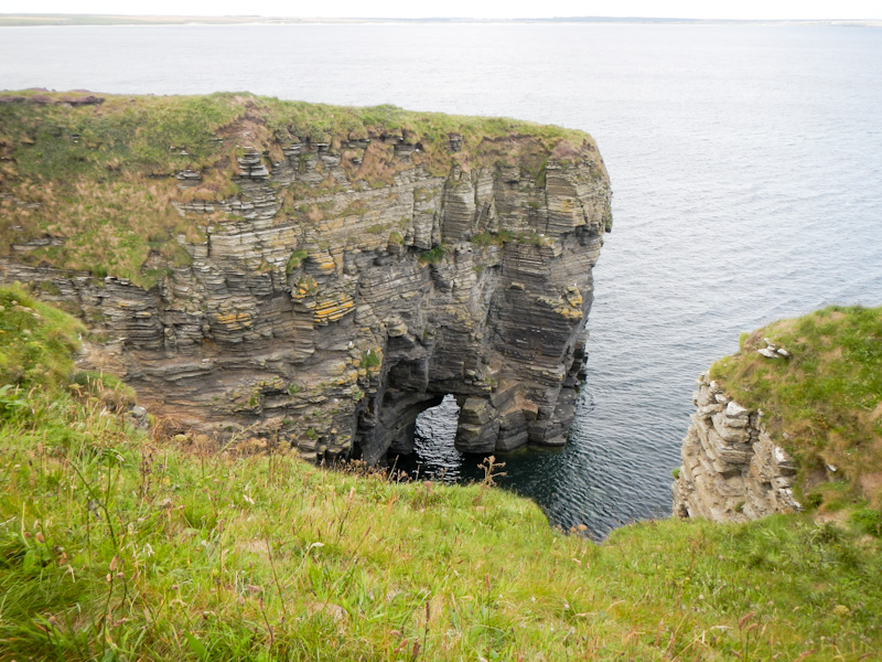
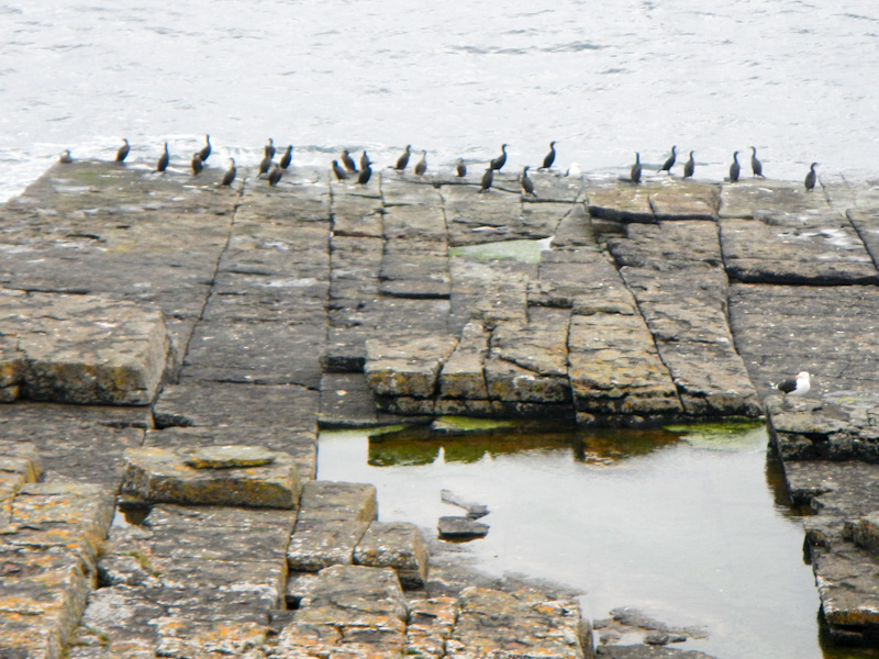
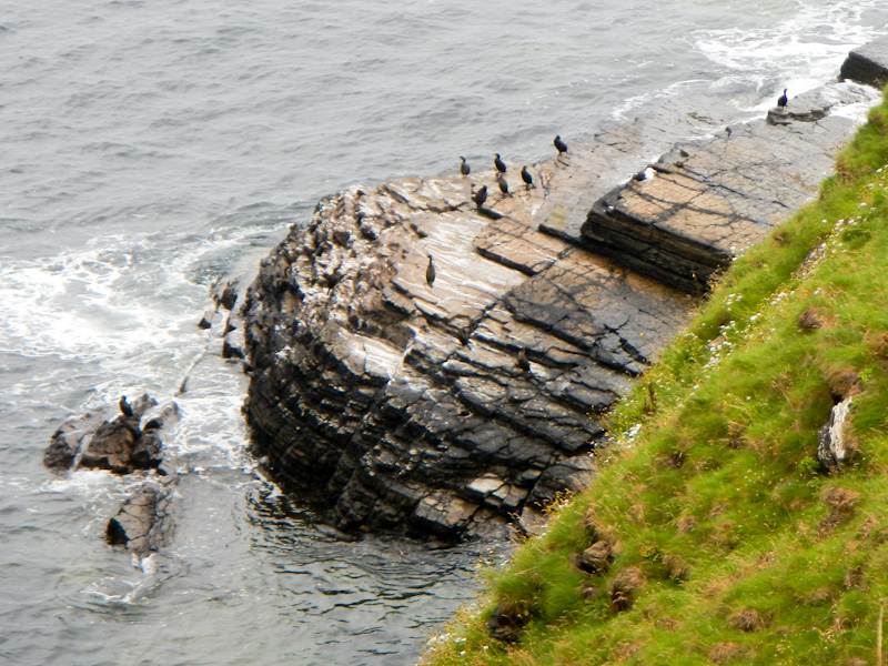
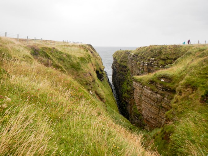
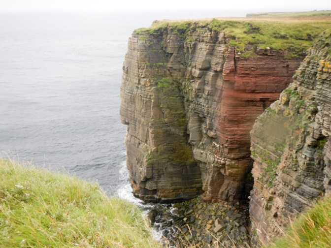
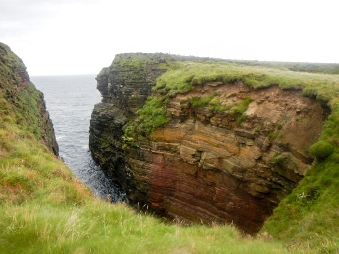
I was pleased to reach a section with cliff top footpaths past geos and stacks as well as lots of seabirds.
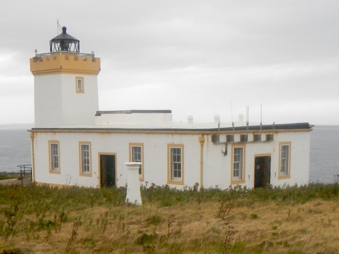
The Stevenson lighthouse at Noss Head was clearly visible.
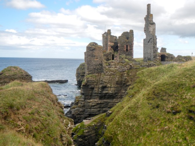
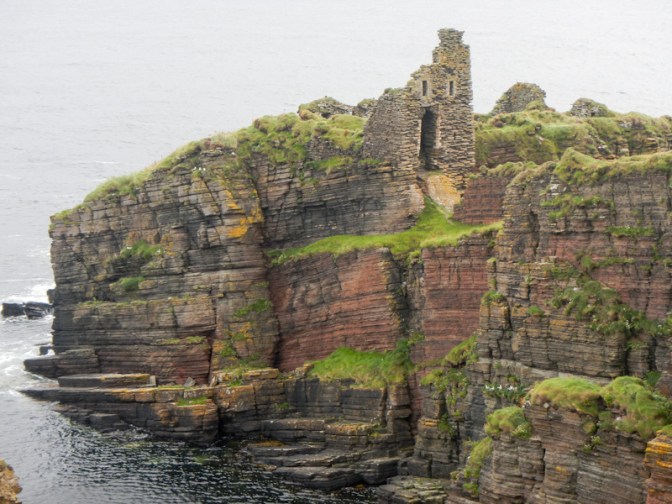
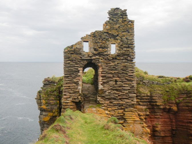
The route turned inland and I was surprised to arrive at a coffee van – so of course I had to enjoy a cup of coffee. The owner of the coffee van lives in one of the two lighthouse residences. I soon realised why it was worth his while selling coffee in what I had thought was the middle of nowhere; there was a car park on the other side of the gate just outside the lighthouse grounds and from there it was a short stroll to Castle Sinclair Girnigoe which is on the NC 500 tourist trail. I was suddenly amongst crowds.
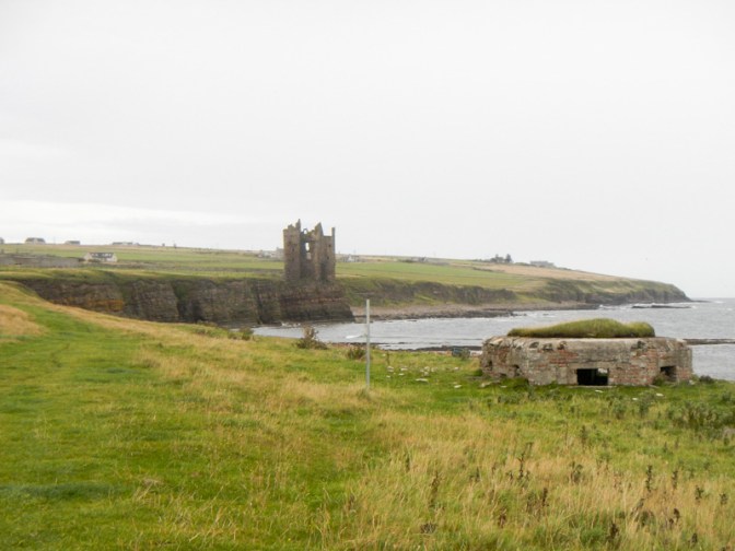
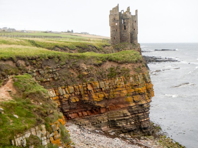
The castle ruins are spectacular, perched precariously on the cliffs. This is the only castle in Scotland to be listed by the World Monuments Fund. It’s actually two castles: Girnigoe Castle was built around the late 15th century and was the possession of William Sinclair, Earl of Orkney. Sinclair Castle was built in either 1606 or 1607. Both castles stand on the same narrow rocky peninsula that rises from 12m to 18m above sea level. It is bounded on its north and east sides by the sea and to the south by a narrow geo, giving it a strong defensive position. However, its position makes it very vulnerable to collapse secondary to cliff erosion.
Once I was west of the castle, the path was deserted again even though the coastal scenery is magnificent.

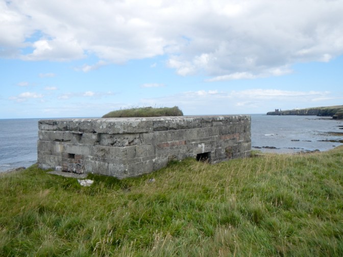
Only a few hundred metres further and I was looking at the remains of a concrete building dating from the Second World War. The bay was used as a bombing range and this quadrant shelter was one of two used to enable observers based in them to provide measurements from which calculations could be made of the aircraft crew’s accuracy in dropping the bombs on a target. This included top secret exercises to test a bouncing bomb similar to the bombs used in the Dam Buster raids and also designed by Barnes Wallis.
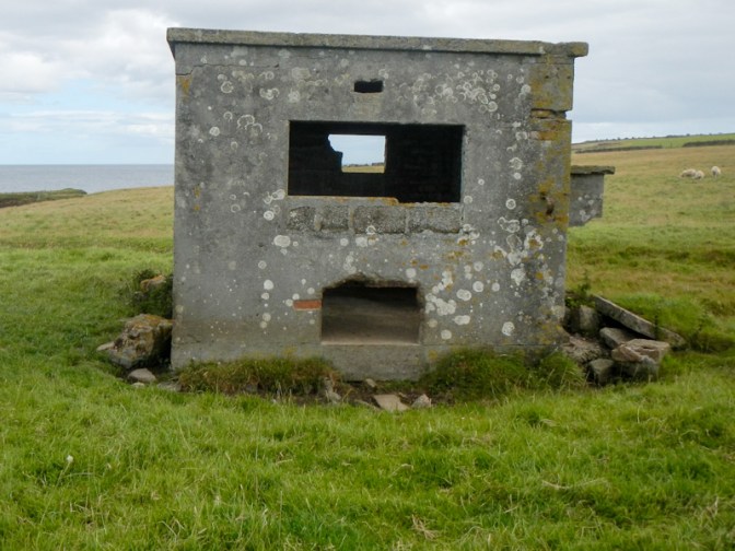
I saw a machine gun pillbox; this type of pillbox was placed every four hundred yards round Sinclair’s Bay as a defensive measure, but not around the centre section where the height of the dunes was considered a sufficient obstacle.
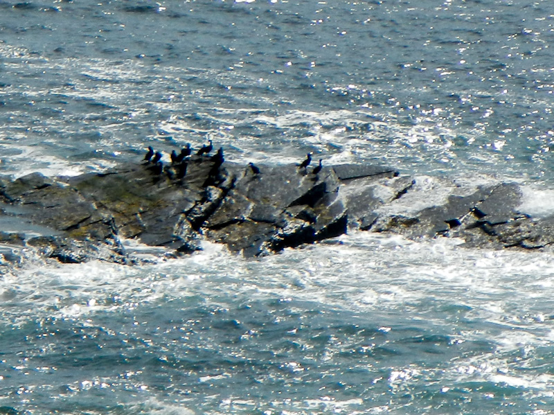
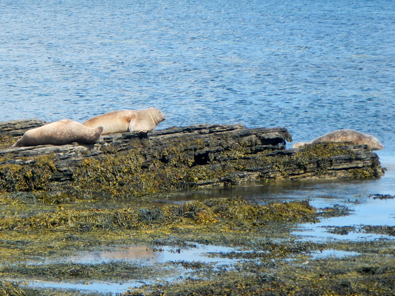
I sat near the beach to eat lunch and was very fortunate to see a lot of seals both on the rocks and in the water. The photos were taken with a lot of zoom and further electronic magnification as I didn’t want to disturb the animals.
I walked through Ackergillshore where there’s a slopeway and old lifeboat house before passing the late 15th or early 16th century Ackergill Tower.
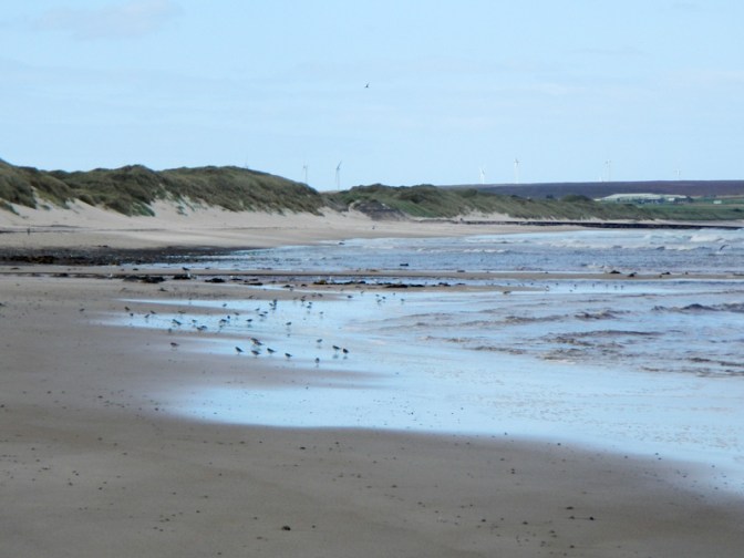
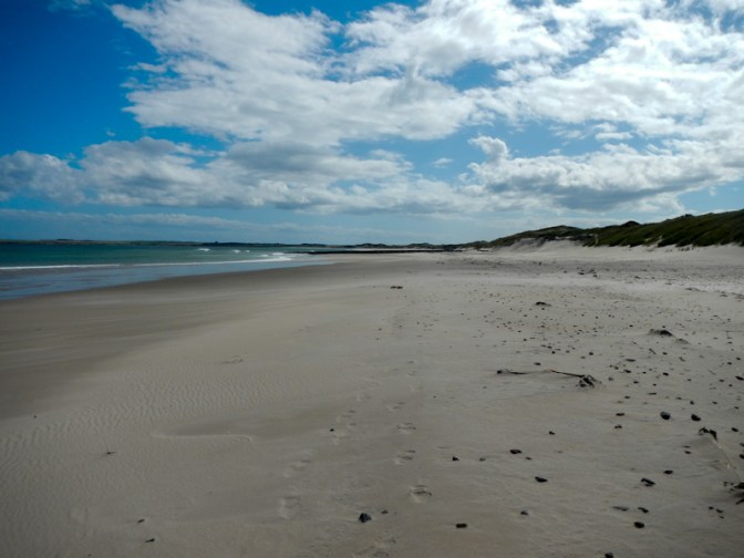
Soon afterwards the route descended on to a very long stretch of almost deserted sandy foreshore backed by dunes. I walked briskly over the firm sand as the tide continued to retreat. However, when I arrived at the Wester River, the water level remained too high for me to feel confident that I could manage a safe crossing.
I followed the alternative signed route, crossing fairways on a golf course and then at least a kilometre on the very busy A99 where I was recurrently hopping on to the verge to dodge the traffic.
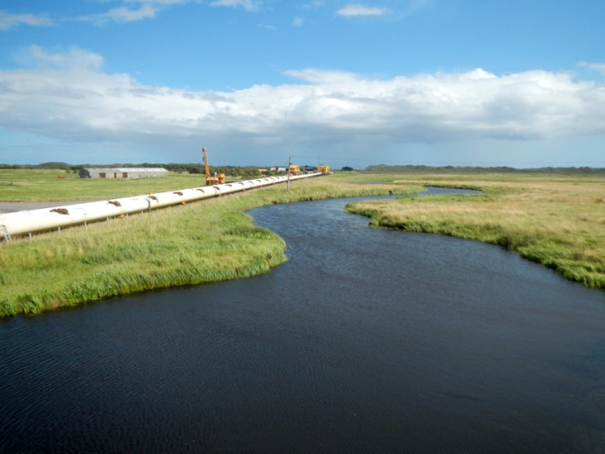
I crossed the place where Subsea7 was preparing the pipes over 7km in length to be launched into the North Sea at Sinclair Bay to serve the oil rigs in the North Sea. This is where the huge towhead being transported from Wick Harbour would end its road journey.
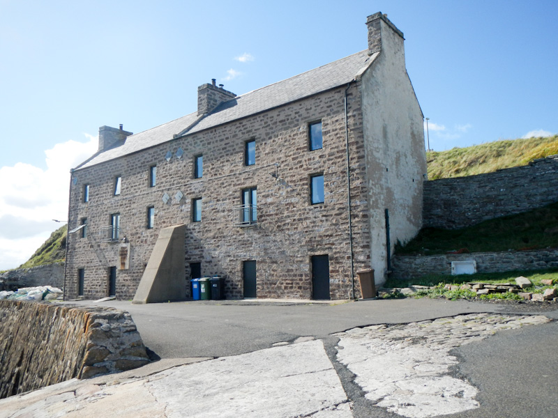
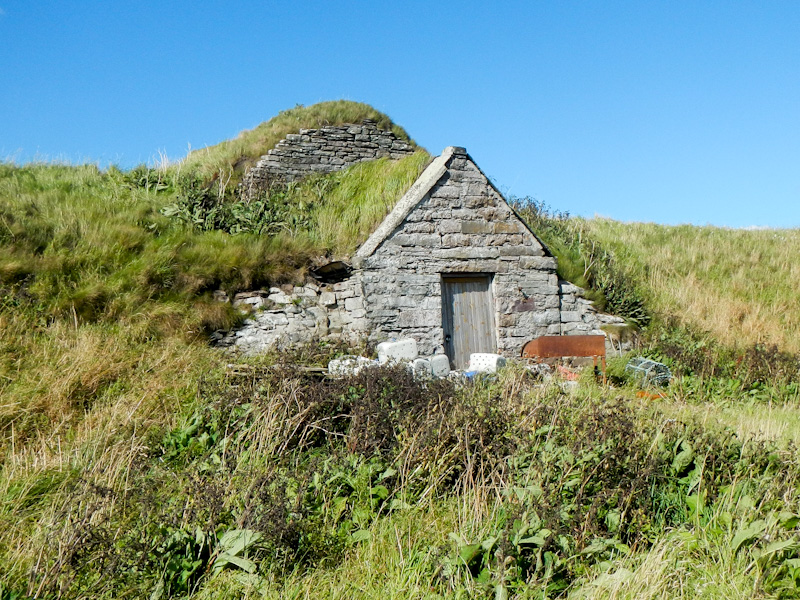
Soon after passing the Subsea7 pipeline, the route returned towards the sand dunes and beach. Soon I had arrived at the low cliffs near Keiss. There was a harbour, more relics of World War 2 and a historic harbour warehouse as well as an ice house. This was my end-point for the day.
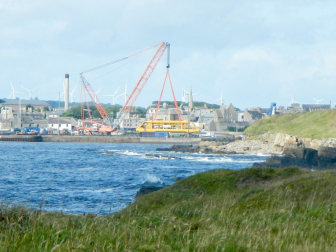
I was collected and we drove back to Wick, seeing the enormous towhead at its overnight resting place. Hence next morning my husband suggested that I should have an earlier start so we would be clear of the road before 9am as we didn’t want to be stuck behind a slow moving oversized load. As we passed the layby where the towhead had been left for the night, it was clearly being made ready to continue its journey.
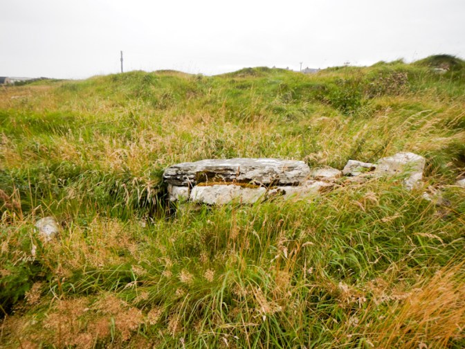
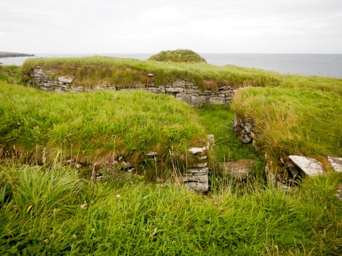
I was dropped off at the harbour at Keiss. As soon as I left the village and was on the cliff tops, I passed the ruins of a broch. These are circular stone structures with thick walls standing up to fifteen metres high. They were built in the Iron Age for defence, as homes and as status symbols. Brochs are only found in Scotland and the highest density of them is in Caithness.
I passed more scenic geos and stacks.
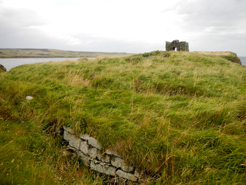
I saw the ruins of Keiss Castle on the cliff edge. It was built, possibly on the site of an earlier fort, in the late 16th or early 17th century by George Sinclair, 5th Earl of Caithness (1582-1643) – the same Sinclair dynasty that built Castle Sinclair Girnigoe which I had seen the previous day. Keiss Castle is mentioned on the NC500 website but didn’t seem as popular as Castle Sinclair Girnigoe – perhaps because there’s no convenient car park or because it was earlier in the day; in fact there wasn’t anyone else around when I was there.
The large house further inland was built in 1755 when the old castle was abandoned.

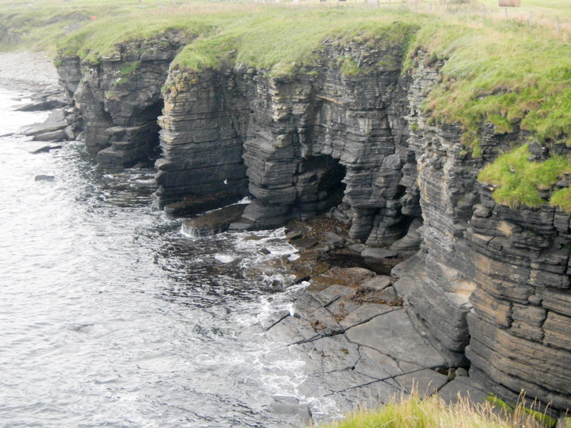
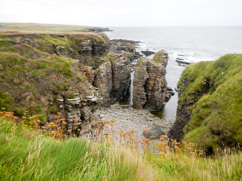

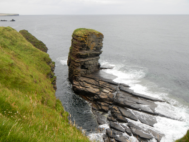
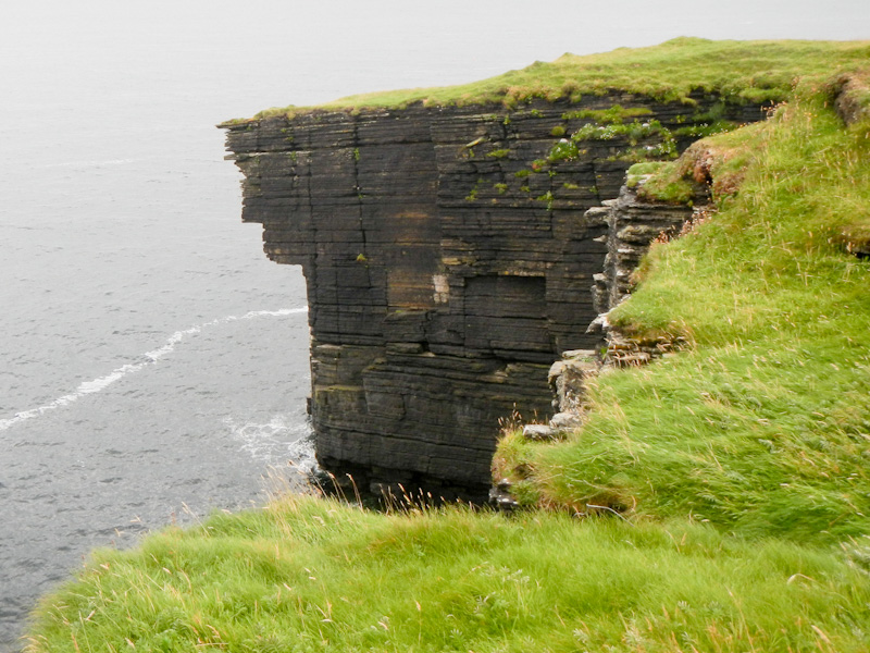
The route continued along narrow paths on the cliff tops. There are more World War 2 pill box structures, lots of caves, stacks, geos and arches, flocks of sea birds including gulls, fulmars and cormorants.
I passed the ruins of the relatively well-preserved Nybster broch.
At Castle Geo I saw the ruined Bucholie castle – yet another castle perched precariously on the cliff tops.
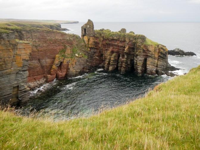
Bucholie Castle is believed to date from the 12th century, built by Sweyn, a Norse pirate and freebooter. The present visible structures were built in the fourteenth century by the Mowat family, who were granted the lands by King Robert the Bruce. However in 1661 it was sold to the same Sinclairs and apparently from that time it was abandoned and fell into disrepair.
The headland in front of the gatehouse as part of the keep tapers to an extremely narrow point, with unstable cliffs on either side of an unstable step to the entrance and entering the castle is deemed dangerous.
The sights continued as I walked further and reached the remnants of yet another broch.
My route continued past some buildings in Freswick including a big house which is a sixteenth century tower house owned by the same Sinclair family as the castles until the early twentieth century. At that stage it was in disrepair, but has been restored since . Near the house I saw the first person I had seen since leaving Keiss harbour – this path certainly wasn’t crowded.
Further around Freswick bay, the path leaves the coast and follows a signed diversion on a minor road (to avoid some fields of cattle). I re-joined the coastal path at Skirza pier. Soon after I overtook a woman walking alone and then two women walking together. They were surprised to see other walkers on the path.
I walked through a disused flagstone quarry and past more outstanding coastal scenery as a heavy shower hit.
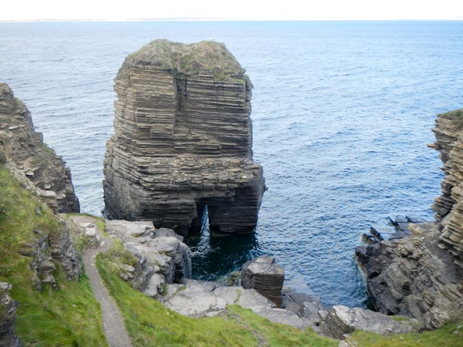
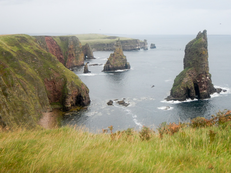
It was dry again by the time I had amazing views of the stacks of Duncansby and I sat on the ground near here to eat lunch whilst taking in the views.
The lone woman walked past – I discovered that she was in the final stages of an expedition from Lands End to John O’Groats by any means possible. What a fantastic story she had to tell. She is carer for her disabled husband and had discussed with her local Social Services team in Nottinghamshire about having a sabbatical to enable her to walk LEJoG, camping and carrying all her equipment. Social services had agreed and her husband was cared for in a residential home in the meanwhile. When she reached Carlisle, her husband became unwell and was admitted to hospital so she had returned to Nottinghamshire. Once he had improved, she had continued her expedition from Carlisle “by any means” including buses and trains. She was currently camping at a site in Wick so she could use buses for transport and complete day walks on the John O’Groats trail; this was of course her final walking day.
The two women walked past as I was almost finishing my lunch break. They were friends who lived locally in Thurso and were walking the trail as a series of day walks.
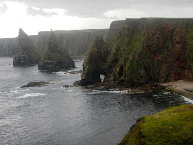
I enjoyed more views of the iconic Duncansby Stacks from different angles. The path was becoming more busy with people walking from the nearby car park to view the scenery.
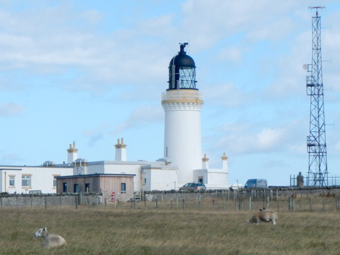
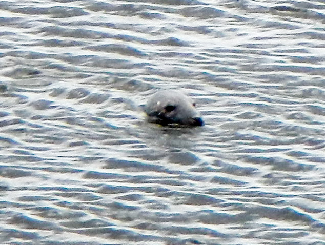
I passed the viewpoint and lighthouse at Duncansby Head before turning to follow the north coast of mainland Scotland past the Bay of Sannick, where there was a seal in the water. There were fine views across the Pentland Firth.
Before long I was walking on a gravel path with the incongruous sight of the John O’Groats tourist complex ahead of me. However, I have to admit that I was just as guilty as everybody else and bought an ice cream from one of the many outlets. After meeting my husband, I looked around unsuccessfully for the inspirational and adventurous lady who would have just completed her convoluted expedition to John O’Groats to see if she would like a lift in our car back to Wick.
The stunning picturesque castles standing perilously close to the cliff edges, the impressive stacks, arches and geos, as well as opportunities to watch seals on the rocks and in the water were all highlights of this adventure.

I think the John O’Groats trail is one of the finest in the country. And now they are extending it along the north coast to Cape Wrath.
LikeLiked by 1 person
Thanks for that information. That would make an interesting walk.
LikeLiked by 1 person