14-16 February 2025
The weather forecast wasn’t great – a damp start to the weekend then dry but with stronger winds. The temperature was predicted to be above freezing but feeling as low as -3 deg C on Sunday morning with a maximum of +3 deg C all weekend taking wind chill into account. However, I was keen to venture on to the moor for some walking and wild camping.
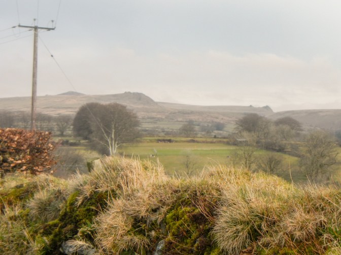
I alighted from the train at Ivybridge on Friday afternoon, appearing to be the sole walker as everybody else rushed off in the opposite direction towards the car park. I was soon warming up as I followed the well trodden route of the Two Moors Way uphill and on to the well defined path following the route of the old tramway towards Red Lake. The visibility was poor and it certainly wasn’t the weather for photos! I tested out my Garmin Inreach Mini 2 by sending a message – it works in the fog!
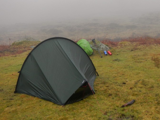
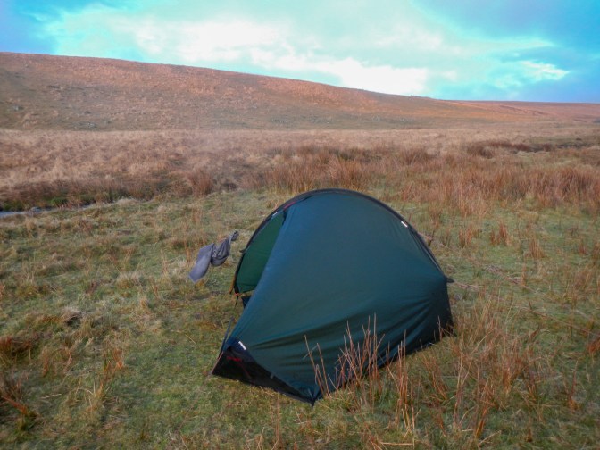
Eventually with the help of my GPS I realised that I had reached the point to leave the tramway. Actually there was a reasonable path as I headed off towards the River Erme, crossing the tributary stream Hook Lake. Unfortunately I managed to step and sink into a boggy area but just got away with a very wet right foot managingkeep my left foot dry. I had planned to camp near Erme Pound but spotted a nice flat and fairly well-drained grassy area before I reached the Pound. This was good timing as on this very dull day the light was beginning to fade.
I had my tent up quickly, sent a check-in message to family from my Garmin InReach (no phone signal here) and rapidly had the stove on to heat water to rehydrate my food. What with the cold, wet and lack of light I was soon cocooned in my sleeping bag. I could hear rain beating on the flysheet but I was warm and dry.
Saturday morning dawned – it remained wet and the visibility poor. It wasn’t the most encouraging of mornings for an early start so it was just after 9am by the time I had packed away my wet tent and was ready to walk.
I soon passed the walled ancient enclosure of Erme Pound, spotting some remains of medieval houses.
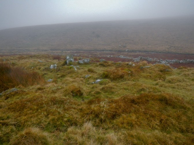
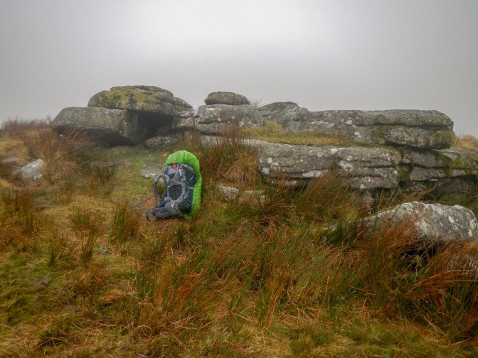
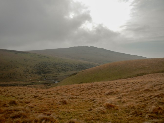
I crossed the River at Red Lake Ford without getting wet feet – a bonus! After crossing Dry Lake Ford, I swung in a northerly direction across the foggy and featureless moor. There’s a right of way marked on the 1:25,000 map but no clear path on the ground apart from loads of sheep tracks which obviously don’t necessarily go in the direction I wanted but are relatively easy to walk on. As I discovered, it’s easy to end up making a 180 degree turn without realising it and I should have been keeping a closer eye on the compass. Back on route and going the right direction I passed close to a wooden post that’s marked on the map. I stopped for a snack in the relative shelter of some boulders.
Soon after setting off again, I reached Little Fox Tor. However, tragedy was about to unfold as I reached for my SatMap to check that I was indeed at Little Fox Tor. The SatMap wasn’t where I expected it inside the holster bag attached to my rucksack belt. Clearly it had somehow fallen out of the bag which has a Velcro closure. I decided to backtrack to find the machine. I tried to retrace my steps but there was of course no path apart from a myriad of animal tracks and I realised very rapidly that this was worse than looking for a needle in a haystack; the most likely outcome on the foggy moor was that I would get totally lost. Actually I had been about to replace my GPS unit (several features didn’t work properly any more and the company has folded so the device isn’t supported) so it wasn’t as expensive a mistake as it seemed at first sight. Obviously I had hoped to find it as it was what I was using to supplement my paper map and compass and of course because I didn’t want to leave litter on the moor.
I returned to Little Fox Tor to take the obligatory tor bagger photo and then descended to Whiteworks. As I descended, I saw behind me a fairly large group of walkers – the first people I had seen since leaving Ivybridge the previous day.
I lost enthusiasm to go and look for Strane Tor (I had marked its position on my now lost GPS although I had also written the grid reference on a piece of paper) and felt rather dejected as I trudged along the minor road to Princetown, passing a Dartmoor Ranger vehicle stopped in one of the small car parking pull-ins. I even wondered whether I would call it a day and phone my husband from Princetown – he had said before I started that he would be happy to drive up and fetch me if I wanted to cut my expedition short. Moreover I knew that my tent was wet, the conditions were still misty and it was cold. Fortunately I realised that I would have been very disappointed if I had stopped.
What with taking longer to cross the moor in fog and then spending time looking for my lost GPS unit, I was aware that the remaining daylight was short for me to reach my next planned camping spot and get sorted out before dusk. It took will-power to walk past Fox Tor Cafe without stopping – but I succeeded.
I trekked past the National Park Centre and through the car park. Disappointingly, it isn’t possible any more to park for an extended period in the car park. It used to be an option to pay for forty eight hours parking, something I have done so that I could spend a couple of days and nights backpacking and camping on the moor from a central point.
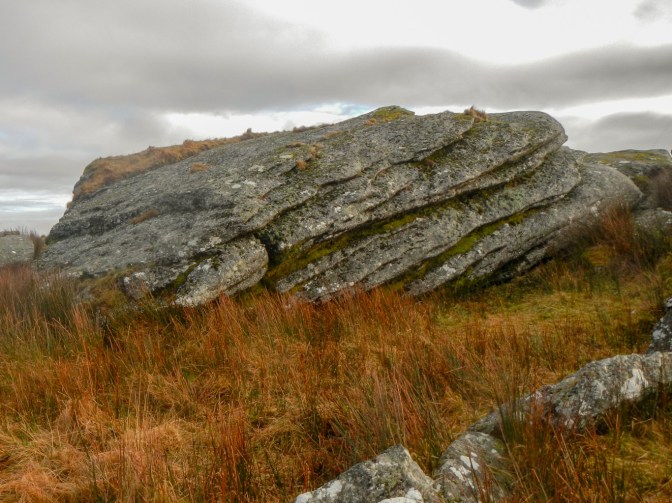
I passed the Dartmoor Brewery and was soon climbing up to North Hessary Tor. Miraculously, with a sudden change in the weather, the fog lifted and I saw the sun. I headed over to Herne Hole Tor. It’s not marked on the OS map but is only a small deviation from the direct route between North Hessary and Rundlestone. Hence although I had walked the route many times previously, I had never bagged Herne Hole Tor. It turned out to be a relatively impressive outcrop given that it isn’t on the map – certainly not an outcrop that’s so small it requires GPS confirmation of being in the right place.
I enjoyed the clear views as I ascended towards Great Mis Tor. However I opted not to walk right up to the tor as I was keen to reach my planned camping area next to the River Walkham near Dead Lake foot.

I wanted to get my tent pitched to make the most of the breeze and short period of sunlight and partially dry the tent. For the second night in a row, I was fortunate to find a fairly dry area of grass near the river. There wasn’t any phone signal but I was able to use my InReach device to send a message including my location to my husband. The sheep moved on as I arrived and didn’t return all night. I spotted two bedraggled ponies on the other side. The river crossing looked as though it could be tricky but that would be a problem for the next day.
It seemed colder than the previous night and the breeze gave added wind chill. However my hot food and drinks warmed me. The tent was damp but the inside of my sleeping bag remained warm and dry. The skies were clear and the area free of light pollution so I enjoyed a tremendous spectacle of stars – just a pity it was too cold to linger outside my tent. The wind gusted through the tent’s air vents but I was protected from wind chill snug in my sleeping bag.
I was up and away the following morning soon after 8am having enjoyed a breakfast of hot porridge washed down with coffee. The fact it hadn’t rained and that it was windy meant my tent was relatively dry. The visibility remained good – a fine camping spot.
I was fortunate to find a safe river crossing point not far upstream from my campsite. I headed north before turning west towards the huge outcrop of White Tor incorporating a hilltop fort. I’d decided to alter my route to head towards Lydford and then access the Granite Way (a path on a disused railway line) all the way to Okehampton Station. The weather had become more cold and windy so I decided not to tackle my previously planned route over the more exposed and higher north moor including going over Hare Tor.
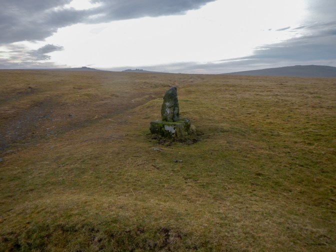
After passing the isolated Stephen’s Grave, I saw the first person since the walkers I had seen in the distance near Little Mis Tor the previous day. The middle aged man walking his dog realised that I had been camping out, explaining that he knows the moor well as he lives in Peter Tavy and works on the ranges. I had clearly been lucky with water levels being sufficiently low to ford the River Walkham where I had done so.
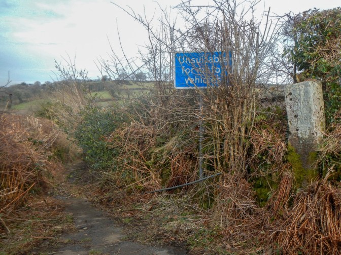
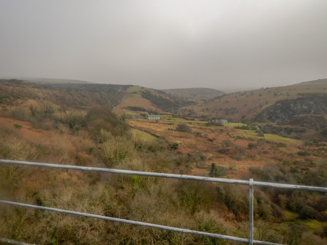
Having left the moor near Peter Tavy, I walked along almost traffic-free narrow lanes to Willsworthy Bridge. I left the road along a well-signed path across sheep pasture. There were some excellent views of Tavy Cleave and tors to the west and north of the Cleave.
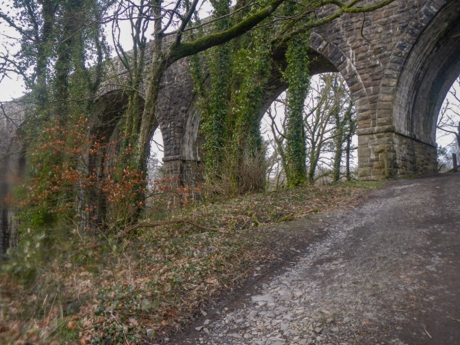
I proceeded across a corner of Willsworthy range, walked a short way up the treacherously busy A386 and then crossed on to a footpath towards Lydford, passing under Lydford Viaduct.
I managed to access the disused railway track bed in a section before the Granite Way started and clambered through the undergrowth on a faint path. This wasn’t advisable as I discovered when I reached a very wobbly fence blocking my way – I certainly wasn’t going to risk climbing it. Not wishing to back track to Lydford when I was so close to where I wanted to be on the Granite Way, I accessed the road by sneaking through a back garden gate, along the side of the house to the front and through the front gate. Fortunately I wasn’t caught, even when I crunched with thumping heart along a gravel path at the side of the house! It would definitely have been better to have walked the extra very short distance round on the road so I promise I won’t trespass there again!
Having accessed The Granite Way, I realised that I had plenty of time to walk all the way to Okehampton Station so I could travel home on Sunday evening rather than spend a night camping in ever more windy and cold conditions. Even the Granite Way was exposed and windswept so I was pleased that I had decided to change my route and avoid the higher parts of the moor. The views of the tors from the old railway line route were much better than I had remembered – it was several years since I had been this way.
The final section of the route from the area of the old Meldon Quarry seemed long and I kept thinking that Okehampton Station must be just round the corner. However I was in luck arriving before 4pm just in time to enjoy a hot cup of coffee from the station café before catching the well-used two coach train back to Exeter.
It had been a cold weekend but I had enjoyed a superb traverse of Dartmoor and over the areas I had walked (apart from the Granite Way) it had been almost deserted. I had to confess to my husband about the lost GPS unit but he was less upset than I was about it – claims he was always dubious about the SatMap. We have already been in contact with the amazing team at GPS Training. I ordered a replacement GPS following a Zoom meeting with Jon Monks and assessment to match my requirements most closely with what is currently available. I definitely recommend this company and am looking forward to accessing their on-line training to ensure that I use my new unit in the most effective way. I have also ordered the zip up case to try to keep my device secure during my walks!

Despite the lost satmap it seems like it was a great walk. I love seeing the moors and Tors!
LikeLiked by 1 person