11 Oct – 21 Nov 2023
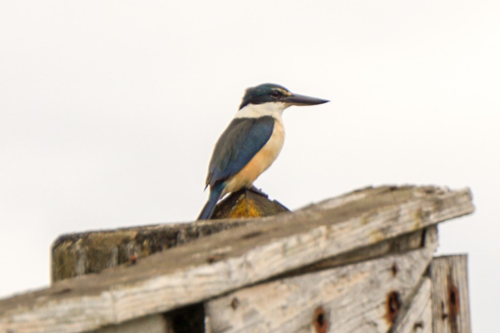
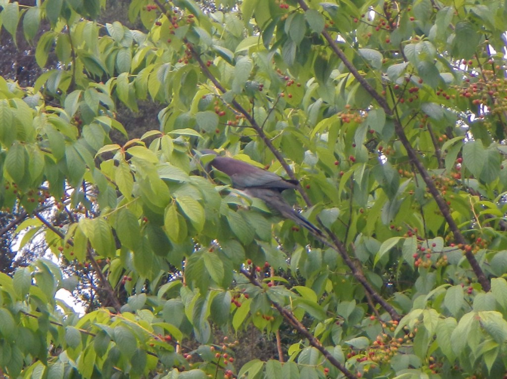
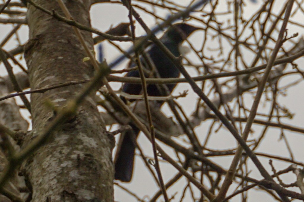
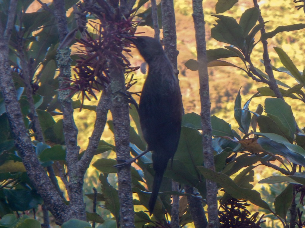
I had my first sight of New Zealand peering out of the plane window on the flight from Sidney to Auckland. It was about 30 hours since we had left London’s Heathrow Airport. Even so, I was still alert enough to spend the final leg of the flight watching “The Unlikely Pilgrimage of Harold Fry” and to be excited about my first glimpses of the country so far from home where my husband and I were about to spend six weeks exploring, walking (especially me) and photographing (especially my husband who I have to acknowledge for the stunning featured image of the iconic tui bird to head this post).
The passport check was very rapid but the anxious wait to be reunited with our baggage seemed long. However, this wait was negligible compared with the time taken to clear biosecurity. I explained that my walking boots were brand new apart from being “walked in” on city pavements and that my waterproofs and gaiters had been double washed and reproofed. By the time I told the officer that I had scrubbed my trainers and used tweezers to remove gravel from the soles, they clearly thought we weren’t a large risk so we didn’t have to unpack and repack our crammed luggage bags.
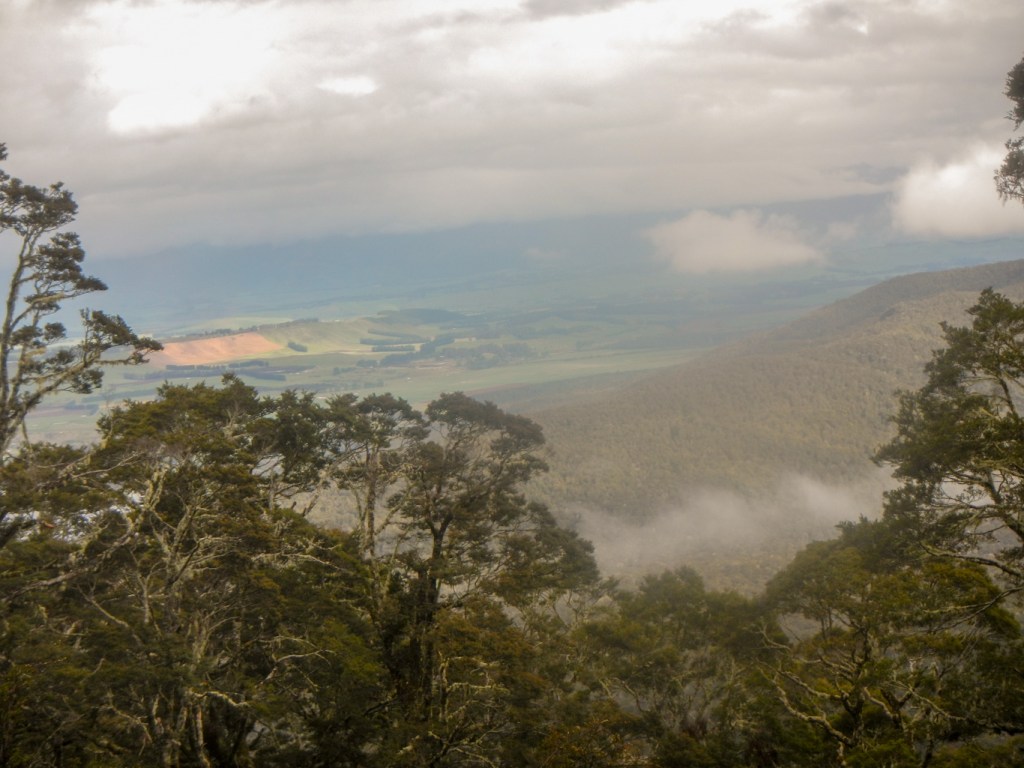
We’re used to travelling in Europe so it was odd to be abroad in a place where the main language is English and the traffic drives on the left. However, most of the trees were unfamiliar as were many of the birds. In addition over the coming weeks we were going to see many dramatic landscapes very different to those of the UK.
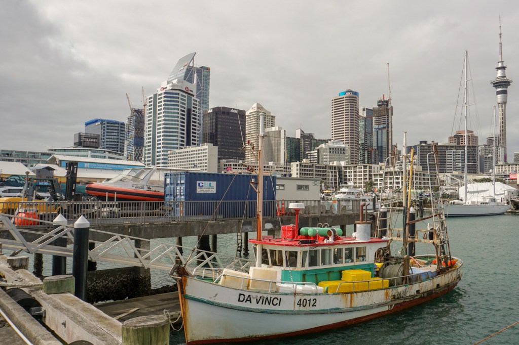
11 October – arrival day and a walk round the redeveloped dock area built on reclaimed land in Auckland.
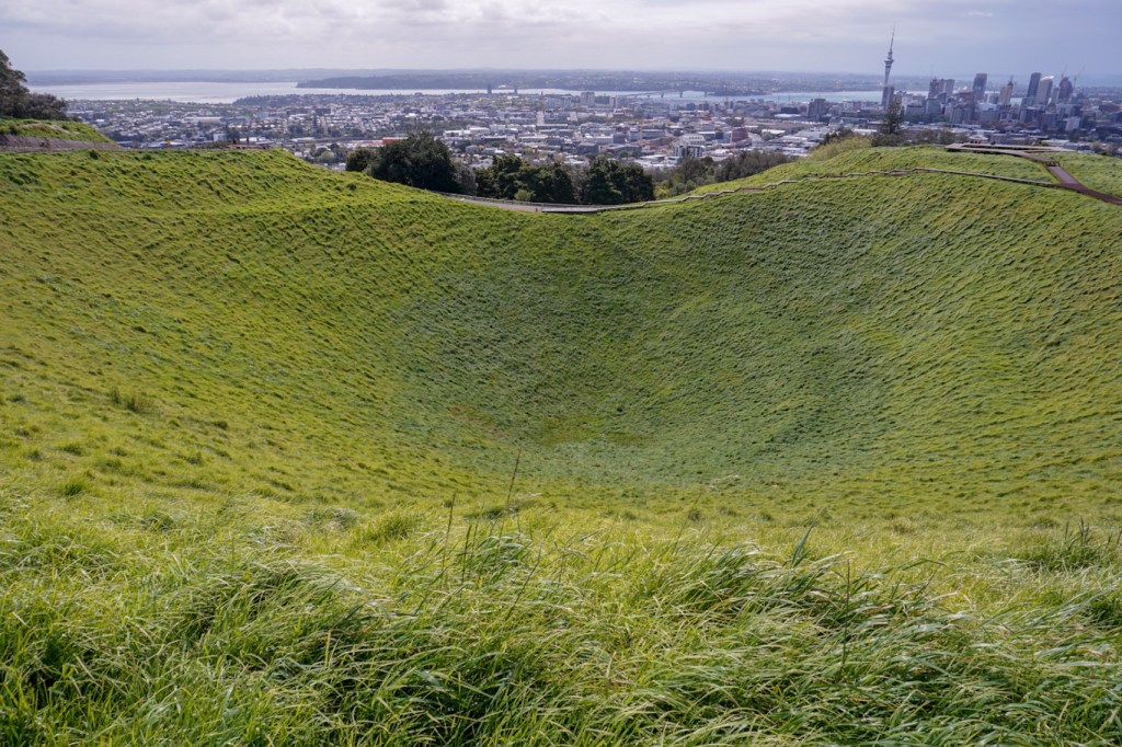
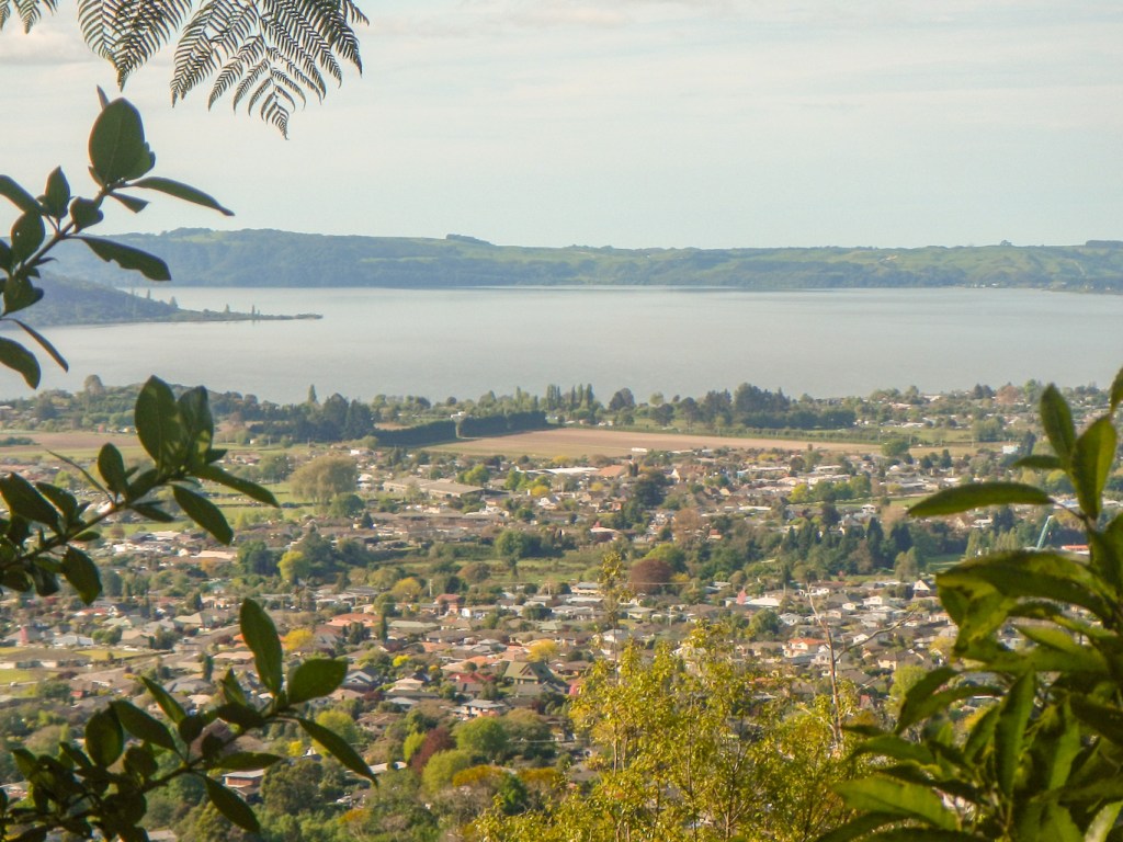
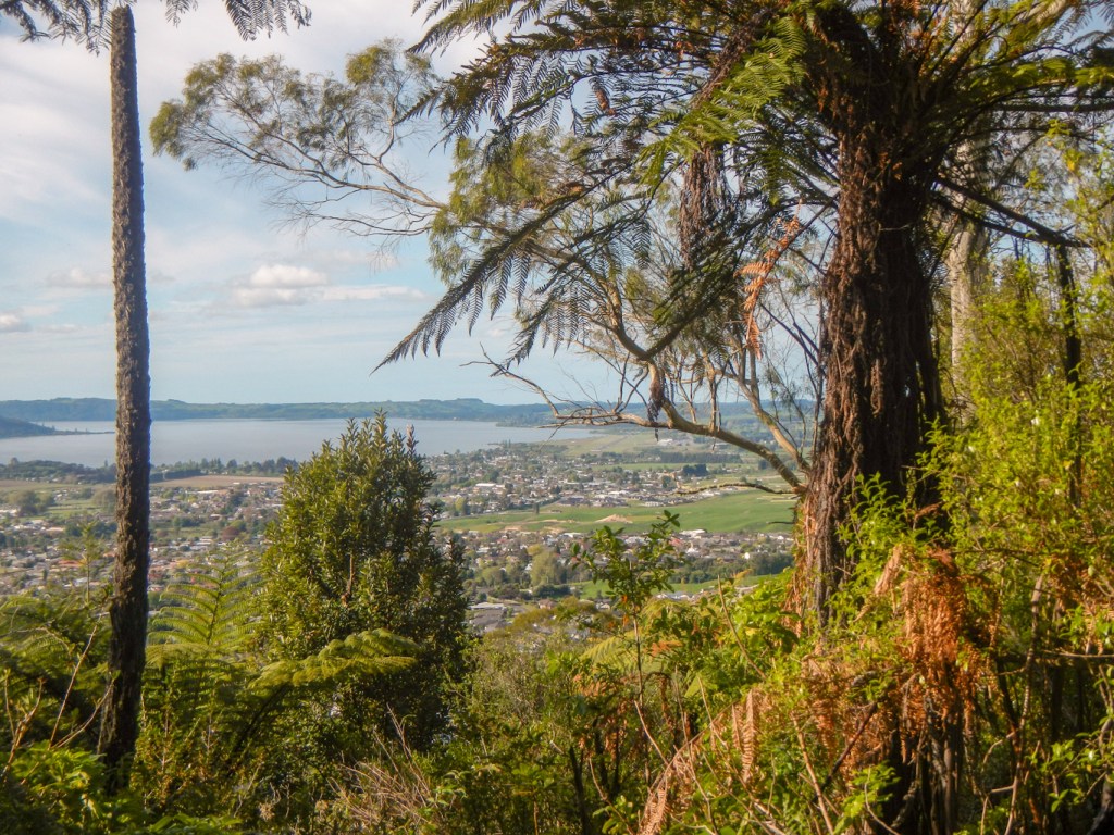
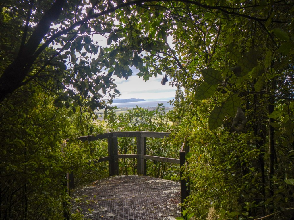
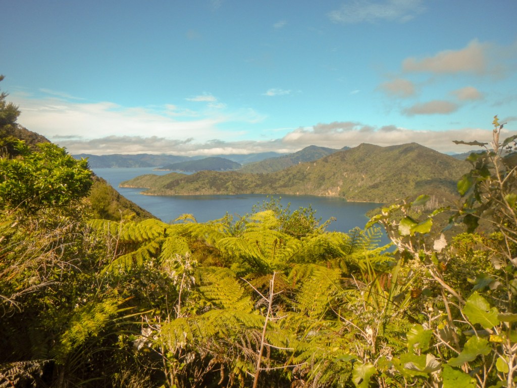
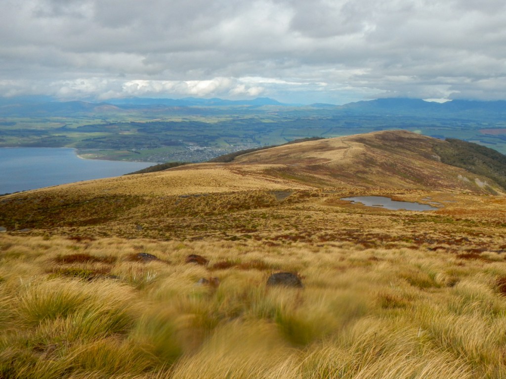
12 October – a walk round the city and up to the top of Mount Eden – Auckland’s highest volcanic cone. We began to start to learn about the relationship of the Māori people to the land. The crater is highly tapu (sacred) to Māori people and hence not to be touched. Māori regard land, soil and water as taonga (treasures) and the people are the kaitiaki (guardians) rather than owners of these taonga. Unfortunately this belief, which would protect the environment for future generations, appears to have been a major reason why the Māori people were vulnerable to exploitation by European settlers who had different views regarding land ownership and rights and did not attempt to understand the Māori concepts. In fact, as we travelled round New Zealand and learned more about Māori values, I realised how these are in line with many principles of conservation and caring for the environment. I feel following our visit that, in twenty-first century western society, there is a lot to learn from these people.
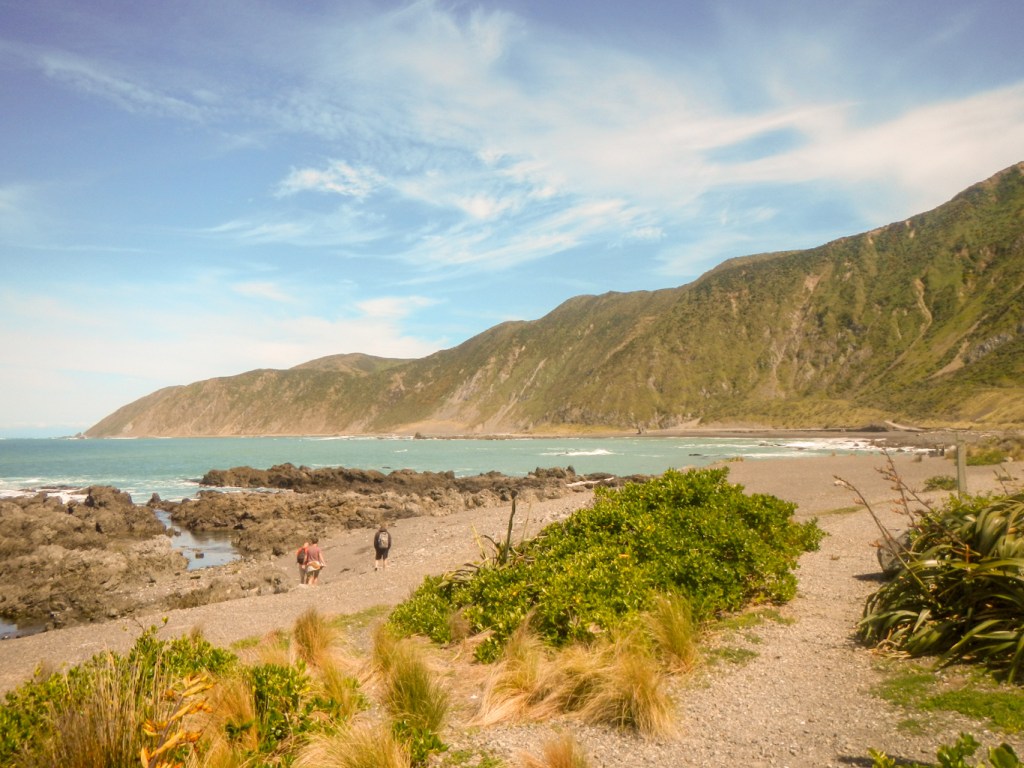
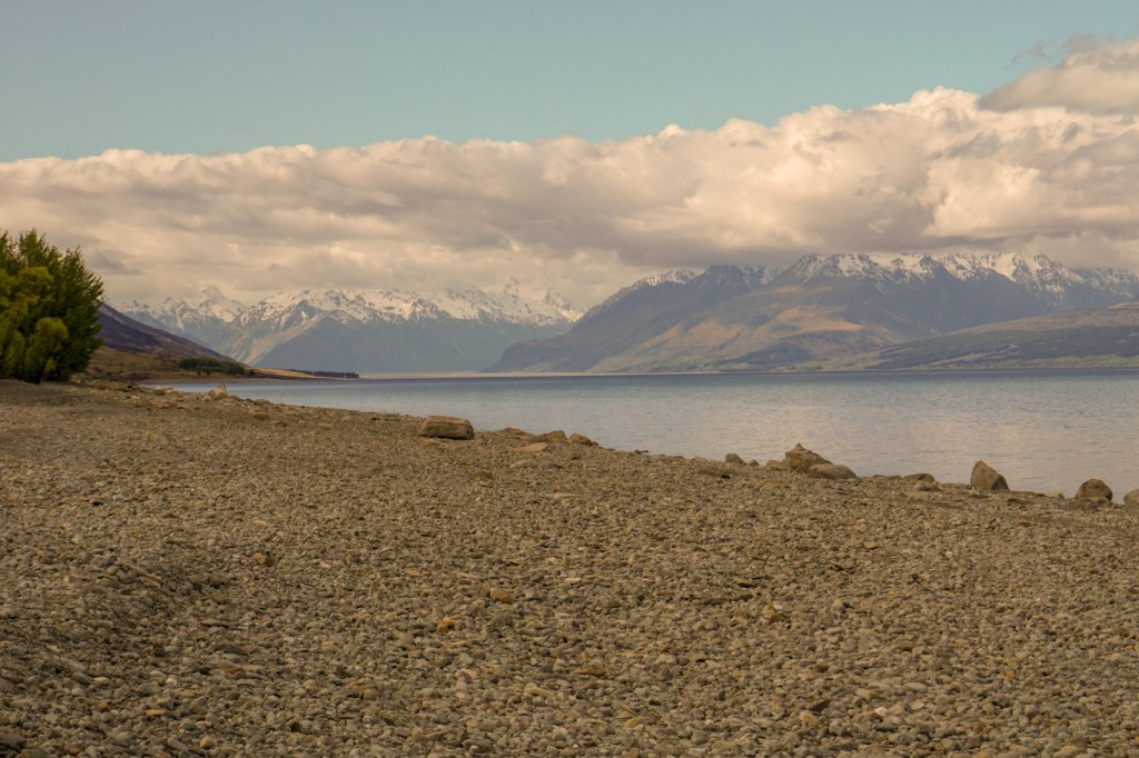
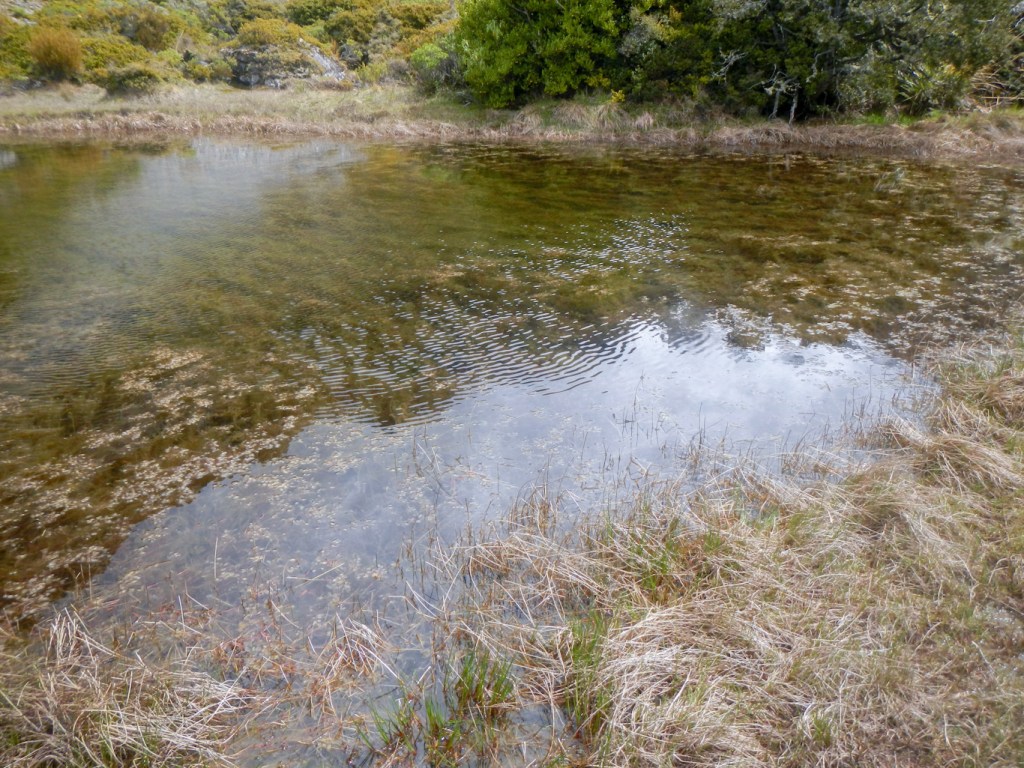
13 October – expedition to Rangitoto Island. A predator free island which was formed only 600 years ago when the volcanic cone erupted from the sea. It has lava caves and the world’s largest pohutukawa forest.


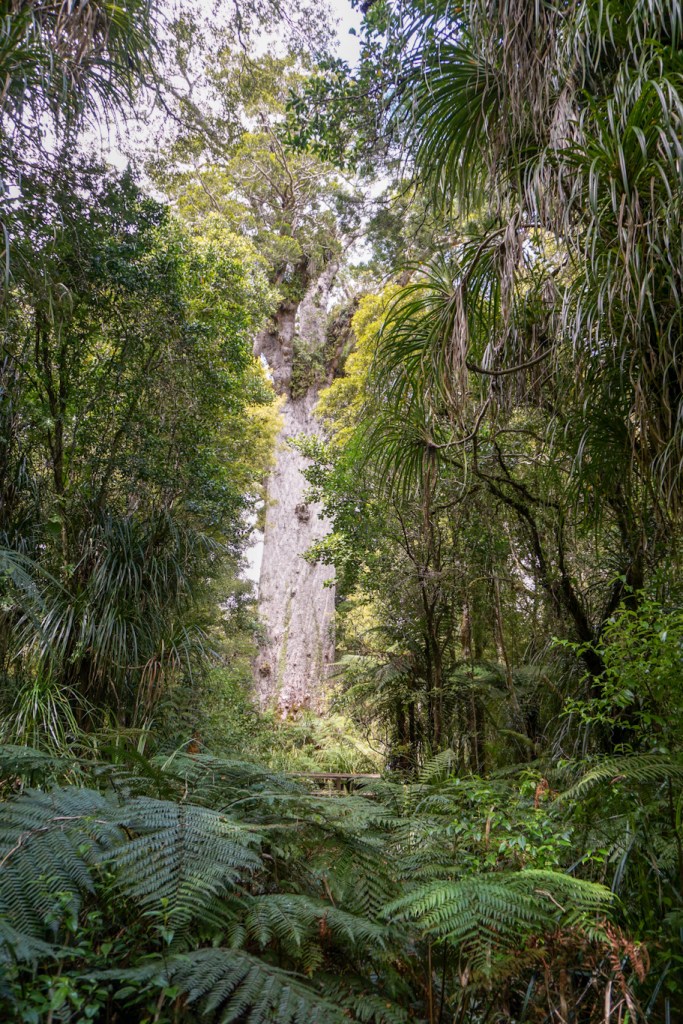
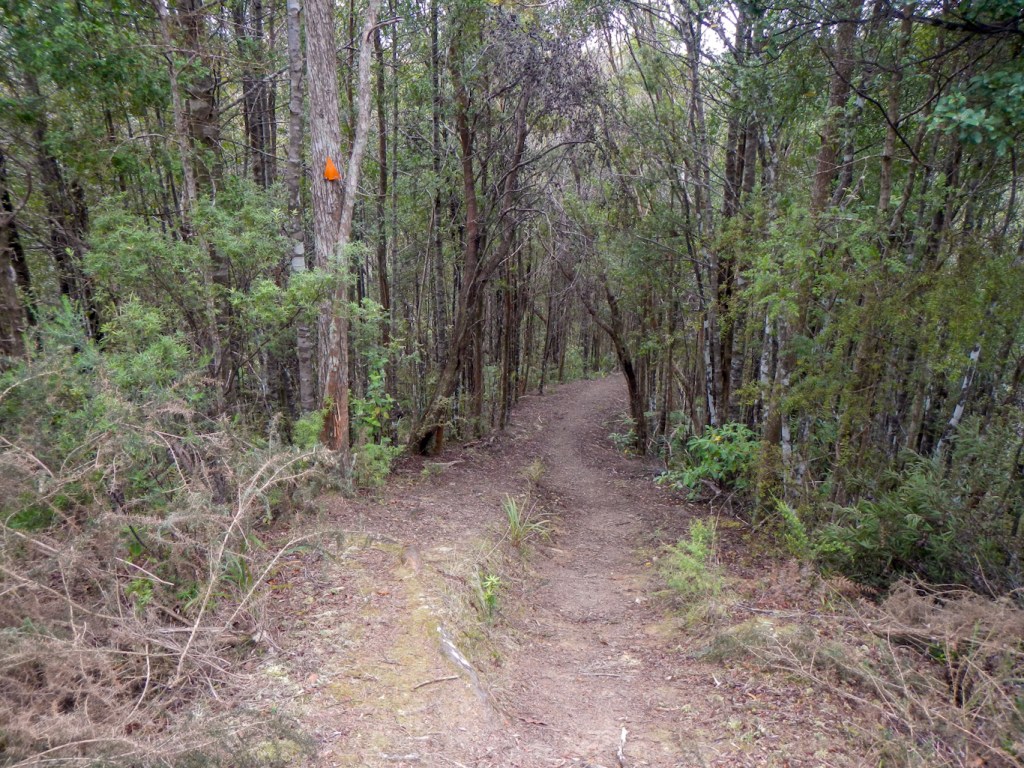
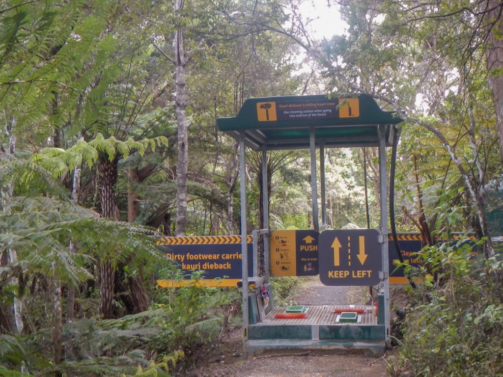
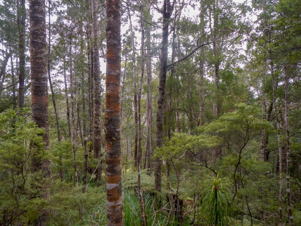
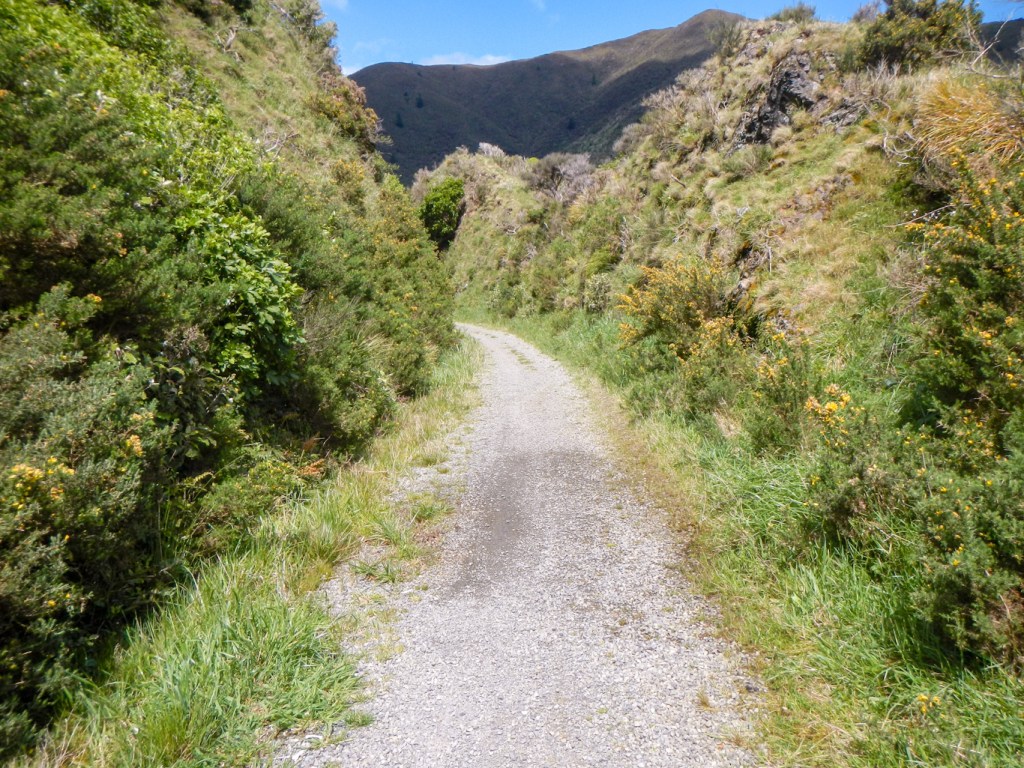
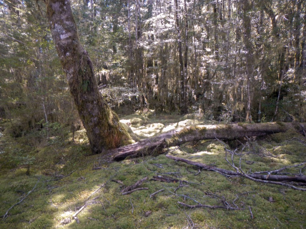
14 October – we collected our hire car and set off to the north to reach Paihia in the Bay of Islands. A highlight on the journey was walking to see two huge kauri trees. They are at risk from kauri die-back disease so, before walking along the footpaths, we had to walk through a unit to brush and disinfect our footwear.

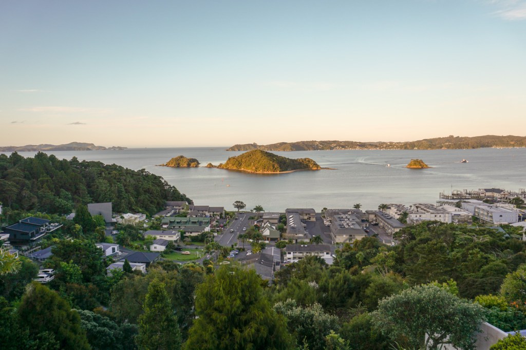
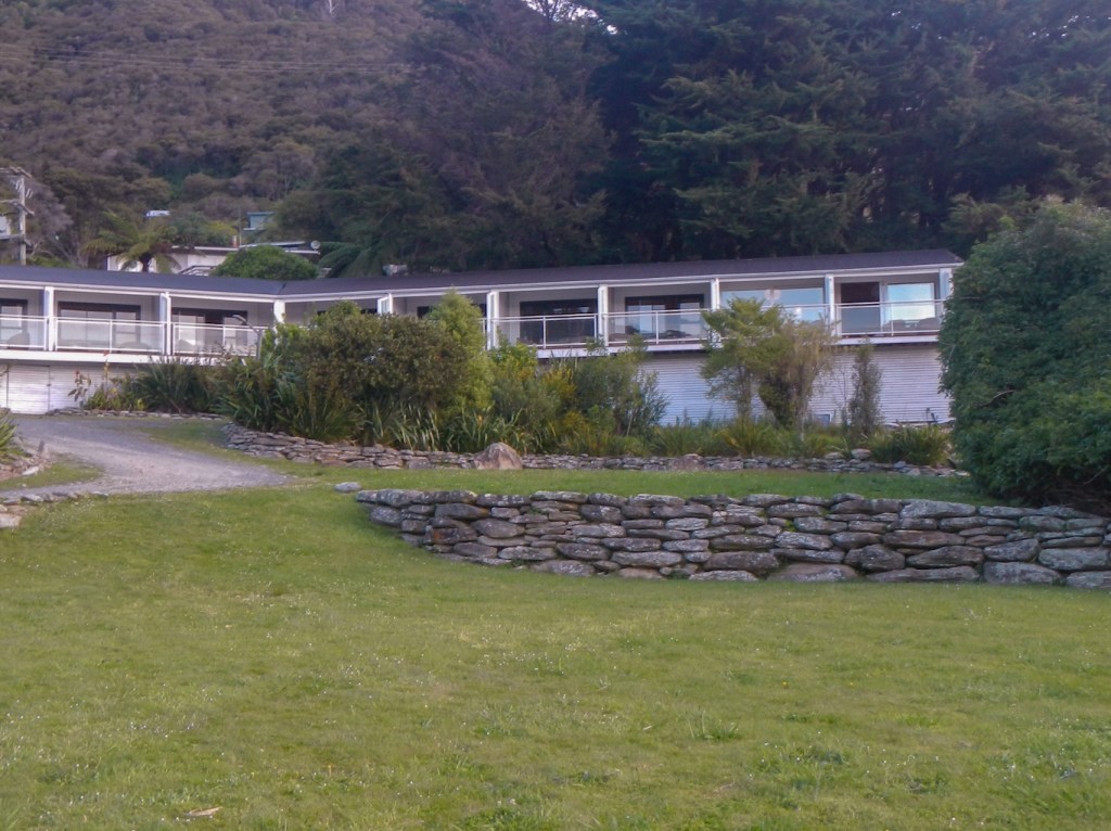
15 October – staying at Allegra House https://www.allegra.co.nz/ we enjoyed awesome views over the bay as well as the benefit of the knowledge of our hosts Heinz and Brita who gave us many tips to help us maximise what we could do during our short time. The breakfast including homemade bread was also wonderful.
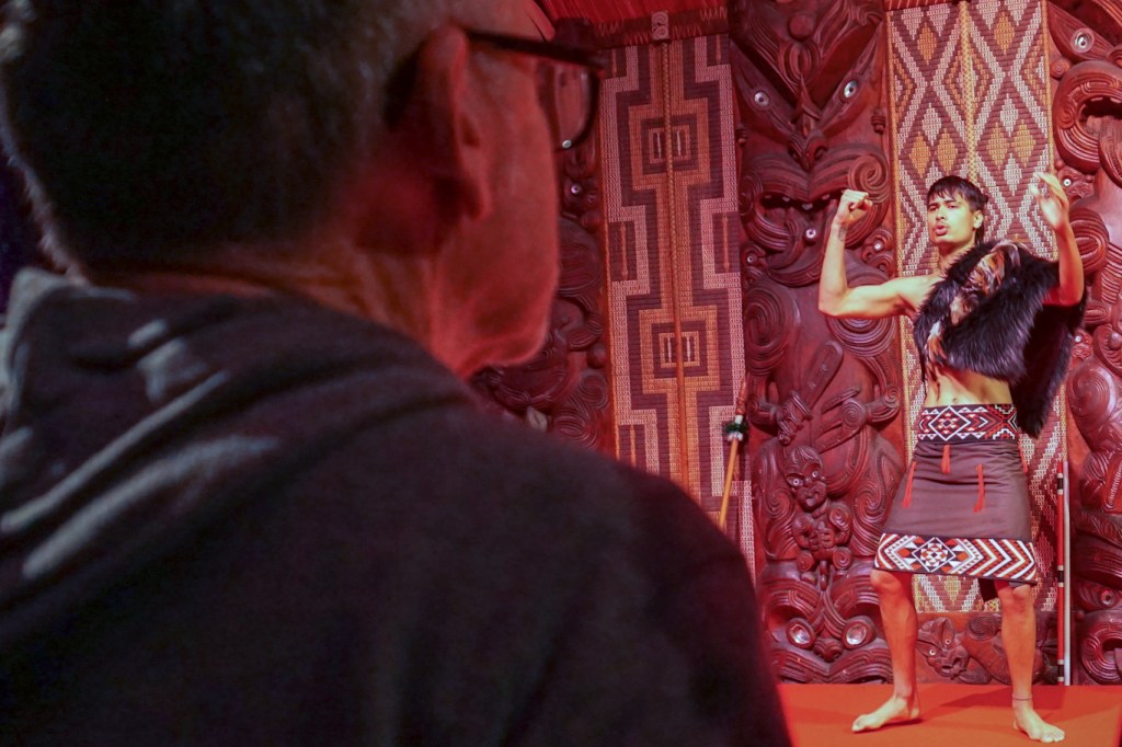
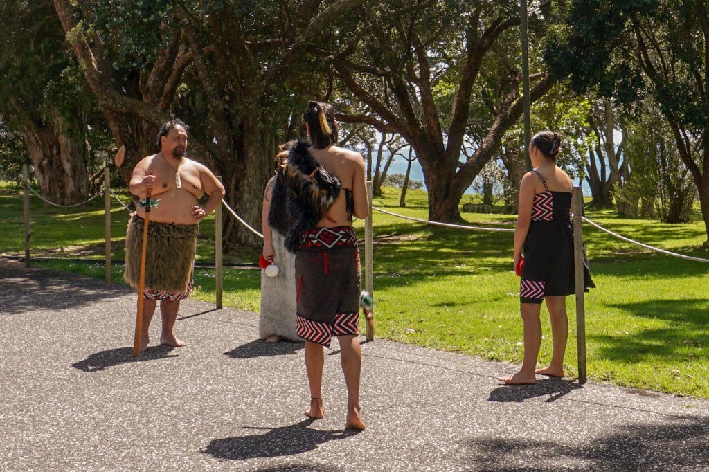
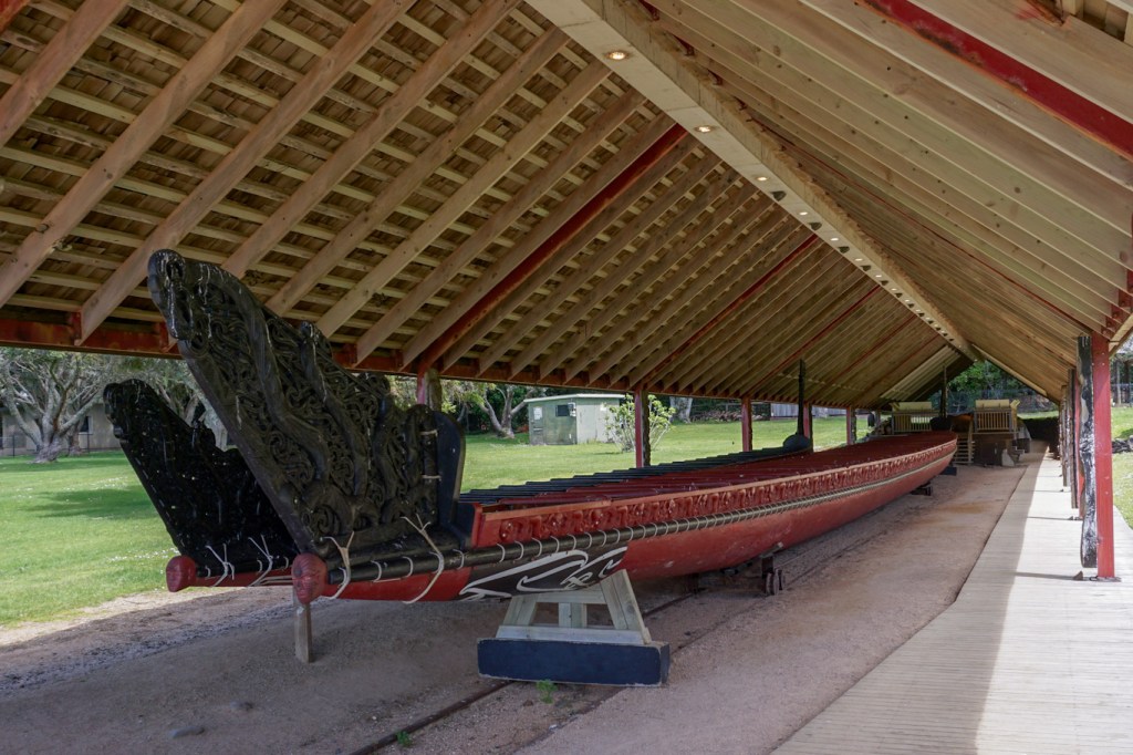
We walked to the Waitangi Treaty Grounds, New Zealand’s most significant historic site where on 6 February 1840 the first 43 Māori chiefs signed the Treaty of Waitangi with the British Crown. We enjoyed a guided tour, a cultural performance including entry to the Whare Runanga (meeting house), and two museums – one a showcase of the role of the treaty in the past, present and future and the other about the sacrifice made by Māori serving their country during times of war.

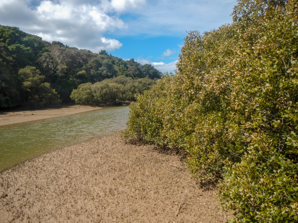
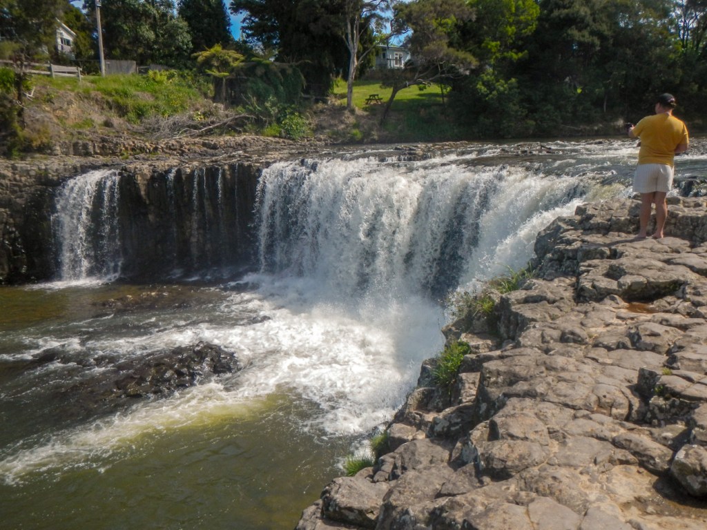
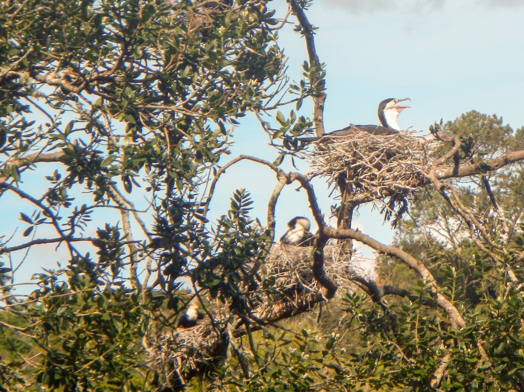
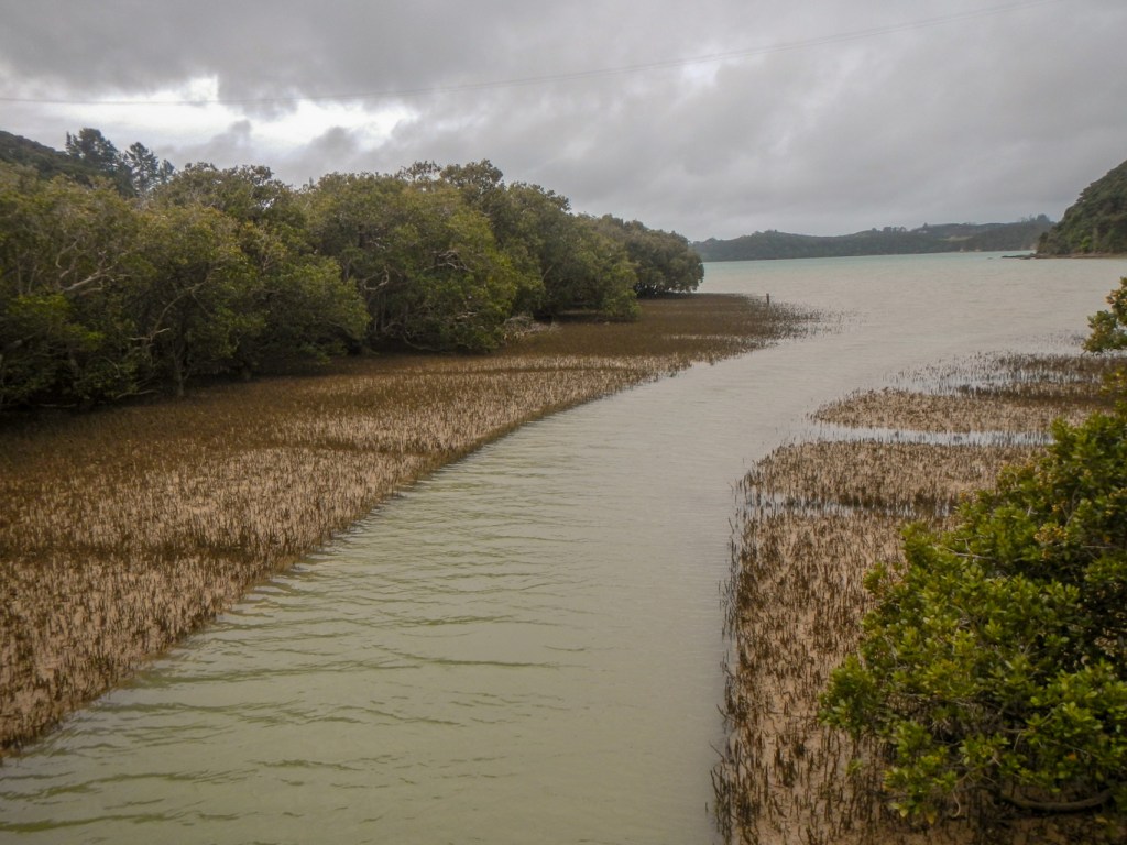
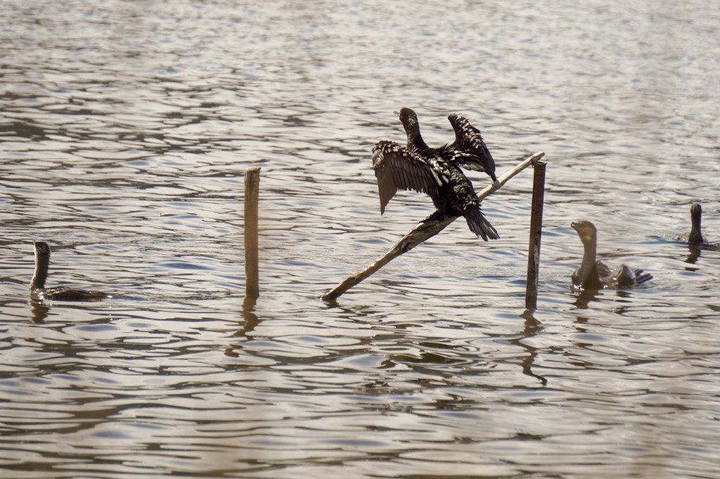
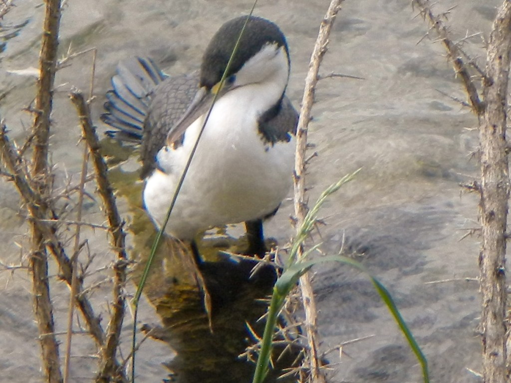
I walked on a track through the bush and mangrove swamps to Haruru Falls, spotting many birds along the way including nesting pied shags as well as listening to the amazing singing of the tuis.

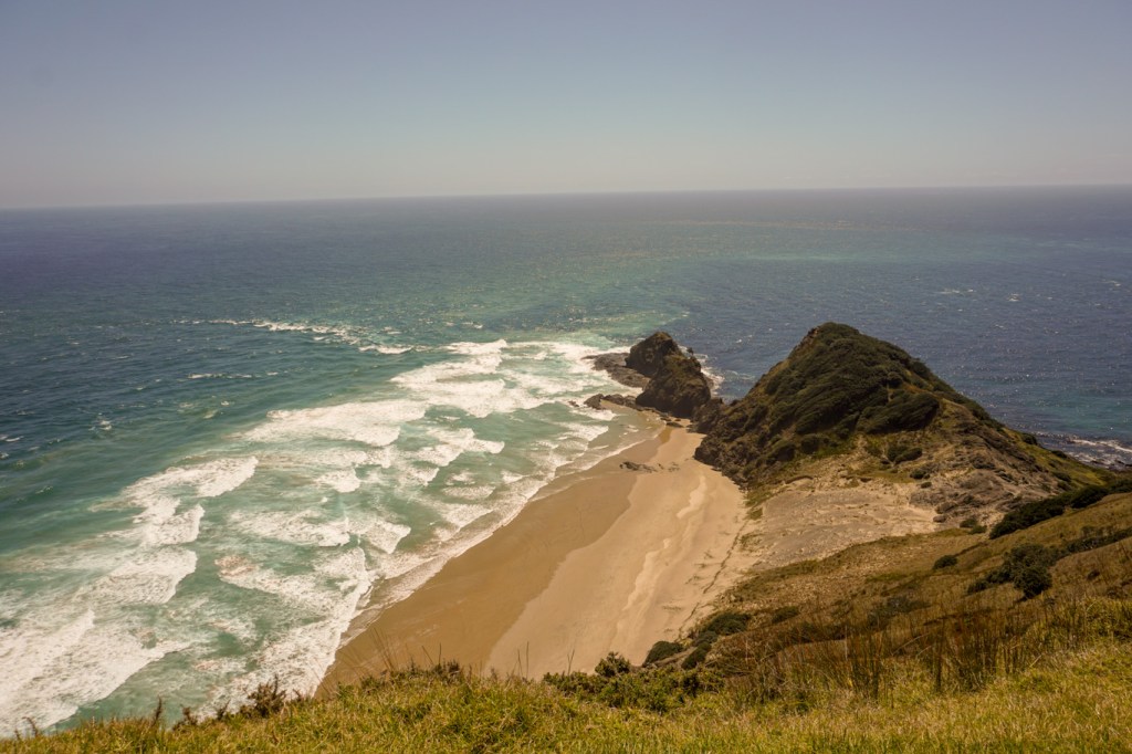
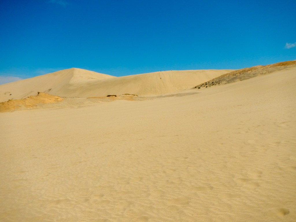
16 October – a scenic journey of more than 450km round trip to Cape Reinga where Māori believed the spirits depart the mainland back to their homeland Hawaiki. Here the opposing currents of the Pacific Ocean and Tasman Sea collide. We also braved the gravel road to see the giant Te Paki sand dunes and visited the huge expanse of the ninety mile beach although more accurately it is “only” about ninety kilometres long.


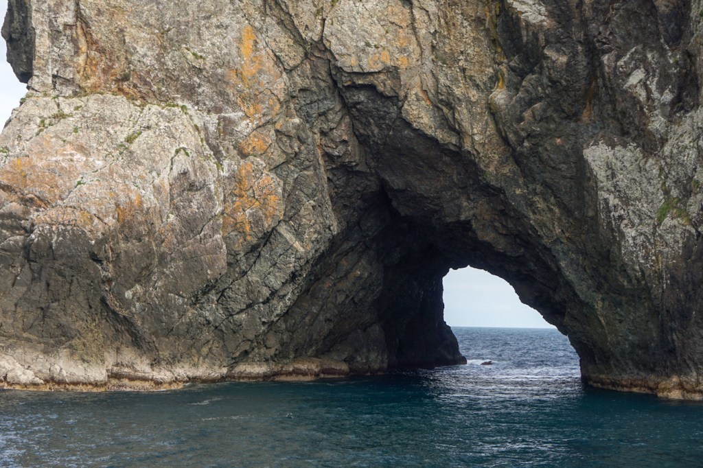
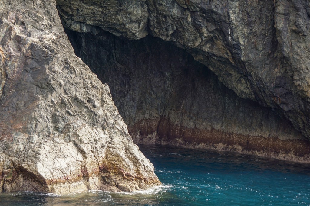
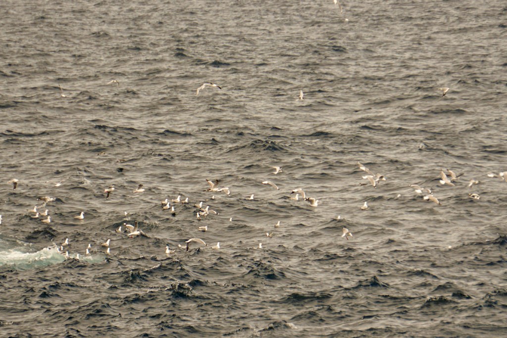
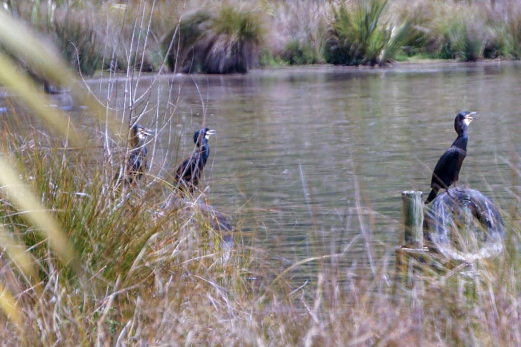
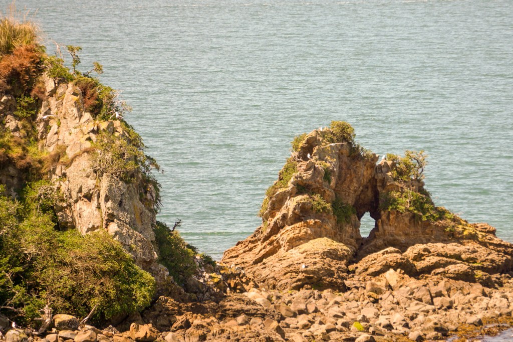
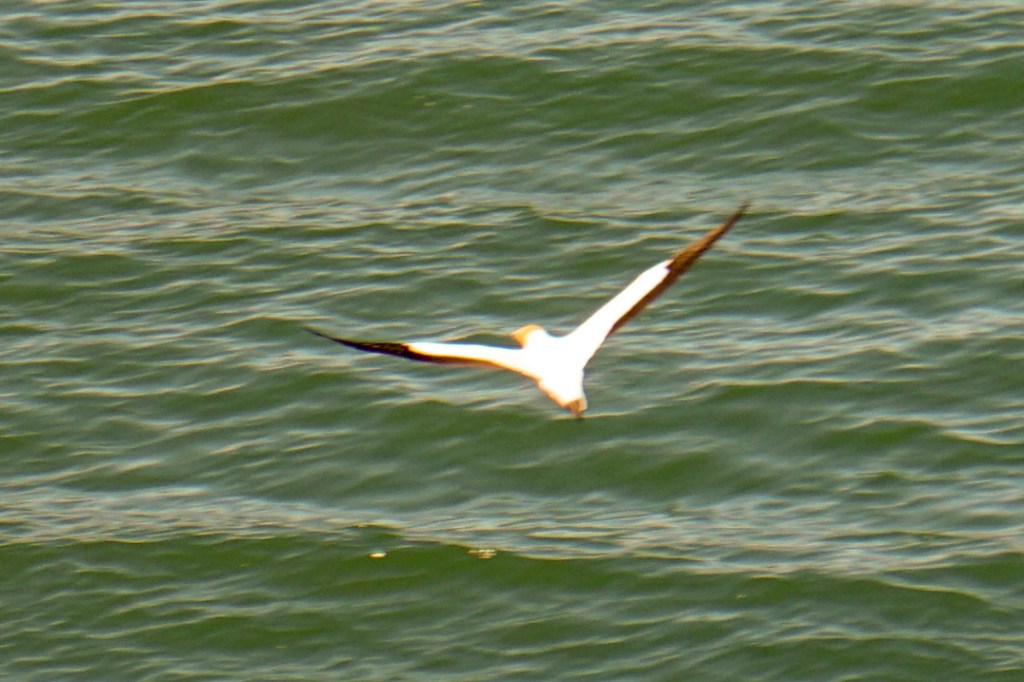
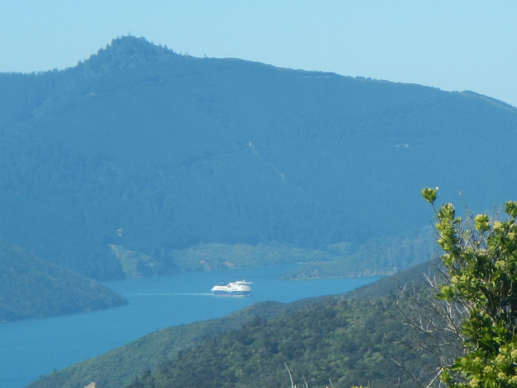
17 October – boat cruise around the Bay of Islands to the iconic Motukokako (the hole in the rock), although the sea was too rough for the boat to pass through the hole. We saw many birds including Australasian gannets, shearwaters, terns, variable oystercatcher and black-backed gulls. We landed on Urupukapuka and I climbed to a high point for the view as well as walking to Paradise Bay.

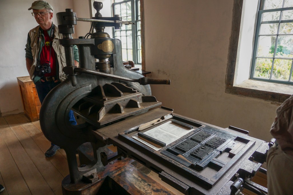
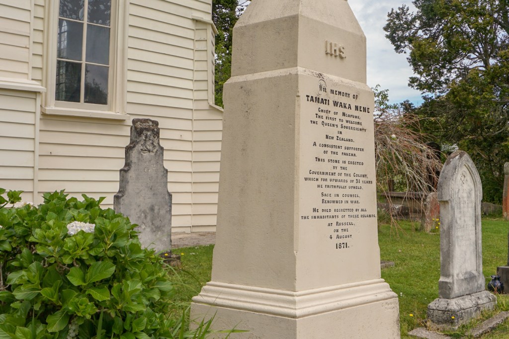
As suggested by Heinz and Brita, we disembarked at Russell on our way back and visited the Pompelier Mission built in 1842 to house the Catholic Mission’s printing press which printed 40,000 books in Māori over its seven years of operation. We also visited Christ Church – the oldest surviving church in New Zealand (1836) in particular to look at the wooden exterior which has musket and cannonball holes dating from the Northland war in 1845. The church graveyard contains a large memorial to Tamati Waka Nene, the first Māori chief to welcome the Queen’s sovereignty in New Zealand.
18 October – Brita gave me details of a superb all day circular walk over the hills through the bush and back to Paihia following a coast path. I spent the day doing that and exploring Paihia afterwards. Meanwhile my husband drove round the area (he had developed a foot injury) including a visit to Kawakawa where the main tourist attraction is apparently the colourful public toilet designed by Austrian artist Friedensreich Hundertwasser.


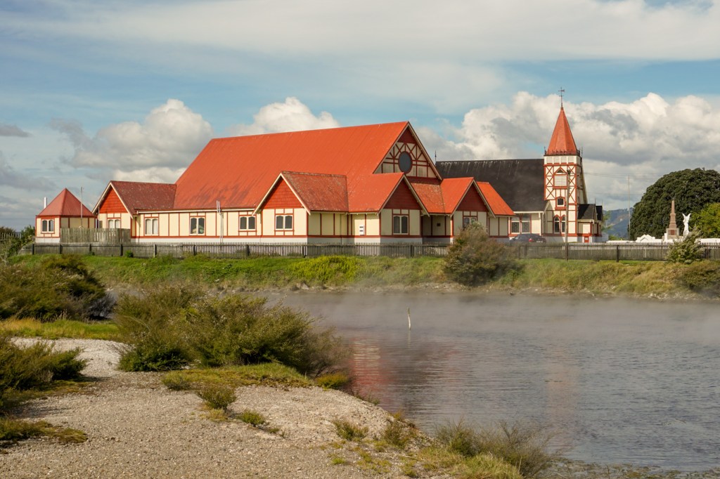
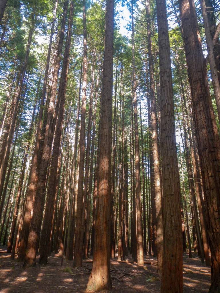
19 October – a long drive mainly along State Highway 1 past Auckland to Rotorua. Rotorua is famous for its geothermal areas so we noticed immediately the sulphurous smell. We were booked to stay at B&B @ The Redwoods which was next door to the Redwood Forest. Vivien, our hostess, was extremely helpful in guiding us towards making optimal use of our time in the area. She is proactive in having personal links with many of the local tourist businesses. The accommodation was first class https://www.redwoods.nz/.
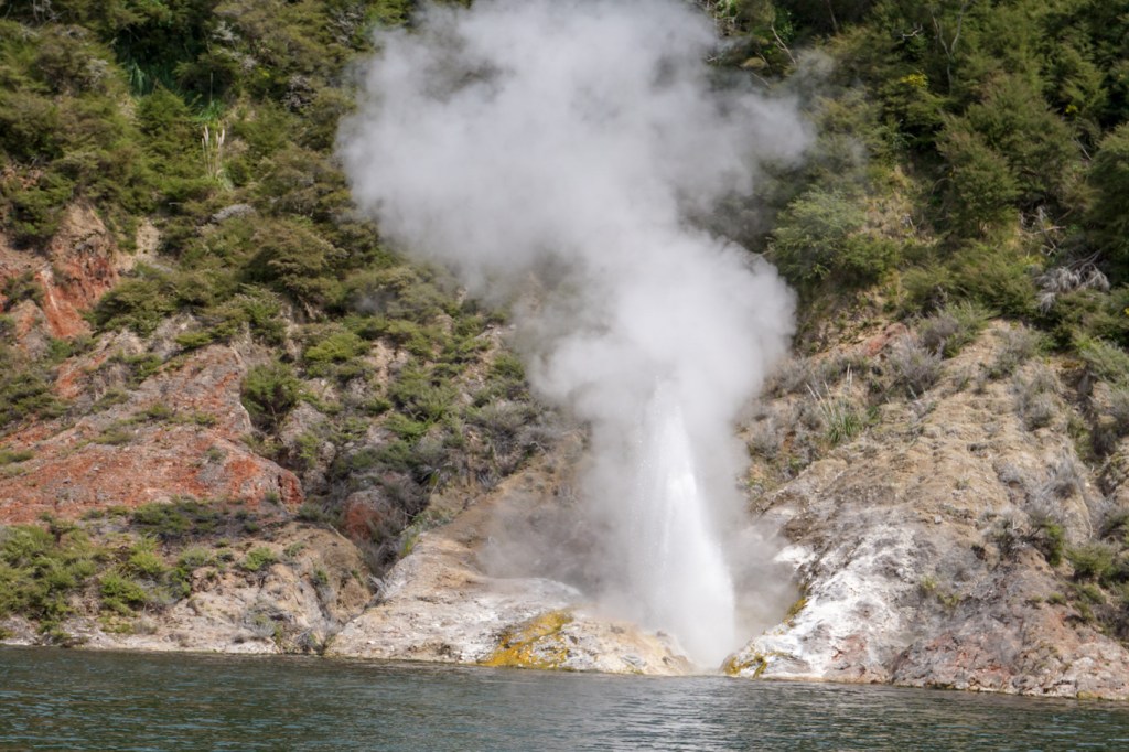
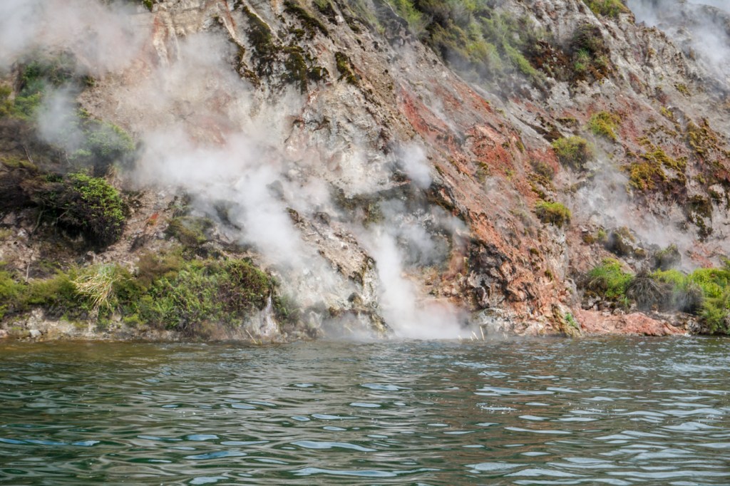
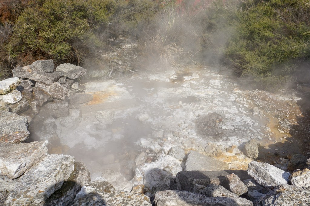
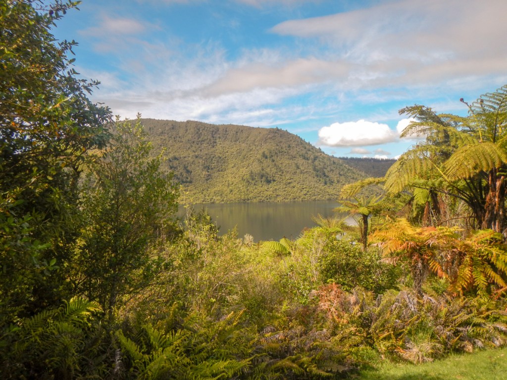
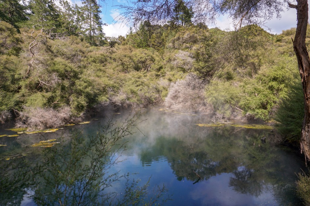
20 October – visit to the Waimangu volcanic valley, walking through the geothermal valley to Lake Rotomahana where we went on a boat cruise to the pink and white terraces and saw an active geysir as well as hot springs only visible from the lake.

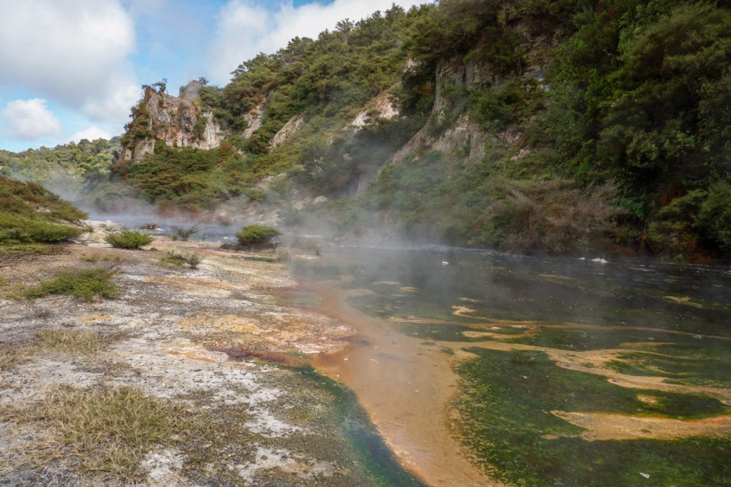
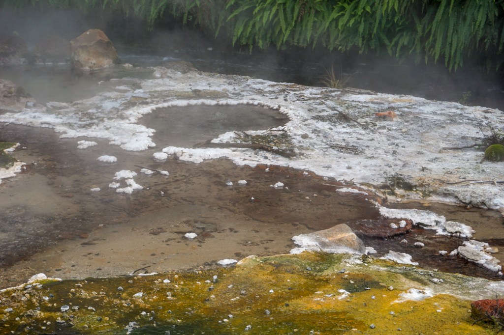
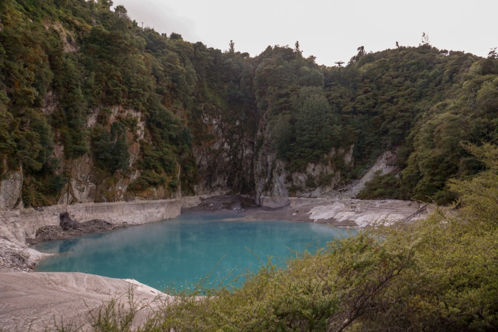

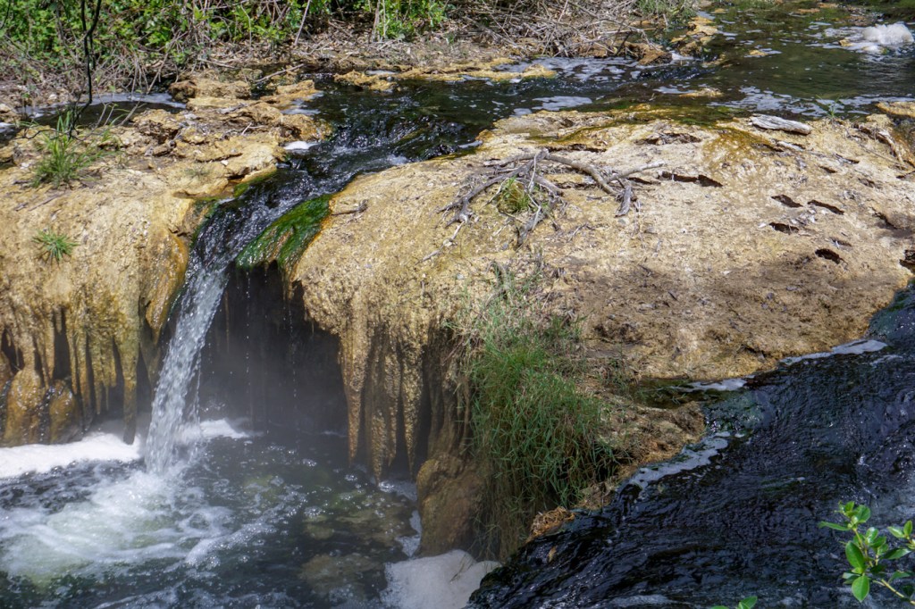
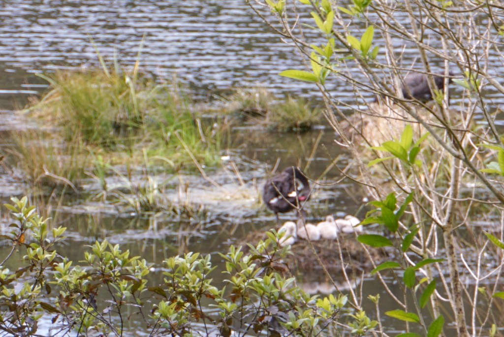
The geothermal system created by the eruption of Mt Tarawera on 10 June 1886, is the youngest geothermal system in the World and the only one created as the direct result of a volcanic eruption. Highlights included boiling mud pools, fumaroles, hot springs, the lakes, nesting black swans, scaups (a native duck), New Zealand swamp hens and little black shags. Surprisingly, much vegetation has grown since the 1886 eruption – many kanuka and manuka trees which are suited to the soil conditions.
After this we drove back to Rotorua and found the Māori village that Vivien had told us about, including the large square and sacred meeting place. There were many fumaroles and hot pools in the area and warnings that new ones appear on a regular basis (including in people’s gardens).

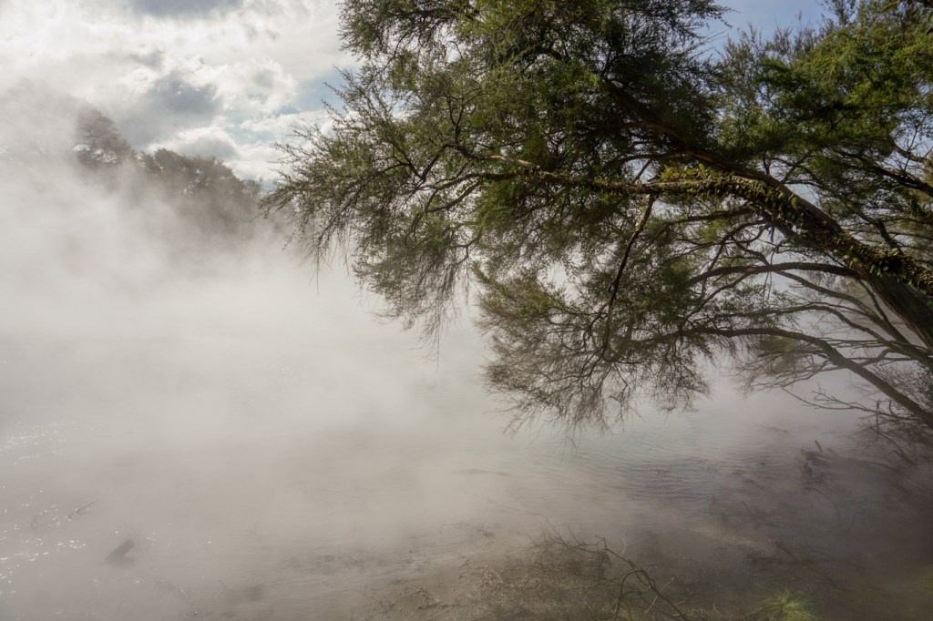
We walked through Kuirau Park where there are many mud pools and hot pools at a temperature above 100 deg C. We were swallowed up in clouds of sulphurous steam at some points.
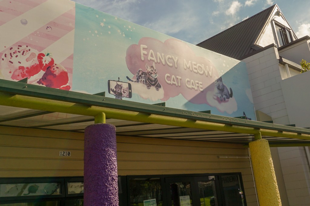
Unfortunately the Fancy Meow cat café had already closed so we missed the opportunity to cuddle cats while drinking coffee.
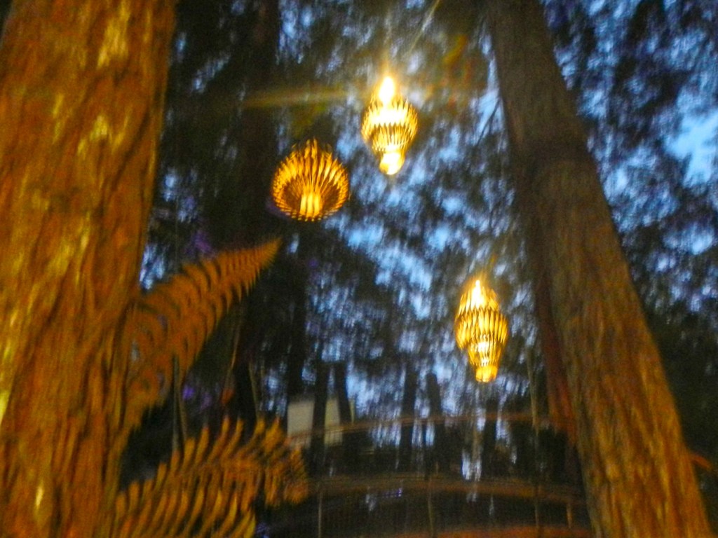
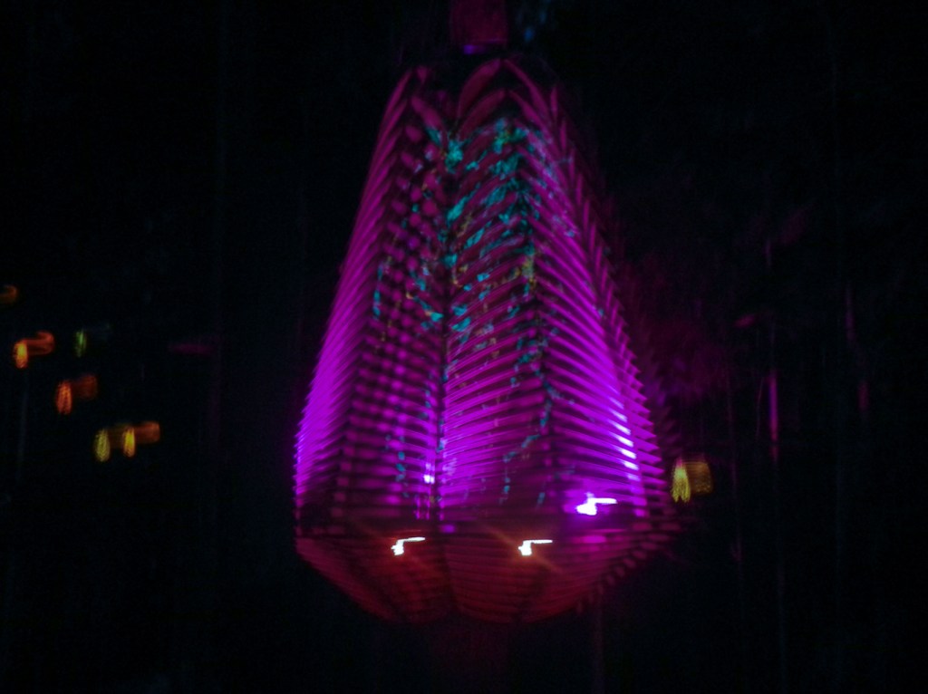
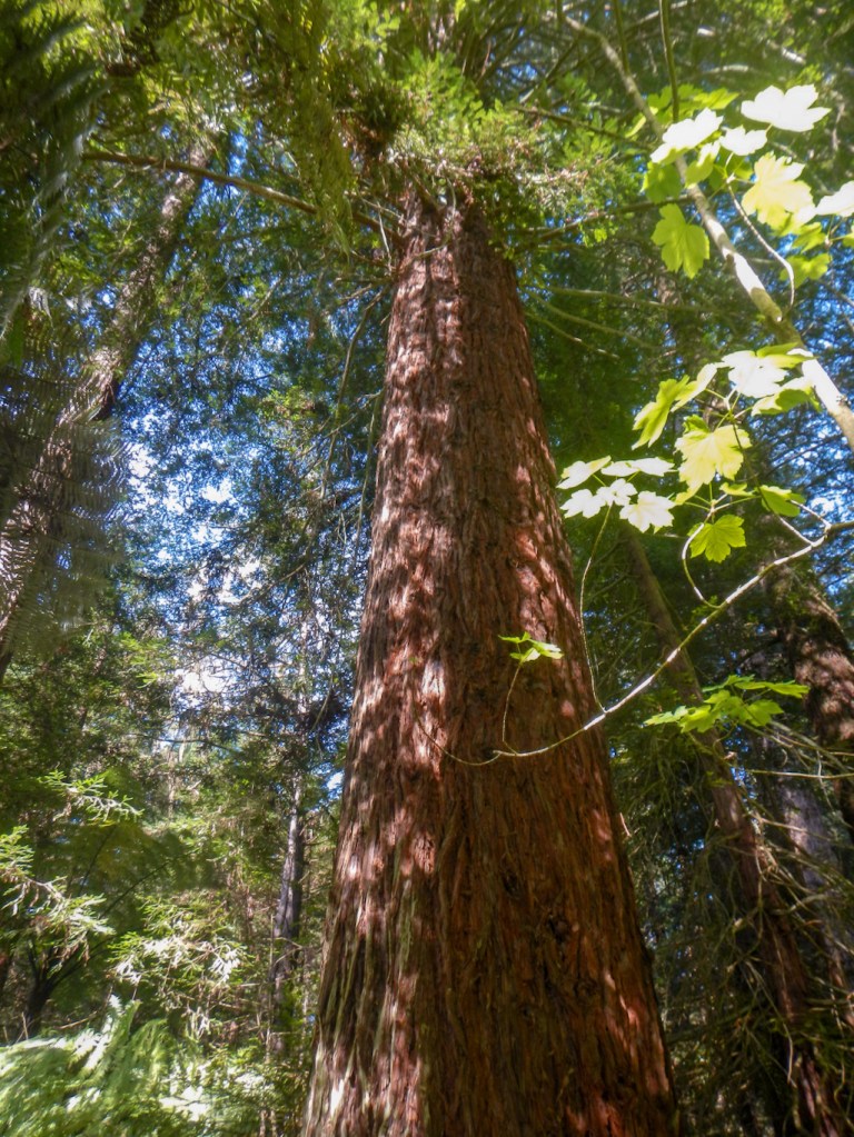
In the evening we followed Vivien’s excellent advice again and visited the World’s longest living tree walk – 700metres long with 28 bridges and 27 platforms, all illuminated by eco friendly wooden sculptural lanterns designed by David Trubridge.
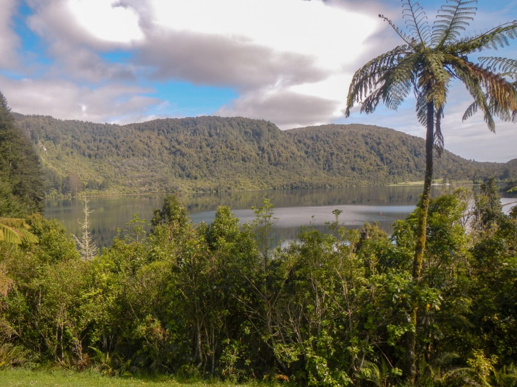
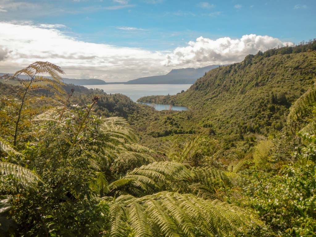
21 October – we decided to go and look at some of the lakes near Rotorua. Once more, we received first class advice from Vivien about the different lakes and the best route to drive. We visited the blue lake (Lake Tikitapu) which I circumnavigated on a walking track, the green lake (Lake Rotokakahi) which is sacred to Māori, drove past the buried village (buried in 1868 volcanic eruption) to Lake Tarawera and then went to Lake Okareka where we did some bird watching from the lakeside walk.


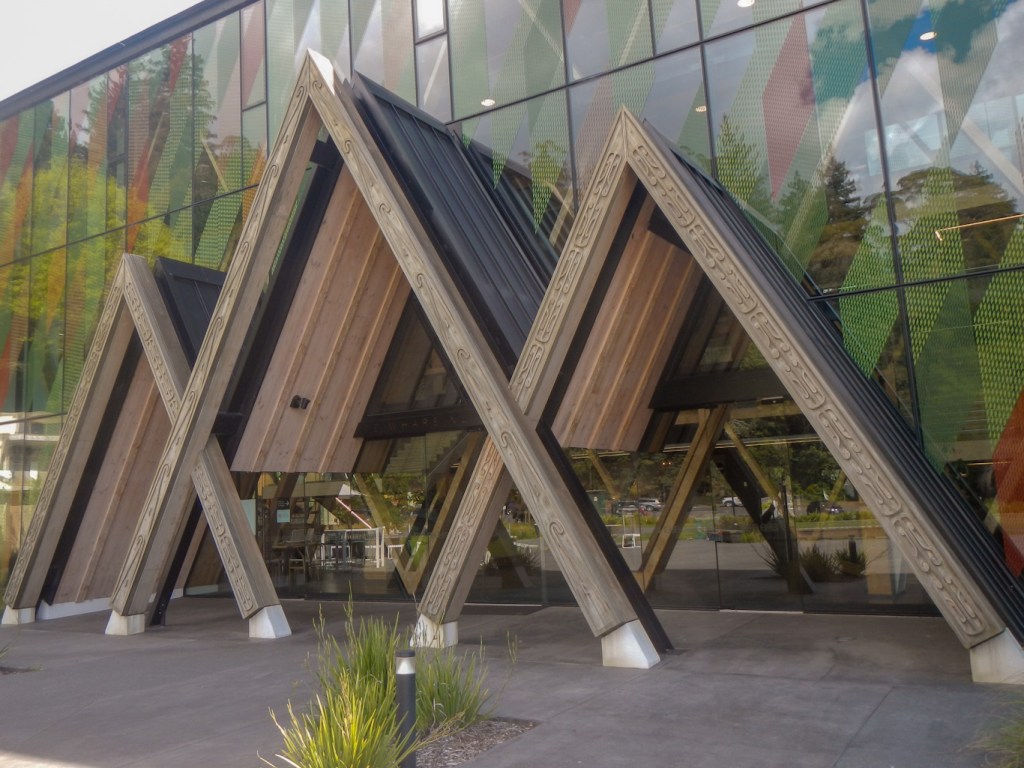
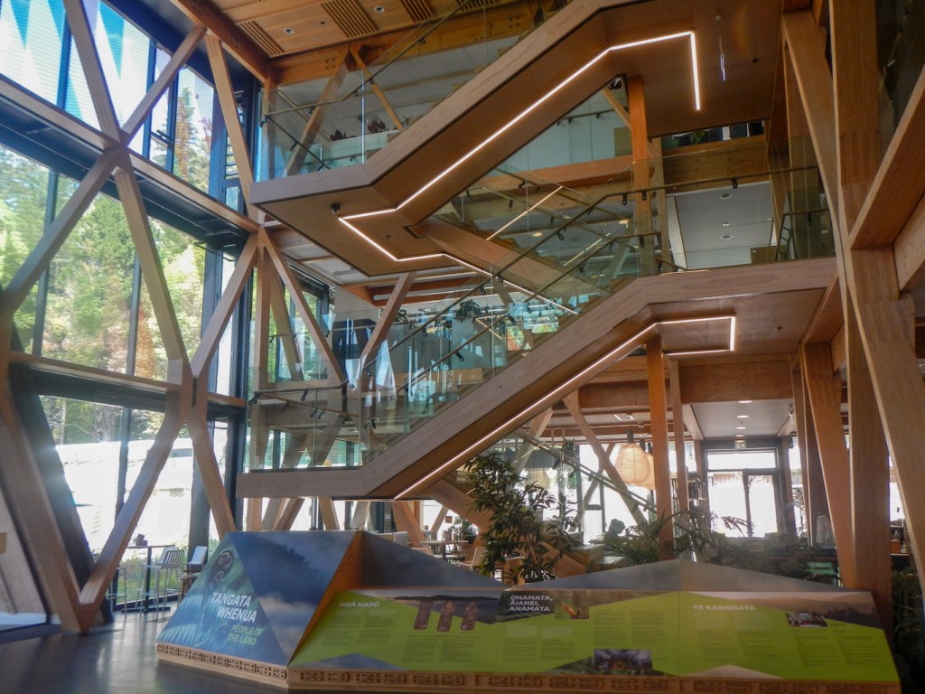
We headed back towards the redwood forest and visited the exhibition centre. Te Whare Nui o Tuteata is the largest wooden diagrid structure building in the World. Diagonal grid structures (diagrids) are an efficient way to provide strength and stiffness, requiring less material than traditional structures. The cross laminated timber provides strength but also flexibility to help protect the building during earthquakes. In addition the building is expected to be carbon neutral over its lifespan. The display included information about the innovative research work being carried out in the adjoining woodland research centre to support precision forest management, new bioproducts, clean technologies and improved industrial design.
As if I hadn’t walked far enough already for one day, I spent the early evening walking on a hilly 7-8 mile walk through the redwoods, reaching areas of fern, larch and more open woodland with superb views over Lake Rotorua and the city.
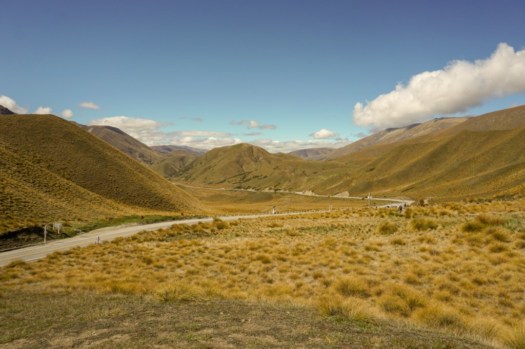
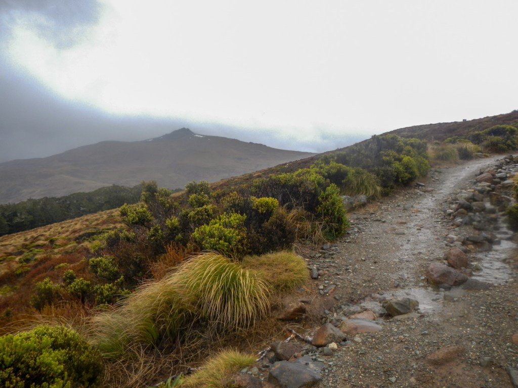
22 October – having been so well looked after with such brilliant advice about how to spend our limited time, we were sorry to say good bye to Vivien. However we were set to move on to Turangi. We passed lots of steaming areas and enjoyed views of volcanoes. The route then ran close to the shore of Lake Taupo. A cold wind and some rain meant we weren’t keen to linger by the lakeside so we arrived at Turangi before the I-centre closed at 1pm. Unfortunately the volcanic activity centre with earthquake simulator mentioned in our guide book closed in 2021 and actually we didn’t get any information that we didn’t already know about the Tongariro Alpine Crossing. We booked into the motel promptly and I spent a rainy afternoon preparing for the walk as the weather the next day looked promising.
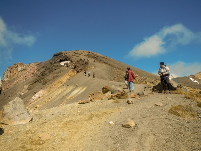
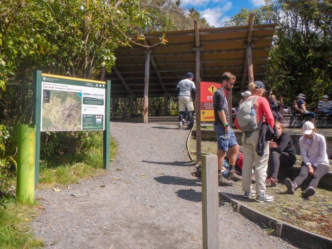
23 October – this was the Labour Day Bank Holiday so the roads were very quiet at 07.30am when we set off for the start point of the Tongariro Alpine Crossing at Mangatepopo road end. My husband had decided he wasn’t going to attempt it as his foot was still painful. Hence he was able to give me a lift to the start point and from the end point, meaning I wouldn’t have the expense and logistical issues of sorting shuttle transfers.
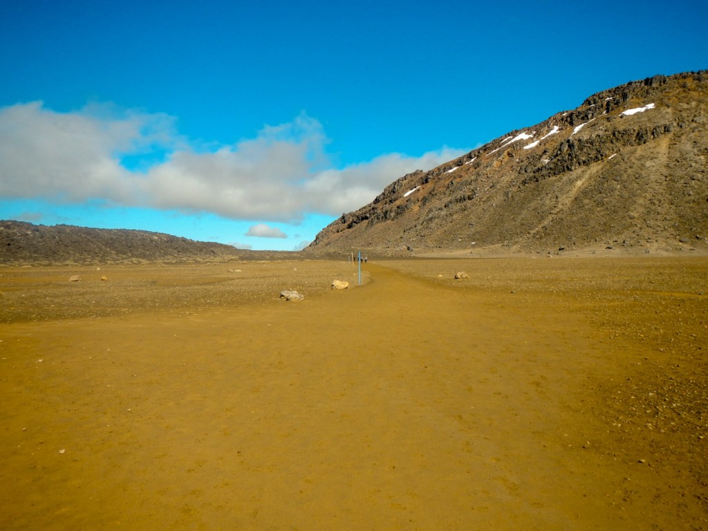
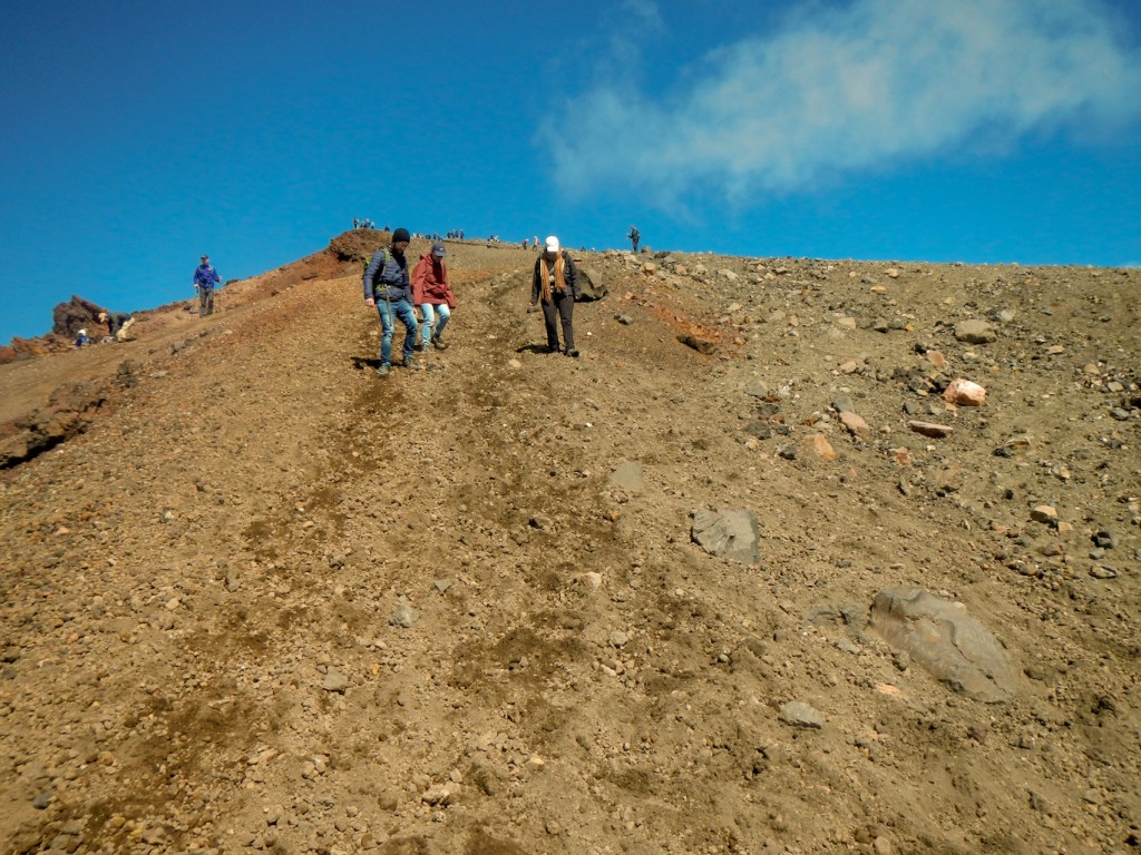
The walk is 19.4km but is advertised as taking 7-8 hours and there are many warnings that it is very challenging. As I arrived at the start, I saw lots of people preparing to set off. I was soon at Soda Springs, where there are notices explaining that this has been the easiest part of the walk and to turn back if feeling tired, the weather looks bad etc. I continued onward. A few people overtook me but I was moving faster than most of the other walkers and overtook several groups.
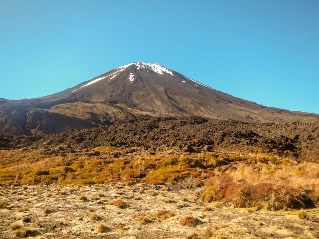
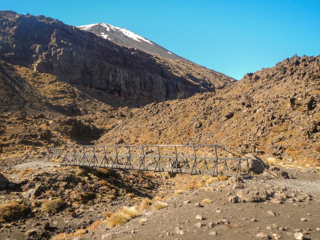
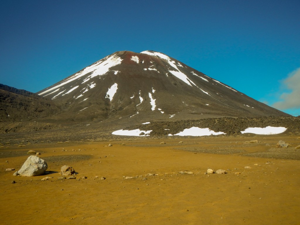
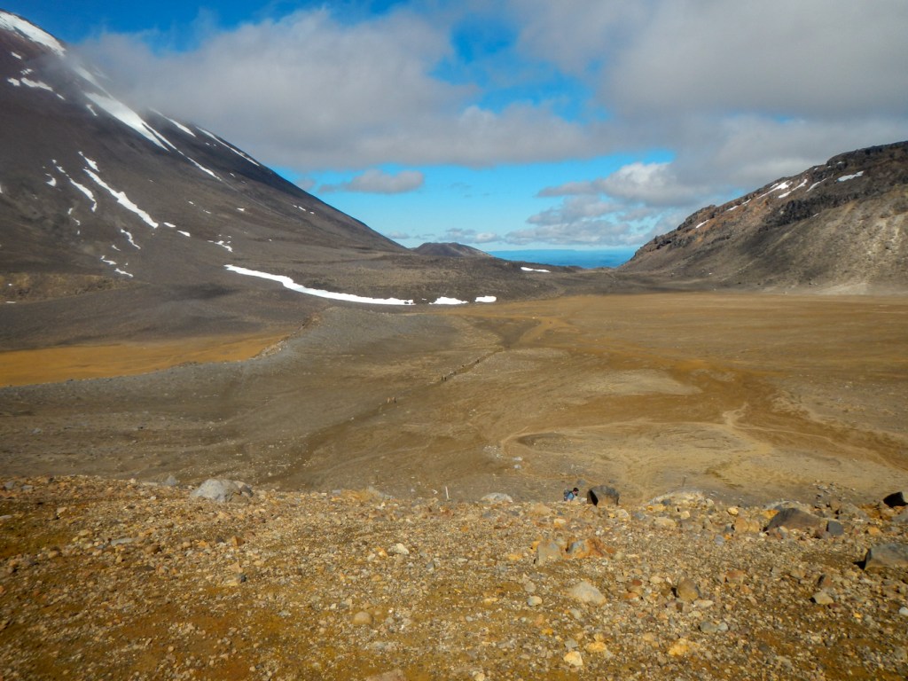
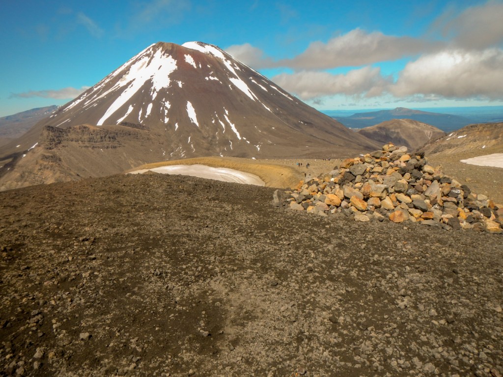
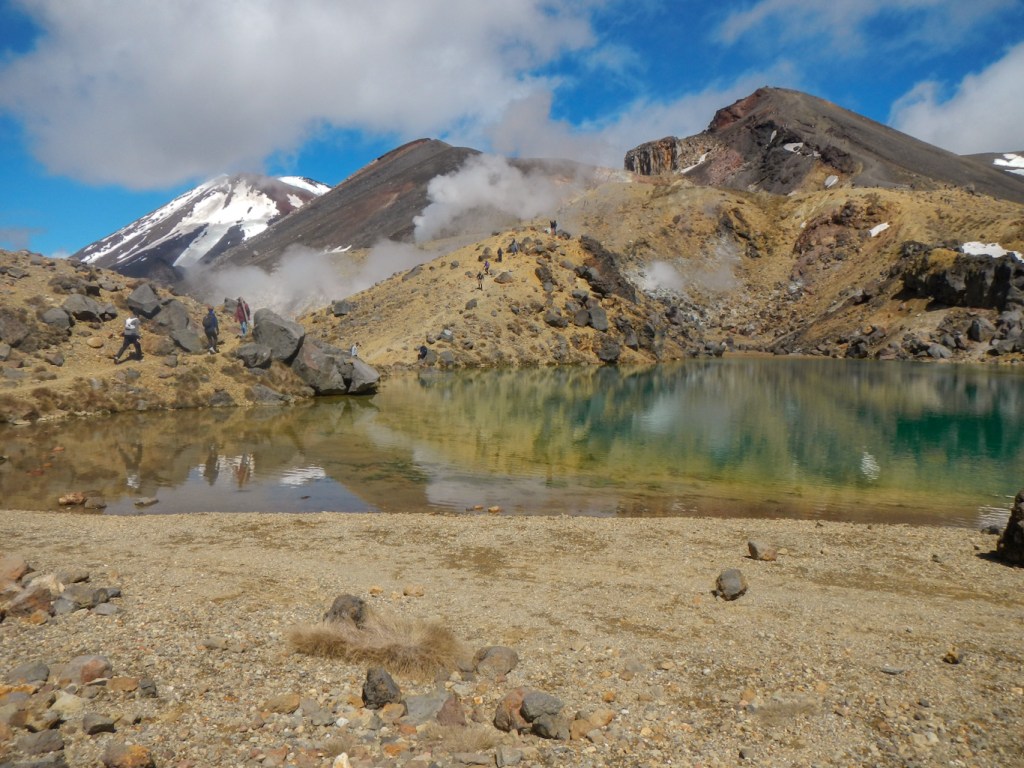
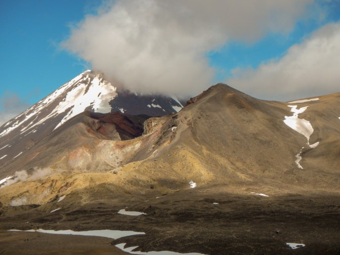
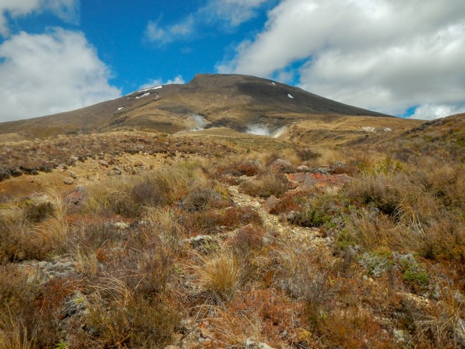
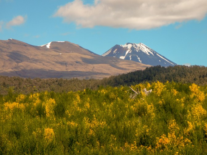
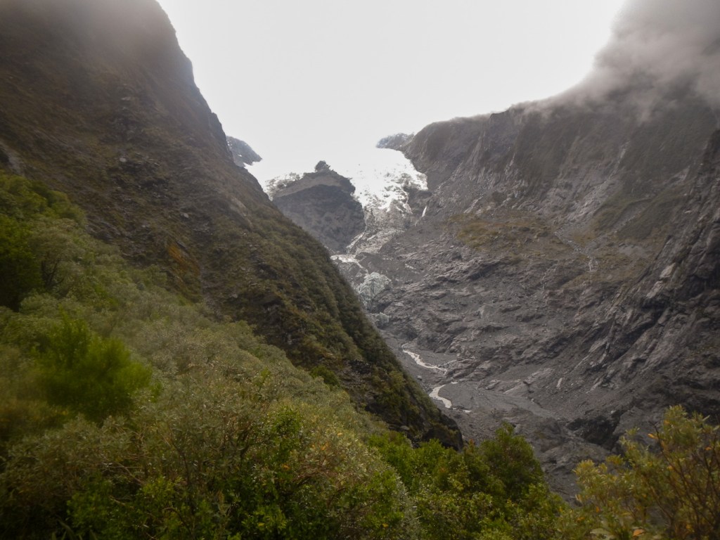
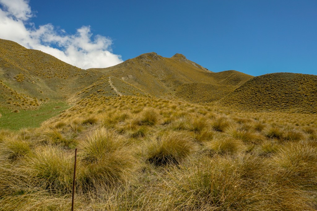
The path becomes more steep and rocky but then passes over a large flat sandy bowl (South Cirque) and, on this sunny day, there were stunning views of the snow covered summits of Mount Tongariro and Mount Ngauruhoe.

After this easy bit of walking, there are further warning signs about the risks and difficulties of the ongoing route. Indeed the path becomes more steep and precipitous. However soon I spotted the highest part of the route ahead of me – the Red Crater. I heard some other walkers at Mangatepopo Saddle saying they couldn’t believe it was that far to climb, whereas I was surprised that I only had such a short way to go to reach the high point. I met a walker heavily loaded with full camping equipment walking towards me. He told me that he was completing the Tongariro Northern Circuit having been out for a few days. I reached the view point on Red Crater less than two and a half hours after leaving the start point.
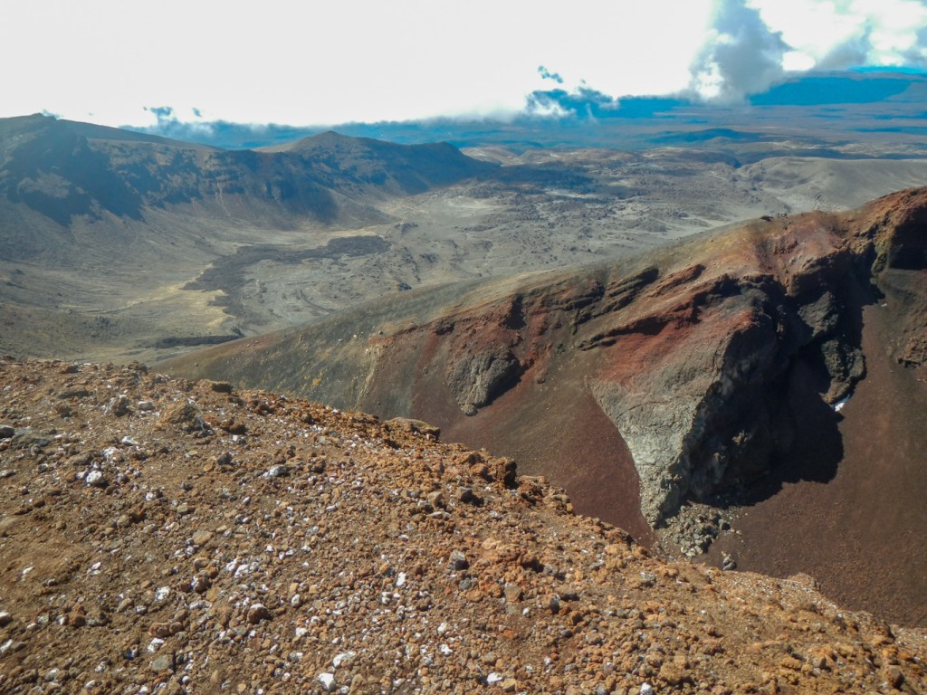
For me, the descent from Red Crater was the most difficult part of the walk. I crept along very slowly, using my trekking poles for support and stability. Everybody else seemed to be overtaking me. Some confident individuals were almost running down the steep volcanic rock scree and managing not to fall. Others were slipping and falling.
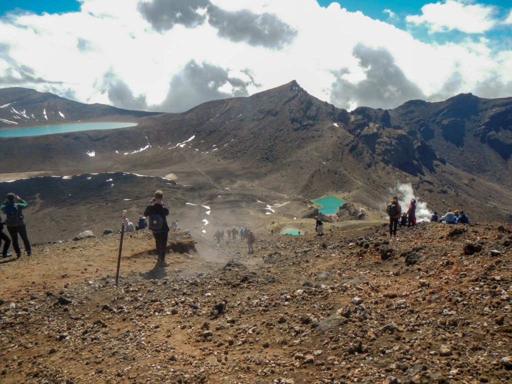
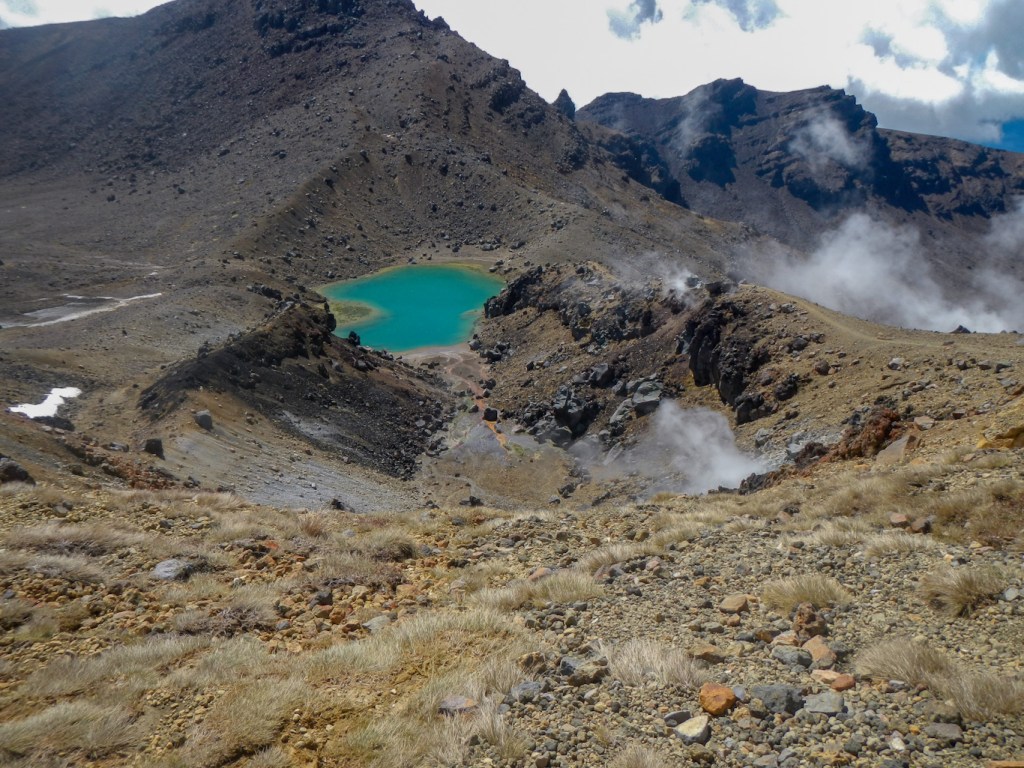
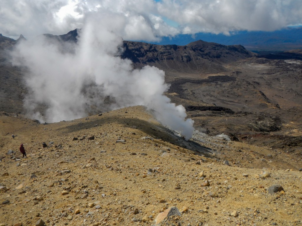
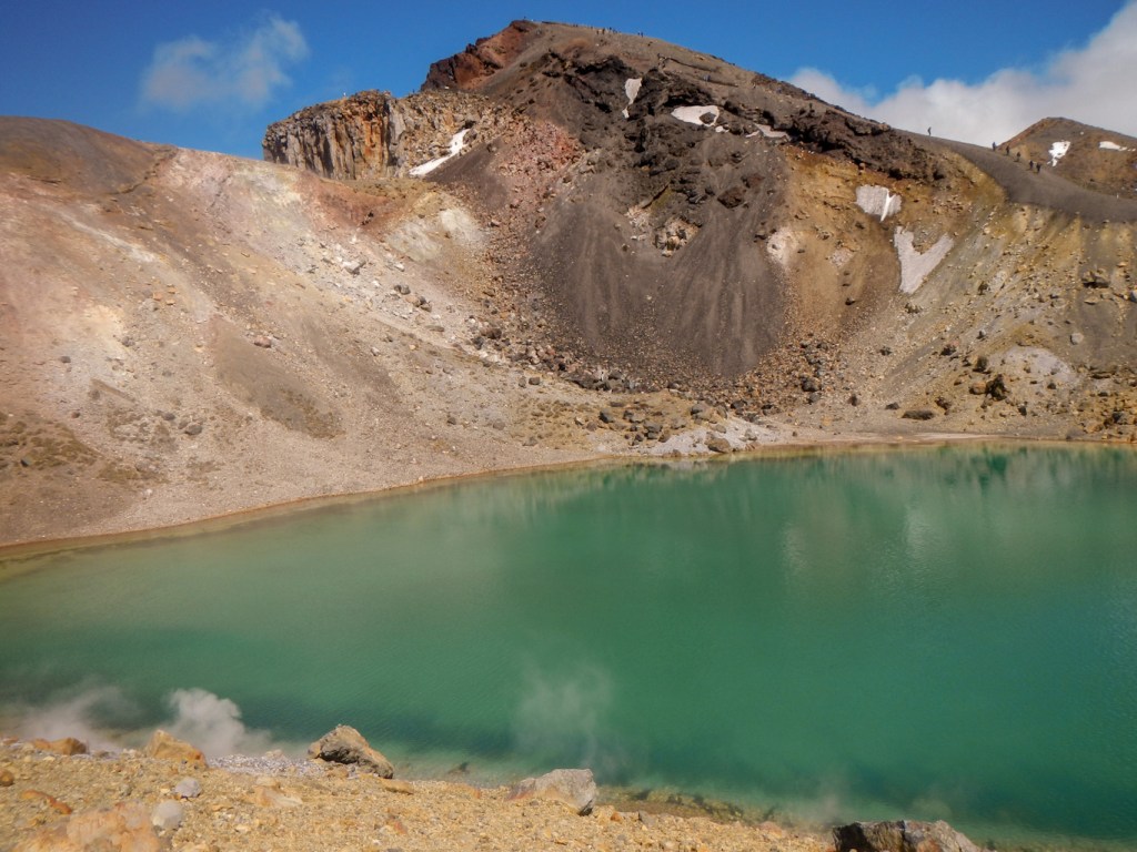
I am sure I was the slowest of all on this section, but I reached the end of it without a single fall. I took frequent stops to look at the views of areas of geothermal activity and the Emerald Lakes.
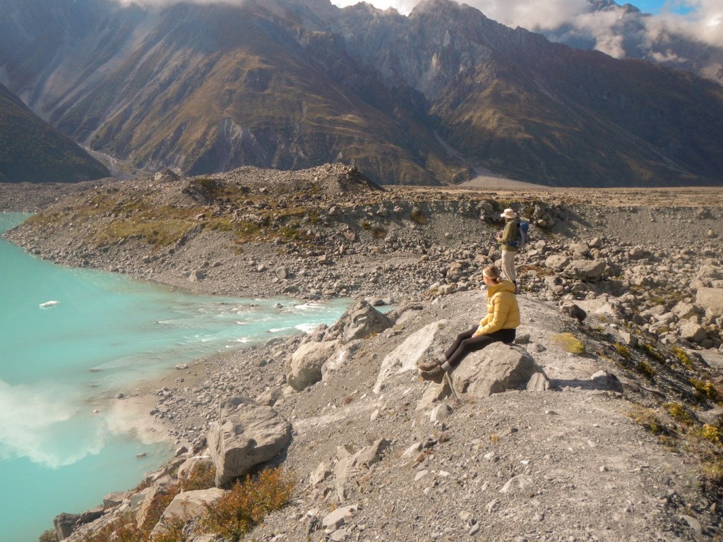
I was still ahead of time so I deviated off the main path to go around and near to the Emerald Lakes. I sat on a convenient rock to eat an early lunch. It was a superb spot with tremendous views of the Red Crater, fumaroles and the Emerald Lake itself which had erupted only around ninety years ago. Although the area was fairly busy, it wasn’t too crowded. However I noticed that my rock seat was re-occupied very quickly after I left to continue the walk. At this point I was actually on part of the Tongariro Northern Circuit just before it joins the Tongariro Alpine Crossing.
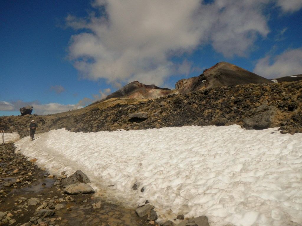
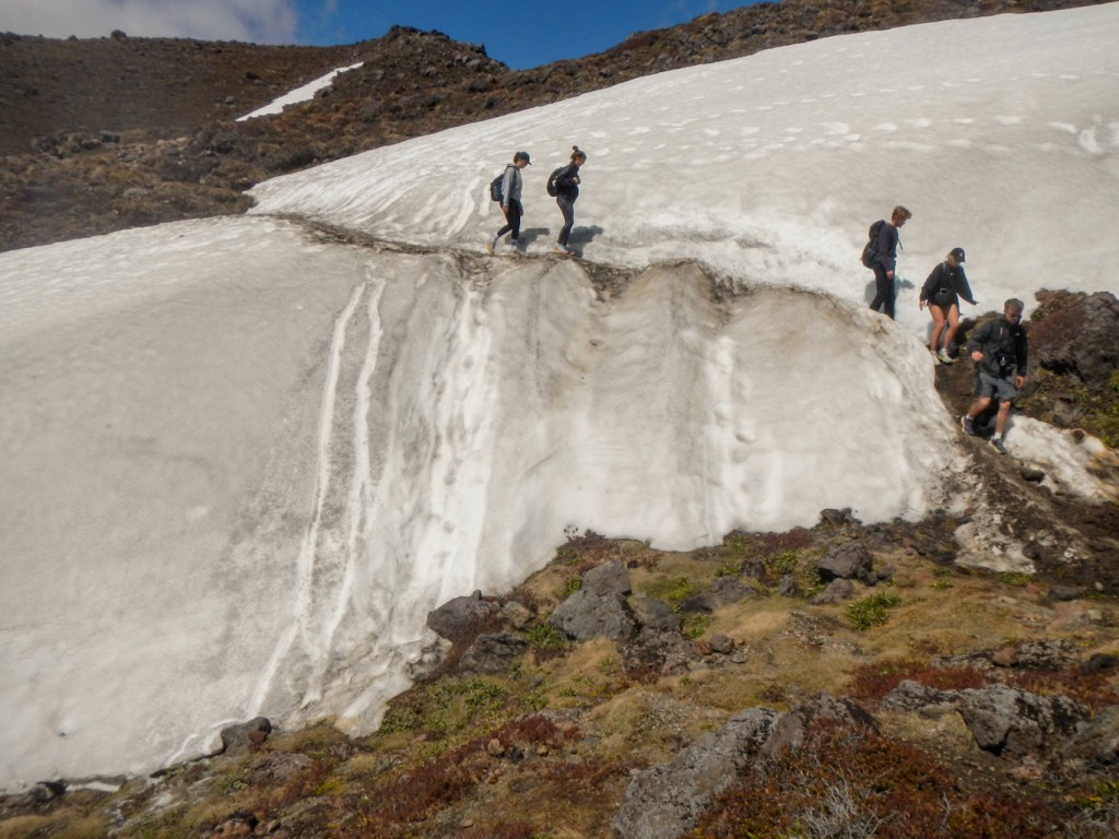
I re-joined the main Tongariro Alpine Crossing path at a sign explaining that this is the half-way point. My descent was gradual on a well-made track. There were a couple of short bands of snow to cross – which I made certain to do carefully as my holiday insurance didn’t include winter sports cover.
Near Blue Lake, there is a notice saying that 40% of helicopter rescues are between this point and the end – a warning not to be blasé about the descent.
I reached a viewpoint looking towards the Ketetahi Hot Springs. The area of the springs is private and so they can only be seen at a distance from the path. The track continues to descend on big zig-zags with helpful steps on the steeper sections. The fact that this is an active volcanic area is emphasised by notices about an eruption in 2012 which destroyed a mountain hut and led to closure of the track for many months.
Eventually I reached the bush-line (Totara forest) and a notice stating that it is just 45 minutes walk to the end point at Ketetahi car park. I realised that this meant I should be at the trail end by 14:30 after just over six hours walking rather than at the time I had my lift arranged around 16:15 to 16:30. I had a phone signal so sent a text to my husband. The path becomes much less steep and there are notices about potential lahar danger and advice not to linger. Lahar are a violent flow of mud and debris which can occur in valleys in volcanic areas.
It was difficult to know how close I was to the car park until suddenly I spotted a large wooden shelter. This day it was providing welcome shade from the sun. It was just before 14:30 as I had predicted when I had texted my husband. There was a signal and I had a reply saying that he would arrive around 15:00 and had just completed his visit to the National Army Museum. Incidentally he says that this museum is very interesting and well worth visiting for someone who is interested in this sort of thing. I was disappointed that I had also missed the opportunity to drive over the remote “desert” road and past the large orange statue of a carrot at Ohakune (but there isn’t time to do everything!). The Rangipo Desert evolved as the result of two million years of volcanic eruptions that coated the land with pumice and destroyed all the vegetation but technically isn’t a desert.
I am pleased that the weather was perfect for me to have the opportunity to complete this trek heralded as the best one-day trek in New Zealand and regarded as among the top ten single-day treks in the world. It is indeed a wonderful walk with unique and magnificent scenery. However, it wasn’t as long and challenging as I had thought given all the warnings – for example on the Swiss Via Alpina I was completing walks which included many longer and more difficult traverses day after day carrying a heavier backpack. Notwithstanding this, it does have the highest number of search and rescues for hikers in New Zealand and clearly needs to be treated with respect. Having seen the clothing, footwear and backpacks of some of the other walkers, I suspect that much of the problem has arisen because some of those attempting it are taking it on without much past experience of mountain walking as it has become a “bucket-list” item. There are also plenty of excellent alternative walks to do in the area which allow enjoyment of similar views and scenery, as I was to find out the next day.
24 October – this was when I realised how fortunate I had been to complete the Tongariro Alpine Crossing the previous day. It was definitely a day when it was better to walk at lower level as it was windy, cold and cloudy. We drove to Whakapapa village past a damp landscape with the volcano tops entirely obscured by cloud. We made a brief visit to the excellent Department of Conservation Visitor Centre with its superb and informative displays about wild life, geology, footpaths and skiing.
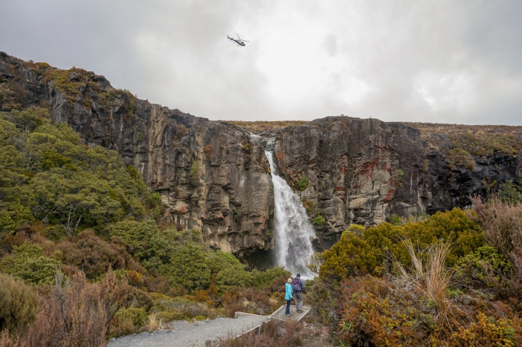
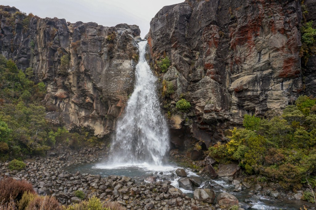
The weather was forecast to deteriorate as the day went on so we decided to start our walk to the impressive Taranaki Falls. We saw a helicopter ferrying path building items from the village to an area near the top of the waterfall.
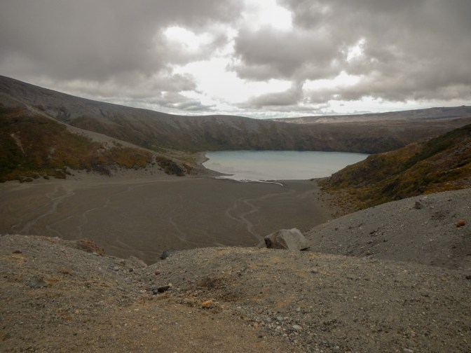
I continued on to the Tama Saddle and the Lower Tama Lake viewpoint but decided against continuing to the Upper Tama viewpoint which was in the clouds. The Tama Lakes are in huge 10,000 year old explosion craters.
I spoke to a man who had been in the mountains staying at huts and away from phone signal for three days but now on his way back to civilisation at Whakapapa and to a couple who had spent the previous day walking to a remote mountain hut in excellent weather but now retracing their steps and giving up on their planned expedition due to the poor forecast for the next few days. Returning from the Tama Lake view point, the cloud lifted a little and I had a view of the Pinnacle Ridge, the oldest exposed part of Ruapehu with rocks over 220,000 years old.
I arrived back at Whakapapa to join my husband for coffee and cake at a horsebox repurposed as a mobile café. The owner told us that the impressive looking but closed iconic Chateau Tongariro Hotel in the village had shut down following the triple whammy of Covid, a poor ski season and an E grade earthquake safety rating.
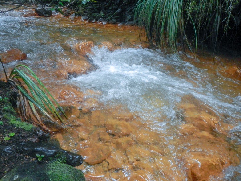
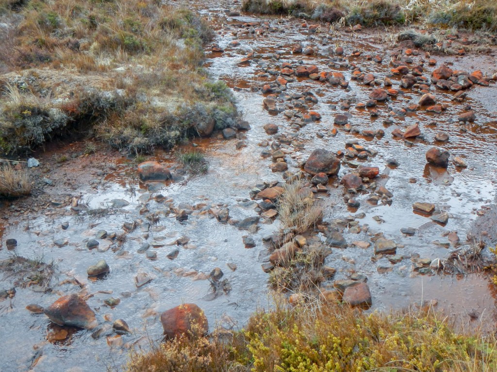
I walked up to the nearest start point of the silica rapids loop track while my husband drove further up the road to the far start point (or end-point). I walked through the bush, reaching the so-called Gold Rapids although actually the colour is due to oxidised iron (rust!).
I passed some areas of lava covered with alpine plants. The plants have developed a red coloration as protection because red pigments filter light and neutralise the damaging chemicals that cause cellular damage which are formed by plants when growing under stress in excessively wet, dry or cold places or without shelter from direct and reflected sunlight.
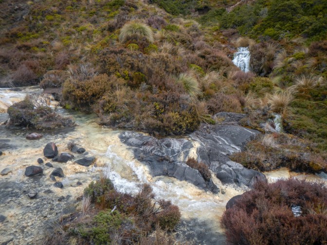
I reached the Silica Rapids area, where I met my husband who had approached from the opposite direction. These are shallow terraces covered with creamy white deposits. When the stream emerges from lava cliffs at the head of the valley the water is rich in aluminium and silicate minerals. As the stream gathers speed and the water is aerated, the alumina-silicates are deposited on the stream bed.
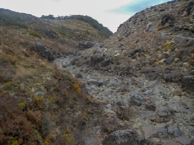
We walked together back to the car, passing a dry valley which was an old lahar path.
We drove on up the hill to the lower station of the Sky Waka gondola at Iwaku, where it was very cold and windy. The summer season for the gondola doesn’t start until the beginning of December.

We drove back down the road past Whakapapa making a final stop for a very short walk to the Tawhai Falls. Although only 13m high, it’s a picturesque waterfall that plunges into a deep pool over an ancient lava flow. The pool was the filming location of Gollum’s pool in Lord of the Rings.
My boots were very muddy so after returning to the motel, I spent the evening scrubbing them to comply with biosecurity rules on moving between areas as I wasn’t predicted to need then for our final day in Tongariro.
25 October – We were very fortunate as the weather moved over more rapidly than the forecast had predicted. It had rained heavily overnight so we woke to a dry day.
Our first stop was at the steaming hot mud pools at Tokaanu. We also saw trout in the cold water stream.


We drove past some impressive steaming cliffs but sadly there wasn’t anywhere to park the car to allow us to take photos.
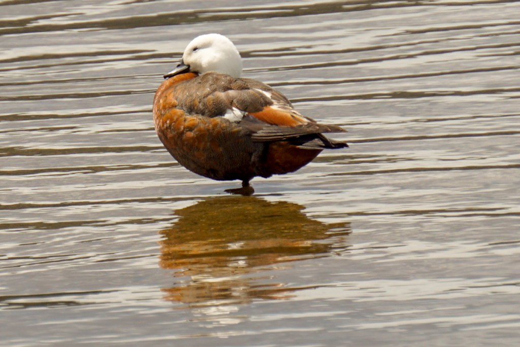
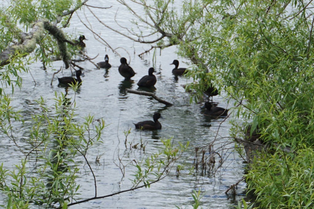
We turned off the main road, reaching lakeside villages on Lake Taupo which were all very peaceful and virtually deserted. We were able to stroll along the shore of the lake looking for birds – New Zealand scaup, black swans, California quail and of course the fan-tails and tui seemingly ubiquitous in New Zealand but of great curiosity to us.

We returned past the Tokaanu pools and decided to hire a private geothermally heated spa pool to wallow in and relax for twenty minutes – definitely recommended.
My husband dropped me off as we approached Turangi and I walked on a very overgrown but definite path up Mt. Maunganamu, colloquially Mosquito Hill. In view of the poor maintenance of the path, I was surprised to discover a solid lookout platform near the summit with views over the Tongariro River only partly obscured by tree branches. According to maps, there used to be a circular path at the summit but this seems to have disappeared and so I wasn’t able to look in all directions. My walk back to Turangi mainly followed a track that I suspected was the old road and now appears to be used by motor cyclists on off road bikes and ancient cars driven by young children – fortunately under the watchful control of an adult in the passenger seat.
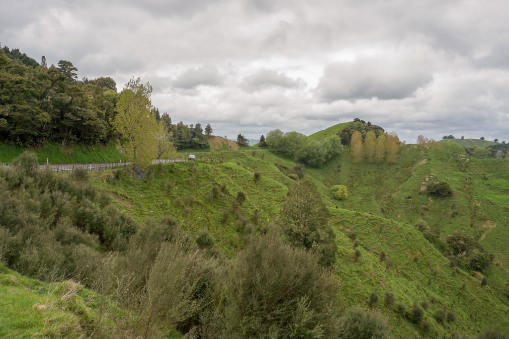
26 October – the start of our drive from Turangi was in fog almost all the way to Taumarunui. However we were fortunate that the visibility improved. Taumarunui was the place where we turned on to State Highway 43, known as the Forgotten World Highway and New Zealand’s oldest heritage trail.
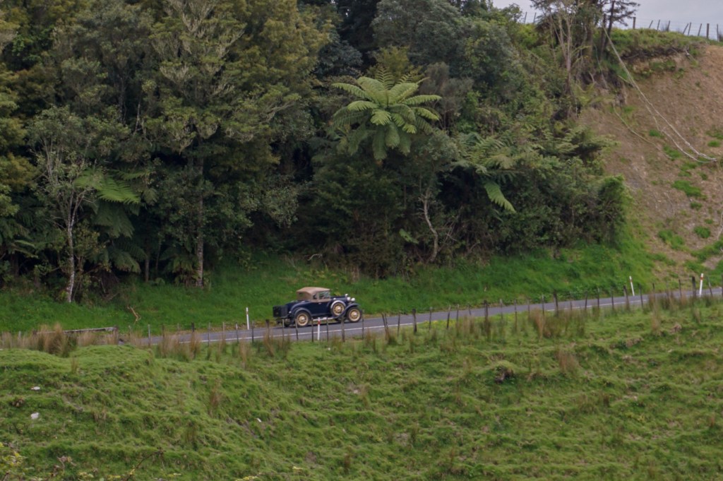
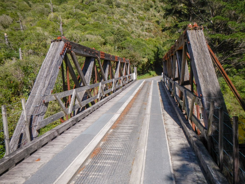
As soon as we turned off State Highway 4, we seemed to be in another world. Unsurprisingly it felt more like a Lord of the Rings set than like real life as this was one of the landscapes used for the films. Ridged hills rise each side of a deep valley containing a fast flowing river. The road is undulating and winding, still partly gravel but gradually more of its length is becoming a sealed highway. We passed over high saddles between the hills and the views were superlative. We noticed grass covered hills topped with rock from which trees were growing – like a reverse tree-line. An assortment of vintage vehicles drove past in the opposite direction as it has become an iconic route to drive.
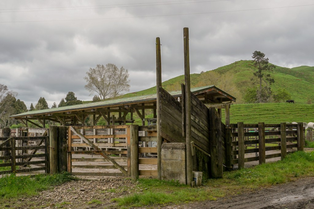
Much of the land is used for sheep and for beef cattle farming. We had to stop for sometime once we reached the Tangarakau Gorge section as the road was closed until 3pm because of the road surfacing work. I walked along a side road past some large cattle stations while we were waiting.

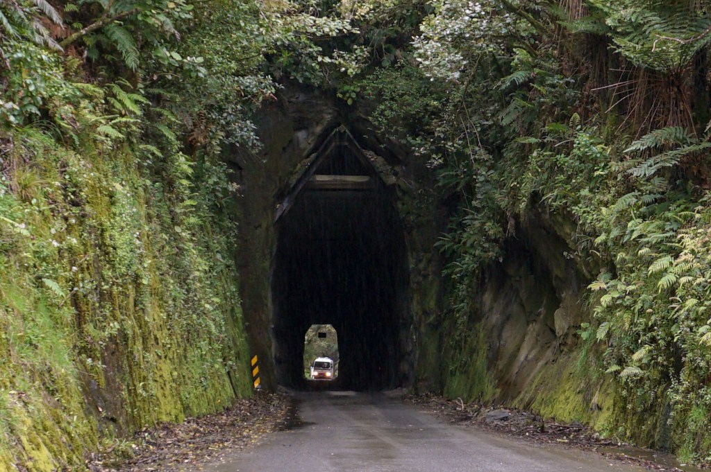
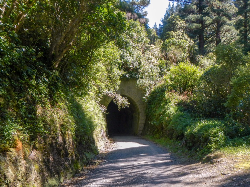
Once under way again, the gorge is huge with steep rock sides and followed by the narrow Moki “hobbit” tunnel.
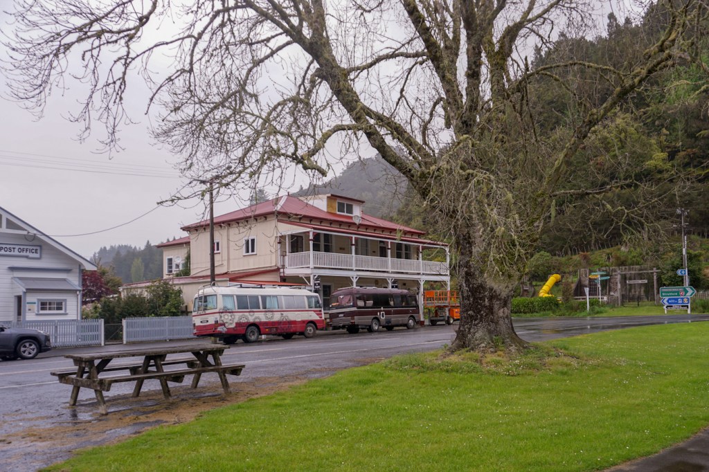
Eventually we reached the village of Whangamomona, which declared itself a republic in 1989. The “centre” of the republic is the quirky village hotel where we stopped briefly for coffee and cake. Two flower power buses which we had seen earlier in the day also parked there. We spotted the Presidential Park and the historic butcher’s shop. However our good fortune with the weather had ceased and it started to rain heavily.
We continued on over further hilly roads with hairpin bends, eventually reaching the unforgotten world again at Stratford, from where it was only a short distance to our spa accommodation, Platinum Lodge, in Pembroke . https://www.platinumlodge.co.nz/ The room was superb and we were even given a free lift into Stratford and back for our dinner.

There should have views of Mount Taranaki from the room and by the morning the cloud was starting to clear and we saw parts of the volcanic cone through gaps of clear sky.
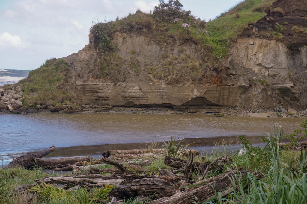
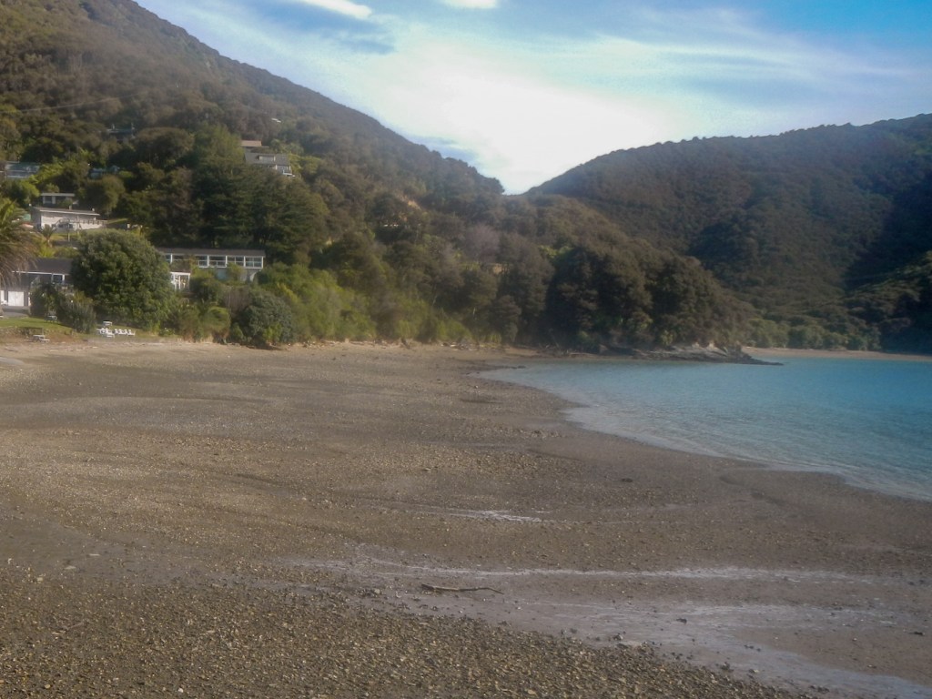
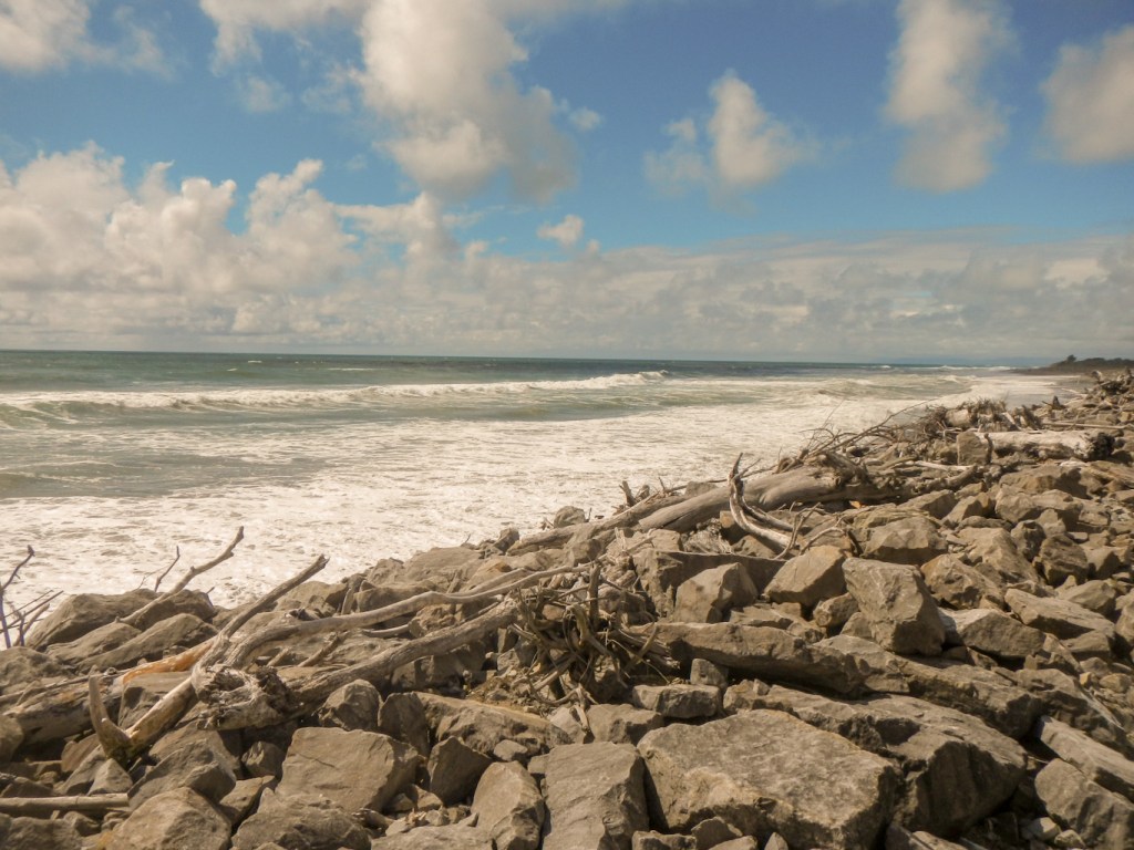
27 October – the drive to Lower Hutt was shorter than some of our drives, allowing more time to stop at attractions on the way. Our first stop was at a windswept Kai Iwi Beach, a wild foreshore strewn with enormous pieces of driftwood in copious quantities. We were reminded of the vulnerability of the landscape – we could see that the huge cliffs were undercut and eroding, putting the beautiful homes on the tops at risk of falling into the sea. There were also many notices about actions to take in event of an earthquake and / or tsunami.

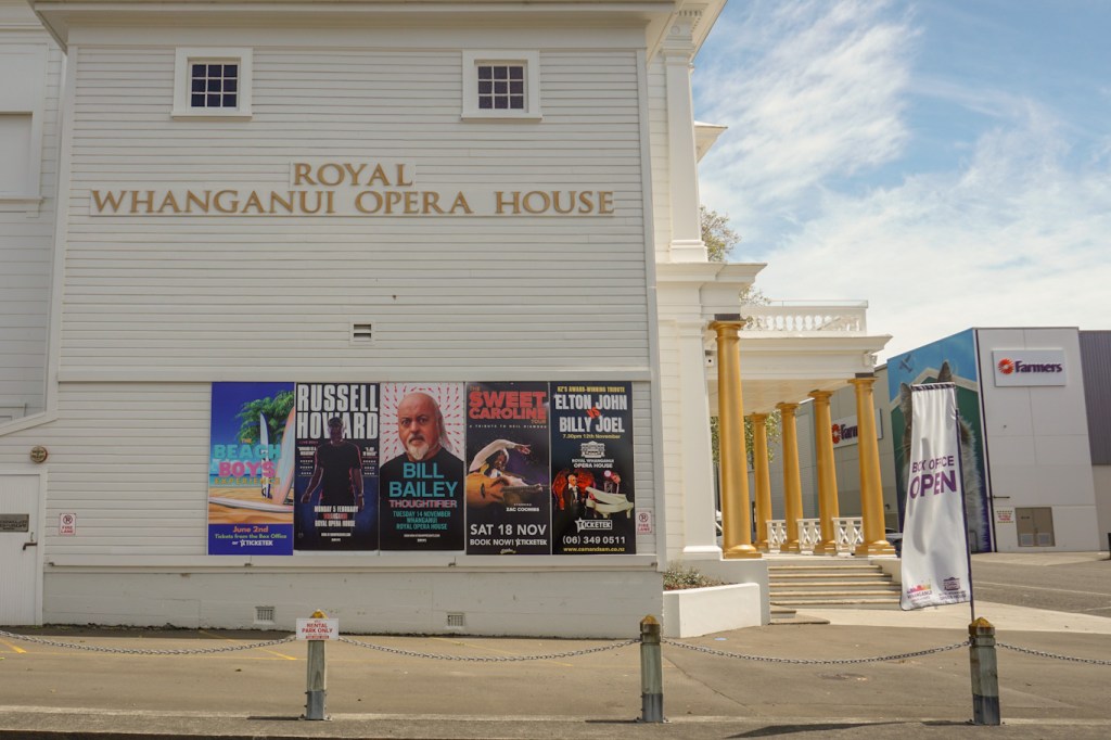
Next stop was Whanganui City where we parked near the opera house and were delighted to note that Bill Bailey would be performing there in mid November. He comes from the same town as me in the south west of England and his parents became friends with mine through the local St John Ambulance Association. We discovered he will be in Wellington on 19 November and we are travelling there too on that date, but my husband said we would be arriving too late to get to the concert (and besides it would probably be sold out already).
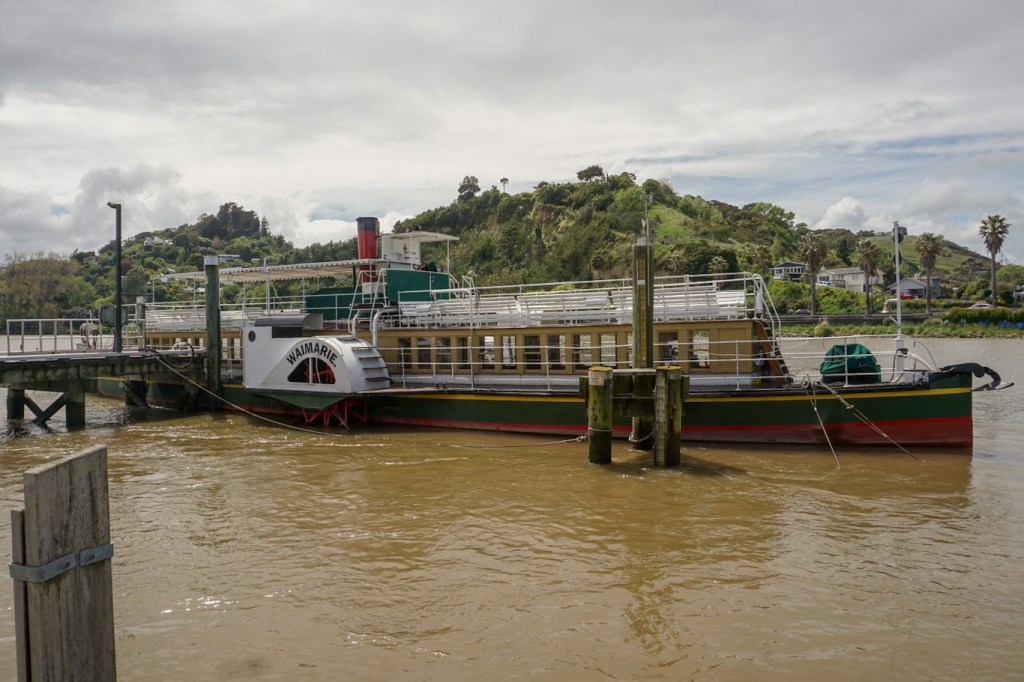
Whanganui actually turned out to hold much more of interest than we had expected. We visited the fascinating exhibition on the quay about the Whanganui River paddle steamers and their history stretching back to Victorian times. We also made a quick visit to the regional Museum but only had time to look at the exhibition about the Whanganui River. This was superb with a multi disciplinary display about the river centring on the fact that the river has legal rights as a person – a status conferred in 2017 – in line with Māori values and principles. The Whanganui tribes have nurtured a deep connection with the waterway for at least 880 years.
We had to move on – our parking time was about to expire. Besides we still had some distance to travel to our destination and our friends, Maggie and Martin, who we were staying with for the next three nights, would be expecting us. We hadn’t seen them since before they emigrated well over a decade ago. That first afternoon and evening in Lower Hutt, we had so much to talk about over a bottle of wine or two that we suddenly realised at bed-time that all our luggage was still in the car!
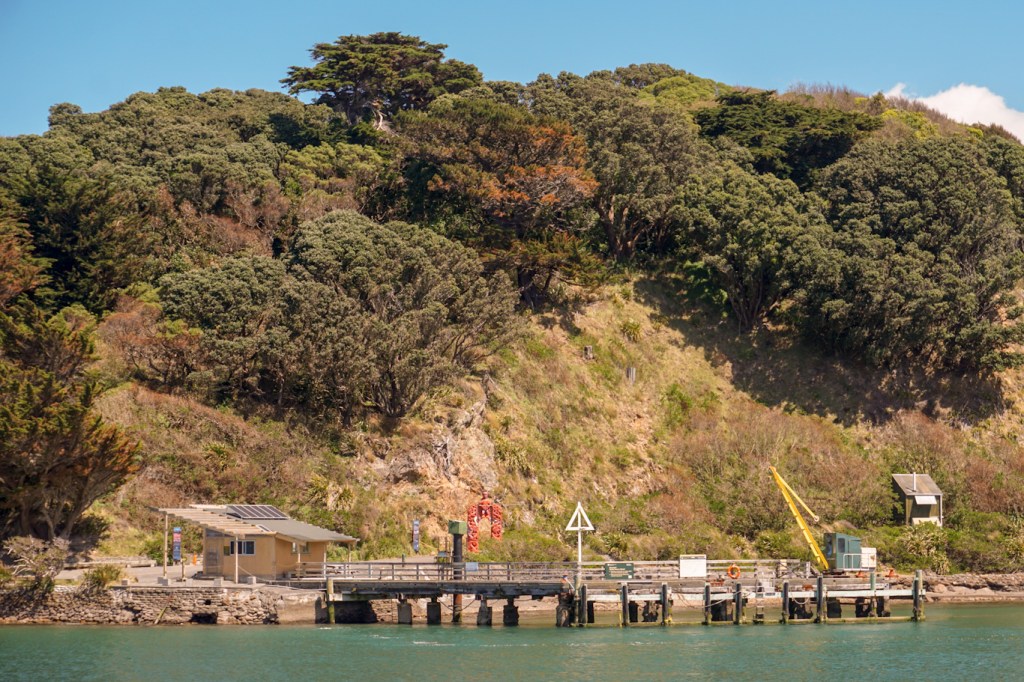
28 October – Martin gave us some directions to reach Days Bay and we managed to follow these with little incident. We were off to explore Matiu (Somes) Island located in Wellington Harbour. We caught the first 10:00am ferry and once on board discovered that for some reason which wasn’t explained to us there wasn’t any charge on that particular day! The island is predator free so, as soon as we arrived, we were ushered into a wooden shed, the doors were closed and we were asked to open and inspect our bags and clean our footwear. Biosecurity checks were completed and no “hitchhikers” had been discovered so we were free to explore the island paths.
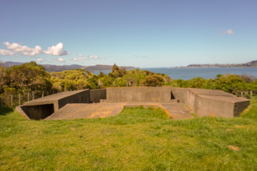
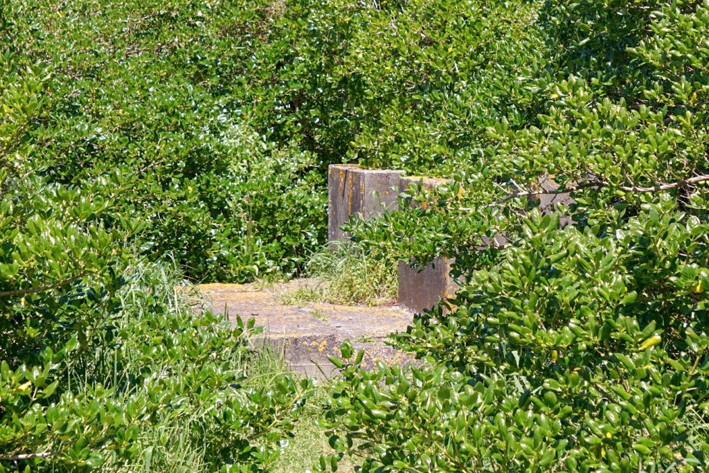
Displays in the visitor centre outline the longstanding Māori occupation of the island which was returned to Māori ownership in 2009. It has served as a human and animal quarantine station with a cemetery and monument commemorating those humans who died while serving quarantine on the island. It’s also been a sheep research station. In World War 1 and much of World War 2 it was a camp for enemy alien internees who were considered a security threat. The remains of five concrete structures with gun emplacements were an anti aircraft artillery position in World War 2, although never had to be used. We also saw the remains of a degaussing station operated by WRENs in World War 2 to de-magnetise and hence protect allied shipping from magnetic field detection mines.
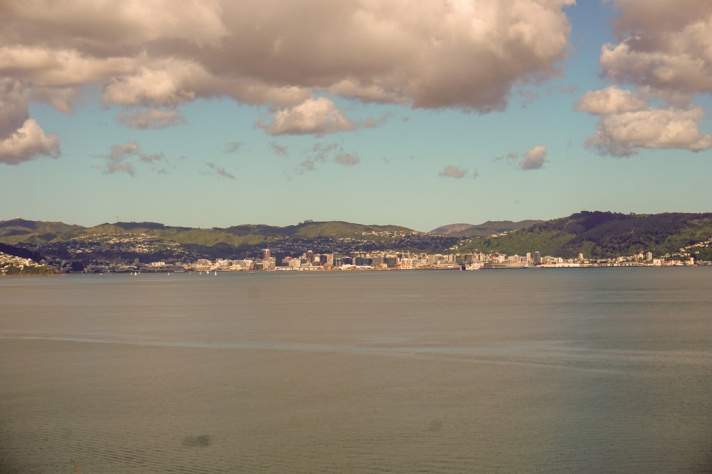
We strolled round the island looking at the magnificent coastal scenery and views towards Wellington as well as spotting birds including black backed gulls, variable oyster catchers, a diving gannet, fan-tails and even a very shy red-crowned parakeet.

We returned to the mainland and spent the afternoon wandering along the Eastbourne Heritage Trail including seeing the Wahine memorial to over fifty people killed in a ferry tragedy in 1968.
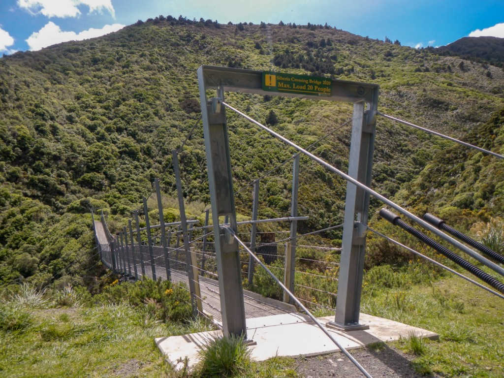
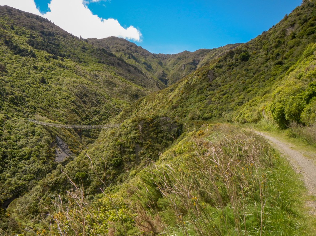
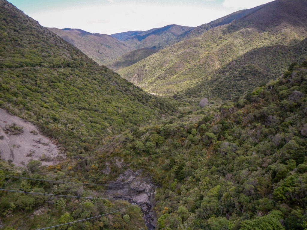
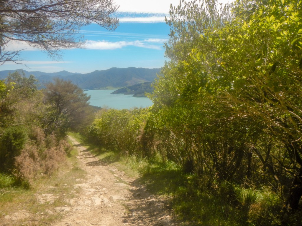
29 October – We followed Maggie’s excellent advice after our inquiry as to what walk we should do nearby given we had only one day. This was the Remutaka Rail Trail. We set off while it seemed that most of the rest of New Zealand was watching the final of the rugby World Cup and the path was very quiet. We walked 10km steadily rising to the summit of the track crossing a couple of bridges, negotiating what would have been tight bends for a train and traversing a dark tunnel.
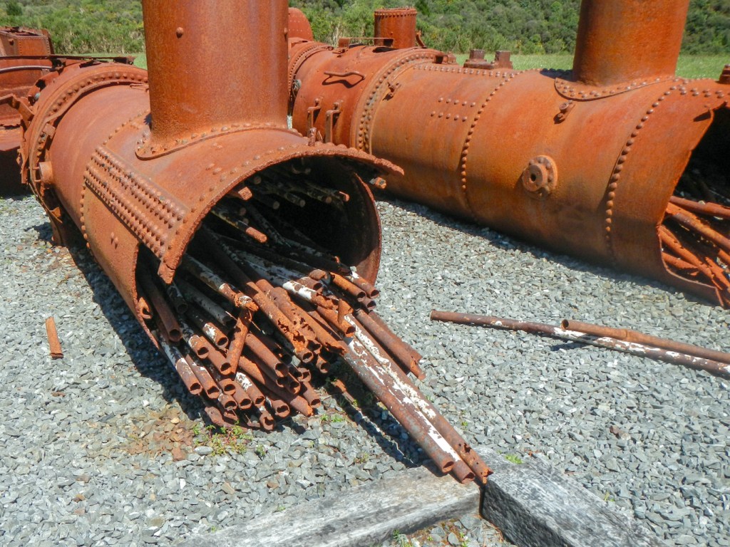
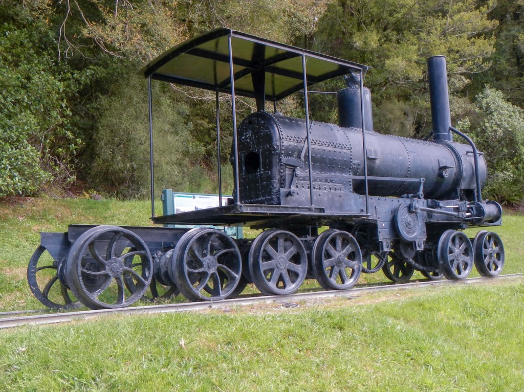
We saw some rusty old engines at the summit halt.

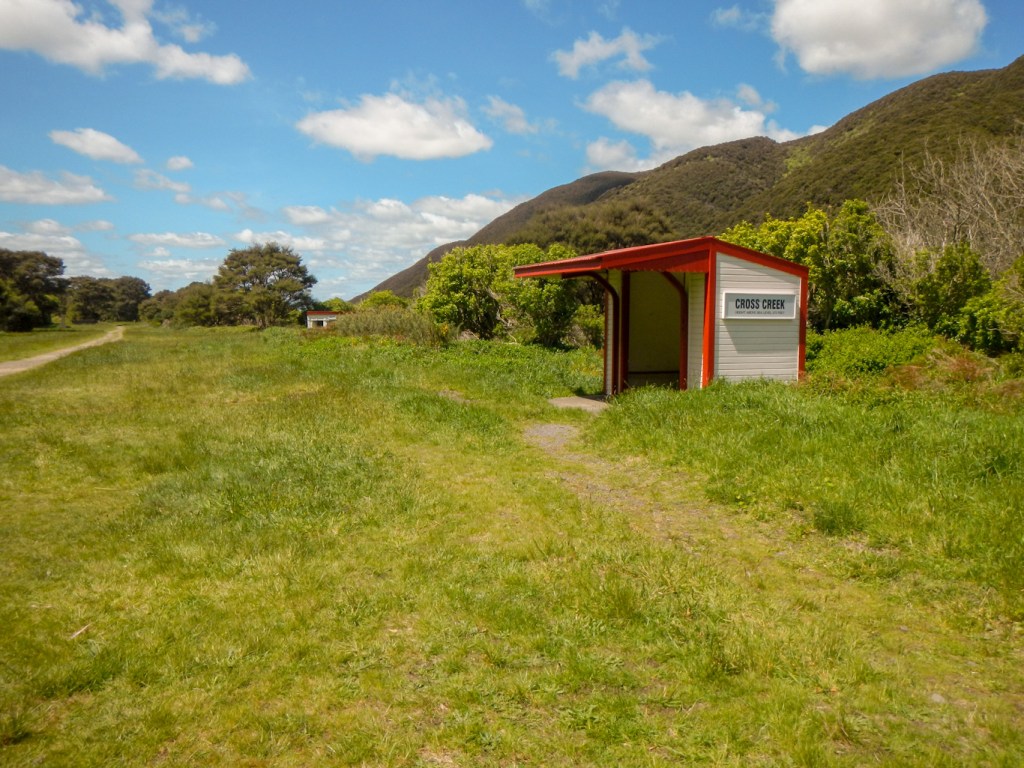
I definitely asked if we should eat lunch at the summit picnic area but my husband suggested we go through the long 680m tunnel first – this is what we had brought our head torches for. We were through but of course there wasn’t anywhere suitable to eat lunch near the narrow and rough downhill path. My intention had been to walk the additional 5km down to the old station at Cross Creek before turning but my husband didn’t want to go any further. Eventually we both went back through the tunnel for lunch and then he returned down the 10km to the car while I traversed the tunnel again and walked on to Cross Creek.

I’m pleased I made that choice as I found that stretch much the more interesting part of the walk. A short diversion to a viewpoint gave a stunning vista of the line swinging round the hillside.

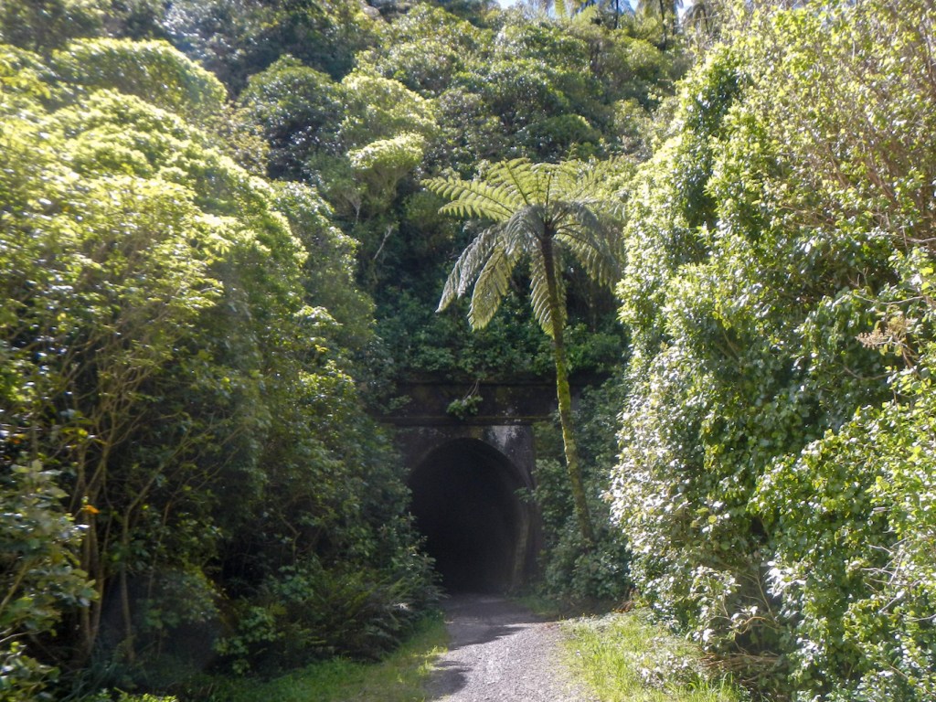
Another tunnel, a footbridge over a chasm and yet another tunnel followed in rapid succession.
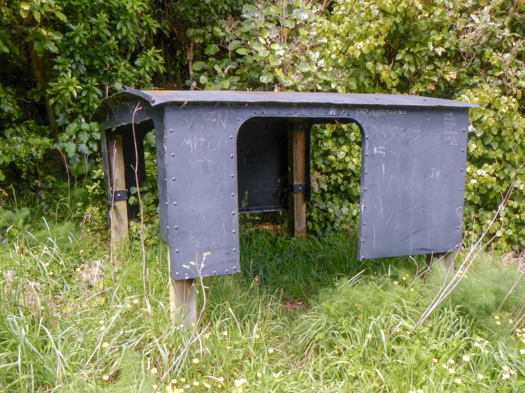
The cab part of an old engine by the side of the path had been used by workmen on tea breaks.
The gradient on this side of the summit is much steeper than on the path we had walked up in the morning. Boards explained how long and hard the work had been to build the track with tunnels over / through such a hill.
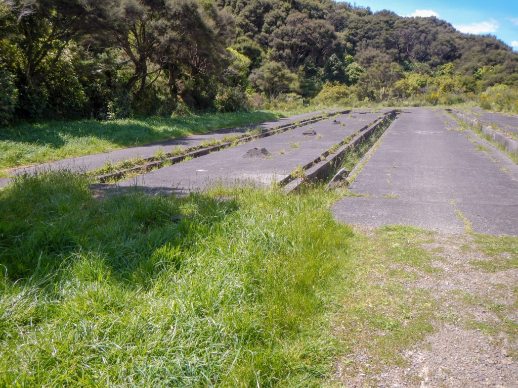
Eventually I reached the end of the line at Cross Creek and saw the remains of the turntable as well as the old inspection pits. The brake blocks burnt out and had to be changed after each journey.
I walked back to the car as quickly as possible – fifty-six minutes to the summit compared to the advertised time of one hundred minutes and a further ninety minutes for the ten kilometres to the car park – and I didn’t run at all!
30 October – We had already had to say good-bye to Maggie the evening before because she had to go to work. It was surprising that our three night stay had already come to an end.
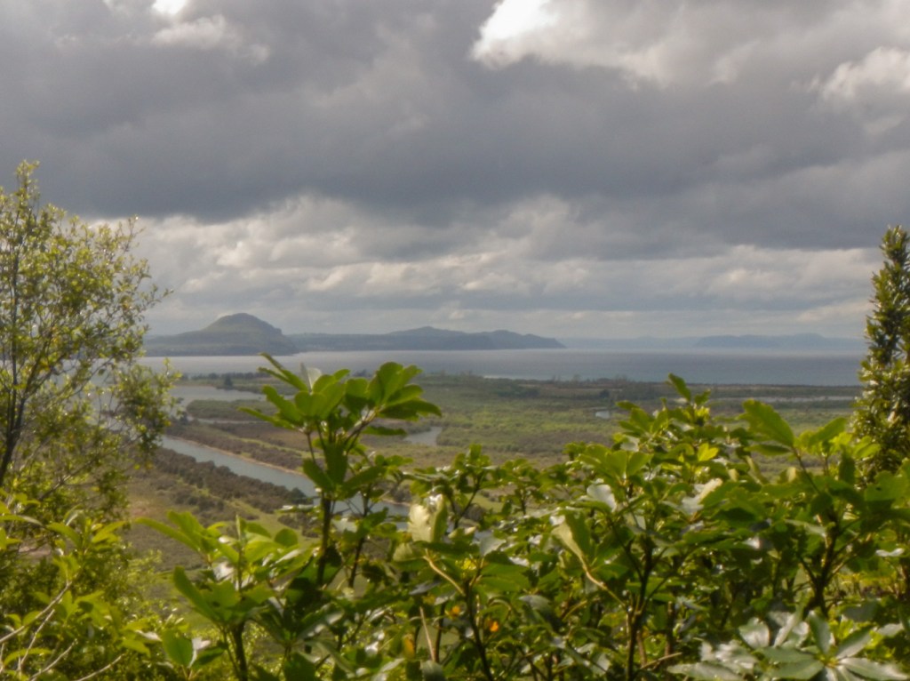
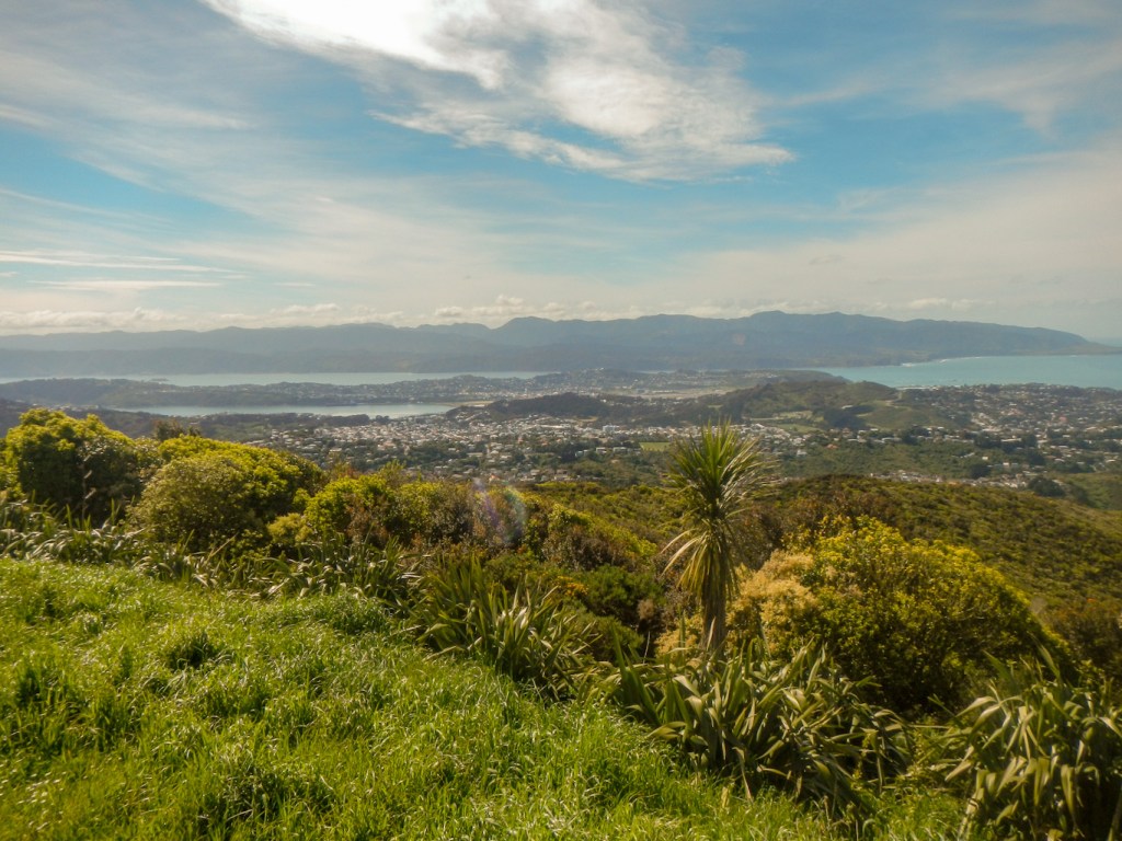
Martin had a real treat in store for us, offering a sightseeing expedition to the south end of Wellington after we had dropped off our hire car. Our first stop was the Wellington wind turbine on a high hill to the west of the city with superb views and close to a special fence enclosing a predator free area.

Our tour continued down to the Taputeranga Marine Reserve.
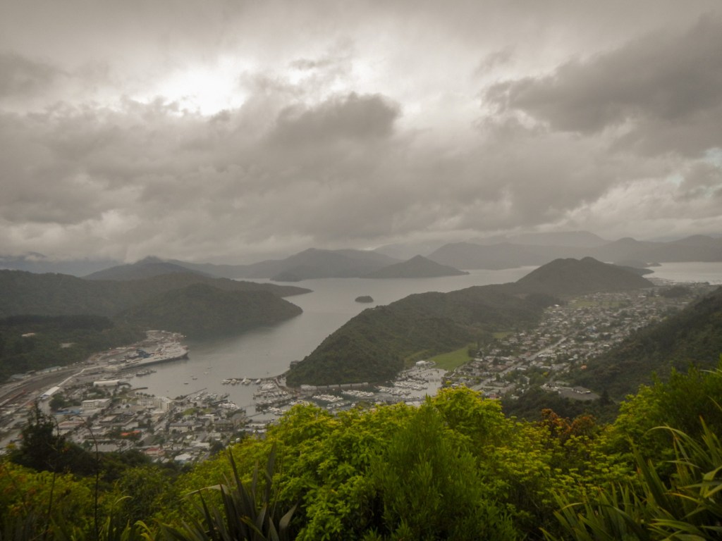
We enjoyed a few stops for sightseeing as Martin drove us all around the coastal road then through the Wellington central business district and out the other side to the Interislander Ferry Terminal, from where our journey to South Island would start.
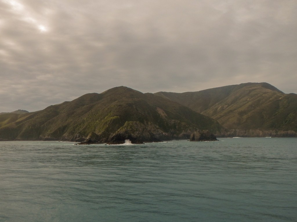
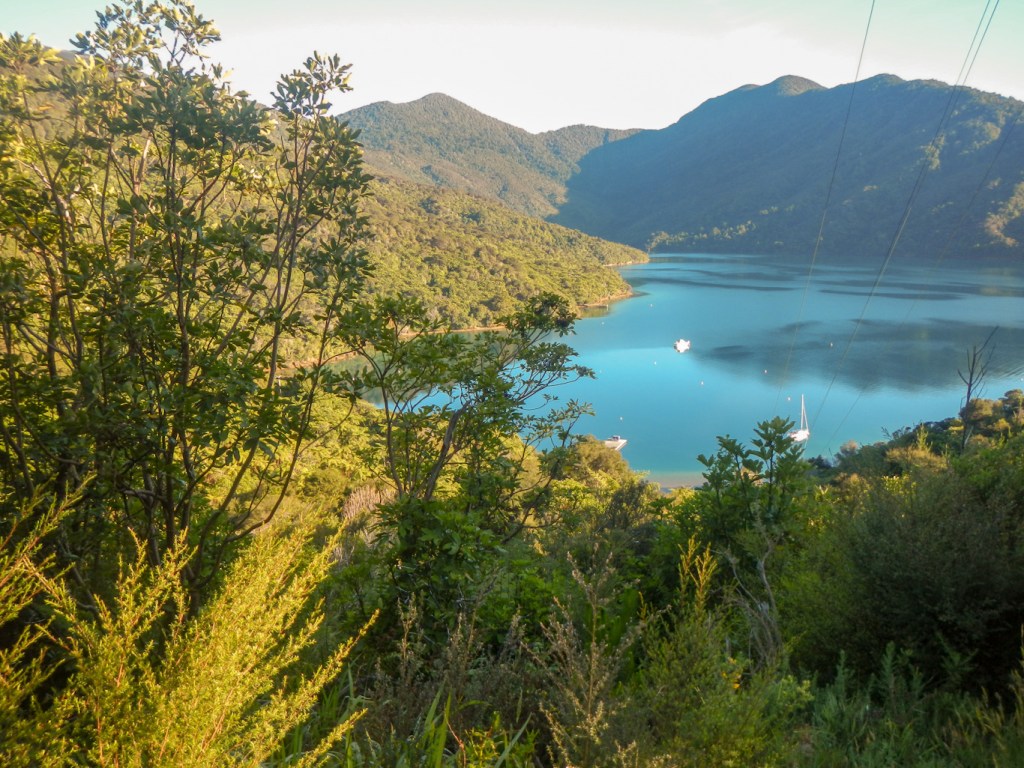
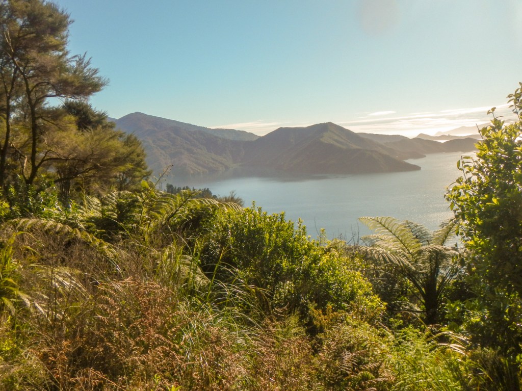
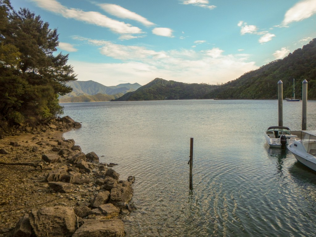
We were fortunate that the seas were light and so we were able to enjoy a smooth voyage across the Cook Strait before turning into the shelter of the Tory Channel and then the Queen Charlotte Sound to reach Picton.
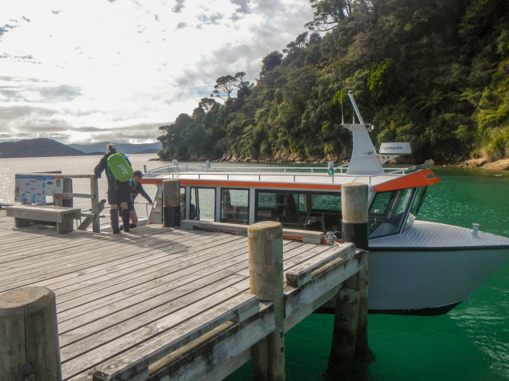
31 October – After arriving at our booked accommodation at Tombstone Lodge (it’s opposite the cemetery), I had made my rucksack ready for my three day walk on the Queen Charlotte Trail. Hence I just had an early breakfast of porridge washed down with coffee sitting in solitude (apart from a cat) in the hostel dining room. What with all the road closures for building work in Picton, I was concerned I would get lost on the way to the quay. However I was first to book in at the Beachcomber office and receive my tickets and track pass, as well as explaining that I would be carrying my luggage – baggage transfer is included in the “package” if required https://www.beachcombercruises.co.nz/qct-walks/great-track-pack-pass/the-great-track-pack-pass/.
Soon a small and intrepid group had gathered. Before we had even stepped on the boat, the receptionist from Beachcomber popped out of the office to suggest we walk to the end of the jetty as dolphins had been spotted. Unfortunately they were just swimming away as we reached the spot.
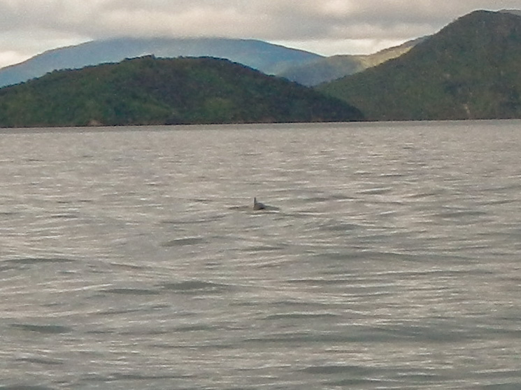
However, on the ferry trip to Ship’s Cove we saw dolphins and also some fluttering shearwaters – their “fluttering” flight looked a bit like the flight of a puffin.
Some people were dropped off at other points, leaving just a group of three and me to drop off at the start of the Queen Charlotte Trail.
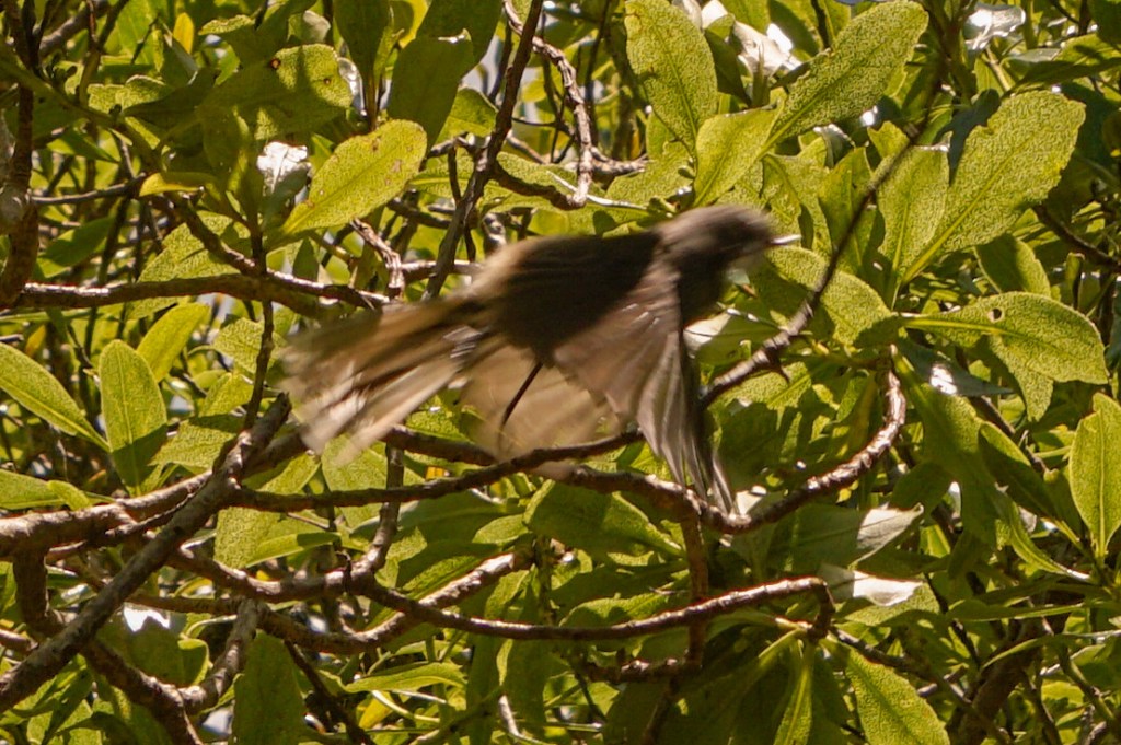
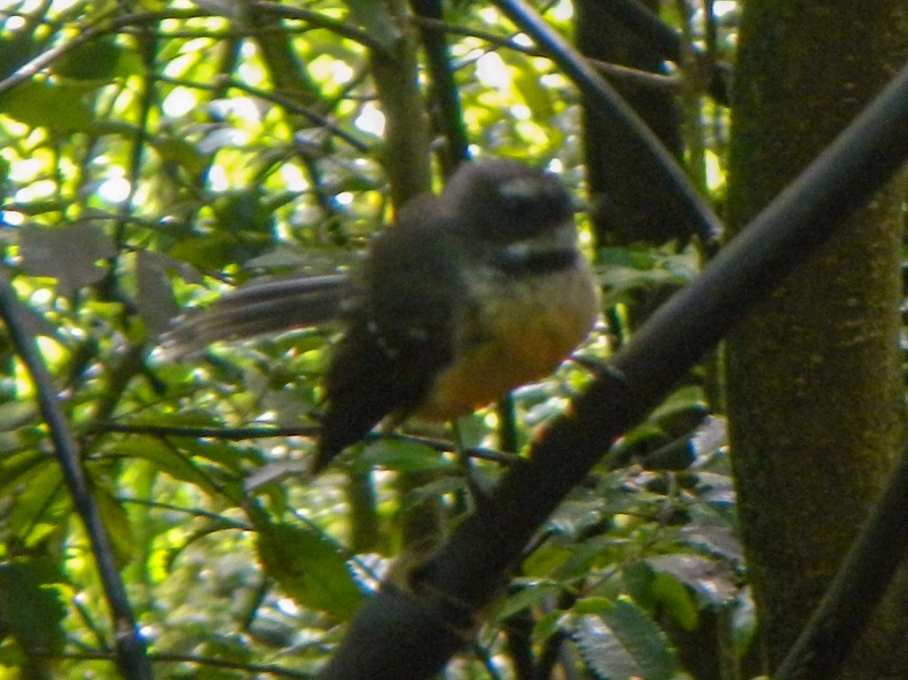
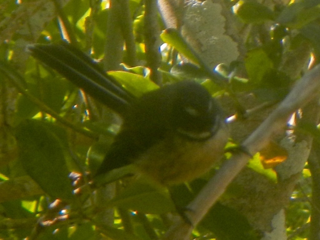
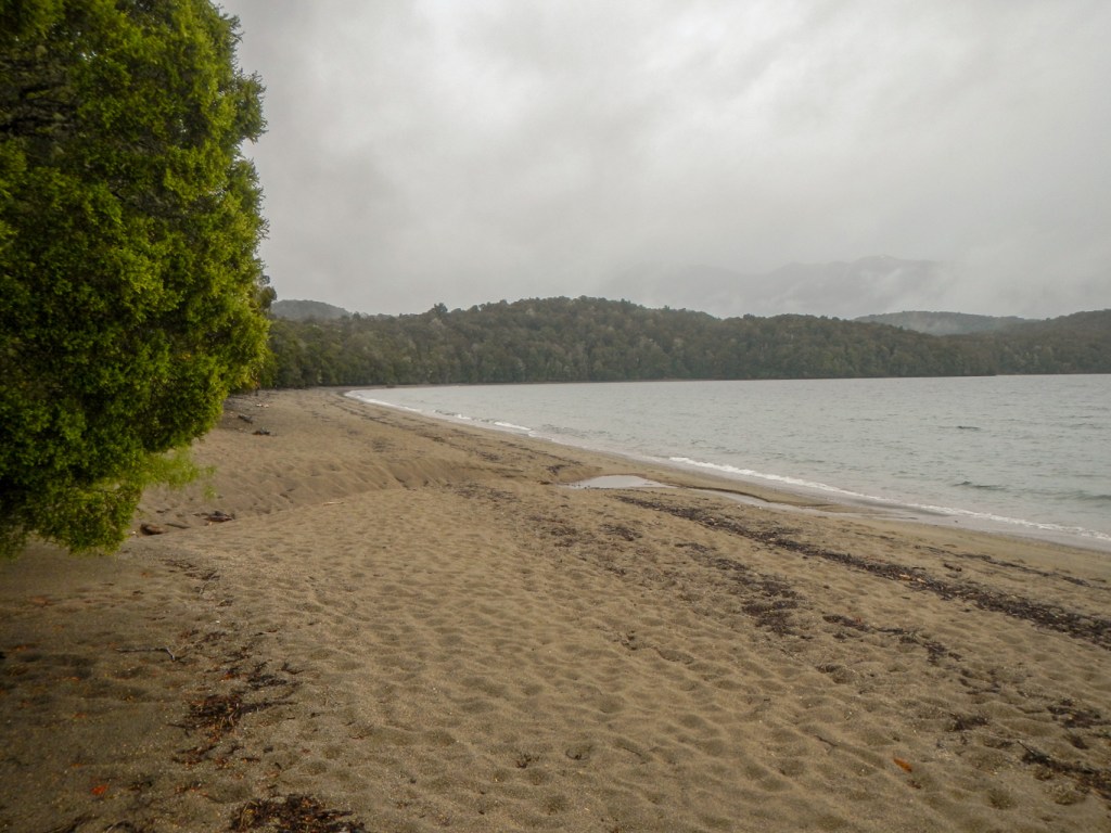
I decided to walk to the waterfall which is at the “real” start of the trail; not only did I see the waterfall, but also managed my best picture to date of a fantail.
By the time I arrived back at Ship Cove, the other walkers had left so I had it to myself to explore this place where Captain Cook made five visits between 1770 and 1777.
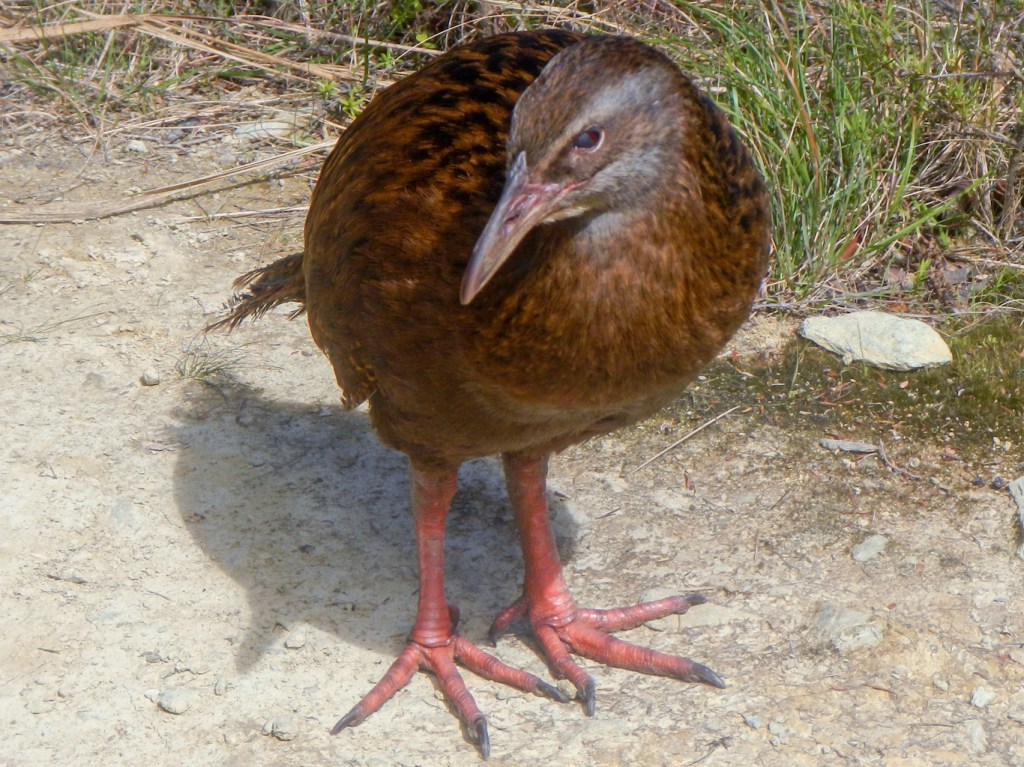
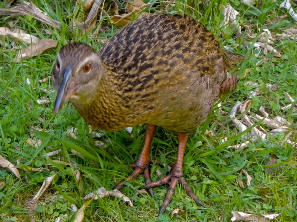
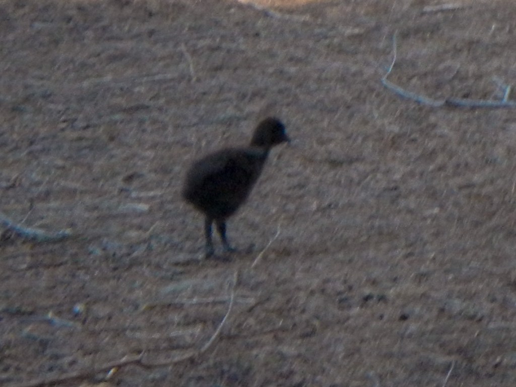
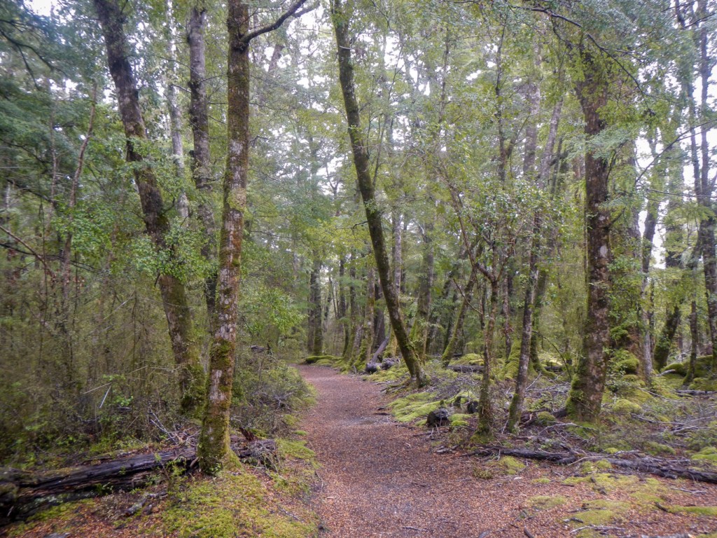
I set off uphill along the track which passed through dense bush. I had my first glimpse of a weka but it was scared off by a mountain cyclist – the only person I had seen since leaving Ship Cove. I passed a view point.
Soon I caught up with the three walkers who had landed at Ship Cove at the same time as me. They’d stopped at a picnic bench for a snack and, to my delight, there was a weka pecking around for any crumbs they dropped.
I descended to the campsite at Schoolhouse Bay then the path headed uphill again.
I found a picnic bench to stop for lunch and it wasn’t long before I had my own weka! There are little blue penguins around Endeavour Inlet, although they are rarely seen and even more rarely during daylight so unsurprisingly I didn’t see any.

Before reaching Furneaux Cove, I took a diversion to look at a Rimu (red pine) – over 1,000 years old with a trunk over two metres in diameter and a canopy spreading over thirty metres.

I reached a turning to some antimony mines at around 3pm and stopped for a rest and a snack. I decided not to walk up to the mines and was about to walk on as some people approached from that direction. They appeared to have spent all day walking from the Punga Cove area and expressed concern about my intention to get there that day and whether I would get there by dark. I explained that I was expecting it to take me three hours (they were disbelieving).
In fact I ended up arriving at Punga Cove reception at 17:50 even though I stopped to look at some dolphins spotted far across the bay and then again when I saw yet another weka.
I was staying in a basic room with shared bathroom and a shared kitchen area. However, I had done well as I appeared to be the only guest staying in that part of the resort so had all the facilities to myself.
1 November – dry, sunny and clear weather again. I had brought my own porridge for breakfast and enjoyed eating it while watching and listening to a tui singing just the other side of the window.
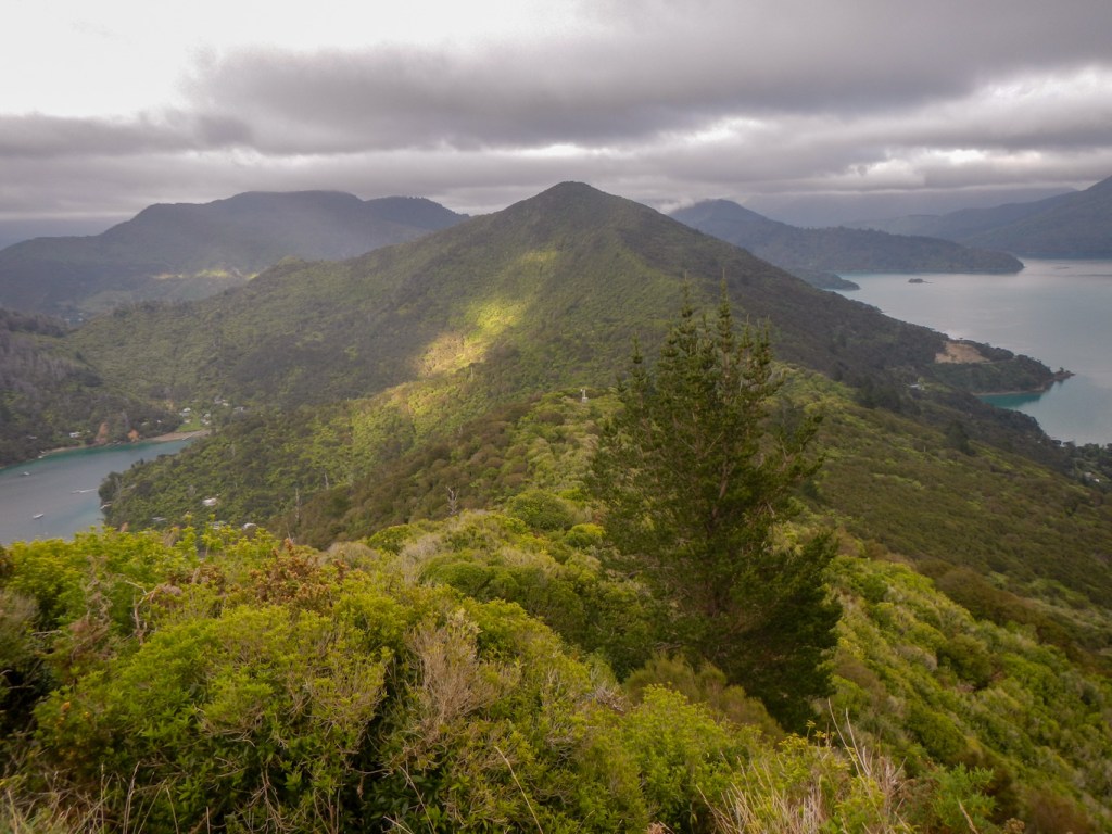
The staff had explained that I didn’t need to go back to where the path to Punga Cove had left the main trail, so I walked out of the top entrance to the resort and ascended the big hill to Kenepuru Saddle. This was the part of the path where I needed the trail pass.
In contrast to the walk the previous day, initially through the bush with only occasional views and then following the coastline, the walk mostly follows the ridgeline. There were trees obscuring the view at times but in between the trees the views were amazing.
The diversion to Eatwell’s lookout was steep but worth making for the awesome all around views.
I met a couple of New Zealanders from the far south who were camping and told me about paths in their part of New Zealand which are often less easy to follow and a lot less busy.
There were more birds to spot along the way – weka including chicks, fan tails, tui and possibly a silvereye. I even had to slow down to avoid walking between a weka bird and its chick.
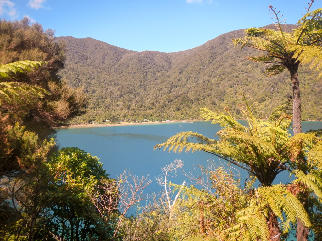
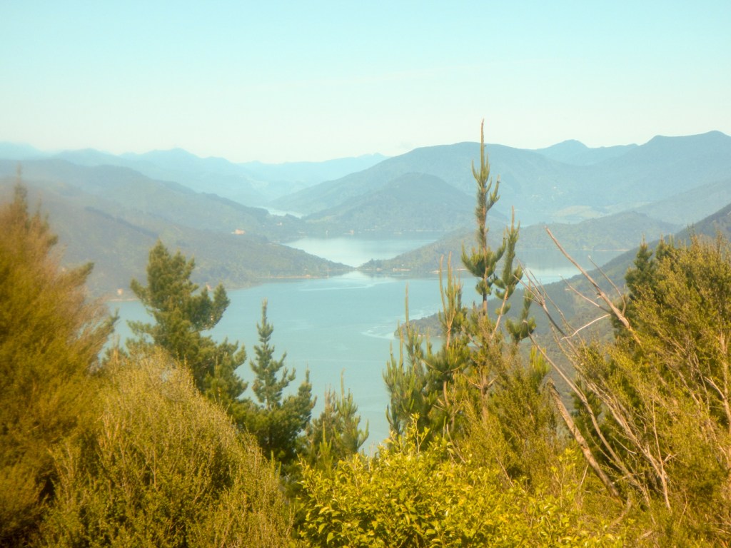
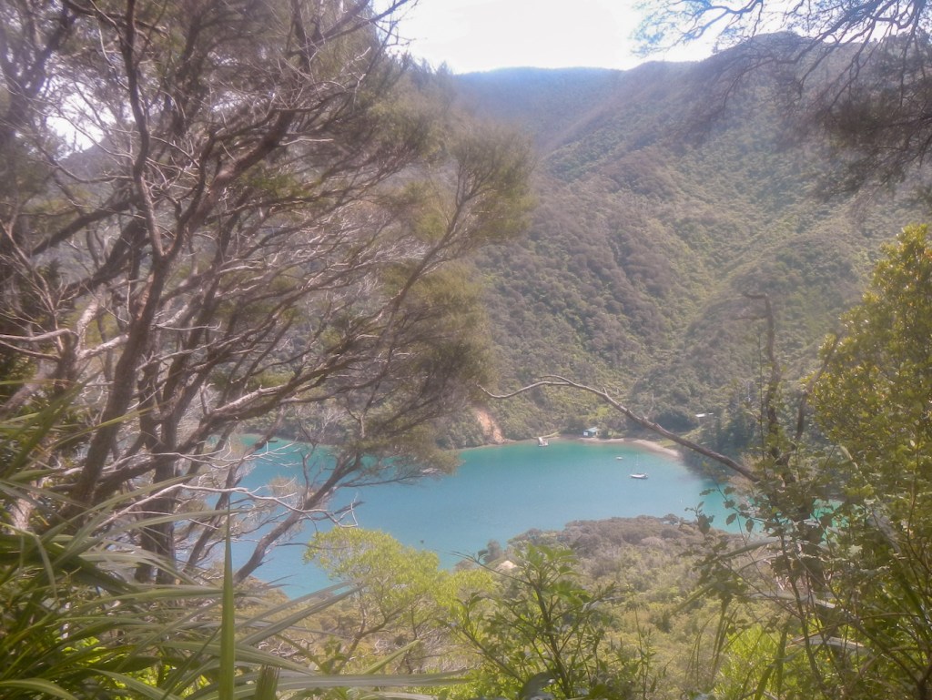
At Bay of Many Coves, there were excellent views over the islands and the Queen Charlotte sound. I also saw the ferry plying its way between north and south island.
Eventually there was a long descent through mixed forest, including beech and manuka, to Torea Saddle, where there is a war memorial.
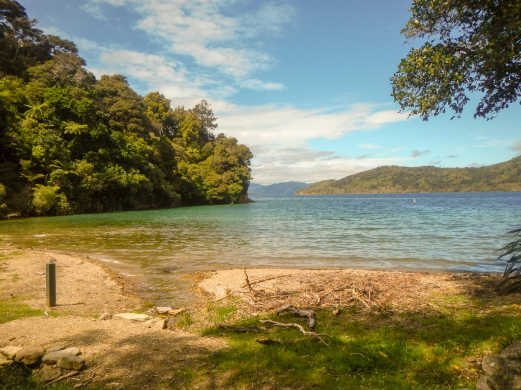
I followed the road down to Portage and discovered that I was in a superb room with its own balcony overlooking Portage Bay.
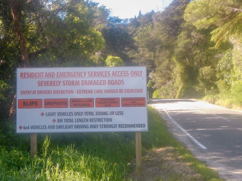
After a reviving cup of coffee, I was ready to explore the area. I discovered that the roads following the coast in both directions were open just to residents and that they were only suitable to drive along in day light. The road subsided during storms in July 2021 and still hasn’t been repaired sufficiently for it to be reopened to everybody. I had considered walking round to look at “The Gap” to the east of the Portage but was frightened off by the warning road sign – not sure whether it applies to walking on the road as well as driving.
Instead I turned to walk towards Cowshed Bay; the road was closed here too but it wasn’t far so I walked along to the campsite. Here I saw the camping couple I had seen previously and they reassured me that there was a track from the campsite directly to Torea Saddle. I followed that and then walked down to the harbour at Torea Bay on the opposite side of the ridge. Apart from the person cleaning the toilets, it was deserted. I walked back over the saddle to the Portage. It’s called The Portage because it’s at the lowest point over the ridge and is where Māori pulled their canoes overland between Kenepuru Sound and Queen Charlotte Sound.
For the record, my evening meal included green mussels, which are a local delicacy.
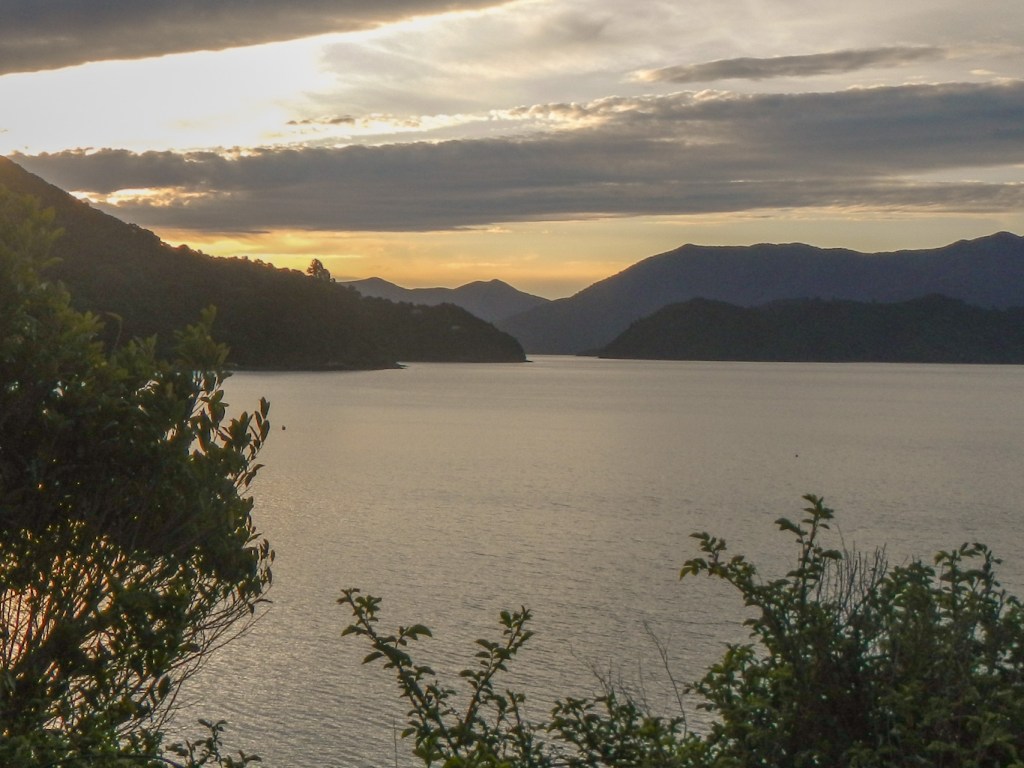
The sunset was beautiful but as there are hills in the direction of the setting sun, it was really the bright light reflected on the water that caught my attention, rather than the setting sun. It was so peaceful, with the only sound being the singing of tuis.
2 November – It barely seemed possible that I was already on the final day of this walk. I decided to start early at about 06.30am as I wanted to be sure to be at Anikwa by 3pm in good time for my booked boat to Picton at 3.30pm.
The first bit was just to go back up the road to the saddle. The hotel would have given me a lift at 7am but I walked – it meant I could leave slightly earlier and it warmed up my muscles on the road before turning off on to the steep path.

There was a lot of uphill walking to an excellent viewpoint on the ridge at 407m.
I also made the extra 0.9km diversion to the Onahu Lookout at 417m – it was awesome!
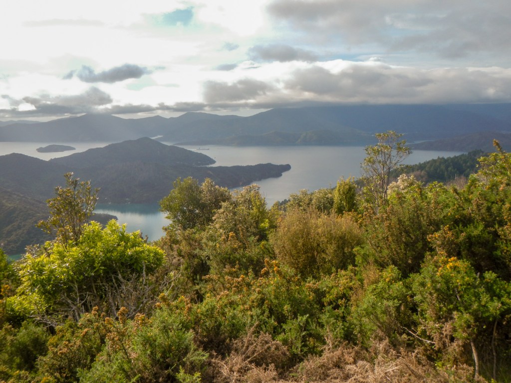

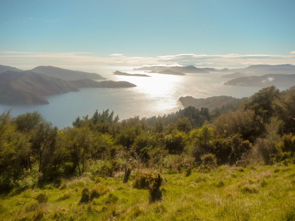
There were excellent views from the ridge almost all the way to Mistletoe Bay.

I thought I was moving well, but was overtaken by a lady who was walking Te Araroa, the 3,000 km New Zealand end to end path. She had a long day – had planned 47km, although was possibly going to cut it down a little.
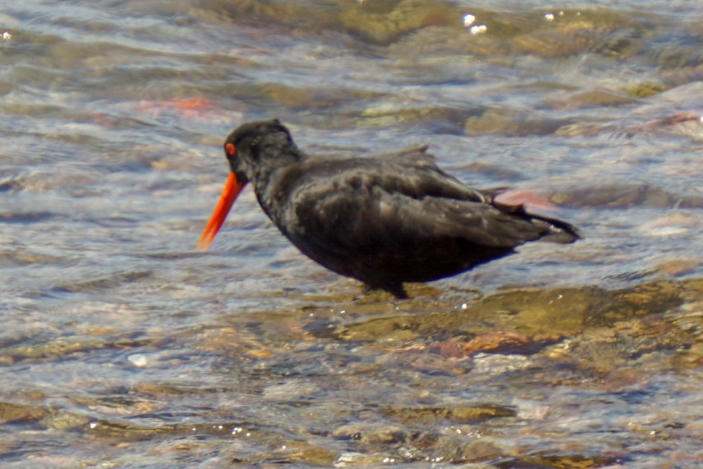
I went off the track near Mistletoe Bay as I had plenty of time and walked on the road round the bay. I think the bird I photographed was a pied shag – initially I had hoped it was a very rare king shag, but they have pink feet..
I returned to the path. Initially the views weren’t as good as in the earlier section but then improved again and the Grove Arm viewpoint was stunning.
From this point, there was a steady descent towards the shore and a path following the coast leads to the end of the trail at Anikwa. It was still only 13:45.

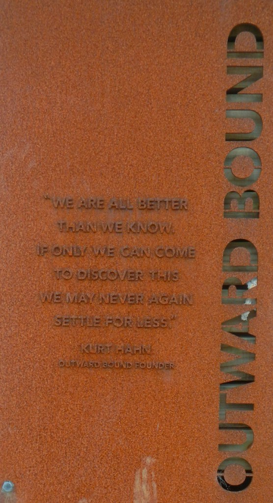
I wandered past the Outward Bound Centre up the road, looking without success for somewhere to buy coffee. I walked back and fortunately looked at the papers I had been given before leaving Picton. I should have read them before! I was supposed to phone Beachcomber once I reached Anikwa. I didn’t really want to turn on my phone so I walked down the jetty and discovered that the water taxi I should be catching had already just arrived. The skipper was happy to take me back to Picton there and then; it turned out that all the other people I had met on the trail and at Anikwa were booked with a different company and I was the only client for the Beachcomber Water Taxi.
Hence I was back in Picton before I was due to leave Anikwa! On the short journey, I saw shearwaters, a gannet and black-backed gulls, but no dolphins.
Thanks https://www.beachcombercruises.co.nz/ for such great service! They were definitely a superb company to book with from start to finish and I would have still been at Anikwa until 3.30pm or later if I had been booked with any other company.
3 November – A rainy day so I had definitely been fortunate to walk Queen Charlotte Trail in dry and sunny weather! With getting back early the previous day, we had been to the Avis car hire desk to add my name as a driver for the car my husband had already collected to use in the south island.
We set off towards Blenheim planning to visit the widely advertised museum – a good activity for a rainy day but unfortunately it was “temporarily closed”. Afterwards we discovered that it’s been closed for a long time. However, the farming museum, a stones throw away in the same grounds was open. We paid the small entry fee and a very enthusiastic volunteer spent the next two hours or so personally guiding us around the collection of historic tractors and other farm machinery – all more interesting than I had thought, even the different varieties of barbed wire. He also discovered my husband’s interest in electronics and so showed us around the collection of vintage radios, record players, TVs etc. which he personally curates in addition to his role with the farm machinery. After this mammoth tour, we had a short look round the collection of historic buildings forming the open air museum.
My husband suggested lunch at the Aircraft Museum café he had already visited during my time on the Queen Charlotte Trail. Actually I’m sorry I missed visiting this as it sounds as though it’s a lot more than simply a display of aircraft; it houses film-director Peter Jackson’s (The Hobbit and Lord of the Rings) collection brought to life in a series of film set-like dioramas.
The rain continued, but we drove around the vineyard area, trying to spot he famous names. The area is flat with gravelly soil and surrounded by mountains; apparently that, combined with sunny days and cool nights, provides perfect conditions for cool climate grapes.
We returned to Picton. Having been inactive all day, I went on a very brisk walk on the Tirohanga track rising from the town and with a fine view point looking over the town and harbour. It wasn’t until I arrived at the beginning of the actual track that I realised the 1.5 hours time to do it as a return route actually meant from one of the two entry points to the summit and back rather than the entire circle incorporating the whole length of the track and the walk through the town between the two entry points. In the end, I did manage the complete circle in 90 minutes by walking very quickly. Despite the rain, I saw a few other people coming the opposite way – although there was a comment from one about there being more than one mad person! Actually the weather was improving and the view was better than might have been expected. It was definitely a worthwhile walk!

4 November – A car journey from Picton to Franz Josef Township. We drove past miles and miles of vineyards in the gravel stoned valley of the Marlborough area. As we went further upstream, the vines looked younger and there were new vineyards being planted. People who sold this land on for vineyards after previous use for sheep pasture must have made a fortune!
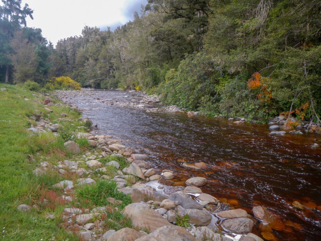
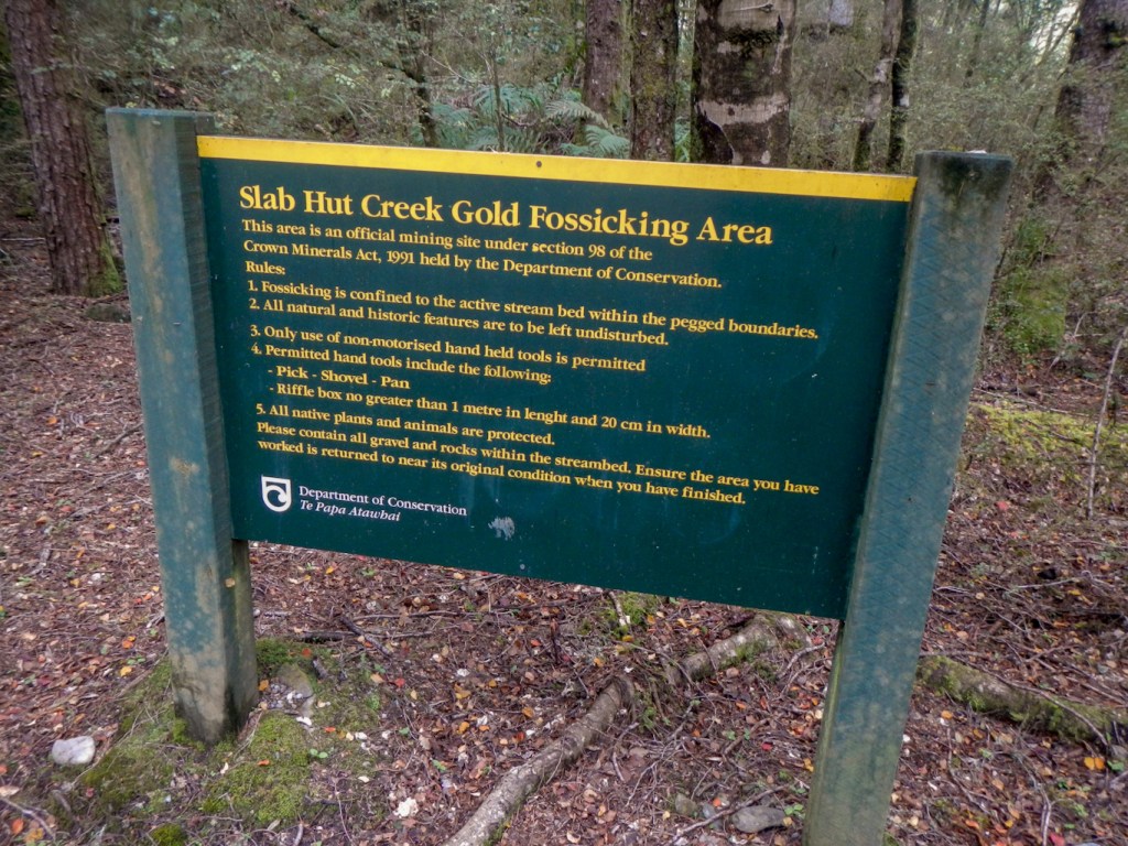
We drove through an enormous gorge with an earthquake slip transition. This was gold prospecting country. We stopped near an old gold prospecting village and read an information board detailing the rough and ready lifestyle of the prospectors. Many had moved on from the Australian Gold Rush to try to do better in New Zealand.
We stopped near a stream where it is still permitted to use hand tools in the stream and hunt for gold – so long as everything is put back into its natural state again afterwards.
We passed through some historic gold mining towns.
We stopped at a train engine monument. The engine was used in the timber trade – which followed on after the gold prospecting fizzled out. My husband explained to me that the engine is notable as it has a chain coupled shaft which is easier to maintain than the traditional bar across the wheels.
We stopped on the coast at Hokitika a seaside town with various historic buildings including an old town hall and a Carnegie Library.
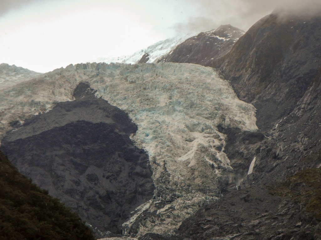
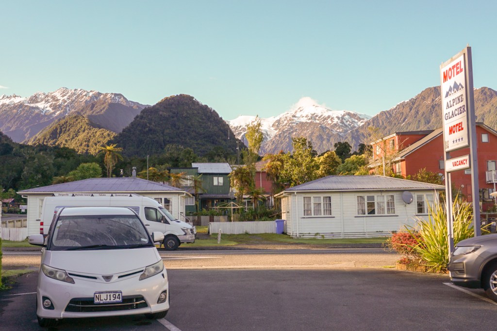
On arrival at Franz Josef, it was sadly too cloudy to see the mountains.
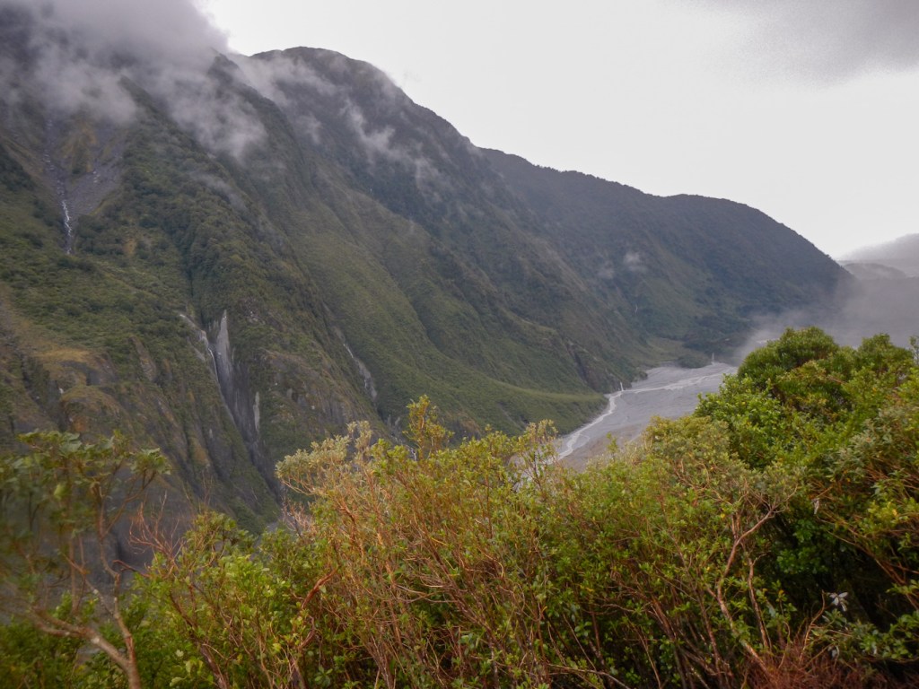
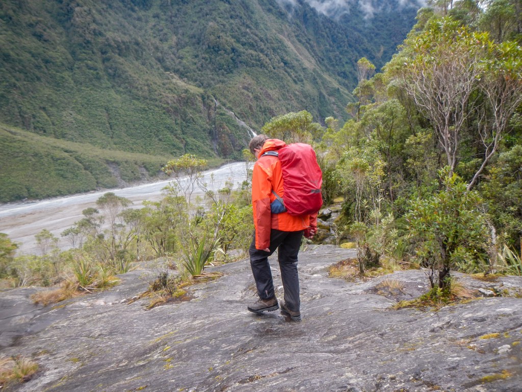
5 November – The forecast was of worsening weather through the day so we decided to start early on a “challenging” track to Roberts Point. It’s only 12km but listed as taking 5-6 hours. The trek began easily enough and then there is a sign explaining that the onward route is for experienced trampers only. The weather was wet but in any case the walk is through rain forest and the advice is that the rocks underfoot are more often than not wet and potentially slippery. Fortunately our boots seemed to grip reasonably well but we knew we couldn’t rely on that and so took care. We climbed over boulders, up rocky slabs, over tree roots, across raging torrents of side streams. The path was usually fairly obvious and there were markers to follow. Signs warned of previous fatalities when people had attempted to leave the path and descend to the main river. There were four suspension bridges to cross with enormous drops from them into the valley below. They wobbled as we crossed them. One was very long with only one plank and open sides below the hand cable. We almost gave up but met some people descending who had overtaken us near the bottom. They told us it was only another thirty minutes to the top so we continued. In fact at that stage we had done all the most difficult bits.

We were rewarded by a superb view of the glacier from the viewing area at the top. The rain had stopped – temporarily. It wasn’t windy so we considered eating lunch at that point as there was a seat on the wooden platform. However the rain began again so we started our descent.
Our descent was as slow as our ascent. This was partly because I was faster than my husband down the less steep parts in the forest and he was faster than me over the rocky slabs. Hence to stay together, there was a lot of waiting around. It was actually a less tricky descent than we had thought it would be as we looked carefully for natural rock steps and diagonal rock cracks to avoid stepping on potentially slippery smooth areas of sloping rock slabs.
Including our rests and lunch stop, the expedition took us eight hours.
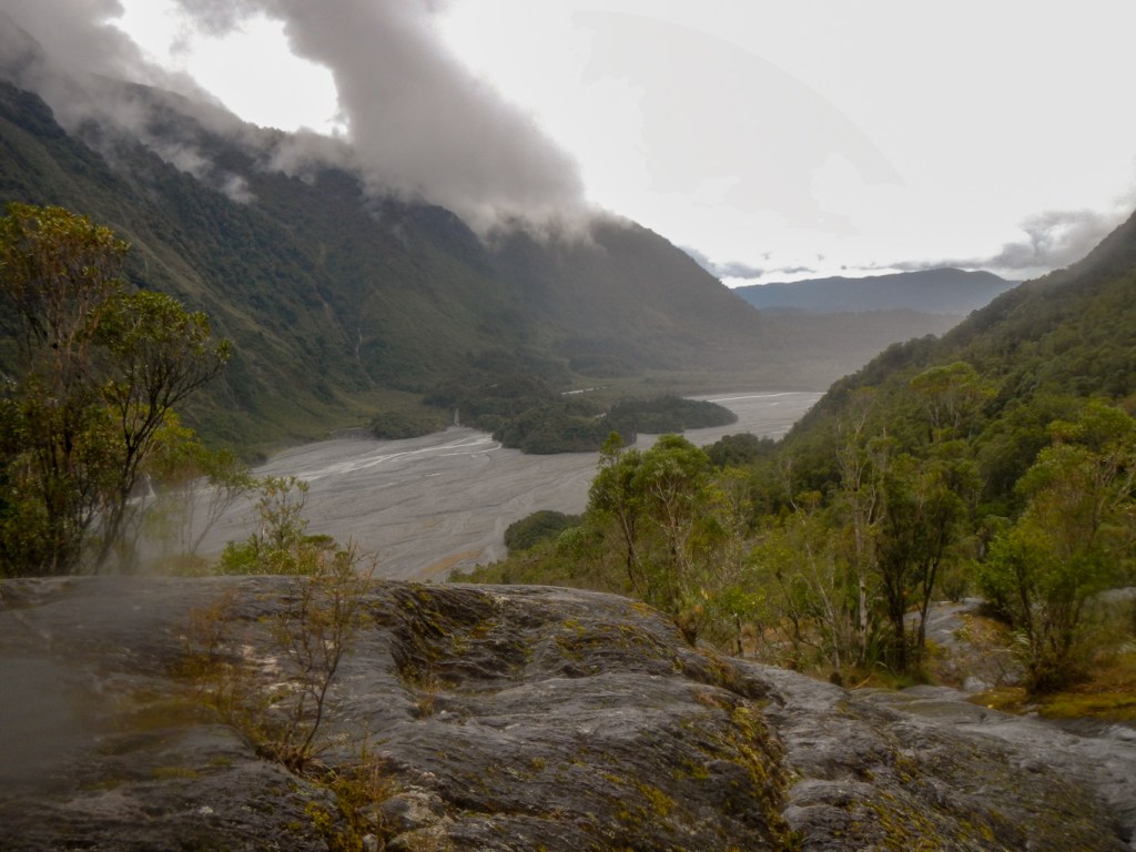
Having arrived back in Franz Josef township, there were crowds of people disgorging out of coaches and taking selfies and other photos of themselves and others with the scenery in the background. I felt smug that I had done a “real” walk amongst the scenery!

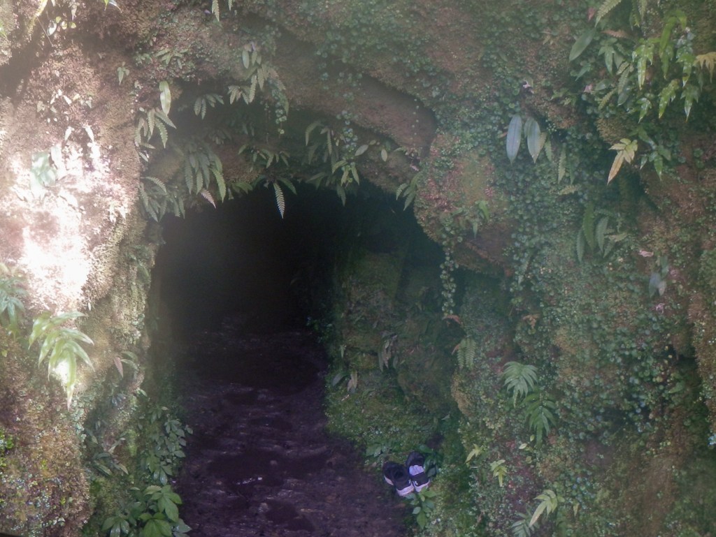
I was keen to walk up to the Tatare Tunnels but my husband said he had walked far enough for one day. I made my way up the track unaccompanied, wearing full waterproofs even though it wasn’t raining; I was also carrying my headlight. This was all so I was ready to walk through the dark 1500 foot and six feet high roughly hewn rock tunnel to its end at an aqueduct. There was ankle deep water in places, but my feet were in walking boots so remained dry. One person had taken off their shoes and left them by the entrance so I presume they paddled through in crocs or similar – it was far too stony to paddle without footwear. As I made my way to the far end of the tunnel, a family passed me returning to the entrance – carrying a very happy toddler in a backpack.
Pioneer miners drove a 500 metre tunnel system through from the Tatare Gorge to pipe water to the Waiho terrace. While the gold recovered did not cover mining costs, Franz Josef township was established on the operation site. From 1911 the sluice pipes provided water supply for the old Graham Hotel.
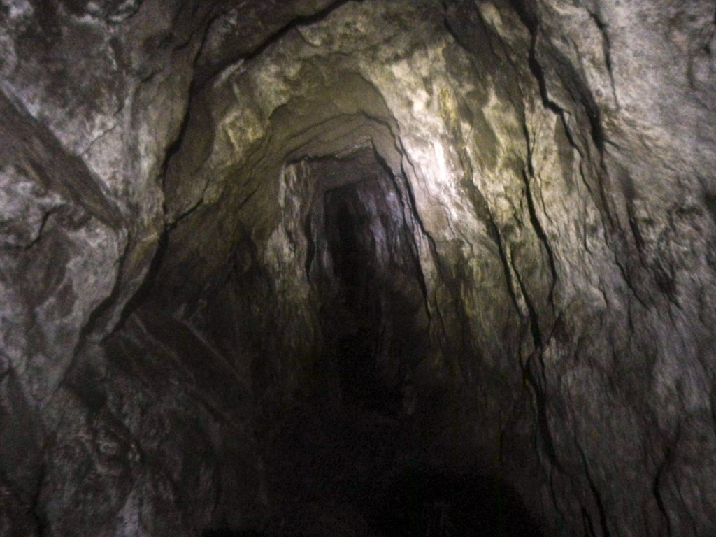

The high-pressure water drove a Pelton wheel in the town and generated electricity for a sawmill during the day and lights for the town at night. In 1938 water from the Tatare Tunnels powered a small hydro station in the Tatare Gorge until it was destroyed by a slip in 1982.
As I walked back to the town, I overtook the family with toddler – he was walking along happily by then and collecting interesting leaves that he found on the ground.
I was tempted to take the side turning to the Callery Gorge walk to look at other relics from gold mining days and the historic Callery Gorge bridge. However, I knew my husband would be waiting – so I returned to the town; there are always more things to do! After dinner, I tempted him out on the Terrace Walk with the hope of finding glow worms. We didn’t find any glow worms but while we were out there was a siren alert. We rushed back towards the town wondering whether it was an earthquake or avalanche warning and we would be swept away. However it turned out to be the call for the volunteer fire and emergency team and later we discovered that it had been a training exercise rather than an actual emergency.
6 November – The weather had made a remarkable improvement overnight. The view of the mountains from near our motel was stunning.
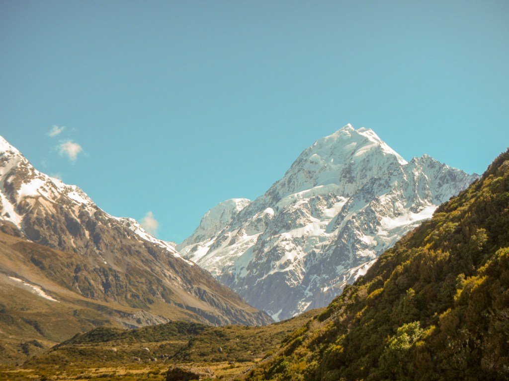
However it was time for us to move on again to drive by a circuitous route to Mount Cook. As the crow flies, it’s close but the road route is long. The views of rivers and mountains are amazing.
We stopped at Bruce Bay with views to a headland and sight of fur seals. The coastal scenery of stacks and arches is magnificent.
We stopped at Knight’s Point where there is a viewing tower and a path through the sand dunes.
Haast has a superb DOC Visitor centre with lots of information, displays and maps of enticing walking tracks.
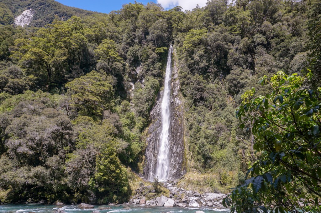
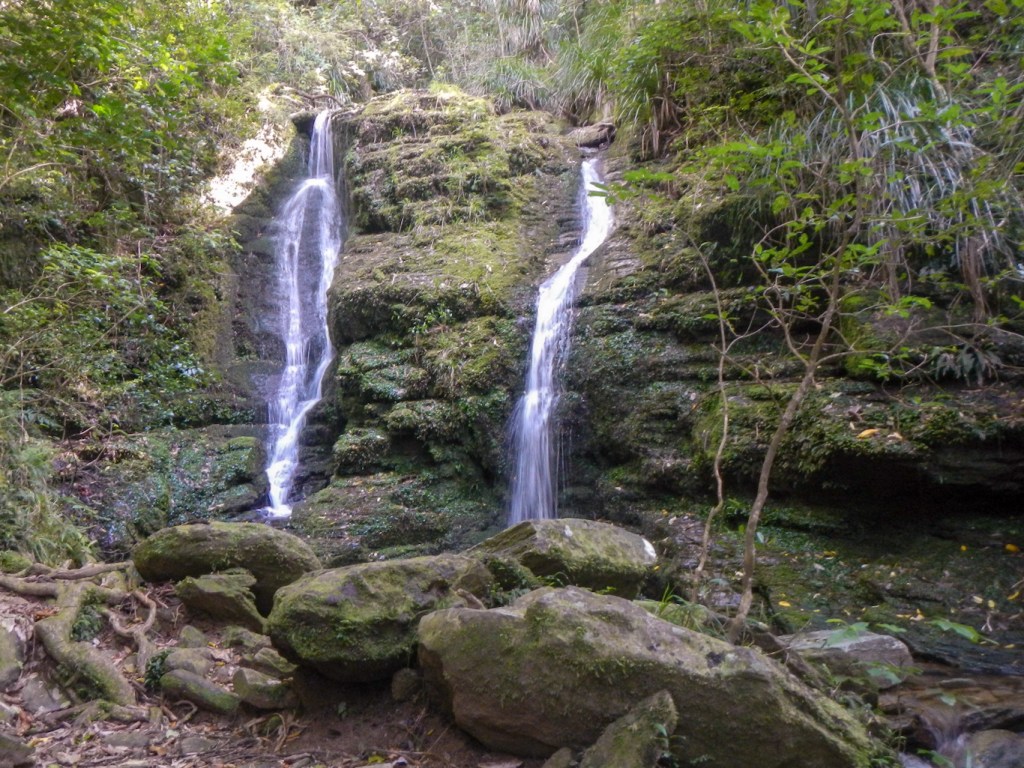
We stopped twice near impressive waterfalls – Thunder Creek and Fantail.
We passed many lakes and traversed windy mountain roads.
There are scattered homesteads, farms and sheep stations but not really any villages apart from a few collections of what appear to be solely tourist facilities. We stopped at Tarras – this small cluster of buildings appears to “service” a large area – it consists of a school, a golf course, a café and three shops.
We drove up a mountain road to Lindis Pass where we stopped to admire the views.

We stopped at Twizel to stock up with supplies from the superb supermarket. This is the last place to buy food for Mount Cook village 67km away! I spotted freeze dried lightweight camping food in the supermarket – we saw this in a few supermarkets in New Zealand, unlike UK where it’s only available from outdoor shops.
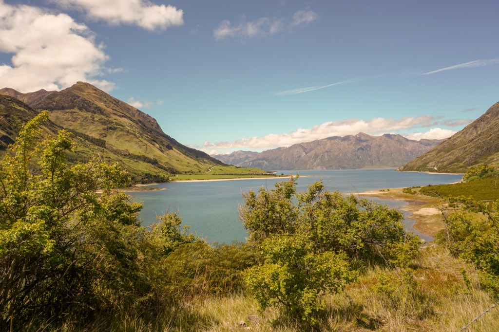
We made a final stop at a view point overlooking Lake Pukaki – it is also possible to walk down to the shore of the lake.
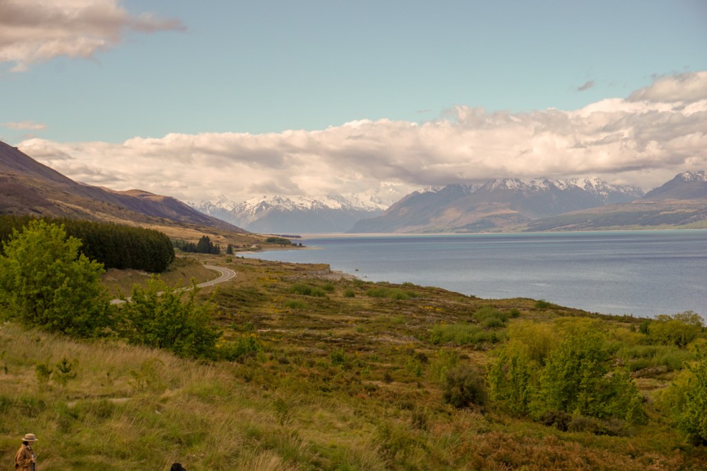
Our motel room was excellent at Aoraki Court Motel –https://www.aorakicourt.co.nz/accommodation/ – views of the mountain range, a beautifully equipped kitchenette and the en suite included a spa bath.
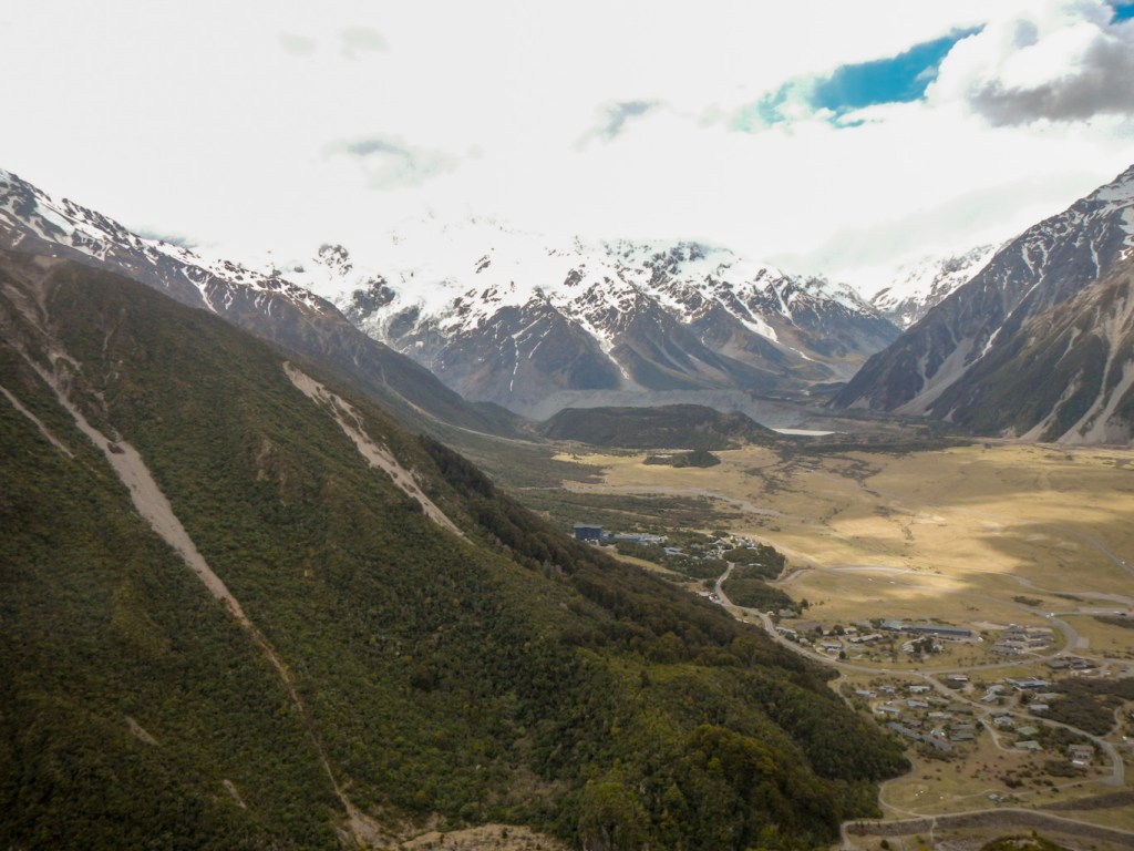
7 November – There was cloud on the summits. A paradise shelduck was keeping an eye on its chicks swimming on a puddle outside our apartment. We walked up to the DOC visitor centre – yet another brilliant centre with interesting and informative displays as well as information about the local walking tracks.
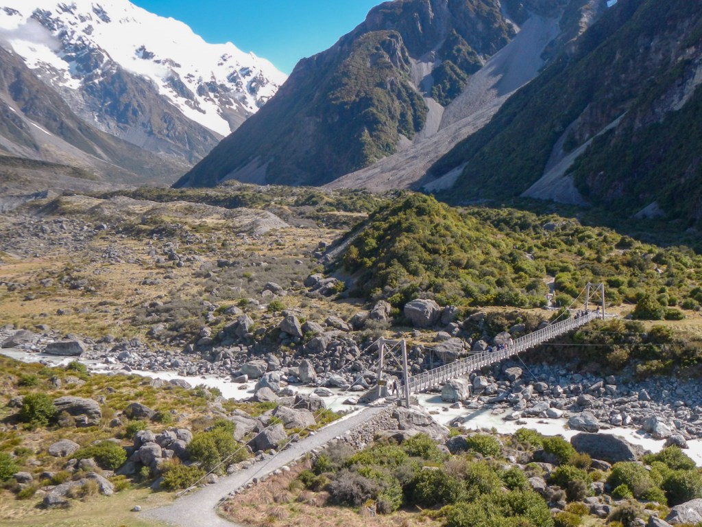
The weather was improving so we drove up to the car park for the Hooker Valley Track. It’s an easy walking track and became increasingly busy as the day went on. We crossed three swing bridges, all much less precarious than those on the track at Franz Josef.
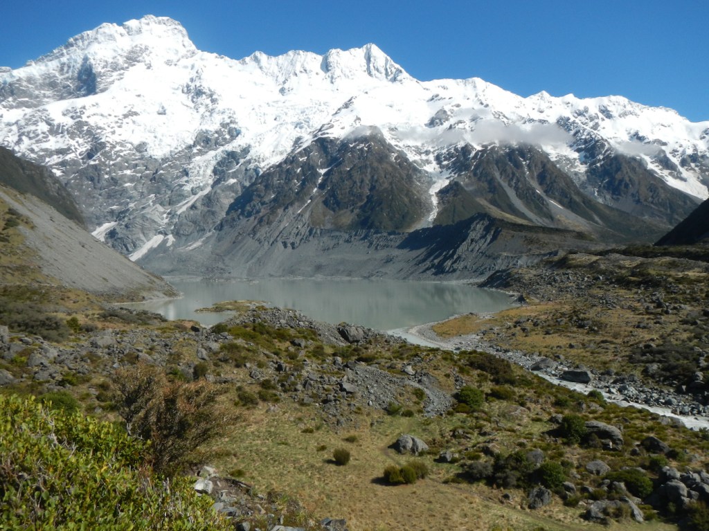
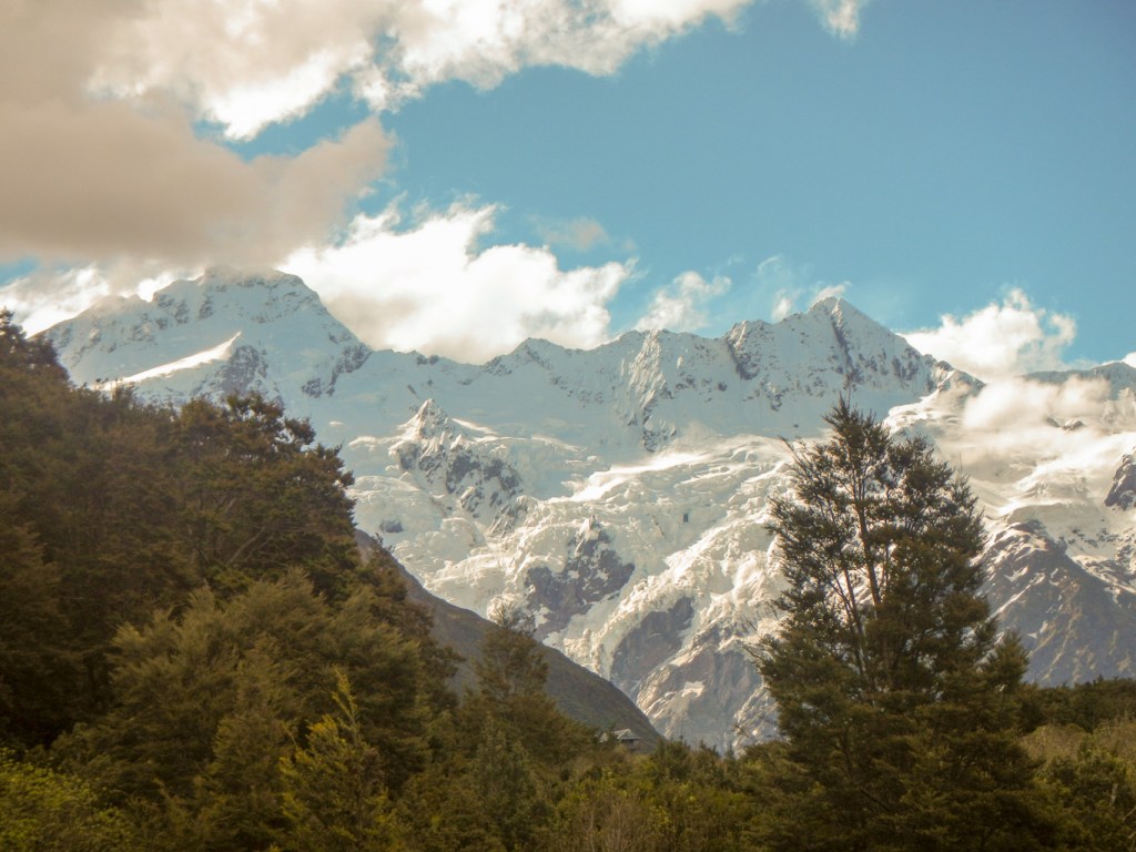
The track ends at the glacier lake from where there are stunning views of Mount Cook, the Hooker Glacier and the Southern Alps. On the return along the same path, with views across to the Sealy Range we diverted to an Alpine tarn where we spotted a New Zealand falcon. The temperature was climbing and we heard some avalanches in the distance.

My husband drove back to the village and motel, while I tackled the steep 2,200 steps ascent to the freshwater lakes at Sealy Tarns. The walk with 600m of ascent took me 75 minutes. There are excellent views of Hooker Valley, the Mueller Lake, the Hooker Lake and the moraine wall between. The Mueller Hut is a further ascent of 400-500m but the notice at the DOC visitor centre had advised that there was still snow and avalanche risk. Despite this, others appeared to be tackling it with only summer equipment.
I returned down all the steps after spending fifteen minutes at the tarns. Uphill, I had been overtaking others but I was overtaken by many people during my more cautious descent which took almost as long as my ascent.

I reached a branch point to Kea Point. Realising this is only a thirty minute return detour, I walked to the viewing deck to enjoy views of Mount Sefton, The Footstool, the Hooker Valley and the Mueller Glacier Lake. I was able to walk back to the village and motel on a direct path without going back to the car park.
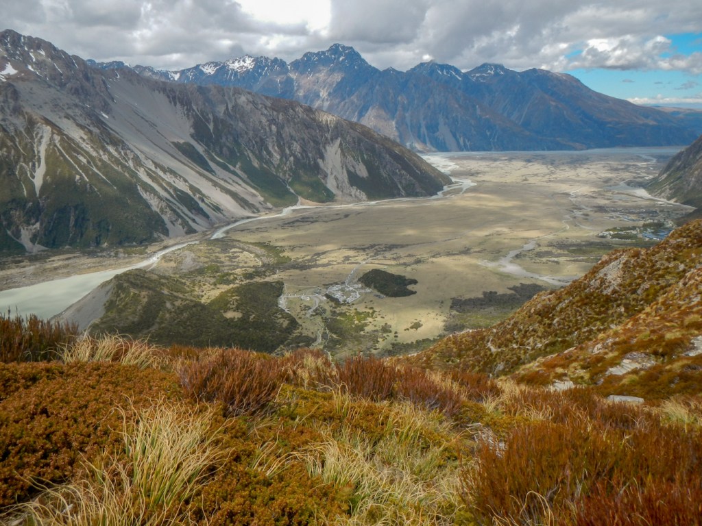
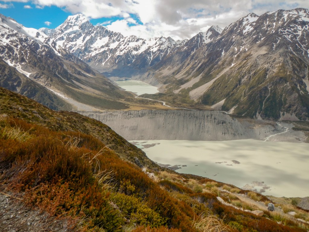
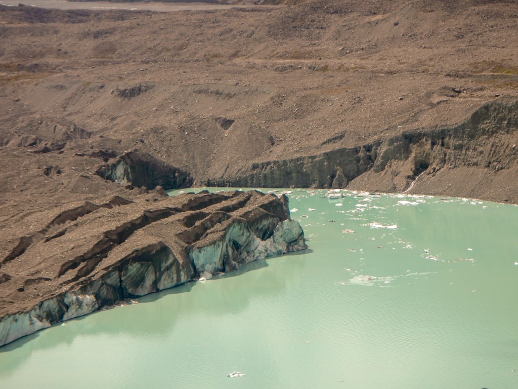
8 November – The weather was better than promised by the forecast – dry with high cloud. We headed by car to the Tasman Valley car park and completed all the “short walks” to the blue tarns (nowadays green as they contain more rainwater than glacier water), to the glacier viewpoint (it’s receding rapidly) and to the Tasman Lake.

The Tasman lake didn’t start to form until 1974 and is now large enough to take commercial boat and kayak tours – a sobering reminder of the retreat of the glacier as the terminal moraines we reached marked the previous foot of the glacier. There was a steady stream of sightseeing helicopters we spotted flying over throughout the day.


We returned to the car park and decided to walk up the track towards the Ball Hut. It’s a 4WD track. We negotiated two parts of the track where there are warnings not to stop in case of avalanches. Fortunately at this stage of the season at this height there really wasn’t any snow left to create an avalanche. However some of the rocks looked a bit unstable.
We had hoped to reach a point where we could see the glacier. We reached the end of the 4WD track where a car was parked labelled with mountain guide stickers. A sign warned of precipitous drops ahead. As the weather was good and we could see where we were going, we strolled on up the track and drew almost level with the edge of the glacier in the huge valley below us.

Ahead we could see an enormous cleft where the path disappeared. we assumed that the Ball Hut had become inaccessible from this direction. In fact I have since discovered on-line it is possible to navigate past here and past two further slips to reach the Ball Hut. However we weren’t prepared with all the equipment we would have needed and our objective was really just to reach a point to view the glacier at closer range.
We sat on a stone looking over the glacier valley to eat lunch. While we were eating an Australian couple drove to where the other vehicle was parked and walked up to look at the glacier.
We set off back to the car park but were soon overtaken by the Australian couple in what turned out to be a hired “ute”. They stopped and offered a lift, which seemed a good option to save the time retracing our steps. They had hired a “lucky dip” vehicle and could hardly believe what they had been given. It was a very bumpy ride probably almost to the limit of the vehicle’s and driver’s capability.
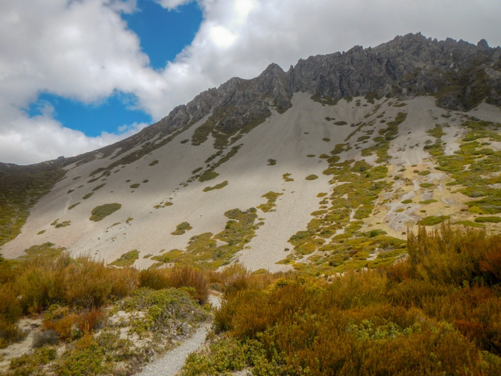
Back at our car, we drove to the motel. In view of the “saved time” I was keen to walk up to another view point 300m above the village. Initially I walked round the Governor’s Bush Walk through tawai/tawhai/silver beech forest. This was more undulating than I expected but worth doing to have a good look at the area of rare silver beech forest saved by Governor Brown. Unfortunately the route to get on to the Red Tarns path was over a gorge so I lost all the height that I had gained to reach the high point of the Governor’s Bush Walk. There was a 300m ascent up rocks and many uneven steps. it was almost a repeat of the Sealy Tarns Route although only half the ascent.

However it is a much less popular walk and I only saw a couple of other people on it. There are excellent views of the village and the mountains from the top.
I could see Mount Sebastpool as well above me – I was halfway up this mountain.
The tarns are named for the red pond weed that grows in them; the plants at the edges of the ponds eat insects.
Having returned to the motel, I caught up with my husband and we walked up to the village to enjoy dinner at the traditional “Old Mountaineers’ Cafe” – dinner cooked from a limited menu by the owner who is also a mountain guide and served by his wife. Sadly they can’t get any staff….. https://www.mackenzienz.com/visit/old-mountaineers-cafe-bar-and-restaurant/
9 November – Another long journey and we had some plans for activities on the route so we left Mount Cook village before 08:00am.
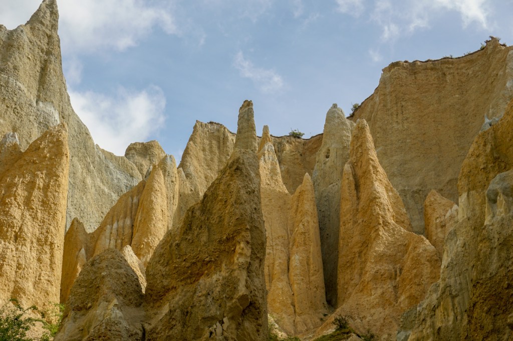
Our first stop was at Omaramu clay cliffs. These are up a side road and then a further turn off onto a gravel road. There’s a $5 charge to continue along the private road to the car park. However it’s well worth the price and the detour. The cliffs are made up of layers of gravel and silt, originally formed by the flow from ancient glaciers over a million years ago and thrust up through the fault line during earthquakes.
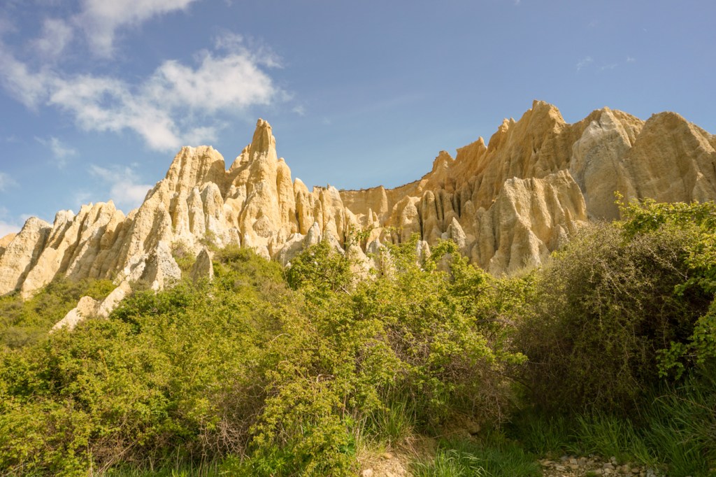
A gravel path leads through a narrowing and up a slope to the most dramatic “grotto” like part of the formation. We were fortunate that we arrived just before a “rush” of cars, so we had a short time with just the two of us (and a pigeon) in this scenic and other-worldly area and we took loads of photos.

Back on the main road, we drove over the scenic Lindis Pass the way we had come to Mount Cook. The car started to make an odd noise when it went over a bump. it didn’t seem to relate to any noise that our luggage could be making “rattling around”. We continued on to roads which were new to us, through Karawarau Gorge and an old gold mining area. There had been a rock bridge used by the Māori people to cross the gorge, but it has long collapsed.
The car was still making the noise so we drove on carefully and decided to drop in to the Avis car hire area at Queenstown Airport. The upshot was that the very helpful staff decided we should swap to a different car so they could run checks on it. Hence thirty minutes later we were driving into Queenstown centre in a different (but the same make and model) car. Sadly Queenstown Centre roads appeared to be being rebuilt and we couldn’t find anywhere to park so we drove back towards a big shopping centre near the airport where we visited a superb outdoor shop https://www.bivouac.co.nz/ before continuing on our way.
Again there was more amazing scenery – snow-capped mountains, huge open landscapes, an enormous lake, vineyards and lots of places with familiar Scottish names.
Eventually we arrived at Te Anau where we restocked our food supplies at the supermarket before heading out of town to our destination at Manapouri.
The new leaseholder had only taken over a few weeks earlier and was still coming to terms with all the quirks and foibles of the place which had previously been run by the same person for decades. The upshot was that our booking had somehow slipped through the manual system which he was trying to bring into the computerised 21st century. However Henry was adamant that he would work something out – in the end it meant that we had one night in a different chalet unit before swapping into the one we had booked. Each chalet is unique but all are retro with decor and fittings in keeping with the 1960s or 1970s. Everything was spotlessly clean and it was a lovely place to stay https://www.booking.com/hotel/nz/manapouri-holiday-park.en-gb.html.
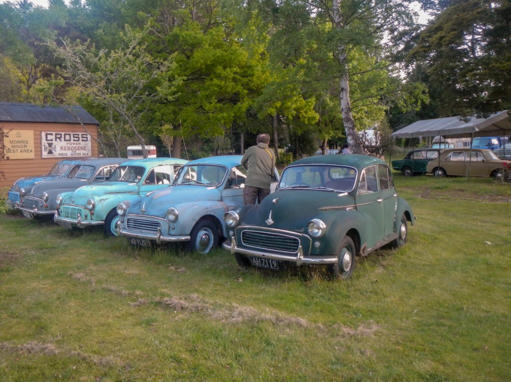
After cooking and eating dinner, we walked down to Pearl Harbour, returning along the beach. Amazingly, looking out over the lake, it’s over 80km to the open sea and all that land is an uninhabited wilderness. The length of wilderness north to south is even greater. Most of it has never been touched by any human and much of it never will be particularly as it has been designated as an area only for wildlife. It is mind bogglingly HUGE. We also spent time looking at the owner’s collection of rusting old cars – mainly Morris Minors of all types.
10 November – A lovely sunny day and we headed for Te Anau to book a trip to the glow worm caves. To our delight RealNZ who operate the tours were able to book us on to the earliest expedition at 10:15am. https://www.realnz.com/en/destinations/te-anau/. While we were waiting, we wandered off to the DOC visitor centre – another informative display where we learned about the New Zealand Alpine fault line and a bit more about rare birds in the area including takahe.
Returning to the start place for the glow worm tour, I was surprised to meet Nicole and Scott from Australia. I’d met them on the Queen Charlotte Trail, when Nicole was struggling to walk because of her advanced knee arthritis. I was pleased to discover she had completed the trail and her knee feeling at least temporarily better. What a coincidence – they were booked on the same glow worm cave tour as us!
The trip to the Te Anau Glowworm Caves begins with a cruise to the western shores of Lake Te Anau. The place where we disembarked is out of bounds to humans except for these tours. It is an area where the rare takahe birds breed. We enjoyed an informative talk about the caves and the glow worms, which are actually insect larvae, (as well as a cup of coffee), before venturing underground in a group of twelve.
The underground world is amazing. By geological standards, the caves are very young (12,000 years) and are still being carved out by the force of the river that flows through them. The result is a twisting network of limestone passages filled with sculpted rock, whirlpools and a roaring underground waterfall. We were shown a very small stalactite – only 4cm long as it hasn’t had time to grow any bigger.
Deep inside the caves, beyond the roar of the water, we were transported by small boat into a silent hidden grotto inhabited by hundreds of glowworms, unique to New Zealand. In the subterranean darkness, they produced a glittering display that is extraordinary. The silence and darkness apart from the twinkling glittery glow of the worms added to the experience.
Sadly we left this subterranean wonderland, for the voyage back to Te Anau.
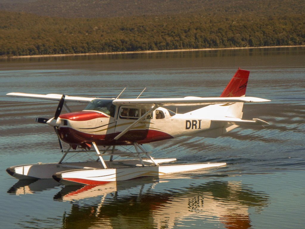
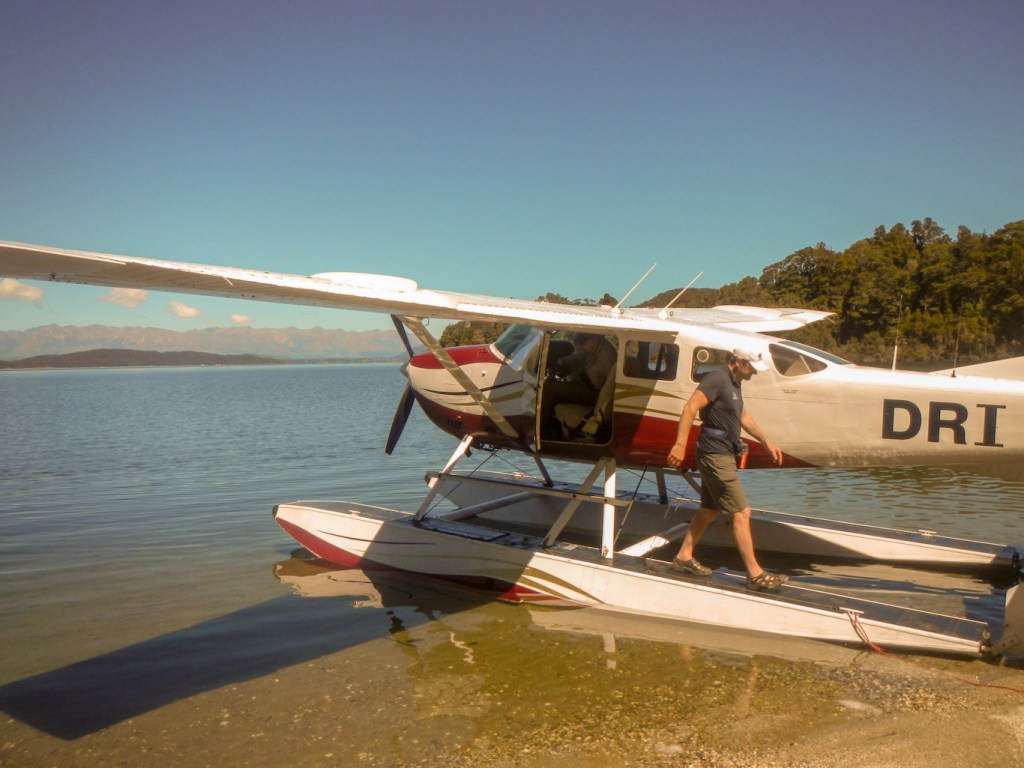
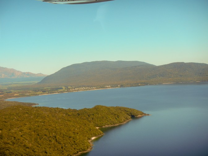
It was a beautiful day and we had noticed the two float planes on the lake. On the spur of the moment we decided that in such weather a scenic plane ride would be amazing. Suffice to say we managed to contact the pilot and booked on to the 2pm “mystery” ride including a landing on a remote beach. There were three other passengers – a young couple from Auckland and their six month old daughter. Due to some communication issues, they had been told that they had booked on to a flight to look at Doubtful Sound. Our pilot, Ivan, decided that we should all do the trip we thought we had booked so we ended up having an extra long flight as well as the landing!
Ivan is also a stunt pilot and trainer – one of the World’s leading! We were in more than capable hands. My husband was really lucky and got the front seat next to Ivan. I was the only passenger in the very back so could look out of both sides of the plane. The family sat in the middle row of seats. We were all kitted out with head sets so we could hear what Ivan was telling us – he gave a superb and informative commentary that added to the experience.
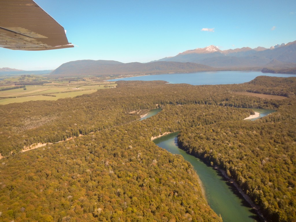
The whole flight was amazing – one of the major highlights of the entire holiday. We took off from the water and were soon passing over some deep hidden lakes separate from the main lake.

We saw waterfalls, water slides, forest and mountain ridge after ridge. We flew low over the mountain pass and over Doubtful Sound. There were a couple of boats in Doubtful Sound below us – that was where we would be the next day!
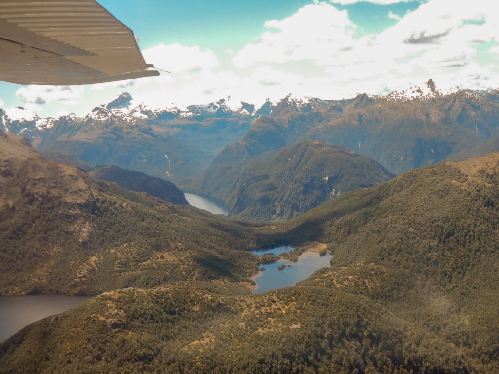
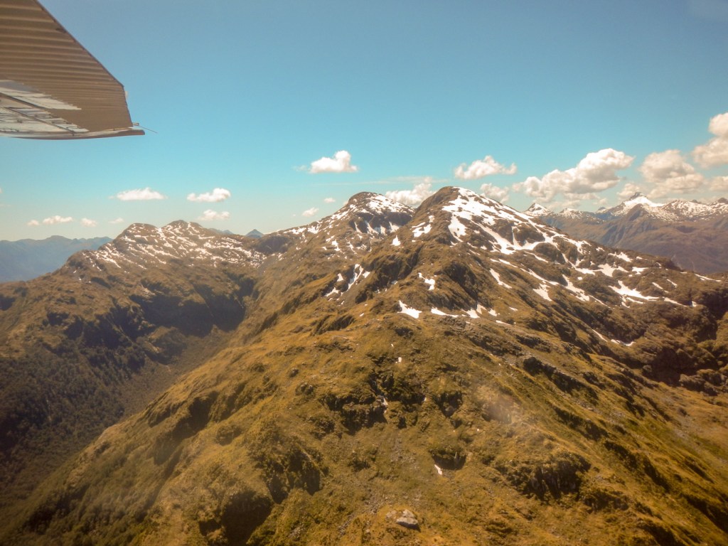

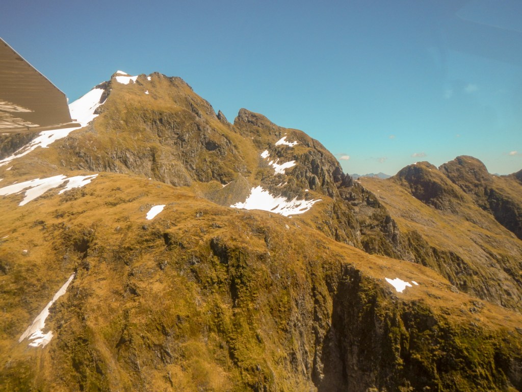
We flew over the mountain ridges again – the ridges seemed to lead from one to another and I was trying to pick out amazing ridge walks – but most of the ridges are actually inaccessible or out of bounds for people. There are miles and miles of majestic unspoilt and untouched landscape. We flew back over the mountain pass and were above lake Manapouri.
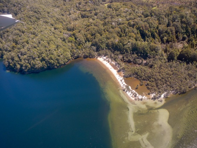
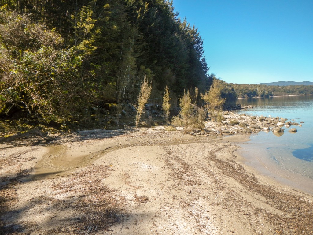
Ivan explained that we were going to make a landing and climb out of the plane on to a beach. For the short duration of our visit, this was our own beach. Ivan pointed out some tracks which were straight lines – kiwi tracks. In broad daylight the chance of actually seeing a kiwi was infinitesimal; however we had evidence that they had walked on this beach. We also saw geese and deer footprints. Behind the beach in the bush there was loads of lichen hanging from the trees and a thick carpet of ground moss. This beach is barely frequented by humans. Untouched landscape was all around us. Awesome!
Soon it was time to climb back into the plane and leave our little bit of paradise. We flew near Manapouri village where we were staying. There were views of the dense virgin forest and of the cultivated farmland.
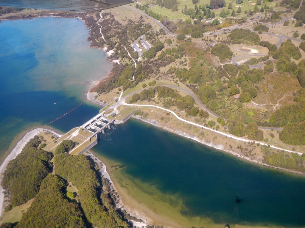
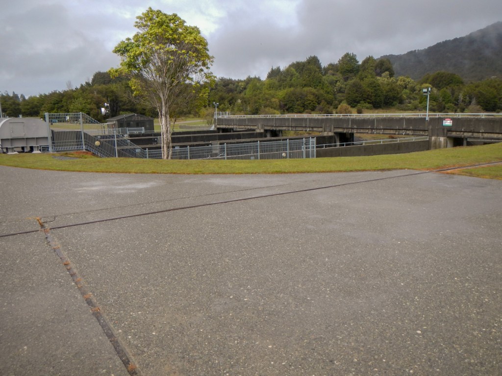
We passed over the control gates for the hydro electric scheme.
The landing on the lake was incredibly smooth. Our scenic experience was over but the memories will remain. I definitely recommend this https://www.wingsandwater.co.nz/. Ivan is an absolutely brilliant pilot as well as being extremely friendly and helpful.

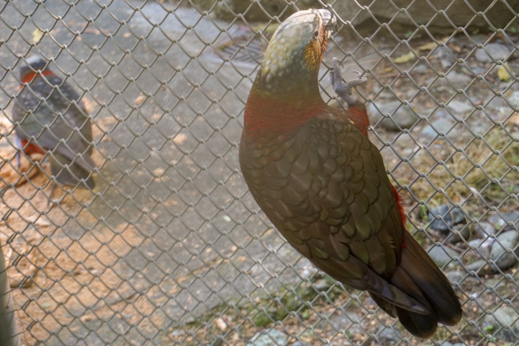
How could we follow that experience? We drove to the bird reserve off the road back to Manapouri. We saw a rare takahe, a red crowned parakeet and a kea.


We arrived back at Manapouri and Henry showed us to our new “home”. Actually we preferred it to the larger unit we had been in the night before. After cooking and eating dinner, I decided to go for a walk round the village. I discovered the “wee bookshop” – an adult branch and a children’s book branch and peered through the windows as it was closed. There are many more houses in the village than I had thought when we wandered down to the harbour the previous day. They are mainly single storey wooden buildings in sizeable grounds. I returned to the apartment but at sunset we wandered together down to the lakeside to look at the orange and pink colours over the lake.

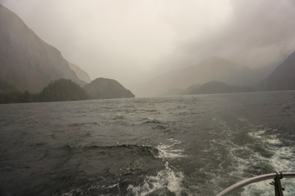
11 November – This was our day to start the cruise on Doubtful Sound, an experience that we had booked long before while still in UK. We had opted to travel on the small boat with up to ten passengers and this turned out to be an incredibly sound decision. At Pearl Harbour, only a short walk from our motel apartment, we met up with our fellow passengers and were transported by catamaran across Lake Manapouri to the West Arm, where we met David from https://www.doubtfulsound.com/.
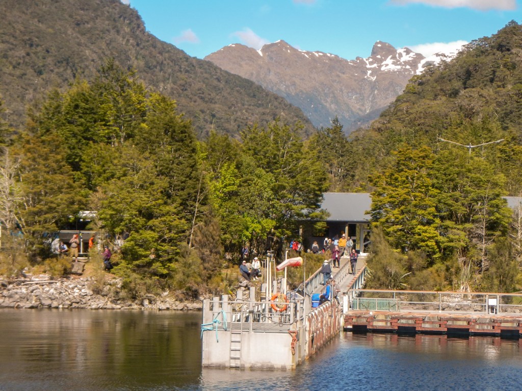
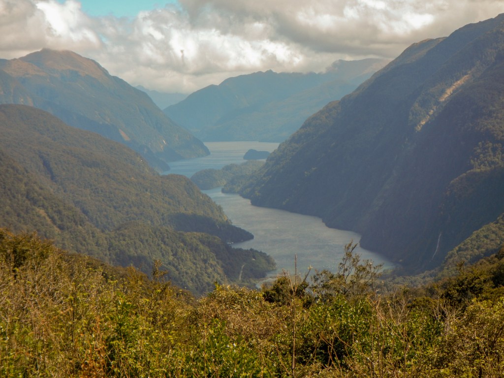
David was to be our skipper for our twenty hours on MV Southern Secret and his first job was to drive us on the gravel road over the pass to Deep Cove on Doubtful Sound. In this area it rains for over 220 days per year with a rainfall of 8-12 metres over the year. We were seeing it in an atypically dry state. We saw a sign for the Dusky Bay Track – reputedly the most difficult walk in New Zealand with difficult river crossings and it takes 5-10 days to walk depending on how long one has to wait to get across the rivers. We crossed a dry ford and the water was actually way below road level – sometimes it can be waist height or higher across the road! We saw a huge glaciated valley – steep sided with trees growing on almost no soil. What should have been a huge waterfall was diminished by the recent dry weather. This area was a filming location for Peter Jackson’s The Hobbit and Lord of the Rings.
We arrived at the boat moored in Deep Cove on Doubtful Sound, where we enjoyed a warm welcome from Jenny, who explained that we could treat the boat like our home for the next 20 hours – just a minimum of safety rules. I was the only passenger who admitted to any medical knowledge should there be a medical emergency. The boat is even equipped with a defibrillator!
We enjoyed a fabulous buffet lunch soon after getting underway. There was so much to look at – the glaciated landscape, tree avalanches both recent and old – these take 100 years for the vegetation to regrow fully, huge waterfalls – although less impressive than average due to all the recent dry weather, fleeting glimpses of fiordland crested penguins in the sea, sea gulls, shearwaters, oyster catchers.

We passed a large island and were almost out at the Tasman Sea, with just some small islands sheltering us within the sound. Here on some rocky islands, we saw lots of fur seals including what appeared to be entire family groups with young seals.
Out of the shelter of the islands, the sea became rough so we returned into the sheltered area and soon it was time to try our hand at fishing. We had to try several spots. I caught a sea perch but it was too small and had to go back in the sea. Others caught some sea perch that passed the size test and then I suddenly had something huge tugging on my line. With luck more than skill (and some help) I managed to land a large blue cod. These fish were to be cooked later by Jenny as part of our evening meal (together with a different fish that had been caught by previous guests); some of our catch was put by for the following guests too.
It was too rough to go kayaking so we went to pick up some lobster pots. There was a reasonable yield of lobsters which were carefully measured by David to check that they could be kept and eaten. the smaller ones were returned to the sea. Most were male – identified by having only a single breastplate and one row of claws. There are tight controls around fishing and lobster capture – people must have participated in the fishing in order to be entitled to kill and eat the catch.
We arrived at the head of one of the arms of the sound to try our luck at kayaking in the river, but the tide was out too far.

It was almost dinner time when we saw a seal surrounded by a few seagulls swimming up to the surface and frolicking in the water.
Time for dinner and to eat delicious food expertly prepared by Jenny and including some of our catch. It looked as though kayaking was off, particularly disappointing as we could see passengers from the “big” boat in kayaks.
After eating our main course, David suddenly asked if anyone wanted to go kayaking. Of course I volunteered immediately, although confessing to no experience (except kneeling on a stand-up paddleboard). Fortunately Nick and Sophie from Oxfordshire were up for it too and had a lot of experience including multi-day canoeing down the River Severn so they agreed to look after me.
We changed quickly, donned life jackets and were each assigned a kayak. Nick gave me some advice about rotating the paddle and we were off, managing to stick together. It all felt very relaxed; we paddled to a nearby bay and back without incident then returned safely to the boat.
We even had desert after our excursion!
12 November – the weather changed in the night and we heard rain on the boat. We got up as soon as we heard the generator going and joined David at the front of the boat. It was amazing how the weather had suddenly changed – it was cold, dull and rainy. Actually this was typical fiordland weather so I guess our experience wouldn’t have been complete without it. We discussed the computer on the boat – the sonar maps the depth of the fiord and compiles a composite map of the bottom formed from all the journeys made. We learned about waste disposal from the boat and water supplies. It was a bit rough and Jenny had a hard time in the galley preparing breakfast.
We reached the end of one of the arms of the Sound, where there was a small waterfall. David was able to get so close that the water landed on the boat and I was able to walk behind the waterfall on the deck (clothed in full waterproofs of course as it was pouring with rain too).
We passed the Lady Alice Falls again – it hadn’t rained sufficiently to make them much bigger than on the previous day.
Soon we were back at Deep Cove and it was time to leave the boat. As my waterproofs were already soaked, I took the option of walking up the track whilst David sorted out a few things prior to taking the minibus along the track with all of us inside. The tuis were still singing although I couldn’t see them. Eventually the minibus caught me and I had been left the front seat so I wouldn’t make everybody wet in the back! We had time to stop at a waterfall which was a bit fuller than on the previous day.

All that remained was to say good bye to David and to travel back to Pearl Harbour in the large catamaran. It was even sunny at Manapouri, where the rainfall is much less than at Doubtful Sound. It had been an amazing excursion with wildlife sightings as well as the adventures fishing and kayaking!
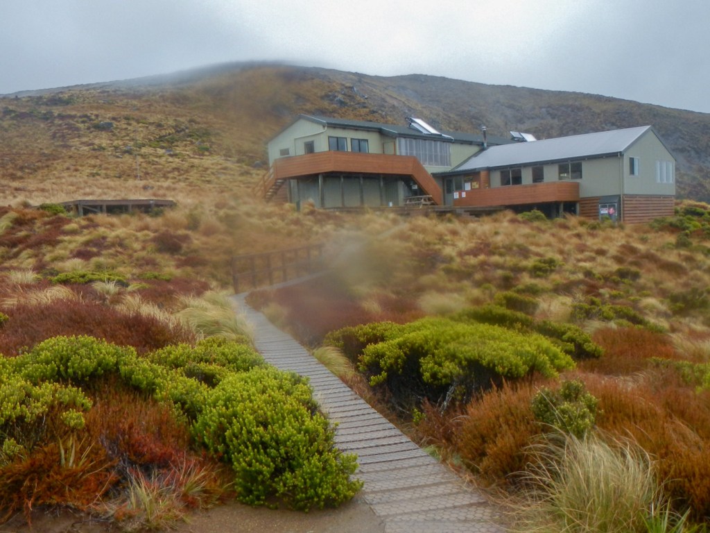
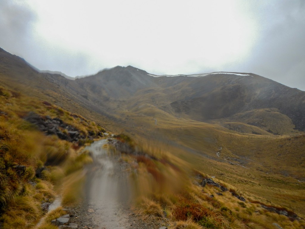
13 November – It was pouring with rain. I had planned to make a solo trek from the control gates car park (the gates regulate water flow between lakes Te Anau and Manapouri for the West Arm hydroelectric power station) to Mount Luxmore and back. There was news saying that the rain forecast for the day was heavy and long lasting even for this area and that there was increased risk of land slips. The walk I had planned was predicted to take 8-10 hours according to the leaflet I had picked up; however the website actually states 8-10 hours return just to Luxmore Hut (Luxmore Summit is advertised as a further 3 hours return). In any case it would be a long and hard day.
I decided that the weather was against me so we headed by car to Te Anau to try to find some suitable wet weather activities. Actually there appears to be very little to do here in wet weather, apart from waiting for the weather to improve. We visited the bank, the bookshop and a café. At 10:30am the weather seemed to be improving. I looked at the situation and decided to give the walk a try. Admittedly it wasn’t ideal setting off on what was predicted at very best as an eight hour walk at 11.00am but it was an out and return walk so I could turn back after half the available time.
I had about ten hours of daylight until 21:00. I suggested a pick-up time of 20:00 but my husband said he would be there at 19:00 although not to worry as long as I was no later than 20:00. I decided that I would have to turn back by 16:00 at the latest to ensure a return in daylight. I was carrying a head-light and I was also planning to turn back if the path looked unsafe.
The first 5.6km to Brod Bay is on an almost flat and well-made track around Te Anau Lake. It’s under the trees. The rain restarted and I stopped to put on waterproof trousers (already wearing a waterproof jacket). I reached the campsite after an hour (the sign had suggested 90 minutes).
From Brod Bay, the climbing began. Up to then I had seen few people. However I started to overtake groups of people laden with enormous packed rucksacks who were heading for an overnight stop at Luxmore Hut. The hut was advertised as being 4hrs 30 minutes from Brod Bay (but a very fit walker in good conditions might only take half that time). I was overtaken by someone who seemed to fit into this category although he was carrying even less than me. I was also caught by a man from Christchurch who was carrying a large rucksack but wearing only shorts and a T shirt – he explained that more clothes slowed him down and he was wanting to get to the hut quickly and enjoy a whisky! We arrived below some towering and scenic limestone bluffs. A gap in the trees together with breaks in the cloud afforded some views towards Lake Manapouri.
I suggested that the man, who had started to walk at my pace, press on and I sat on a rock for a rather soggy lunch stop. Eventually I reached the tree line and an easing of the gradient.
A sign suggested that the walk to the Luxmore Hut would take 45 minutes. It was a prominent track with panoramic views and well maintained boards passed over the more boggy and fragile parts of the ground. I saw a sign to some nearby caves as I reached the hut (and attached helicopter landing site at 1085m). I didn’t stop – it was 14:30 so I had taken 3.5 hours from the control gates and 2.5 hours from Brod Bay even including a short break. I had some hope that I could reach the summit by 16:00 which was my very latest time to turn around.
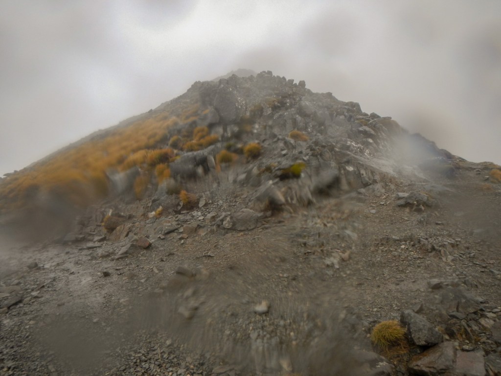
The weather was possibly worsening or perhaps it was just more windy and cold because I was in a higher and more exposed area. The track had deteriorated in quality, ascending steeply again but was still clear ahead. There were a few people descending towards the hut. I continued on and was fortunate that the path was mainly sheltered by rising ground from the worse of the wind. There were areas of scree which looked unstable so I pressed on without stopping. I arrived at a sign stating that the side path to the summit of Mount Luxmore was only 400m ahead. I reached the turning and at this point I was just about on the 1400m contour and so a further 72m ascent to the summit. The sign on the path stated it would take ten minutes. It was 15:40 so I had time to do it. However the path wasn’t distinct and was extremely exposed along the ridge. In the gusting wind I was concerned that I would be blown off my feet so unfortunately I just wasn’t quite able to get there. On the plus side, the views were good from where I was standing and I had actually managed to walk a lot further than the DOC signs suggested was possible in the time. I made the decision to bail out and so began my descent.
As I walked back to the Luxmore hut, the weather improved a bit and I even saw a rainbow over Lake Te Anau.
I also spotted the hidden lakes that I had seen from the float plane in such different sunny and dry conditions only three days earlier.
There were walkers outside the hut taking photos of the view. It was tempting to take the short side path to the caves but I knew that I was pushing things for time especially to try to get back for 20:00 so I wouldn’t need to spend time phoning or messaging my husband. I pushed on.
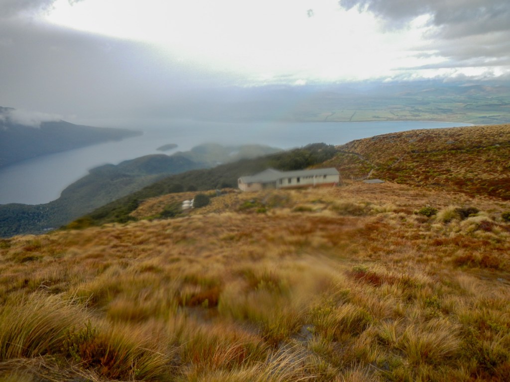
I met a few tired walkers finishing their ascent to the hut. I saw more rainbows and views towards Lake Manapouri in the distance as well as Lake Te Anau closer at hand.
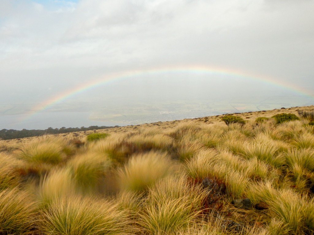
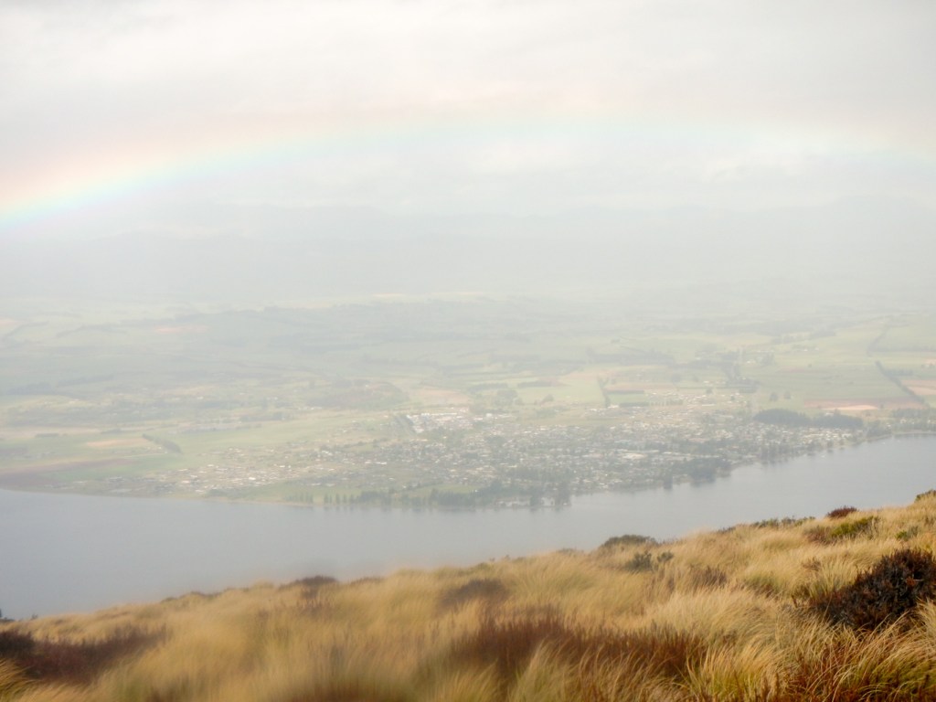
I reached the limestone bluffs again and took photos there in the better weather conditions.
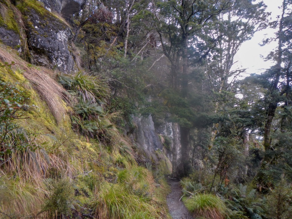
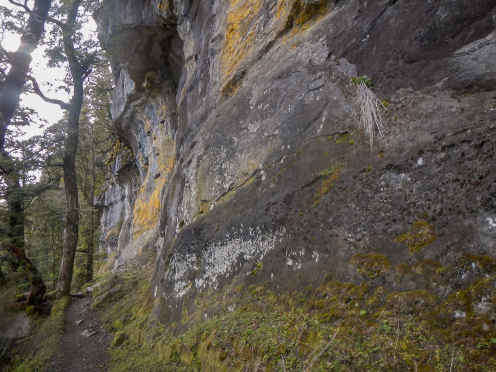
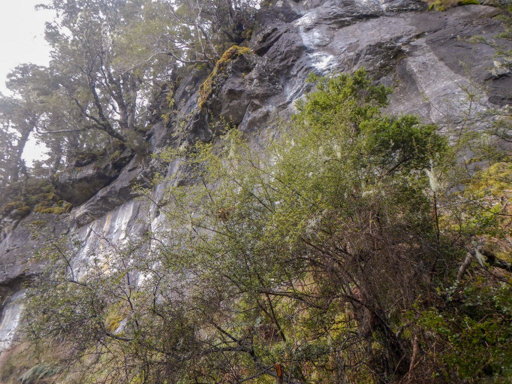

It seemed a very long way from the cliffs down to Brod Bay where there were several pitched tents.
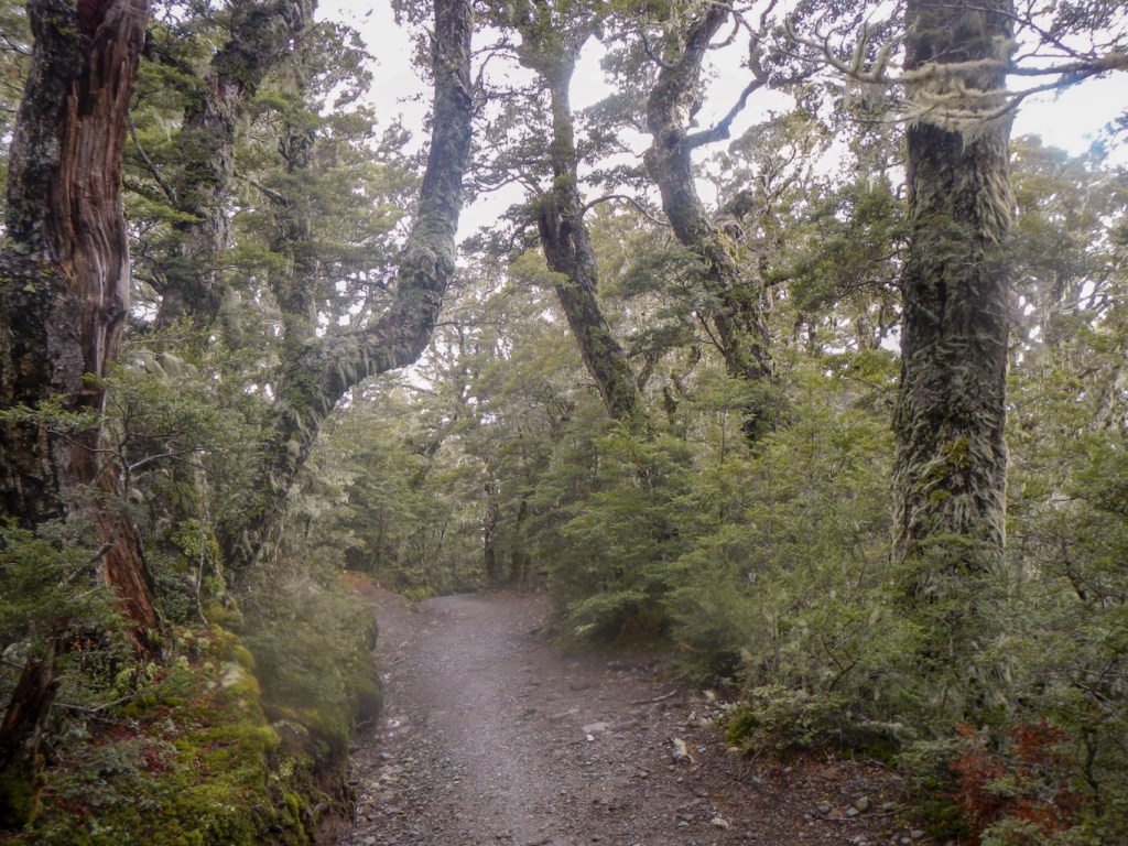
Just the last few miles along the flat path remained. As I approached the end, two men and a lady from the search and rescue service were walking towards me – “we’re just on a training exercise” they reassured me. I was back at the car bang on 20:00, four hours and twenty minutes after I had turned round ten minutes short of the summit of Mount Luxmore. The walk had taken nine hours in total including rests. The signs on the track would have suggested a fifteen hour return walk, although my pamphlet had stated eight to ten hours. Nonetheless to have completed it in nine hours in such wet conditions certainly wasn’t bad! It had been a superb day walk despite the conditions.
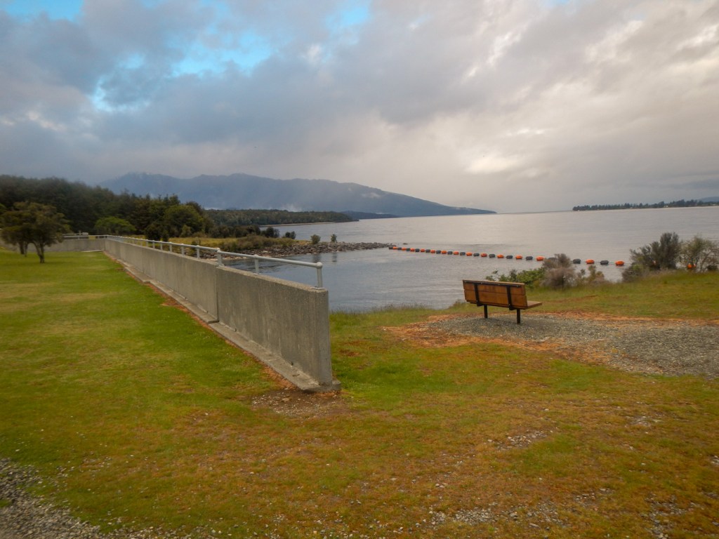
I just had to dry out. Goretex rainwear isn’t at its best when the humidity is so high.
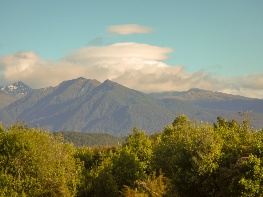
14 November – Another long drive, this time to Dunedin, following part of the southern scenic route. We started at 08:00am in sunny but windy conditions driving past more lakes and mountains.
Our first stop was at Clifden Suspension bridge crossing the Waiau River – the largest suspension bridge in New Zealand. It’s an engineering marvel, constructed of wood and built in one year at the end of the nineteenth century. Before it was built, people and goods had to be ferried across the river at the mercy of difficult currents and adverse weather.
Next stop was Orepuki, otherwise known as gemstone beach, to try to find some beautiful pebbles.
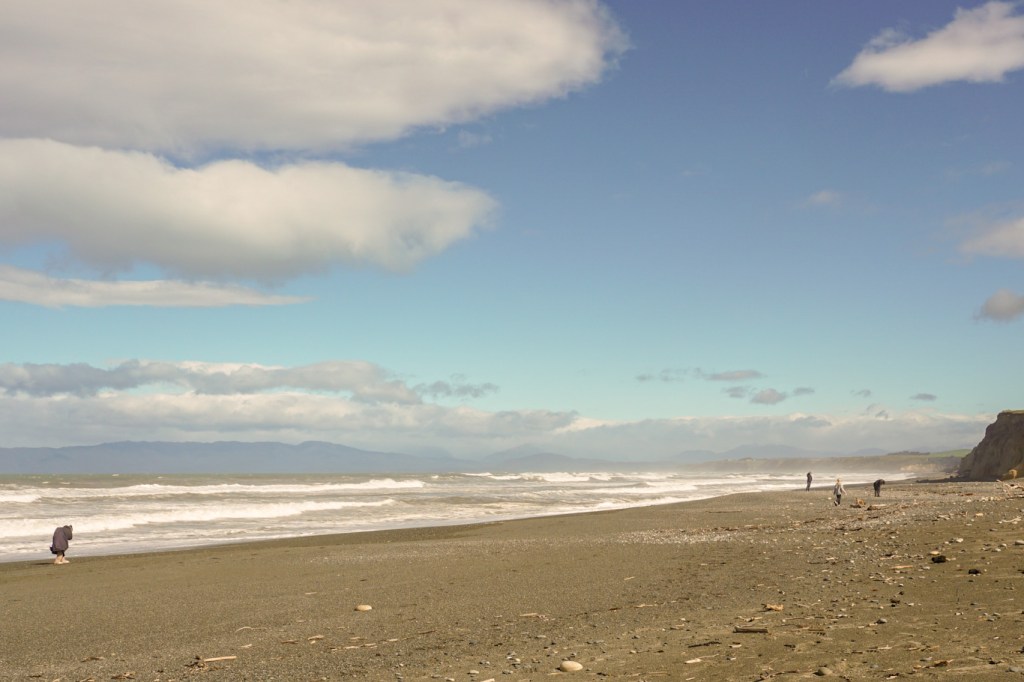
Our next stop was the town of Riverton with boats on the bay. We saw a preserved sawmill steam engine.
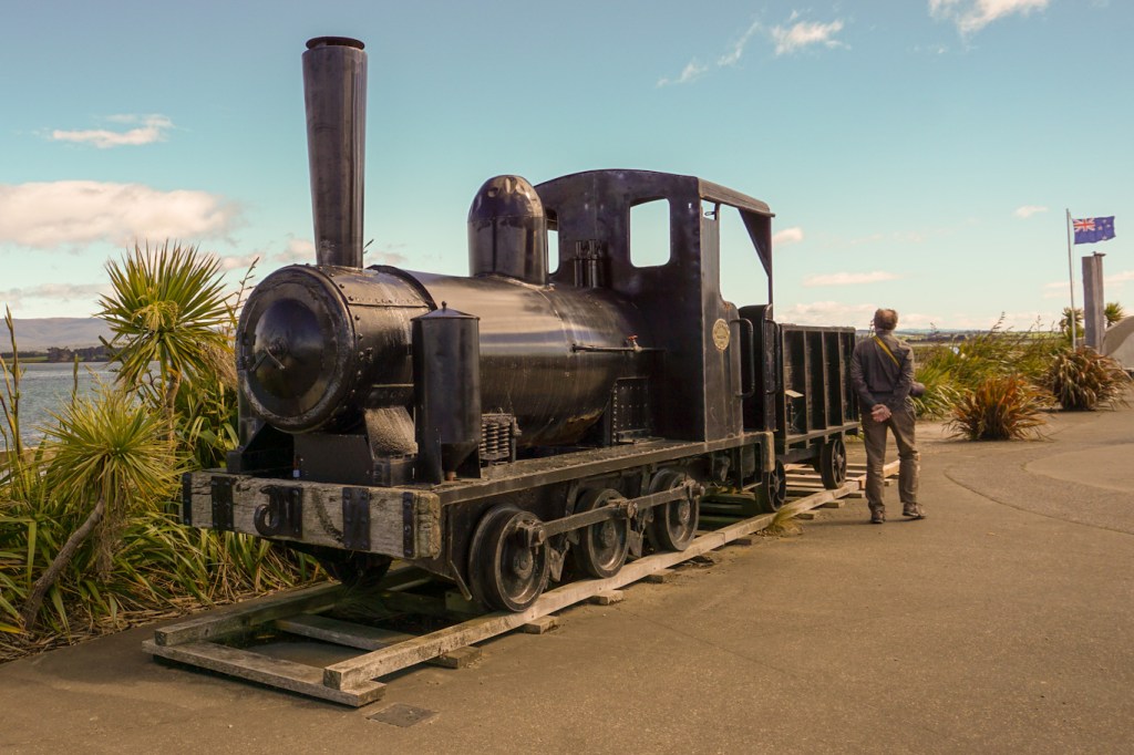
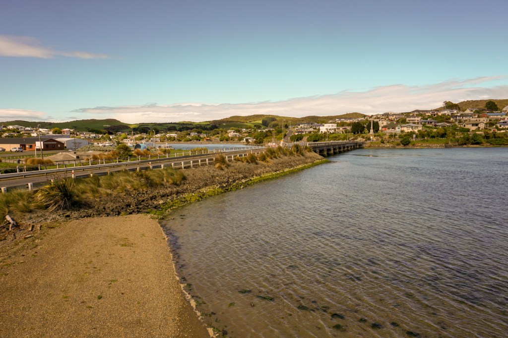
We didn’t stop at Invercargill, New Zealand’s most southern city or divert down to Bluff, the oldest European settled town in New Zealand as we had our sights on getting to Waipapa Point where there was a chance of seeing sea lions. Unfortunately there weren’t any to see but we saw the lighthouse which was built after multiple shipwrecks in the area and also noted the incredibly windswept trees.
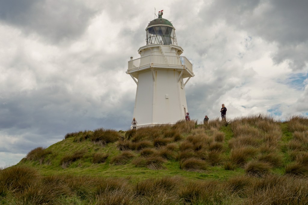
We stopped near Slope Point and walked to the most southerly point of the South Island.

We stopped at Curio Bay. This is a nesting area for penguins and another area where sea lions and dolphins are often spotted. We didn’t see any and unfortunately the visitor centre was closed due to staffing issues. However we were able to look down from the viewpoint at the ancient fossil forest.
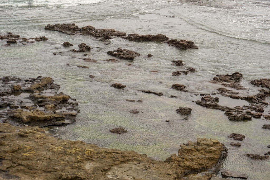
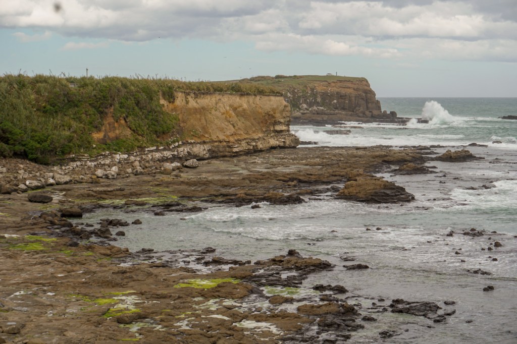
Unfortunately we didn’t have time to stop at Cathedral caves or to take the scenic route to the Purakauni Falls so we will have to return to explore this corner of New Zealand a bit more. It was late enough anyway by the time we arrived at our hotel just west of the main part of Dunedin – and it was pouring with rain.
15 November – This was another driving day, although not quite such a long journey. Hence we started the day by driving to nearby Tunnel Beach. There is a steep downhill path from the car park with tremendous views of an enormous sandstone natural arch. The path culminates in a tunnel on to the beach. It’s actually best seen at low tide but, even though we visited nearer high tide, we could appreciate the complexity of some of the natural sandstone rock formations.
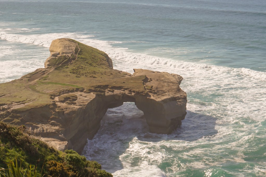


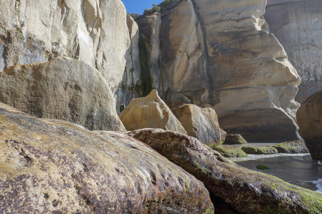
We didn’t stop at all in Dunedin itself – so do really need to revisit this interesting area. We were heading for Shag Point – initially we thought we were looking at sealions but then realised that these were in fact fur seals. We didn’t see any penguins, although they are found in the area.
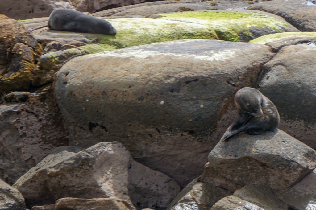
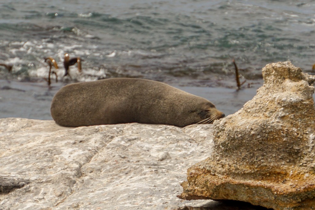
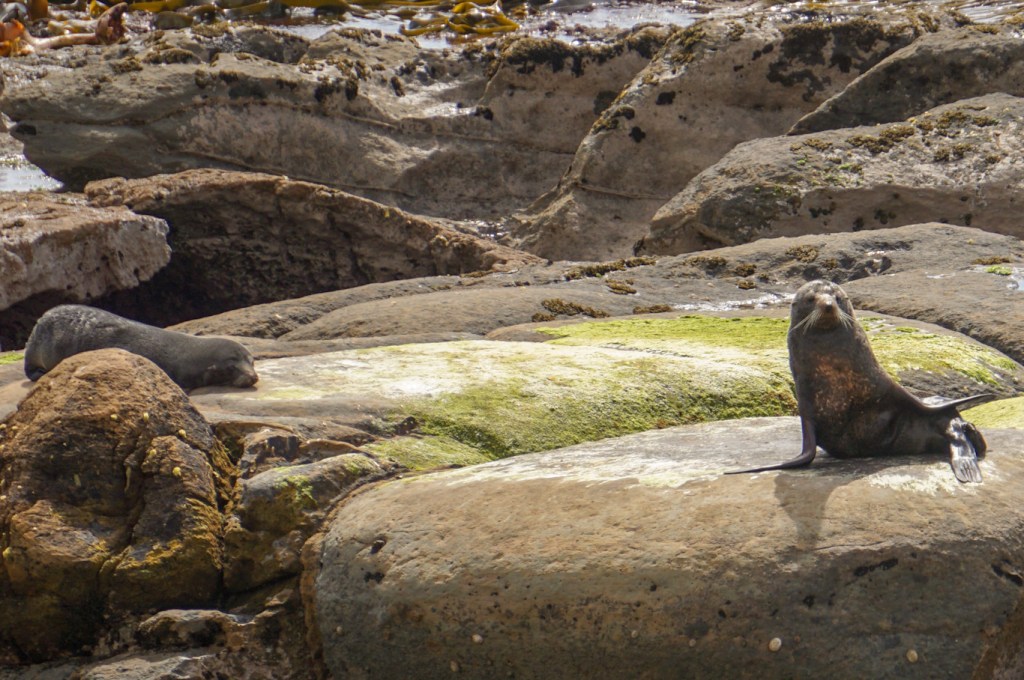
We drove on to Oamaru. We had hoped to be able to see blue penguins as there is a colony. Unfortunately when we arrived, we were told that the penguins spend the day at sea and can only be seen on land after sunset.
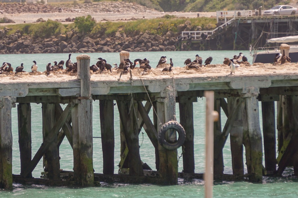
The town originally developed as a centre from which refrigerated meat was shipped – very big business. However, with economic decline in the twentieth century, has had to reinvent itself to survive. We discovered an unexpectedly eccentric town centre incorporating steampunk(“tomorrow as it used to be”) in addition to a precinct of Victorian buildings housing an eclectic mix of antiquarian bookshops, antique stores, vintage clothing shops, artist studios, penny farthing displays and quirky cafés.
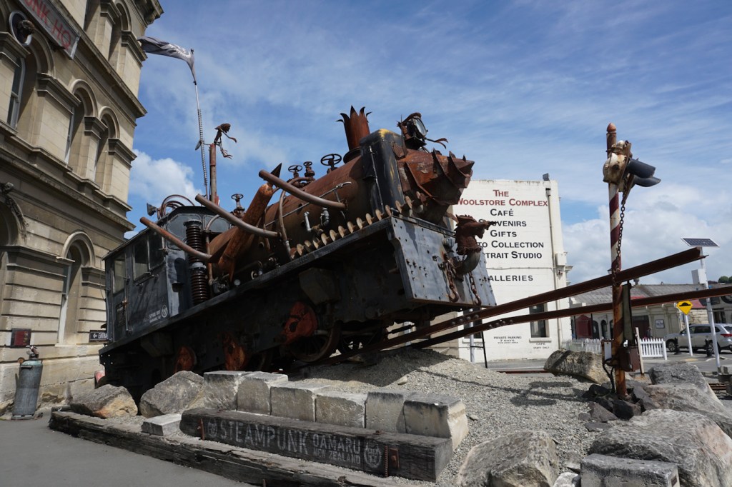

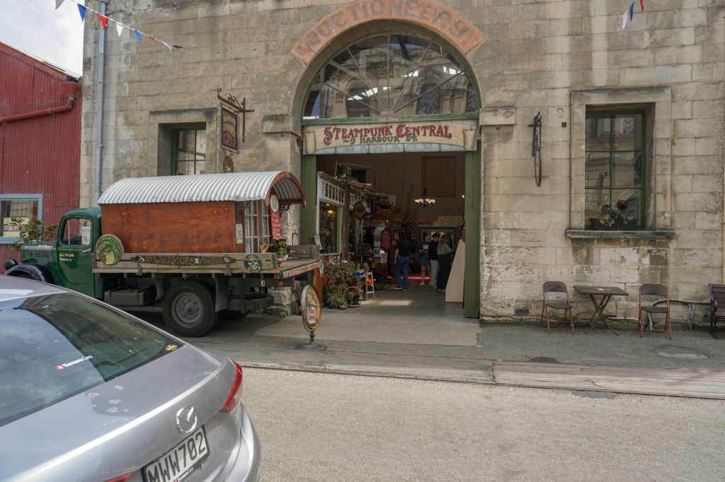
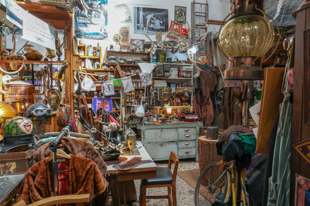
We spent so much time in Oamaru that there was no time for any more stops until we arrived at Christchurch Airport to drop off the hire car and travel by taxi to our hotel near a huge area of open parkland and sports pitches close to the centre of the city.
16 November – We walked to the city centre, arriving at the riverside area which has been redeveloped after the serious earthquake in February 2011 which killed 185 people and devastated the centre of the city. The riverside area is now a walkway, cycle route and green space running through the city centre. We saw eels in the river, art installations by famous sculptors including Anthony Gormley, traditional trams, a bridge of remembrance in memory of New Zealanders killed in World War 1 and subsequent conflicts and the poignant memorial to those people killed in the 2011 earthquake.
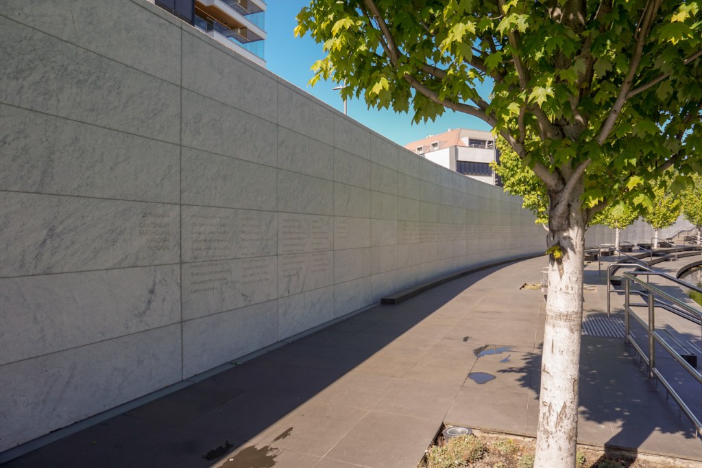
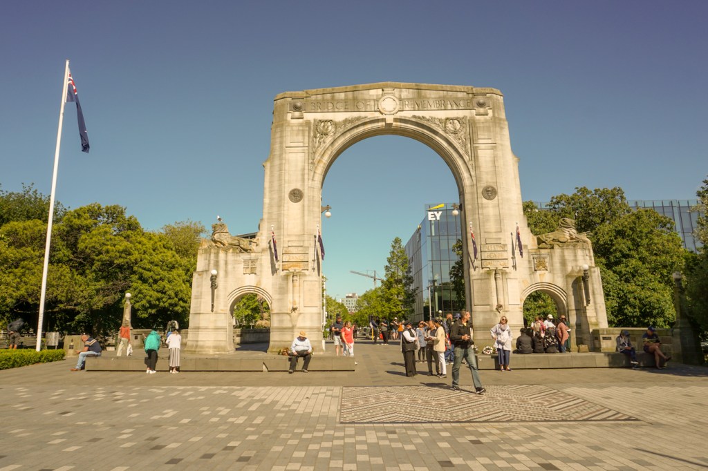
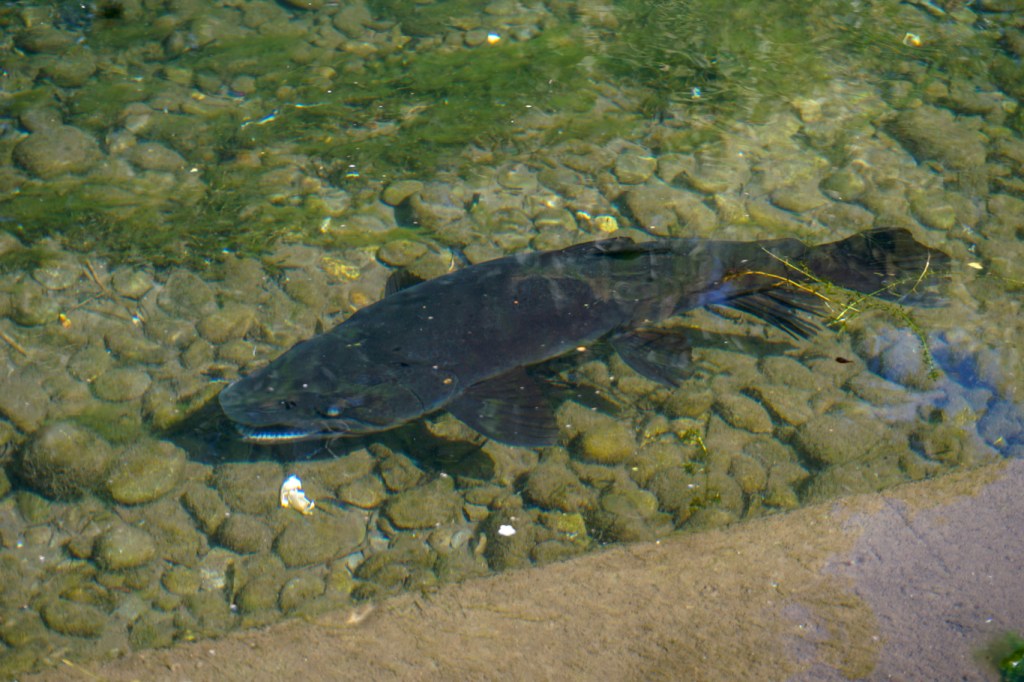
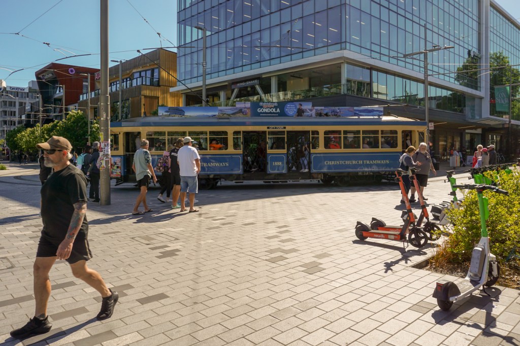
The city is still being rebuilt following the earthquakes: damaged buildings remain fenced off, swathes of derelict land have been repurposed as car parks where there were previously buildings which have been demolished, new buildings are being constructed and partially damaged buildings rebuilt.
The old cathedral is being restored and in the interim a temporary cardboard cathedral has been built – inside the building, the structural girders are covered with cardboard.

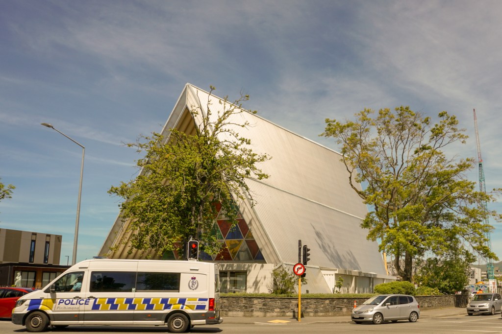
The modern town hall dating from 1972 was damaged significantly in the earthquake of 2011 but after much discussion has been rebuilt; in 2020 it was registered as a Category 1 listed building.
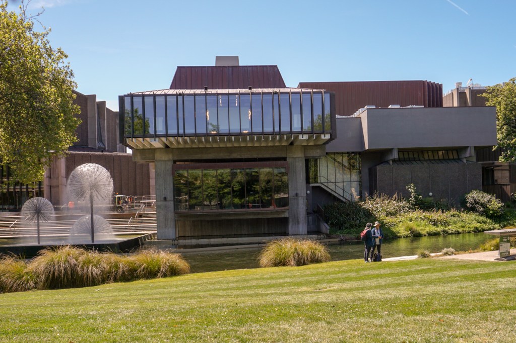
We made a short visit to the Art Gallery to look at an interesting and thought provoking exhibition involving examination of the human body from different perspectives.
We visited the Arts Centre area, consisting of old university buildings, some still used by the university but others developed as museum and arts areas for the public to visit.


We visited Quake City, a special exhibition incorporating displays and artefacts following the earthquakes. It includes information about the history of the city; personal accounts of those who lived through the earthquakes – both the immediate effects and how life had changed for them in the longer term; information about the science behind earthquakes, including the longer term consequences due to liquefaction as well as the immediate structural damage caused by the tremors. It also provides information about how buildings can be constructed so as to reduce the impact of seismic events and improve their safety in future earthquakes, which will inevitably occur in this area.
We hired a kayak and paddled up the river through part of the grounds of the huge botanic garden within the large area of parkland close to the city.
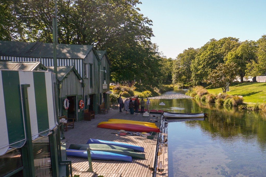
We returned to our hotel, initially strolling through the grounds of the botanic garden and past the Magnetic Observatory centre where eminent geophysicists worked between 1901 and 1941 to make celestial and magnetic observations in conjunction with scientists at the Antarctic base.
17 November – We were up early for breakfast and to walk to the railway station to board the TranzAlpine. Apart from freight trains, the only trains on this line are those designated as Great Journeys of New Zealand. The station caters for two train departures and two train arrivals per day – the TranzAlpine and the Coastal Pacific.
We were treated to a scenic journey across the expansive flat but deceptively wedge shaped Canterbury Plains, following the braided Waimakariri River, through multiple tunnels and over viaducts, along the course of a gorge on an uphill journey all the way to Arthur’s Pass. We enjoyed an informative intermittent commentary about the features we were passing, all delivered through personal headsets. There is even a separate observation carriage with no windows to get in the way of photography from the train.
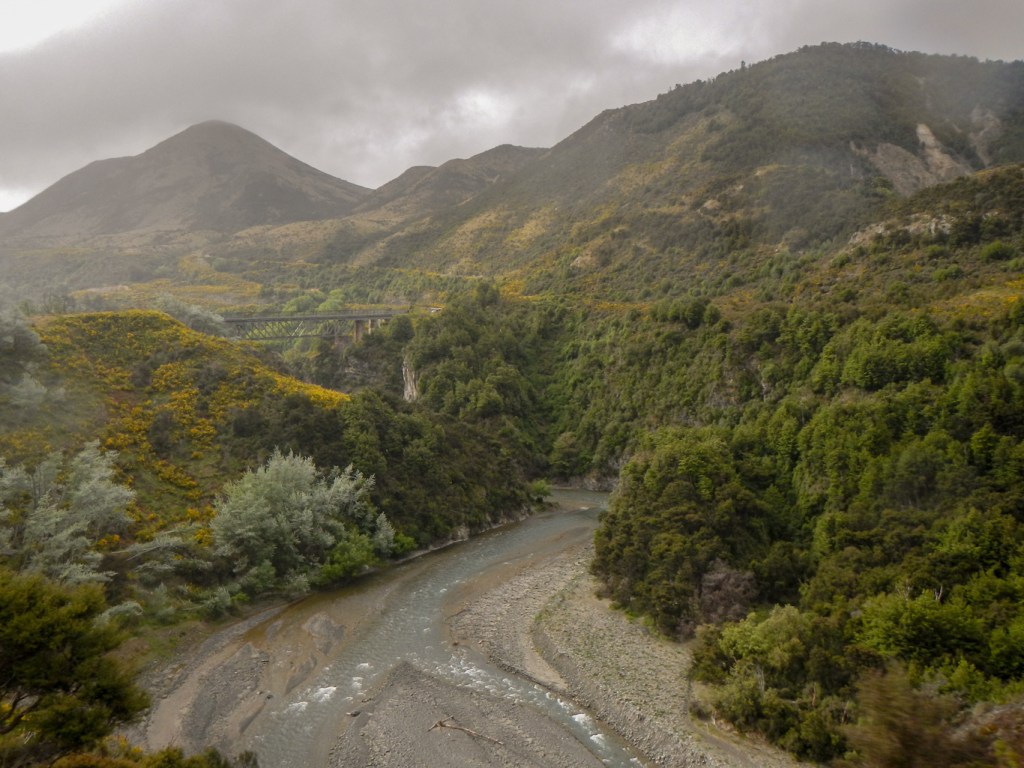
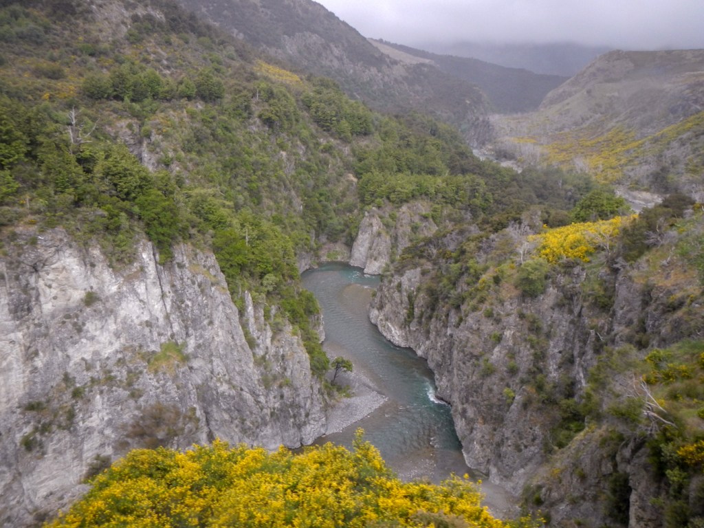
Arthur’s Pass Village in the heart of the Southern Alps at 900m above sea level is New Zealand’s highest altitude settlement. We disembarked here and the train went on to Greymouth on the west coast.
It rains a lot at Arthur’s Pass and this day was no exception. We received a friendly welcome at the DOC Visitor centre and then set off to explore. We walked together to ascend the steep but good path with 150m of ascent to view the impressive devils Punchbowl Falls.
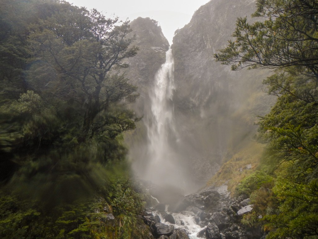
I was keen to walk to the summit of Arthur’s pass with the Dobson Memorial but my husband decided to turn back to the village.
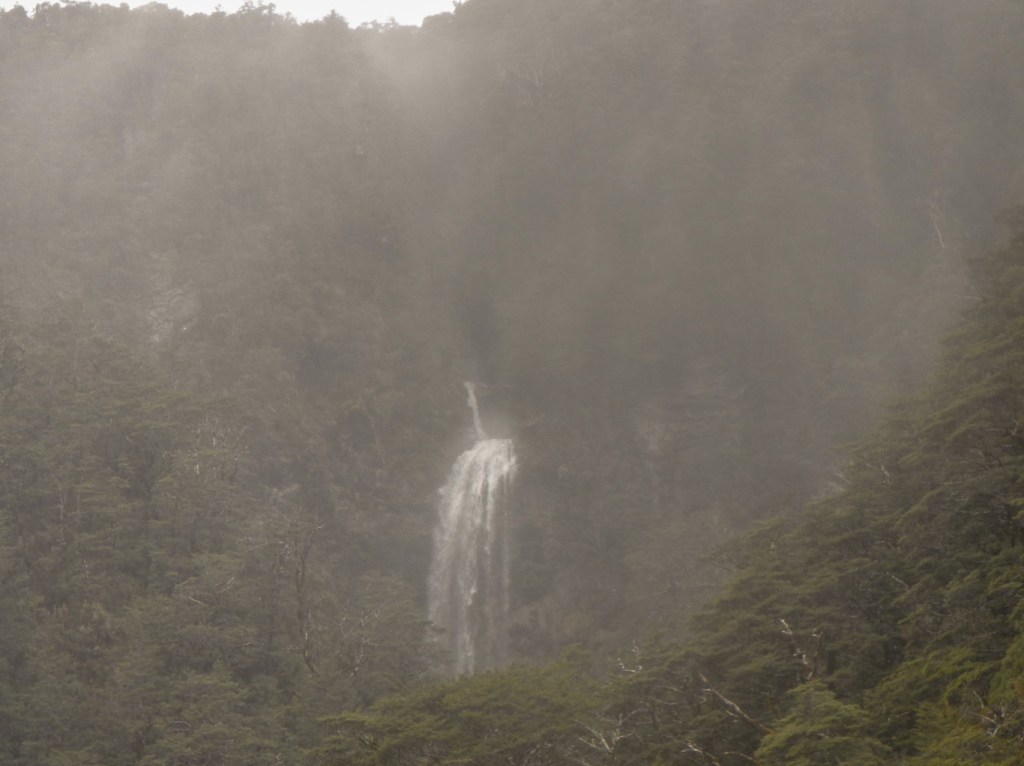
Despite the rain, it was an interesting walk through sub-alpine mountain beech forest, passing a viewpoint of the Bridal Veil Falls and Jack’s Hut – a restored roadman’s cottage.

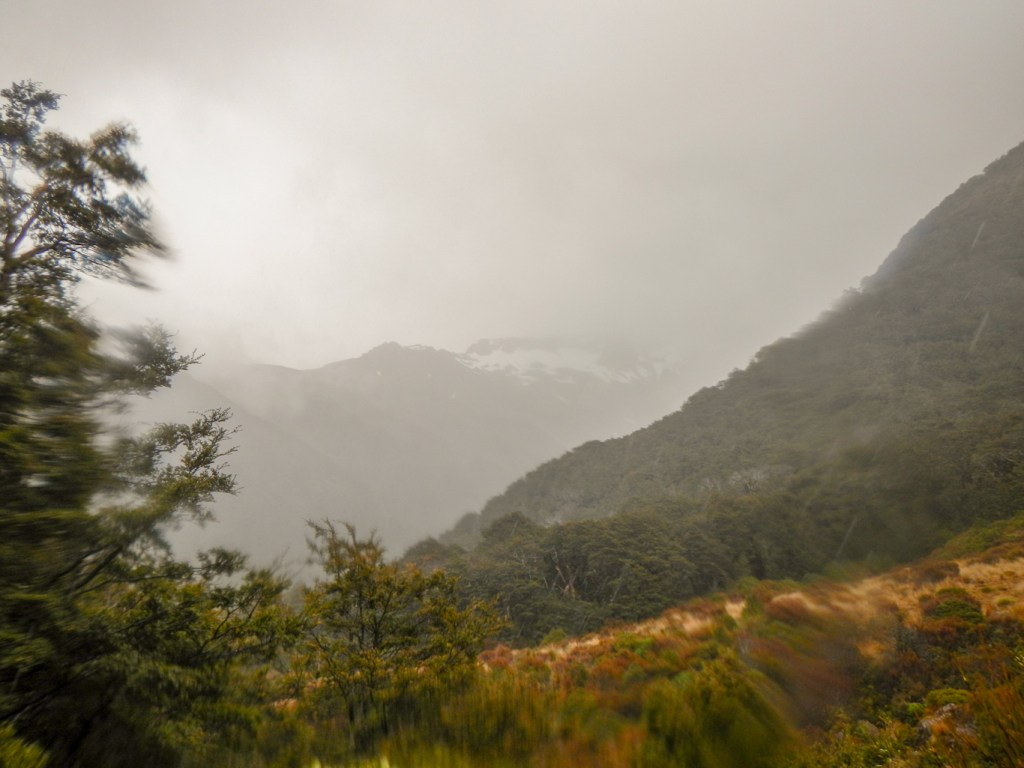
At the top of the pass is the monument commemorating Arthur Dudley Dobson, the surveyor who gave the modern name to Arthur’s Pass.
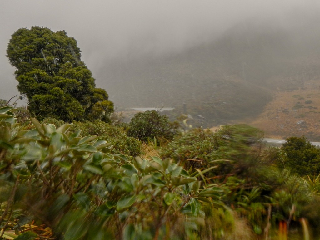
I also saw a rescue helicopter at the top of the pass, later discovering from the staff at the DOC Centre that the helicopter had flown to Christchurch with a patient the previous day but had been unable to cross the mountain range safely to return to its base. It had landed in Arthur’s Pass village overnight and then taken off to continue its journey that morning. The warden was very surprised that it had only reached the top of the pass – but the evidence was on the photo that I showed him.
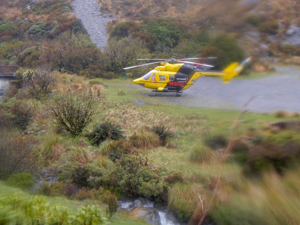
I took a short diversion on my return trek, to look at Bealey Chasm, a narrow channel where the river cascades over huge boulders.

I returned to the village, discovering a kea outside the café when I was looking (unsuccessfully) for my husband inside the café. Eventually I discovered him taking photographs of another two keas in the village car park.
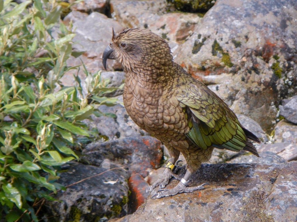
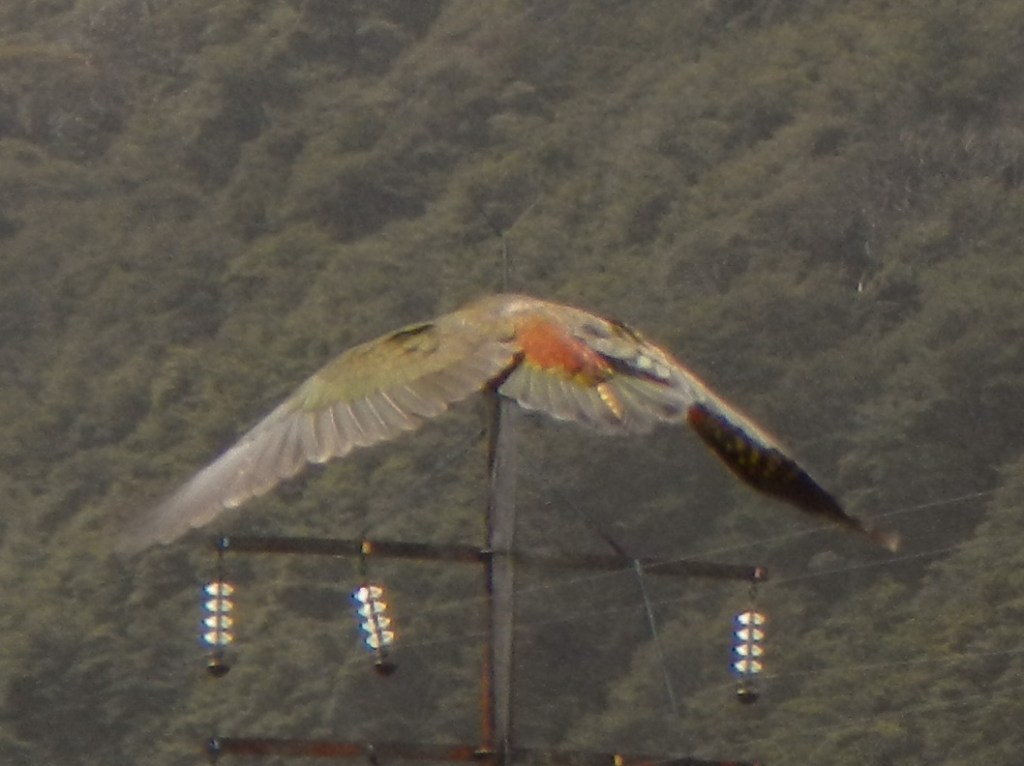
There was still time before the train was due to look at Avalanche Creek Waterfall and visit the small chapel where the window at the altar end of the building frames the waterfall – an impressive sight.
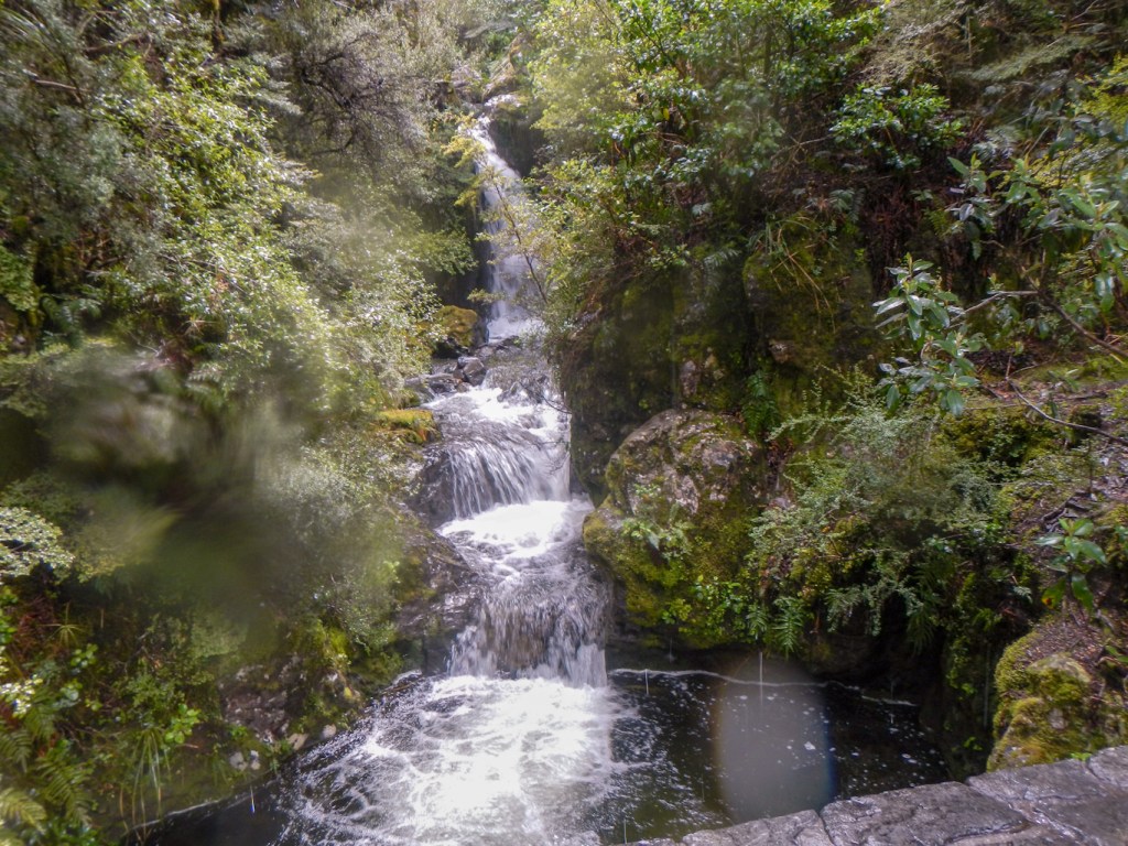
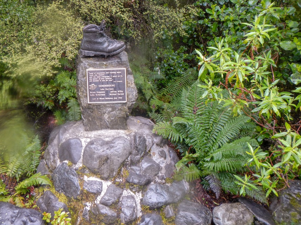
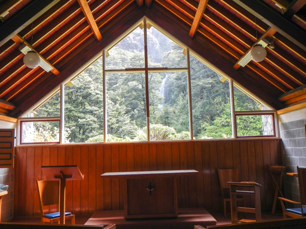
The return journey on the train was as impressive as the outward journey and, with so much scenery to look at, there was plenty to see that I had missed in the morning.
18 November – We walked once more through the parks to Christchurch centre. There are quite a number of different paths and we seemed to take a different route every time. Park run had just ended so there were lots of people jogging home or off to a café with their running friends.
We reached the modern bus station and were soon bound for Lyttelton on the number 8 bus. We passed a gondola station climbing a mountain, went through a tunnel under the mountain then emerged close to the harbour. Lyttelton is the city port for Christchurch. A huge cruise ship with over 4,000 passengers, “Ovation of the Seas”, was moored in the harbour.
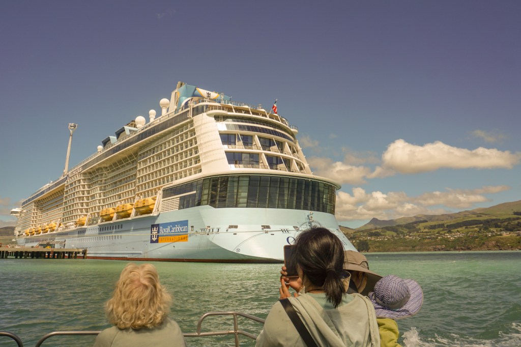
We walked through the busy Saturday street market and then climbed up to the prominent time ball originally built in 1876 to assist ships’ navigators to determine their longitude. Every day at 1pm a 100kg ball was dropped above a tower so navigators could adjust their chronometers and determine error rates. The tower was damaged and collapsed following the series of earthquakes in 2010-11 but a huge funding project has resulted in it being rebuilt so this landmark with its maritime and human history lives on. The landscaped gardens also allow an excellent view of the harbour below.
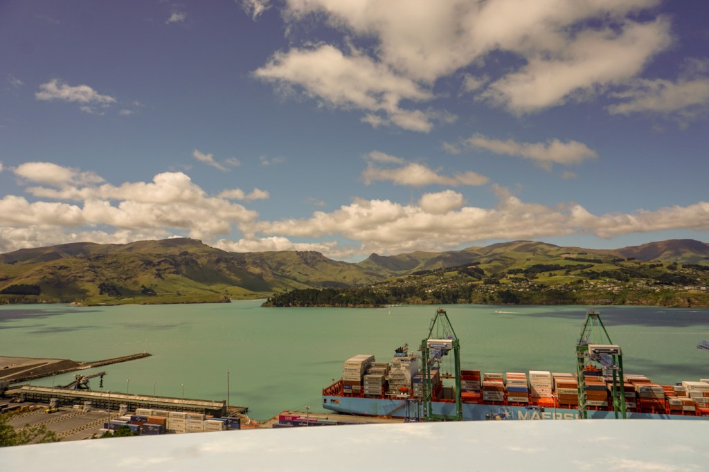
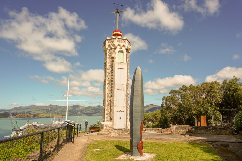
We caught a catamaran ferry across the harbour to the quieter Diamond Harbour. I walked some distance along the cliff top path to enjoy fine views.

As we waited for the return ferry back to Lyttelton a father fishing at the end of the jetty managed to catch a small shark to the delight of his young son (and then had to return it safely to the water whilst avoiding the sharp teeth). This provided some entertainment but we were soon on the ferry and then the bus to return all the way back to central Christchurch.
19 November – A very early start and we were at the railway station before 06:00am to catch the train. This time it was the Coastal Pacific to Picton. All our luggage was labelled up to transfer directly from the train to the Interislander ferry and we hoped that we would be reunited with it in Wellington.
We spent the journey looking out of the window at the ever changing scenery, listening to the informative commentary and rushing through to the observation carriage to take photos without any window glass in the way. As we passed walkers and vehicles we waved and the people waved back at us. The train only makes one return journey per day on this route and is a tourist sight in its own right.
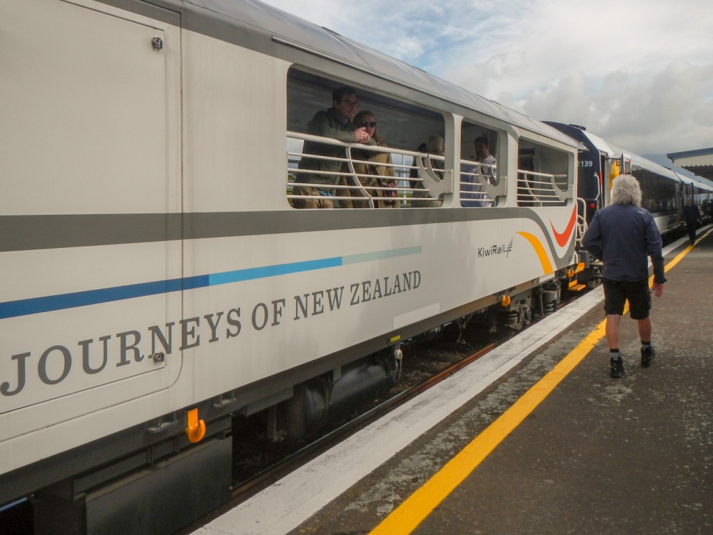
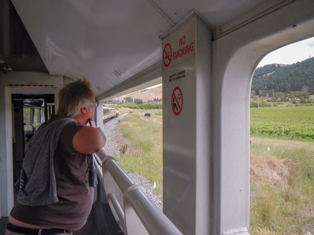
Initially we travelled through urban and semi-urban Christchurch but were soon going over the vast and sparsely populated Canterbury plain looking at braided rivers (again), enormous fields, isolated dwelling places and sheep stations and a background of hills.
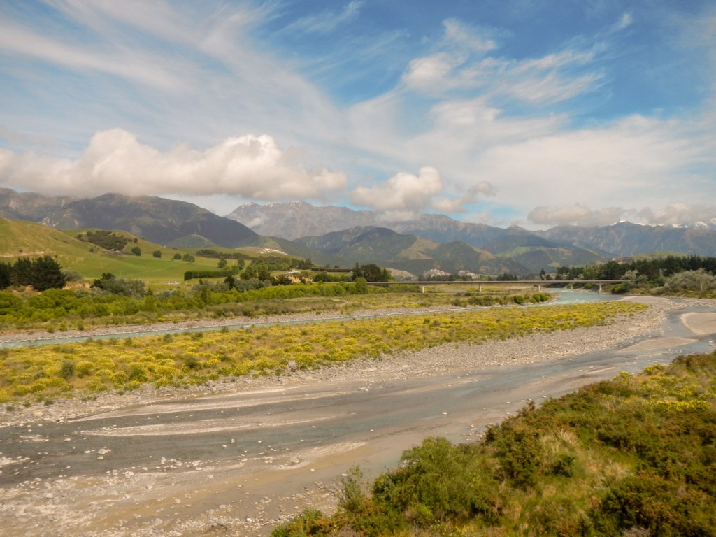
The journey continued, following the rocky shoreline of the Pacific Coast where we spotted many seals lying on the rocks and swimming in the sea.

We passed through a huge gorge and some tunnels hewn in the rock.
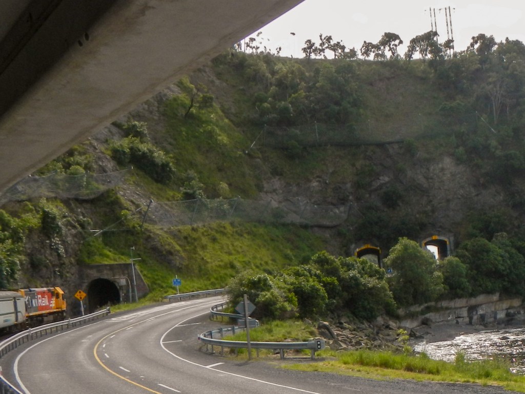
Eventually we reached Marlborough, where we passed some saltpans and also saw many vineyards.
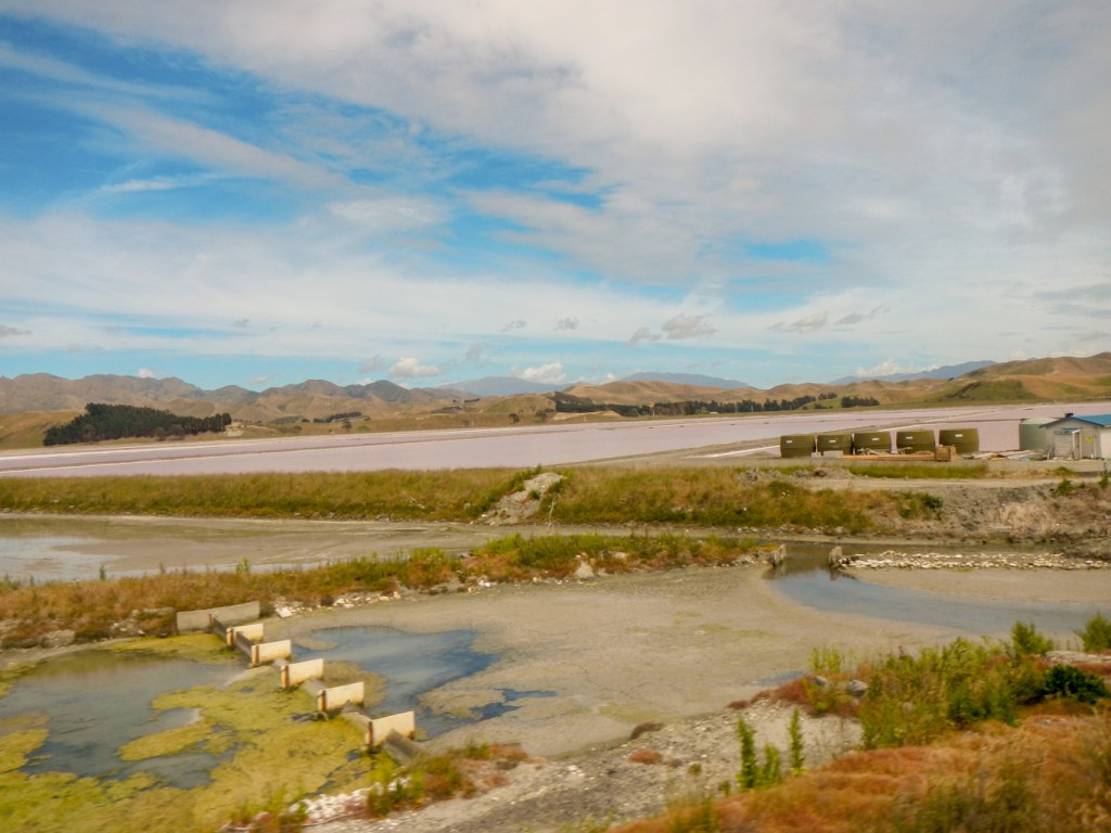
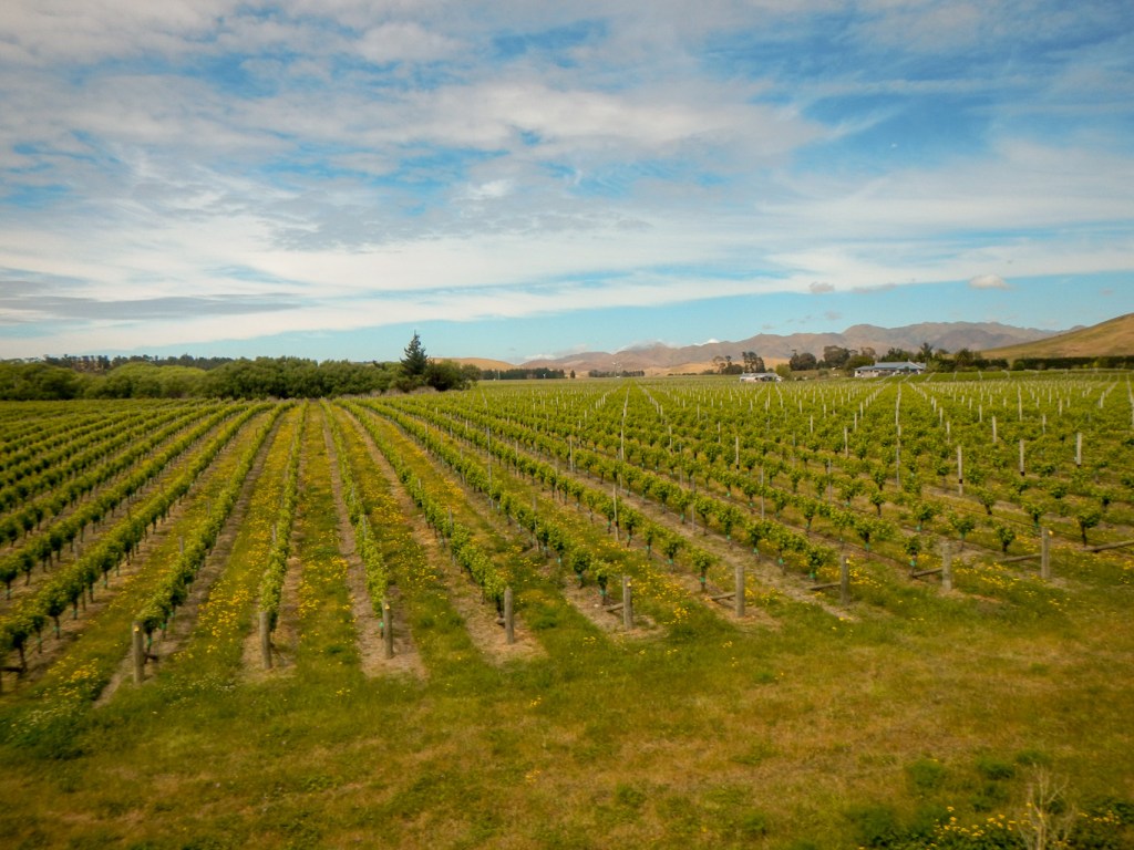
We disembarked at Picton – the end of the line – and had a short stroll along the seafront before getting on to the boat ready for our voyage to North Island. The boat sailed through the Queen Charlotte Sound and Tory Channel before voyaging across the open ocean. We were fortunate that the weather wasn’t very windy and the seas were light. Our voyage was somewhat disrupted by a crew training exercise involving a fire that had broken out in a cabin. The crew had to practice evacuation of the ship – but the passengers were not expected to role play.
We arrived at Wellington in misty but calm conditions. The cruise ship “Ovation of the Seas” had preceded us, doubtless making less impact on the large city of Wellington than on the relatively small port of Lyttelton where we had seen it the previous day.
20 November – our last full day in New Zealand. It hardly seemed possible that our six week stay was about to end. We caught a bus into the centre of Wellington, breakfasting at a quiet café near the parliament buildings.
We spent some time looking at the outside of the impressive modern beehive building and the adjacent older parliament buildings.
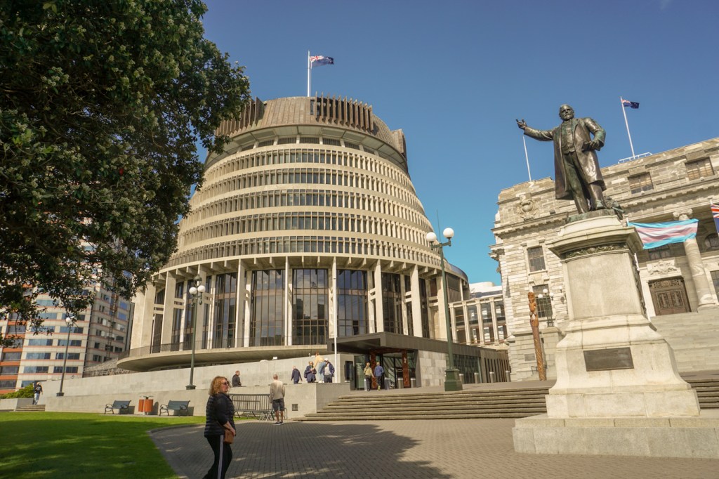
On 27 July 2023, Te Kāhui Mōuri (the Clan of Vitality) was unveiled on Parliament’s forecourt. These taonga (treasures) include two carved pou (carved posts) flanking the steps of Parliament House and are physical recognition of Parliament’s significant relationship with Te Āti Awa Taranaki Whānui (Māori tribes). The carved posts are a gesture of welcome and protection for the public, parliamentarians, and staff on the parliamentary precinct and a physical representation on the whenua (land) of Parliament of the restorative work it is undertaking on Māori-Crown relations.
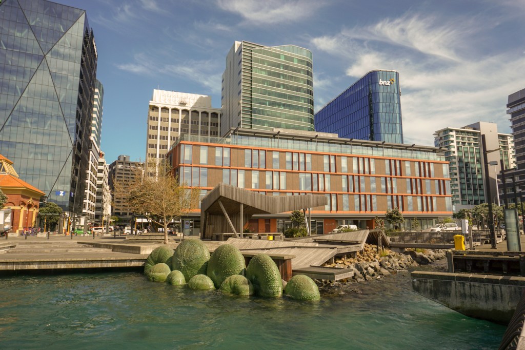
We walked towards the Museum of New Zealand (Te Papa Tongarewa) along reclaimed land of the rejuvenated and reclaimed harbour front, backed by the tower blocks of the business area.
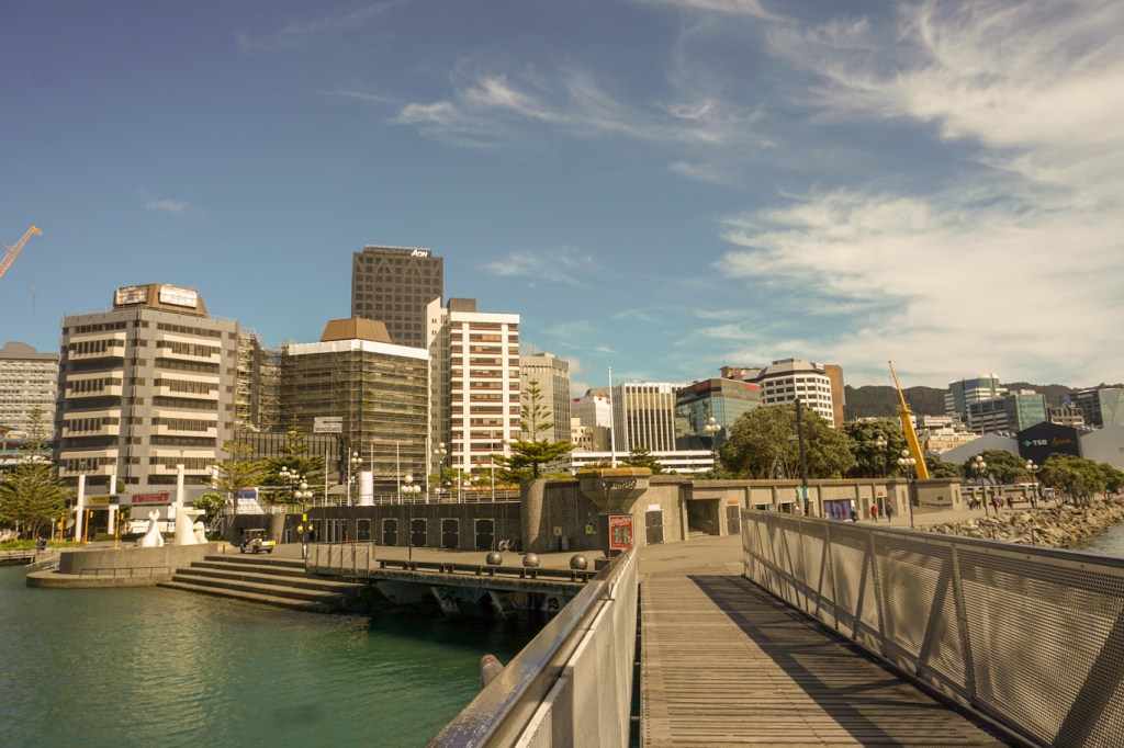
As we arrived at the front entrance of the museum, we were halted temporarily by security guards for a VIP who turned out to be Prince Edward making a visit to the Gallipoli exhibition.
We visited an exhibition outlining the problems that have been caused by clearance of forests, draining of wetlands etc. for farming and also by both deliberate and inadvertent introduction of new species. We learnt more about how attempts are being made to mitigate the resulting reduction in biodiversity and ecological disasters and the contributions we can all make to try to help.
Having wandered round the extremely interesting and clearly presented exhibition, we stood in the café area awaiting the exit of Prince Edward and his entourage from the Gallipoli exhibition. We saw him chatting to the gathered children and I took a photo using my phone, fortunately avoiding the disaster that would have ensued if I had accidentally dropped it on Prince Edward’s head.
We visited the Art gallery area where we saw both modern Western and Māori art which prompts thought provoking comparisons between the two different World views.
We went on to visit the Gallipoli exhibition – a phenomenal display with helpful artefacts, models and text leading to sobering reflection on the heroism and bravery alongside privation leading to enormous loss of life and life-changing injury for seemingly minimal or no overall gain.
We had barely scraped on the surface of all that there is to see at this amazing museum. However the day had almost ended and we needed to get back to the hotel to pack for our early flight the next morning.
Our visit to New Zealand was over, but I hope that many of the amazing memories of our activities and what we have seen will remain with us. I also hope to visit again – having learned about it, I would be keen to walk the 3,000km Te Araroa route, seeing a cross section of New Zealand the slow way!

Wow! What a fantastic journey and thank you for sharing. We loved looking at New Zealand through your eyes. You saw so much. If you make the journey again, it would be great to catch up. We should be back by then 🙂
LikeLiked by 1 person
An amazing experience. The photos are gorgeous 😍. Makes me want to travel there.
LikeLiked by 1 person