30 September 2023
I was very excited when I was told that the fortieth anniversary celebration for the Lands End to John O’Groats Association was to be held in Great Malvern. For me, the Malvern Hills are where my exposure to hill walking began. In 1973 at the age of twelve, I saw a sign in school advertising an eighteen mile sponsored walk over The Malverns in aid of The Royal Commonwealth Society for the Blind. I had never walked eighteen miles before and had little idea how it would feel to do such a walk. However, I had always enjoyed going out for walks; my favourite books to borrow from the library included those describing outdoor expeditions and other adventures. I couldn’t wait until I was old enough to be able to start on the Duke of Edinburgh Award Scheme and to be allowed to go on walking or cycling expeditions staying away at youth hostels overnight with a friend independent of adults.
I didn’t discuss it with my friends but bravely (I was in the first year of comprehensive school) approached the teacher named on the notice. She issued me with further information and a sponsor form. I collected sponsors – mainly long suffering neighbours – and turned up as arranged early in the morning on the specified weekend day. The only other taker for the adventure had been one boy (also a first year). There were two teachers and we all travelled together from Keynsham in one of their cars. I will always be grateful to Miss Andrews and Miss Stevens for introducing me to what has become a lifelong passion. They were also the teachers who, once I was old enough, would supervise my exploits in connection with the Duke of Edinburgh Award. I was ill equipped – my only shoes were my school shoes, I’m sure I didn’t have a proper waterproof but only a nylon pac-a-mac to put on over my nylon anorak if it rained; moreover I expect I was wearing denim jeans. I don’t think I had a rucksack so I’m not sure how I carried my packed lunch or my mac! I suspect that nowadays due to unsuitable footwear and clothing I wouldn’t have been allowed to participate on the basis of health and safety regulations. However, this was the 1970s and I completed and enjoyed the eighteen mile challenge walking with the two teachers. The boy became tired and was given a lift back to the start by the organisers. I was hooked and keen to be old enough to start a paper round so that I could buy some proper equipment. In fact I went again the following year but I had persuaded a few friends (all girls) to do it too and we all finished.
I visited The Malverns again in around 1982, on a holiday with my parents and sisters. I think I managed to walk or run to the highest point (Worcestershire Beacon) on each day of our holiday and even managed to persuade the entire family to make the ascent on one occasion. There was a café on the summit at that time and I climbed the last bit quickly to buy a hot drink for my mother to celebrate her ascent.

Ten years later in 1992, I moved with my husband to live to the west of Worcester. Malvern Splash was our local swimming pool and I also visited the town to walk and run on the hills including competing in the Worcestershire Beacon Race held every year on the second Saturday in October. We continued to live in Worcestershire for most of the next fourteen years although for the majority of time this was in the Evesham area. Nonetheless, I still visited the hills from time to time until we moved to Exeter in 2006.
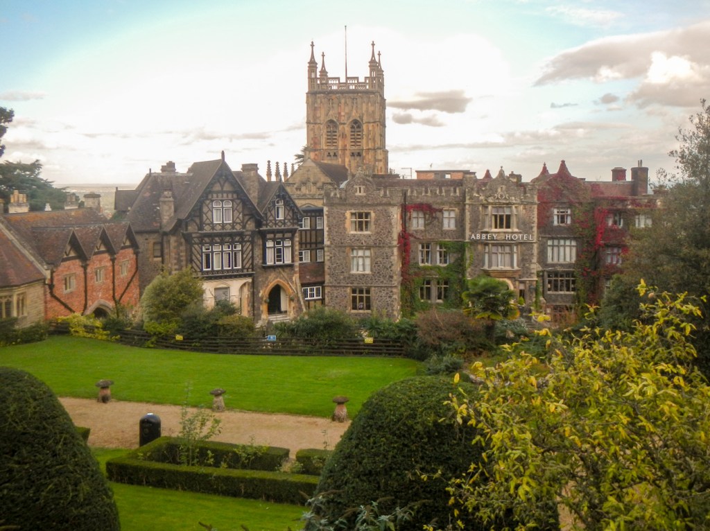
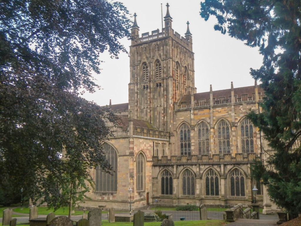
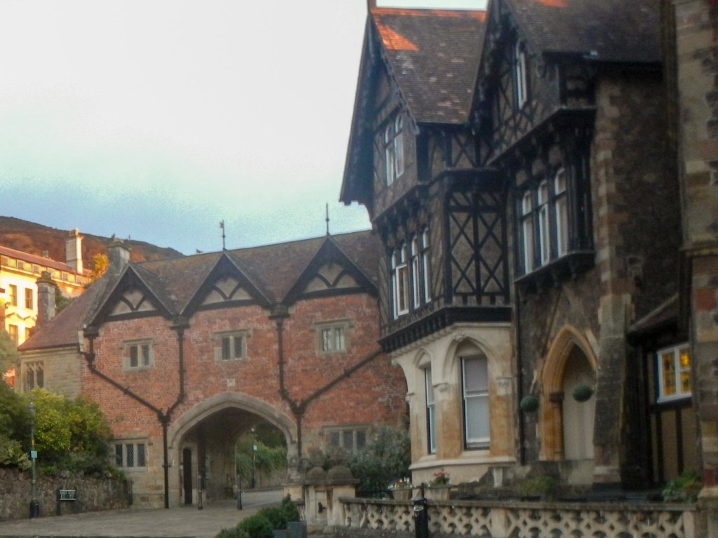
The Social Secretary of the LEJoG Association managed to work wonders and had made a block booking at a very good rate for the iconic Abbey Hotel. The oldest part of the hotel was built in 1848 on the site of ancient monastic buildings. This was in the heydays following the Water Cure being brought to Malvern by Dr. Wilson in 1842. Today the Priory Church (now the main parish church in Malvern) and the Abbey Gateway are all that remain of Malvern’s Benedictine monastery.
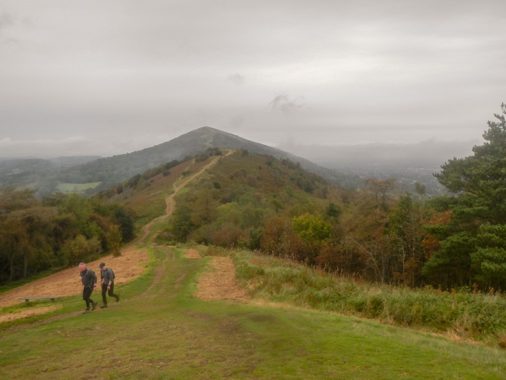
Saturday morning saw me being the first hotel guest in breakfast promptly at 07:00am ready to make an early getaway as I was planning to walk over each summit from the most northerly (End Hill) to the most southerly (Chase End) before walking back over the hills (but not over every summit) to Great Malvern. I was rewarded by seeing a spectacular sunrise from the breakfast room. For the record, I was wearing walking boots, carrying a rucksack and wearing lightweight and rapid drying clothing!
I headed north towards North Malvern and the clock tower via the Clare Walk so I didn’t have to walk all the way on the pavement. From there, I took one of many steeply ascending paths.
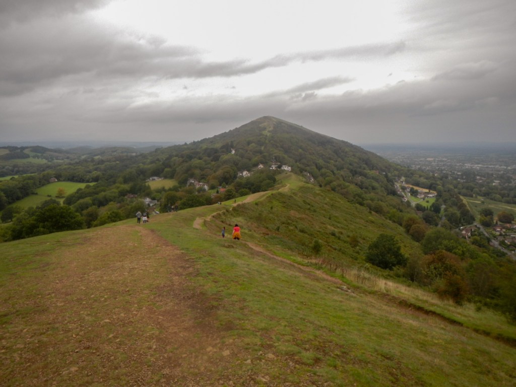
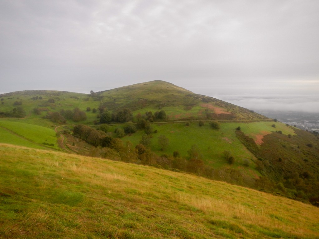
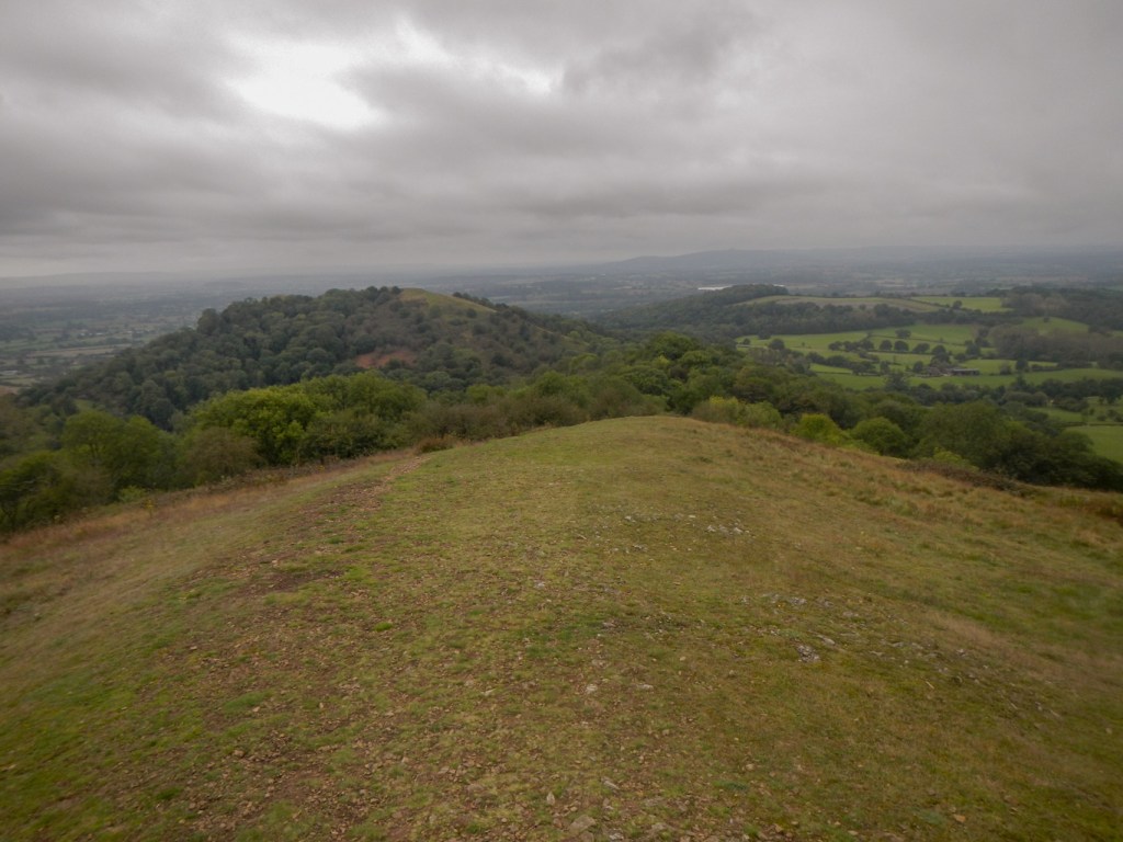
Unfortunately, clouds had descended and some of the spectacular views I had hoped to witness I just had to imagine. However I was fortunate that some of the low cloud cleared as I approached End Hill.

I could see North Hill which is almost 70m higher than End Hill. This was my next objective. A couple of walkers were leaving as I arrived. Great Malvern was virtually obscured by cloud.
Table Hill was next and is 26m lower than North Hill. The same two walkers were just leaving so I wondered if they were attempting “all the summits” as well.
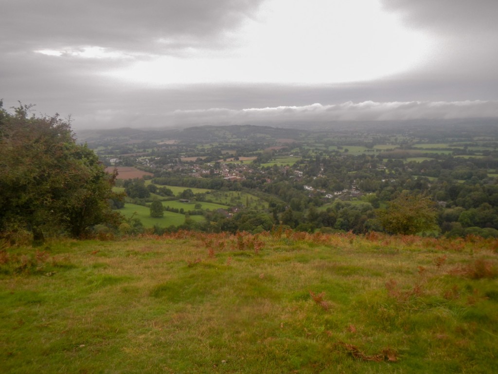
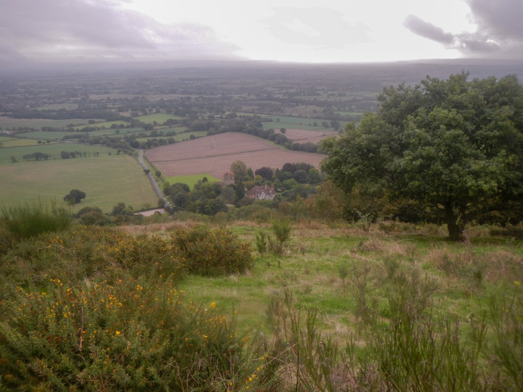
There followed a further descent, crossing Lady Howard De Walden Drive and an ascent to Sugarloaf Hill. The gaps in the cloud were more to the west than the east so I still couldn’t see much of Great Malvern and the Vale of Evesham.

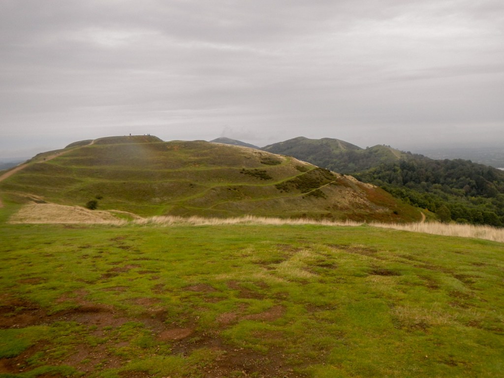
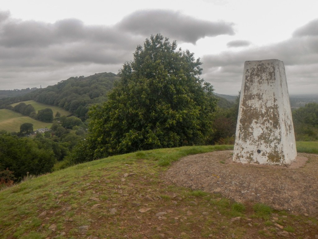
A steady climb followed to the Worcestershire Beacon. This is the highest point on the Malvern Hills with the summit marked by a trig point and a commemorative monument to Queen Victoria, complete with toposcope. Even in the cloudy conditions, it was a popular spot.

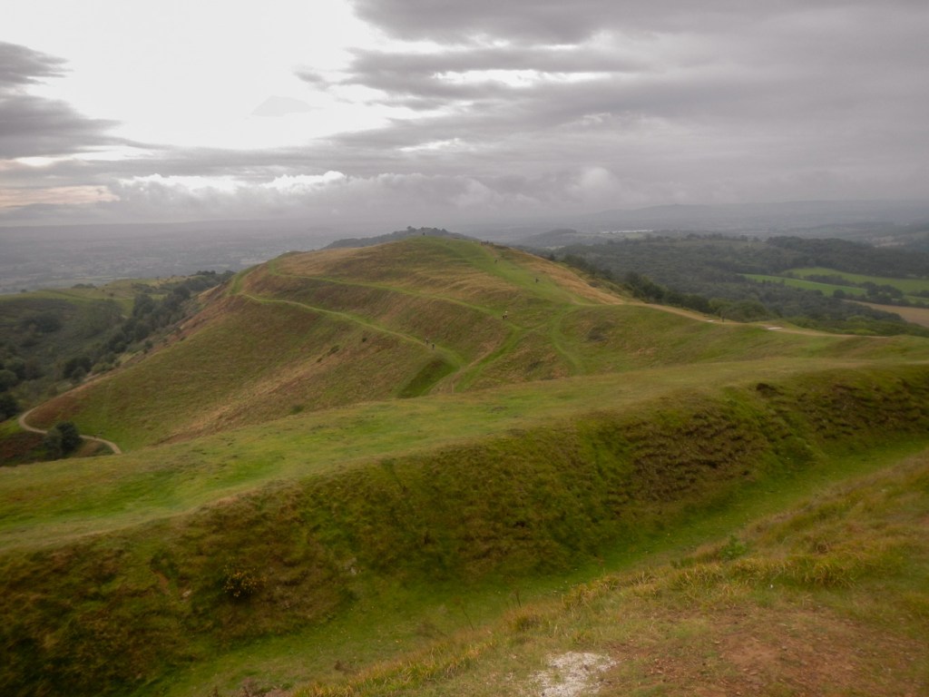
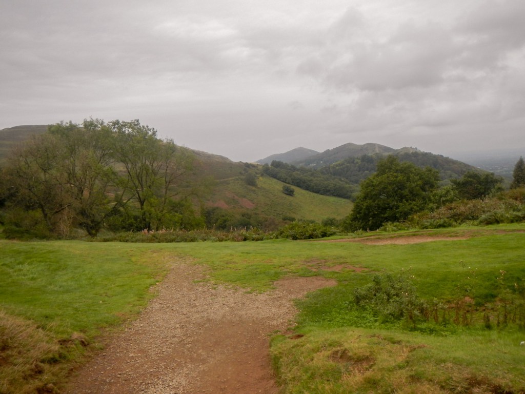
The next summit was Summer Hill. Most people missed it out favouring the bypassing track; this appears to have been the access track to the café which stood at the top of the Worcestershire Beacon until destroyed by fire in 1989. An Act of Parliament permanently banned construction of a replacement café, in the interests of conservation. There’s then quite a lot of descent from Summer Hill to the Wyche Cutting and I could see the hills of the next section ahead.
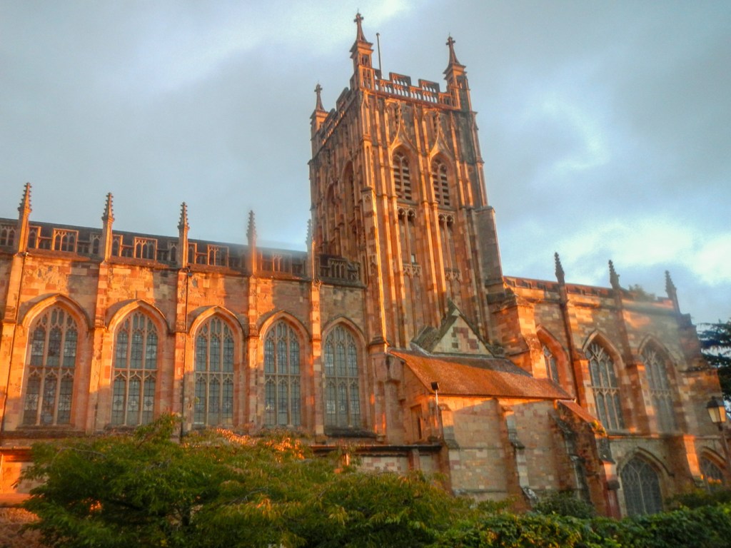
I crossed the road and was soon climbing up again to walk over Perseverance Hill, Jubilee Hill, Pinnacle Hill and Black Hill in rapid succession. I could see the impressive earth works of the Iron Age hill fort (British Camp) on the Herefordshire Beacon ahead of me. I could also see the tower of Little Malvern Priory to my left. This is the remains of a Benedictine Monastery and the original tower and choir is used as a parish church nowadays.
There is another steep descent to the road at British Camp Pass followed by a steep uphill to the summit of the Herefordshire Beacon, crossing the lines of Iron Age earthworks built along the natural contours of the hill. Visibility had improved and the obelisk on the Eastnor Estate became visible.
I descended some steps on the south side of the hill fort, passing a mother with her very young son who was managing to keep count of the steps up to seventeen. However letting me pass put him off and I heard him start at one again. Hangman’s Hill and Swinyard Hill followed, with good views in particular looking back northwards over the range.
I descended again and walked along the most muddy path of the day, meeting three cheerful walkers walking towards me, wearing St Peter’s Hospice T shirts. Just after passing Midsummer Cottage, I spotted a path to the left and climbed through the woods to the summit of Midsummer Hill, where there is a concrete shelter. This hill is another Iron Age hill fort and is significant with ramparts spanning both Midsummer Hill and Hollybush Hill.
Of course, there was another descent, this time to the A438; a short distance along the road, I saw a path into the Eastnor Estate and another climb followed up Ragged Stone Hill. At the summit I met a group coming towards me who were wondering whether it was possible to walk from there over the following hills as they could see a cliff face (actually part of one of the many quarries). I explained that I had walked from End Hill and North Hill so indeed it was possible. They were very surprised that I was planning to walk back, albeit not over all the summits. They explained that they had set off too late to go far!

I descended to the pretty hamlet of Whiteleaved Oak where I walked past what looked like a set of stocks. There was actually an oak tree (hence the name) for 500 years until 2020 – it was believed to be sacred but was destroyed by a fire caused by lanterns hung on its branches. A sunken footpath starting next to a cottage took me to the final summit, appropriately named Chase End Hill. It’s the lowest summit at 191m but, despite this, it has a trig point.
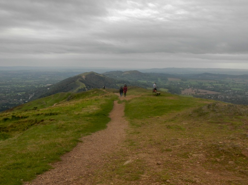
There remained the long return walk. I returned through Whiteleaved Oak and climbed from the road on to a track crossing the road over a bridge. The path led through a gate over farmland, past a herd of cattle that I was pleased to see appeared to be safely far away and disinterested in walkers. It rained a bit but not enough for me to stop to put on waterproofs. I proceeded onto a very narrow lane which soon crossed the A438, eventually reaching a car park. I walked up a clear track, passing between Swinyard and Hangman’s Hill. I spotted Clutter’s Cave but unfortunately so did a family who beat me to it. I wasn’t inclined to hang around as I was looking for a nice place to sit to eat my lunch so I missed out on looking into the cave. I was soon at the toposcope on Broad Down and I sat near it, where there were good views north over the hills, to eat my sandwich.
I by-passed the Herefordshire Beacon on a well defined path, I also managed to bypass most of the summits on the section between British camp Pass and the Wyche Cutting; however the path was still far from flat.
I followed the old café service road on the next section and didn’t climb Summer Hill this time. However I did climb to the Worcestershire Beacon summit and was rewarded with much clearer views than in the morning.
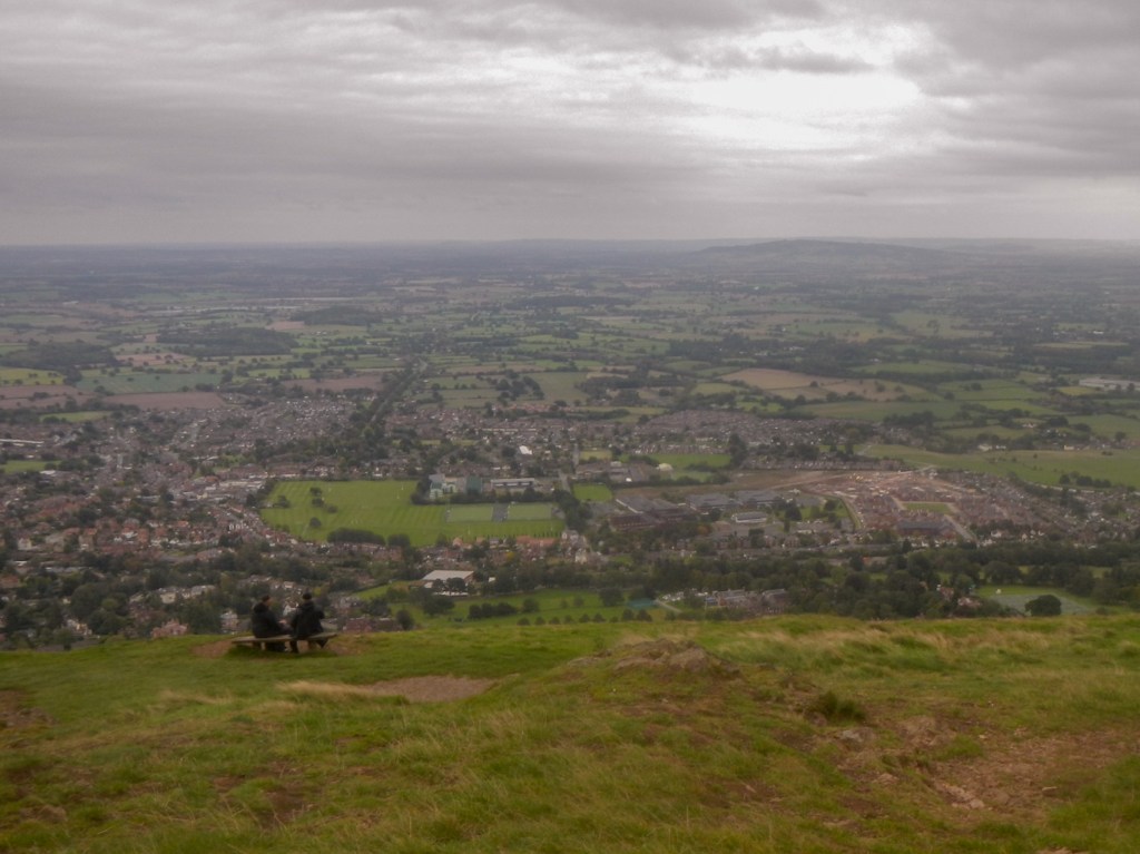
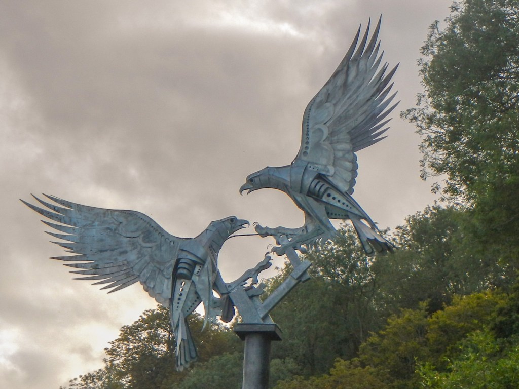
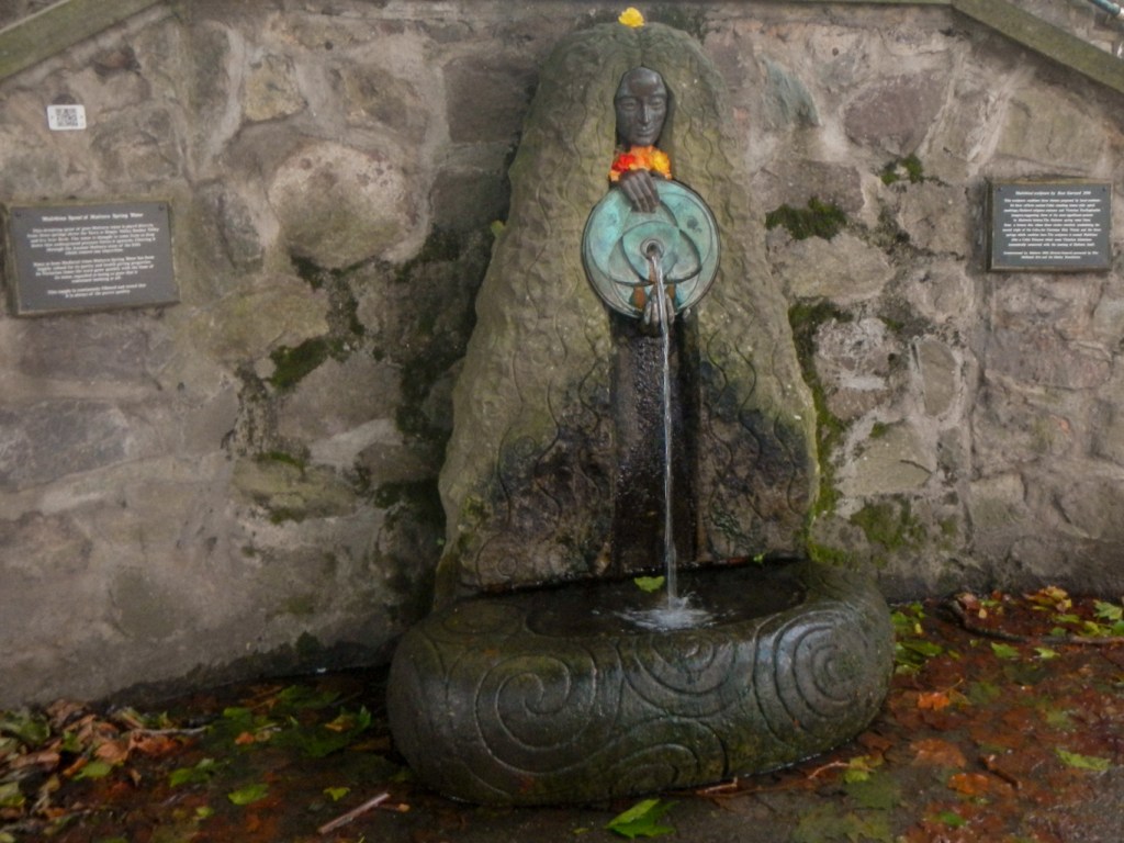
It wasn’t far and was downhill all the way to Great Malvern past St Anne’s Well and then down 99 steps (I didn’t count but that’s what the sign said). I emerged into Rose Bank Gardens where there is a sculpture of buzzards and was just across the road from the Abbey Hotel.
The Malverns aren’t a high mountain range, but they are high compared with the surrounding land and, therefore, provide fine viewpoints in clear weather. I had walked almost twenty miles with a surprisingly large total ascent of around 5,000 feet. I had walked well and was back in plenty of time to be ready for the 40th anniversary dinner of the LEJoG Association. I’m not quite sure how I managed the walk in 1973 wearing my school shoes and clothing that was more suited to walking round the town than over the hills. I know I didn’t go over quite all the summits that day and the walk was only between Hollybush car park and North Malvern return but even so….

Lovely! Reminds me of visits to my Grandparents and walks on the Malvern Hills. Thank you!
LikeLike