8 July – 23 July 2023
This is the first section I have completed of what I hope will be my longest walk ever. I’m planning to attempt the entire E1 route which starts at the North Cape in the far north of Norway. It passes through Europe and eventually finishes at the southern tip of Sicily. Rules now only allow UK citizens to spend ninety days in a one hundred and eighty day period in the Schengen Zone and ninety days isn’t enough time to walk approximately 5,000 miles. To be fair, I never intended to complete the route as a single continuous journey as of course certain times of year are better for walking than others especially as I don’t have plans to walk through snow. Hence this will be a walk in stages.
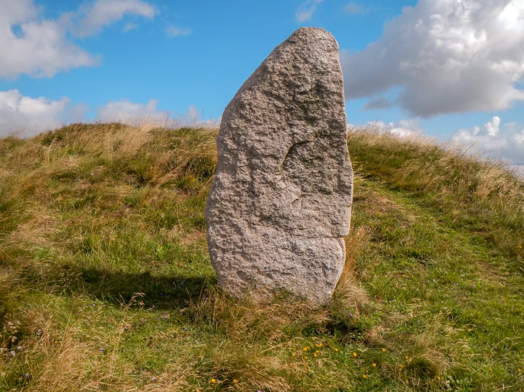
When I was looking at the options last winter, my ankle was still in a fairly precarious situation following my fracture at the end of May 2022. I was keen to start the expedition but didn’t feel confident about tackling the very remote areas in northern Norway and Sweden. My compromise has been that although I intend to complete the route, it will not be sequential. Hence my decision to spend some time this summer walking the section in Denmark – much flatter terrain and less remote. It was also an area that I have never previously visited and a good stand-alone expedition.
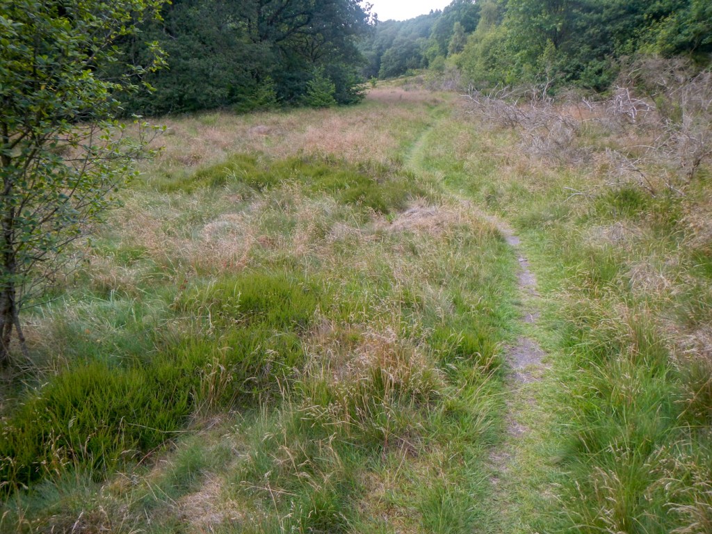
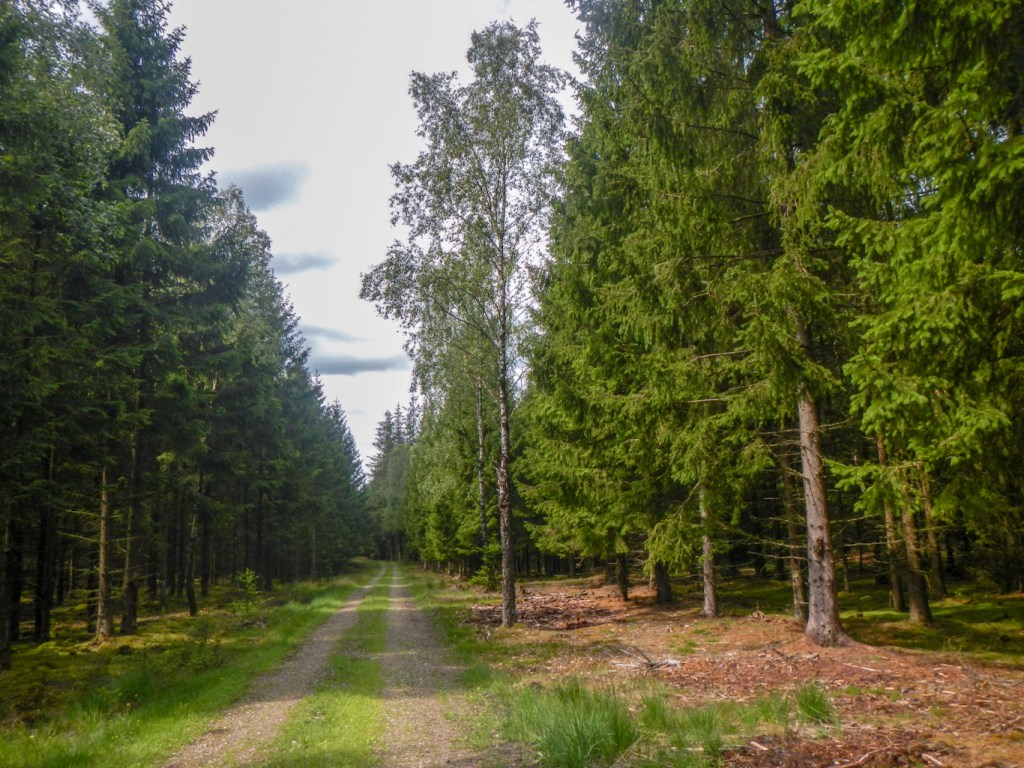
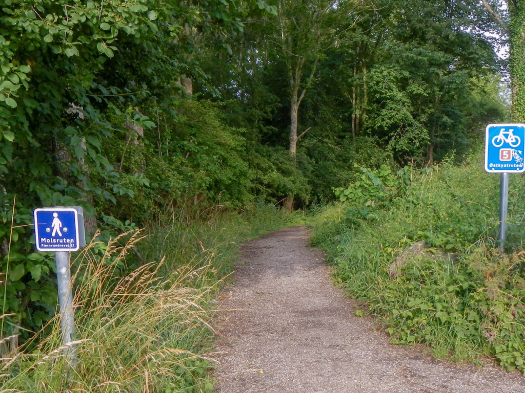
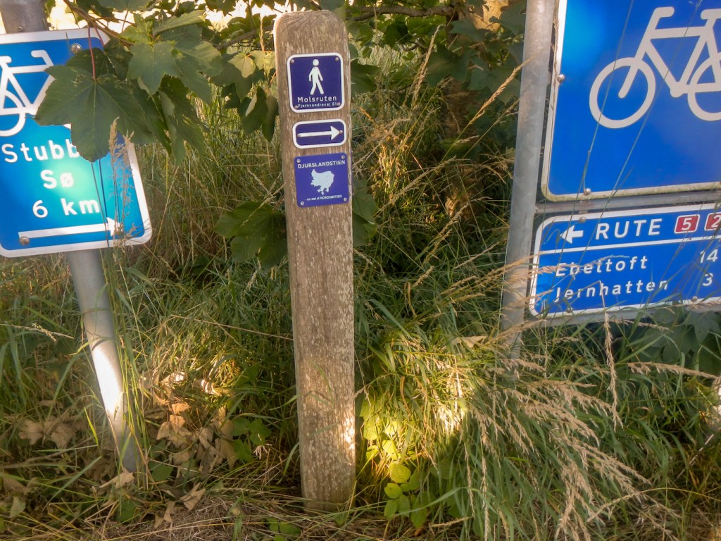
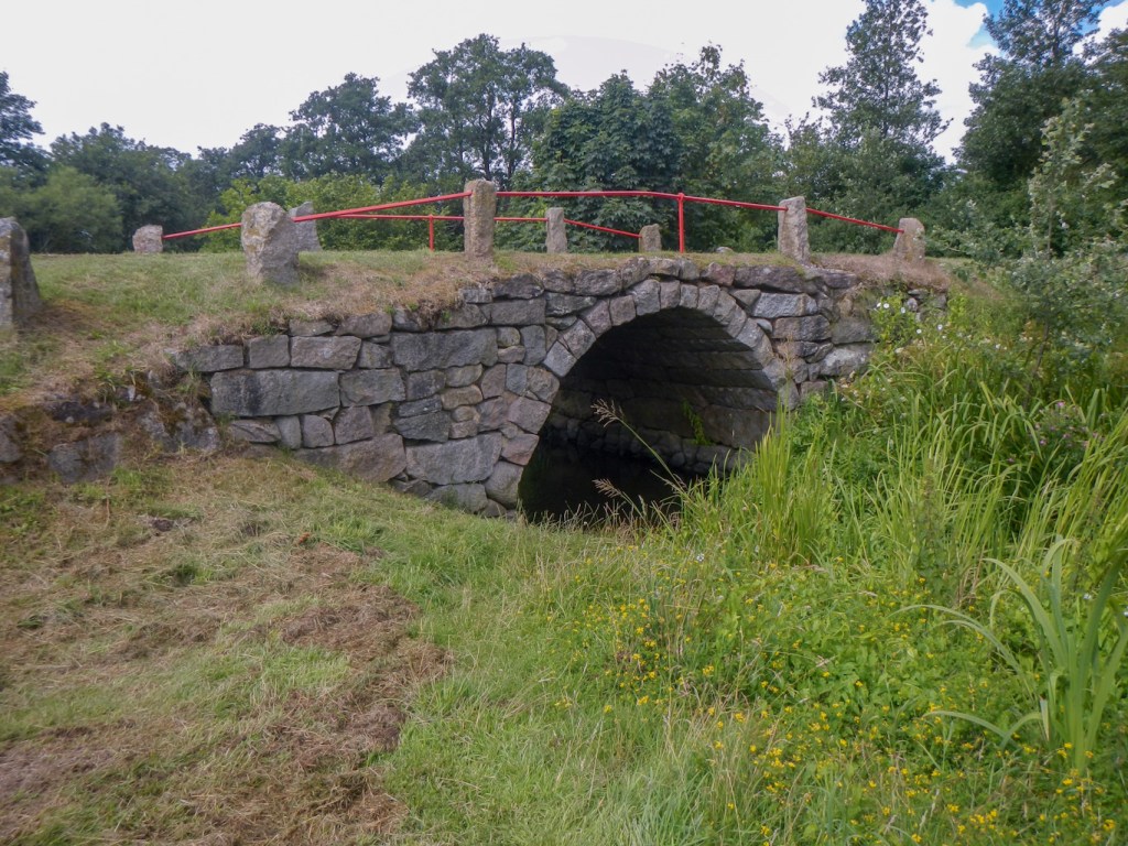
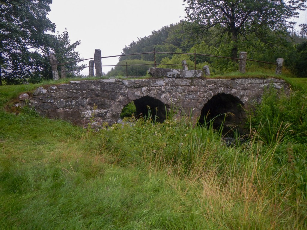
The E1 in Denmark runs from the port town of Grenå via the Molsroute to Århus. From there it continues on the hiking trail Århus – Silkeborg to just before Silkeborg. After a short stretch on the way Silkeborg – Horsens the E1 meets the Hærvejen at Vrads and follows it to Padborg. I managed to buy a couple of lightweight weatherproof 1:100,000 maps, designed primarily for cyclists; these cover the entire route. I transcribed the E1 route from a 1:150,000 map where it was marked and used this as the basis for my route finding. Where the route was well signed this was fine but unfortunately the scale meant that some paths weren’t included so this made it difficult if I “lost” the signs. I was reduced to trying to follow paths as close to a bearing as possible on a number of occasions but I ended up close to my intended destination in all cases.
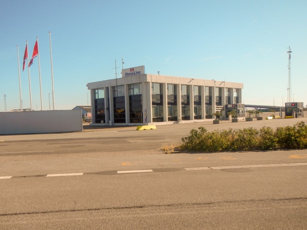
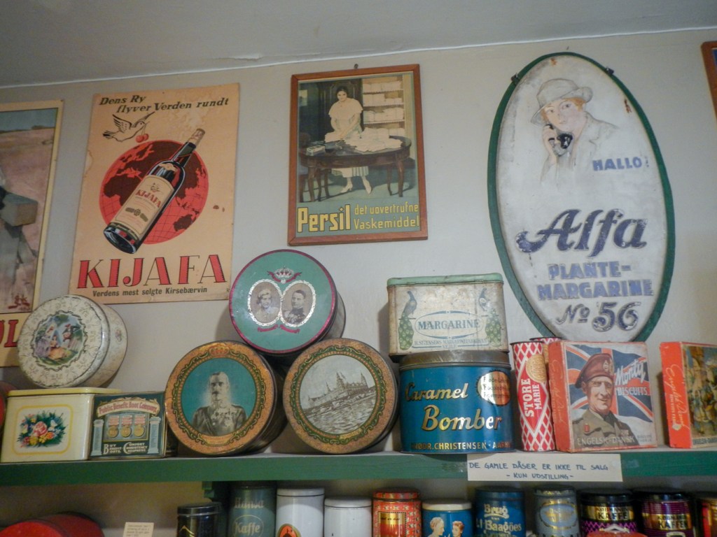
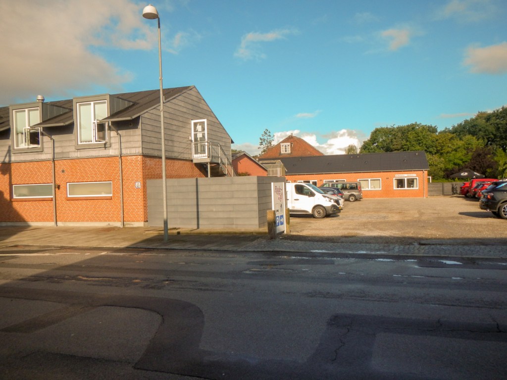
My first problem was finding the most efficient way to reach Grenå. In the end, rather than travelling on the ferry from Halmstad to Grenå, which would have brought me in from Sweden on the E1, I opted to fly to Århus via Copenhagen then catch the light railway to Grenå. This also gave me opportunity to buy gas for my stove and some lightweight trekking meals from https://www.eventyrsport.dk/eventyrsport-aarhus-c in Århus. This is a superb shop stocking an enormous range of outdoor equipment. The staff are very friendly and helpful. I revisited to stock up on trekking food when I walked through and stayed in Århus. Of course it would also have been possible to buy equipment if I realised I had forgotten anything! However I seemed to have everything so I didn’t really explore the shop as I didn’t want to be tempted to add to my load.

The concern with travelling by air is loss or delay of luggage and this would have been a serious problem given that I had to entrust my tent, stove, sleeping bag etc. to checked-in luggage. For a dreadful few moments at Århus airport, I thought the worse had happened. All the luggage from the flight appeared to have arrived on the belt and mine wasn’t there – it arrived a few minutes later as I was trying to work out who to ask about it. The transit bag protecting my rucksack looked very muddy and dusty so I suspect that my luggage had fallen off the trailer bringing it from the plane to the luggage belt. Fortunately it had been retrieved and the protective bag had done its job!
I decided to allow sixteen walking days for the route of approximately 240 miles giving an average of around 15 miles per day. Clearly this would be a minimum distance as it doesn’t allow for deliberate diversions, walking off the route for accommodation and, of course, navigational problems.
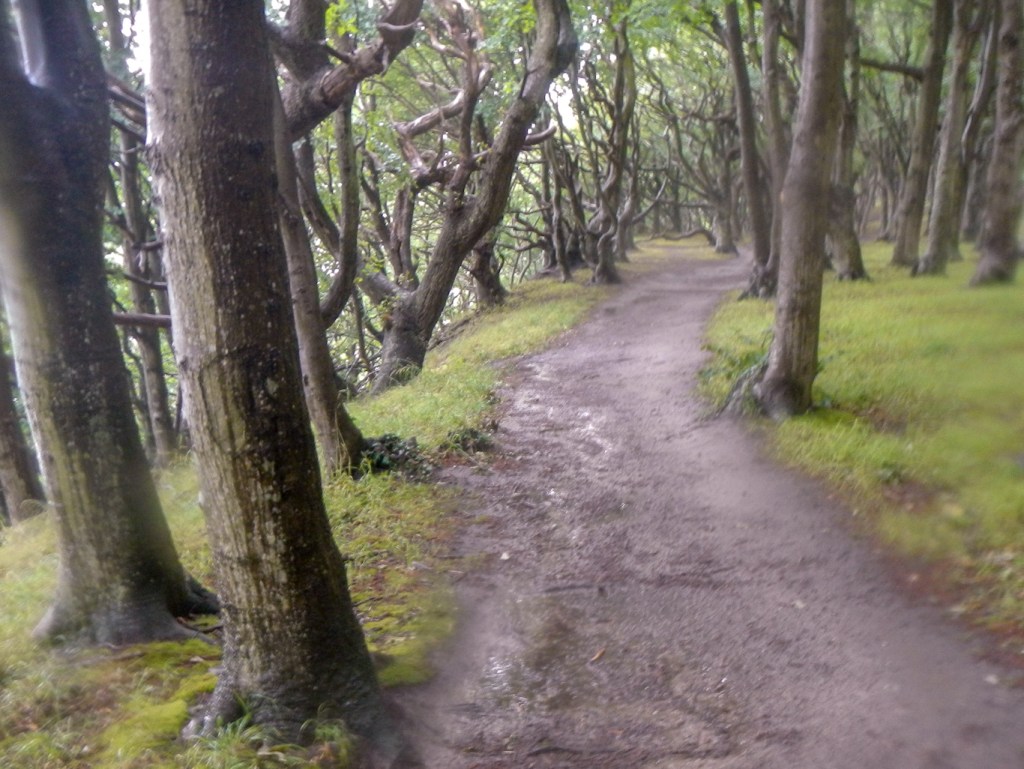
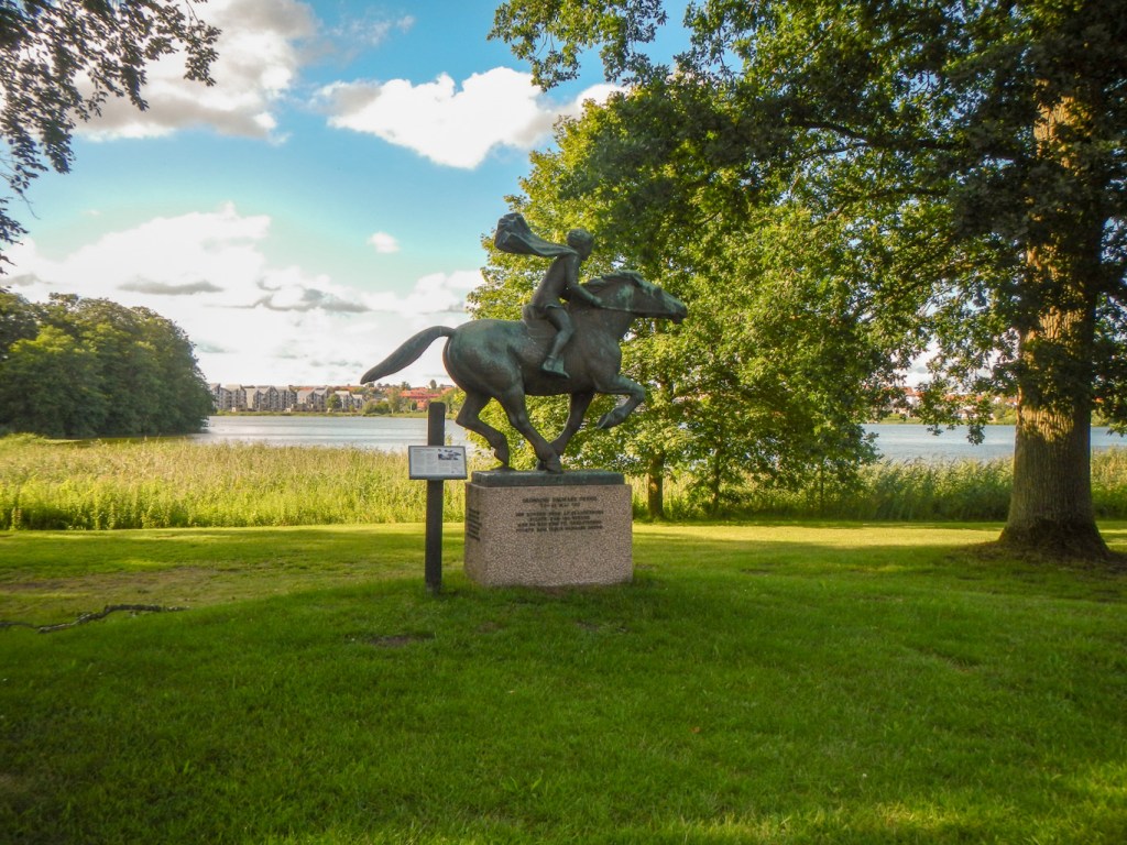
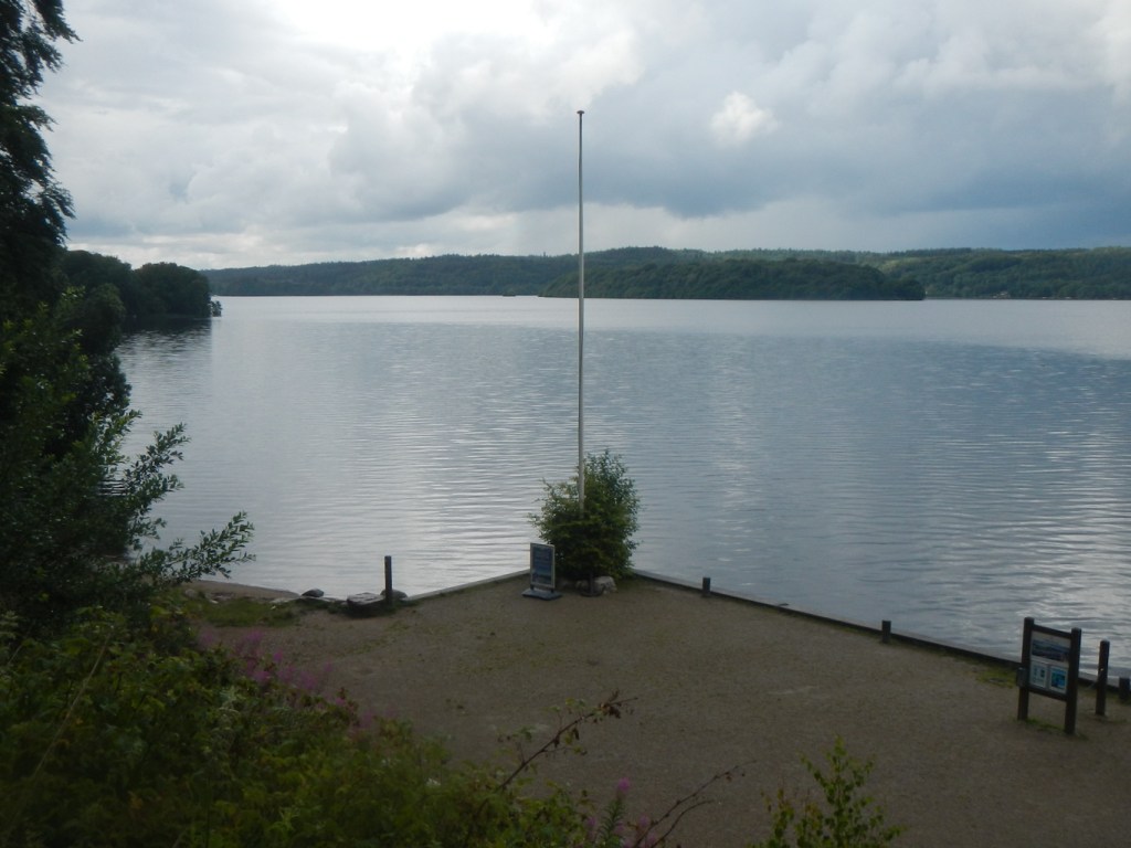
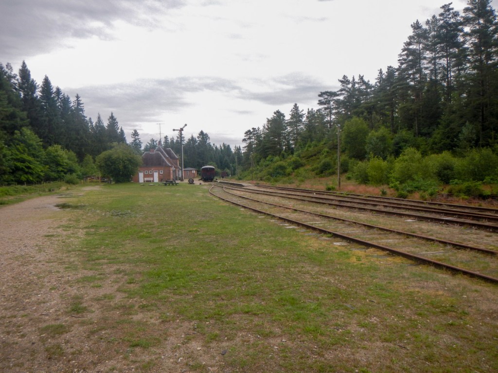
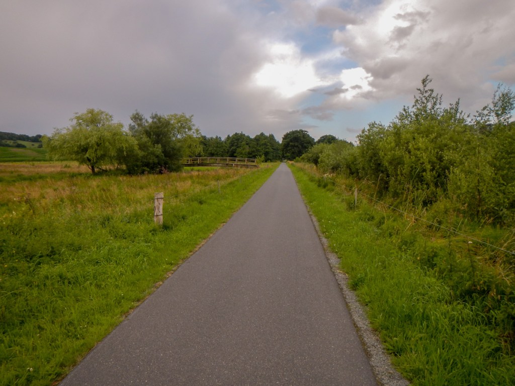
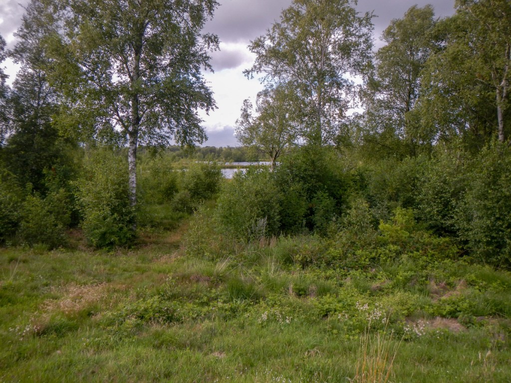
Day one was rather an inauspicious start. I walked from my accommodation in Grenå town to the port following a footpath for just over two miles along a river. I was keen to ensure I started as near to the disembarkation point of the ferry as possible. The main problem was knowing which path to take. There weren’t any signs announcing the E1 or the Molsroute along which the E1 runs at this point. I took a line as near to the coast as possible and even descended to the soft sandy beach at times. It was very hot and sunny.
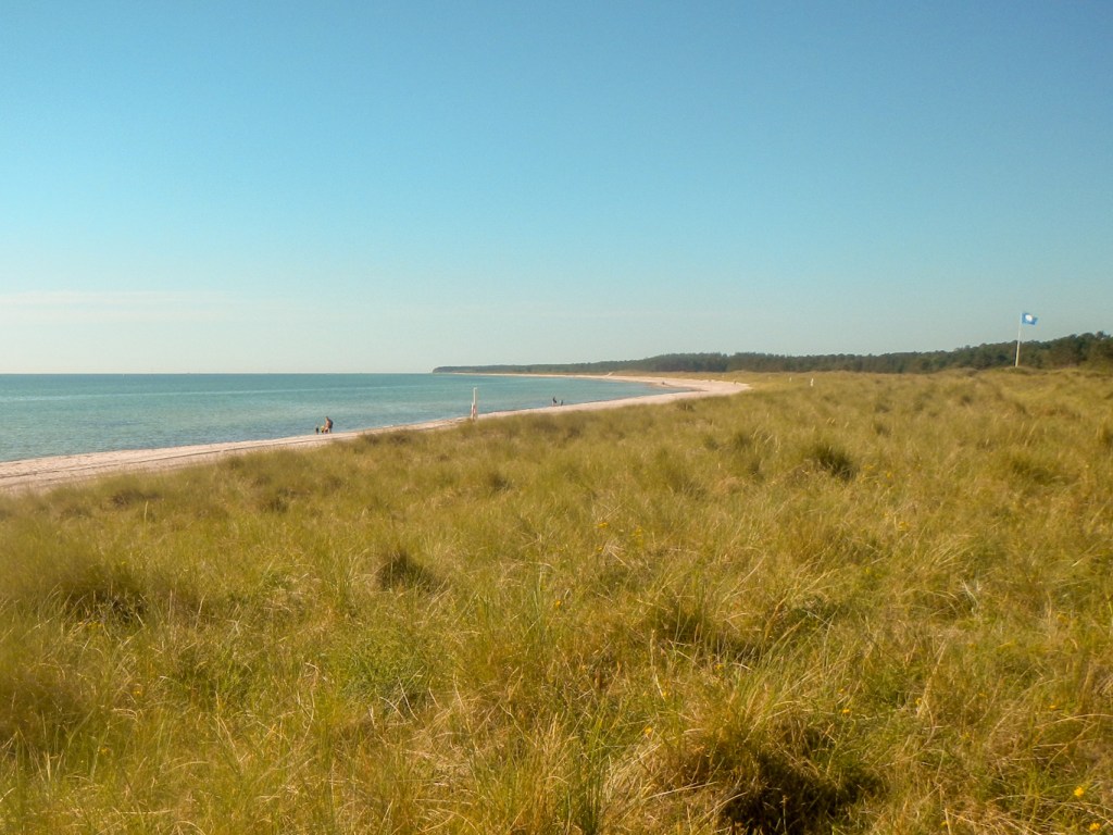
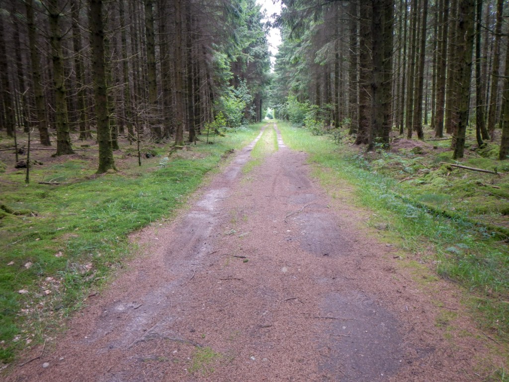
I passed Grenå Strand, reputedly the second best beach in Denmark. There weren’t any other long distance walkers but there were many people swimming and paddling as well as multiple sunbathers scantily dressed or even unclad. At times I found a path through the forest (skov) and was glad of the shade. I was rewarded by spotting a red squirrel running up a large tree.
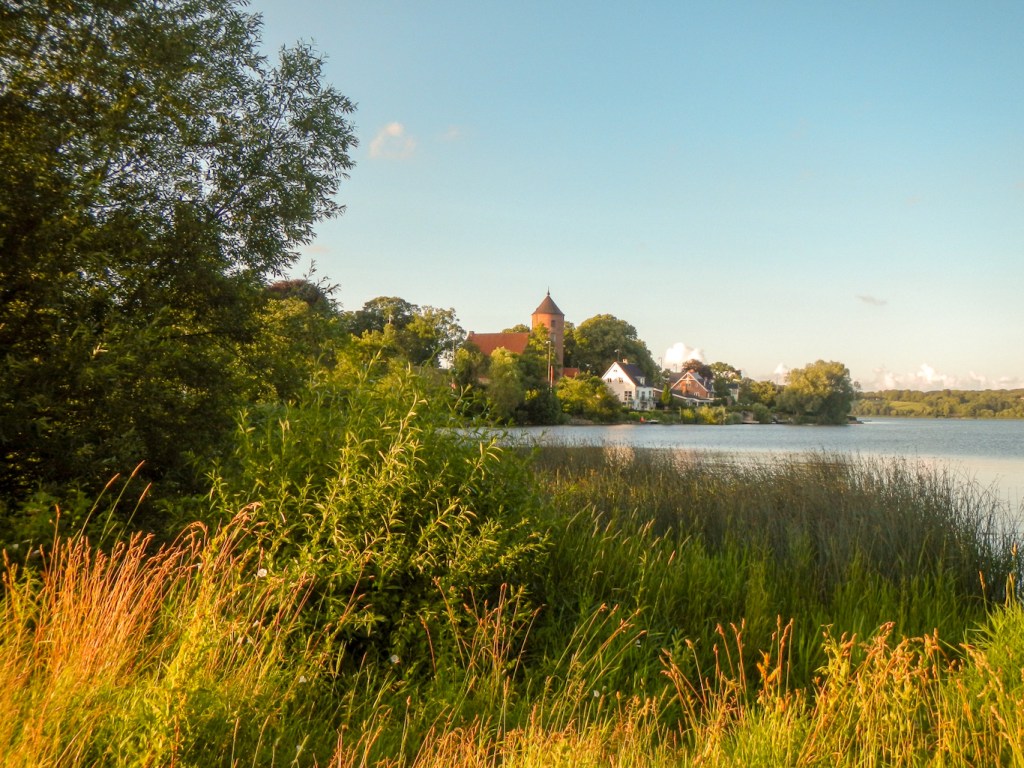
It wasn’t until the afternoon that I saw a sign for the Molsroute. There was even a map showing my location – I was further along the coast than I had feared as I thought that my progress had been slower.
It was easier walking over some areas of pebble heath where there were old lime kilns but also an area where extraction still takes place. I am sure this was part of the coast that I had seen from the air on my flight the previous day.
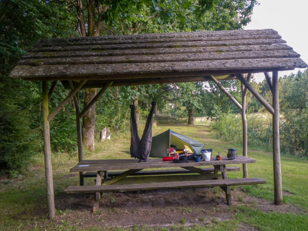
I was delighted to reach my booked campsite at Rugard Strand just before 2pm as the campsite reception was opening after the lunch break. I had enjoyed a good initial walk and I was pleased that I hadn’t been over ambitious with the distance. Unfortunately my hip belt had rubbed against my sweaty skin in the heat and I had a large area of damaged skin which I dressed; however otherwise I was feeling positive about the ease of the walk and that my ankle was holding up well.
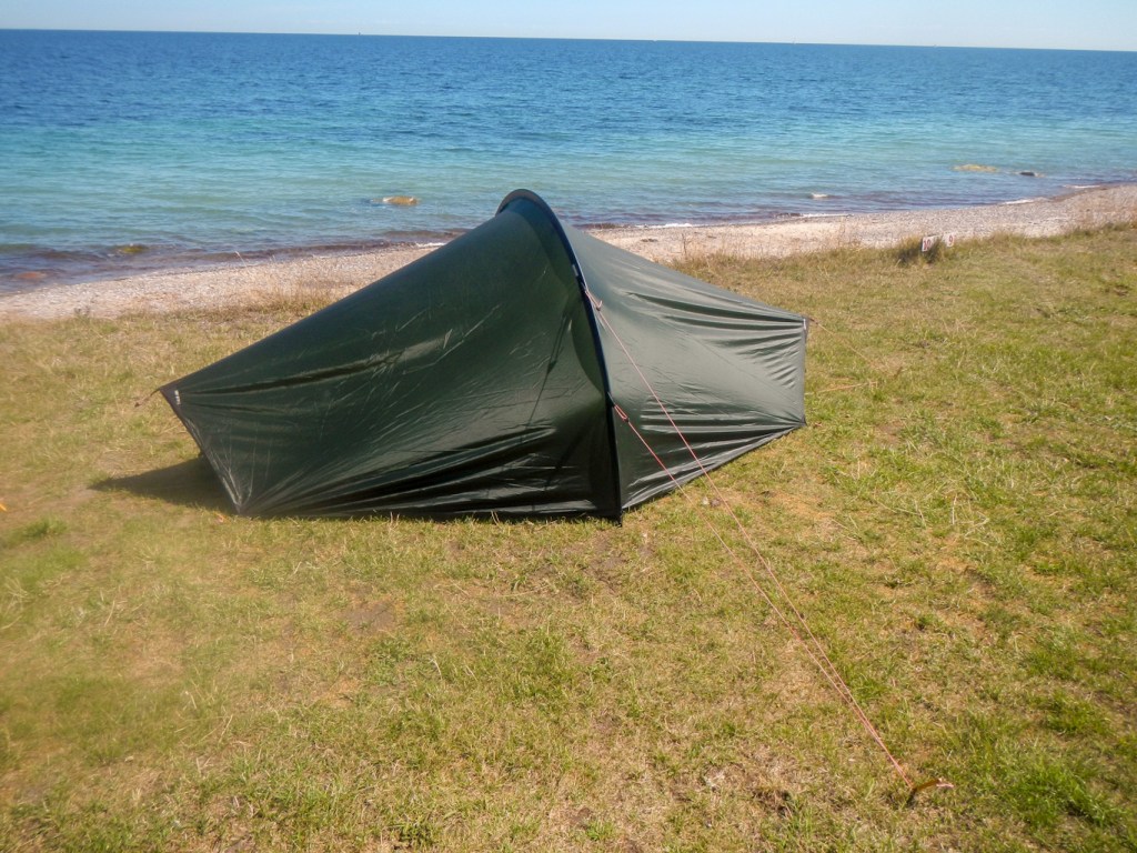
The new burner for my stove was remarkably rapid – partly due to the warm and wind free conditions but partly because I had become used to the old burner which I realise now had developed an obstruction to gas flow. I had an excellent spot to camp with superb views right next to the coast.
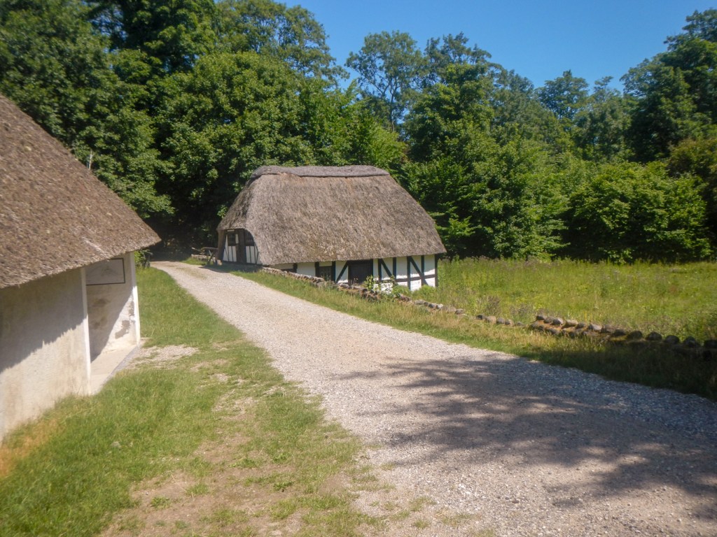
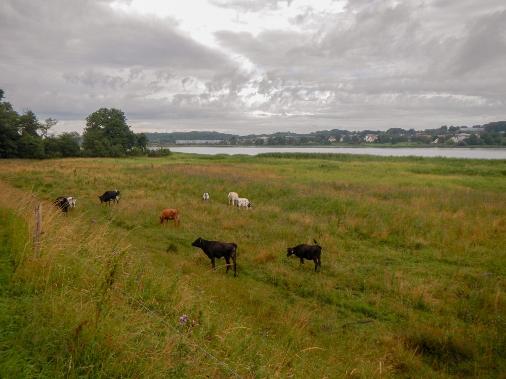
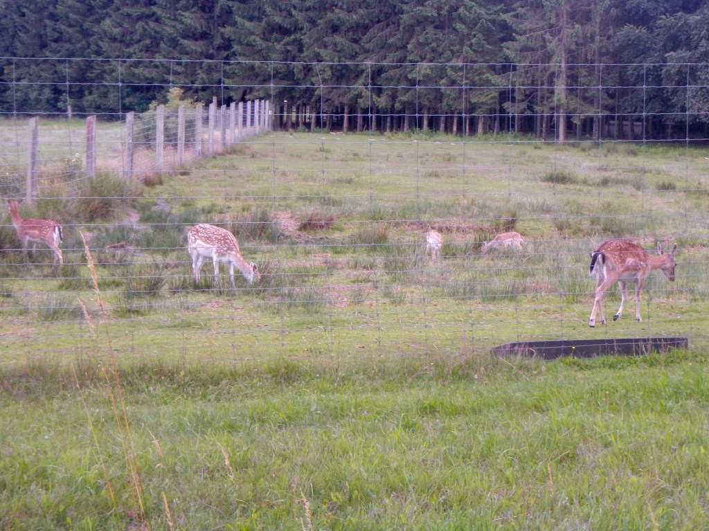
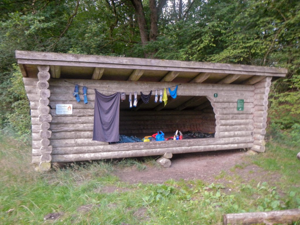
The next day was hot and dry again. I encountered my first E1 sign as well as Molsroute signs. The route led inland past fields of wheat and barley, cattle all safely behind electric fences, scattered dwellings many of which were thatched. I passed an animal park – this must be Denmark’s equivalent of Woburn Safari Park as it’s possible to see many animals from the public footpaths – but unfortunately not from the footpaths I needed to take. However I did see red kite and even an eagle (but not the white-tailed eagle). I walked near a large lake then through a forest to Ørnbjerg Mølle where I planned to camp. I found it easily. It was fortunate that I had my tent as the shelters were full but there is a separate area to camp about 100m away. It was another short day – I had arrived by early afternoon.
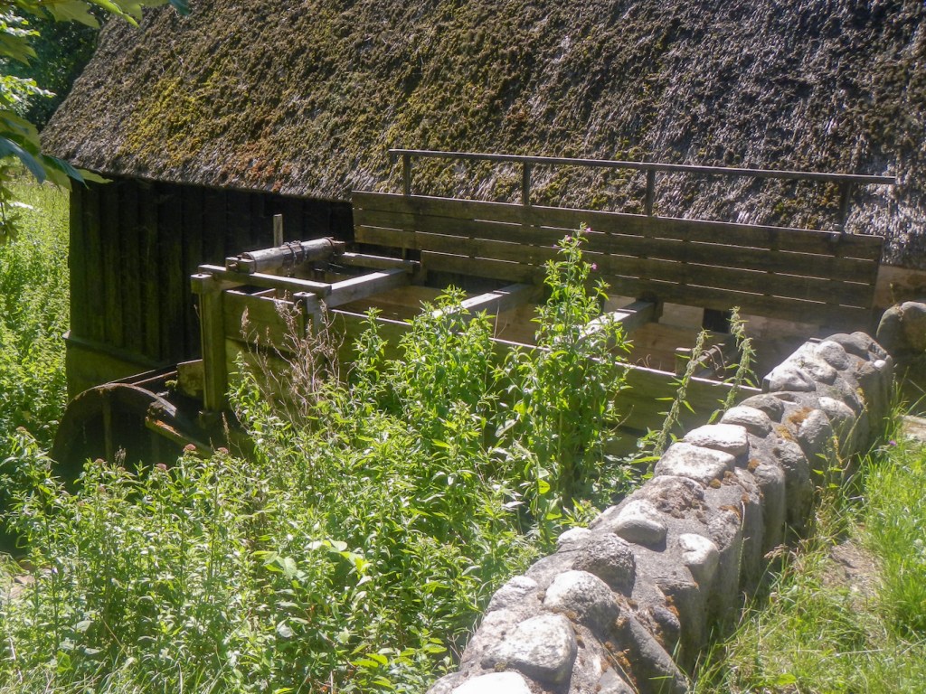
There was only one other tent on the site, occupied by a man with whom I had no communication! However I had everything I needed – a drinking water tap and a composting toilet. There was also an interesting display area about the mill. The whole area has been restored by volunteers. Staying there is completely free! There’s a website which I found very useful and it includes details as to shelter sites and “primitive” camping areas as well as some information about availability of drinking water taps: https://udinaturen.dk/. There are other apps and sites which are similar.
I was relieved that I didn’t have any further to walk. it was so hot that I felt exhausted just lounging around my tent and the water mill. The birds were singing and I had views of mixed woodland – birch, oak, ash, willow, beech, sycamore, Douglas fir and others. There were many insects too but nothing as bad as the Scottish midge!
I should have been careful as to what I wished for. The weather changed overnight and it was still raining as I made my porridge and coffee for breakfast. The rain had cleared as I took down and packed my tent – but I was still packing a wet tent.
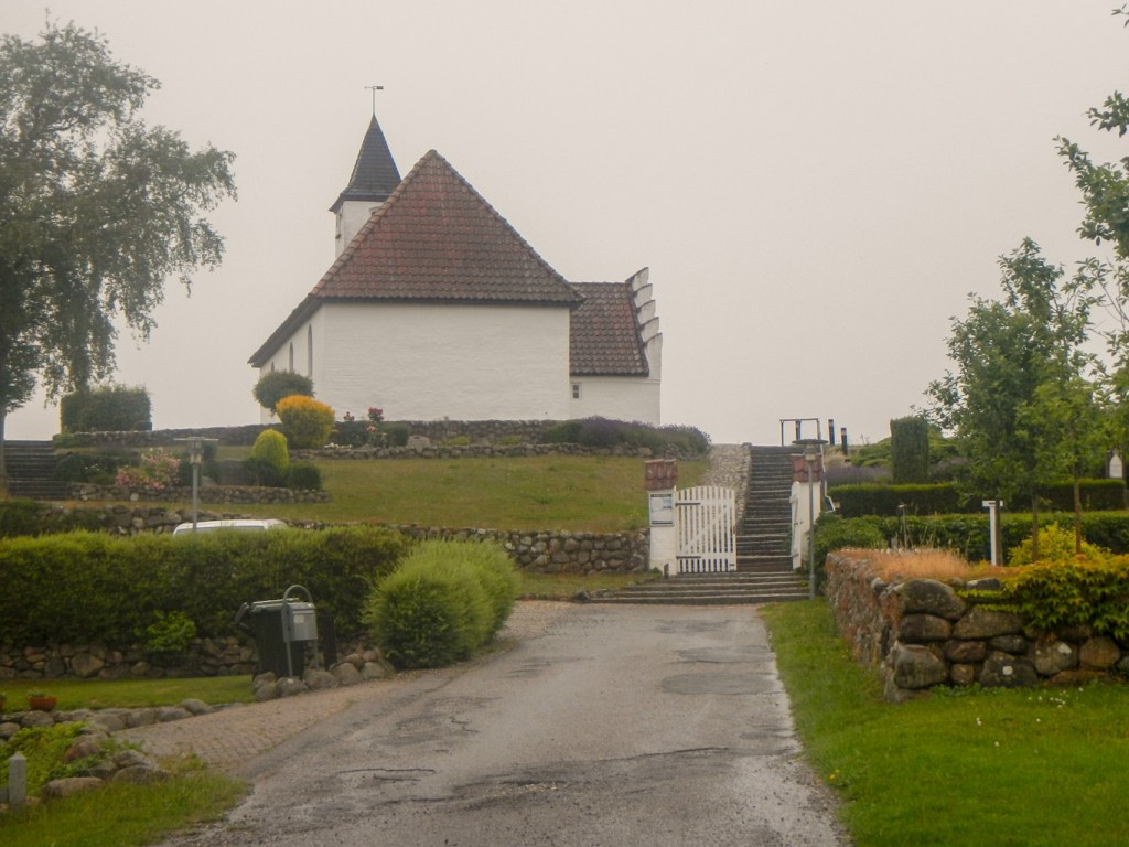
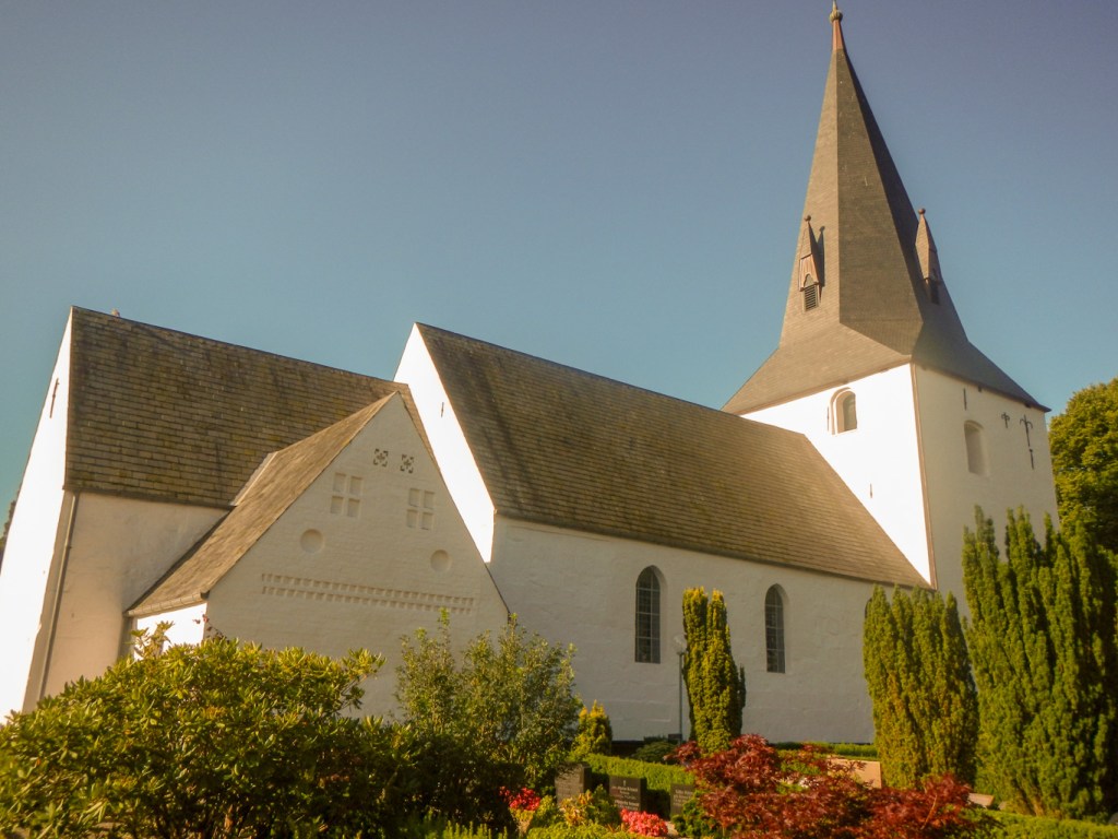
I had only walked a few miles when the rain restarted, initially gently but suddenly it became torrential. Keijlstrup is a lovely village and there were friendly notices inviting me to stop and sit on some picnic benches. However, I just pulled on my full waterproofs. By the time I reached Egens, I was soaked. I saw a sign to the church and diverted there, climbing up the steps to what would have been a spectacular viewpoint in better conditions. Egens Kirke dates from the Middle Ages and is one of the smallest churches in the country. The old cemetery is built on terraces around the church. The building was unlocked and I took refuge from the rain. As I sat at the back of the church, thinking about pulling a snack out of my rucksack, a lady opened the door. She was surprised to see me as she had just come to empty the dehumidifier – unfortunately I had added to the damp problem! I think she was the priest, Anne Hanson and she explained that she had responsibility for four parishes. She even kindly offered me a lift to Rønde, my final destination for the day; of course I had to decline as I would then have had to return to walk the stretch again.
I left soon after as she had a call on her mobile. Actually I was keen to walk to Kalø Castle Ruins as well; the picturesque 700 year old castle perched on a small peninsula at the end of a half kilometre causeway. Fortunately when the rain was at its heaviest I was sheltering again but in the picnic area before venturing along the causeway. A passing cyclist sought refuge too but a group of teenagers with heavy rucksacks stayed out in the rain!
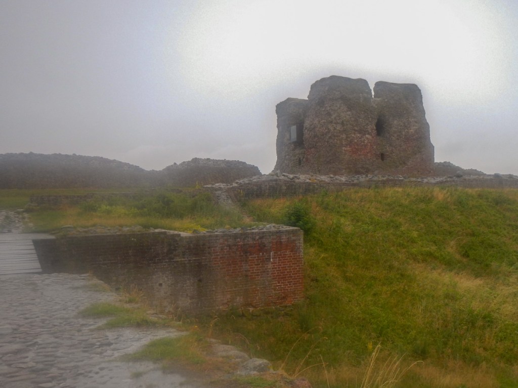
The rain eased and I sat forth. The uneven stone-paved path is is Denmark’s best-preserved and longest medieval road. The ruin is one of Denmark’s best-preserved medieval castles that King Eric VI had built in 1313. Inside the tower, are the remains of the castle’s dungeon. The large holes at the bottom of the wall were probably made by the castle’s prisoners, as they attempted to escape. Given the weather conditions, the castle was surprisingly popular, although I did have the building to myself for a short time.
An interpetive board near the picnic area explained that this area had provided inspiration for J.R.R. Tolkien’s Hobbit and Lord of the Rings sagas. As I walked further towards Rønde through Hestehave Skov, the gnarled and twisted trees resembled my imaginations of Tolkien’s “Ents”, an anthropomorphic species closely resembling trees.
As I emerged into parkland near Rønde, the heavens opened again. I had stopped to look at the route to the DanHostel, where I was booked to stay and a passing dog walker advised me to just descend to the town and seek shelter! I did this, before climbing the hill to the hostel. it was a third “short” day and only 3pm even with my visit to the castle.
The https://danhostelronde.dk/ is excellent. I had an amazing room with superb views to Kalø Castle Ruins and to Bregnet Church. There was also plenty of space for me to dry all my wet equipment! The friendly warden explained that the forecast was dry for the next day but rainy on the following two days – “but not as bad as today”.
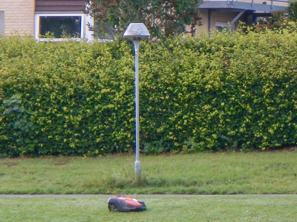
I woke early and boiled water for porridge and coffee in the very well equipped and clean hostel kitchen. I was keen to get moving as I thought that any rain would be more likely later in the day. I left at 07.30, returning to the park I had left the previous day. I counted at least five robotic lawnmowers cutting the grass – the fact that these are not vandalised or stolen is a mark of the safety of this country.
In the main, my route coincided with the cycle path round the coast, although there were a few deviations. I had to divert inland to get past a huge power station. Towards Århus I was able to walk over dunes and along the foreshore before reaching a footpath adjacent to the light railway line between Århus and Grenå. I’d had a longer walk than on the previous days but still arrived around 15.30 (just as the rain started).
The city hostel https://danhostelaarhuscity.dk/ was very different from the one at Rønde with many more groups of young people rather than families. However I had a comfortable room to myself and was able to complete the drying of my tent. I had plenty of time to stock up on food – both lightweight trekking meals and standard supermarket items.
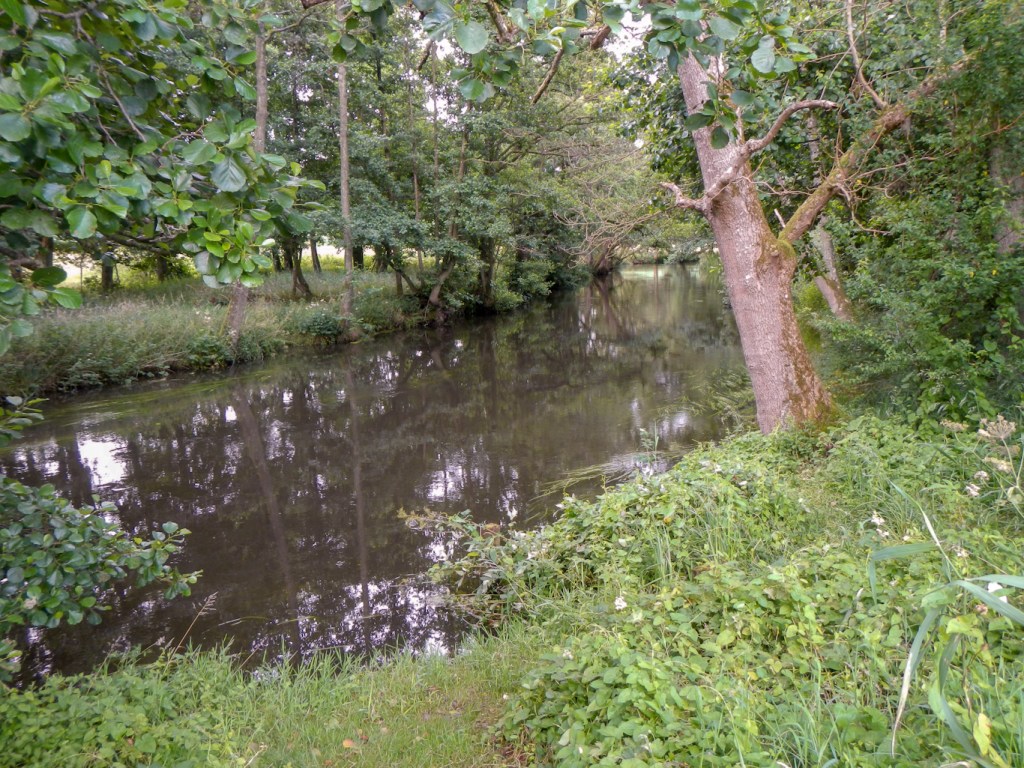
I was fortunate to pick up a street map at the hostel and be able to work out the quickest way to the countryside and my new route – I had completed Molsroute and started the Århus – Silkeborg trek. It was initially a pleasant lakeside walk then went uphill along some quiet tracks and roads. I ate lunch at a shelter site where there was a water tap.

After lunch, I struggled with the route – the route on the ground was different to the one I had marked on the map. Soon after regaining the correct route, I missed a waymark as I hadn’t realised that the markers I was meant to follow had changed to red circles. Purely by chance, I stopped for a rest at a picnic area and managed to re-find the route. It was all a bit like going through a maze with many twists and turns but my diligence in following a convoluted series of markers through a forest paid off. The scale of my map was too small to be of much use on this section.
Eventually I reached Skanderborg. It had been a long day of over twenty miles walking and had become very warm again. Unfortunately, the markers seemed to leave me up a dead end in an industrial and trading estate. Eventually I resorted to using Google maps to navigate the labyrinth of streets. I reached the main part of the town; my hotel was beyond the far side of this. However I arrived in the end and managed to book in – everybody else there seemed to have arrived by car and be fairly elderly and I felt that the receptionist was trying to work out what I was doing.
However, I ended up with a luxurious room and unlimited coffee and tea available from near the reception desk. I decided to go out to dinner at https://tarantini.dk/ as it had good reviews on Google. It was superb – an extremely friendly owner, an appropriately attentive waitress and tasty food at very reasonable prices. It was definitely worth the walk back into town even after such a long day. Suitably refreshed, I enjoyed the stroll back to the hotel and deviated slightly to look at various sculptures, the church and the picturesque lake.

I arrived for breakfast at 06.30am and left the hotel at 07.30. There was a forecast of thunderstorms and I was keen to get miles under my feet before they started. I had picked up a useful free map at the hotel, published by Skanderborg Kommune and including my intended route for the day but also depicting a shelter and primitive campsite at Sletten. This was further than I had initially planned for the day but would avoid a deviation off my route to reach a camping area I had noted previously in the town of Ry.
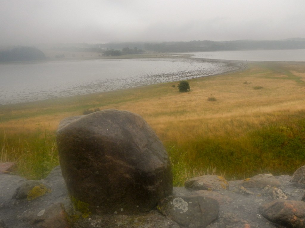
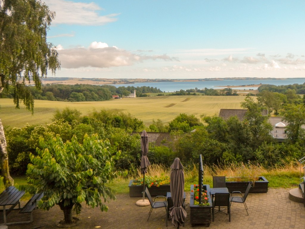
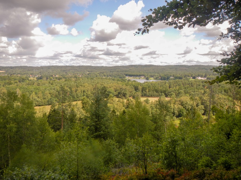
I could see that my route proceeded round the lake near the hotel before branching northwards and reaching the east end of the lake Mossø, which is Denmark’s third largest freshwater lake and Jutland’s largest, as measured by surface area. Unfortunately it wasn’t as easy as it looked and I ended up on a twisting and turning mountain bike path at one stage. Fortunately there weren’t any mountain bikes! However after that deviation, I reached the lake without incident and was fortunate to be close to a picnic area with shelter when the first heavy shower of rain reached me. This is Denmark’s lake district and is a beautiful landscape with many areas of forest too. It’s also more hilly than most of Denmark.
I sensed that I was being caught and indeed before long a Swiss man drew level with me. He had been walking for several months, starting from somewhere in Norway (not as far north as the North Cape) and walking to his home in Basel. Rather than a rucksack, he had built himself a trolley / trailer that was attached to him, constructed from lightweight metal used in aircraft manufacture and some walking poles. It also converted to a seat when he stopped for a rest. Very impressive!
I stopped for lunch near Øm Kloster Museum which specialises in the study of medieaval monastic culture. It sounds interesting and only costs 50DK (under £6) admission but I didn’t have time to stop. Neither did I have time to walk to the bird tower located on Lindholm head, a peninsula that goes out into Mossø’s north side. I continued to follow the Århus – Silkeborg walk through a large forest, spotting a few deer as I went.

The turn off to Ry approached and I decided to continue on. Soon after this there was an extremely heavy rain shower – even the cyclists on the track stopped riding when it was at its most torrential. I wasn’t sure about the drinking water supply at my proposed shelter / camping site so I purified some stream water with chlorine dioxide tablets. Unfortunately I left my camera between my rain cover and rucksack – I thought I had lost it as I couldn’t see it anywhere, but I remembered having it during the heavy shower. Eventually I took my rucksack off as I was thinking about walking back on the track to search for it; but there it was!
By the time I reached the turning for Himmelbjerget I was feeling very tired. Until the mid-19th century, Himmelbjerget was perceived as the highest point in Denmark. At the top of Himmelbjerget stands the Himmelbjerg Tower, which is 25 metres high and was erected as a memorial to King Frederik VII, who on June 5, 1849, gave the Danish people their free constitution. Nowadays, people still meet on the mountain to celebrate democracy and the constitution.
I wasn’t tempted to turn off but instead I turned down to the side of Lake Julsø, the largest of the three Himmelbjerg-lakes near Silkeborg. The old hotel was closed but this was clearly an important calling point for pleasure boats on the lake.
I followed the path round the lake and reached Sletten. Unfortunately when I arrived I discovered that the buildings were locked, although there was drinking water available from taps. I wasn’t sure whether it was permissible to camp. I spotted a man and his son walking – the father explained that this was in fact a private scout camp site and shelter area but that there were some “public” shelters nearby or I could risk camping under the trees well away from the path.
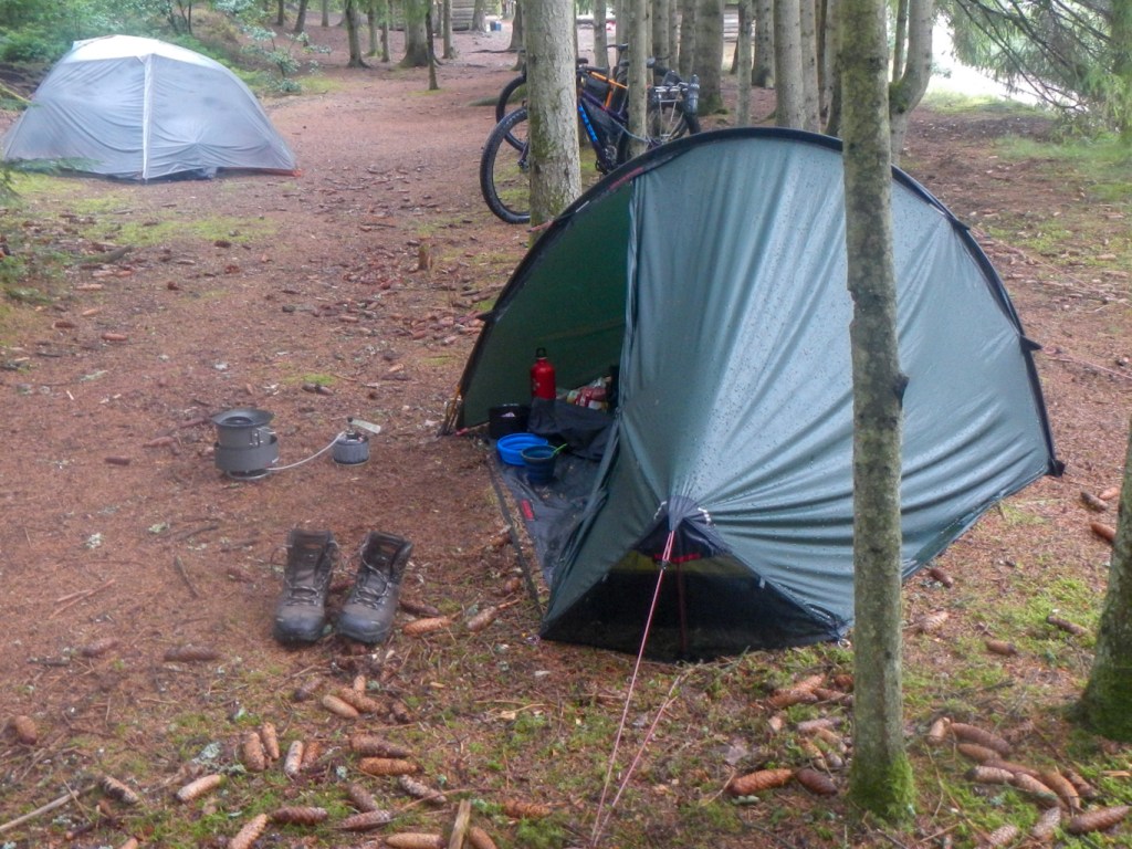
I opted for looking for the shelters. One was already occupied by Henriette and Frank, a couple in their 50s from Copenhagen. I decided to put my tent up rather than use the remaining shelter. Henriette is a consultant hepatologist in Copenhagen with a particular interest in rare liver disease. It’s amazing who you meet in such remote places and we had some interesting discussion about healthcare in Denmark and in UK.
I was late getting to bed after a late arrival at the shelter site and talking too much! I didn’t think the next day would be as long as I was well ahead on my schedule and I had four further un-booked nights until a booking at the DanHostel in Vejen. Hence I couldn’t get too far ahead. I had a vague plan to get on to the Silkeborg-Horsens or Hærvejen route and then look for a suitable shelter or primitive campsite as I could see on the website that there were free camping areas and shelter or primitive camping sites available. I was still struggling a bit with understanding the system and in particular being concerned about drinking water as I was uncertain as to whether my chemical purification would be sufficient given the population level and the paucity of fast flowing streams.
I found a lovely primitive campsite complete with water and composting toilet after walking for about an hour – of course that was far too soon to stop! The marked path was tortuous. I ascended to a stunning viewpoint looking over the lake.
Eventually, with the help of a location map in a small car park, I decided that I had reached the point to leave the Århus – Silkeborg walk and head in a more westerly direction. After all I was meant to be walking north to south and I was still further north than Skanderborg which I had left over 24 hours earlier.
The tracks on the ground weren’t as straightforward as the map in the car park suggested so eventually I decided to follow a compass bearing in a westerly direction. I knew that I would reach the 52 road but just wasn’t sure where! Eventually I came out just to the north of Rodelund. This village boasted a labyrinth, an unmanned petrol station, a Thai massage facility and a couple of car salesrooms but no supermarket. However the labyrinth hosted the tourist information centre and I picked up a useful overview leaflet about the Hærvejen route. A labyrinth was the last place I wanted to be – I was more concerned about getting lost for real.

Somehow, I managed to navigate myself on to a disused railway line north of Them. This was the the Silkeborg-Horsens route – exactly where I was meant to be. My map showed a camping place next to the path. I found it but although there was a drinking water supply and what appeared to be a small shelter, the toilet was locked. There was a notice which I realised referred to staying overnight – my problem was that I didn’t know enough Danish to understand whether it meant I could stay there or wasn’t allowed. “Du mae ikke” looked a lot like “you may” but it was odd that the toilet was locked. Anyway it was only 3.30pm and I hadn’t started my walk until 10am. I realised that if I walked a further 6-7 miles I would reach another camp and shelter site which was marked on the https://udinaturen.dk/ site unlike the one that I had just found.
I continued onward and within yards came across a location map sign board next to the path. I studied this, comparing it with my paper map. As I was doing this, a man across the road who was gardening wandered over and began to talk in English! I asked what he knew about the shelter site just yards up the track and he wasn’t sure about its current status so we wandered up there together for him to read the sign. Unfortunately for me “Du mae ikke” means “You may not”. The man I had met, who turned out to be from Sheffield but married to a Danish lady he had met in London, thought that the chance of being challenged for camping there would be minimal. However, just to be on the safe side, he explained that I would be welcome to put my tent up in his garden. However he confirmed that the spot 6-7 miles away was definitely in current use. He also confirmed that there was not just one but two supermarkets just up the road so I went to procure some more food.
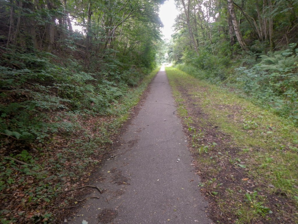
As I returned to the path, he waved from his garden. The tarmacked disused railway line was almost flat and the good surface made for a relatively brisk walk. The path went through several cuttings so the view wasn’t the best but I did pass a bison and birds of prey centre where there were also some deer.
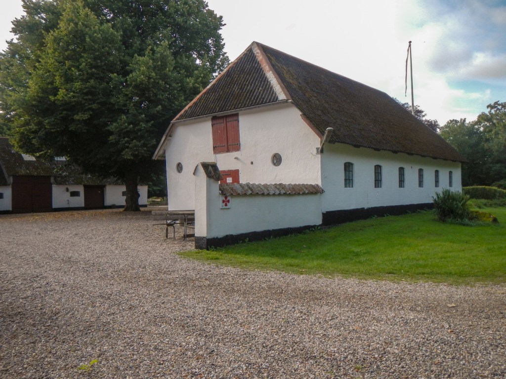
The shelter and camping spot turned out to be adjacent to a railway station on the old line. However at this point in Vrads, the line was no longer a path. It has been taken over by some enthusiastic railway preservationists to run preserved trains between Vrads and Bryup, just over three miles away. The station buildings and a preserved carriage at Vrads have been converted into a restaurant.
The shelters were already occupied but I spotted a tent around 50-100m away and the occupants were happy for me to camp there too. Nicola and Martin explained that although they are English and previously both worked in Cumbria in university administration and maintenance, they had emigrated to New Zealand. However their latest project was that they had resigned from work in New Zealand, sold their house and most of their possessions, bought cycling, camping and outdoor equipment and were travelling the World until their money ran out. Their current phase was a 90 day off-road (preferably) cycle camping expedition from the Netherlands to Norway and Sweden then Denmark and to Germany, mainly following The European Divide Trail. It could only be 90 days in Europe because of the time allowed in the Schengen Zone for UK passport holders following Brexit. I reflected on this incredibly brave adventure – their possessions were little more than their bicycles and the equipment they were carrying. It made my adventure seem very tame!
It rained overnight and storms were forecast for most of the day. However I was lucky and dodged all the rain apart from one shower after I’d been walking for about thirty minutes. There was a train due at the station around midday but I wasn’t keen to wait round all morning just to see the preserved line in action.
After the road walk to Vrads and out the other side, I was off road on tracks and paths nearly all day. The terrain was sand and gravel / pebble heathland with mixed woodland – a bit like walking on Woodbury Common. Worldwide, this is a rare and biodiverse habitat so it seems amazing how many times I come up against this terrain on my walks. Palsgard Skov is one of Jutland’s oldest plantations and includes old moorland with coniferous trees, raised bog, and areas with oak trees and 100-year old beech trees. I passed a couple of nice shelter sites with drinking water. I walked in to the town of Nørre Snede, bought some fruit and a soft drink from the supermarket to consume immediately, and walked out the other side.
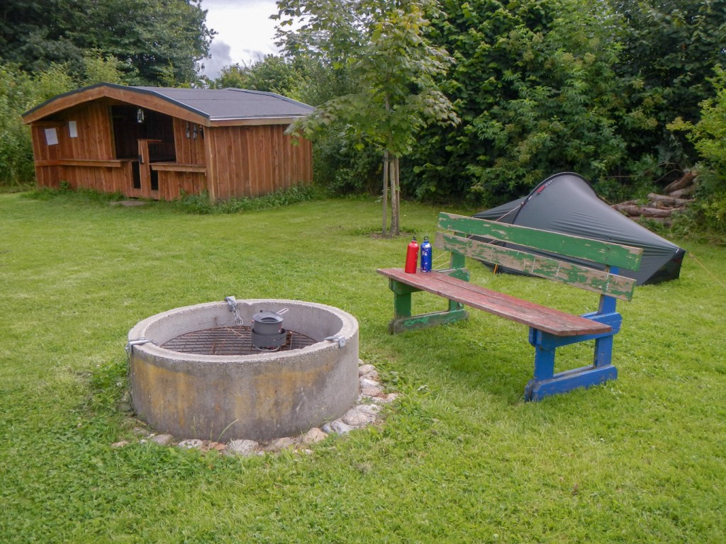
The walk continued over similar terrain. Apart from in the town, I only saw a couple of small groups of walkers all day. My planned overnight stop was at a camping and shelter site with drinking water near a nature and education centre in Koutrup Forest. I struggled to locate the shelter site even after I had found the nature centre (including toilets and a shower!). However, I got there in the end. it was fairly late and there was no one else at the site so I decided to use a shelter. This was remarkably comfortable and I slept well, even though there was a field next to me with a mixture of different cattle including Highland cattle and saddlebacks. They were on the other side of an electric fence.
I was up early and my decision not to use a tent was justified – it would have got wet in the night. With no tent to pack away and more space than my tent to get dressed in the shelter, all my preparations were slick. Sadly my amazing collapsible mug had broken – perhaps I sat on it. Anyway a fragment had chipped off. I managed a repair using sticking plaster and tenacious tape (duct tape wouldn’t stick) – success and it didn’t leak. I was still ready to leave at 07.30am.
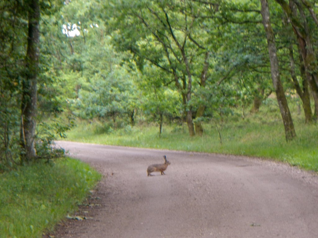
It was dry and sunny but a south wind had developed overnight – walking into the wind was harder work but refreshing. A hare sprung across the track in front of me. I crossed the watershed for the source of Denmark’s main rivers Gudenåen and Skjern Å although I didn’t take the diversion to the springs.
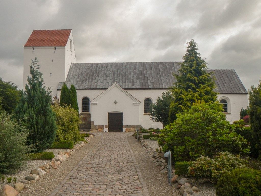
However I didn’t miss visiting Denmark’s highest church, 127m above sea level. It was built in 1150-1200 and functioned as a pilgrimage church next to St Peter’s Holy spring. The crucifix at the churchyard wall was erected along with numerous other roadside crucifixes that were to be found along Hærvejen in Catholic times.

Unfortunately the dry weather didn’t last and I was caught in a torrential and protracted shower. Just as I reached a shelter site near Givskud, the rain stopped. I had needed to be 45 minutes earlier! A couple had stayed at the shelter overnight and were planning to finish their walk in Jelling – they were still packing and getting ready for their trek. However they made a strong recommendation that I should visit the museum at Jelling – “It’s free and the reception will look after your backpack while you look round”.
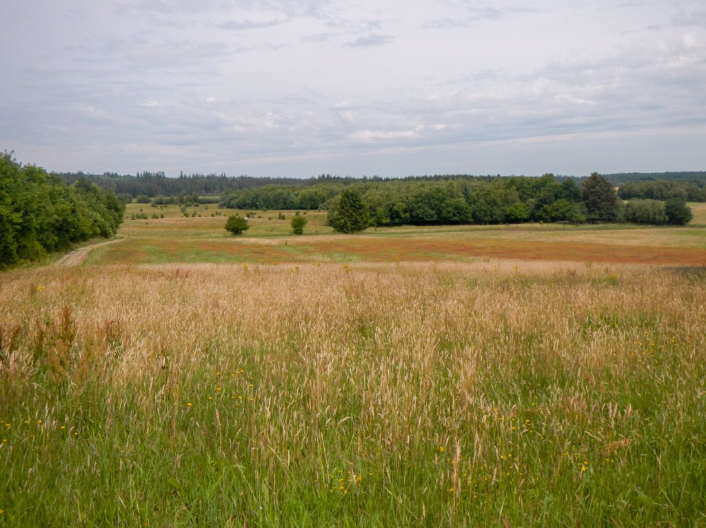
The route moved into a more intensively farmed area – huge corn fields and herds of cattle. Showers continued on and off but nothing like the first drenching of the day. I passed an old coaching inn which had been an important staging post on Hærvejen and has been converted into a modern hotel. I picked out a few burial cairns in the fields – there are many in this area. The strong headwind persisted.
The site at Jelling is on the UNESCO World Heritage list. The Hærvejen route passes right through the site from north to south.
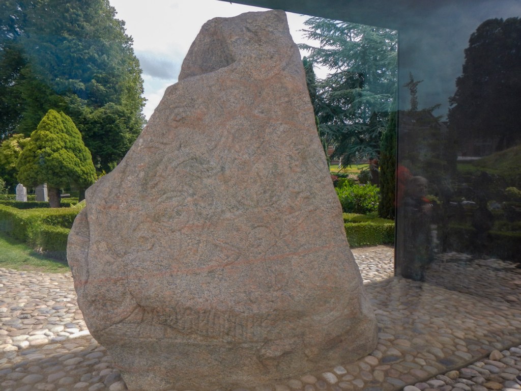
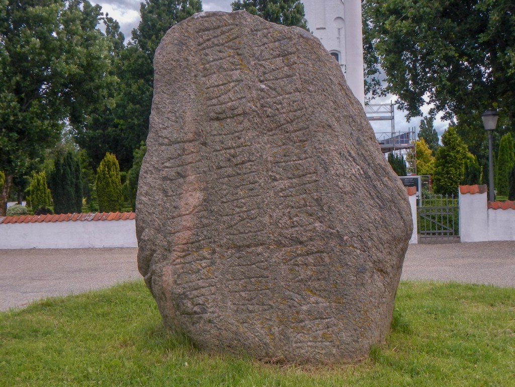
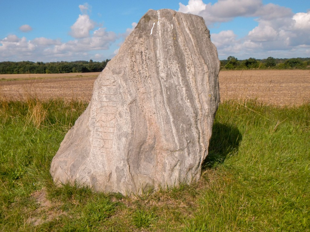
Denmark was named in Jelling. King Gorm carved the name on his rune stone around 950AD. The inscription translates “King Gorm made these runes in honour of his wife Thyra, the pride of Denmark.” This is the first ever known mention of the name Denmark.

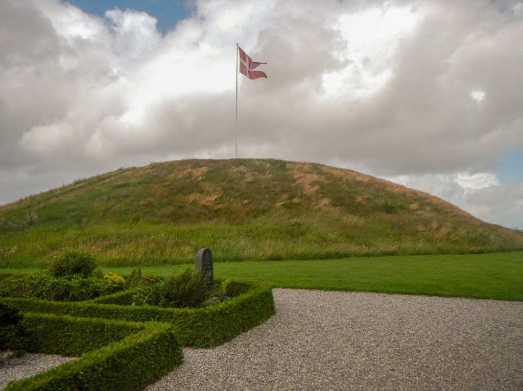
In the winter of 958/59 AD, King Gorm died. He was buried in a wooden chamber which was covered in turf, boulders and more turf. The mound grew until nearly 2.5million cuts of turf had been laid in place. Today, Gorm’s burial mound is known as the Northern Mound.
Harald Bluetooth took over the position of king from his father. He raised the large Jelling stone. The inscription on it reads “King Harald ordered these remembrances made for Gorm, his father, and Thyra, his mother; that Harald who won for himself all of Denmark and Norway and christened the Danes.” It has been called Denmark’s certificate of baptism.
Harald launched a second construction project to build a second mound (now the Southern Mound). This had to be larger than the burial mound containing Gorm’s tomb – it contains approximately four million cuts of turf and is a solid mound not built for burial.

A large stone ship dating from the time prior to Harald’s baptism (similar date to the Northern Mound) was built. After his baptism, Harald surrounded the grounds with a nearly 1.5km long palisade – a huge fence built from oak timber. The stone ship and the palisade have been sculpted and landscaped to form an impressive current day monument and this was the first part that I saw of the site as I approached from the north.
Jelling Church is located next to the rune stones and between the two huge mounds. The chancel had originally formed the nave of an earlier church dating back to the very early Middle ages. This is still the hub of church life of the parish and the churchyard continues to be used as a burial place.
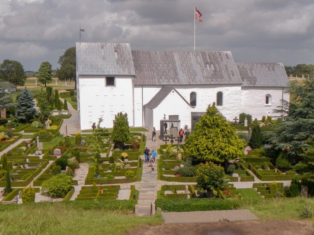
At the edge of the historic complex, there is a modern museum including full explanations of the importance of the site and many interactive displays. As I had been told, admission to this impressive monument and the museum is entirely free.
Having enjoyed experiencing a significant slice of Danish history, I continued my walk. I had plans to head to a private shelter site listed on the https://udinaturen.dk/ site but in the end I opted to seek a place at the camp site https://www.fscamp.dk/ at Fårup Sø located near the south of Jelling. It was directly on my route. Having checked in I went to the camping area only to find a familiar tent – that of Nicola and Martin who I had met two nights earlier. They were staying for their second night having decided to take a rest day. The facilities at the site were superb and I took advantage of the electric kettle to boil water to make my meals. If I’d realised then I could have bought something other than the dehydrated trekking food that I was carrying. Unfortunately I hadn’t packed a costume so I couldn’t go swimming in the pool.
I checked out promptly at 08.00am having said good bye to Nicola who had just poked her head out of her tent. I stopped at a supermarket in the small village of Jennum to buy a soft drink (and reclaim the deposit on two previous plastic bottles) before reaching Skibet. I saw the Legoland shuttle bus as the campsite had only been twenty minutes drive from Legoland (indeed I had heard numerous planes passing over the campsite to and from Billund airport. However my route turned off road on to a disused railway line which I followed for the rest of the day. Easy navigation!
It turned out to be an interesting route passing meadows, a stream, woodland and arable land.
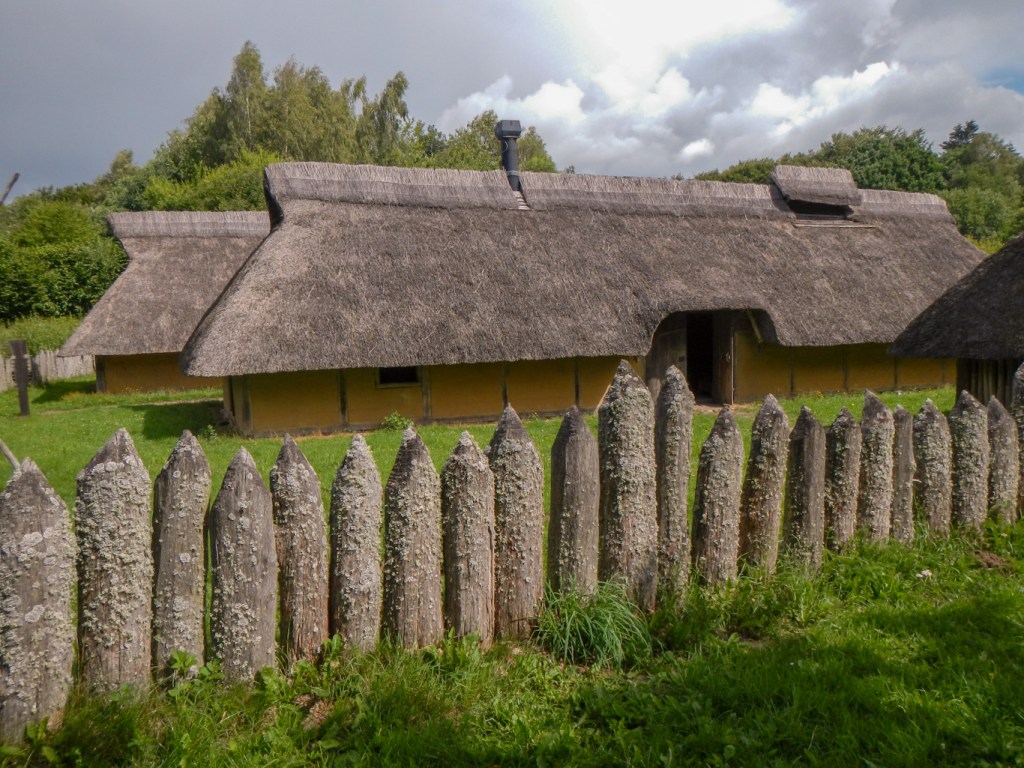
I also visited a reconstruction of an Iron Age village. The residents explained to me that in the past up to thirty people had stayed there for a period in the summer, living in a reconstructed Iron Age village, wearing period clothing and spending their time caring for the animals, gutting and salting fish to cook, grinding corn etc. This year there were only two volunteer families (seven people), one family living in the “Chief’s” House and the other in the “Guest” house but meeting to eat meals together. The smaller houses further down the hill were all unoccupied. There was a separate primitive campsite with water, but it was too early for me to stop for the day and I had my eye on reaching a camping area further on next to an old grocer’s shop and a railway station.
I walked further to reach Ravning station. This had a small primitive camping area adjacent but also a reconstruction of part of a huge bridge constructed in the tenth century by King Harald. In addition to realising that the Danes needed to convert to Christianity, he also realised the importance of a good road network across Denmark.
I met two women from the local area out for a walk. When I told them that I was heading to camp at Bindeballe they told me that was where they were heading eventually although walking in the opposite direction at that time.
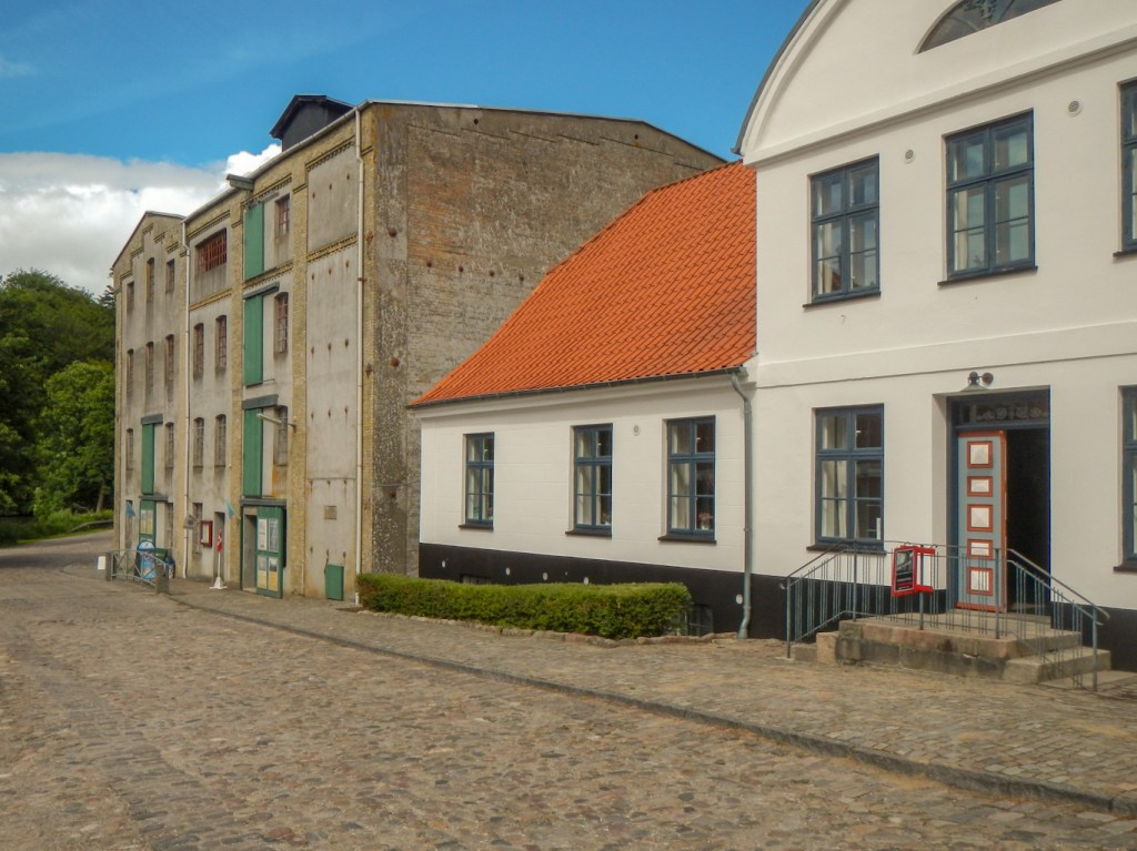
I walked through the station and found the historic grocery shop and café. Eventually having asked at the café, I discovered that the place to ask about camping was the shop. The pleasant assistant explained that having paid 50DK (under £6) I could camp anywhere in the garden, there were free showers, water, a toilet and plenty of hot water. I found a pleasant corner well away from the café customers which was essentially my own section of garden next to a pond and with a covered seating area! I discovered later that for some reason that area wasn’t recommended for tents – but we didn’t know why – and as I hadn’t been told otherwise by the owners who had plenty of opportunity to see my tent there, I didn’t move. It was only about 3.30pm so I took the opportunity to wash my main walking trousers (wearing the trousers I had brought along as pyjamas in the interim!). The breeze had restarted and I was able to set up my elasticated washing line under the sheltered seating so I didn’t need to worry about showers of rain.
Having done my washing and other chores, my priority was to get cake and coffee as I had already seen the huge and scrumptious looking choice of cakes. I wasn’t disappointed.
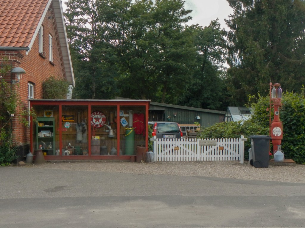


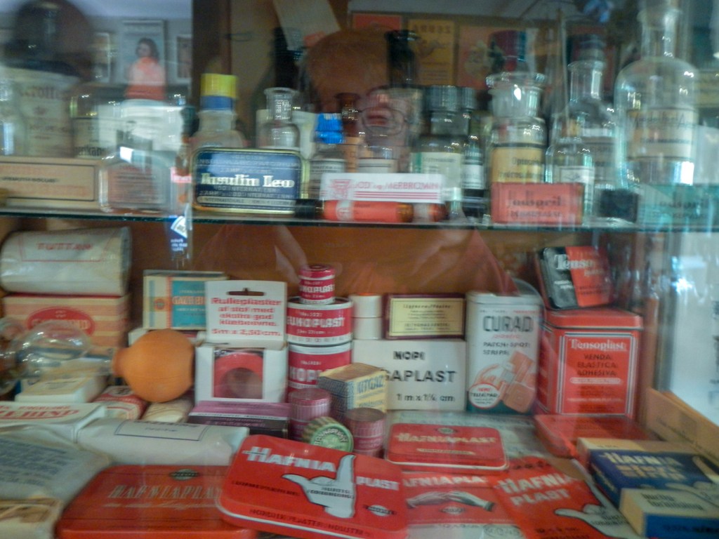
After that I went sightseeing – an old fashioned grocery and general store, a historic petrol station and a disused railway station with carriages and displays. I even re-met the two walking women who having completed their circle were heading to the café before it closed at 5pm.

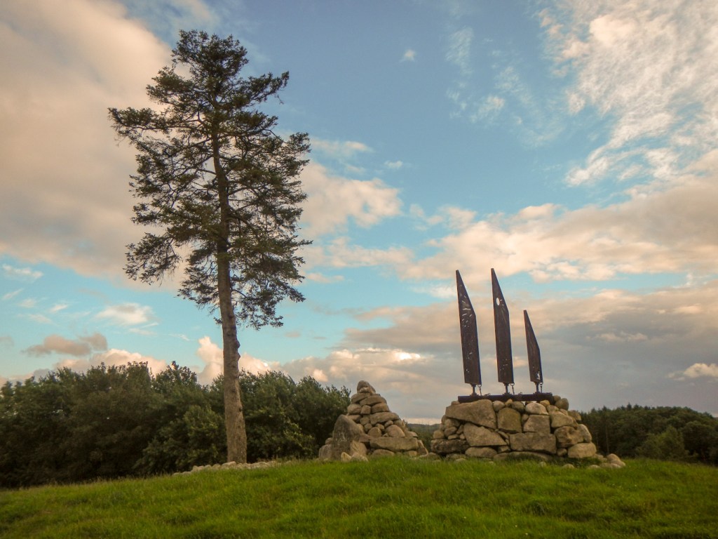
After dinner, I walked back the way I had walked into the village to go and explore a small hill. I saw a green woodpecker. From the summit there were excellent views. However I can’t find any information about the huge cairn and attractive wind sculpture and no-one I asked at the camp and shelter site knew anything about it.
Unfortunately there was a lot of intermittent dog barking overnight. I was up early and left at 8am. My trousers were more or less dry. After the woodpecker sighting last night, this was a day to spot more birds. I saw a jay at the campsite as I ate breakfast. Later in the morning as I walked along, I heard a jay screeching then almost immediately an eagle swooped across the road in front of me. I also saw many wagtails flitting and “bouncing” along the road ahead of me.
I thought that I would arrive at the hostel in Vejen early, but there was a lot to see. There was a large erratic boulder – the Hamborggårdsten is a boulder that the glaciers of the last ice age transported from the Åland Islands to Denmark about 15000 years ago. The more than a billion-year-old stone made of granite with red feldspar crystals in a dark mass weighs about 50 tons.

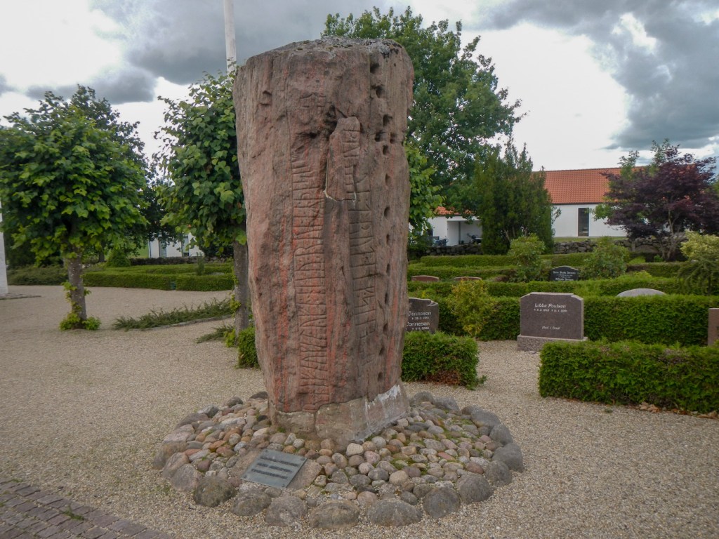
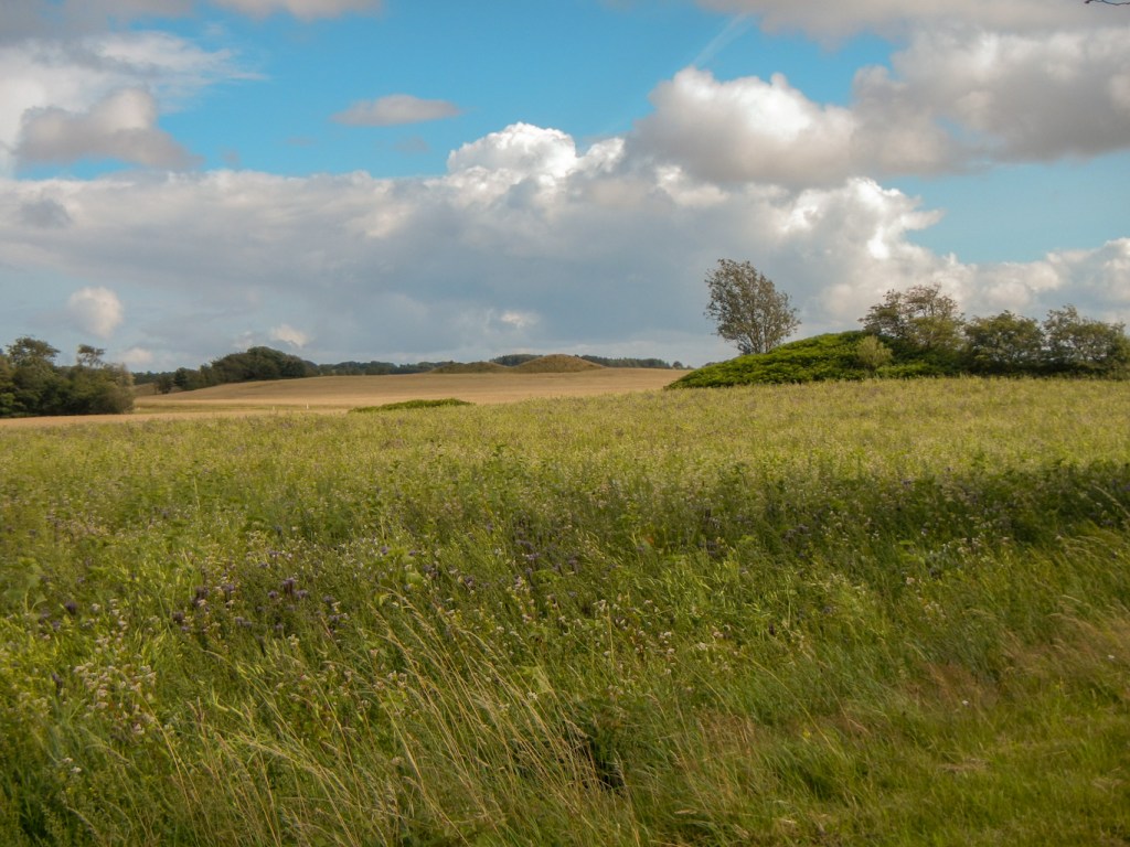
Not far from this, I came across two Bronze Age burial mounds and a 45m long stone ship with a rune stone at its bow. There is a close connection with the Jelling monuments.

Arriving in the village of Bække, I made for the Tourist Information. I was immediately welcomed and offered coffee! There are informative displays which I read. Some Romany people popped in and the guide explained that there was a large traditional horse trading fair happening the next day just a few kilometres away. He suggested that I visit the supermarket opposite to buy some food for lunch, return to eat it and then he would give me a tour of the church while his wife looked after the Tourist Information Centre. A stone next to the tourist centre commemorates the trading fair.
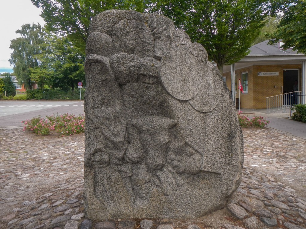
I went with my guide to the church and looked at the rune stone in front of Bække Church that has a link to Ravnunge-Tue. It was found in the churchyard’s embankment in 1810, but where it stood originally is unknown. The inscription reads “Ravnunge-Tue and Funden and Gnyble, the three raised Thyras mound”. Although it can’t be definitively proven, it seems reasonable to believe that these three men were behind the construction of one of the mounds at Jelling. My guide who is heavily involved as a volunteer guardian of the church building (currently overseeing a roof restoration project) felt very certain of the links between this stone and the Jelling Monuments.
He sent me on my way but advised me not to miss the footpath diversion to Læborg as there was a rune stone to see in the churchyard. The church was originally located in open land and was used as a landmark by travellers on the Ancient Road, and according to history books also by seafarers in the North Sea. The original tower of height 17.5m collapsed in 1818 and was rebuilt to a height of 13m.
In the end, it was quite late by the time I arrived at Vejen. The Danhostel was about a mile out of the centre but positioned near the onward route. I had to check in at the Sportshotel. As I was getting near, a lady spoke to me – she was one of the two who had been walking near Bindeballe and spoken with me. She explained that she had seen me walking through Bække as she drove through; she was in Vejen visiting her sister who she introduced to me.
I actually lost my way between the reception at the Sportshotel and the Danhostel! As breakfast was served at the Sportshotel, I hiked there with my entire rucksack the next day so that I didn’t have to make a second journey to check out! This was still a place within easy reach of Billund so I was advised to delay having breakfast until after 07.00am as it would be full of children over-excited about a visit to Legoland between 06.30 and 07.00.
In the end I left at 08.15 to walk through extensive grounds of the sports centre and into the countryside along a network of footpaths and cycle tracks. The route led into what appeared to be a “new town” – it had modern houses with space for bicycles under shelters, lots of open spaces and many children’s play areas. There were also wide footpaths and off road cycle paths.
I reached Skibelund where a national rallying point was established in 1864 after the loss of southern Jutland to Germany in the Prussian Danish war. Today this rallying point is surrounded by monuments in memory of prominent public figures.

I arrived at the River Kongeå soon after and crossed the bridge. From 1500 and until 1850, this river was the customs border between Schleswig and Denmark. Although both areas belonged to the United Monarchy of Denmark, the payment of customs duties was still obligatory when crossing the border.
In 1851, the customs border was moved south to the Eider and for the first time in centuries, it was possible to freely cross the river Kongeå. After Denmark’s defeat by Prussia in the war of 1864, Kongeåen became part of the border between Denmark and Germany once again. It remained so until reunification in 1920, when Southern Jutland became Danish again.
I followed what is now a pleasant riverside path past a pilgrim hostel and eventually reached Knag Mølle, a corn mill built in 1780. during the 1830s it was converted into a mill for grinding bones to produce feed for pigs and chickens and fertilizer (hence the name Knag derived from “knoger” meaning “bones”) but after three decades it was converted back to a corn mill and used until 1952.
I passed several interpretive panels showing photographs of when the area was the German / Danish border (between 1864 and 1920).
A very straight track through Skodborg and Haraldsholm Skovs took me to Jels.
The Slotsgaarden where I was booked to stay in a very luxurious shelter was easy to find. I received an extremely warm welcome from Annette who was looking after the bed and breakfast and garden shelter business while the owners were on holiday. She explained to me that she came from Germany although she had lived in many different places during her adventurous and fascinating life. This included some high level production work with the BBC in London as well as running her own business after she left the BBC. The facilities there were amazing – a well equipped kitchen and access to a shower with plenty of hot water.
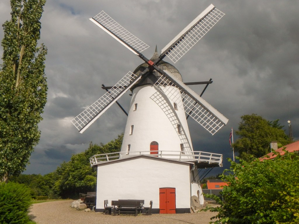
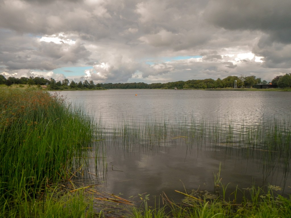
After settling down there, I set off to explore the village. This included going to look at the windmill. Jels Mølle is a large Dutch-style smock windmill built in 1859. It was in use until 1959 to mill feed grain, flour and grist and was heritage listed when it closed. It’s one of the few preserved windmills left in Denmark. I also walked to the lake area – three lakes in a row in Jels: Jels Nedersø, Jels Midtsø and Jels Oversø -together form a small subglacial stream trench, which was created approx. 12000 years ago during the latest Ice Age.
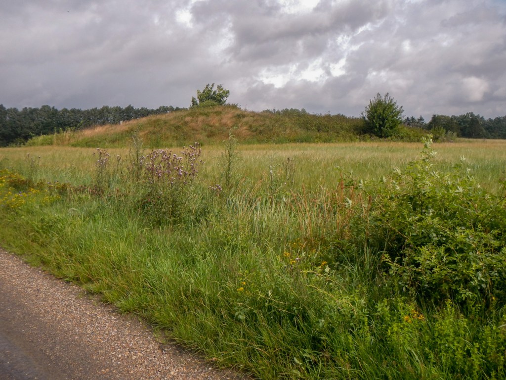
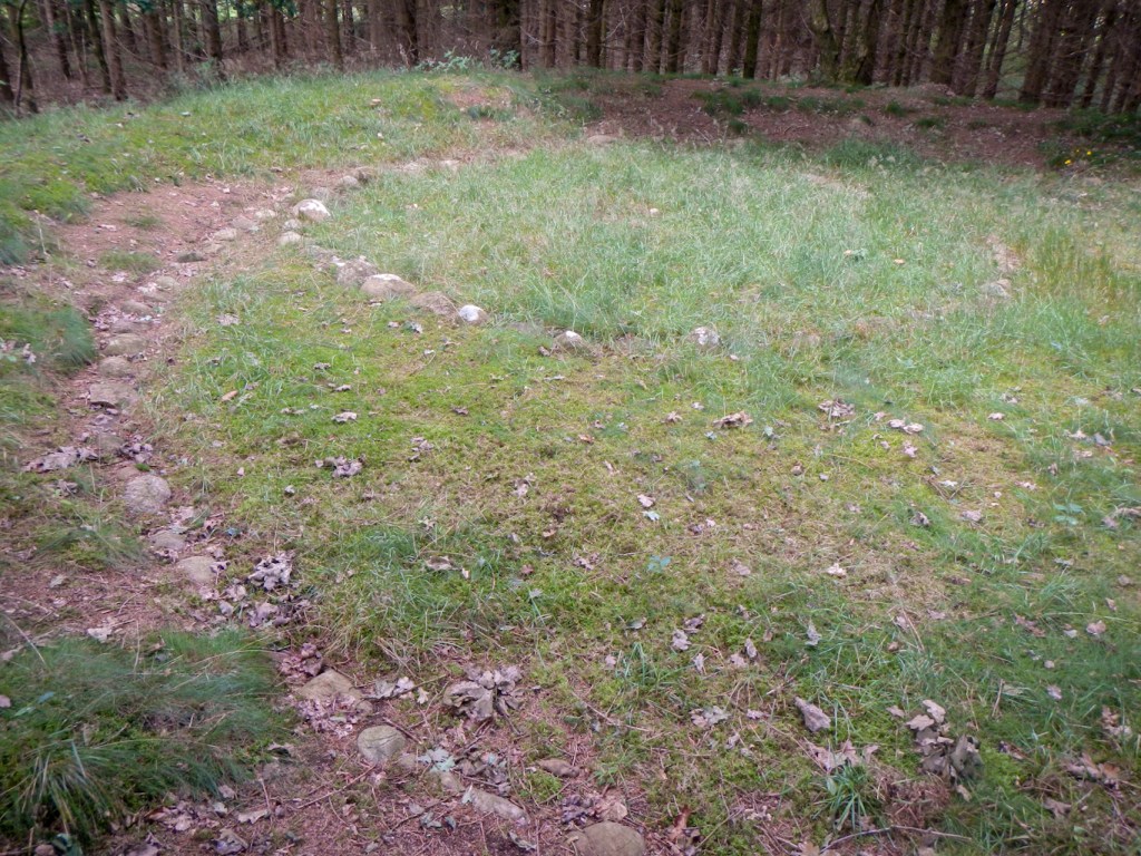
Next morning I was ready to leave by 07.45. I was hoping to be able to walk as far as the former Hærvejskro, Immervad Kro but realised that depending on the path this could be too far so I did have a fall back position. Unfortunately I missed a sign and managed to take a wrong turning quite early on leading to 2km further walked. The only consolation was that I spotted what appeared to be an ancient burial mound in a field.
I arrived at the beautiful 11th century church at Jegerup in time for an early lunch. I was delighted to find that the church was not only unlocked but that a supply of coffee and chocolates had been left out in the porch for visitors to help themselves.
Unfortunately, on my way out of the village I followed a sign for a footpath that turned out not to be part of the Hærvejen. I was rewarded by passing a small lake where there was a grey heron perched patiently on the bank looking for fish. To compound the problem, I thought that there was a crossing point over the railway line which would put me back on my intended route. There was no crossing point – just a “dead-end” track on each side of the line. There was nothing to do other than retrace my steps – 4km more walked than necessary.
I was on a mission and made good time to the edge of Vojens, trying to make up some lost time. Leaving Vojens, I passed a fenced off area of forest used as a military training area. To my surprise I had reached Tørning Mill soon after 3.30pm despite all the wrong turnings and extra walking.
Tørning Mill is huge. It has been a corn mill since 1494. Today the turbines drive a generator that produces “green” electricity. The mill is situated at the centre of a sub-glacial trench, created by a stream of water that melted under the ice during the last Ice Age. I didn’t have time to look around but I did buy a cup of coffee. However when I asked for some tap water to fill my water bottle it was declined as the water wasn’t suitable to drink. As I sipped my coffee outside, the assistant rushed out with a plastic bottle of water, asked for my water bottle and kindly poured the bottled water into my water bottle. I offered to pay but was told it was “gratis”. Later I discovered that there was a temporary problem with the water in the area.
I had a further long walk mainly on gravelled and tarmacked surfaces. I passed a huge Arla dairy processing factory at Høgelund just before reaching Vedsted. It appears to be the company’s main centre for manufacture of blue cheeses. I didn’t stop in Vedsted but noted the two lakes and walked between them.
I arrived at an area of upland bog – Abkær Mose – this is one of Denmark’s largest and ecologically important areas of moss peat.
Before long I was delighted to arrive at the former Hærvejskro, Immervad Kro and see that there was already a Hilleberg tent pitched in the camping area opposite the farm. I walked into the large square between the buildings, alerting a friendly black Labrador that began barking. The farmer’s son took my payment of 30DK (under £4) to pitch my tent. I had expected the use of a drinking water tap and a toilet but amazingly this small fee permitted me to have a shower and to cook and eat in the part of the complex which served as a pilgrim hostel. There weren’t any pilgrims staying but I met the friendly German couple whose tent was already pitched. They were cycle camping through Denmark and impressed to note that I had a Hilleberg tent too (they have five of them in various shapes and sizes and agreed with me that although expensive they are economically a good investment as they are so well made).

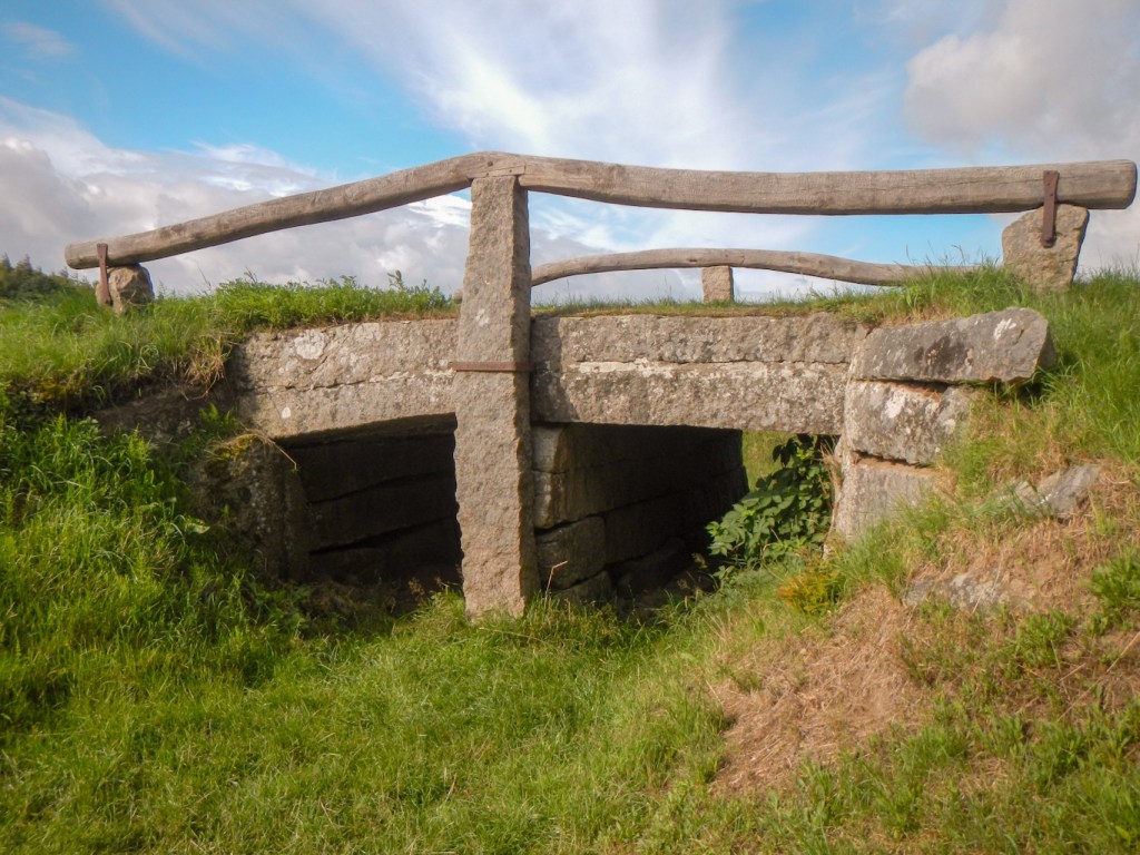
It rained overnight but was dry in the morning. The German couple cycled off as I finished packing only to return five minutes later needing to repair a flat tyre. Hence in the end I was away before them and reached Immervad Bro, constructed in 1786 and the oldest bridge on Hærvejen.
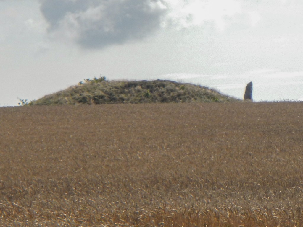
I hadn’t walked for much longer when I reached a side path – only 200m to the Bronze Age burial mound of Strangelshøj. Adjacent to the mound, there is a 2m high standing stone and there is a legend that the scent of freshly baked bread will make the monument turn. from my vantage point, I saw the German couple cycle past – evidently the flat tyre only took about thirty minutes to be repaired.
A few yards further along the route I came across a tenth century runic stone. Only the name Hærulf is carved in the stone and no-one knows who he was. After Denmark’s defeat in the war against the Prussians in 1864, the stone became war booty and was taken to Berlin but was returned to Denmark in 1952.
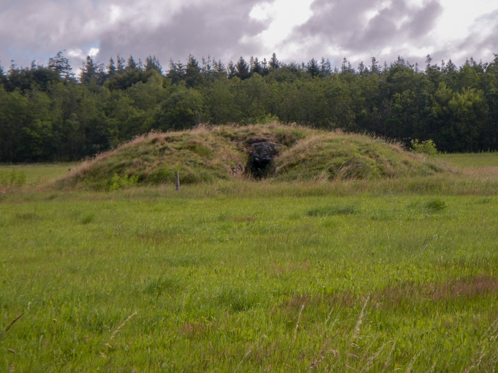
South of the village of Øster Logum with the usual whitewashed Romanesque church I reached the line of the First World War German defences which stretched across Jutland from east to west. The purpiose of this line was to guard the vulnerable German north flank from attack. The entire position consisted of 900 bunkers, 33 artillery positions, trenches, barbed wire entanglements etc. By mid 1917, the line was one of the strongest defensive lines in the world.

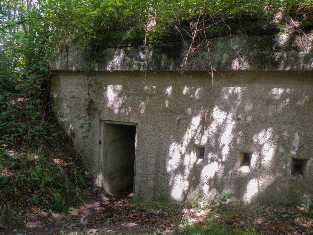
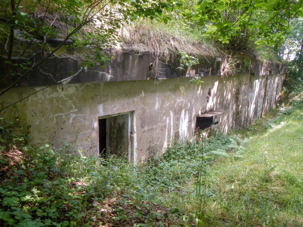
Today it’s possible to enter 31 of the bunkers. I took a deviation off route to explore Andholm which is is one of the few batteries that was not blown to pieces. The post was on private land and the owner wanted to preserve a memory of the time. The three bunkers are hidden in woodland but are almost intact.
The deviation took a bit longer than I had expected but fortunately I didn’t have far to go to reach my destination for the day at Rødekro. it was a pity that I missed a sign and ended up on the east side of the town, as in fact the Hærvejen goes directly past my booked hotel.
The market town dates back to the mid 19th century and got its name from the inn which was there in 1642. I stayed in the very modernised building on the site of the old inn. As I ate breakfast the next morning I noticed photographs and etchings of the old inn at different periods.
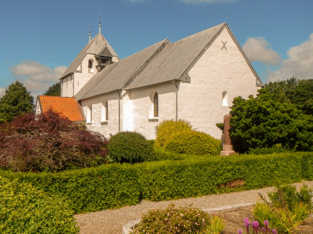
I arrived at Rise. This was the principal town in the area until the mid 19th century. The large whitewashed Romanesque church is sited at what would have been one of the most important cross roads on the Hærvejen.
I wondered why the footpath deviated away from the cycle route only to reach a major road. However this was obviously desingned so that the walker didn’t miss the three burial mounds at Hjulgraven. These were excavated in 1980 when the adjacent industrial area was being developed. The biggest mound appeared to have been constructed in four stages and used as a burial site from the late Stone Age well into the Bronze Age.

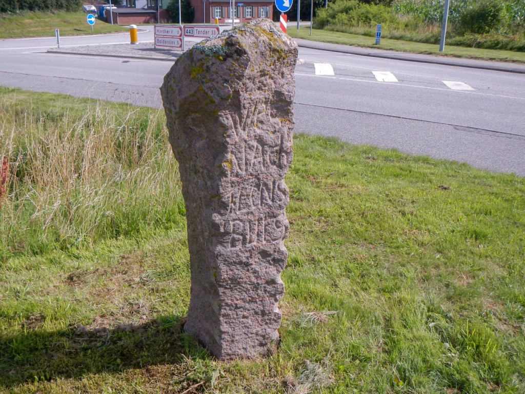
Soon after this, there was an old granite signpost on the Hærvejen.
A sudden heavy rain shower coincided with me passing a picnic area with a covered shelter. A Danish woman out for a day walk was already taking refuge. She turned out to be a teacher and explained that over the last thirty years she had organised many excursions for schoolchildren to experience theatre, music and cultural events in London. Brexit was making this more difficult although not impossible. I was impressed by her knowledge of UK politics in comparison with my almost non existent knowledge of Danish politics.
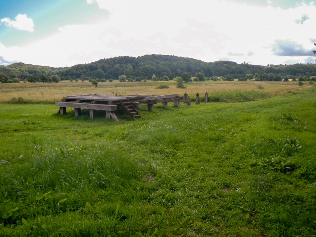
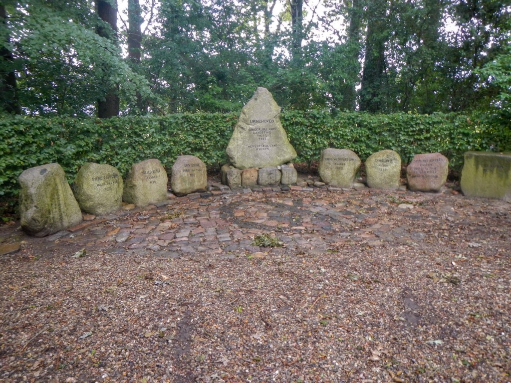
She explained that I should be sure not to miss visiting Unrehoved Tingsted just a little way further on. Southern Jutland had its own parliament here until 1523 and there were various memorial stones in a scenic grove that was established in 1946-48.
I reached a second old bridge (Povis Bro) on Hærvejen where I ate lunch. The bridge passes over Bjerndrup Mølleå and dates from 1844.
My route skirted Kiplev so I missed seeing the church which was one of the most important places of pilgrimage in the late Middle Ages. For some reason there was a small dog leg on the route as far as the out of town shopping centre complete with MacDonalds. I followed the diversion but I wasn’t tempted by MacDonalds and just continued past on the marked route.
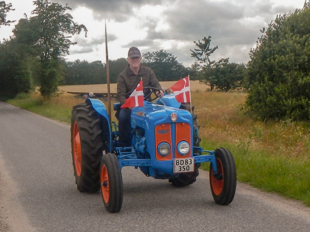
I was almost at my planned overnight camping and shelter spot at Bjerndrup when I saw five vintage tractors resplendent and shiny with Danish flags flying from them. The cheerful drivers waved as they passed me and I took photographs.
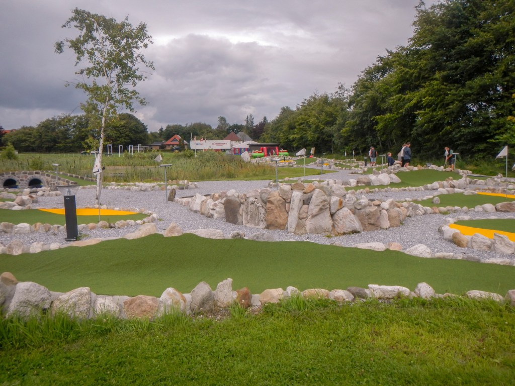
When I arrived in the village, Danish flags lined the main street. I made my way to the shelter area behind a crazy golf course, passing a large marquee and a solitary shiny green tractor that seemed to have missed the procession. I pitched my tent next to the shelters. Some people playing crazy golf explained that this was the day of the “city” carnival and they were expecting jousting and horses that evening!
The facilities for me were a water tap and also toilets in a section of the community centre. There was also an outdoor electric socket. All was available “gratis” and there was even a table tennis table although there was a fee to play crazy golf.
Sadly it started pouring with rain and there was no sign of it stopping. I retreated to my tent. The bouncy castle next to the marquee was deflated and evidently the horse jousting was cancelled but the disco party continued. Two Bavarian men turned up at 21.30 to occupy one of the shelters – they had driven all the way from Bavaria and reported that they had already tried to get in at a couple of other shelters but these were fully occupied.
The party with an extremely loud bass beat continued and I found out from some volunteers clearing up in the morning that it had gone on until 02.00am. I had fallen asleep before that. Sadly the washed out village party and carnival had been a year in the planning.
I packed my tent away dripping water but was fortunate to be able to pack my rucksack under shelter.
I reached the third of the old bridges on Hærvejen. The Gejlåbro was constructed in 1818 although there had been previous bridges at the site. A number of flat stones under the bridge are thought to date back from the ford that was here prior to the first bridge.
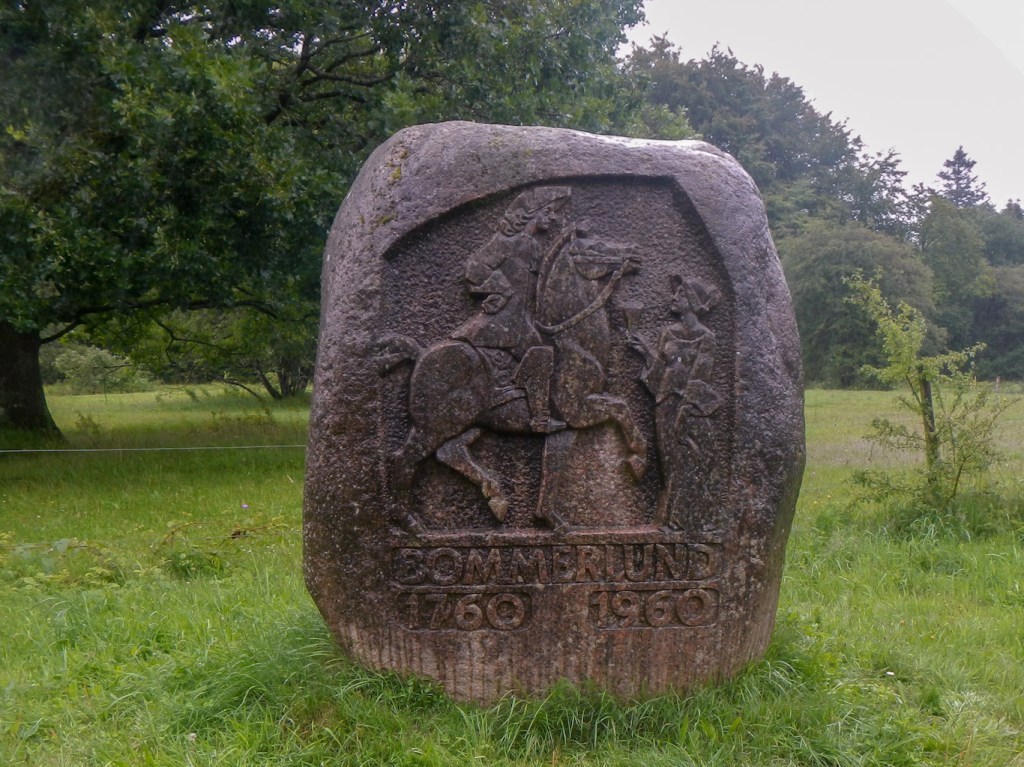
Not far from the bridge, I came across a stone depicting a carved horseman. This was erected in 1960 at the place where Bommerlund Kro was sited. There is a legend that the recipe for Bommerlund Snaps arrived at Bommerlund Kro in the hands of an exhausted French horseman who gave it to the innkeeper to thank him for treating him so well during his stay.
It was pouring with rain so I diverted to a nearby shelter area in the plantage to rest for a few minutes. The site was occupied by a tent with a couple of bicycles close by so I assume the occupants were still in the tent due to the inclement weather. Unfortunately I couldn’t quite remember which path I had come in on when I diverted so I just followed tracks which were in the correct compass direction through the large forested area.
I found the path with signs and was on a major road which passed over the motorway. Fortunately there was a pedestrian and cycle path. It was still pouring with rain. A cyclist stopped and asked me the way to somewhere – I tried to find the place on my map, but then he told me it was 100s of km away!
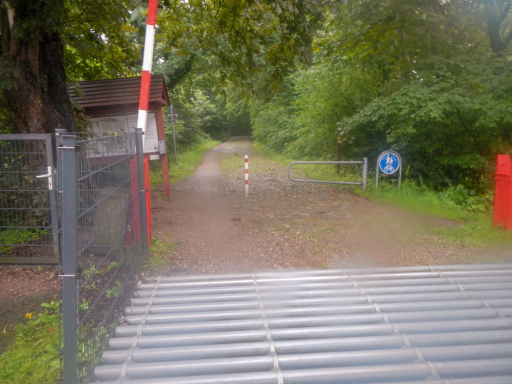
I left the road as soon as possible and made my way through woodland and along minor roads to Krusa, virtually on the Denmark-Germany border. At the border which I reached at 1pm, the E1 was signed as such on the German side.

I crossed the border and followed the E1 on the German side for a short distance. However that is a walk for another time and my overnight hotel was back on the Danish side at Padborg. I managed to find the old border crossing on the Hærvejen, now only open to pedestrians and cyclists. It’s a cobbled pathway.
It was still pouring with rain. I made my way to my booked hotel for my final overnight stay in Denmark. There was a lot of equipment to dry out in my hotel room. Fortunately I spotted a couple at breakfast the next morning who looked as though they were walkers. They were as grateful to receive my half canister of stove fuel as I was to give it to them as I couldn’t take it on the plane. I caught a train to Hamburg the next morning in order to fly home. My adventure in Denmark was over.
I enjoyed walking in a country so full of friendly people and with so much superb scenery as well as a fascinating history. The primitive camping spots and shelters are excellent; if I had realised just how good they are and easy to find and use and usually with a drinking water supply then I wouldn’t have booked so many nights in hostels and hotels.

Wonderful to read your blog Kathryn. Some great memories for us too. Was lovely to meet you (twice!). Happy travels. Nicola and Martin 🙂
LikeLiked by 1 person
This is an amazing challenge. I hope you will manage to walk the full length of the E1.
LikeLike