18-28 April 2023
The Isle of Man is unique. The island was purchased by the British Crown in 1765 from the Stanley family (the Earls of Derby) who were feudal Kings or Lords of Man. It’s not part of the UK and so has its own government – the Court of Tynwald, probably the oldest surviving parliamentary body in continuous existence in the world. However I didn’t need to carry a passport to travel from the UK. The island has its own Manx currency, which is aligned to the UK pound – so UK notes and coins are accepted but any change is more often than not Manx which is only legal tender on the island. Any items posted on the island need to have a Manx stamp.

The Isle of Man Government website ( https://www.gov.im/about-the-government/departments/cabinet-office/external-relations/crown-services/office-of-lieutenant-governor/ )explains as follows: “As a self governing Crown dependency, the Crown has ultimate responsibility for its good government. Whilst His Majesty’s UK Government is responsible for the Island’s Defence and International Relations, the Isle of Man is not part of the United Kingdom and has its own Manx Law under which it passes Acts of Tynwald and makes its own Regulations (as Primary and Secondary legislation). The UK Parliament has paramount power to legislate for the Isle of Man on all matters but it is a long-standing convention that it does not do so on domestic matters without the Island’s consent.”
My interest in the Isle of Man for this project of “map adventures” is that it has a 1:50,000 Landranger Ordnance Survey map so is included; unlike for everywhere else, there is no corresponding 1:25,000 Explorer map published by the Ordnance Survey.
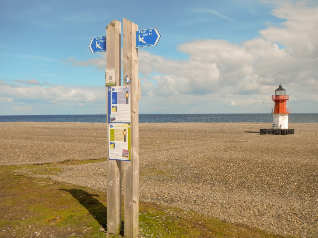
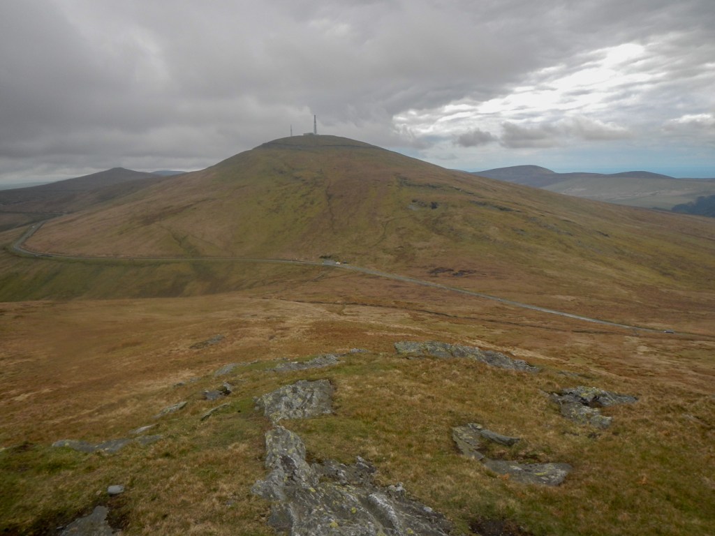
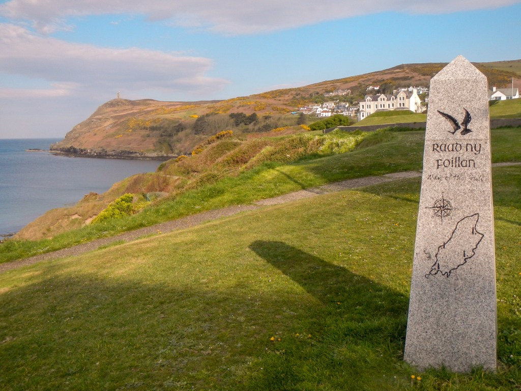
My planned adventure involved walking round the coastal path – Raad ny Foillan (The Way of the Gull) and also taking a day to climb to the high point (Snaefell) and then follow a ridge walk including North Barrule (the second highest summit and a fine viewpoint).
I planned the circular walk over seven sections varying between ten and twenty miles so there was time to explore as well as just walking each leg. We stayed in excellently sited luxurious four star self catering accommodation at the small hamlet of Cronk-y-Voddy, halfway up the island. This meant that all my start and finish points were within a half hour or so drive. https://www.visitisleofman.com/stay/the-forge-p1316791
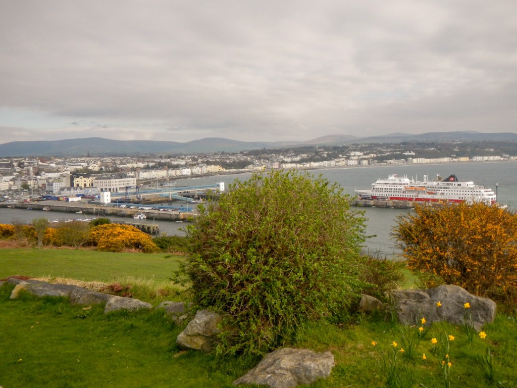
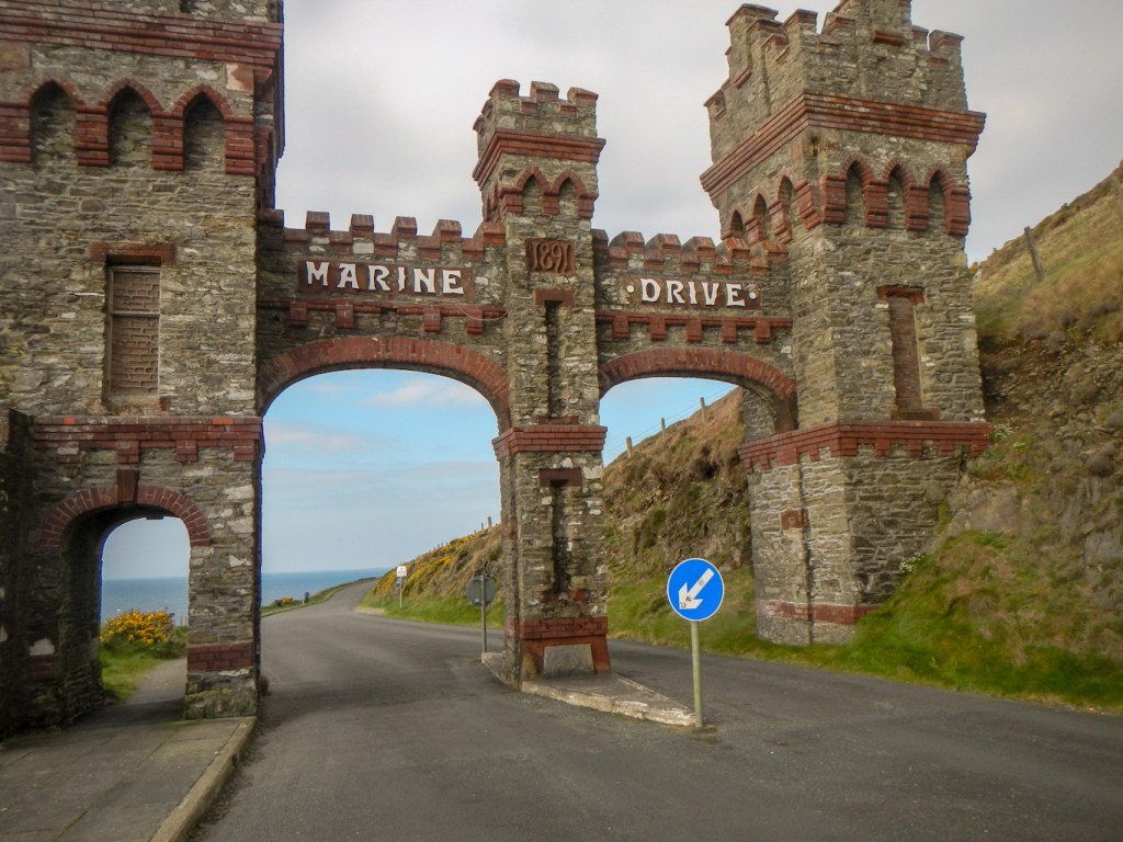
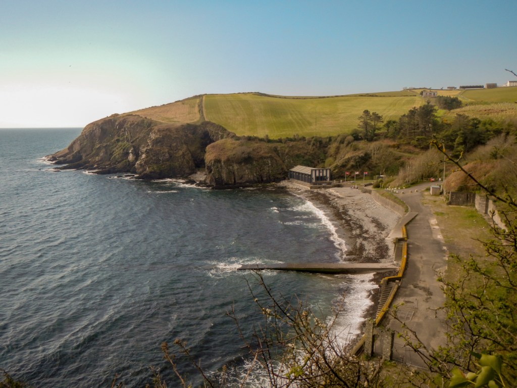
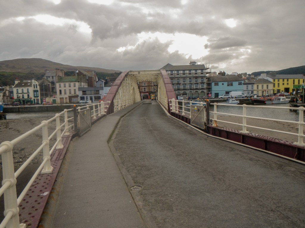
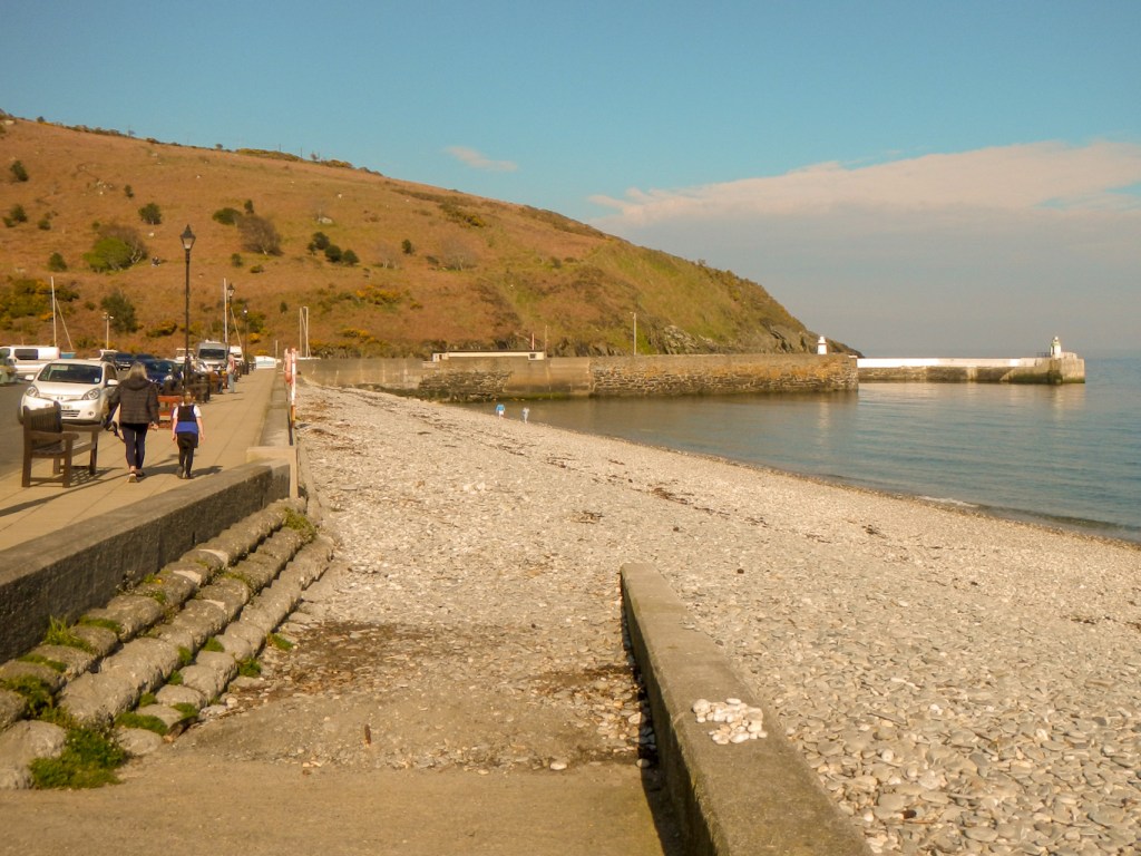
I started from the main town and the ferry port of Douglas but soon left the bustling town behind me. The path climbed up some steep steps and then over the tarmac surfaced Marine Drive – built in Victorian times as an electric tramway route but now a quiet scenic road which is almost traffic free and at risk from cliff fall from above and cliff erosion below.

As I approached Port Soderick on a narrow path with steep steps, I saw further remnants of Victorian and later tourism with remnants of a funicular railway, a promenade and pleasure grounds. A friendly dog walker coming towards me recommended that I visit the building next to the beach to look at some old photos of the area in its heyday – “It won’t take five seconds”. By the end of our conversation, I had discovered that I was talking to Lady Philippa Lorimer, wife of the current Lieutenant Governor for the Isle of Man (the King’s personal representative on the Isle of Man). Quite surprising who it is possible to meet out on a walk!
Of course Philippa was correct that my visit didn’t take five seconds – it took most of an hour! I was welcomed warmly by a volunteer who introduced himself as “Scouse” – but was keen to tell me he’s not from Liverpool. He is a retired submariner and explained to me about the phenomenally successful work being achieved by “Heroes on the Water”: https://heroesonthewater.im/. Essentially it’s a charity that provides a service to wounded military and blue-light workers who have suffered mental and/or physical health problems arising from their work. He told me that he had visited the project and received help and then decided that he wanted to give back something. He also informed me about the much appreciated support of the project by Sir John and Lady Lorimer so wasn’t surprised that I had been advised by Philippa to take a look. I did see the old photos of Port Soderick and I was given a cup of coffee; however the highlight was learning about the work that this charity has done to give wounded individuals reasons to continue living and to turn their lives around.
My walk continued round the island with different landscapes unfolding each day. There is clearly a good reason that the Isle of Man has been called the UK in miniature.

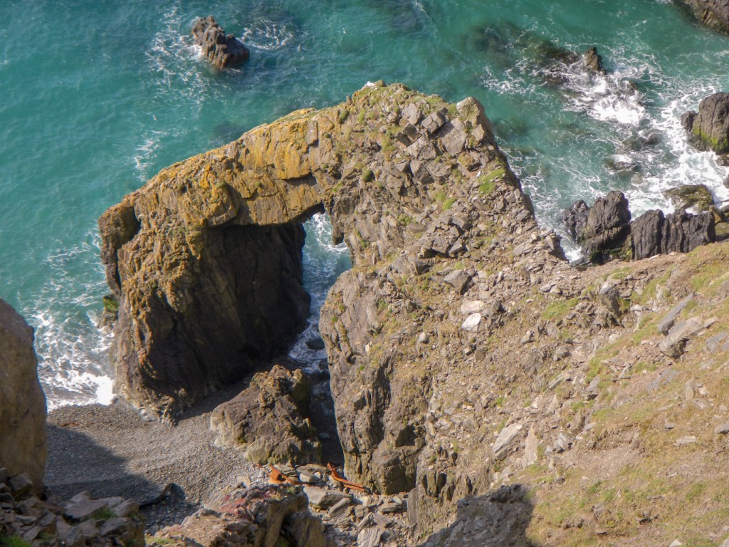
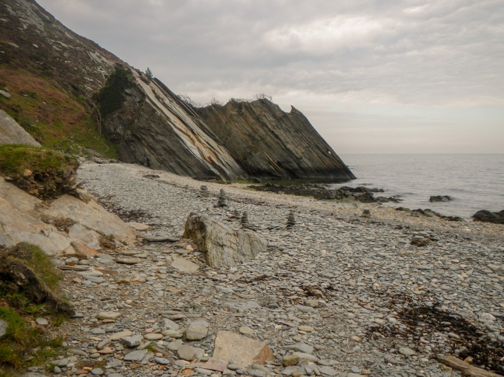
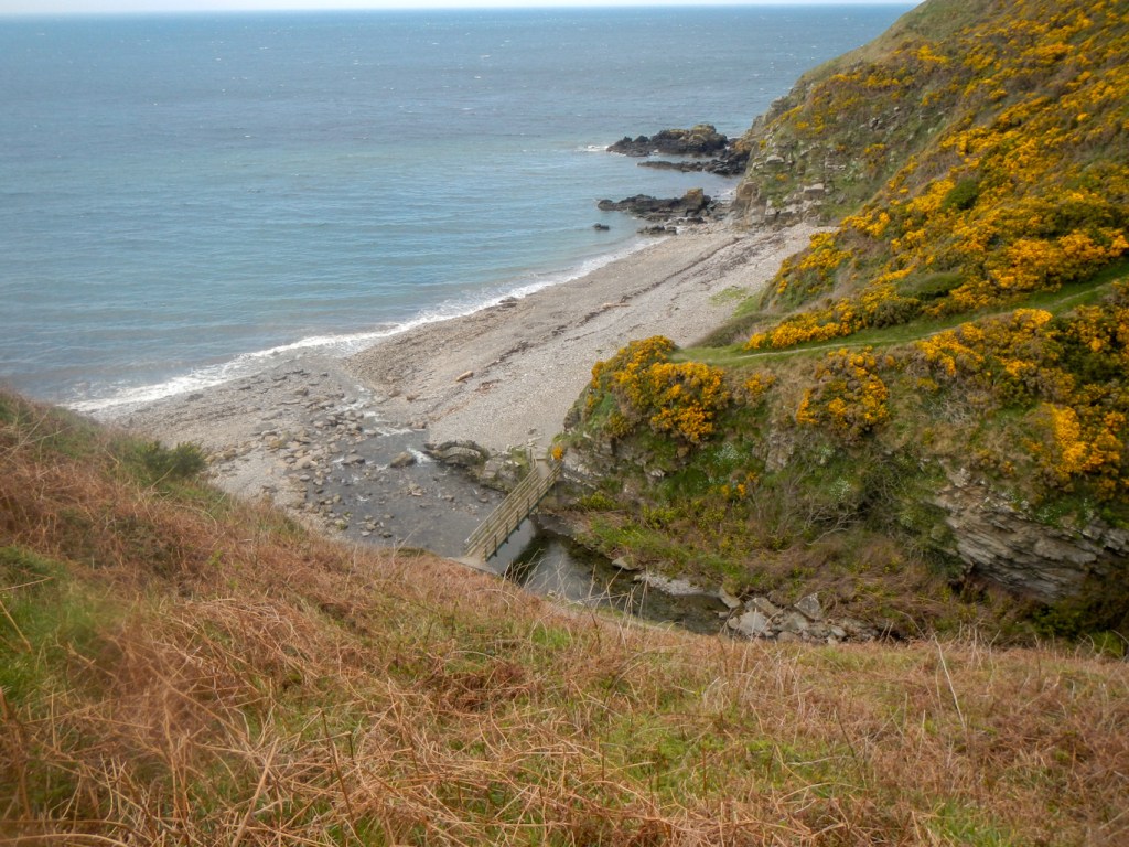
The south of the island is hilly with awesome cliff formations forming coves and bays.
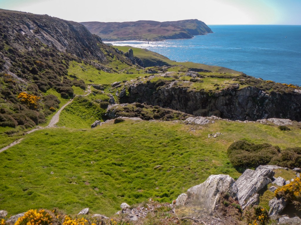

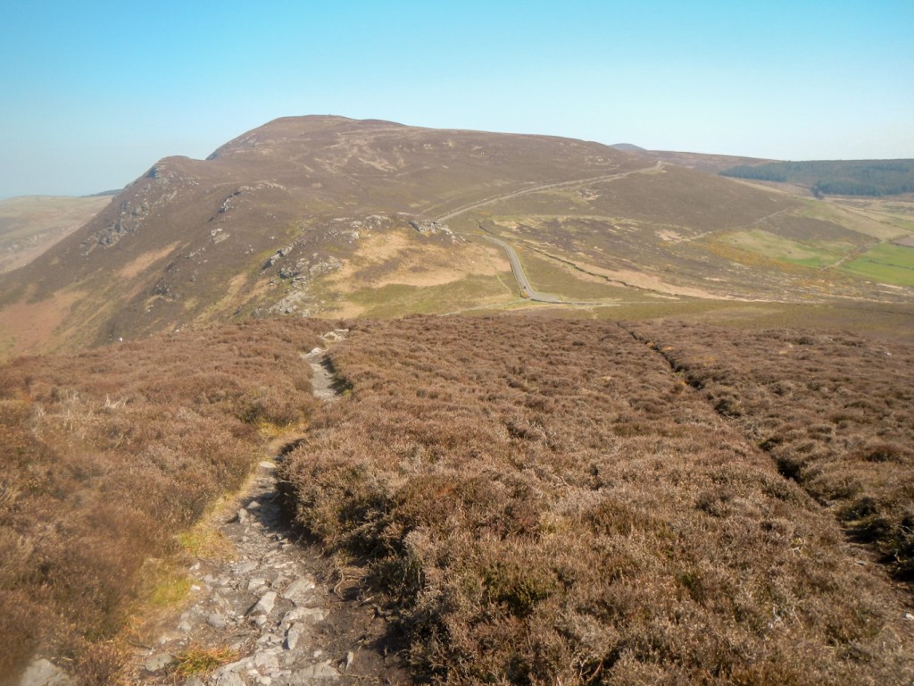
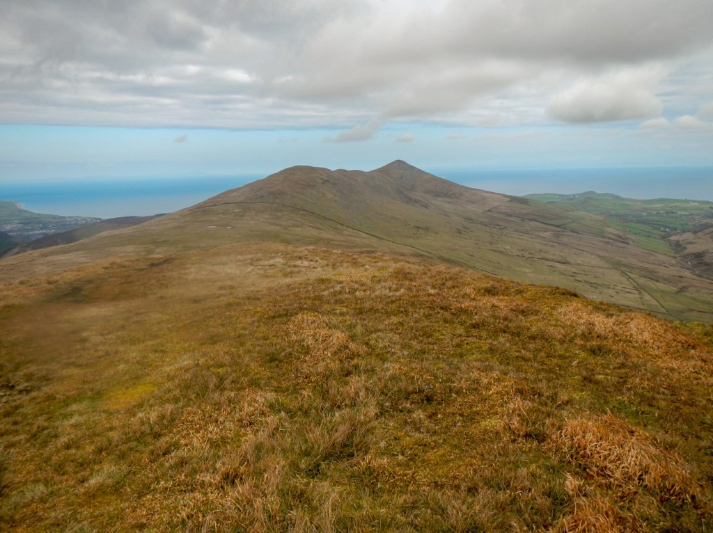
The middle of the island is mountainous and, on the west side between Port Erin and Peel, the mountains extend as far as the sea with sheer cliff faces. The path passes over three remote moorland peaks and a lower level path is recommended in poor weather. I was fortunate to enjoy good weather to complete this section.
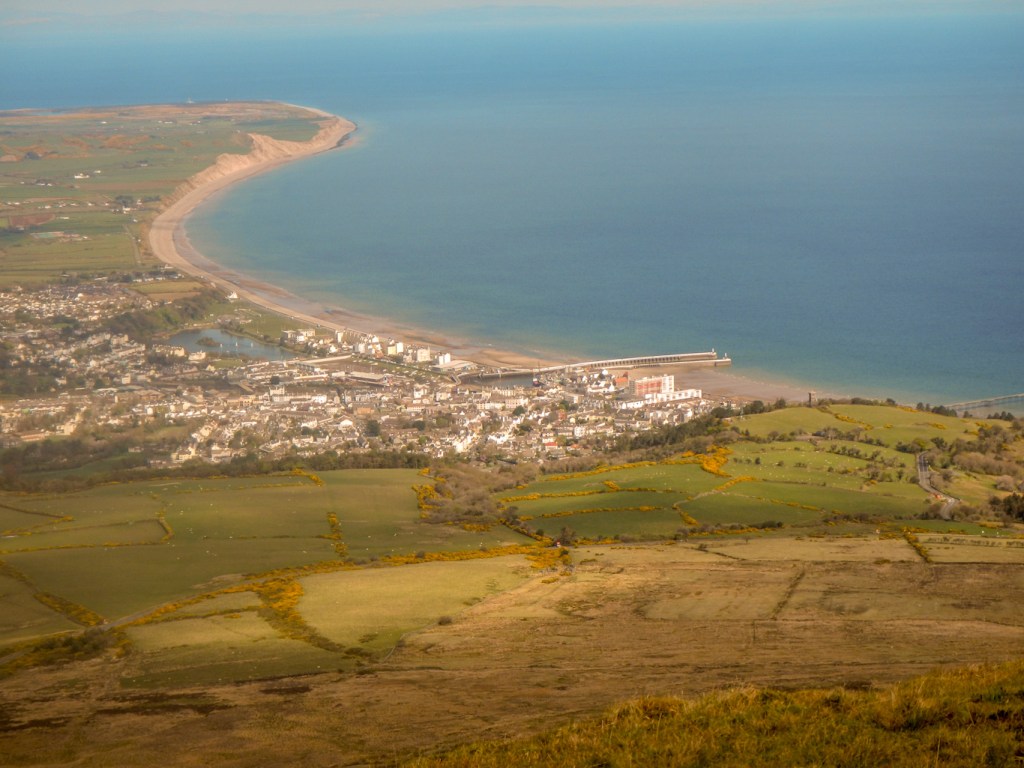
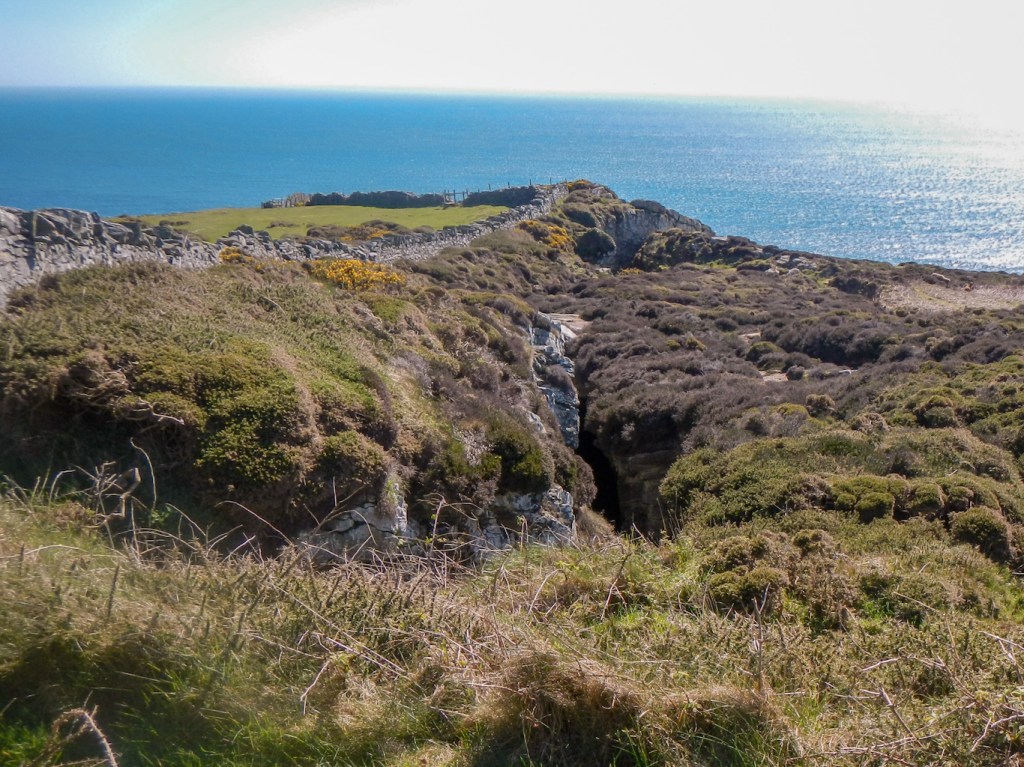
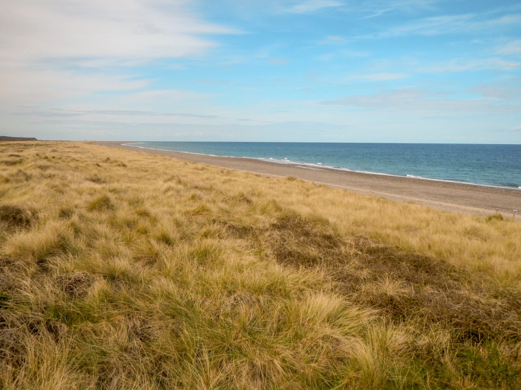
The north of the island is much more flat with long sandy beaches, backed partly by dunes and partly by muddy unstable cliffs. The walk becomes tide-dependant with many miles walking on the foreshore, although I was also able to walk on paths over the extensive area of rare lichen heath habitat in The Ayres Nature Reserve

Unfortunately, due to the tide times, my plans for each day and the unwillingness of my husband to offer drop offs at what might be construed as unreasonably early in the morning, I wasn’t able to walk on the foreshore for a few miles of the route north of Ramsey to get around Shellag Point. I resorted to some road walking interspersed with a marshy footpath and a path through fields then past Ballaquark Farm. However, I enjoyed excellent views of Snaefell and North Barrule where we were to walk together the following day (a break from coastal walking). I also met a very friendly farmer who was pleased to have completed lambing in February when the weather had been remarkably dry. His colleagues who had chosen to lamb later in the year had struggled with the waterlogged ground and there had even been a freak snow storm two weeks previously. He wasn’t surprised about the boggy area and recounted tales of seeing some walkers in white trainers, who tended to retreat quickly!
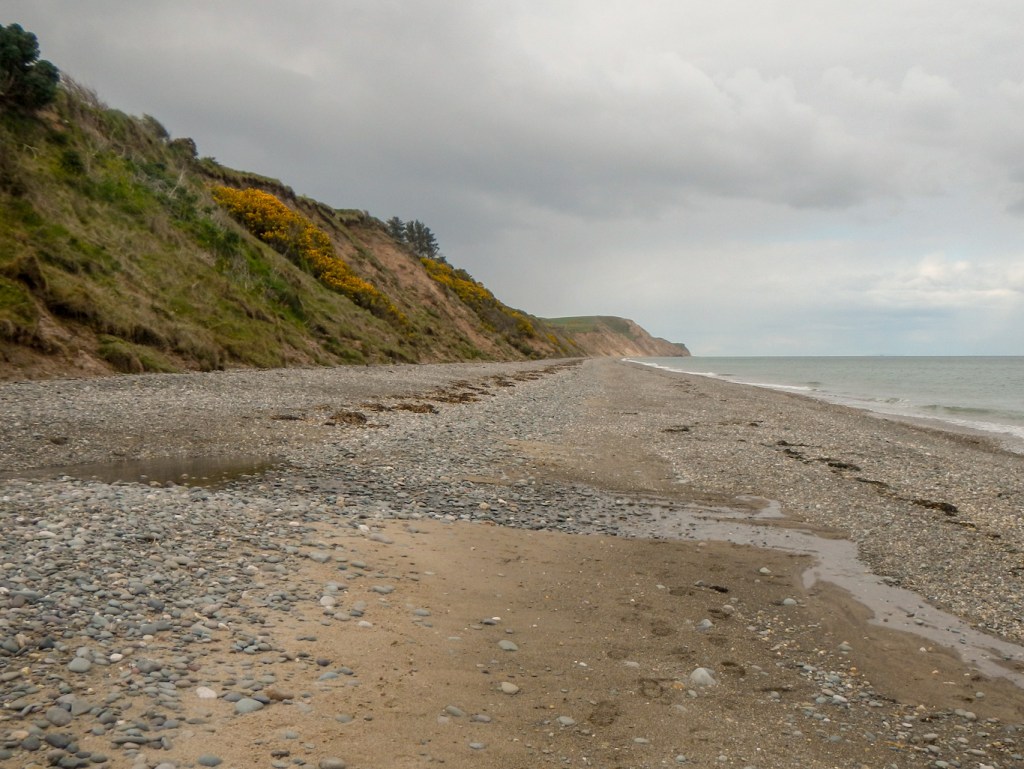
I managed to regain the foreshore using a path onto the beach at Dog Mills. However it was quite hard work walking on the shingle so I was pleased to have taken the more inland route rather than struggle on shingle for what would have been several miles. It’s a pity that it hasn’t been possible to negotiate with landowners and offer off-road, cliff top alternative paths to the beach route.
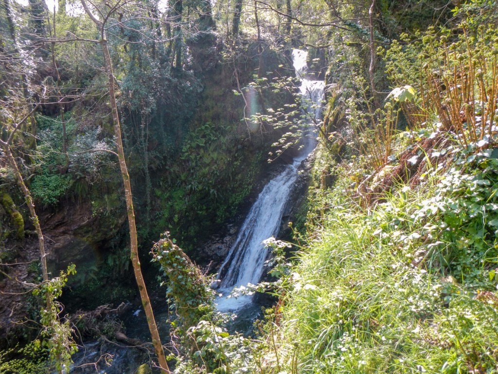
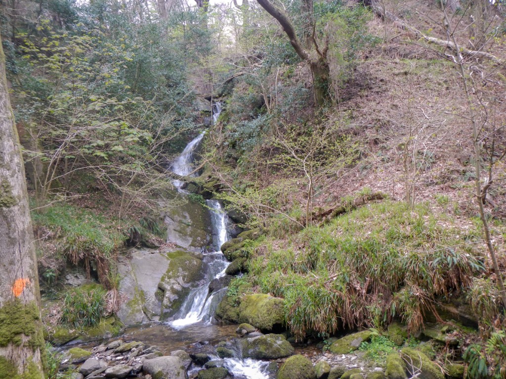
The many steep wooded glens traversed by fast flowing streams including spectacular waterfalls are a further feature of the landscape. The two that I found most impressive both involved a small diversion from the main route. I visited the triple tiered Spooyt Vane hidden in Glen Mooar.
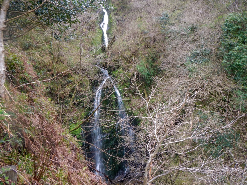
The very best glen that I visited was on the penultimate day walking to Laxey. Part of the path in Dhoon Glen was closed due to a landslide but fortunately there was a diversion. This involved descending multiple precipitous slopes, luckily on a path that included some steps. I climbed down all the way to the equally scenic cove of Dhoon Bay, where I met a couple with dog on a walking and campervan holiday. Despite living in Morecambe, so close to the departure point for the Isle of Man ferry, it was their first visit to the island – and they seemed to be enjoying it just as much as I was.
From Dhoon Beach, I had a hard climb back up the Glen and then a further uphill trek before walking along a quiet “B” road followed by a very stony and steep downhill path to reach Laxey. The superb beach café was still open and I managed to fit in what I thought was a well-earned reward: whippy ice cream with cake as well as a coffee before closing time. Thanks to the lovely staff there! https://www.facebook.com/laxeybeachcafe/?locale=en_GB
It’s a real pity that part of the walk after Laxey includes a stretch of walking along a busy road without a raised pavement for much of the way between Fairy Cottage and Ballagawne. It was even worse when I saw how poor the visibility was to cross the road and access the track to Garwick Glen (I had been walking facing the oncoming traffic). However having reached Garwick Glen, things improved and I was walking on footpaths and minor tracks and roads all the way to Groudie Glen and the outskirts of Douglas.
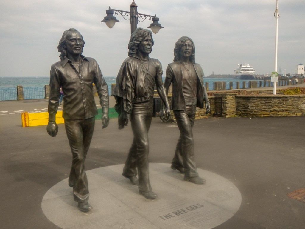
A precipitous and narrow footpath diverted from the pavement; it actually felt like I was going through people’s back gardens at times. However there followed a stretch of walking on a wide pavement and promenade, Douglas Bay to my left and the town to my right. I made rapid progress, partly because I thought I would be late at the far end for my pre-arranged pick-up point. However my husband was waiting near the Bee Gees statue to make sure I didn’t go past without taking the obligatory photograph.

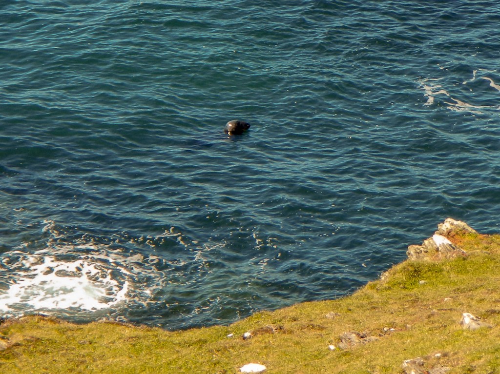
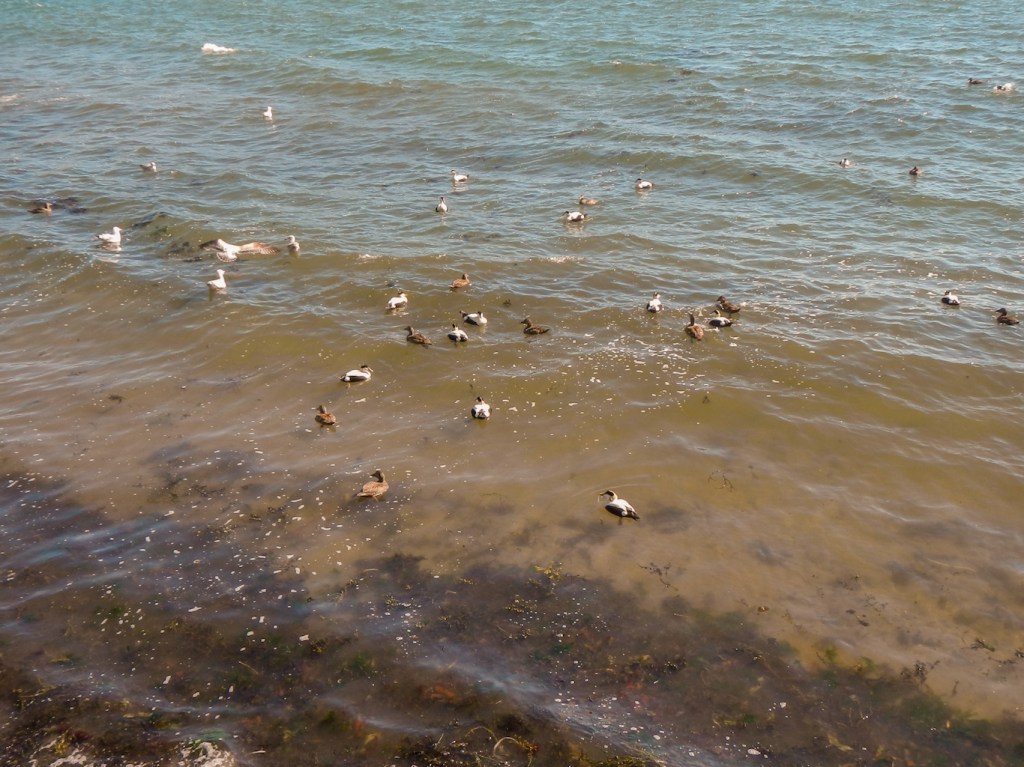
Apart from coastal scenery, highlights included historic monuments and wildlife sightings. I wasn’t fortunate to spot any whales, dolphins, porpoises or basking sharks. However I did see a couple of seals swimming in the water.
I saw and heard countless birds – robins, chaffinches, tits, skylarks, gulls, cormorants, oystercatchers, tern, heron, ducks, geese and am sure I even saw a hen harrier which I recognised by its owl-like face.


The coconut scented gorse rarely seemed to far away from me. There was also masses of pungent wild garlic. Primrose, bluebells and celandines provided an abundance of colour.
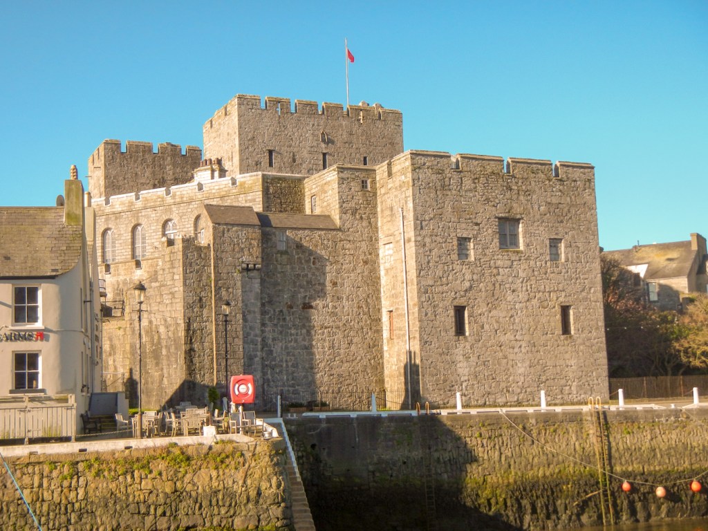
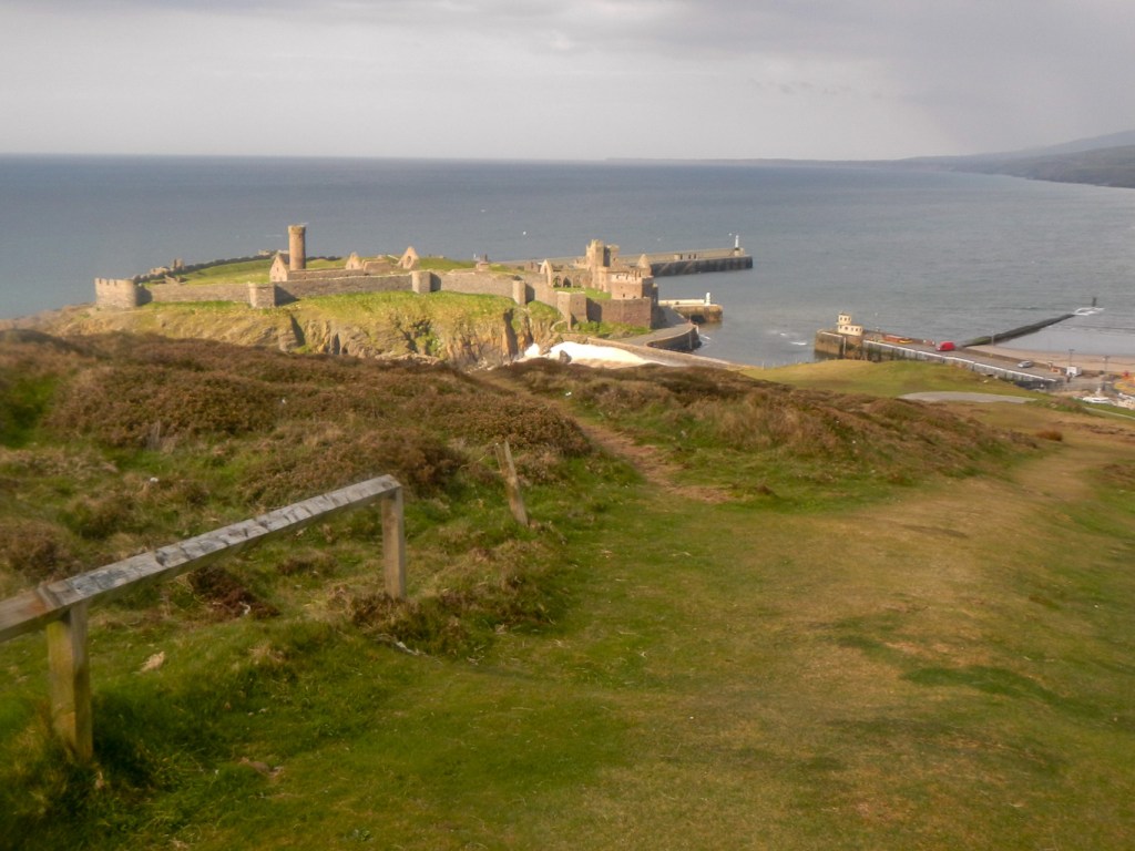
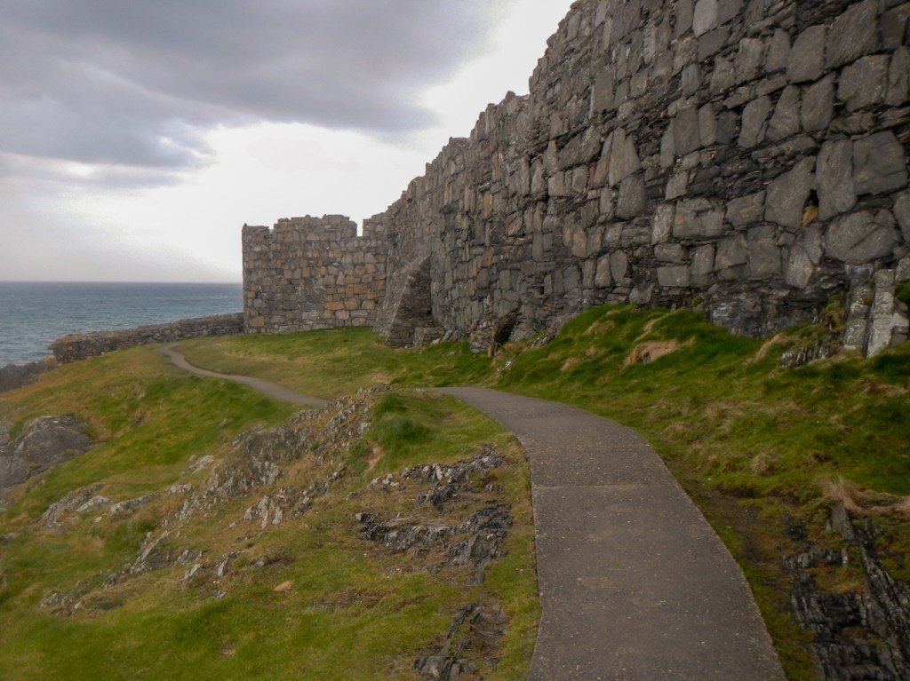
Historic buildings include the massive castles at Castletown and Peel. I particularly enjoyed the impressive approach I took to Peel over a broad green track. It’s not actually the official route but gave superb views of the harbour and the Castle perched on St Patrick’s Isle. I even extended my walk by circumnavigating the castle on a path below the walls.
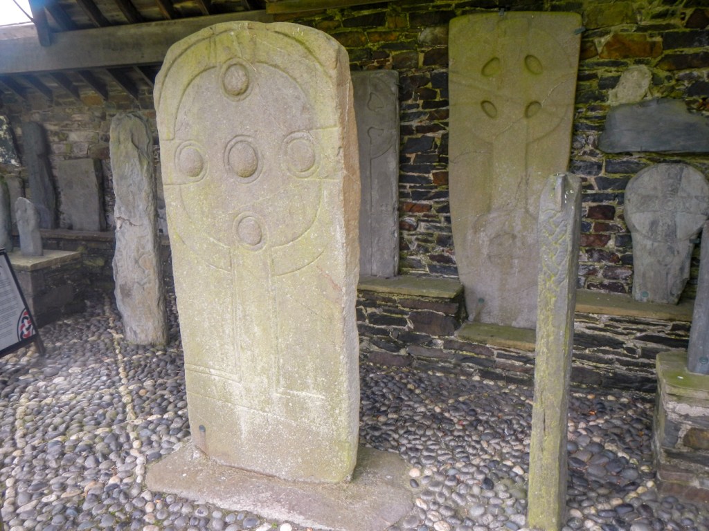
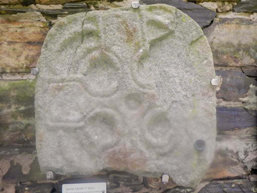
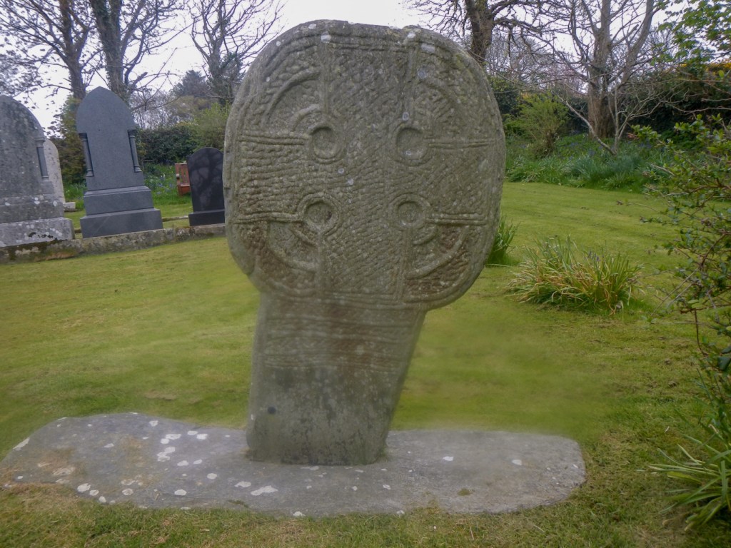
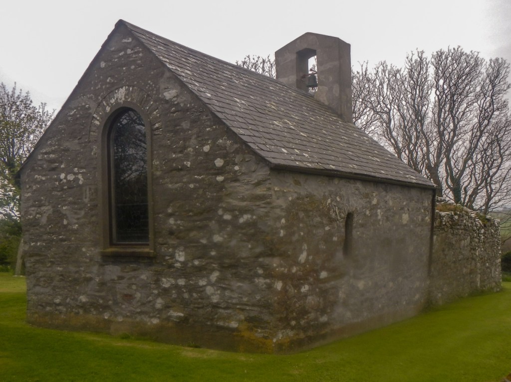
I looked at the famous Manx crosses at Jurby Church, at Maughold and at the tiny Lonan Old Church. The last was my favourite: a remote location with a scenic and well tended churchyard. There is a collection of stone crosses in a shelter, but also an impressive 7th-9th century wheel headed cross in situ to the south of the church building. I was fortunate to be able to pass through an archway into the ruined part of the church and then into the restored eastern end. As evidenced by an order of service for a funeral dated on the day of my visit, so presumably held earlier in the day, the church is in active use. As I left another visitor arrived, remarking that she had struggled to find her way with it being so tucked away at the end of a very narrow lane.
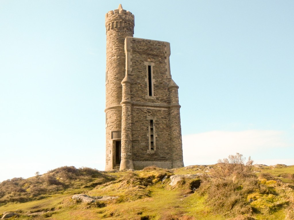
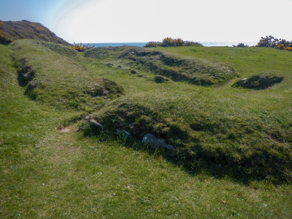
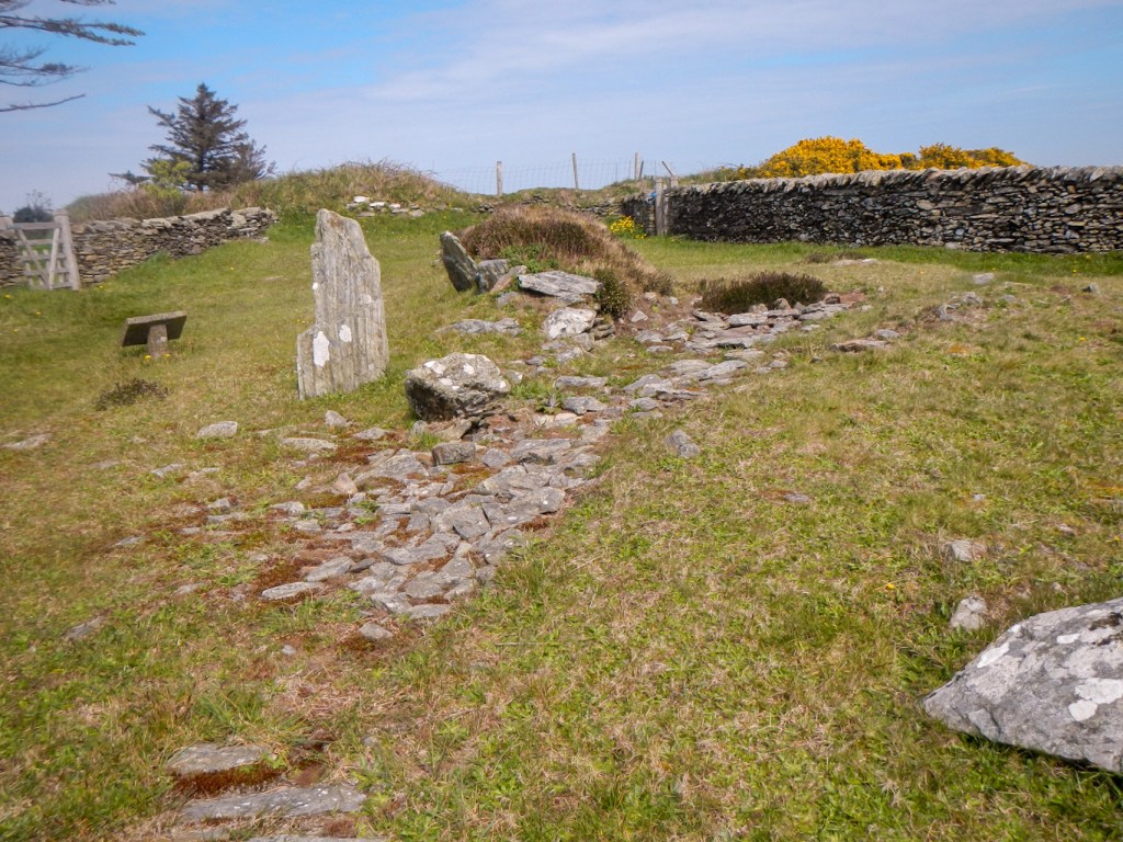
I didn’t have time to visit the restored historic village at Cregneash but I did climb the hill from the coast path to look down on the village. The island has evidence of earlier occupation too including Neolithic burial sites.

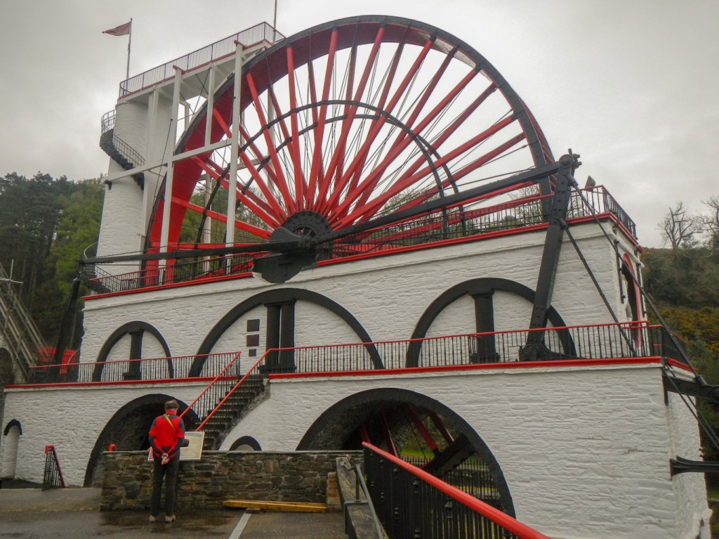
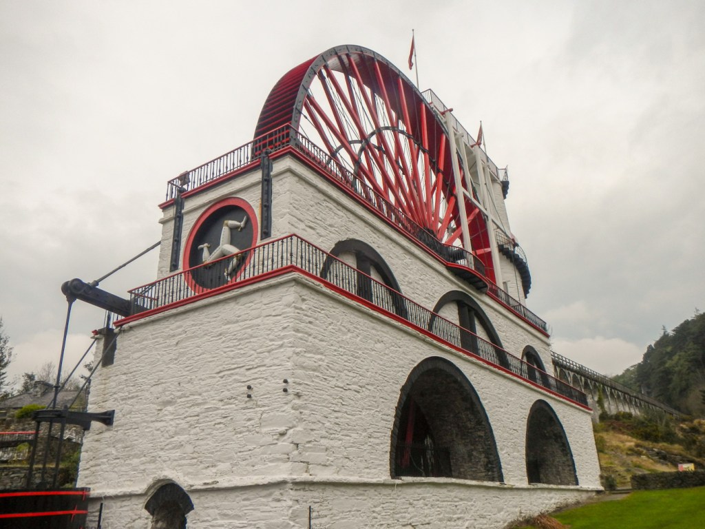
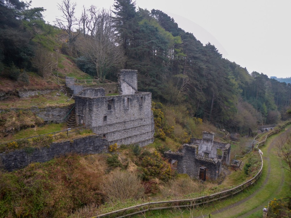
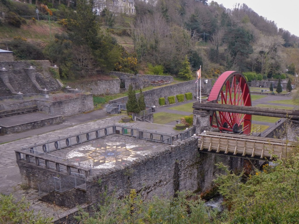
The final day of my circumnavigation was short – just ten miles. Hence before setting off, I spent the morning with my husband exploring the huge Laxey waterwheel and other relics of the lead and zinc mining previously carried out in the area.
As for the mountain walk, I did this accompanied by my husband. The main road through the mountain area was closed for upgrading ready for the TT season so we adjusted our route.
I think that by the end of our ten day stay, I could say quite honestly that in many respects the Isle of Man is a microcosm of the UK, offering a wide variety of splendid countryside and an abundance of wildlife. It definitely has more to offer than just motor bike racing!

Thanks for that write up, reminded me of a trip I did when I walked around the island bivvying wherever, 1990. Lovely place great times.
LikeLiked by 1 person