14-15 January 2023
I’d stayed in Central London overnight and so I made an early getaway on the Central Line. It was amazingly efficient with the tube arriving as soon as I set foot on the platform at Lancaster Gate. I reached Loughton Tube Station before 9am. It seemed odd to alight from a tube train in what appeared to be a leafy country town. I strolled past an enormous Sainsbury’s supermarket then up the High Street which was very quiet as the shops hadn’t opened for trade. I spotted a multitude of useful and interesting stores including an independent bookshop and also a branch of Robert Dyas where you can buy almost anything. In fact I was so distracted looking at all the closed shops that I walked past the turning to the forest. I spotted an alternative route up the hill before turning back along a quiet parallel road at the edge of Epping forest.
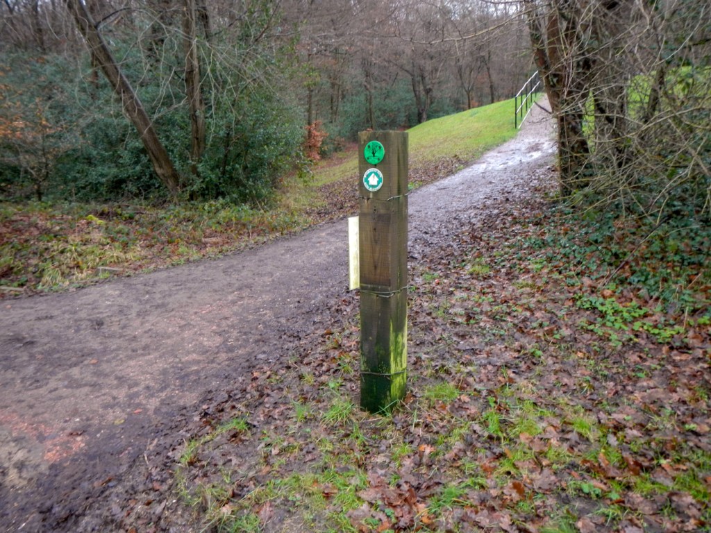
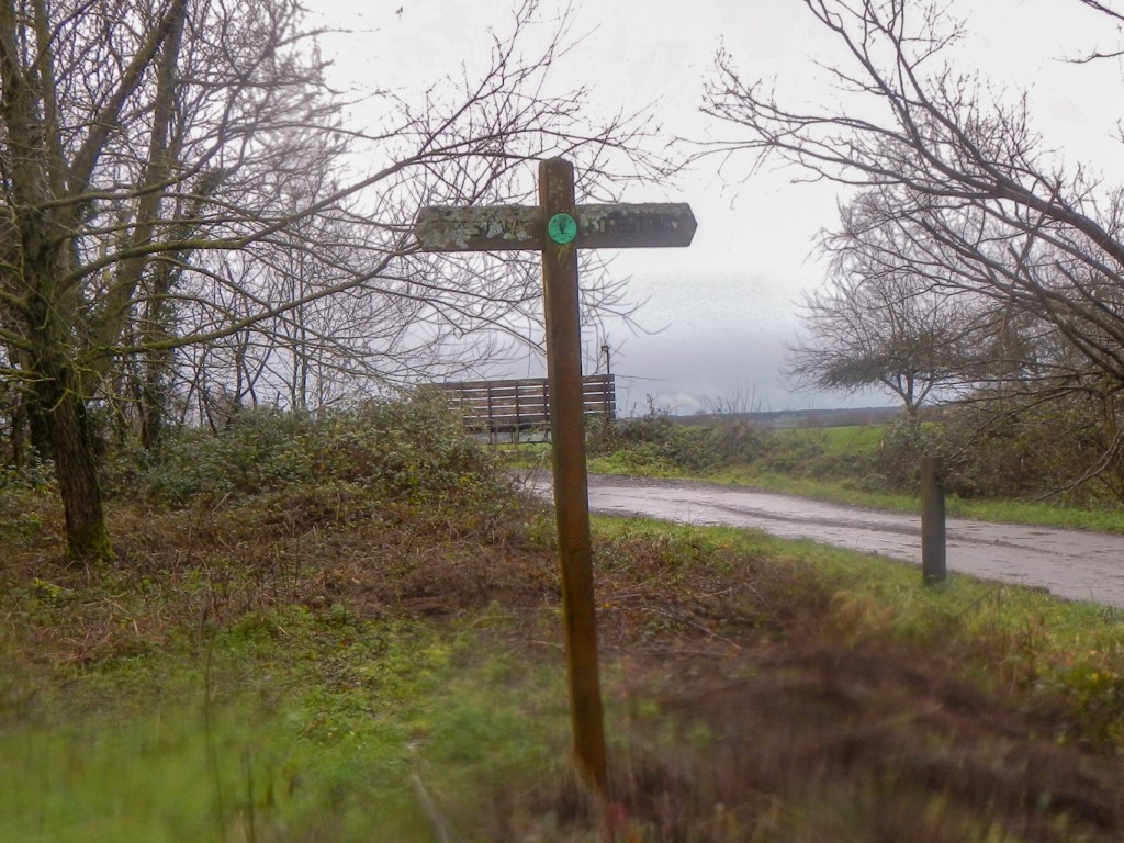
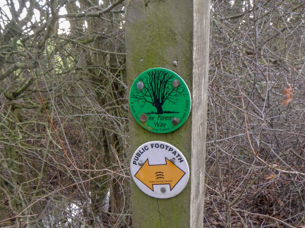
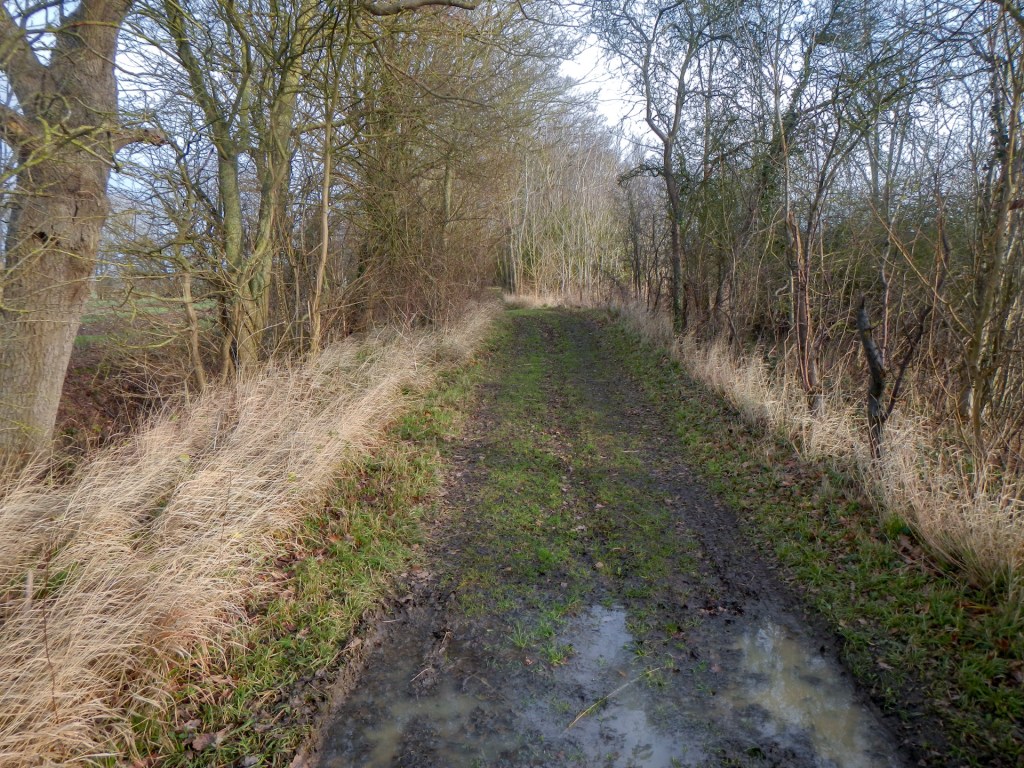
I spotted the first “Forest Way” disc on a post. That seemed positive – the walk definitely still exists as a waymarked trail. The recent wet weather meant that the path was muddy and slippery so I stopped to sort out my trekking poles. To my horror the catch to extend them seemed to have broken – however seemingly it had just caught while packed in my rucksack and I was soon underway complete with working poles.
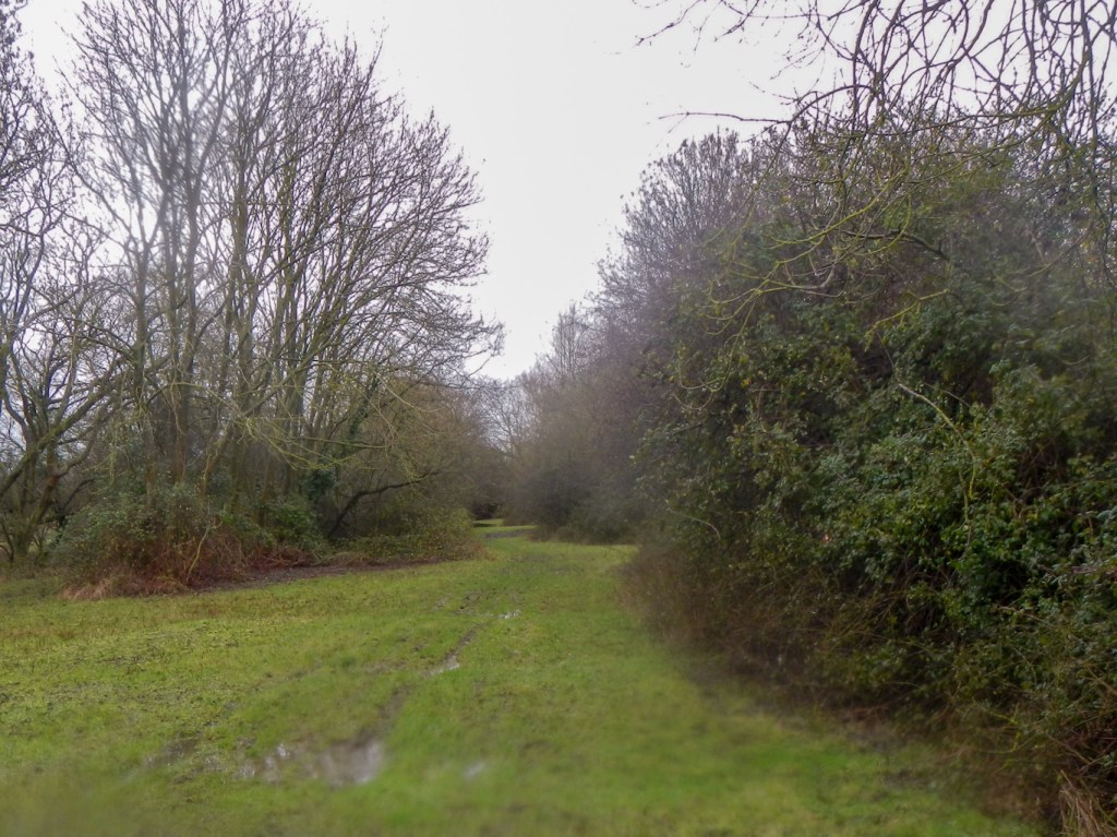
There were several other walkers, although none with backpacks, and a plethora of runners. A single robin was perched on a tree branch as I walked past. Many of the trees showed evidence of previous pollarding. This form of woodland management dates back to Anglo Saxon times or possibly earlier. Approximately every fifteen years, trees would be cut back to a height of 2-5 metres. The branches were used by Commoners for fuel, fencing etc. and new shoots would grow out of reach of grazing cattle and deer. The right of Commoners to lop wood ceased with the 1878 Epping Forest Act. As a result, the trees have grown huge crowns so the woodland floor is permanently shaded and plants such as primroses are increasingly rare.
Epping Forest is part of the former Royal Forest of Waltham. Under the Epping Forest Act of 1878, which was designed to halt further clearance of the forest for agricultural use, the City of London Corporation took control of the forest. Their duty was to keep the forest unenclosed as an open space for public recreation.
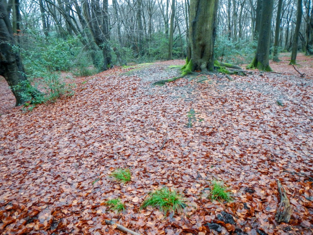
The earlier couple of waymarks had been promising but it was going to be a while before I saw any more. I struck off up a small unsigned path which seemed to fizzle out to nothing. However, keeping on in roughly the right direction I arrived at Loughton Camp. Some signs explained that this is an Iron Age Hill Fort deep in the forest at one of its highest points. The earthen banks would have been three metres high with ditches three metres deep outside them, all built using hand tools. Nowadays there is a small impression of an earthen bank (visible if you know it should be there). In the eighteenth century, Epping Forest was the haunt of highwaymen including Dick Turpin who reputedly had a “cave” built into one of the banks of the fort.
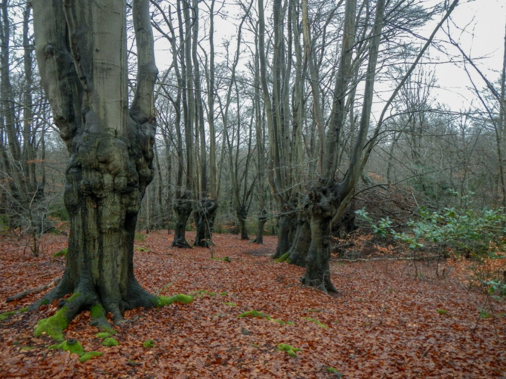
Impressive trees in the area include oak, hornbeam and beech. At this time of year, apart from the mud, the ground is carpeted with decaying fallen leaves forming a natural compost.
There were some yellow arrow waymarks but I didn’t see any Forest Way discs. I made my way through the forest as the threatening rain arrived in earnest. I made a couple of accidental deviations along footpaths that led me in the wrong direction, before arriving at the Epping Forest Visitor Centre at High Beech. It had just opened so I popped in but couldn’t see any information about the Forest Way other than what I already had.
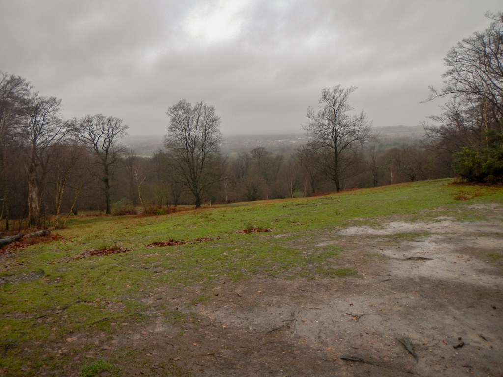
I soon left and proceeded further. There were less people but those I saw included horse riders. At one point there was an open view across the very rural looking but damp and misty Lee Valley.
The main forested area was behind me and I reached a quiet lane through a country estate which now appears to be owned by the City of London Corporation. A bridle path took me past the large and impressive looking Woodredon House. Soon after this, a footbridge took me across the noisy and busy M25. I could hear the roar of traffic for a long time.
I reached a minor road at Upshire and Copped Hall Green. The walk guide mentions it being a good place for a picnic, but not on such a wet day as this I think.
The way soon turned off the road and proceeded across fields. This was by far the worst part of the entire walk. I almost wondered whether to give up on it. I was definitely on the right of way as was evident from my SatMap; however it was across the middle of a ploughed field. Presumably, when the right of way was established, it had followed a long gone field boundary. Very rapidly my boots became covered with thick and heavy layers of sticky mud. At that point, there was little choice but to go on. Eventually I was reassured that I was on the path as I saw the first way mark for a long time. The wooden post was lying on the ground but the disc denoting the Forest Way was definitely there. Soon after that I passed a digging machine in operation – seemingly making a muddy track even more muddy. The driver stayed in the cab which was reassuring for me as I didn’t want an encounter with an angry farmer.
Eventually I passed a long row of farm and excavating machinery and reached Parvill’s Farm where I crossed over the minor road. There was a footpath sign on the other side which I followed over more mud. Unfortunately the footpath disappeared but I soon regained it further on. Near a path junction there were a multitude of signs and various footpaths. Fortunately I picked the correct one and made my way along the track past a stables with lots of cheery motto signs on the fences. This track was part of Epping Long Green – a green droveway with a double hedge harbouring a multitude of plant and insect species. Essex actually has over 800km of green lanes, representing a historic network of minor roads which survive as public rights of way.
Epping Green is located on ancient market routes and cattle drover’s lanes, which stretched from as far afield as Norfolk. Unfortunately it seems to be in decline: the village shop closed around 1996 and the two pubs closed in 2018 and 2021. I passed through rapidly on the section of Epping Long Green that has been incorporated into the B181 and then continued on in the same direction on a further green lane section. I saw another “Forest Way” sign.
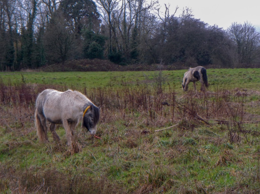
At Rye Hill, the green lane ended and I turned briefly onto a minor road where I noticed an enormous amount of rubbish – mainly packaging from takeaways and disposable cups which I assume people had thrown out of their cars as they drove along. However I can’t imagine why someone took a mattress up there to dump it at the roadside! All very disgusting and upsetting. Soon I turned off along a small path leading to more farmland and woodland, before emerging on to Latton Common where there were tethered horses grazing. There was an underpass to cross the busy A414 and I walked along the edge of Harlow Common, where there were more tethered horses. I reached a minor road and crossed over the M11 on a bridge.
The route on along the road past Foster Street and the church, along a track and then back over the M11 seemed long. I was relieved to turn towards Old Harlow and eventually reach my destination for the night at Pages Guest House.
A remote check-in service such as has apparently proliferated in small guest houses since Covid19 was in operation. Actually I didn’t see the text about it until I had failed to gain entry by ringing the bell. I discovered it as I turned on my phone to contact the owner. However, having found the text, everything worked out and I was soon cosy in a warm room. I popped out to buy food for the evening after exploring a guest kitchen with microwaves and fridge as well as the all important self-service breakfast supplies for the morning. This meant that in the morning I could get away quickly rather than having to wait for breakfast to be served. It seems very impersonal to use remote booking but every cloud has a silver lining.
I was concerned that the next day would be “more of the same” with poor signage and the possibility of needing to cross very muddy fields. No wonder I had seen so few people walking after the initial part of my walk in the main Epping Forest. At least it looked as though I would have a dry day.
I put on my boots and gaiters as near to the front door as possible but still left lots of dry mud on the floor – I tried to gather the bits into a small pile. The mud the previous day really had been extreme.
I needn’t have been so worried about the path. There were more signs and no ploughed fields to cross all day. The paths looked much better used – unsurprisingly given they were well signed.
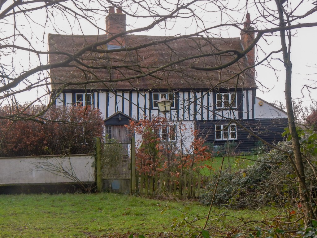
There were several impressive looking large houses – which I suspect had been farm houses or manor houses in the past.
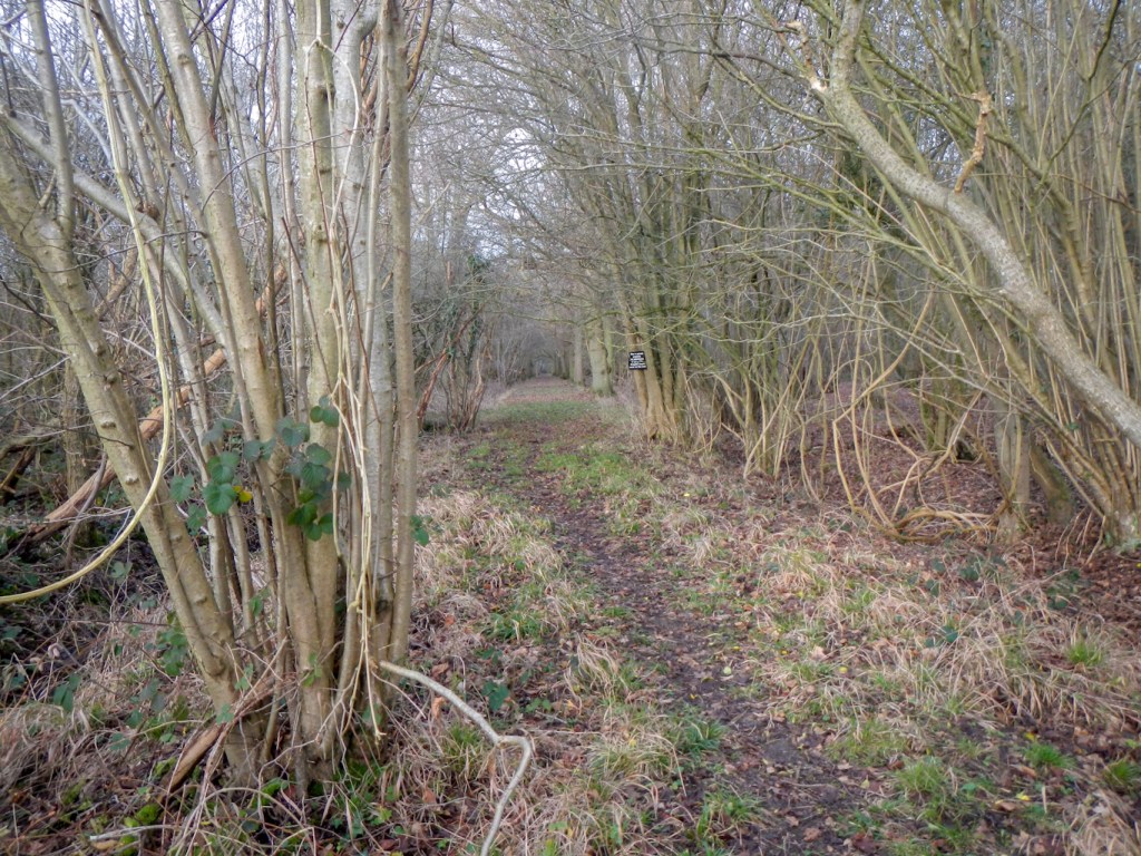
It was a pity that the woodland at Matching Park was clearly signed as off bounds with the footpath passing round the perimeter along field margins. However that didn’t stop me taking a photo of an avenue through the trees.
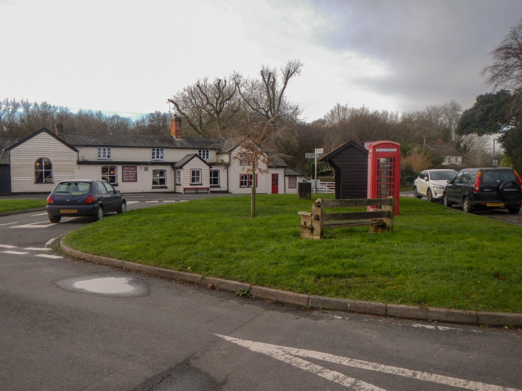
Matching Tye, unlike Epping Green seen yesterday, appeared to be thriving with a pub at the edge of the village green and several old houses. “Tye” is an ancient word which means a settlement around a common or green away from the main centre.
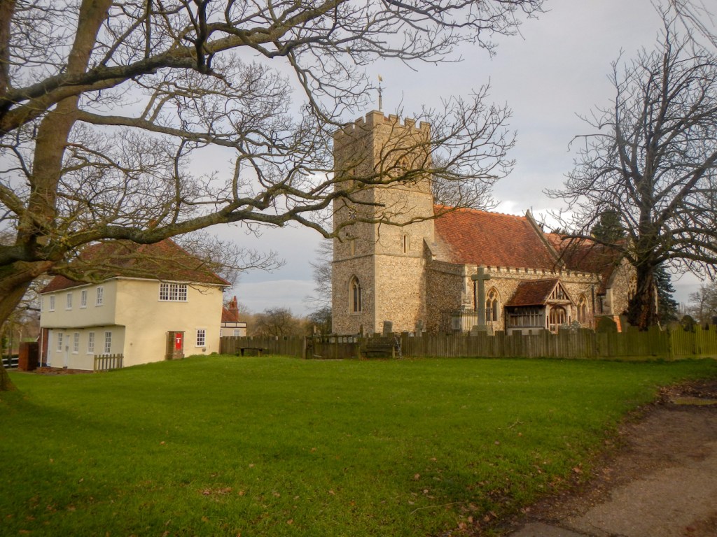
I followed a path from Matching Tye and before long was on the church green at Matching. The name “Matching” dates back to Saxon times when the Maecca (Match) People settled in an open area of the forest. The church, sited on one corner of the green, was constructed around 1200 on the foundations of the original Saxon church. Adjacent to the church, is the marriage feast house built in the fifteenth century and used by local brides on their wedding day. The green is also the site of a huge oak tree planted in 1887 to celebrate Queen Victoria’s diamond jubilee.
I left the village past a large pond that almost encroached on to the road. A path led along a green lane. I heard some long tailed tits, blue tits and blackcaps singing before I spotted them flitting between tree branches above me.
The path around the houses at Parvilles, where there seemed to be evidence of an old moat, was well signed. It led past a couple of large ponds. There was even a notice put up by the farmer apologising for the state of the path – due to some work to protect from subsidence into the brook. This was amazing compared with the poorly signed paths of yesterday across ploughed fields. I’m glad I didn’t give up and try to catch a bus or train towards Hatfield Forest instead of continuing on the path.
There wasn’t any reason for me to stop at Hatfield Heath village. Getting across the busy B183 on a sharp bend was a potentially hair raising experience but I managed and then walked up a private road towards Woodside Green. It was a pleasant walk across the common before reaching a minor road. I followed this to a pedestrian access path on to the main part of Hatfield Forest.
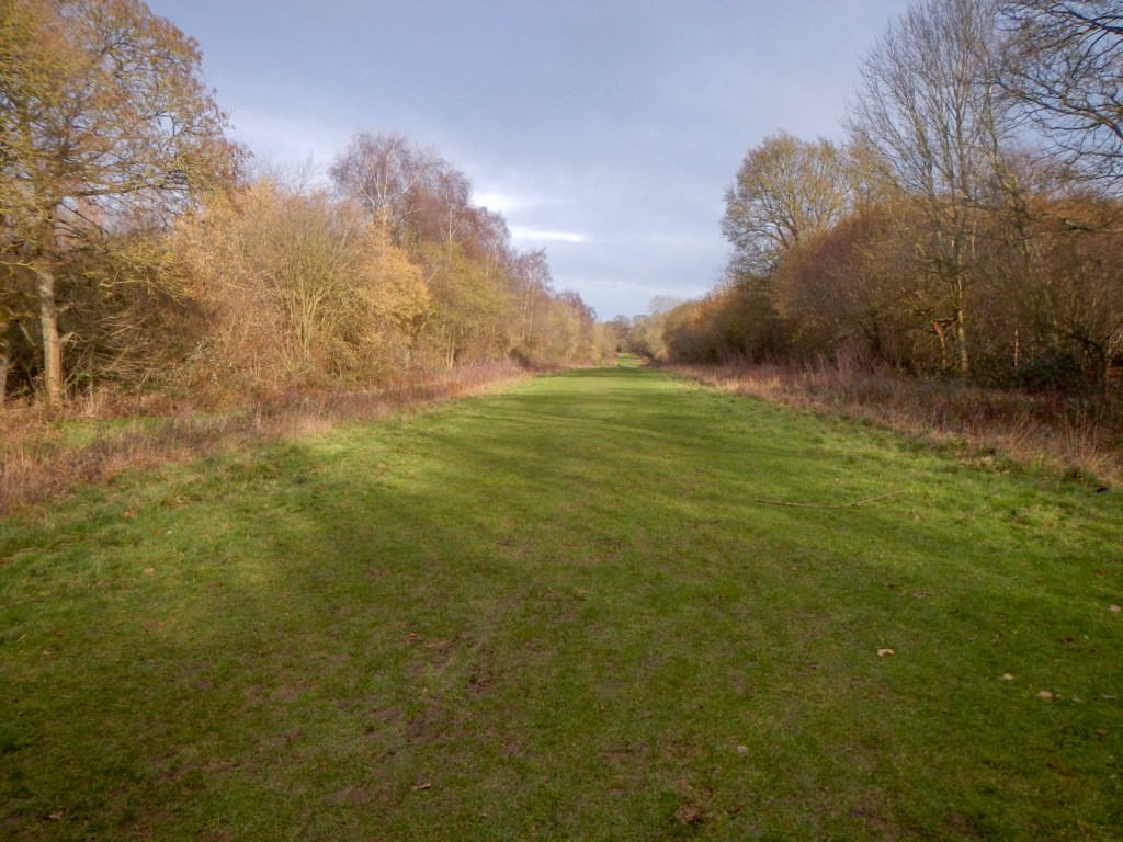
Hatfield Forest seemed much more open than Epping Forest. There are wide grassy rides between the blocks of trees. Nowadays the Forest belongs to the National Trust.
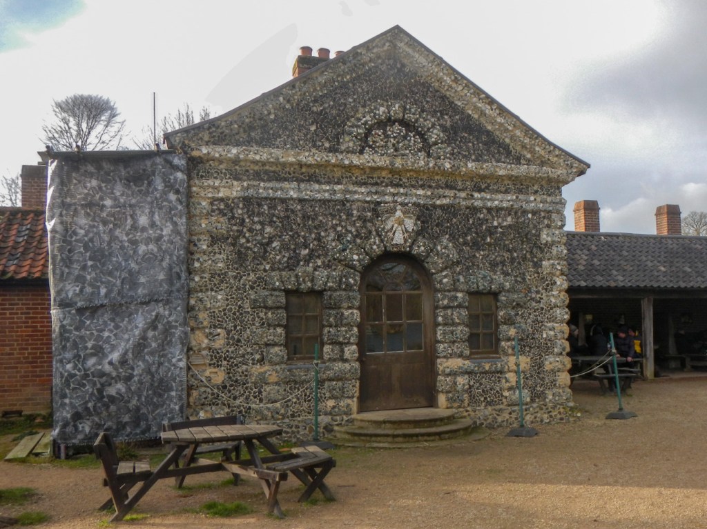
I deviated from the trail to visit the area of gardens landscaped by Capability Brown in the eighteenth century and the ornate Georgian shell house which is currently being repaired.
I headed back to my route and then north up to the end of the Forest Way. Hatfield Forest is thought to be the most complete surviving example of a small medieval Royal Hunting Forest. The woodland management has traditionally been acieved by “coppicing”. This is cutting trees close to the ground every 8-25 years. The stump sends up fresh shoots which are harvested for fencing, firewood, charcoal etc. newly coppiced woodland was protected from grazing animals by woodbanks with fences on top. The National Trust has fenced off some areas of woodland so the deer are kept out in order to perform coppicing. I didn’t see any deer during my visit though.
Soon I reached the Flitchway disused railway track, now a cycle and foot way. My expedition in and between the Royal Forests was complete and all I needed to do was walk the short distance to my booked overnight accommodation at nearby Takeley Street.

Looks like you had a great adventure with some part of it better than others.
LikeLiked by 1 person