28-29 May 2022
On Saturday morning, I moved on to map 22. This transition was while I was sitting on a bus that was running late and unusually made up for lost time. The “miraculous” catch-up happened despite us all being driven to a “bus depot” in the middle of nowhere and changing on to a larger bus to continue the journey. Duncan, our driver, chatted to passengers in a mix of Gaelic and English. Two sisters who I had met at the bus stop and, like me, were travelling to Balivanich, the capital of Benbecula, good humouredly taunted each other and Duncan. Friends met up and chatted, catching up with the latest news. Pensioners going shopping were dropped off directly outside their destination which was not necessarily a bus stop. I reflected on this microcosm that seems to be uniquely typical of island-life, certainly Scottish Island life. It was the sort of atmosphere I yearn for, having enjoyed it for myself, whilst spending a year living and working on Shetland.
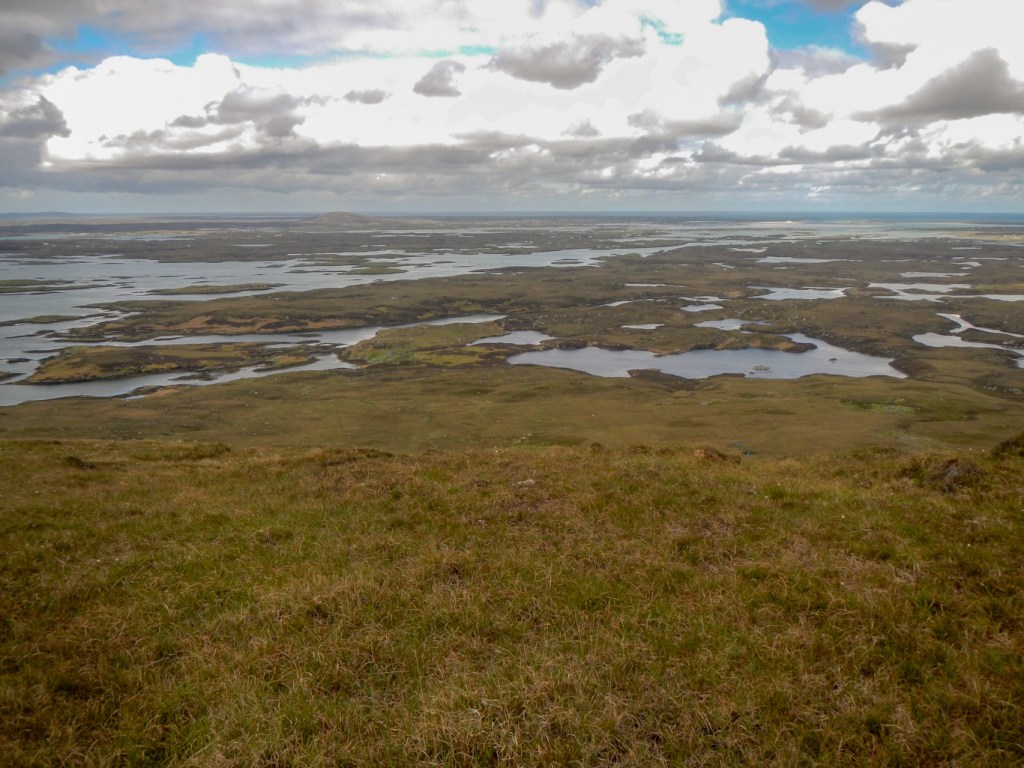
I gazed right towards the three dramatic peaks of South Uist – Thacla, Beinn Choradail and Beinn Mhor, remembering the superb ridge traverse that I made a few years ago. I looked left towards the machair and beach – less dramatic but an amazing landscape typical of the area and I know there is a chance of seeing otters too as I have walked that way as well in the past.
Duncan stopped the bus just outside the Uist Hardware Store https://www.uisthardware.co.uk/ . It’s not even necessary to be a local to have personal service! This shop appears to sell everything that could be conceived of as being useful. Island shops such as this provide an essential service for both local people and tourists. I didn’t stop to browse as I didn’t want anything to tempt me into having more to carry. My two canisters of gas were packed with the receipt and my name and pick-up date clearly marked. Thanks for such phenomenal service!
I progressed to a friendly local supermarket to buy a few fresh provisions to supplement my dried food. I noticed a sign to an open restaurant – Stepping Stone https://www.facebook.com/TheSteppingStoneRestaurant/ The temptation was great as it was lunchtime and would mean that I could avoid using one of my freeze dried meals that evening. One of the sisters I had met on the bus was outside, spotted me and told me it was a great place for good filling food. Suffice to say, I enjoyed a delicious meal of lamb, potato and vegetables, all served very cheerfully and efficiently. It was a very generous portion and certainly set me up well for the rest of the day.
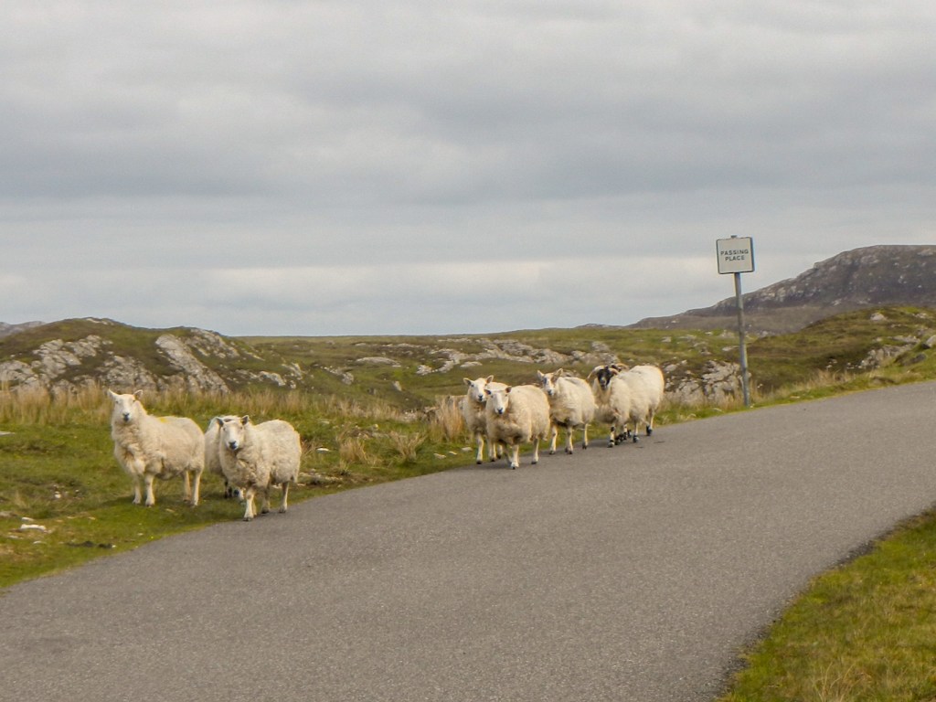
So to the expedition itself. My first foray was to Grimsay, a small island linked by causeway between Benbecula and North Uist. The weather was excellent with wonderful clear views. As I reached the turning to Grimsay, I was catching up with a walker ahead of me who didn’t turn off – possibly on the Hebridean Way route. I met some sheep on the road, even looking as if they understood how to use the passing place.
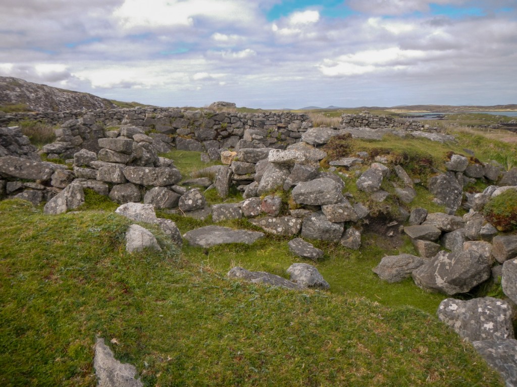
I turned on to the moorland. It was tremendous to feel that I was leaving the road and exploring areas where only walkers can venture. It turned out to be remarkably difficult to find the Iron Age wheelhouse, particularly given how much there was to see when I did find the correct place.

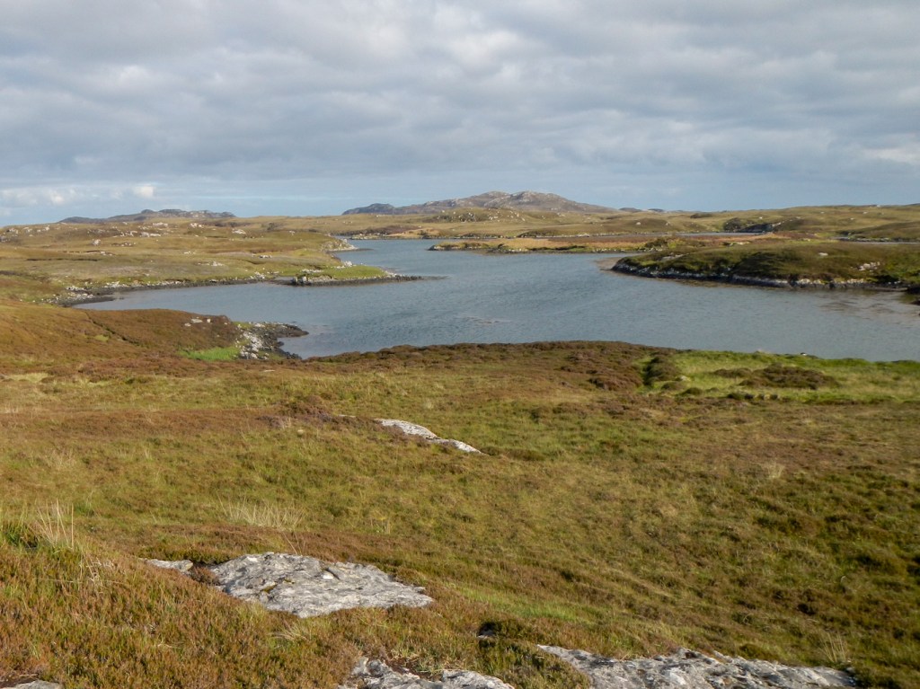
I was also rewarded with some superb, clear views across to Eabhal as I walked around Loch Hornaraigh.

I returned to the main road and crossed the causeway to North Uist. My intention was to spend five nights wild camping on the island as I slowly made my way towards the ferry to Leverburgh. This ferry across the shallow and treacherously rocky Sound of Harris departs from Berneray which is linked by a causeway to the north east extremity of North Uist. I had walks planned incorporating points of interest for each day. The first of these, at the northern end of map 22, was a traverse of Eabhal, the highest mountain in North Uist.
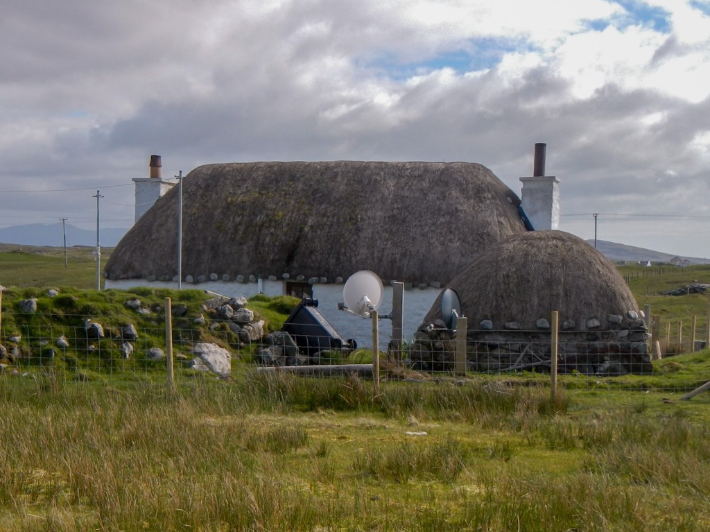
Soon I reached the turning along a minor “no through” road to Cladach Chairinis. At the far end of the metalled road, a cheerful workman getting in his van at the white house (previous primary school) called a greeting. From there I was on my own. I passed a traditional Hebridean thatched cottage, noting the juxtaposition of old and new with a satellite dish in the garden. It’s almost impossible to escape from modern life.
The path was intermittent but, in the excellent conditions, navigation was straightforward and my GPS stayed turned off in the rucksack. This had been one of the places where I had thought that I would lack confidence without the aid of my Satmap, but the clear weather was some of the very best that the Outer Hebrides has to offer. All the landmarks mentioned in the route description in https://www.cicerone.co.uk/walking-on-uist-and-barra were easy to find. It is phenomenal that such a complex watery moorland landscape is so accurately mapped by the Ordnance Survey. I was of course carrying the 1:25,000 map too.
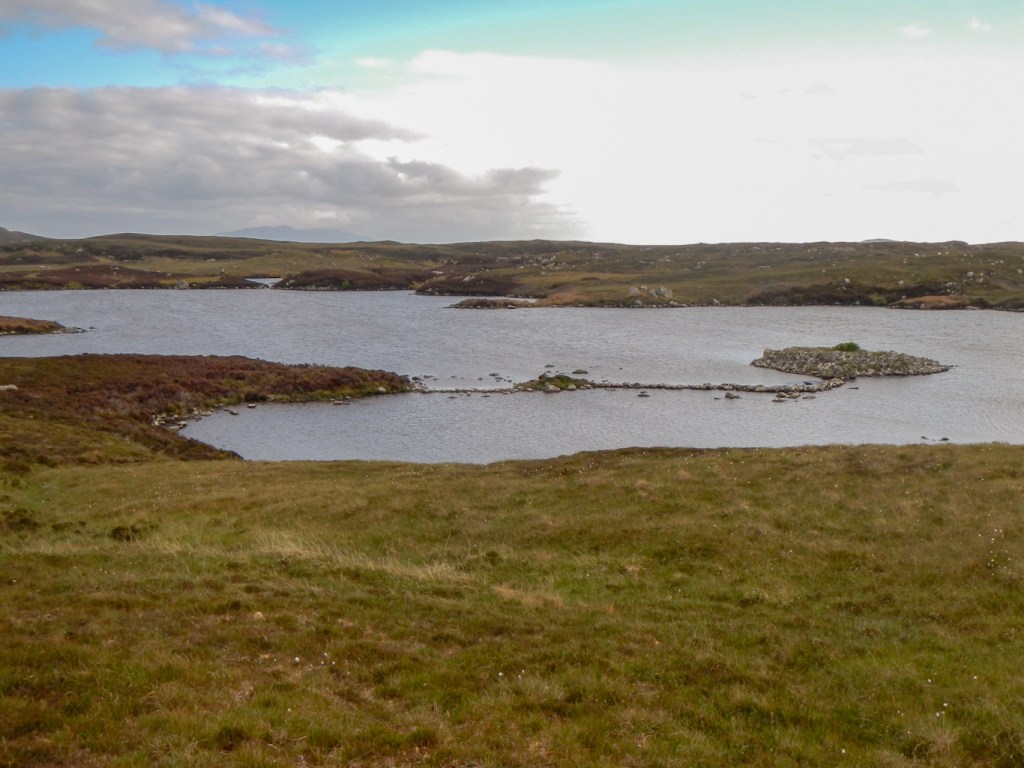
It wasn’t long before I reached the southern end of Loch Obasaraigh. Here I turned south to follow the eastern shore of Loch Dun an t-Siamain, which, in the Cicerone book, is given as a descent route. The stone causeway out to the dun itself was prominent.
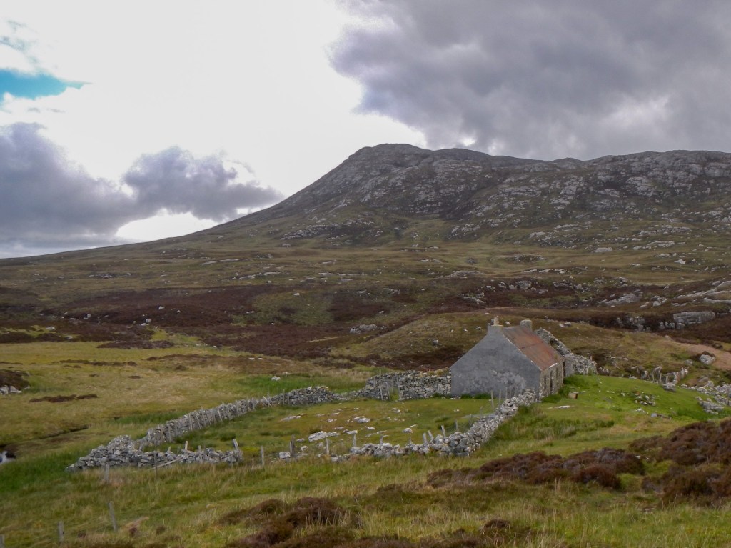
I made my way towards the abandoned Eabhal settlement, which is located on a narrow isthmus between the freshwater loch I was walking beside and the sea loch. I had planned to camp on grassy ground near the buildings, but the area was covered with sheep faeces. Hence I searched nearby and found an ideal flat camping area with superb views across the sea loch. I even wondered whether I might see otters – but was disappointed.

Remarkably, the settlement was in the past the home of the local shepherd and his family. The children crossed the moor with bare feet to attend the school at Cladach Chairinis (the white house I had passed earlier).
I woke to blue skies and an awesome view from my tent.

Sadly before I had even eaten my breakfast, the skies clouded over, but it was only a short shower. I packed a damp tent and started on my way at around 09.00am. I had calculated that I would reach some tidal stepping stones at 898 631 (almost at the Loch Euphort road end) near low tide around 1pm.
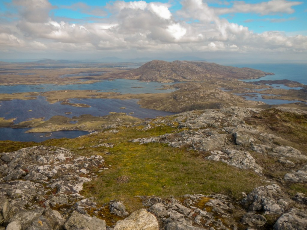
As I made my way towards the summit of Eabhal, I had excellent views back to the Eabhal settlement as well as the freshwater loch and dun with causeway. All the landmarks I was looking for appeared.
The extremely watery nature of the area with the complex and intricate network of fresh water and sea lochs gradually revealed itself to me as I climbed higher.
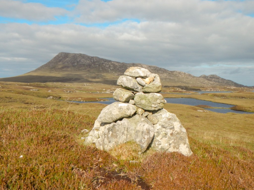
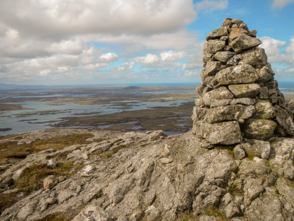
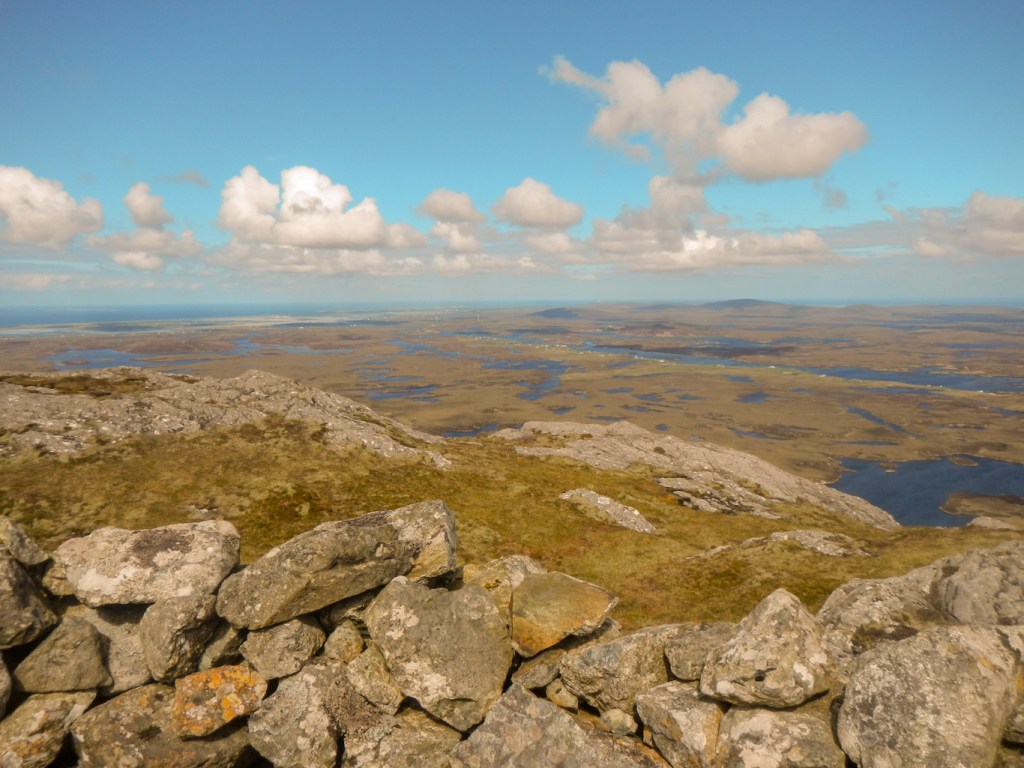
I reached the summit after less than two hours of relaxed walking, giving me time to enjoy the fine views. The summit was superb – very windy but there was a welcome stone shelter surrounding the trig point. I could pick out Harris to the north, Skye to the east and then turning south could see South Uist and Benbecula. St Kilda should have been visible on the western horizon but I think that I would have needed binoculars to pick it out.

The descent towards Loch Surtavat was easy to see. I took a line due east so as to avoid being anywhere near the cliffs to the north. I spotted a herd of deer below me in the valley.

I was pleased that the ground, although rocky, was not descending steeply and realised I had definitely followed a sufficiently easterly course to avoid the cliffs that are mentioned in the route description as areas of risk.
Sadly, rocky ground and indeed any wilderness hiking will never be entirely safe. Soon after I had photographed the deer, disaster struck. In one step of my right foot, rather than being out on an amazing walk in superb weather conditions, with plenty of time and walking well within my capabilities, I was in serious trouble. My right foot was stuck in a hole next to a rock. The rest of my right leg and body continued to move forwards on the descending line I was following. Of course, I was carrying around 20kg as I had sufficient food in my pack for the next five days as well as all my regular kit. My right leg buckled under me so that it was trapped by the weight of me and my rucksack. In order to extricate myself, I removed my rucksack and rolled it onto ground to the right of me. My foot was well and truly stuck but eventually I managed to free it. I was of course wearing good quality Meindl walking boots with ankle protection. My trekking poles were jammed into the ground but miraculously intact. Initially I assumed that I had a fairly severe ankle sprain.
I was able to stand. I was able to hoist my rucksack on to my back. My right ankle was painful and I stood still for a few minutes as I really felt quite shaky. I proceeded on, using my trekking poles and arms to support some of my weight. I thought that my boot would be to some extent splinting my ankle. I scanned the terrain carefully to try to find the easiest line of descent and, having walked lower than the cliffs, to begin to swing round in a more northerly direction towards the eastern side of Loch Obasaraigh.
I was slow. I soon realised that I had virtually no medial (inside) stability of my ankle, even with the support of my boots. I decided to stop and look at my ankle. My medial malleolus (ankle bone on the inner side) seemed to be in the wrong place and the bone was very tender. The outer side of my ankle was swollen but I did not think the bone was tender; however my examination was not thorough as I realised that I should replace my footwear before any further swelling would make that impossible. I flicked on my phone and saw that there was some phone signal. I wondered whether I should seek help but I hoped that I could reach the road near Loch Euphort (that would be just on the southern edge of map 18). I turned off my phone, anxious to conserve the batteries. Having never called the mountain emergency services in the past for myself and always managed to walk out after other accidents (even a wrist fracture in 1981) I still hoped that I could self-rescue.
I walked further. I was becoming more slow and even the partial weight bearing I had just about managed on my right leg was becoming difficult. As I approached the eastern end of Loch Obasaraigh, my hopes were raised as I saw some people walking towards me. I met them just before the crossing point of a burn flowing between the lochs. It was a group of three people with a dog. One was wearing a veterinary college sweatshirt, which seemed promising. I called out: “Excuse me. Please can you help? I think that I have broken my ankle and I am wondering whether I should call for help or try to reach the road.” They suggested that it was unlikely that I had broken my ankle as I was standing and when I told them that I had examined my ankle, told me I shouldn’t have taken off my boot. I guess I realised that wasn’t the best of decisions but at least it had helped to confirm my diagnosis of a probable fracture rather than a severe sprain. They warned me that the onward route to the road was rough and stony (as though I couldn’t have guessed!) and that they were going on up the mountain and intending to return the same way.
I managed to cross the sandy burn – checking the depth and ground with my poles – I was wearing gaiters too.
Once I was following the shore of the loch (loch on my left) the lie of the terrain made it even more difficult with lack of medial right ankle stability. I soon realised that the chance of me reaching the stepping stones while they would be passable that day was zero and the chance of reaching them at all in any sensible timescale was minimal. I removed my rucksack and turned my phone on to check for signal. I had an “emergency” signal meaning I could call 999. Having called 999 so many times in my professional life for other people, it was surprisingly difficult to make the decision to do so for myself, especially while in the “wilderness”. The problem is the knowledge of just how expensive these resources are as well as the opportunity costs which mean that others may not get timely help if I made an unnecessary call.
My accident had been at around 11.15. I had taken over two and a half hours to move well under a kilometre (probably nearer 500m). I turned on my Satmap to get an accurate grid reference and wrote it down – NF 9121361340 – that positioned me to the nearest square metre apart from any technical errors with the GPS. It was windy but I was wearing plenty of windproof clothing. My 999 call was at 13.55. I asked for ambulance as no coastguard or mountain rescue option was offered.
I turned away from the wind which was interfering with sound for the call taker. I answered the preliminary questions although the call taker seemed a little out of her depth with my unusual answers. I gave my location as a grid reference and was told that I needed to give a post code (I said that I didn’t think it had a post code). I remembered that I had what3words app. The call taker explained to me how to avoid cutting her off while I opened the app. It didn’t seem to be working very well but I pressed the symbol for current location and gave the words – ironically one of them was “ankle”. After a period of silence, I was told that I had given a location in Tamworth! That was when I realised that the app won’t work without data signal and the last time I had opened it I had been visiting my mother-in-law. I didn’t want to send an ambulance to her – although mistakenly sending an ambulance to my mother-in-law when trying to get help for me in the Outer Hebrides would certainly have provided family amusement and made me the butt of many jokes for years to come. The jokes about me not knowing left from right and my tendency to take wrong turnings have been repeated incessantly and this would at least be something new. Fortunately, once I realised the problem, the call taker agreed to ignore the what3words location. I explained that as long as she had the correct numbers, I was sure that a mountain rescue organisation would understand what my grid reference meant! At her request, I still had to describe my location in words and I also explained what colour I was wearing and the colour of my rucksack cover – I would get it out as it’s brighter than the rucksack.
Before ringing off I explained that I was well equipped to survive for days as long as I could get to the nearby water in the freshwater loch. I was told to keep my phone turned on and she asked about battery levels – these were fine and I also had a small fully charged portable charger. The phone call duration was 16 minutes and 22 seconds.
I settled down to wait, getting myself out of the wind in the shelter of a gully. I took off my top layer and put on more warm layers of clothing then replaced my outer layer so it was the colour I had reported I was wearing. I decided that I didn’t need my survival bag or tent yet. I ate some food and wondered about making a hot drink next.
However I was still eating my flapjack when I heard a helicopter approaching. I hurriedly pocketed my food for later as it didn’t seem quite right to be eating when my rescuers arrived. The aircraft circled and was clearly looking for somewhere to land, having located me.
The noise and wind from the propellers was enormous and I put my head to the ground. Two men emerged from the helicopter and walked quickly down the slope to me carrying equipment. I was so happy to see them – and I think only about fifteen minutes after the end of my 999 call. I had expected to be rescued by a land based team walking into the area as I didn’t think it was serious or urgent enough to warrant a helicopter..
The paramedic, Ben, took all details and made an initial examination. My leg was stabilised in an inflatable splint. My boot was tied to my rucksack and my rain cover returned to my rucksack together with my gaiter. The men explained how I would get into the helicopter and asked about any previous helicopter rides (yes – to Lundy in 2020 and a tourist ride round the north face of the Eiger about 20 years ago).
The coastguard helicopter having taken off landed again in the same place and the two men supported me and half carried me up the hill to it. I turned so my back was to the side door and was lifted in. I sat on a side facing seat near the back. Two other men were piloting and navigating. I was securely strapped in with a five point harness and given a headset to wear.
As we flew to Stornoway, I underwent routine observations. Ben explained that we would fly to the airport and a land ambulance would take me to the hospital. I was repeatedly reassured that they did not think I was wasting their time – in fact I think they preferred rescuing me to doing the training exercise which they had been about to do. I was given paracetamol as we flew – that was timed at 3.10pm, only an hour and a quarter after the start of my 999 call. I could see amazing views out of a window on the other side of the helicopter, but that was of course a bonus as I was there on medical grounds. I did wish that I could see more though!
I suddenly remembered my two gas canisters in the rucksack and that they aren’t allowed on flights. Ben reassured me – I certainly didn’t want to be rescued only to cause an explosion on the helicopter.
Unfortunately my X rays showed a displaced, unstable ankle fracture and presumed severe ligament disruption. After lots of discussion with the orthopaedic team in Stornoway about the probable best management plan, I am awaiting surgery near home. Thanks are due to the surgical team for discussing the options and pros and cons as well as giving me plenty of time to consider my decisions. I was able to remain in hospital for three nights while my husband arranged flights and assistance to get home. The staff at the hospital were very friendly – although this is a mountain area, I seemed to be quite an unusual case. I made myself at home and even managed to wash my sock liners and underwear and dry them on the bedrail in hospital, all while standing on one leg and holding on to the furniture.
In case you wonder what I did with my gas, it went to a good home – one of the student nurses was very grateful. Sadly my tube of Primula cheese spread in my hand luggage was confiscated at airport security in Stornoway – but not until I had eaten most of it with some oatcakes as an early lunch!
I left Stornoway in superb weather conditions, enjoying excellent views of the town, the area and then the Shiant Islands and Skye. I was sad to leave realising that if I had not been injured then I would have been enjoying an unforgettable backpacking trip in excellent weather conditions which are relatively unusual in this part of Scotland.
Sadly it all happened in a single step! Fortunately I was well equipped, putting myself in a position to best ensure survival if I had been unable to get help so quickly. Moreover my husband had my route, expected daily or at worse alternate day communication and would have called for help with knowledge of where I would be likely to be found. I definitely intend to visit again, although aware that this type of injury will involve a year to rehabilitate (if I am lucky). So this will be the last adventure for a while, unless I can find some easier options. There are a few shorter adventures…
However I am sure I will never forget this adventure!

That was an unfortunate accident, could have happened to any of us. Here’s to a complete recovery.
LikeLiked by 1 person
Thank you!
LikeLiked by 1 person
Wow. That was quite an adventure. I hope you are well right now and also that you won’t refrain from similar adventures in the future when your injury has healed. Wish you a quick recovery! And the landscape looks marvelous on your pictures!
LikeLiked by 1 person
Thank you. I am certainly planning to continue with my adventures once I am able. That’s what will be motivating me during my rehabilitation.
LikeLike