24-29 May 2021
The adventure was to be a traverse of the entire Kintyre Peninsula using the 100 mile way-marked Kintryre Way. However beforehand and during the week I noted various possibilities for additional side adventures. I became aware through my travels that this beautiful area, which seemed to also be one of the sunniest and driest parts of the country during my stay, is largely off the beaten tourist track. It has an aura of remoteness and insularity reminiscent of an island community. We based ourselves in Campbeltown, staying at the friendly small Dellwood Hotel (Home – Dellwood Hotel, Hotel in Campbeltown) run by a local family (thanks Tracey and Bruce for a great stay!). Although I had considered wild camping during my walk, my husband had decided that he would like to visit the area too (on our way home from Mull) and so he agreed to take me to my start point and collect me from my end point each day (apart from the days that my walk started / ended conveniently right at the front door of the hotel).
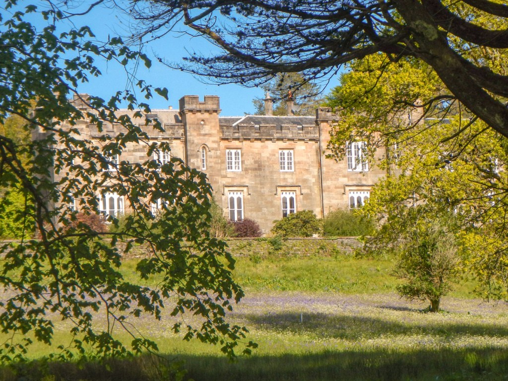
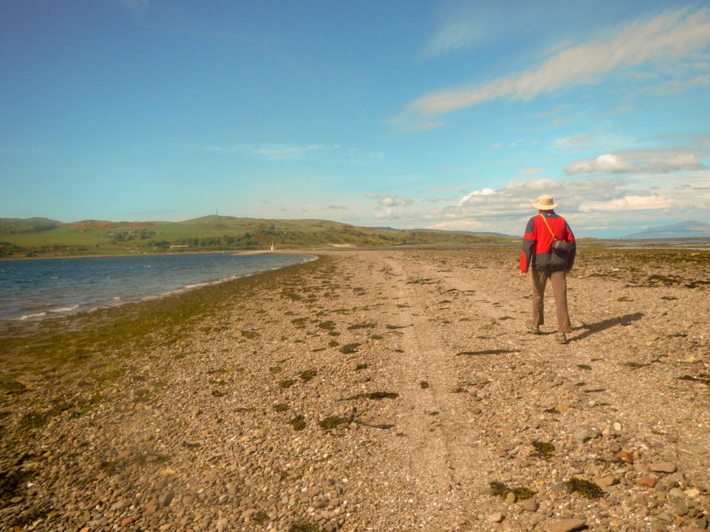
After a bright and early full cooked breakfast, I was driven to the first start point at Tarbert. We had some discussion about where the path went up from the quay, but it was actually clear in the end as it was signed up past the prominent castle overlooking the harbour. Although pre 14th century in construction, the tower dates back to 1494 and the visit of James IV to the Western Highlands. I made the short detour to the viewing platform, before getting underway with the walk in earnest. it was a beautifully dry day.
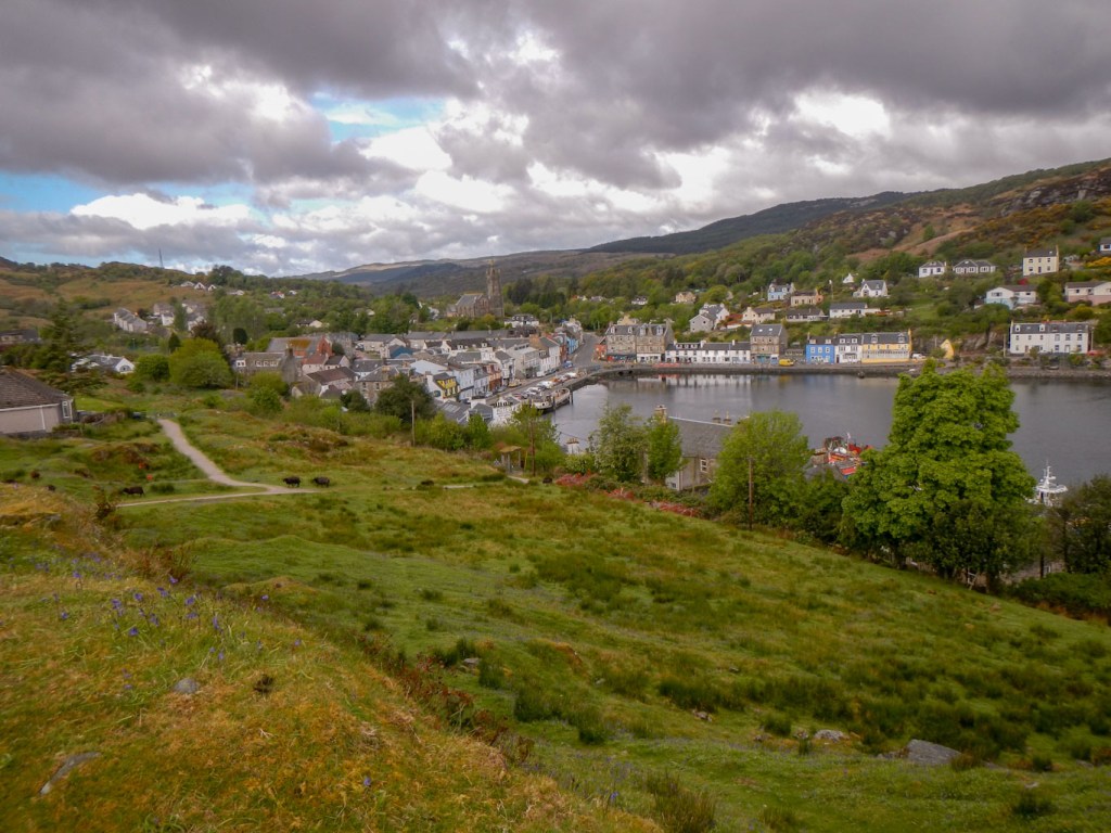
Tarbert from the castle
I discovered that not only were there waymark posts, but also mileposts. One side of the post stated how many miles I had done and the other side told me how many miles were left to do. The route went on to a gravel track through coniferous forest. There were huge log piles at intervals where the trees had been cleared. I had occasional glimpses of tranquil Loch Fyne through gaps between the trees. Later the route went on to a clear path and through deciduous woodland – I noted ash, birch, willow, hazel and occasional oak trees. The forest floor was carpeted in places with bluebells and primroses in full bloom. I spotted three deer on separate occasions but they all ran away rapidly at my approach. The later part of the route to Skipness followed a stream. There were some ruined stone dwelling places, no doubt evacuated during clearances. There were a few other walkers but generally it was all deserted.
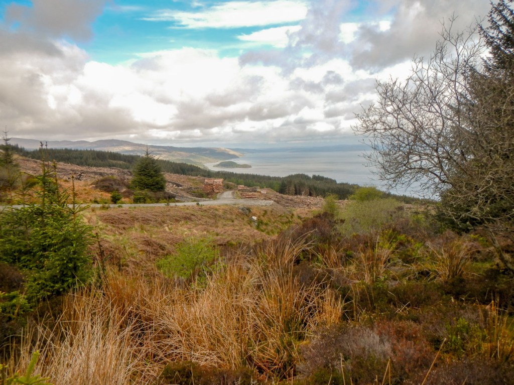
Views of Loch Fyne 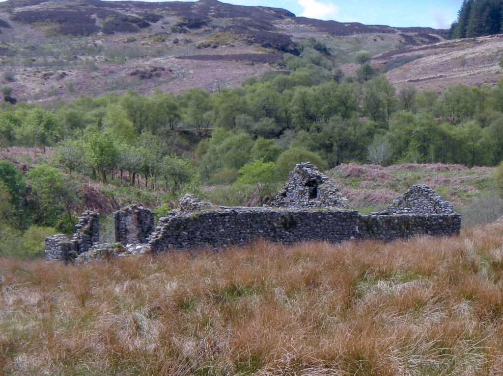
Ruined houses 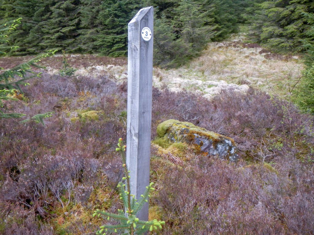
Mile markers 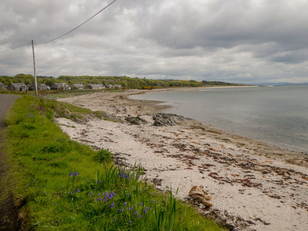
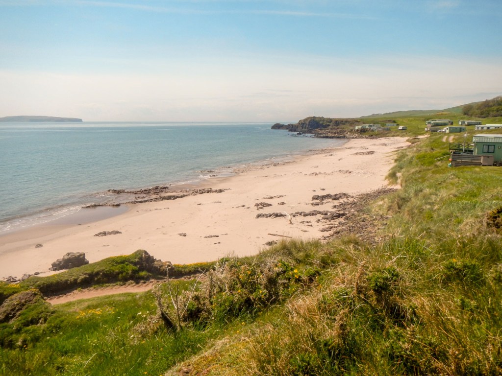
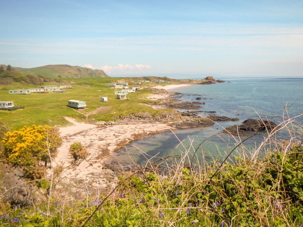
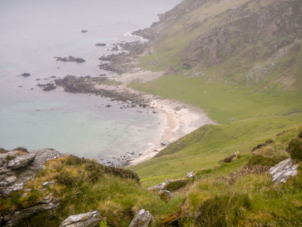
Skipness Bay
When I arrived at Skipness, it appeared that the village was becoming increasingly less populated – the shop and post office was closed down as was the school. I was surprised to see a bus marked “Skipness Ferry Terminal” proceeding up the road towards the village. I had thought that public transport would be one of the first things to fold. However the bus was actually for the ferry terminal at Claonaig to the Isle of Arran. It had already passed the ferry point but it still goes up to Skipness as it drops off for a ferry to Arran and then returns later to collect passengers who have come from Arran and transport them across the peninsula.
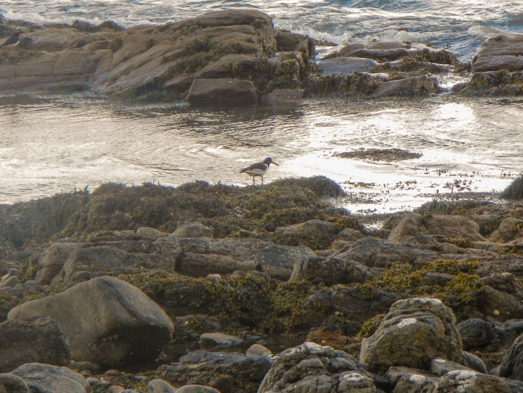
The bay looked beautiful and sandy. Further round the coast, the shore was more rocky. I saw a couple of men who appeared to be living behind beach windbreaks – one who was collecting driftwood, was possibly living in a cave behind his wind break. In terms of bird life I saw oyster catchers, shags, divers and Arctic tern.
A little further on, I was surprised to see a familiar looking car – it was my husband who had just boiled some water for coffee so, as it was lunchtime, I got my lunch out of my rucksack and enjoyed an unexpected hot drink with it from this convenient “pop-up” cafe.

Plenty of waymarks
The route continued on the quiet road past the ferry terminal before turning off cross country on what was initially a track but soon degenerated into a path, vague at times, despite being marked as a track on the map. My progress slowed, particularly as it started pouring with rain. I saw a wind farm in the distance. I passed a couple of small lochans and a larger loch. Soon I was descending past a fish farm hatchery and on to the A83, where I spotted my husband’s car up a side road. Day 1 completed.
I was dropped off next morning at the same spot – the difference was that the weather was dry. The walk started by following the road on a pavement. Eventually I left the road, passing through the grounds of the Ronachan Estate. The path was very close to the road as it followed the rocky shoreline, sometimes descending to the beach. I didn’t see any otters but there were plenty of oystercatchers. The path deviated from the main road to go round the sandy Rhunahaorine Point. In order to go round a holiday park, the route continued on a sandy beach where I saw the shipwrecked remains of “Island Queen” and also spotted the ferry sailing across from Gigha.
Rocky shoreline 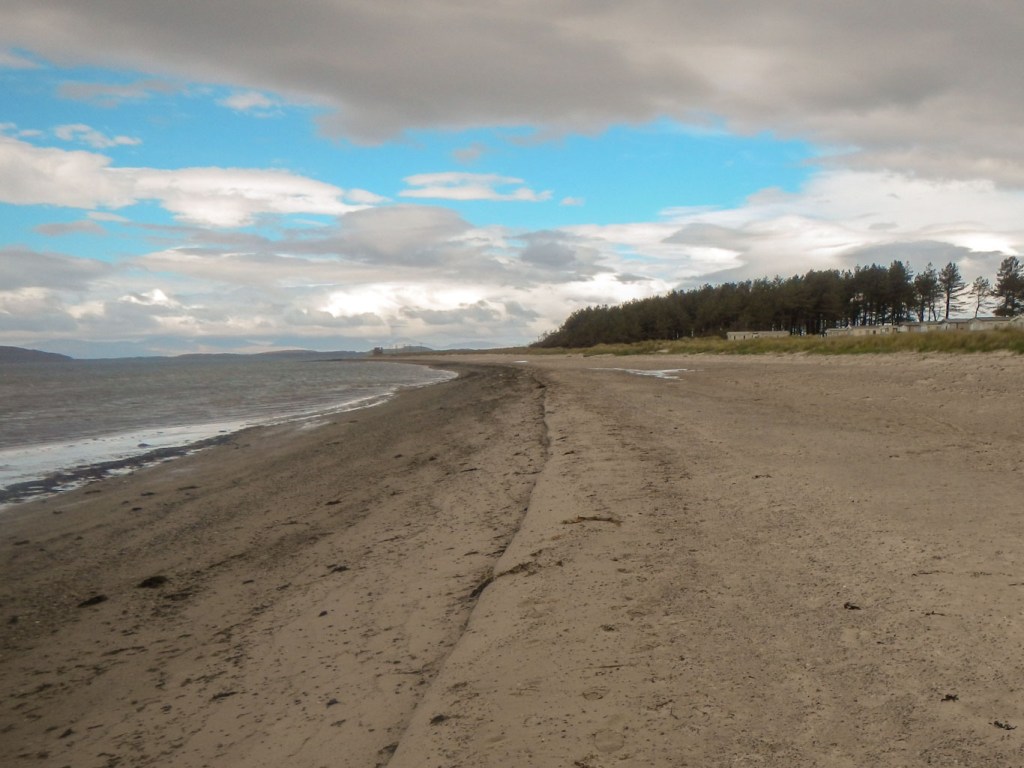
Sandy beach past holiday park 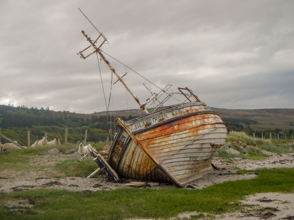
Shipwreck 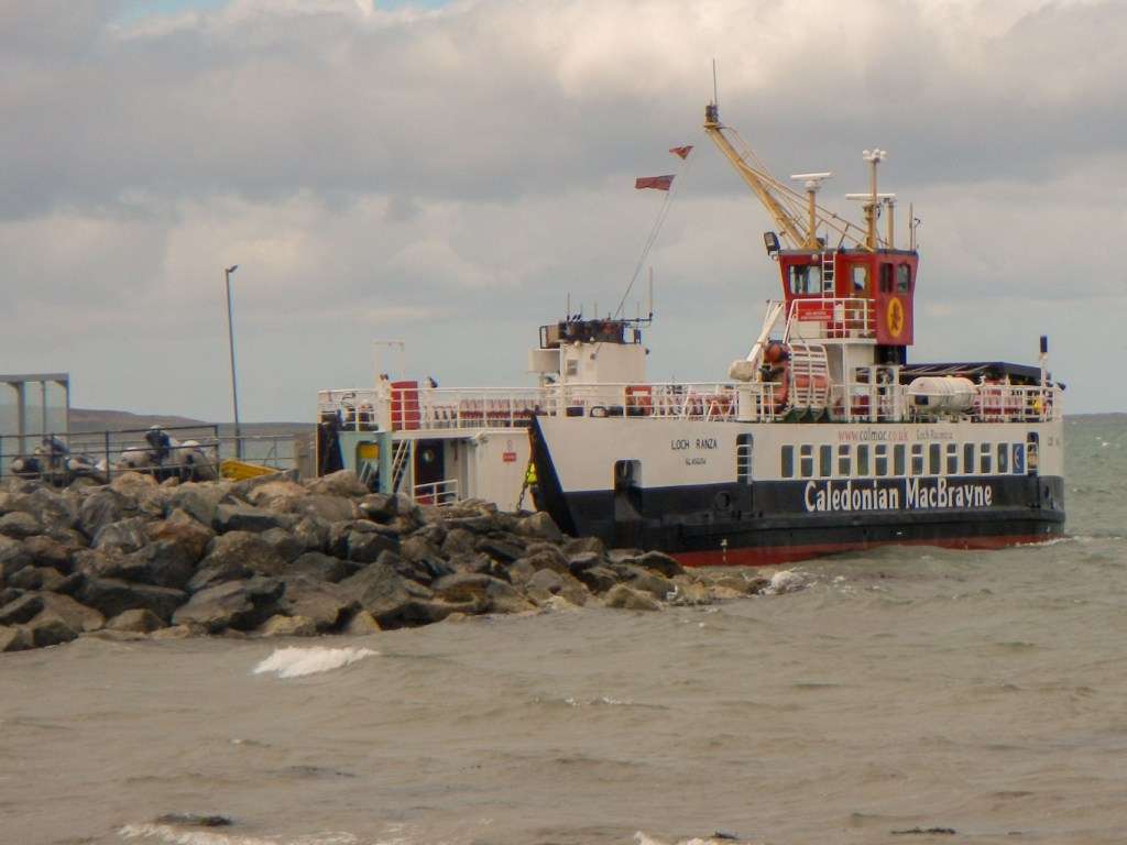
Calmac ferry to Gigha
Having arrived at the jetty at Tayinloan, the path deviated to the village. Faithfully I followed the waymarks but was soon turning back through a small housing estate to the beach. I would have kept on the beach if I had realised. Back on the beach, I ate my lunch, gazing across to Gigha.
After lunch there was just a short stretch to walk back towards the main road which I crossed and I was immediately on a forest track. Despite the notices mentioning the need for map and compass across the desolate centre of the peninsula, I was on a well marked mainly gravel track throughout with plenty of waymarks. It was easy to make rapid progress on this terrain, even though there it was undulating and, initially, primarily uphill. I walked right through the Deucheran wind farm, where there are nine enormous wind turbines, some very close to the track. Warning notices explained the dangers, including of snow falling off the blades. Fortunately there was no sign of snow and the weather was warm, sunny but windy. I enjoyed clear views.
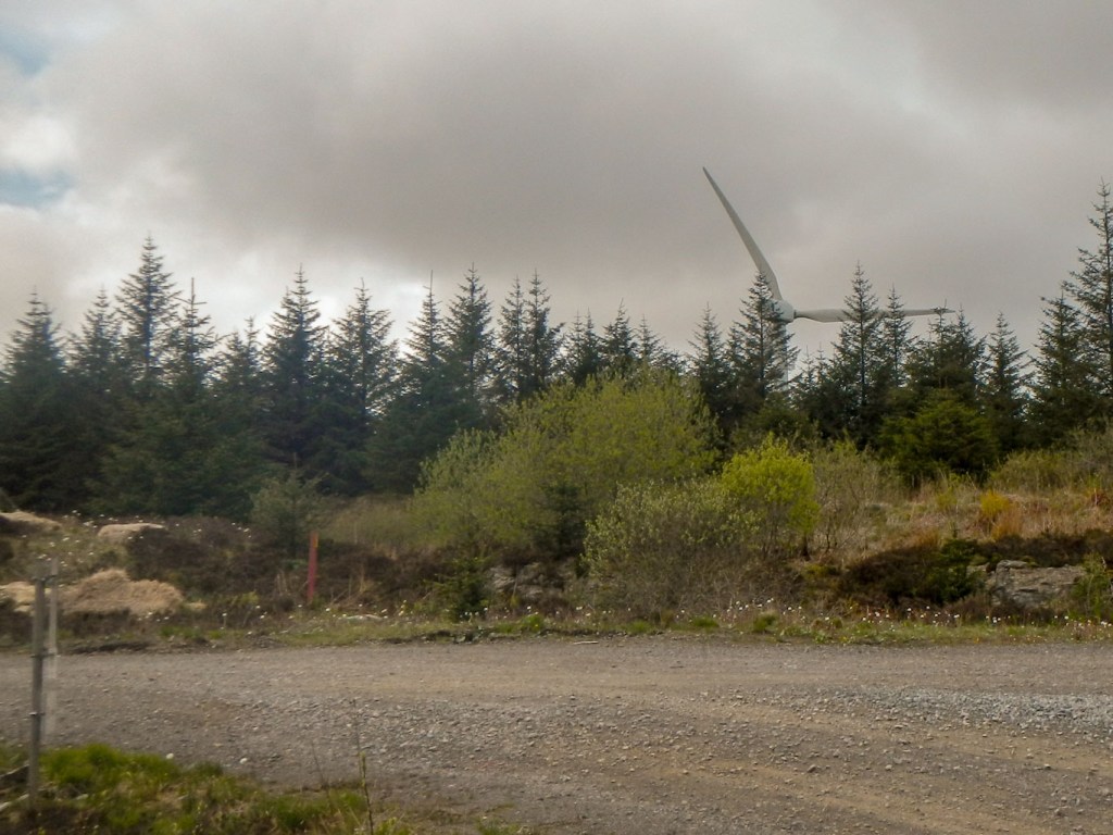
Huge wind turbine at Deucharan
The track descended to a farm and then followed a minor road before hitting the very quiet B842. It wasn’t far to walk along the road before there was a sign to follow a footpath through more woods to Carradale.
In fact, we had agreed to meet at the visitor centre just beyond Carradale, so I ignored the path to the car park near the village. It seemed a very long way to the designated meeting point. Suddenly, out of nowhere, there were a few spots of rain. I was unconcerned as I was nearly at my destination. However the spots turned into a downpour before I arrived at the visitor centre car park. The café was just closing and my husband’s car was nowhere to be seen so I hastily and belatedly togged up in full waterproofs. There was no phone reception (thank goodness I have an Aquapac phone case which means I can operate the phone including turning it on without removing it from the 100% waterproof bag).
I started to trudge down the road to Carradale, as the back up plan was to meet in the village. I must have been a dejected sight as my husband’s car drove towards me. He had decided to wait in the larger car park near the village. In fact he had walked up to the path to try to meet me and let me know but I must have passed that point only minutes before.
He “scooped” me up and I was in the car in full wet waterproofs as he explained that all the eating places in the area were fully booked (Covid restricting numbers). We had agreed to try to eat in Carradale. However he had bought a “feast” of smoked salmon, quiche, rolls, cakes etc. from Co-op with the intention of eating out on a picnic bench. Of course in this heavy rain we ended up eating in the car. He had even bought me a small individual bottle of wine (he was driving), but out of solidarity I decided to leave that until later.
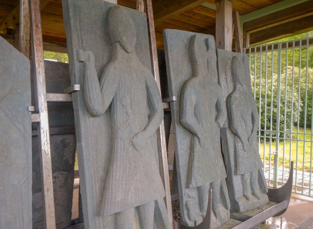
Medieval grave slabs at Saddell Abbey
We returned to Campbeltown along the B road via Saddell. It had stopped raining so I got out of the car at Saddell to look at the abbey and the medieval grave slabs on display, that he had discovered earlier in the day.
The next day it was really sunny and my planned walk was a bit shorter (“only” 21 miles) ending at the front door of the Dellwood. I was duly dropped off and immediately walking on a pleasant footpath before a brief return to the road to cross the River Carradale on a bridge.
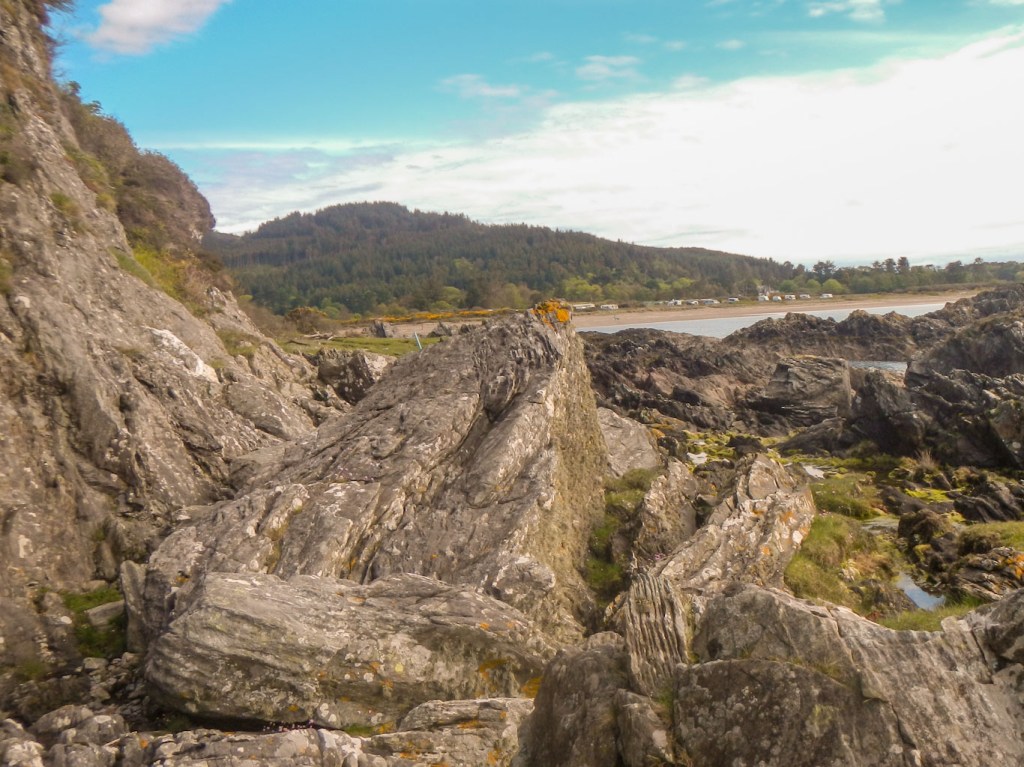
Next the route followed a tidal path with some rocky scrambles. Fortunately the tide was suitable (notice with tide times posted) so I didn’t have to follow the alternative road walk.
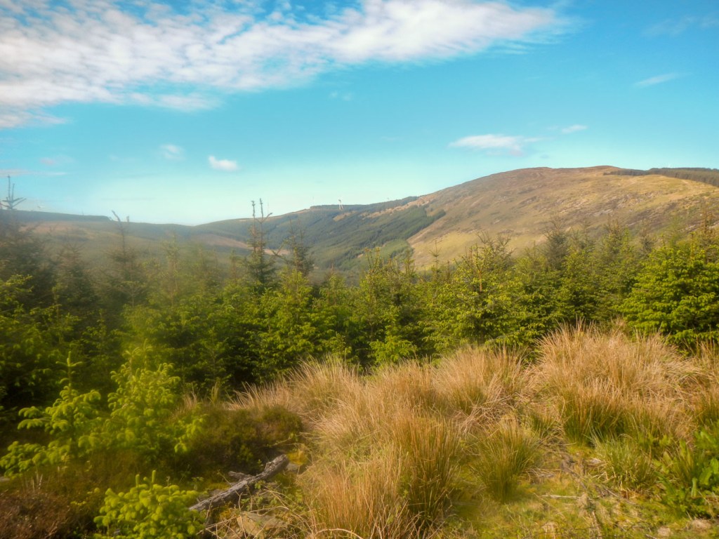
After this more tricky scramble, the route crossed the B842 again and passed through the Torrisdale Castle Estate (“Gintyre Way”). I spotted some soaring eagles – possibly sea eagles, avoided the temptation of the café and was soon through the estate grounds and on the open moor again. There were many wind turbines and I even walked through the construction area for phase 3 of Beinn an Tuirc windfarm. Like the previous day, it was an easy but undulating track walk so I made good progress, eventually descending past Lussa Loch. This is dammed and seemed very empty – it apparently provides flow regulation for Lussa power station. I heard cuckoos as I sat eating lunch overlooking the loch. I think I have heard cuckoos every day of the holiday – but not seen them as they keep well hidden.
Moorland scenery 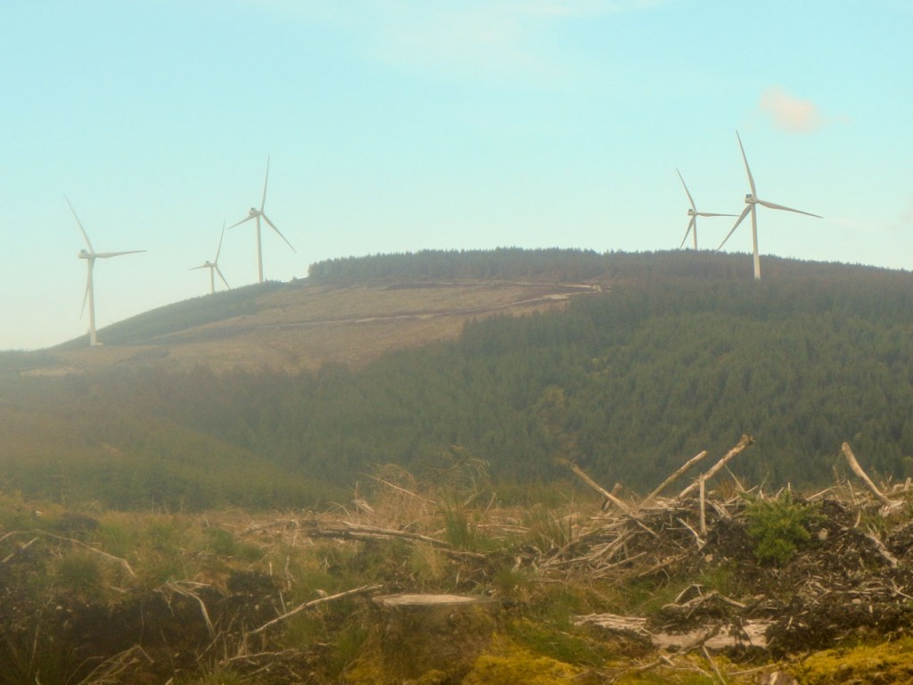
Wind farm 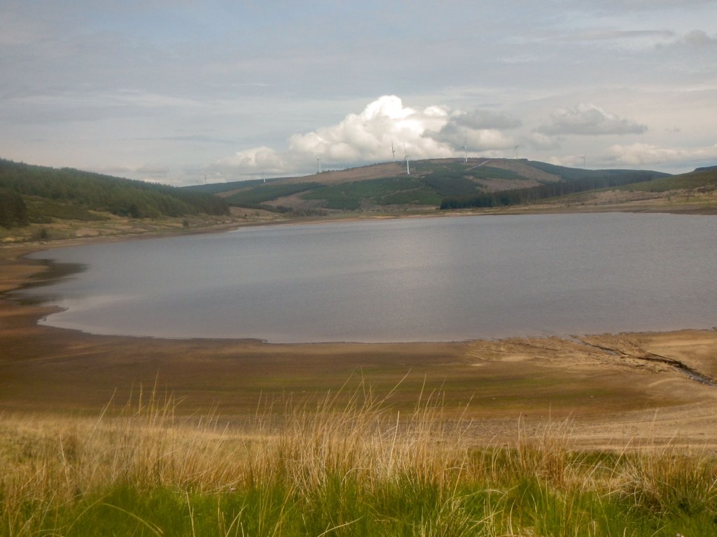
Lussa Loch
Soon I was walking on a very quiet and narrow country lane, virtually all the way to Campbeltown. There were lots of cows and sheep in fields, a few farms (one used to be owned by Paul McCartney), some very exclusive looking bungalows and excellent views looking all the way to the airfield and Machrihanish Dunes on the west side of the peninsula.
I was back at the Dellwood Hotel soon after 3pm. This gave time for “Side Adventure 1”. We had noticed a tidal island, Davaar Island, on the opposite side of the bay. The tide was just right to walk over the pebble causeway. Once over the causeway, we turned right towards the caves. Unfortunately, despite some poking around in several caves we didn’t find the “crucifixion” cave painting. Having discussed it with Tracey at the hotel I am pretty certain I know now which cave it is in and that I needed to look deeper and upwards – sadly there was no time to go back.
The pebble causeway 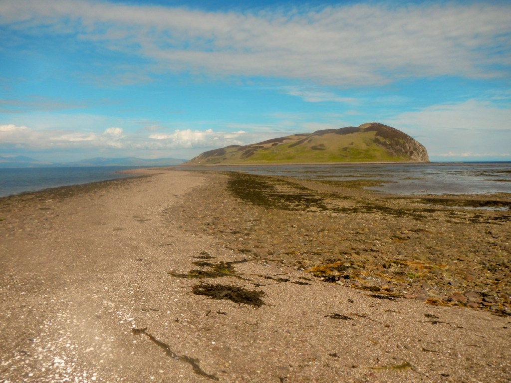
The second part of the “dog-leg” 
One of several caves
All was not lost. The walk across the causeway had been exhilarating. My husband returned the way we had come, but, having retraced steps to the causeway, I walked past some log cabins to the Stevenson lighthouse at the northernmost extremity. Then I turned and cut across to climb up a short but steep path to the trig point at the high point of the island. The views on this clear day were superb, including clearly seeing the entire dog legged tidal causeway to the mainland.
View from the top of Davaar
However the excitement for the day was not over. In the evening, eating our meal at the Royal Hotel we saw Judy Murray – yes that’s Andy’s mum! Her name was on the track and trace sheet too. On returning to the Dellwood we researched and discovered that she was indeed visiting Campbeltown. She had been visiting Dalintober Primary School in her efforts to bring tennis to the attention of children in rural Scotland. That’s where Bruce from the hotel is caretaker. She had even eaten cake from Muneroy (Muneroy Restaurant and Stores) in Southend, highlighted in her Tweet. That’s where I was walking to next day and certainly on Tracey’s recommendation, planning to eat a takeaway cake as well as bringing back a half meringue for Tracey. Of course at breakfast the next morning, we told Tracey all about seeing Judy Murray
The next day there was a fair bit of early mist as I set off from the Dellwood to walk through Campbeltown. As I passed, I said hello to the lollipop lady standing outside Dalintober School and waved to Bruce who was on the other side of the road standing by the school door. It’s interesting how, after a few days, it is possible to feel almost a part of this community.
I walked past the quay and the prominent carved granite cross, past the Art Nouveau Cinema and out of town past the Davaar Causeway. I saw two people struggling to push a bike laden with buckets across the sand – no doubt gathering shellfish. There followed a long undulating road walk. However it was a very quiet road and full of interest – rocky shore line with multiple shags, soaring gannets, the seemingly ubiquitous oystercatchers but unfortunately no otters. There were fields with sheep, fields with cows and calves. The sun gradually appeared and it was turning into a gorgeous sunny day. There were a couple of steep hill climbs on the road and I saw cyclists testing their strength and stamina on these. I even saw deer who stopped long enough for me to take photos!
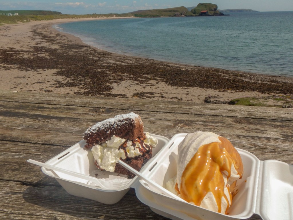
Eventually the route left the road to cross some farmland where I saw tadpoles in a pond then reached some wonderfully deserted sandy beaches. On the fields back from the foreshore there were scattered static caravans and caravan parks but with well separated pitches. It was clearly possible for ordinary cars to reach the sites, although from my approach, it felt as if I was in the middle of the countryside far from any roads. I had whole beaches to myself and sat on one to eat lunch, looking across to small Sanda Island (according to the map it has a pub). I’ve just looked at the website – the whole island can be hired at £2000 per day for up to eight people – too expensive for me! (Private Islands for rent – Sanda Island – Great Britain – Europe: Atlantic (vladi-private-islands.de)) It all looks pretty luxurious and exclusive though! I detoured slightly to reach the prominent and impressive memorial cross to the eighth Duke of Argyll.
Soon this pleasant interlude along deserted beaches ended. Presumably there isn’t permission for the path to continue along the coastline towards Dunaverty Bay. I returned to the road to walk to Southend where my walk for the day was completed. I met my husband and enjoyed eating a generous segment of chocolate cake with cream served personally by Frances at Muneroy Restaurant and Stores. My husband enjoyed his SECOND cake of the day and he hadn’t even walked there. We also remembered to buy a half meringue for Tracey – Frances knew exactly what was required and this was clearly a regular request.
Having consumed our takeaway cakes and coffee, watching dive bombing gannets fishing over Dunaverty Bay, as we sat on a bench overlooking the bay, we continued on our way. We visited the ruined 13th century St Columba Chapel complete with further medieval carvings like the ones at Saddell Abbey and also an unusual gravestone topped by a carving of skull and crossbones. We looked at the well from which St Columba reputedly drank following his landing in 563 to bring Christianity to Scotland. There are even some footprints of Columba which we saw carved in the rock. I thought he had landed in Iona, having the previous week visited the landing point in Iona – clearly all is steeped in legend and a mix of fact and fiction. That said, I did think that the landing place in Iona was treacherously rocky and a likely site of shipwreck rather than a controlled landing! Next to this we visited the Keil caves, previously inhabited by people but now only by birds who I surprised (and they surprised me) as I entered one of the caves. On the rocks below there were seals basking. There is a lot to see here.
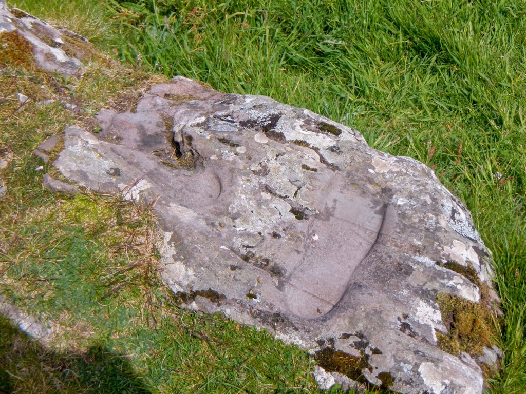
St Columba footprints 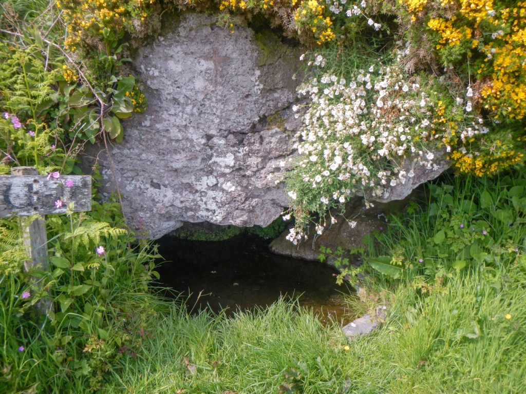
Keil caves
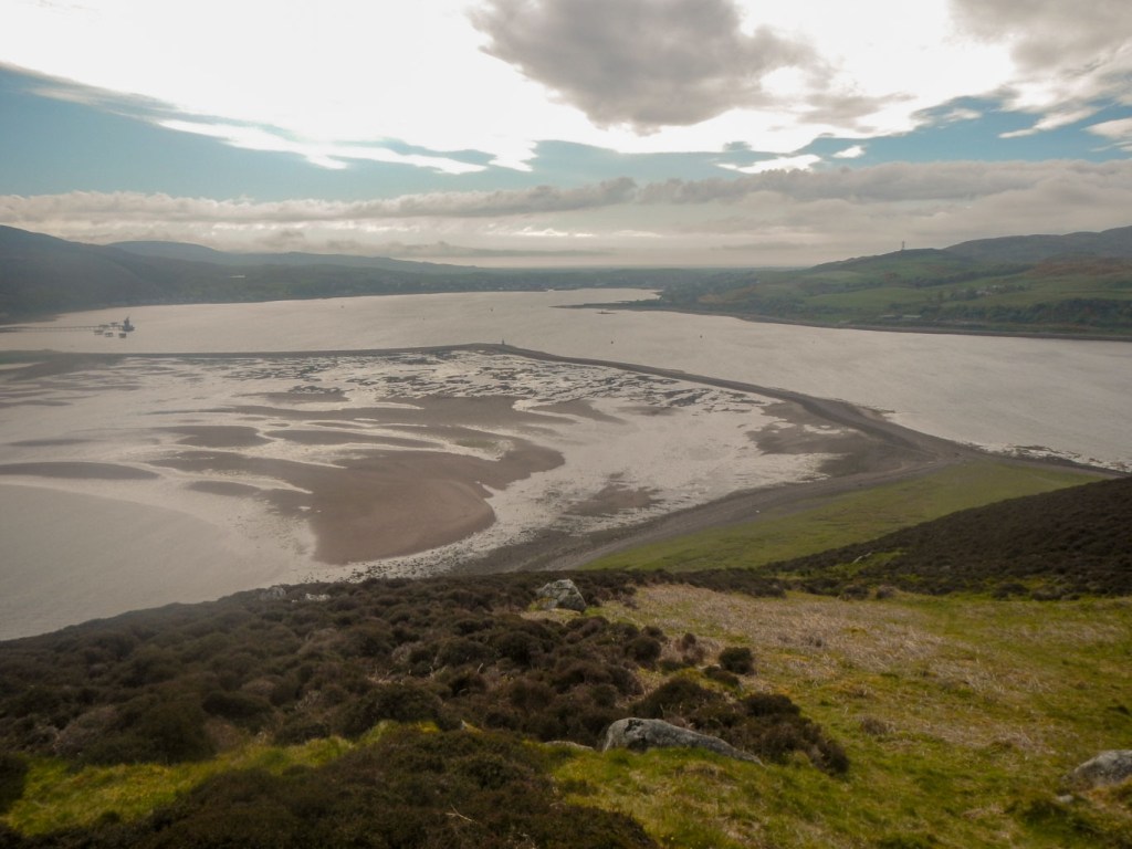
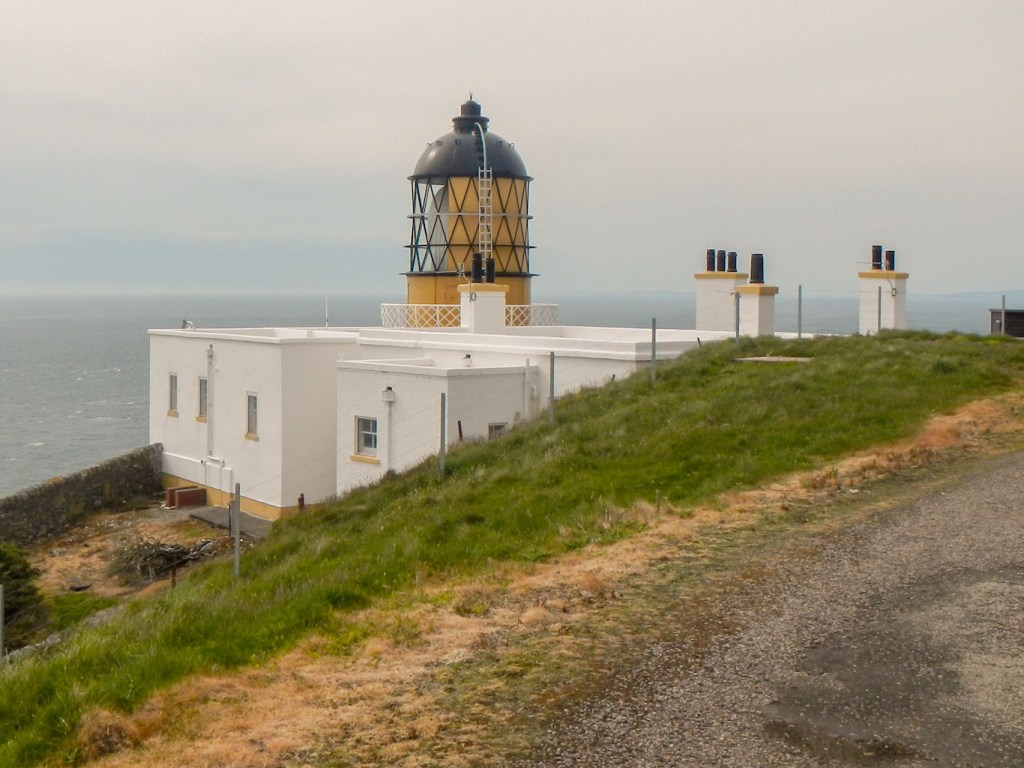
So to “Side Adventure 2”. The Kintyre Way does not actually visit the Mull of Kintyre which seems a sad omission as the Paul McCartney song Mull of Kintyre must surely be a major reason why many people have heard of this part of Scotland. We drove along a very narrow, hilly and windy road to the car park at the end of the public road. From here I descended via a memorial to the 29 people killed in a Chinook helicopter crash in 1994 to the lighthouse. Obviously there are foggy days here and I was fortunate to be enjoying a clear day. This part of the road is even more tortuous and steep than what we had already driven. The views were magnificent although it’s not really possible to see the coastline until reaching the lighthouse perched on the cliffs. I spent some time wandering around the deserted lighthouse grounds. There are two cottages available to rent. This is, as almost does not need stating, a further Stevenson lighthouse.
Lighthuse Mull of Kintyre 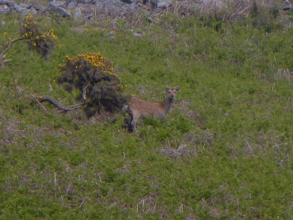
Another deer
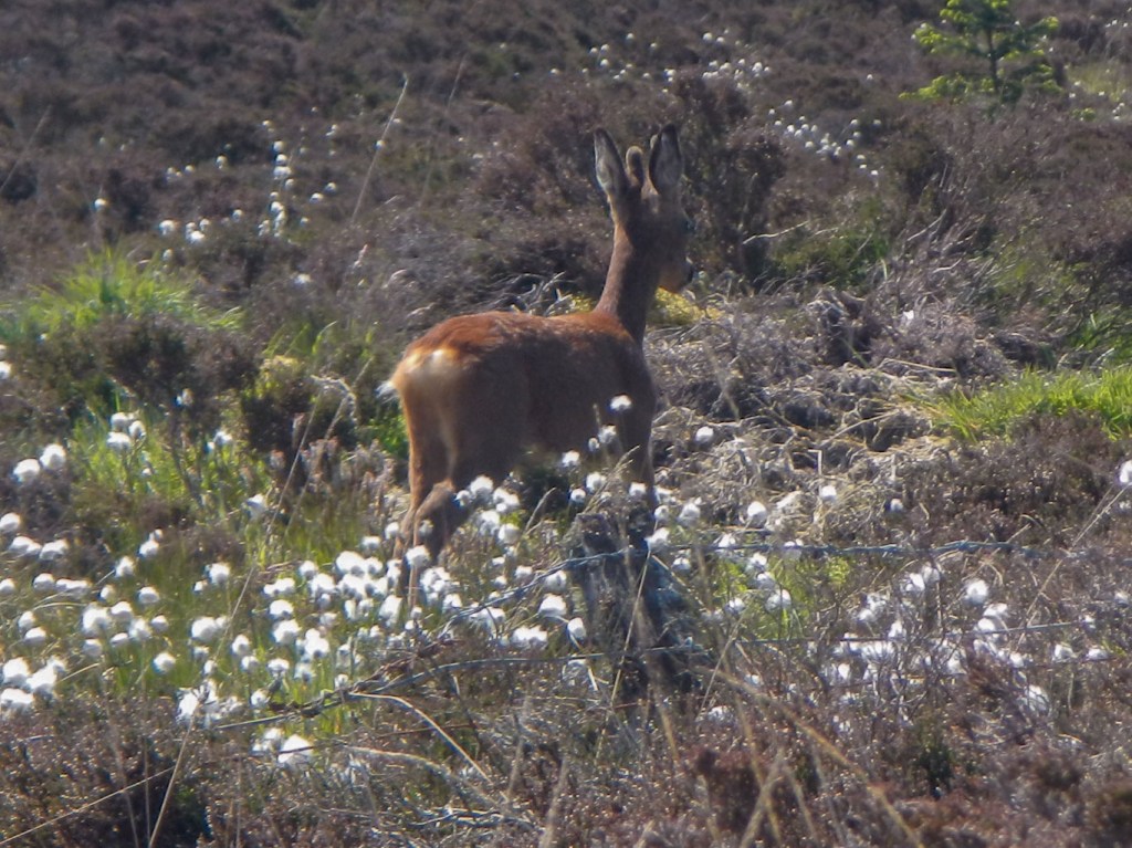
It then remained to ascend back to the car park 305m and 2km away. This took me almost 25 minutes of what felt like brisk walking apart from a momentary stop near the beginning of the climb to look at a deer.
I was looking forward to my final day, especially the walk over the cliffs around Binnean Fithich with what seemed to be the possibility of fine views. Sadly this was the day when the cloud was down and it rained nearly all day. I started from Southend, crossing the golf course to walk near the prominent hill fort site at Dunaverty. From here the walk crossed the bay that I had looked over the previous day while eating cake. Cattle on the beach were eating seaweed and I was relieved that they showed no interest in me. Unfortunately there followed a fair bit of road walking. My husband’s “pop up café” appeared at one point and I drank my coffee quickly while standing in the rain.
Dunaverty Hill Fort
My route left the road and followed an indistinct path mainly uphill over farmland and moor. Eventually I reached a track. It was time for lunch so I found a spot below the track, partially sheltered. I was surprised to hear noises and stood up to see two horse riders on the track. They were equally surprised to see me in this inclement weather.
Soon after finishing my hasty lunch, the route turned off the track along an indistinct path. As I reached the high cliffs, I saw a large colony of wild goats that quickly ran off. This area is part of Largiebaan Wildlife Reserve. The mists, far from rolling in from the sea like the song, were actually blowing out over the sea. I was anxious not to be near the cliff edge in this windy, wet weather with poor visibility. I missed the “path” and turned too far inland, climbing higher than necessary up the hill. However I managed to navigate back on to the path and follow the marker posts as I descended below the cloud level. Eventually there were some views of the beach at Innean, but I wasn’t tempted to descend to the sailor’s grave and the beach given the poor weather.
The path on this side of the cliffs was easier to follow and eventually I reached the road from where it was only a short walk to the end of the Kintyre Way and the car with my husband awaiting me at Machrihanish close to the 100 mile marker. I had completed the planned adventure plus two “side adventures” with one more adventure lined up for the next day.
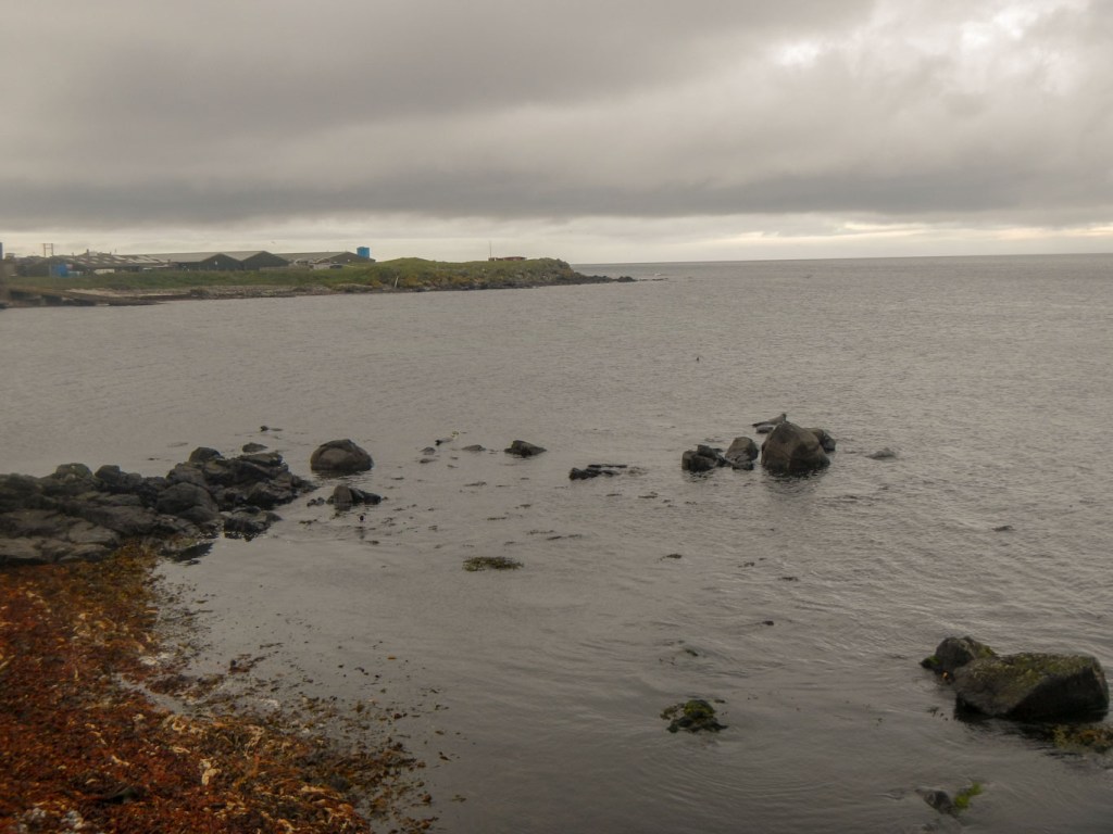
Seals at Machrihanish
When we left the Dellwood Hotel for the final time, Tracey and Bruce were preparing for a family stag party prior to a wedding a week hence. The hotel was closing to paying guests for the stag party.
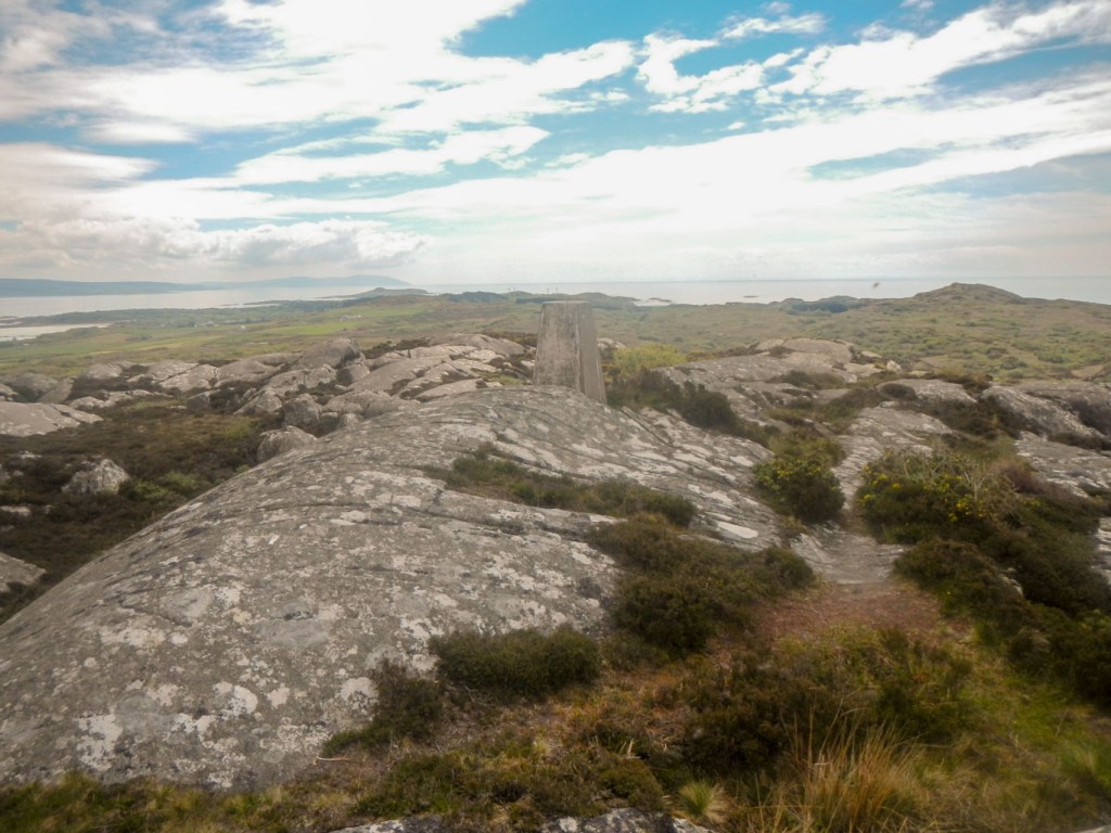
Gigha summit view 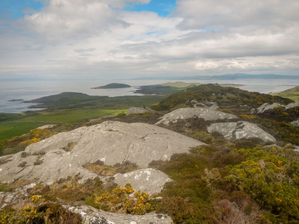
Gigha summit view 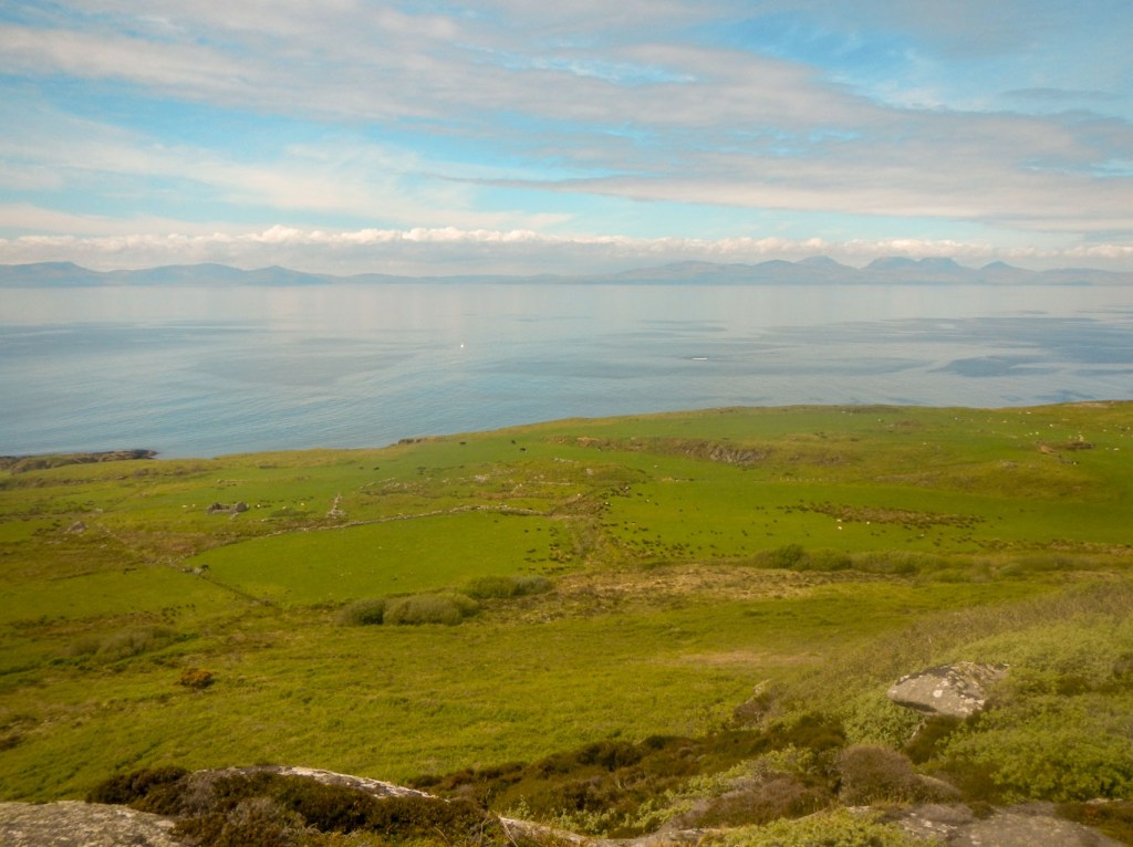
Gigha summit view
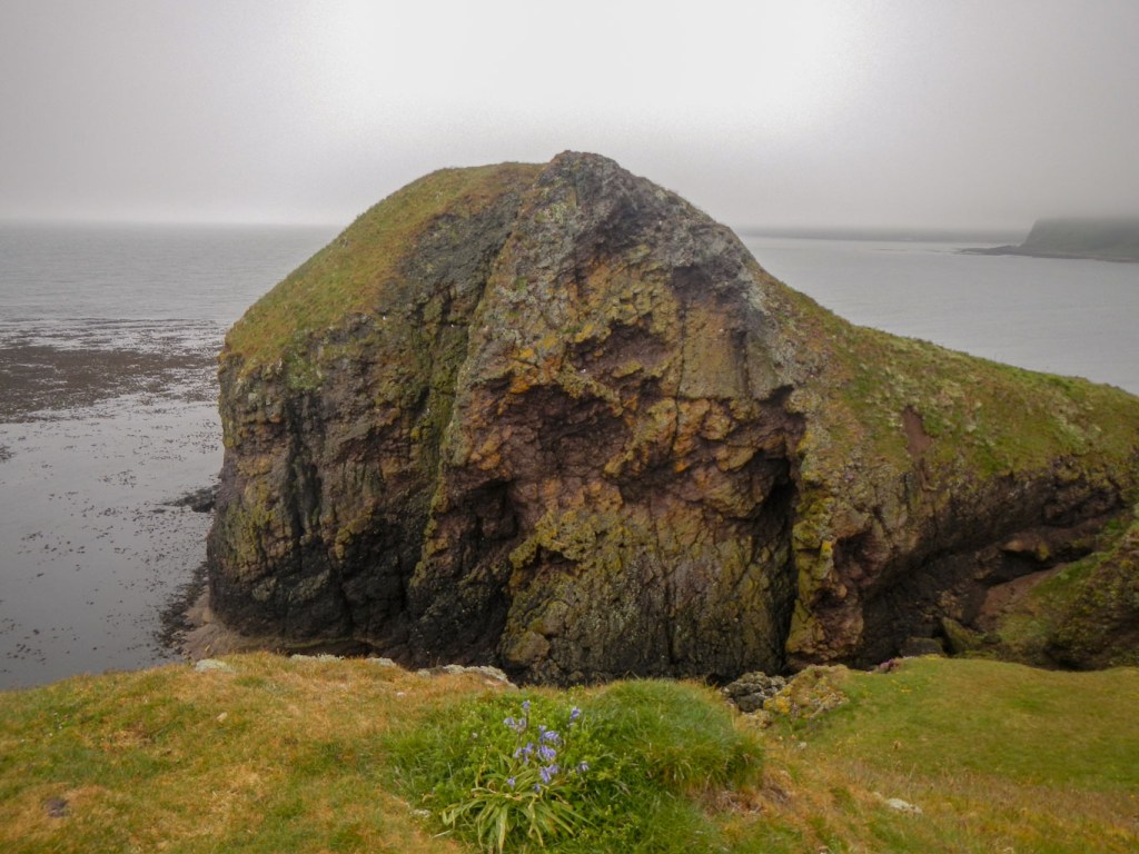
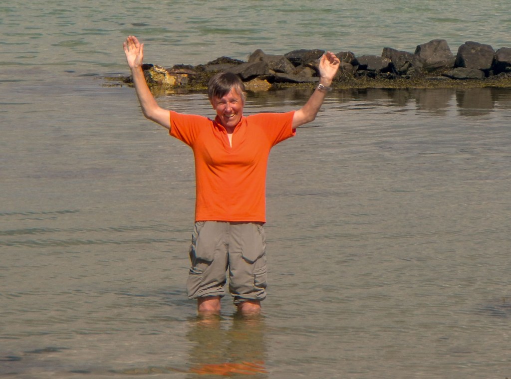
We were looking forward to “Side Adventure 3” which was a day trip to Gigha, travelling across the Sound of Gigha on the Calmac ferry – Loch Ranza. After crossing, we walked up to the north end of the island, visiting the northerly point with excellent views including of the Paps of Jura, making the ascent the hillock of Cnoc nan Gobhar again with glorious views and finally eating our lunch sitting on the beach of the more northerly of the beaches flanking the spit. I looked at heading up to the summit of Eilean Garbh on the far side, but there was an awkward looking steep step up the cliff and I decided against it. However as we returned south towards the village, I did take the turn to climb Creag Bhan, at 101m the highest point of Gigha. Unlike the previous day, it was clear and sunny so it was delightful spot, with a trig point and a view indicator crowning the topmost rocks. The wide ranging views encompassed Jura, Islay, Kintyre, Mull and even Northern Ireland as well as almost the whole of Gigha – and the arrows on the panorama showed me what was in each direction. This for me was the best part of my visit to Gigha. However before we departed on the ferry there was time to visit a small beach at the south end of the village for a quick paddle in the remarkably warm sea, a fitting conclusion to my Kintyre Adventures.

Loved your tale of adventure on the Kintyre Way… glad you found Muneroy! sadly no easy way to incorporate a trek to the Mull of Kintyre into the route – too many cliffs … however Paul McCartney and Wings accompanied by the Campbeltown Pipe Band recorded Mull of Kintyre on Saddell Beach.
You need a very low tide and a warm day to continue along the shore at Tayinloan. Need to duck down as you go under the ferry quay and then there is a pretty deep burn to cross 😎
Good news is a shop will soon be returning to Tayinloan Village !
Note if you share your story on the Walk Highlands website you may win some gear !
Great to get the feedback on the route…. we aim to keep it Wild and Beautiful. Next time for the Sailor’s grave !
LikeLike
Lovely littlereadthankyou.
Enjoyed your blog.
Am hopingtowildcamp September. When less midges. Hopecows are friendly!!! Many thanks
LikeLike