19 March 2026
The weather was set fair and I’d spent an afternoon this week repainting the garden wall so I thought I had earned a “day out” walking again. My start point was Princetown – reached the long way from Exeter along the A30 to Whiddon Down, driving almost to the centre of Moretonhampstead and then up on to the Moor driving past Warren House. Sadly the road closures between Dunsford and Moretonhampstead and from Ashburton on to the Moor are both still in place.
I was booted up and ready to walk at 09.00am as I looked at tremendous views from Princetown towards the North Moor, where I could see a red range flag flying as expected. There was not a cloud in the sky! My first objective was Round Hill Tor to tick off another summit on the LDWA list. It was probably my fourth attempt to visit – the first thwarted by the need to round up D of E candidates who had gone the wrong way, the second because I ran out of time and the third because I didn’t want to stay out any longer in the rain so cut my route short. I’d decided to put it first on the list and got there! In the clear conditions, there were superb views including towards Princetown and the prison.
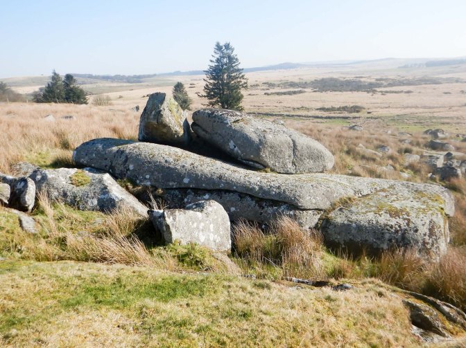
I descended back to the bridge over the Blackbrook River, making my way towards Blackey Tor, surprisingly, despite its size, not being named on OS maps until 2023.
My onward route was tussocky, boggy and even the animal tracks were indistinct. I crossed the Dartmoor Way track and proceeded across Royal Hill, eventually reaching the path along the leat to Peat Cottage. My painfully slow progress improved as I walked along defined although stony paths and tracks towards Raddick Plantation above Burrator Reservoir.
I made a small detour to visit Newleycombe Cross further along the same Monks Path I had followed for a short distance two weeks previously which links Buckfast Abbey with Tavistock and Buckland. However I missed Crazywell Cross a bit further on just off the other side of the track as I was concentrating on overtaking a group of walkers, the first I had seen near me since leaving Princetown.
Some more tracks led to Leather Tor bridge, where I sat on a conveniently placed tree trunk to eat an early lunch. It’s a solid clapper bridge with two openings over the River Meavy, built in 1833 to serve the ancient farms of Leathertor, Riddipit and Nosworthy.
Further walking followed along a track and I soon noticed what appeared to be a cave in the bank at the trackside near the site of Leathertor Farm. Further research has revealed that this is a potato cave, excavated to store root crops where they would be protected from winter frosts and daylight. The entrance is just over a metre high, apparently increasing to about two metres inside and the cave extends back for a length of over eight metres – but I didn’t venture inside!
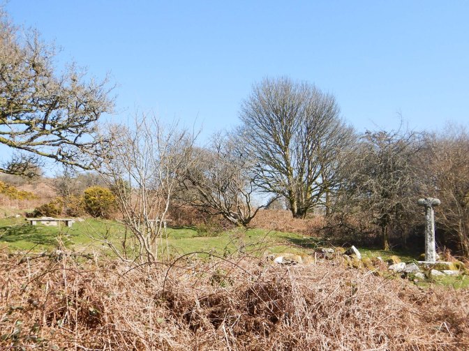
I passed a stone cist (burial chamber) surrounded by a protective fence then arrived at Cross Gate where there’s a scenically placed stone cross (probably not in its original place) and a bench providing a pleasant rest place – but not for me as I’d only just stopped for lunch.
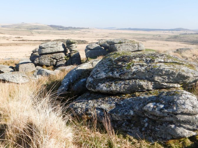
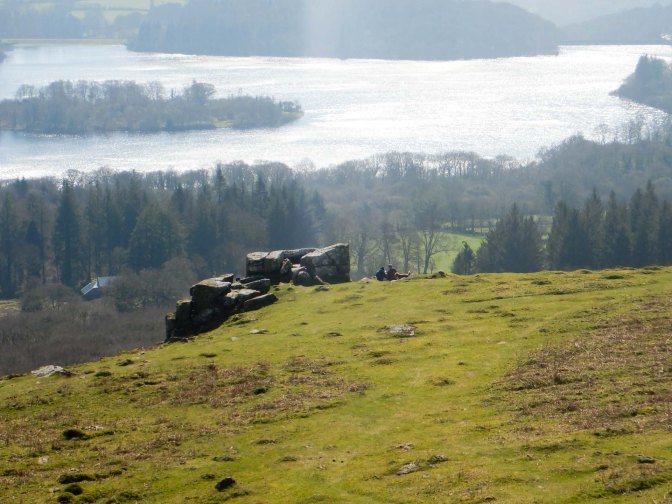
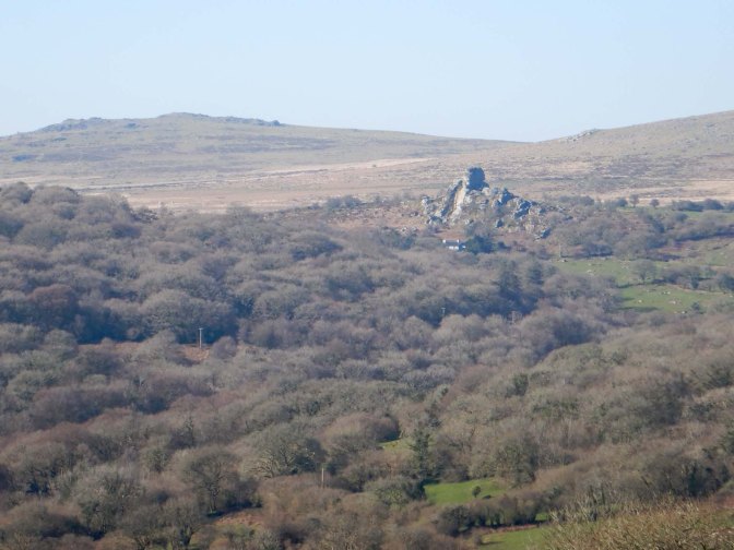
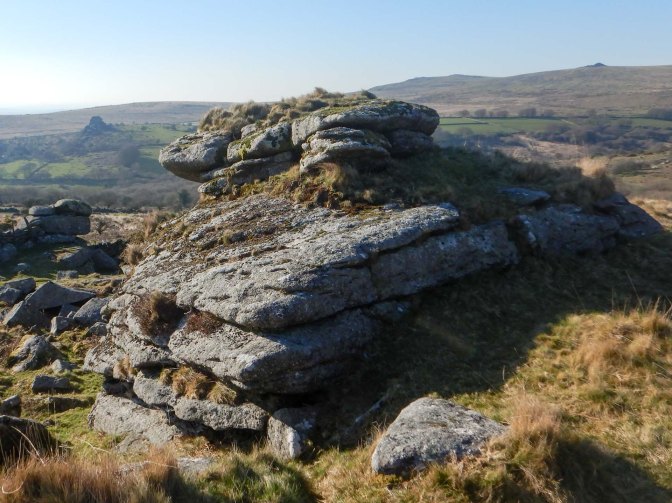
I continued along what had now become a small lane, before beginning my ascent of Peek Hill, initially following the edge of Peekhill plantation. A couple with a dog were sitting in the sun relaxing and enjoying the view over Burrator Reservoir next to Lowery Tor. This was one of my tors to bag from the LDWA list so I moved a discreet distance away before snapping the obligatory photo. The granite outcrop of Lowery Tor contrasts with the metamorphic stone of Peek Hill and the surrounding area on the upper hillside – but I had already “bagged” Peek Hill on a previous visit.
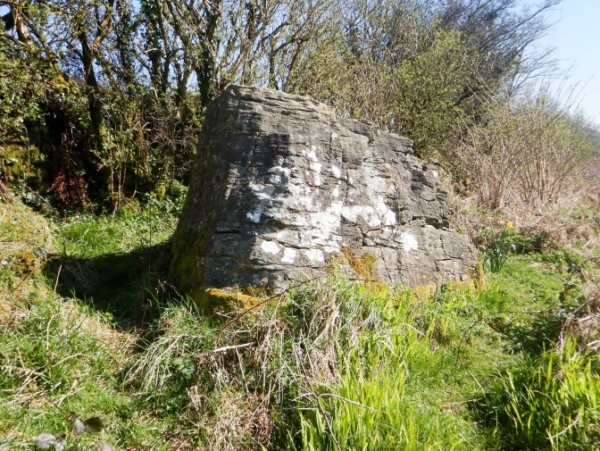
Sharpitor is a huge nearby outcrop that I have also visited in the past so I descended over springy grassland to cross the B3212, cross more grassy moorland and exit through a field to reach an old grassy lane leading to a small surfaced lane near Gipsy Rock. Gipsy Rock isn’t named on the OS map but it is thought to have been the meeting place of the Walkhampton Hundred (administrative division) in Saxon times (thanks to https://www.torsofdartmoor.co.uk/tor-page.php?tor=gipsy-rock for this information).
I reached Walkhampton Church House dating from the early sixteenth century and the church colocated about half a mile away from the village. The cross opposite Church House is possibly a waymarker for the aforementioned route between the Abbeys of Buckland and Buckfast or may be a Churchyard Cross from the nearby Walkhampton Church.
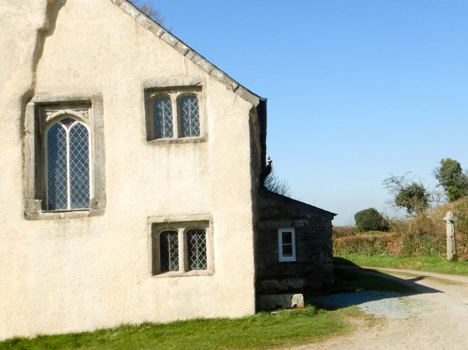
Church House was originally built to brew and sell ale and it would have been open for business straight after church services. Besides the brewing of Church Ale, it served as the Council Chamber, a collection centre for local Tithes, the distribution centre of bread for the poor and an inn on the route from Buckfast Abbey to Tavistock Abbey.
The fact that the church is half a mile from the village suggests that it predates the village and was built to serve the surrounding farms and as a place of prayer on the Monks Path. The current granite building with four prominent pinnacles on its tower is Grade I listed and dates from the 15th century. Unlike most churches which face east, it faces north-east, the direction of the rising sun on the longest day. Gipsy Rock is on this alignment so might be linked with the church site.
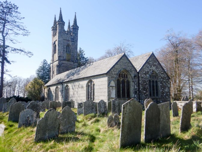
Unusually nowadays the church is kept open for visitors and has a very welcoming atmosphere. There’s also a toilet and access to drinking water. I would have purchased the information book and left a donation but my problem was that I needed to use cash and the only way of paying was by using the QR code so I left without the guide book. Clearly this church in the “middle of nowhere” is technologically very much in the twenty-first century.
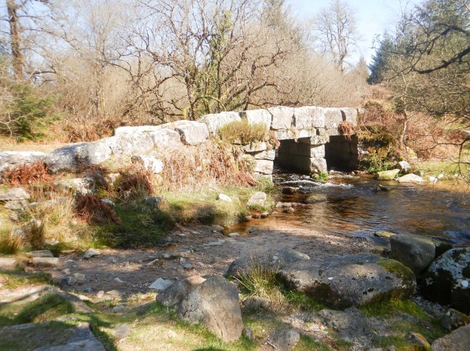
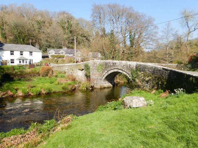
I marched on to reach the magnificent Grade 2 listed late fifteenth / early sixteenth century Huckworthy Bridge over the River Walkham. It’s a picturesque spot and there’s a bench offering a superb view of the rapidly flowing river and the bridge so I enjoyed the remains of my lunch.
Suitably refreshed, I tackled the steep hill out of the valley on the far side of the bridge. I turned on to a bridle path which looked like an ancient byway and crossed a corner of Huckworthy Common past gnarled hawthorn trees.
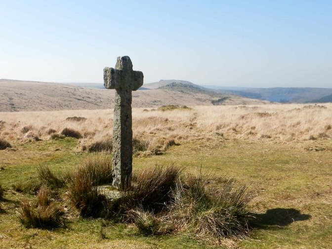
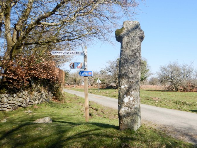
Soon I reached another road and a wayside cross. Travellers from Plympton Priory, on route to Tavistock Abbey, would pass this cross if they wished to call at Sampford Spiney.
I was indeed heading for Sampford Spiney along a very narrow lane. Two cars proceeded in rapid succession but I was sure this was a blip and it would be a quiet lane, given the paucity of habitation along its length. Hence I was shocked to realise there was a huge “Bishops Move” removal van behind me – fortunately there was also a field gate entrance nearby where I was able to wait in safety. The removal van was immediately followed by a much smaller self-drive van. Indeed the road was so narrow and windy that I was walking almost as fast as the vans were travelling.
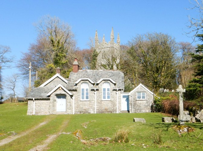
I turned off onto a byway that had been demoted to footpath but soon emerged on a road opposite a grassed area complete with cross, old National Schoolhouse and the Grade 1 listed thirteenth century church behind as well as the nearby manor house once owned by Sir Francis Drake. The Grade 2 listed schoolhouse was originally a church house dating from the late sixteenth century but served as the school from 1887 to 1923 and was converted to a residential building in the 1960s. A notice in the church porch suggested the church is kept unlocked but that certainly wasn’t the case when I was there.
Over ambitiously I had hoped to walk further up to Pew Tor and beyond but my slow initial progress meant this wasn’t going to work if I was to be sure to get back to Princetown before dusk. Instead I headed in a generally easterly direction along the route of the Higher Moor Link on the Dartmoor Way. The lanes were almost devoid of wheeled traffic or indeed of anybody. Eventually I reached the open moor and the relatively flat route of a dismantled railway. There were extensive views including of the iconic but “forbidden” Vixen Tor. This was also when I realised just how breezy it was as I battled to walk straight into the wind.
I had enough time to take the longer route curving around King’s Tor and allowing me to officially “bag” Little Kings Tor. I’m sure I’ve been to it before but not appreciated it was an additional separate tor. I met a lady walking her dog and herself using a crutch – the local people are indeed tough and determined! A runner approached from the opposite direction and a group of young people chatting and incongruously reviewing their mobile phones rather than taking in the magnificent scenery.
Eventually I reached my car at Princetown having covered around nineteen miles – and that included all the initial bog and tussocks which had been slow going.
It had been an amazing and exhilarating day on Dartmoor with constant blue skies devoid of cloud although a strong breeze ensured sufficient wind chill to counteract the heat of the sun. The days have lengthened and the clocks will be changing at the end of the month. Let’s hope this is a foretaste for a summer of adventures!
