20 Jan 2026
It was a wet and windy day and there was even a yellow weather warning. We couldn’t really complain as it was our fourth full day in West Wales and the first with any significant rain. My husband decided that it’s one thing walking when it is forecast to rain later but quite another when it’s already pouring and there’s no sign of improvement all day. However, he was content to drop me off in the ancient market town of Tregaron to start my walk and he would spend the day driving round some interesting sights in the area.
It was of course a day for full waterproofs. The saying “There’s no such thing as bad weather, only unsuitable clothing” has been attributed in various forms to many people including Alfred Wainwright and Ranulph Fiennes and was certainly apt. I was definitely well enough equipped to spend a day walking in the wind and rain on the route I had selected.
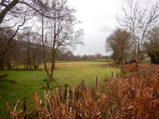
I ascended along a narrow lane out of the town. A woman overtook me in her car and then I passed her as she stood at a field gateway checking her sheep. She passed the time of day and commented that it wasn’t a great day for a walk. However the visibility was actually reasonable and I had views back towards the town behind and hills ahead as I continued to climb on a track past a farm and then on field footpaths.
It became more windy as I reached the open ground but the rain eased somewhat. I had to stop to replace my attached rucksack rain cover which was flapping uselessly as a strong gust pulled it off. I cinched the drawstring on more tightly this time.
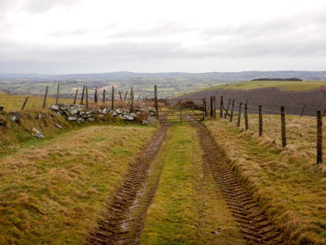
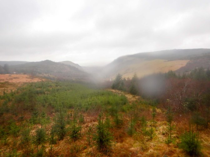
The route was signed sporadically and I needed to keep checking my navigation as I passed ruined farmhouses and reached moorland and areas newly planted as forestry plantations. I skirted a farm building before turning on to a track / path following the Afon Berwyn, a tributary of the Afon Teifi which flows to Cardigan.
I was relieved to see that I didn’t need to cross the stream through a ford as the footpath stayed on the same side. I continued to follow the stream then realised that I hadn’t seen a footpath sign for a while. Checking the map, I noted that I should be about 100m away from the stream so I climbed up the side of the valley to reach a footpath which subsequently became a track.
The path soon descended but became less defined and there was a stile into a garden. Rechecking the map, I was sure that was the path which was confirmed by a sign on the stile. I spotted a footbridge to cross the stream (as on the map), although I was concerned because I seemed to be very near the house and I hoped no-one was in or at least if they were, they wouldn’t spot me. No such luck – a man opened the nearby door and told me to go up through some trees which I did – sadly I think he had meant some different trees as there was no evidence of the gate he had mentioned and I ended up having to straddle a fence to reach the minor road; I wasn’t keen on returning to near the house and trying again. Although he had spoken kindly, I was sure he didn’t want me close to his house again.
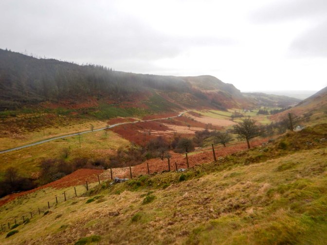
I made rapid progress up the road and along a main forestry track past a car park and viewpoint. Despite the weather, I was able to enjoy the view.
The surfaced track continued so the walking was easy. However, the map showed that I needed to turn off on to a smaller track. Fallen trees blocked the path in several places, but I was fortunate that some of the tree trunks had been partially cleared from the grassy and muddy track. There was an unexpected highlight when two roe deer ran across ahead of me and disappeared. I continued along a soggy track clambering over and under more fallen trees.
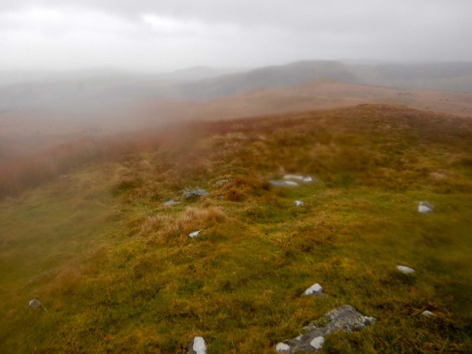
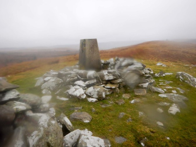
I was relieved to reach open moorland and see the trig point at Carn Fawr which is also the site of a Neolithic burial cairn. It was very windy so I soon left the summit to descend over the open moor.
A network of tacks, paths and country lanes followed, requiring multiple stops to check my navigation. At one point the stream bank where the path had been was crumbling away but fortunately I managed to clamber past. Eventually I reached the “main” road past the small fire station and back to the centre of Tregaron.
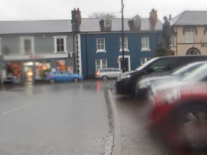
Despite the ongoing rain, I stopped to take a photo in the town square including the prominent statue of Henry Richard (1812-1888). Richard was born in Tregaron. He was a Congregational minister and Welsh Member of Parliament. Richard was an advocate of peace and international arbitration as well as secretary of the Peace Society for forty years in addition to campaigning against slavery.
My walk was completed. Despite the inclement weather, it had been an interesting expedition and at least I was returning to a warm, dry hotel room rather than a tent.
