17 Jan 2026 / 19 Jan 2026
The Pembrokeshire Coast is magnificent, but the probably less well known wild, remote moor, heath and grassland of the Preseli Hills is also located within Pembrokeshire and is mostly within the boundary of the Pembrokeshire Coast National Park.
My walk began at a small forest car park in the Gwaun Valley near Pontfaen. It was just before 10am when my husband dropped me off – due to the late hotel breakfast at the weekend compounded by the bendy, narrow and hilly roads leading to a longer than expected journey time. It really seems quite isolated; apparently around here the locals continue to celebrate New Year’s Day on 13 January as they didn’t change from using the Julian calendar to the Gregorian calendar back when everyone else changed in the sixteenth century. The valley itself was created by torrents of meltwater from the retreating ice during the last Ice Age.
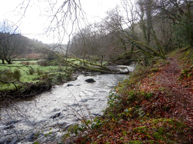
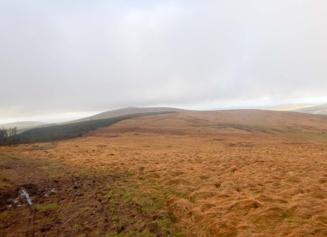
It was scenic although very muddy following all the recent rain and snow. I walked along a path through the woods following the Afon Gwaun before crossing a footbridge and climbing up towards the hills. I was even warm enough to remove two clothing layers and walk wearing only a T shirt under my windproof jacket. I strolled on the signed path through a farmyard where the farmer said “Hello” and later overtook me on his tractor as I walked on a quiet lane with only his farm at the end of it.
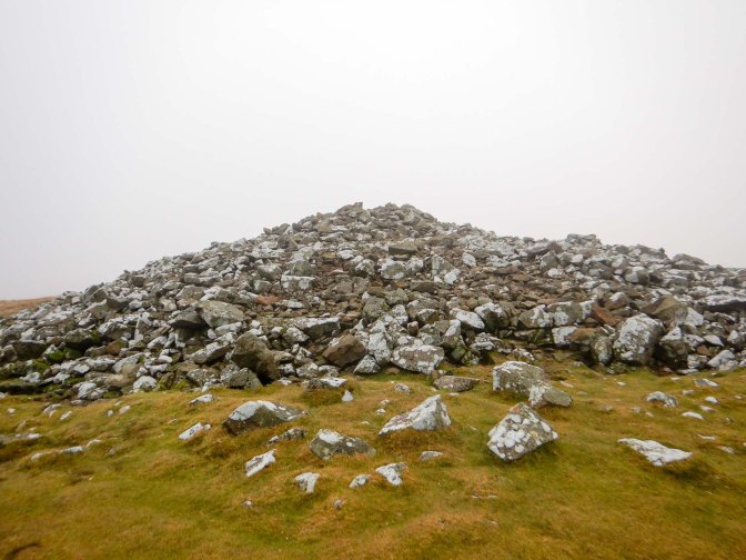
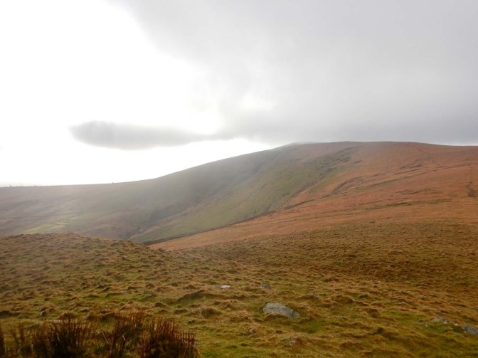
It was quite a stiff climb to the cairn at Foel Eyr (468m). The huge pile of grey stones is the remains of a Bronze Age burial cairn. It would have been a magnificent viewpoint but I was in the cloud and I didn’t pause to look at the toposcope to see what I was missing. I was keen to push on to ensure that I would complete the entirety of my planned walk before sunset.
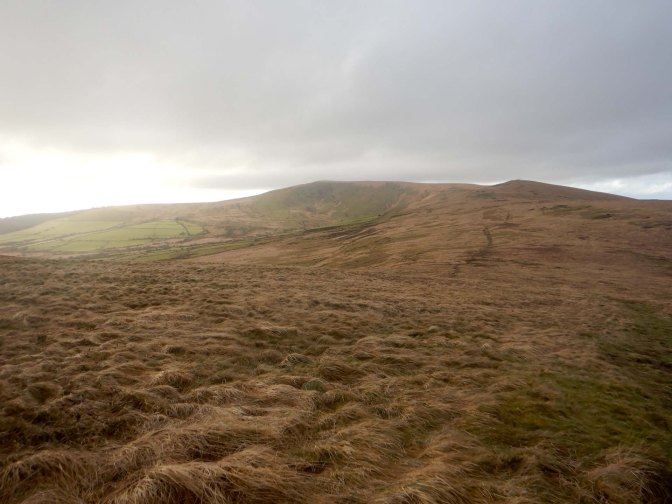
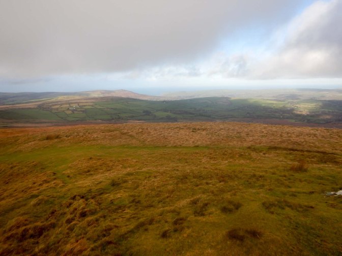
I descended to a car park on the B4329 before starting another climb across open access land, with the Pantmaenog Forest to my right. I passed a couple of walkers heading the opposite way. Looking behind me I could see the summit of Foel Eyr, now out of the cloud.
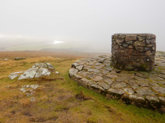
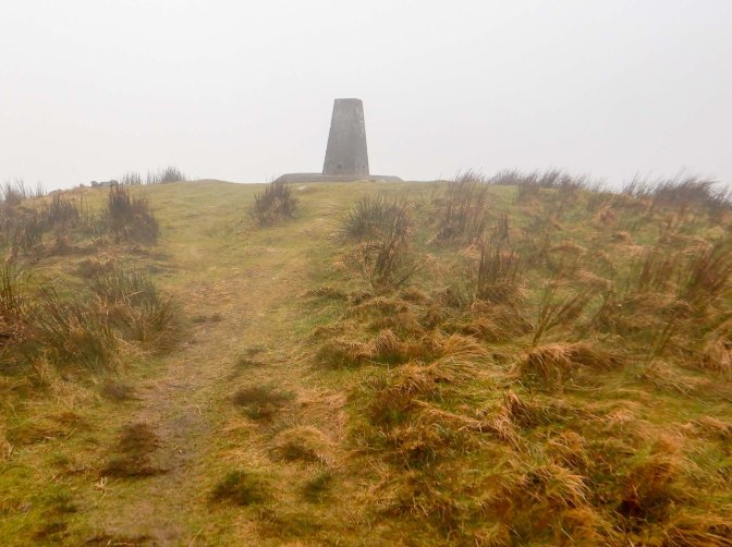
I turned south after passing the forest, heading towards Foel Cwmcerwyn, at 536m the high point of the Preseli Hills. Oddly a group of men were descending carrying a body board – a week earlier this could have been used as a toboggan, but I’m not sure what they were using it for on that day! I passed a prehistoric round cairn and soon the summit trig point was in sight. Unfortunately I was in the cloud once more.
I cut a corner to return to the main ridge. This is “The Golden Road” used as an ancient highway for transporting gold mined on the east coast of Ireland to the south of England. Over its eight mile length there are opportunities for tremendous views over the surrounding countryside. In fact the weather was continuing to improve and I could even see back to Foel Cwmcerwyn which had previously been in cloud.
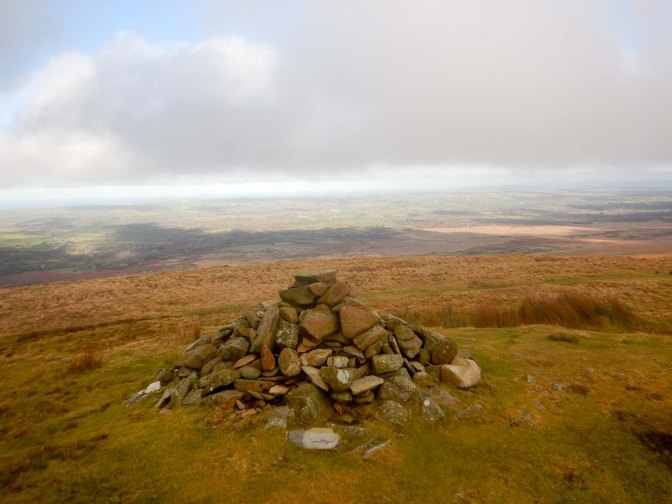
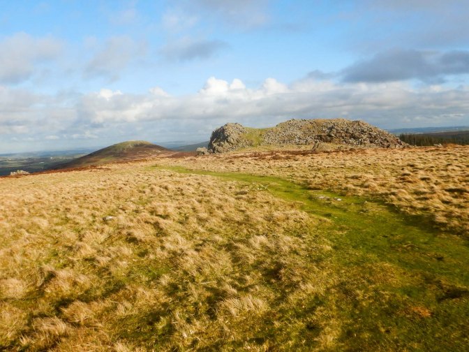
I passed a further Bronze Age round cairn – Foel Feddau (467m).
This was turning into the fine ridge walk that I had hoped for.
I reached Carn Bica and rested for a while in hollow sheltered by the rocks. I realised that I had time to divert over to Carn Sian. Somewhere in this area a Liberator Bomber crashed with the loss of life of six of the nine men on board, during a night flight on 19 September 1944. There’s still some fragments of the plane at the site as well as a memorial plaque laid in 1984. However, despite spending some time walking around the area, I wasn’t able to find the site – I couldn’t find the grid reference on any of the websites so my search was over quite a wide area.
However, I did find some older remains- Bedd Arthur – a possible Neolithic hengiform monument comprising thirteen standing stones all under 60cm tall together with two fallen stones within a barely visible oval bank and ditch. It has been hypothesised that this was a precursor monument to Stonehenge. Originally a burial chamber may have been sited within the stones.
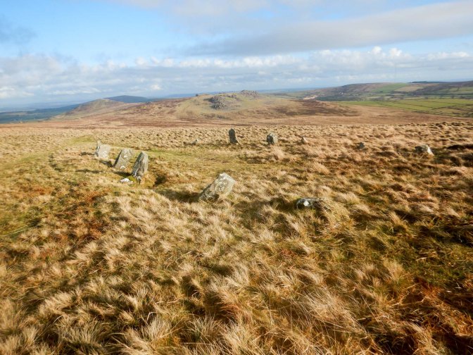
Folklore suggests this as the burial place of King Arthur, but there are many other candidate sites! According to legend, King Arthur and his band of knights landed in Milford Haven and travelled the Golden Road. Meanwhile the magical boar Twrch Trwyth arrived in St David’s and met King Arthur; they chased each other and had a fight.
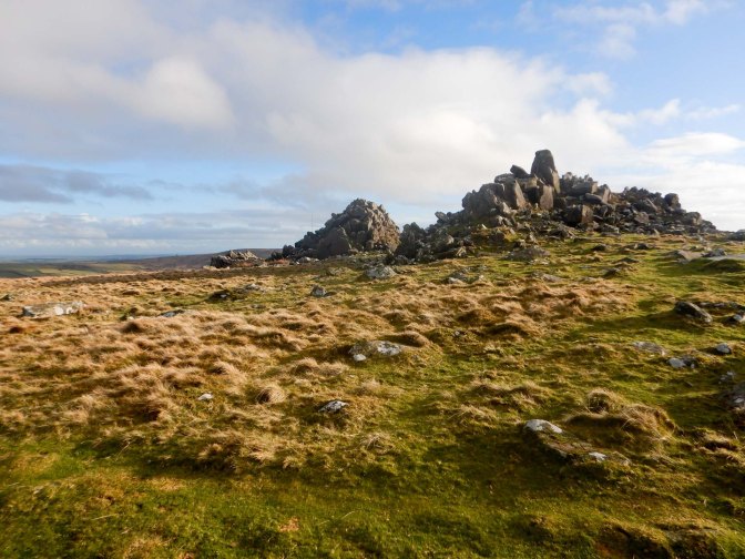
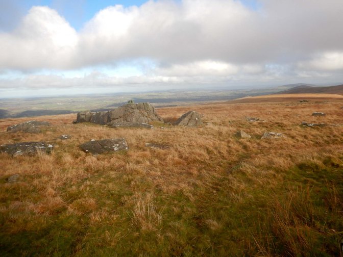
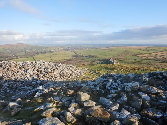
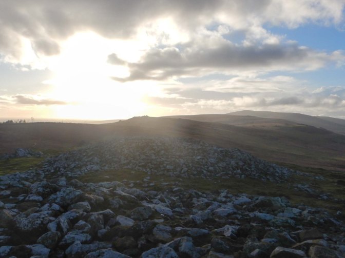
I was heading towards a group of impressive looking rock formations including Carn Menyn, a possible source for some of the bluestones used at Stonehenge. However none of the theories of Stonehenge links have been proved beyond all doubt.
It’s not possible to miss the sight of the prominent Foeldrygarn at the eastern end of the Preseli range. The summit is relatively isolated and hence punches more above its weight than its height of 363m would suggest. The hill is topped by the remains of a hillfort, probably from the Iron Age period. It is enclosed by two dry built stone ramparts and natural outcrops of rock incorporated in the defences. There are three large cairns and a number of hut circles within the enclosures. There’s a trig point on the summit and I enjoyed excellent views along much of the Preseli ridge. A local woman with her two children was making the most of the unseasonably good weather having walked from the road to the summit.
I saw more people on that hill than I had seen all day, including my husband who was climbing up from the road to the south east; I turned as we met and climbed again to accompany him to the wind blown summit.
It had been a satisfying traverse of the Preseli range and certainly choosing to walk from west to east meant that I saved the most dramatic summit for the end.
This was my adventure for the map. However two days later, at the end of a day touring by car up to Aberystwyth and back, I discovered a spectacular short walk on a section of the Ceredigion Coast path. This is also on map 145 and definitely worthy of a mention. In fact, from what I have seen, the Ceredigion Coast path has many impressive features and deserves to be highlighted as it probably suffers from being a neighbour to the longer established Pembrokeshire Coast path; maybe it is a less crowded and equally scenic alternative.
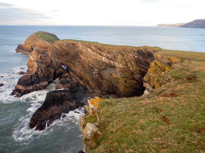
We parked the car easily in a free car park just outside the village of Llangrannog. My husband opted for a short stroll to the village while I followed a track towards Pendinas Lochtyn, a superb example of an Iron Age hill fort. I diverted round the base of the fort, making for the headland overlooking iconic Ynys Lochtyn (an island). The peninsula was deserted apart from several ponies grazing on the springy turf.
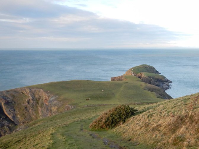
I walked to the furthest extremity of the headland.
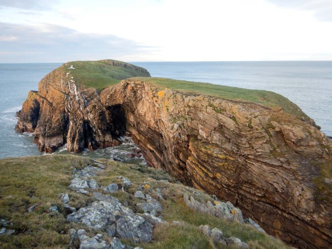
At very low tides it is apparently possible (although probably inadvisable) to clamber down a precipitous path on the vertiginous cliffs, scramble over rocks and past rock pools and continue through a sea cave, on to a large ledge, then up a grass path on to the island itself.
I satisfied myself merely with wandering round the peninsula before returning to the base of the hill fort.
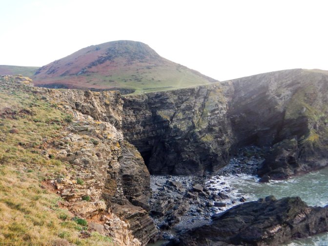
I followed the coast path towards Llangrannog and turned on to a footpath to descend to the beach. The tide was low enough for me to walk on the sand around the small headland and past the stack; legend states that Carreg Bica was a giant’s tooth.
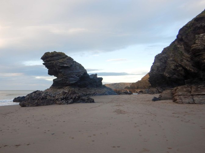
The beach seemed very busy given it’s January and the number of eateries and shops in the small village suggest it may be a popular spot during the peak season. Undoubtedly the coastline is picturesque and I just wished that I had more time to explore it further. Yet another place worthy of a return visit!
