14 August 2025
I’d packed my backpacking rucksack and set off on my planned Fisherfield Six Round on 12 August starting what should have been a magnificent but challenging three day and two night expedition. Sadly my plans went awry. I suspect it was precipitated by coming down the Ben Wyvis path so quickly the previous day; my back gradually became more painful and went into spasm after I’d been walking for just over an hour. Fortunately I had only just started and was still on easy tracks walking in to the mountain area so I walked back to the road.
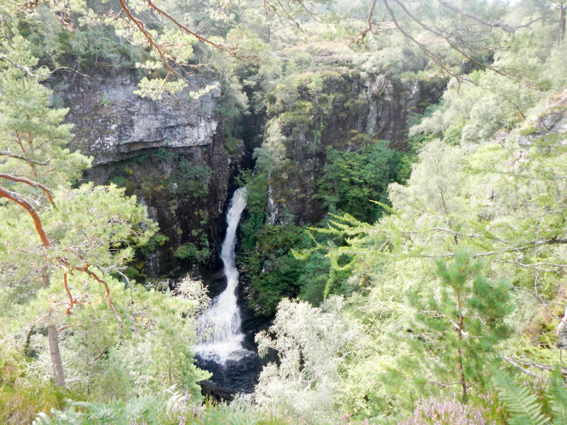
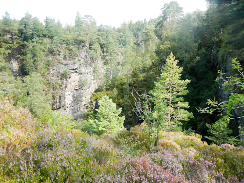
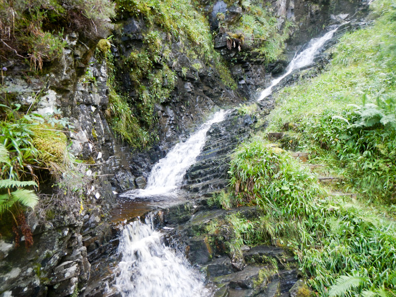
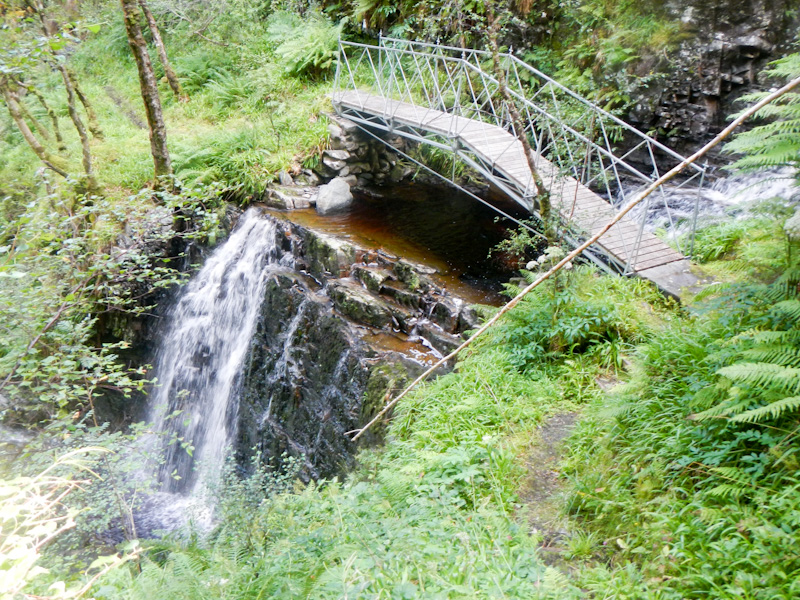
On 13 August, my back was settling so I ventured out on a low level walk from our accommodation at Forest Way Bunkhouse. In the end I walked 18km with just over 460m of ascent. I enjoyed a picturesque expedition near the River Broom and its tributary, Abhainn Cuileig, looking at a couple of impressive gorges and few dramatic waterfalls. I would have missed all this if I hadn’t been injured…… By the way, they’re on map 20.
Actually there was a thunderstorm in the early evening so perhaps it was just as well that I wasn’t still out on the Fisherfield Round.
On 14 August I was ready to attempt a single day adventure on map 19 and decided to walk up to Toll an Lochain, said to be one of the most magnificent corries in Scotland. It’s not a high level walk but it does have sections without a clear path over bleak and potentially boggy terrain. There was a new yellow weather warning for further electric storms later in the day, a further reason not to go on to the summits.
Having been dropped off at the start point where dense rhododendrons obscured the route, the first challenge was to discover the path. Almost immediately, the faint path crossed a shallow but fast flowing stream and continued through more overgrown rhododendrons. I bypassed even more rhododendrons by deviating to the north of where the path was marked on the map.
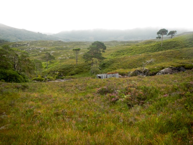
I passed a dilapidated wooden shed next to the stream and then climbed upwards, passing a waterfall.
I continued to ascend and was pleased to find some sandstone slabs which provided respite from the otherwise boggy terrain. Two walkers were descending with large packs – likely they had been wild camping. It turned out that they would be the only people I saw for the entire walk.
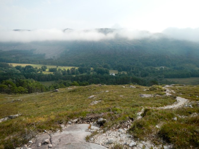
Despite some persisting morning mist, I could see views back to Dundonnell House and to the road from where I had started walking.
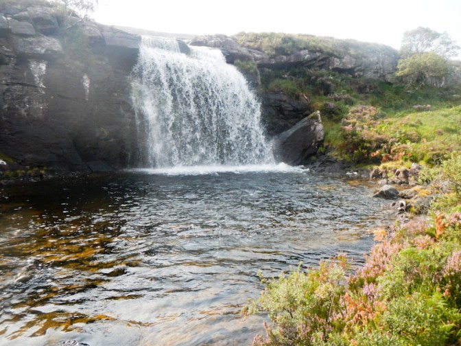
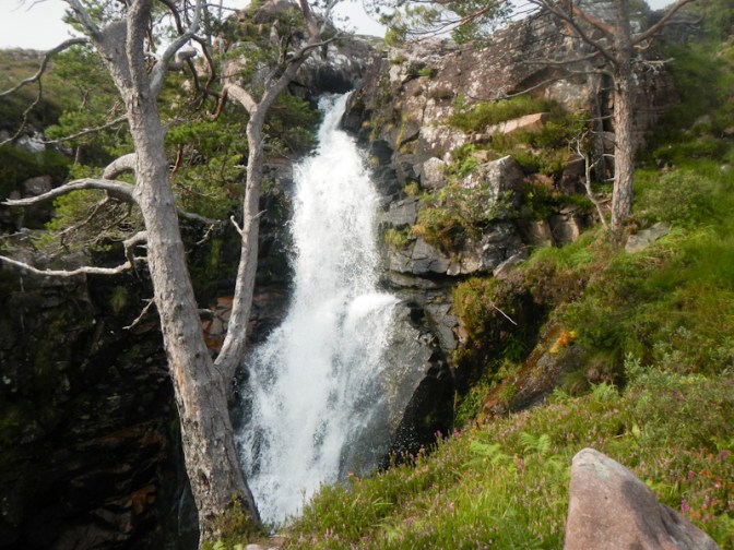
I reached a larger waterfall on the main stream then had to cross a tributary stream flowing from the nearer Glas Tholl corrie. I got wet feet! This isn’t crossable when the stream is in spate and I understood that water levels can rise quickly.
The route continued with a path climbing up to the side of the waterfall.
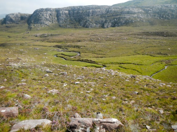
The path became indistinct – actually there’s no path marked on the map. I tried to stick to the sandstone slabs as much as possible as they provided an easier surface for walking. In places there were cairns which were possibly marking the route, although I was on a different line to the GPX route on the Walkhighland website.
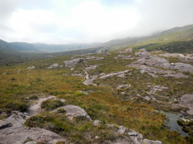
I crossed another tributary stream and continued to make a steady but relentless ascent towards the corrie.
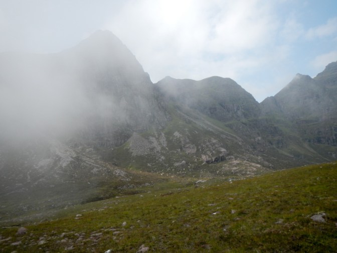
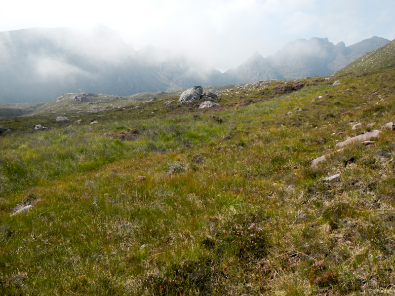
I realised that it was becoming misty again and was resigning myself to the fact that I wasn’t going to see this picturesque corrie in all its glory. The pinnacles that had been visible in the distance disappeared into the cloud.
I didn’t see Loch Toll an Lochain until I had almost arrived.
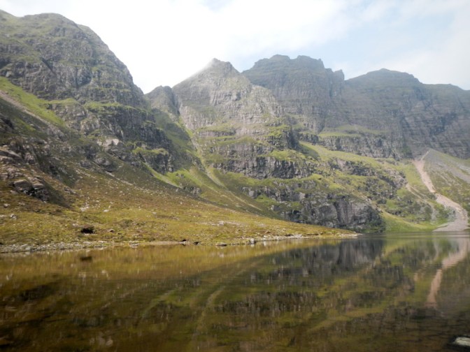
I was very fortunate that the mist was lifting as I approached and by the time I arrived at the loch, close to the dam of stones where the stream emerges, there was only a wisp of cloud hiding part of the magnificent pinnacled range of crags ahead of me.
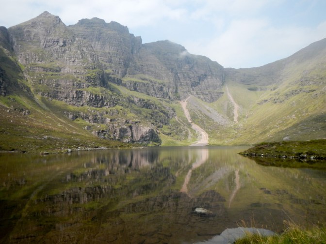
This was the spot for me to sit and enjoy my lunch whilst taking in the views. The sun shone on the great headwall. This has been nicknamed “The British Eigerwand”. I could see Sgurr Fiona, Lord Berkeley’s Seat and Corrag Bhuidhe and the peaks were reflected in the water of the lochan below.
Eventually I decided that it was time to leave. Just afterwards more cloud rolled in and this emphasised to me how fortunate I had been to enjoy the magnificent views.
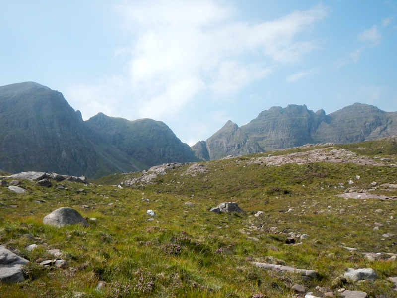
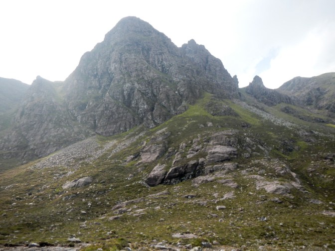
I ended up taking a different line to return as I tried to stick to the route marked out by the GPX co-ordinates. Ahead of me, I had excellent views of quartzite crags to the south east. I hadn’t seen these as I ascended – I suspect they had been in the cloud.
Eventually I was back at the large waterfall. I re-crossed the tributary stream in a different place and didn’t get wet feet this time.
The path from the dilapidated shed went clearly to the rhododendron tunnel that I had bypassed on ascent. It wasn’t too bad in this direction as at least I knew I was at the correct start point. The lower maze of rhododendrons proved to be more tantalising on descent – frustratingly I could hear traffic on the road but took time to work out how to get there. Eventually I found the place to cross the stream and arrive back at the layby where I had been dropped off in the morning.
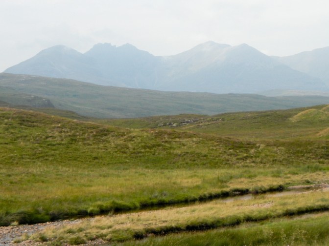
As we drove back on the A832, we stopped at a viewpoint to see the An Teallach massif from a distance in silhouette.
This had been a fine walk with the corrie living up to expectations as well as the scenery on the route. Nonetheless, I am still keen to return to the area and climb some of these magnificent mountains and perhaps to achieve the Fisherfield Round. It will have to be in perfect weather and when I am in perfect condition!
