11 August 2025
This was the day for climbing Ben Wyvis despite a forecast of rain for most of the day. There had been almost no rain the previous day (when I had been on Morven and Maiden Pap) and the next day was forecast as dry but this was definitely an “in between day”. There wasn’t really any “excuse” not to walk as there’s a reasonable path all the way to the summit from the car park next to the main trunk road which links Ullapool to the east of Scotland. I was planning to attempt the Fisherfield Six on the following three days which needed “perfect” weather conditions and the forecast for that was looking positive; I didn’t want to defer my ascent of Ben Wyvis unless it was unsafe.
While I was pulling on boots and full waterproofs in the car park, a trail runner left wearing shorts; clearly she wasn’t deterred by the weather.
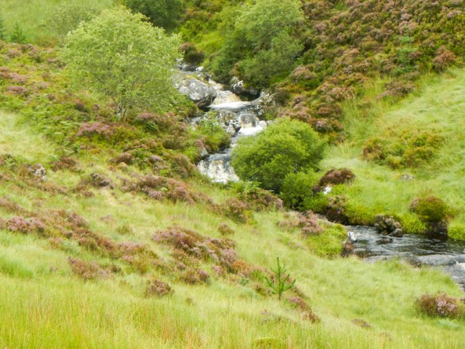
The path ascended gradually following a stream through the forest and then above the forest where it ascended more steeply past waterfalls and rapids.
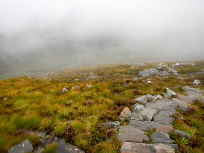
Eventually the path deviated away from the stream. The visibility worsened as I ascended a stepped section but the path was clear and wide so I certainly didn’t feel at risk of exposure to big drops.
As I climbed further, one man descended past me and also the returning runner who must surely have already visited the summit and was already descending.
I arrived at a flatter area where another woman descending told me that there was no view from the summit today. She couldn’t remember when she had last enjoyed a mountain top view so I explained that I had two the previous day from Morven and from Maiden Pap! She warned me of some crosswinds between An Cabar (946m subsidiary summit ) and Glas Leathard Mor (1046m high point of Ben Wyvis); she was pleased to be descending.
There is a stone shelter at An Cabar so that’s where I sat to eat lunch as I was sure there wouldn’t be any significant shelter after that.
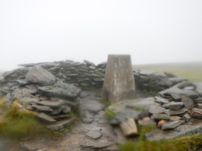
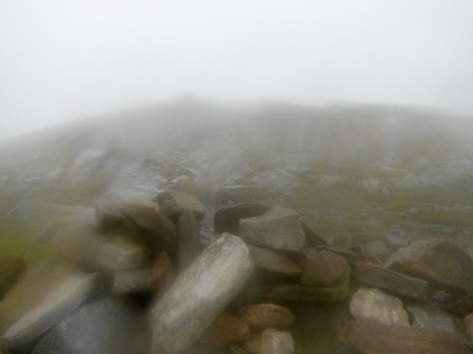
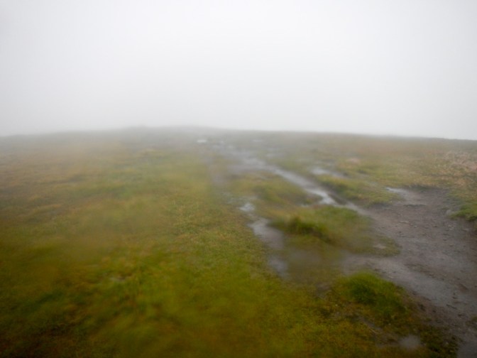
As I set off towards the summit, I saw another walker approaching An Cabar, but didn’t see him again so I suspect he turned round there. The path over this somewhat flatter terrain of the summit plateau was less distinct. There had been instructions to keep on the centre of the path to reduce erosion as it’s a Nature Reserve. This was difficult as it was unclear at times where the path actually was. It only took me about thirty minutes to reach the very exposed and windy summit trig point. There was no view – on a clear day there are extensive views.
I turned back. I soon met two men who had chosen this mountain today to tick the box on another Munro. As they said it was all pretty safe despite the poor weather.
Actually I did make a wrong choice of path as I returned towards An Cabar – being keen to avoid going close to the cliffs to the east, I followed a path too far to the west.
As I descended, I met two further pairs of people ascending.
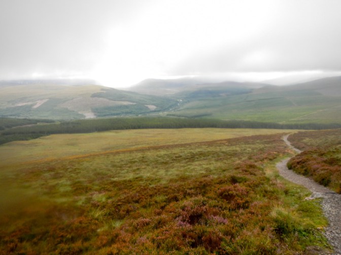
The weather actually dried up a bit as I walked down and I could see a view ahead of me. There was still cloud on the summit though. I made rapid progress and was in the car park under five hours after I had set out. WalkHighlands say the walk takes 4.5-5.5 hours not including breaks so in the conditions, needing to take care not to slip on some of the unlevel wet stone steps, this was fast as it included my lunch break too.
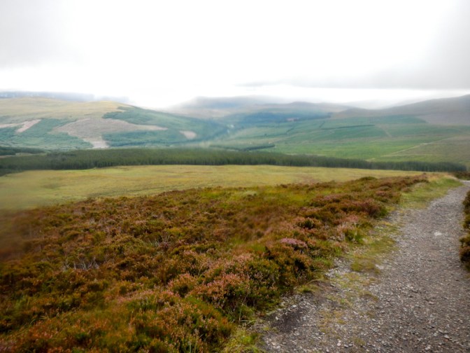
Actually I had enjoyed the walk and found it exhilarating even though I hadn’t been able to see any of the surrounding area from the summit.

Much prefer a walk were it clears as you go around and get a chance to dry off before getting back to the car
LikeLiked by 1 person