2-3 August 2025
It wasn’t until the evening of 1 August that a few alarm bells started to ring when I noticed a yellow weather warning for 4 August including in the area where I was planning to walk and camp between 2-4 August.
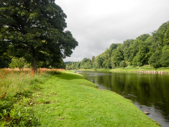
However it was “only” a yellow warning so I was dropped off at the start of the Speyside Way, just west of the coastal town of Buckie, on the morning of 2 August. The weather was cloudy but dry and the wind was much lighter than it had been for the past few days. I was hoping to walk to Cragganmore, following the banks of the River Spey and then take the moorland spur path to Tomintoul.
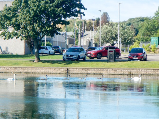
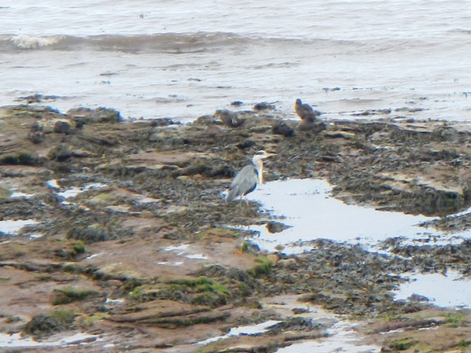
I spotted oystercatchers, gulls, heron and cormorants as I walked but sadly no seals and no dolphins.
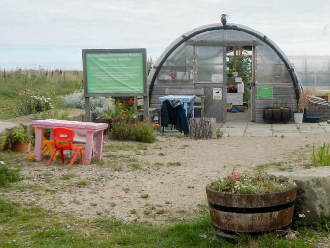
At Portgordon, I saw a very well tended community garden. The gardeners were working hard as I passed. The plastic Polycrubs i saw near the entrance are a vital part of the garden’s operations, allowing the gardeners to grow a wide variety of crops all year, regardless of the weather conditions outside. A sign explained that this Polytunnel/greenhouse hybrid was designed in Shetland as a not-for-profit community project to recycle plastic including from the aquaculture industry. Initially the plan was to enable growth of fresh produce in the harsh climate of Shetland but now the company exports Polycrubs around the world – including to Portgordon.
From Portgordon, the path was less close to the sea, following the line of a disused railway for part of the route to the Scottish Dolphin Centre at the east side of the Spey Estuary. I visited the excellent exhibition area to learn about conservation of dolphins but sadly I didn’t spot any dolphins in the sea.
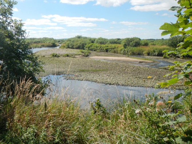
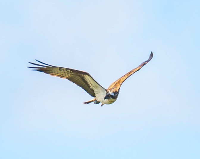
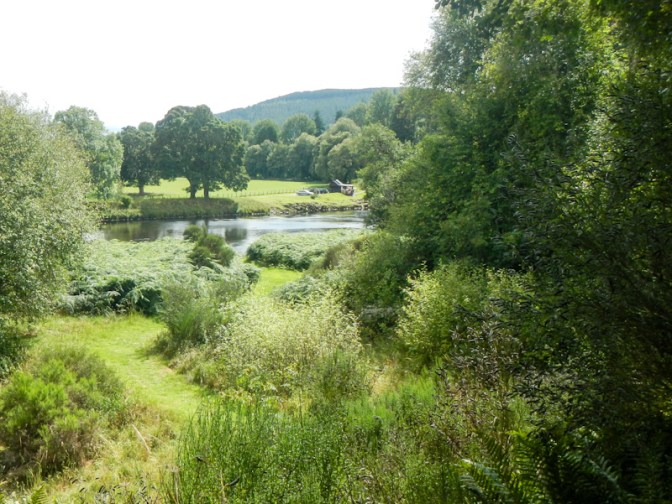
However, I did spot my husband who was taking photos of the wildlife. I sat on a bench with a view of part of the braided river estuary. I was sure that I had seen an osprey and, after my husband joined me on the bench, I saw the bird again – this time confirmed as an osprey by my husband after he managed to get a photo using his telephoto lens.
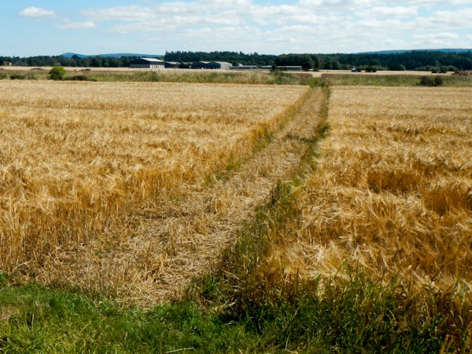
I continued to walk along the track towards Fochabers, passing a farm which both grows barley and starts the whisky making process by malting the grain.
Approaching Fochabers, the path runs through a park close to the River Spey. I bought my lunch from Co-Op in the village and sat on a seat in the spacious square to eat it.
Leaving Fochabers, the route is on an almost traffic free lane up hill past Forestry Commission plantations. The road became more narrow and the hill more steep. A father and two girls were playing “catch” in their garden. The ball came over the fence into the road so I threw it back to them and the man commented about the hot weather making it more difficult to walk up the hill. It was around 22 degrees centigrade so definitely hot for the north of Scotland.
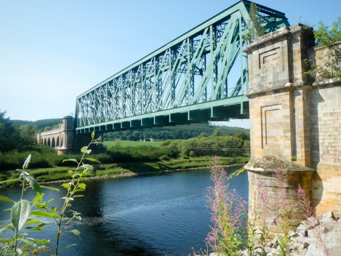
Eventually I arrived at a downhill stretch to a viaduct and a bridge over the Spey.
I walked on a track past a farm then entered Ben Aigan forest, where I heard deer barking. Trees obscured the view of the river from a viewpoint but there were occasional views of the river from the track. I started to look for a place to camp as I had discovered that the free camping area at Fiddich Park close to Craigellachie had been closed by the council even though it’s still included on various websites about the Speyside Way.
I managed to collect water from a stream but the areas I had envisaged as possible camping spots weren’t suitable – no flat part or the ground was too stony or too boggy. Eventually I found a suitable place in the woods below the unfenced road just after I had left the Forestry Commission land and around 5km before reaching Craigellachie.
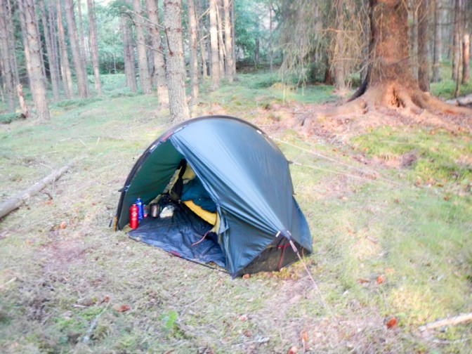
I saw a deer nearby as I arrived and heard some barking later although I had no further sightings. It was a warm night. The rain that was forecast didn’t start in earnest until just before 6am. I ate breakfast sitting in my tent. It was still raining at 08.20 when I started walking but, apart from my tent, I had kept everything fairly dry.
As I walked, I noticed further potential places to camp – but my spot had been fine and I still didn’t have as far to walk as the previous day. I found a side stream which I could climb down to and managed to fill my water bottles before arriving at Craigellachie.
I passed Fiddich Park then the route went on to a disused railway line which has been converted to a footpath.
I arrived at another park area with signs to the Telford Bridge. I turned off here but just as far as a converted horsebox used as a café and already open early on a Sunday morning. It had stopped raining and it was a pleasant place to drink coffee and eat chocolate tiffin.
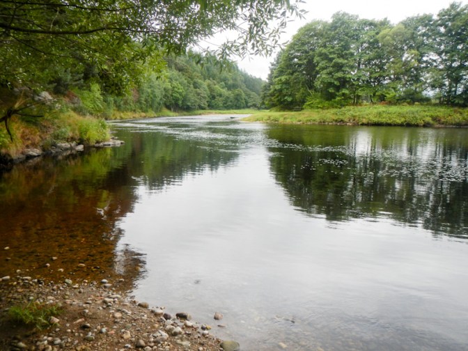
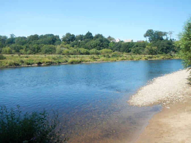
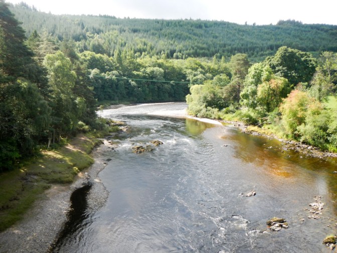
The converted railway line was an easy path and I made fast progress despite some stops to look at the river and even to walk down side paths to river viewpoints.
At Charlestown of Aberlour the sights included a community garden, a visitor centre and tearooms and a pedestrian suspension bridge across the river.
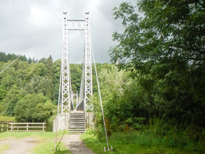
I stopped by the suspension bridge to check my phone and that was when I discovered that the yellow wind warning for Storm Floris on Monday had been upgraded to amber. I realised that the final day of my walk up to Tomintoul as I had planned on Monday (and being collected from Tomintoul by car) might be difficult.
I continued to walk along the route of the old railway line.
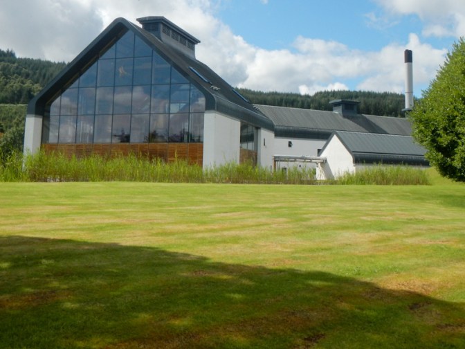
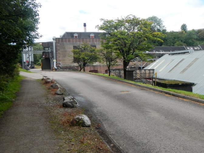
At the Speyside village of Carron, the route passes a very modern looking building set in spacious grounds. This was Dalmunach distillery; building was completed in 2015 on the site of a disused distillery. The design is eco-friendly, has won awards and was said to be inspired by the shape of a sheaf of barley.
I stopped for lunch and took the opportunity to get my tent out and start to dry it. I had worked out that I could walk further than the camping area at Cragganmore which had been my end point for the day. In view of the fast progress along the converted railway line, I would be there by 3pm so I had potential for a few more hours of walking. I studied the map to search for suitable stream water supplies and wild camping spots between there and Tomintoul. The worse of the wind wasn’t predicted to hit until after 10am on Monday so I realised that I could start early on Monday and arrive at my destination in Tomintoul before that. Moreover, I was sure that I would be able to book a space in the youth hostel or accommodation elsewhere in the village if the storm was too severe for my husband to drive to collect me.
Sadly, when I looked at my phone, I discovered that my husband had also seen the updated information about Storm Floris and the amber warning. His solution was somewhat different to mine and he was insisting on driving to collect me that afternoon. This would be from the camping area at Cragganmore so I sent a text to say that I would be there at about 3pm.
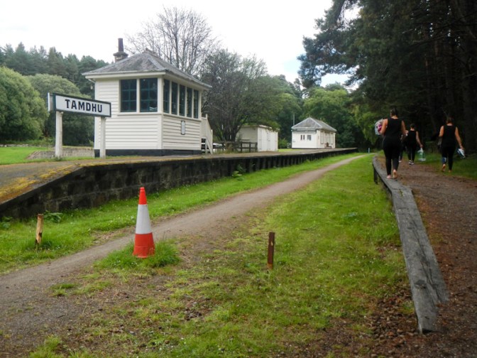
I continued on my way, passing another two distilleries, one adjacent to the old Tamdhu Railway Station. Oddly some women asked me where they could find the changing rooms – not sure how they would expect me to know as with my packed rucksack it should have been fairly obvious that I was just passing through on the footpath; I presume they were kayaking or swimming in the river.
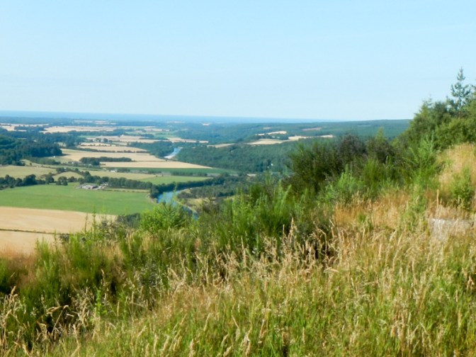
I arrived at the car park at Cragganmore at 2.45pm and my husband was already there, clearly keen to collect me as soon as possible. It still wasn’t windy. The spur to Tomintoul is actually more on map 36 than map 28 but it had been the part of this adventure that I had been most looking forward to walking as it incorporates dramatic moorland.
It was very windy the next day especially from lunch time onwards and indeed there were a lot of trees blown down including some which blocked roads, many power lines were down and 43,500 people were reported to be without electricity; travelling wasn’t advised. In Tomintoul one of the wind gusts was measured at 65mph – a constant 65mph wind would be violent storm force 11. The background wind without gusts was more like the more severe end of gale force 8. It was probably just as well that I was back in Elgin and not out on the high moorland. For certain, I would have been marooned in Tomintoul for the night if I had continued the expedition.