7-12 April 2025
My plan was to walk along the extremely convoluted 110mile route of the long distance Robin Hood Way footpath plus a few deviations, visiting many of the sights attributed with Robin Hood connections. Actually, despite all the connections, it seems that the evidence points to Robin Hood being more myth than legend. Historians delving deeper into the Middle Ages have uncovered more than one outlaw called Robin Hood over a period of over one hundred years. Whether they were bandits based in a forest and clothed in Lincoln green with a merry gang of companions is unknown. It also isn’t known whether they regularly stole from the rich and handed over the stolen goods to the poor. However, it’s a fine story that has stood the test of time and led me on an interesting expedition around a variety of the lanes, byways, footpaths, cities, towns and villages of Nottinghamshire.
There’s much literature debating the issue including https://www.boldoutlaw.com/index.html discovered on-line and academic books such as https://boydellandbrewer.com/9781837650101/robin-hood-legend-and-reality/
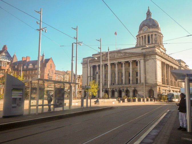
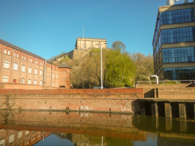
My six day expedition started as I alighted from the tram at the Old Market Square in the centre of busy Nottingham. I spotted the Council House immediately but missed looking for the appearance of Robin Hood in one of the four frescoes in the cupola of the Council House Arcade. With a walk of over twenty miles ahead of me for my first day, I was keen to locate Nottingham Castle and get started.

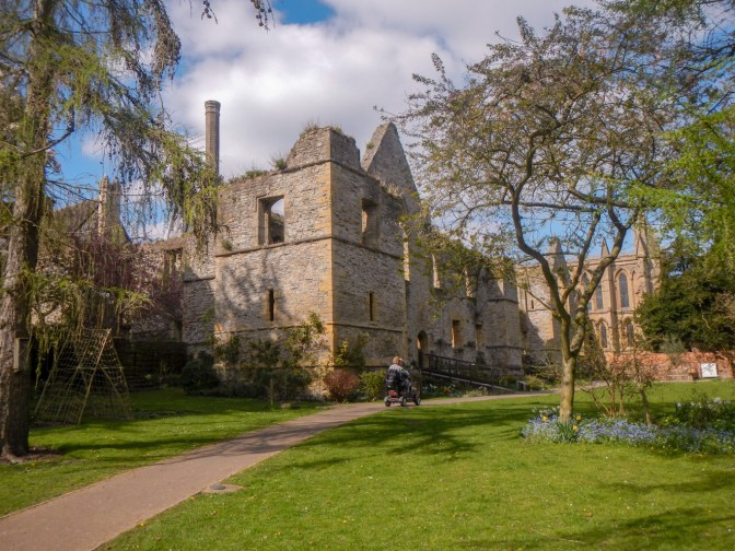
Fortunately the imposing castle, built on sandstone riddled with caves, was easy to find. The present-day castle was built in 1679 by the Duke of Newcastle, damaged by the Reform Bill Rioters in 1831 and later restored as a museum.

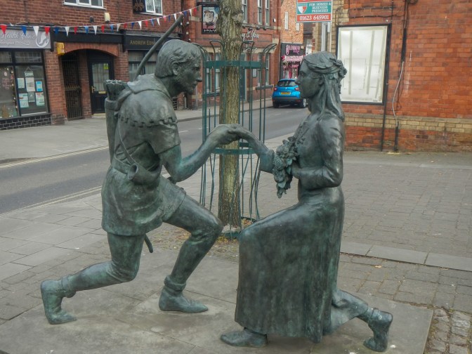
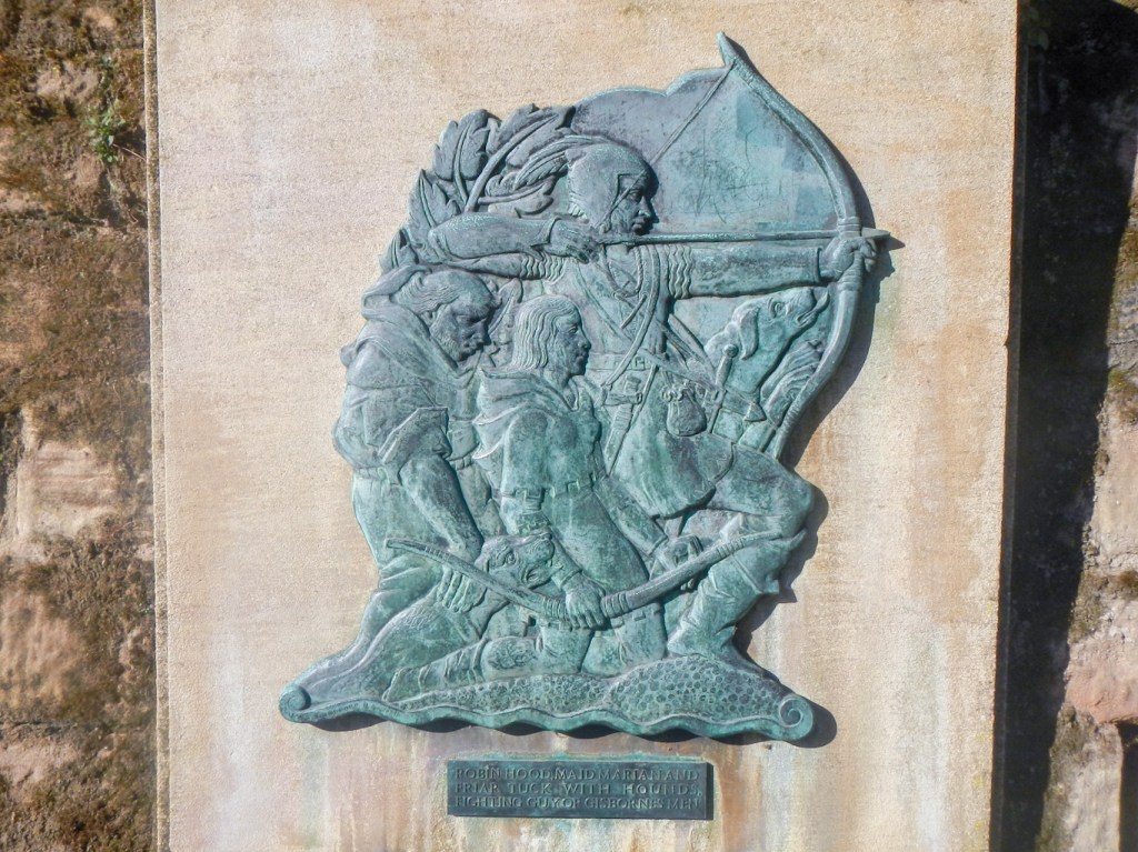
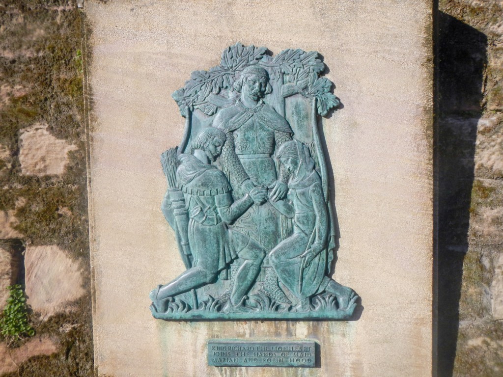
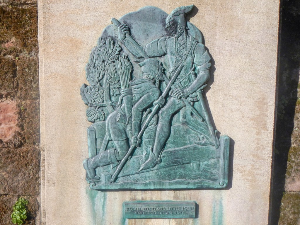
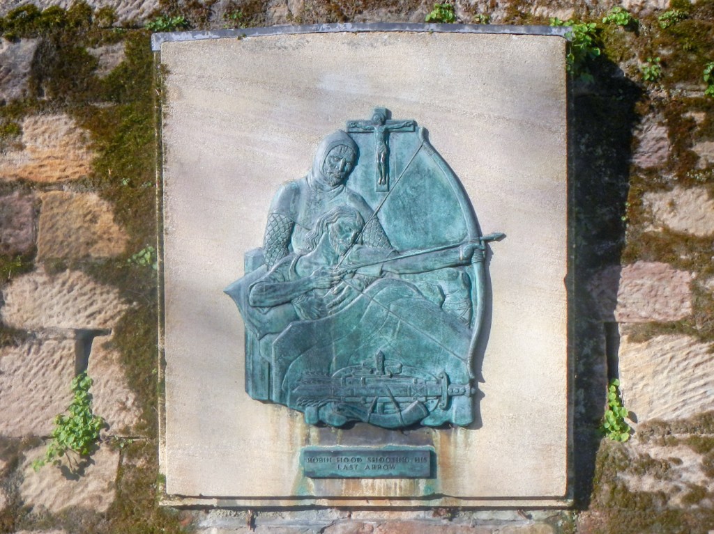
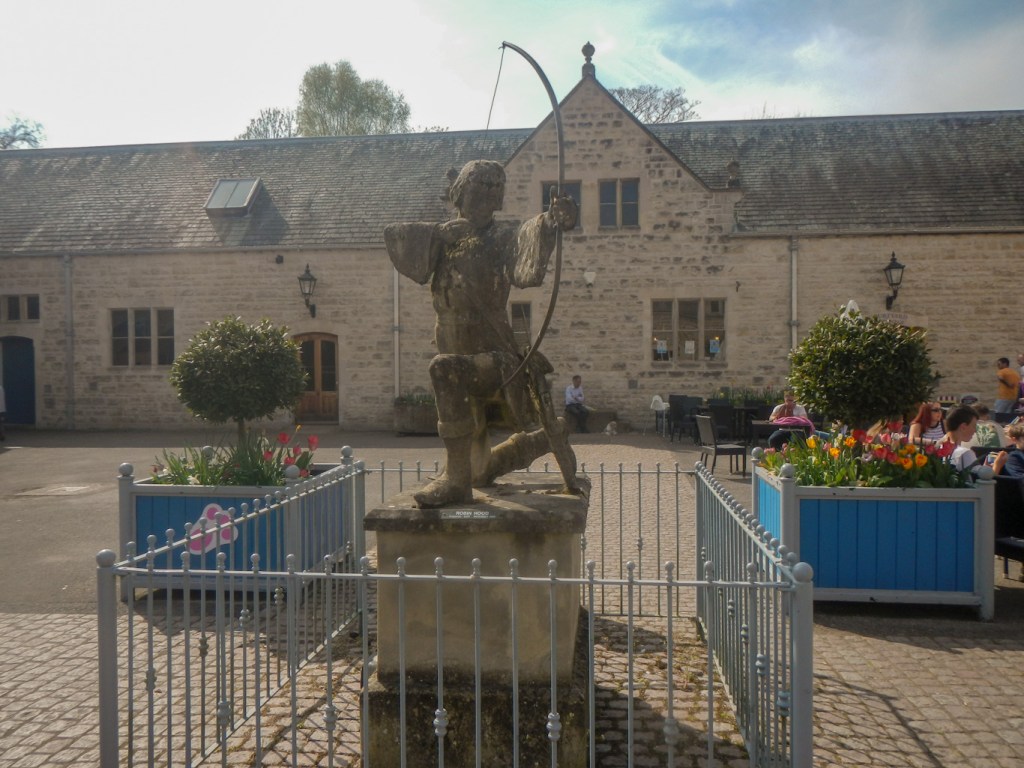
I walked round to the open area of Castle Lawn where there is a statue of Robin Hood by James Woodford (1952) and plaques depicting scenes in his life.
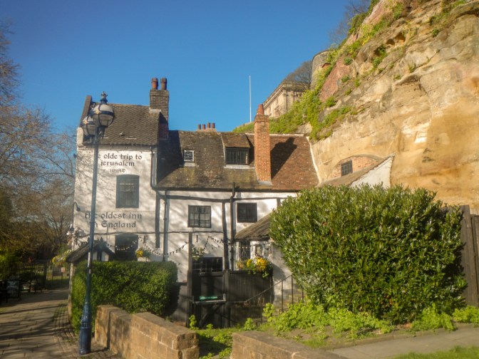
Further round the castle perimeter, I came across Ye Old Trip to Jerusalem Inn which dates from 1189 and claims to be the oldest inn in England. Some of the rooms are built into the castle rock and cave system. It’s claimed that Robin Hood would stop here for an ale or two.
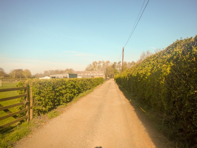
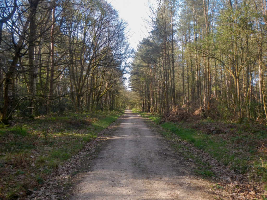
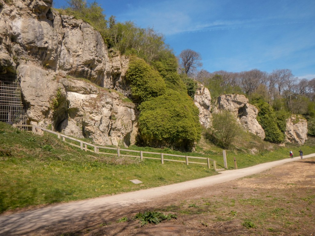
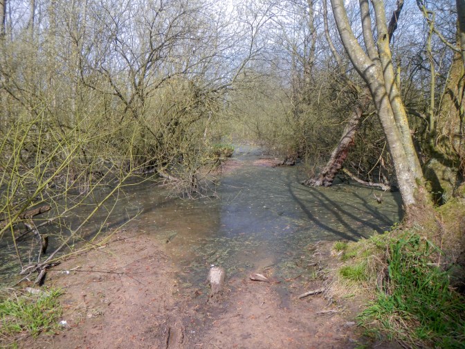
I didn’t see any waymarks for the walk but found my way on the route marked on the maps to walk alongside the peaceful canal and then the less peaceful pavement next to the busy A52.
I reached Wollaton Park where I enjoyed an early coffee with cake at the courtyard café. This was the first of many large “country” estates that I walked through on my journey.

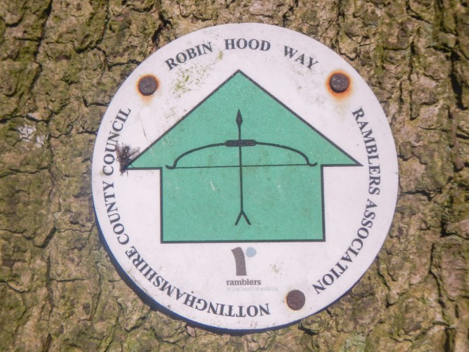
After leaving Wollaton, I spotted the first of many “bow and arrow” waymark signs.
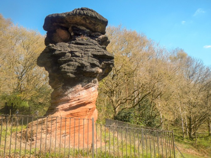
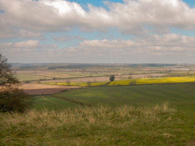
Although I was barely outside the built-up city all day, the route was deceptively rural. I walked through Bramcote Hills Park and then to Stapleford Hill, passing the unusual Hemlock Stone, itself associated with many myths and legends (but not with Robin Hood). In the Middle Ages it was claimed that the Devil threw the stone there from Castleton, Derbyshire, about 40 miles away, because the ringing of church bells annoyed him.
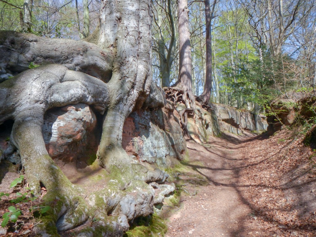
A surfaced track meant that I sped along to Strelley where I saw some very worn paving slabs – part of the 14th century Monks Way taken by the monks to reach Lenton Priory and passing the 14th century All Saints Church (which was locked). The route continues past the gateway to Strelley Hall and then over a footbridge crossing the busy M1.

I walked all the way up to the church at Greasley crossing the Giltbrook Valley. This is peaceful farmland now although for centuries it was a centre for mining and quarrying. Small-scale mining in the Giltbrook valley had started in medieval times. The monks at Beauvale and Lenton Priories leased out mining rights in 1370 and 1459. Later during the Industrial Revolution there was even a named Greasley Engine, a large Newcomen-style steam-powered beam engine used for pumping water out of the coal mines. The final phase of mining in the valley took place as late as the 1960s when open cast coal mining ravaged the landscape. It is hard to believe the changes that have happened since then and the peaceful agricultural land that is now there. I passed close to Reckoning House Farm – now a private residence but would have been the mine office where accounts were kept and wages calculated and paid.
The church was locked but an explanatory notice mentioned that graves included that of Benjamin Drawater, the ship’s doctor to Captain Cook – I wasn’t able to identify the exact grave.
The remains of a castle (actually more like a fortified manor house) are marked on the OS map south east of the church. Apparently much of the stone from the 14th century castle, which was built for the soldier and politician Nicholas de Cantelupe has ended up in the walls of local buildings. It was an enormous and prestigious building rivalling the finest castles in Britain – https://www.bbc.co.uk/news/uk-england-nottinghamshire-61241466. All I was able to see were some ramshackle farm buildings partially hidden by trees.

Nicholas de Cantelupe also founded Beauvale Priory , the remains of which are marked on the map almost 2km north of Greasley. Robin Hood’s Well is marked on the map just to the north of the priory ruins – however both the priory ruins and the well are on private land with no public access so I didn’t extend my walk any further towards them.
The route of Robin Hood’s Way went south east. There is a further bridge crossing of the M1 and a mixture of paths through rural and urban areas. It was becoming quite warm and I overtook a man with his daughter walking and eating ice cream lollies. They had bought a box of three and I was very grateful when they offered me the third one of the box which they would otherwise have thrown away!
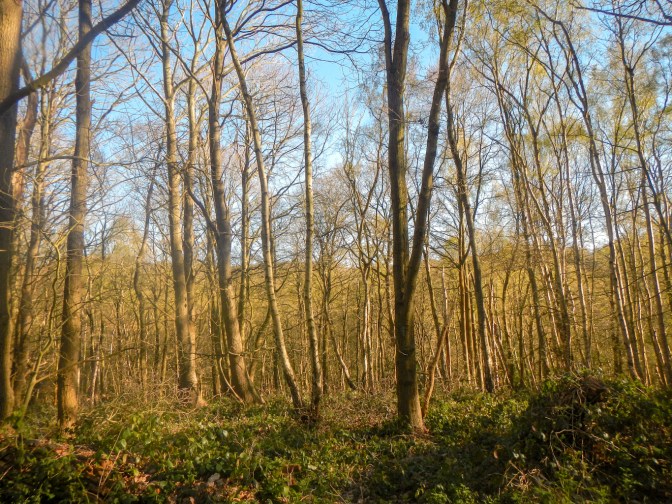
The final part of my walk for the day was through the Bestwood Country Park. This originally consisted of 4,000 unfenced acres of Sherwood Forest, was mentioned in the Domesday Book and has been connected with royalty since 1160. It was disturbed by coal mining but the former tip has been grassed over. Nowadays it is all a very pleasant area of woodland.
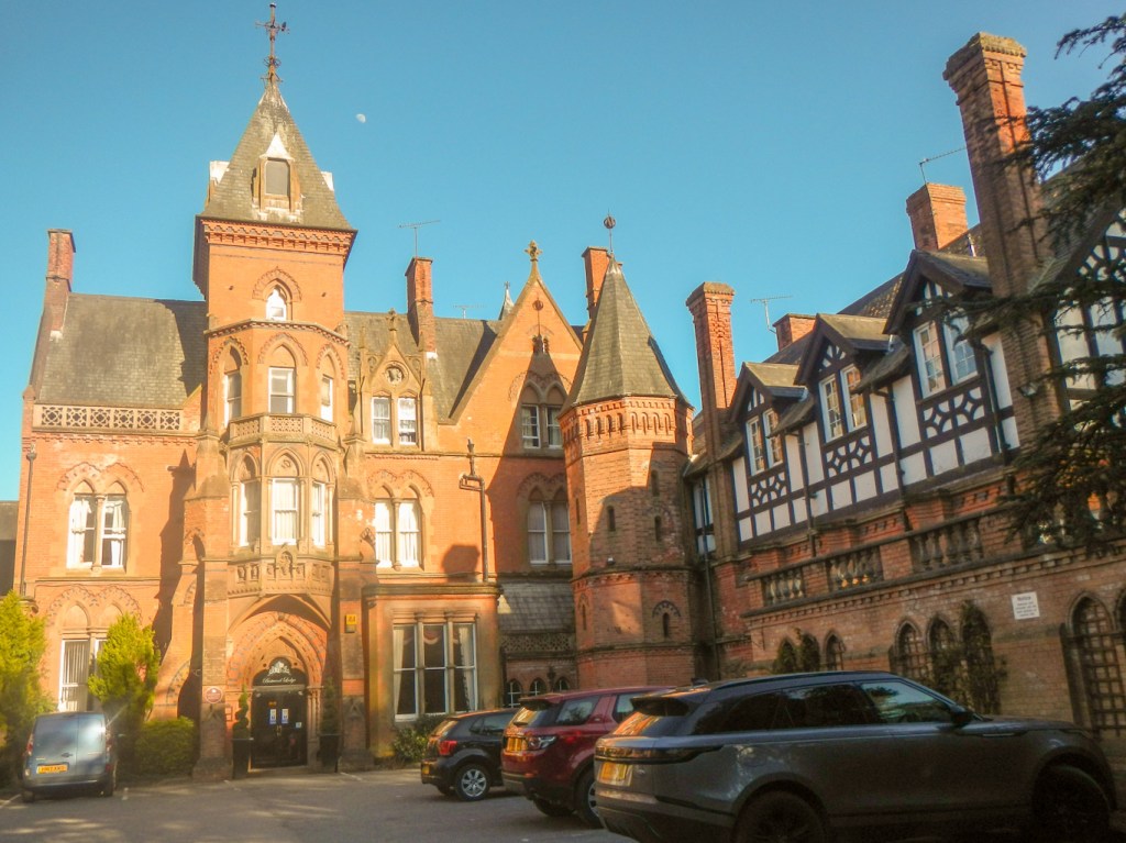
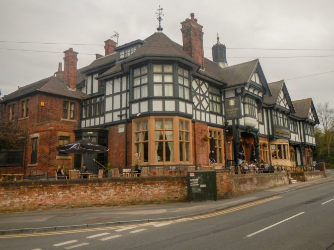
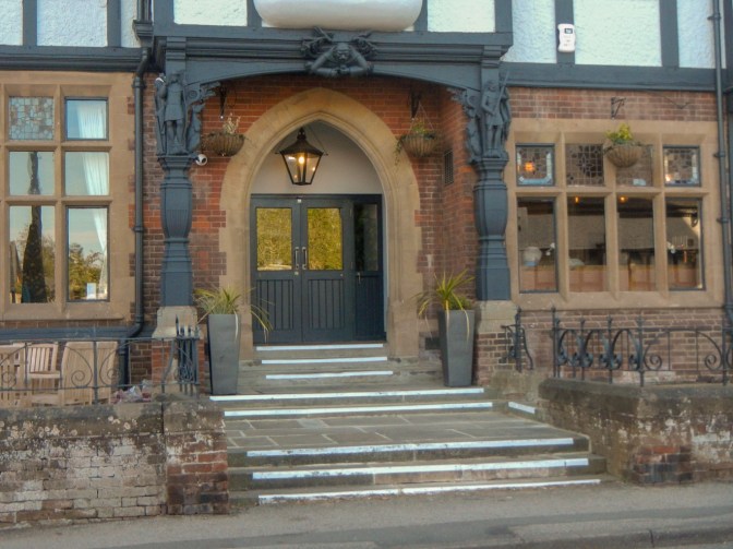
We were staying overnight at Bestwood Lodge (now a hotel). It was built in 1862 by the 10th Duke of St. Albans on the site of a former hunting lodge. It is said to be one of the best examples in Nottinghamshire of the high Victorian mansion on a lavish site. There are statues of some of the outlaws in the main hall of the building.
Next day was still dry and sunny. I left Bestwood Lodge following a track northwards along the east side of Bestwood Park which would have been part of the ancient road from Nottingham to Mansfield. The road was closed in 1760 by Act of Parliament, one argument being that many travellers lost their way on it. In the times of Robin Hood it would have been a hazardous journey and the road would have been entirely within Sherwood Forest.
The footpath and byway following the route of the ancient road went past several smallholdings with a mixture of goats, sheep, hens, pigs and a few cows as well as some horse stables and paddocks before meeting the B683 road. This road was where I moved off map 129 and on to 120 which was the map to use until completion of the route. Just before reaching a cross roads at Papplewick, the route turned off leaving the ancient road and heading east to Burntstump Country Park. I was certainly already going through a plethora of country parks on this walk. Originally part of the Sherwood Forest, Burntstump has historical ties dating back to the medieval period. The park’s name is believed to have originated from a notable burnt tree stump that served as a landmark.
I emerged onto a lane and soon passed Papplewick Pumping Station. It was designed in the early 1880s to pump millions of gallons of clean fresh water every day to the rapidly increasing population of industrial Nottingham. The steam pumps were decommissioned in 1969 to be replaced by electric pumps. A trust was formed in 1974 to conserve the site as a museum and it is now the only steam pumping station in the Midlands which has been preserved in full working order.

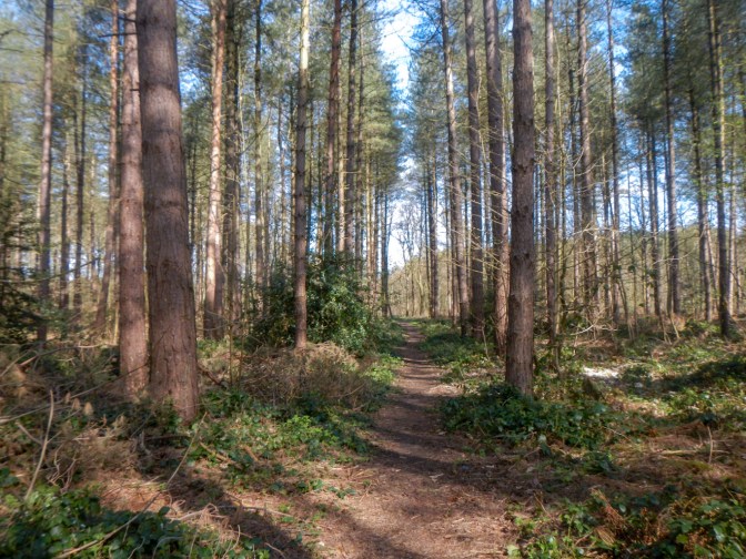
I walked through Blidworth Woods, an area of pine woodland and open heath. Unfortunately it also appears to be a popular area for fly-tipping despite the threat of CCTV etc.
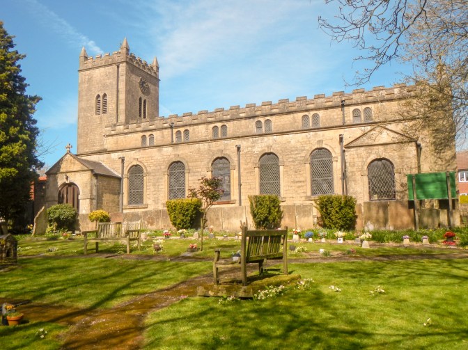
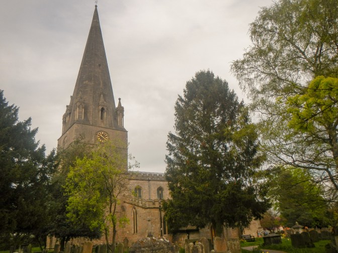
I arrived at Blidworth village and opted to walk along, past the turning for Robin Hood’s Way, to the church. This was locked. Maid Marian’s dwelling was said to be close by.
The route continued on paths over farmland and eventually I reached the B683 road about 2km north of where I had left it several kilometres of walking previously – the route is convoluted! I decided to make a detour to the north end of Papplewick village (even closer to where I had been a few hours earlier) so that I could visit Papplewick Church. This is the church where legend says that Robin Hood’s minstrel Alan-a-Dale was married by Little John. The church also contains early medieval grave slabs for forest wardens, which are carved with bow and arrow, sling, knife and hunting horn. Sadly I couldn’t see these as the church was locked; clearly there is concern about potential vandalism and burglary – multiple signs explaining that there is 24 hour CCTV and others stating that there is no lead in the roof. However I found a nice seat in the churchyard where I ate lunch.
I retraced my steps to the point where I had left the waymarked route, passing Papplewick Hall and Lodge as I re-joined the route. Apparently there is a well hidden cave in the sandstone nearby where Robin Hood is said to have hidden his horses when visiting Nottingham. However it’s on private land so I couldn’t search for it.
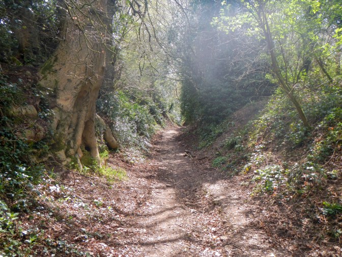
The route follows a well defined track, probably a further part of the ancient Nottingham to Mansfield road. It passes close to Newstead Abbey and the ruins of the priory although not into the grounds (quite) so I didn’t have to pay the admission charge. The track was beautiful especially as daffodils were in flower and the trees just coming into leaf. Robin Hood’s Hills and another Robin Hood’s Cave are a couple of kilometres to the west of where I walked and apparently have fine views of the area where I was walking – however they are on private ground. Robin Hood was said to be able to sit on a flat rock at the east end of the hills and see people travelling on the route where I was walking.
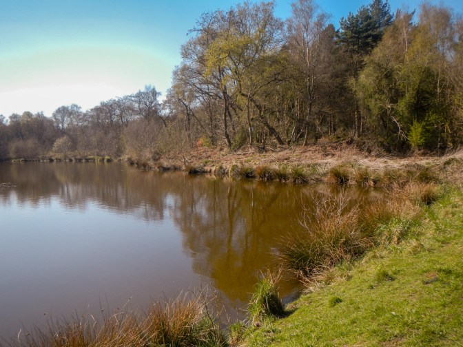
I crossed a busy “B” road and soon entered Thieves’ Wood. Robin Hood would have been able to sit on the rock as above and plan his attack before people entered the Thieves’ Wood area. It’s all very different nowadays – some beautiful mixed woodland with good paths through it. I crossed the A60 road and continued through part of Fountain Dale near a lake before turning off the waymarked route on a footpath then a small road to our booked overnight accommodation at Holly Lodge.
We walked to Larch Farm and had dinner at the very good farmhouse / pub. Incidentally after the old Nottingham to Mansfield road was closed in 1760 as it was deemed to be hazardous, a turnpike road was created from Larch Farm.
The next morning it was still dry weather but very misty. I returned to Fountain Dale. This area is reputed to be the site of the first meeting between Robin Hood and Friar Tuck. The story is that Robin Hood went to the area to try to find the “fighting friar” who was reported to live in the forest. Robin found the friar by a stream and forced the friar to carry him across. However the friar threw Robin into the water. A fight followed but ended after several hours with exhaustion of both parties. They had earned each others respect and became friends.
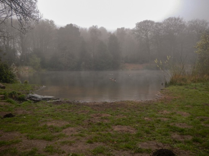
Friar Tuck’s well is marked on the 1:25,000 map near a lake but is apparently overgrown and hard to locate. Moreover there was a path closure and diversion in place…. I wandered on along the footpath after the diversion as far as Cave Pond – the friar was reputed to live in a cave near the far side of the pond, now in the grounds of Cave Park Lodge.
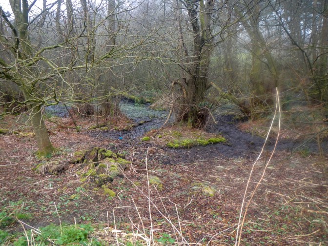
I returned to the main route and crossed a footbridge over a stream – some records say this is where Robin Hood and Friar Tuck fought. The route continues on a road running past the front entrance of Cave park Lodge and then on a track to the northern part of Blidworth. Indeed the route is convoluted – I had walked through the south part of the village the previous day. Blidworth was one of the villages that each provided 100 live deer per year to be kept at Fountain Dale until required by the Crown for both eating and hunting.
The route continues including various narrow ancient roadways or drovers’ roads (now tracks and byways). There was a very difficult road crossing on a bend over the extremely busy and fast moving A614 road – not a great place to choose for a road crossing on a planned long distance waymarked route.
By the time I was on fields ascending Robin Hood Hill (145m), the mist had eventually cleared. This hill is also the site of an Iron Age castle. The views from the summit were excellent. This would have been near the boundary of Sherwood Forest. The vantage point would have assisted Robin Hood in his travels through the forest and was a marvellous stopping point for me to eat lunch. There’s even a nice seat erected by the Robin Hood Association in memory of Geoff Rix a former Secretary of the Association.
The route continues with a mix of byways, tracks, footpaths and occasional stretches of quiet road past predominantly agricultural land, some woodland and villages.
I was almost at the small town of Southwell but the route is convoluted as ever; I approached initially from the west and then proceeded over a kilometre south of the centre before turning east and then north to reach the town centre. The route passes through some of the grounds of the Brackenhurst campus of Nottingham Trent University specialising in Animal, Rural and Environmental Sciences before arriving directly from the countryside into the grounds of the Southwell Minster and Cathedral. It was frustrating to feel I was so near to the town for so long, but the route actually provides a fantastic entry point into the town.
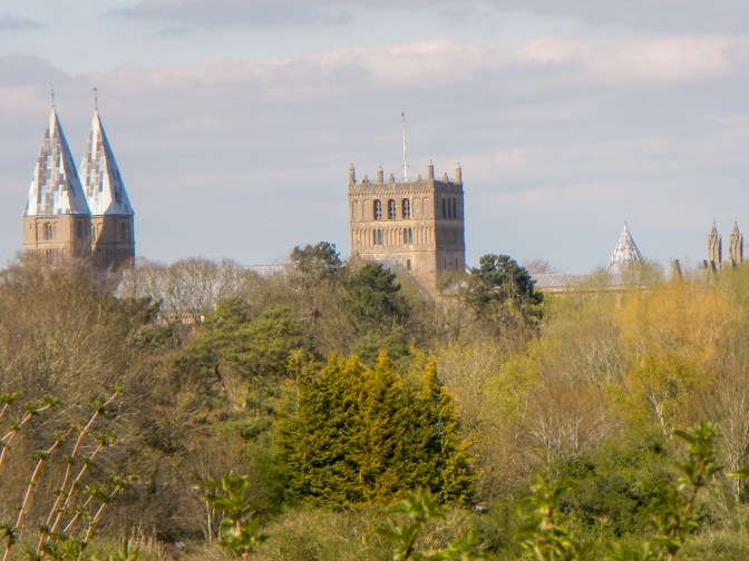
The Cathedral and Parish Church of St Mary of Southwell is known commonly as Southwell Minster and is the seat of the Bishop of Southwell and Nottingham. However Southwell does not have city status.

It’s definitely worth looking at the cathedral and admission is by optional donation. On the outside, the distinctive pyramidal spires of lead are the only example of their kind in the United Kingdom.
The Minster was built partly as an attached church of the Archbishop of York’s Palace which now stands in ruins (apart from the state chamber) next door to the Minster. The Archbishops of York needed a place to break their journeys between London and York which was the reason for the palace being built. The state chamber was closed but I was able to look at the palace ruins and the gardens.
When I entered the Minster, the welcoming Steward explained that there is currently a special exhibition:
“Threads through the Bible: Creation + Cross + Revelation”. This is probably the largest textile project by a single artist ever, taking the artist Jacqui Parkinson ten years, using more than 25 million stitches. Threads through Creation consists of twelve panels telling the story of creation from Genesis; threads through the Cross is eighteen panels telling the story of Jesus’ from his birth to his death, resurrection and ascension; threads through Revelation is fourteen panels re-imagining the scenes described in Revelation. The exhibition is touring to various cathedrals / abbeys over the next year or so and is definitely worth visiting.
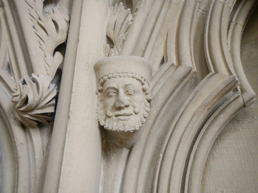

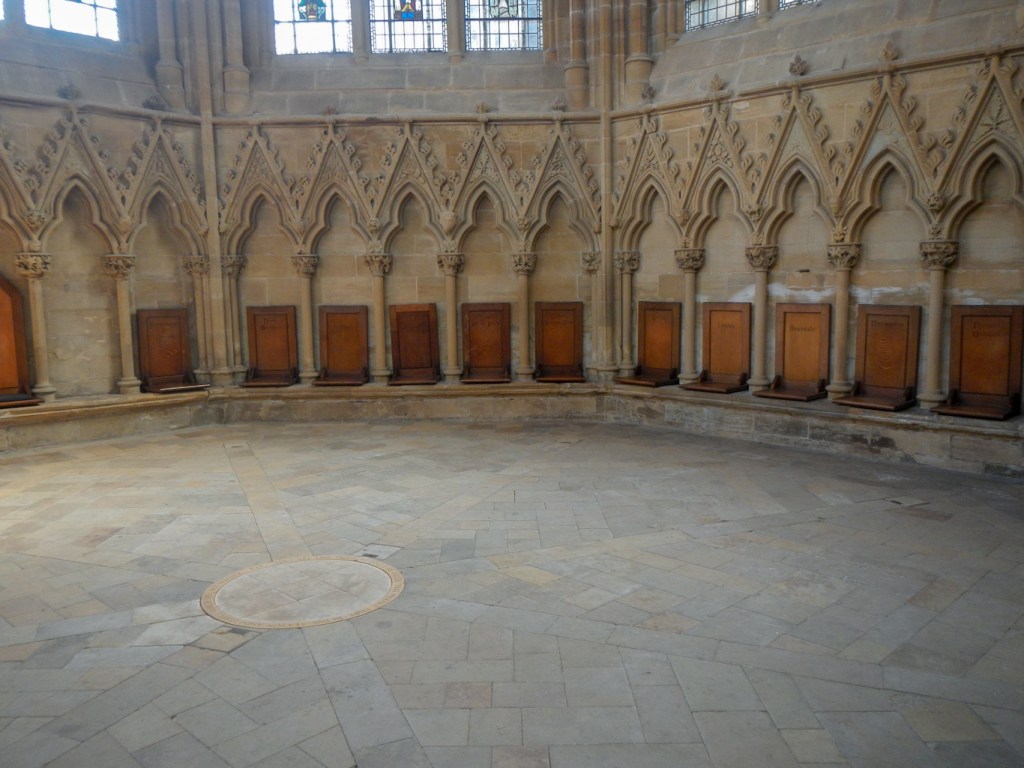
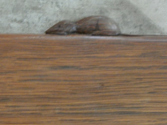
Of course there is also the magnificent Minster building itself. the highlights for me were the intricate stone Chapter House carvings of green men, plants and animals – the Leaves of Southwell, the magnificent modern stained glass of the Great War Memorial Window designed by Nicholas Mynheer to honour local people who have lost their lives in conflicts since the First World War, and the altar rails designed by Robert “Mouseman” Thompson with tiny mice carved into them in his trademark style.
Suffice to say I spent much longer than I had intended looking round the Minster so I ran out of time to explore the rest of the town as I had a further 2-3 miles to walk to our booked accommodation in nearby Rolleston (we couldn’t find any accommodation with a car park in Southwell).
Rolleston has some interest of itself: the children’s book illustrator and writer lived there as a very young child and continued to visit regularly until she was about twenty years old. There’s a trail round the village visiting sites which were significant to her and may have inspired some of her stories and pictures.
The next morning I opted for a lift back to Southwell in order to avoid retracing my steps. Sadly, during the 4-5 mile journey (further than the pedestrian shortcut route), the car developed a fault with a red warning light. We managed to get to the Leisure Centre car park in Southwell, from where my husband called the AA while I worked out what I would need if I had to attempt to continue my expedition without the help of a car. Actually this had been my original intention but my husband had decided he wanted to visit the area too, so I had booked accommodation which worked with a car and multi-night stops at some accommodation as my husband preferred to do that and give me lifts rather than move accommodation each day. I am convinced that my 2009 Peugeot 107 is more reliable than the newer and eye wateringly more expensive Landrover Discovery Sport! My whole expedition was continuing to parts of Derbyshire and Cheshire to complete even more map adventures.
I left on foot with a heavier rucksack to carry. In fact this turned out not to be necessary as the conclusion was that our car went on the Relay vehicle to a repair garage in Macclesfield and we hired a car to continue our holiday together.

My walk continued along footpaths by streams and rivers, though small woods, across open fields and past villages, a golf course and Centre Parcs. I developed plans as to how I would manage the expedition using public transport and realised that it would be feasible with some route tweaking. However I was somewhat relieved when I discovered that this wouldn’t be needed.
The accommodation at the eighteenth century Edwinstowe Dukeries Hotel is more or less on the doorstep of the area that nowadays is regarded as the centre of Sherwood Forest and the Robin Hood legends.
However, I needed to spend a further two days walking before arriving at the end of the waymarked trail outside Edwinstowe Church. The route is indeed very convoluted! The next day I retraced my steps out of the south part of the village.
It felt as though I was really getting somewhere when I turned off into the area of woodland that’s actually labelled as Sherwood Forest on the map.
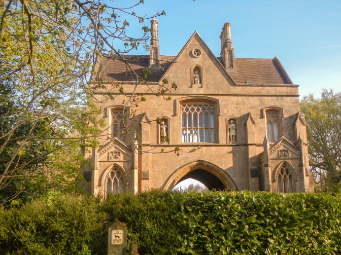
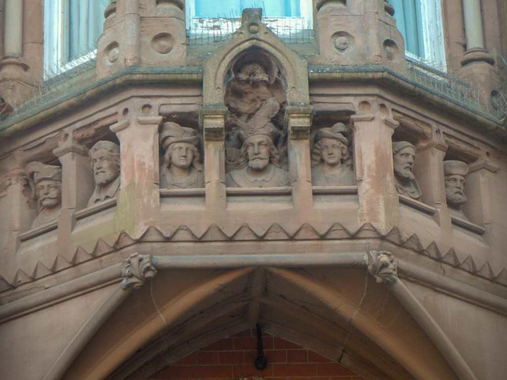
I soon reached Archway House, built by the fourth Duke of Portland in 1842. The façade has some Robin Hood sculptures similar to the ones I had seen already at Bestwood. The turf “ride” running through the archway was intended to enable the Duke to drive from Welbeck to Nottingham but actually no more lodges were built along the route – the spread of railways made it unnecessary especially as the Duke bought his own railway carriage.

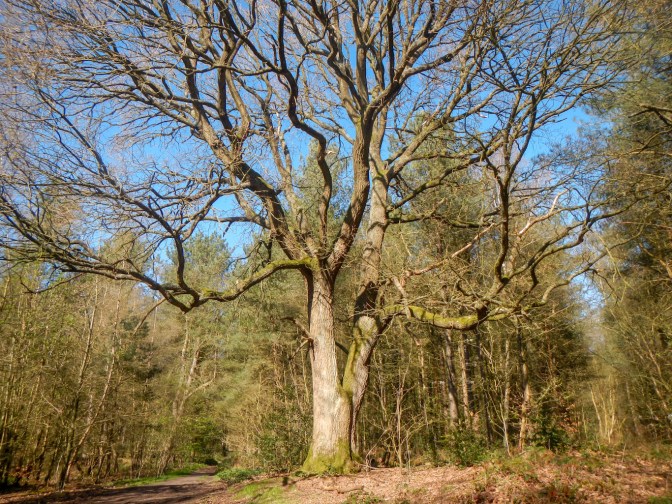
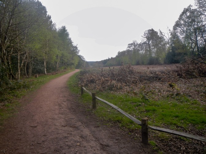
There followed a long stretch of walking through almost deserted forest with many impressive trees including oak, beech, birch, sycamore and larch.
Eventually I turned out near a lodge passing a monument erected by the sixth Duke of Portland commemorating Lord George Bentinck, MP for Kings Lynn and third son of the fourth Duke of Portland.
I decided to divert off the route to look at the Cuckney water meadows commissioned by the fourth Duke of Portland. Essentially the water meadows provided a man-made irrigation system designed to allow a shallow layer of water to flow over grass during cold winters – the flowing water was kept oxygenated and, being warmer than the frosty soil, stimulated growth. Today the area provides important habitat for a range of wildlife including water vole.
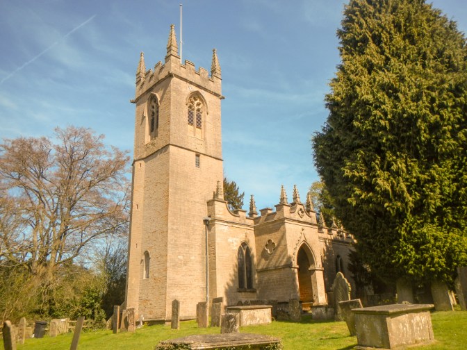
I went on to look at the grade 1 listed 12th century church in Cuckney – it was unlocked and the most notable feature is that the chancel is offset from the nave and the north aisle pillars are leaning. At the edge of the churchyard are the remains of a motte and bailey castle.

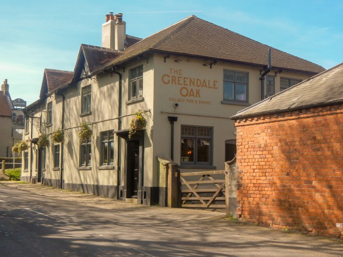
I spotted the Greendale Oak village pub. Unfortunately that was as close as I got to anything like the Greendale Oak as the oak tree itself was in an out of bounds area of the Welbeck Estate at least half a kilometre from the nearest point on the public footpath.
I continued on the waymarked route, passing an isolated chapel which is actually the church for nearby Holbeck. It’s origin is in the Arts and Crafts movement, built between 1913 and 1916 almost entirely by estate employees of the sixth Duke of Portland.
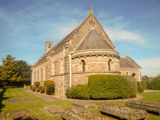
The architectural design is based on a Norman church in the hamlet of Steetley, Derbyshire. Actually I considered making a further diversion to Steetley to look at the Norman church, where the clerk had been reputed to be Friar Tuck. It is considered the finest village church example of Norman architecture. However, it would have added at least six miles to my walk and I just didn’t have enough time. Sadly the “copy” church was locked – although there are some interesting large grave monuments to various Dukes of Portland and their families. A couple of other walkers resting on a bench by the church explained to me that they were National Trust volunteers who do litter picking at Clumber Park which I was due to walk through later in the day and recommended that I visit the chapel there, which would be unlocked.
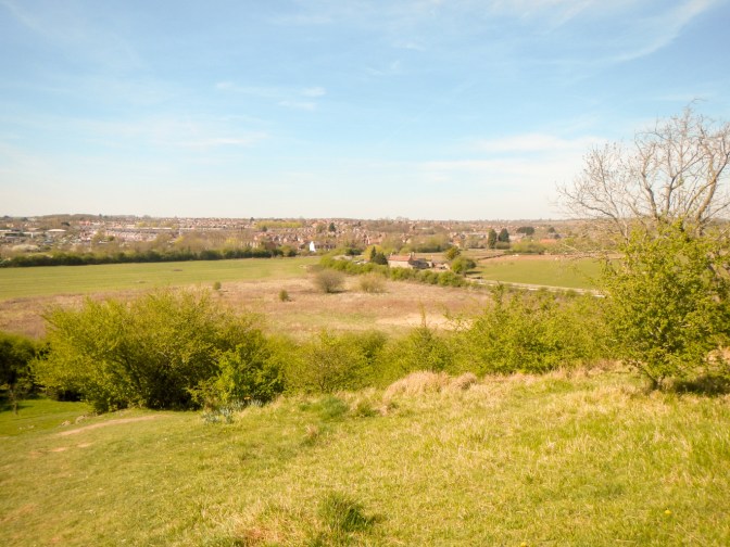
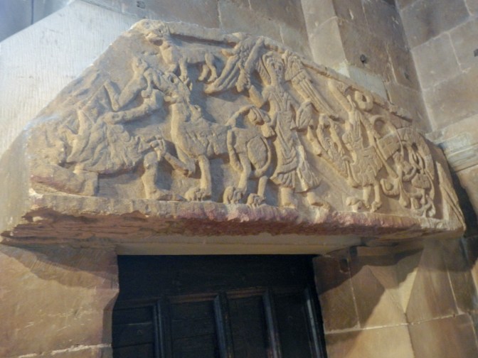
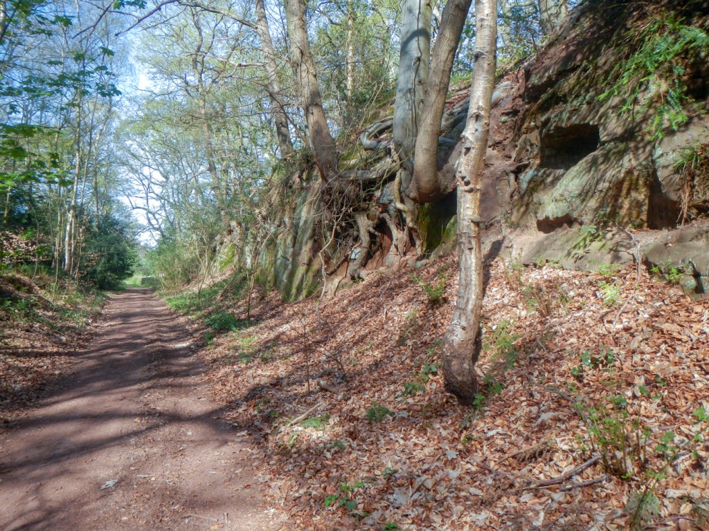
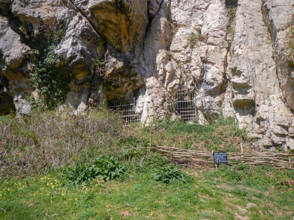
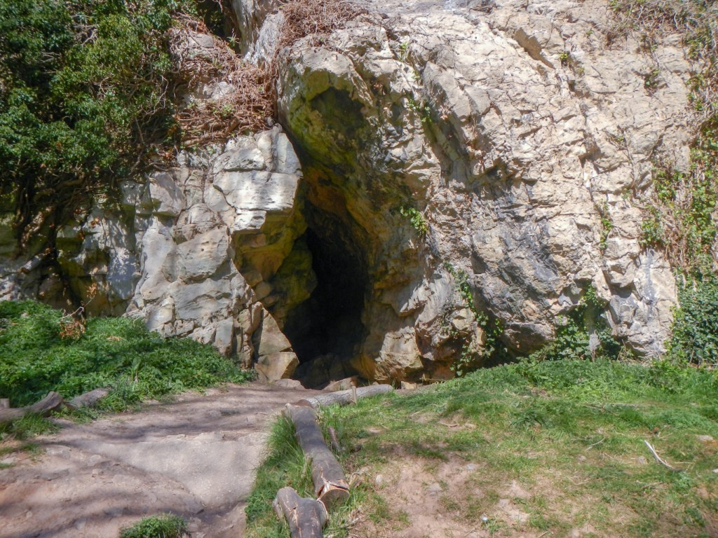
I continued on my way, reaching a hill with views towards Sheffield. It suddenly became quite crowded! I descended to Creswell Crags where it was very busy. It’s a limestone gorge and one of the oldest known inhabited places in Britain, where Neanderthal Man lived as early as 60,000 years ago and modern man dating back 13,000 years (Creswellian Culture). The footpath near Church Hole on the south side of the gorge was closed but this cave contains examples of the oldest verified cave art in the UK. It includes images of bison, reindeer and birds, as well as some abstract symbols which may have had religious meaning. However, I did walk up to the entrances of a few caves on the north side of the gorge including Robin Hood’s Cave – yet another of the caves where the outlaw was reputed to have hidden in order to avoid capture by the authorities.

I continued along the Robin Hood Way – and the path became almost deserted again. I was still in the Welbeck Estate so the scenery was of parkland and woodland.

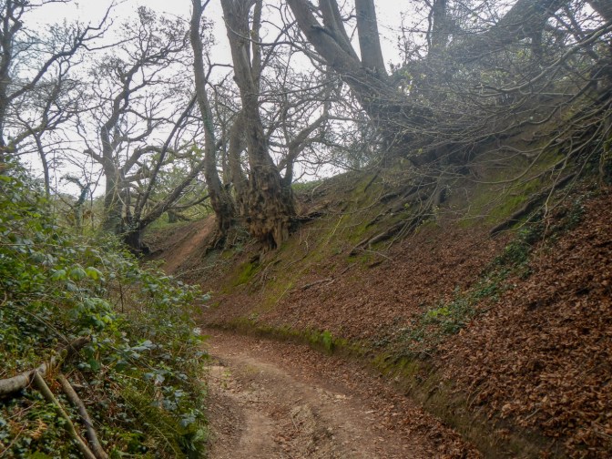
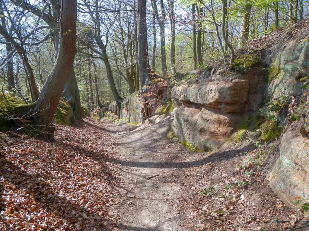
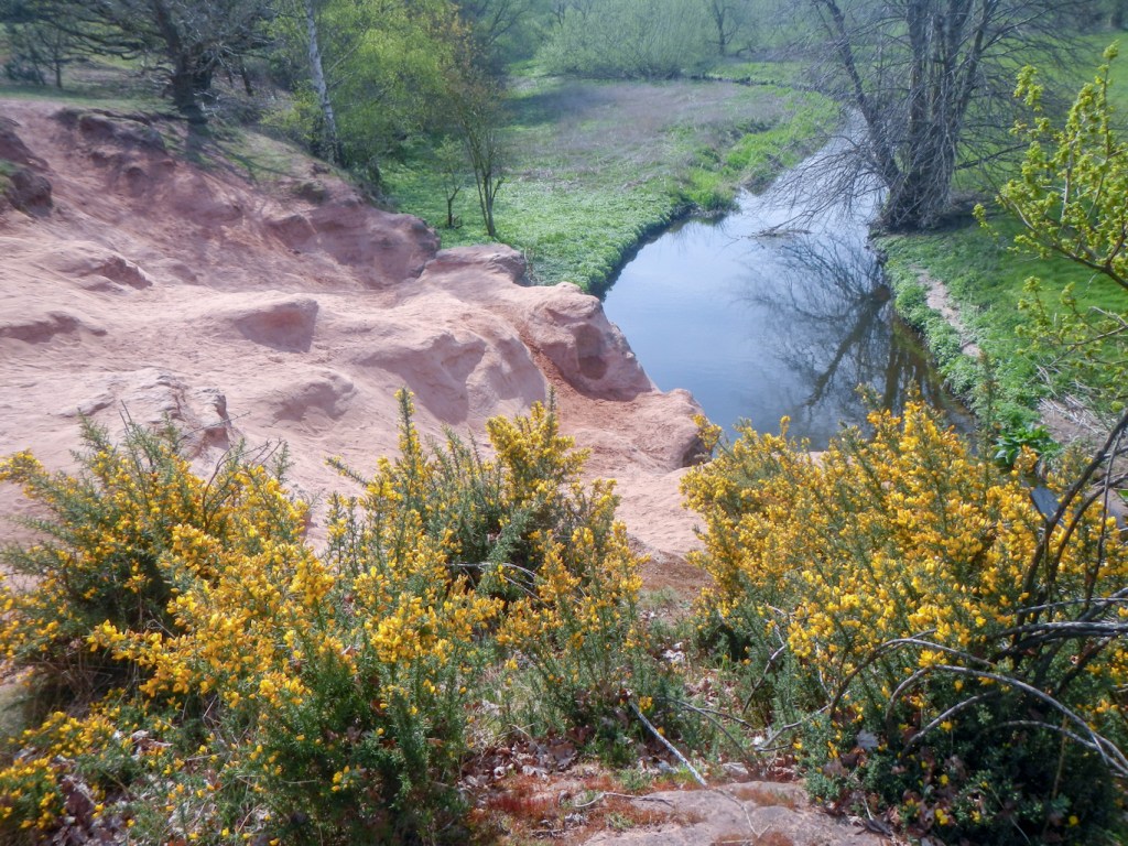
It included a small sandstone gorge with a sunken lane passing through.
The path traversed directly from Welbeck Park to Clumber Park estate, now in the care of the National Trust who bought it from the Duke of Newcastle in the mid to late 1940s. Unfortunately the grand house was demolished in 1938 following fire and also heavy taxation as well as the over riding factor that it was huge, lavish and had been built for a different age.
I visited the café just before it closed and managed to buy both coffee and cake. A couple of volunteers (also litter pickers like the people I had met earlier) chatted to me – I am actually amazed how much dropped litter I saw in the park grounds so clearly these volunteers are providing a much needed service; I just don’t understand why people drop their litter though as it’s clearly not just litter dropped in error falling out of pockets etc. without being noticed!
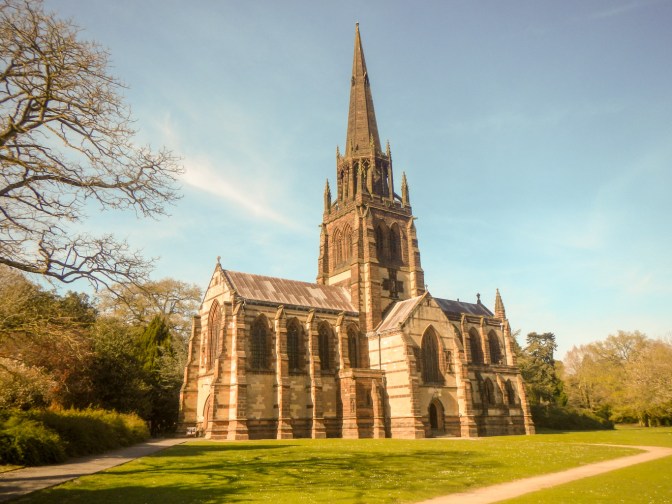
I just had time to visit the chapel of St. Mary the Virgin. It’s actually the third chapel to be built at Clumber Park. It took three years to build, and was opened in 1889 for the 7th Duke. The 180 foot spire towers over the Pleasure Grounds. Built to serve the needs of the Duke and his small family as well as those people who lived and worked on the estate it is amazingly the same size as many parish churches and has even been nicknamed a ‘cathedral in miniature’.
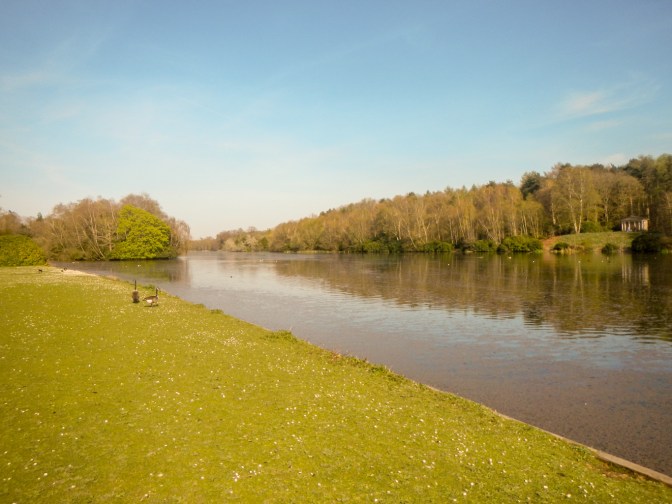
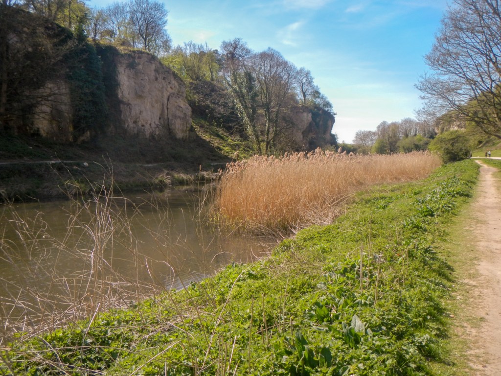
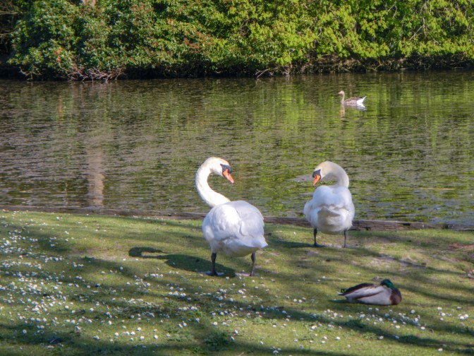
I walked around part of the huge lake – it’s a three and a half mile walk all the way round this lake which has an area of 87 acres – built by the Dukes of Newcastle in the eighteenth century as a grand water feature that would serve as the centrepiece of their magnificent park. I saw many swans, geese, ducks and moorhens but wasn’t fortunate enough to spot a kingfisher. my walk ended by skirting Hardwick Village (the estate village) and reaching the busy A60.
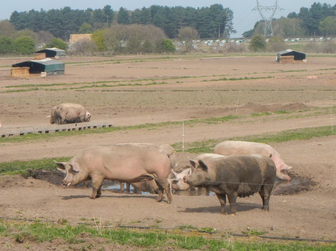
I was dropped off at the same point the next morning to continue my walk. This started with bridleways and footpaths through woods and farmland including past fields of pigs and fields of free range hens. I was very annoyed about the black dog that jumped up on to me, particularly as I was wearing clean clothes before it happened; the elderly owner explained that she can’t keep up with her dog anymore, but the dog was clearly not in her control.
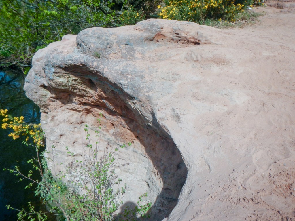
I took the short detour along the banks of the River Maun to visit the outcrop of sandstone forming a low river cliff. The small cave is another of the reputed caves of Robin Hood, although it looks too small to provide much shelter at all. it was much busier with walkers at that point than anywhere else all morning.
I retraced my steps and continued to follow the path until the crossing point of the River Maun. Unfortunately I arrived at a bridleway closure notice – a temporary closure that had apparently been in place since 26th November 2024 to apply until 25th May 2025 (although it may be extended). Furthermore “during the period of restriction there is no alternative route available”. I looked at the very flooded path and decided that there was no sensible way to disobey the closure order. Obviously I had to find a way to get round and ended up walking a total of about 5,500m to get 700m further along my waymarked route. The route consisted of a stretch along a footpath through the woods, 300m on the very busy and bendy B6387, a footpath across fields passing over two footbridges and then about 2,800m along a busy C road, most of which had no pavement and a large amount of traffic driving at around the national speed limit (I kept jumping up on to the verge as traffic passed but most of the verge wasn’t suitable to use as a footpath). This is not “any old bridleway” – it’s marked on the OS map as a selected recreational route and it’s a waymarked long distance trail. There may have been a better route by returning past Robin Hood’s Cave and then including permissive paths through Thoresby Estate to regain the official Robin Hood Way near the South Lodge at 628728 but this isn’t clear from the map and would have required local knowledge of the permissive paths.
Anyway, eventually after my 5,500m walk I arrived 700m further along the waymarked route and followed the path which gradually approached the A614 to cross it at a traffic light controlled crossing point. The route now went on a wide and easily walked track which seemed to follow the border of the Clumber and Thoresby estates. Eventually I reached the previously mentioned South Lodge and was tempted by a sign stating that there was a two mile route to Thoresby Hall, home of the Dukes of Kingston, later Earl Manvers. I was keen to see the statue of Robin Hood, designed by TussardBirt, a grandson of Madam Tussard. After all it was only an extra four miles to walk return and almost flat! Fortunately it was also easy and rapid walking ground.
After my diversion, I had a long march through more forest on the Clumber / Thoresby border and then the Welbeck / Thoresby border between South Lodge and Hazel Gap, where I had passed through from a different direction the previous day.
I saw some signs about naturists – asking them to refrain from removing clothes in car parks, to try to walk in the quieter areas of Budby Forest rather than the busier Sherwood Forest and to put on clothes if they saw other people in the area. I didn’t think much about it until later when my husband who hadn’t seen the signs told me that he had been surprised to see a naked man walking in the forest near the Centre Tree.
Soon I arrived at the Centre Tree. This tree is believed to mark the centre of Sherwood Forest. The “ride” to the south is “The Neutral Ground”, a strip of land between the Thoresby and Welbeck Estates.
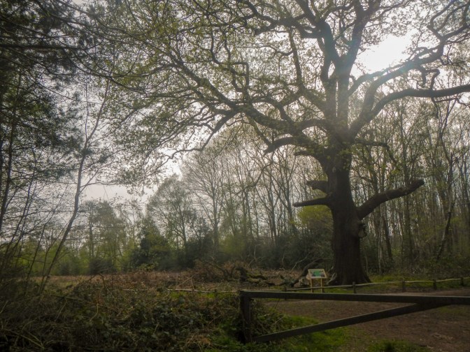
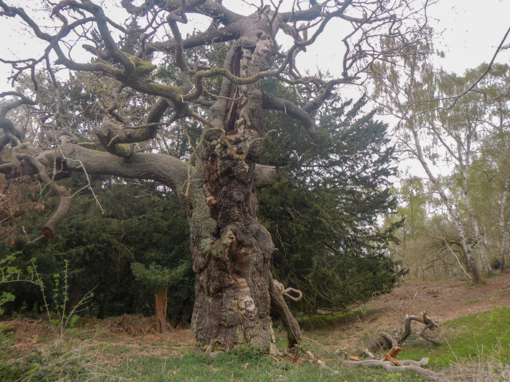
I walked east along the path and reached the impressive major oak. This ancient tree is thought to be the largest oak tree in England and about 1100 years old. The hollow tree has a circumference of ten metres and the canopy spreads twenty eight metres in diameter. The cavity in the trunk is two metres in diameter. It’s been fenced off since 1975 to prevent further compaction of the soil round it by many thousands of visitors’ feet – resulting in water being unable to penetrate to the roots.
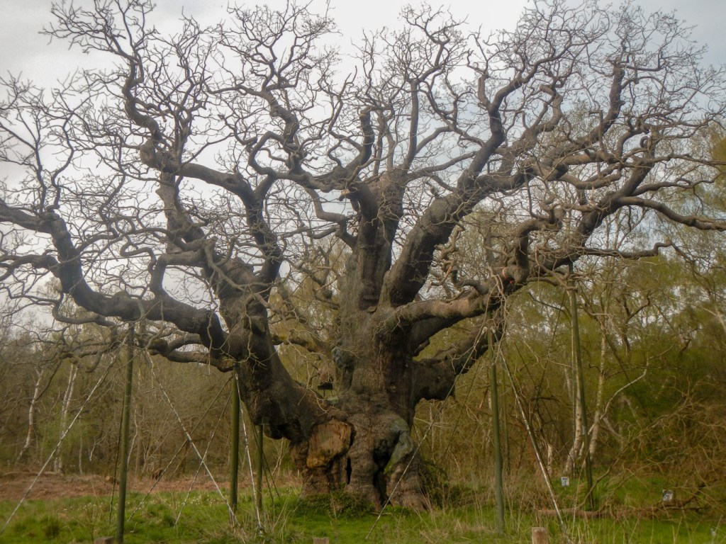
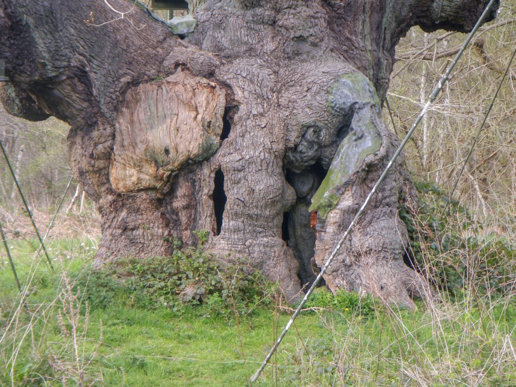
Ancient oak woodland on acid soils such as found here is one of the rarest habitats in Europe. In the area there are hundreds of ancient oaks, each over four hundred years old. Trees that aren’t quite as old but have some features of the ancients are called veterans. Ancient and veteran trees are vital to many animals and fungi which depend on decaying wood for at least part of their life-cycles. Harvesting of straight, mature trees for uses such as shipbuilding and construction has created a “generation gap” leaving the forest with a mix of very old and comparatively young oaks.
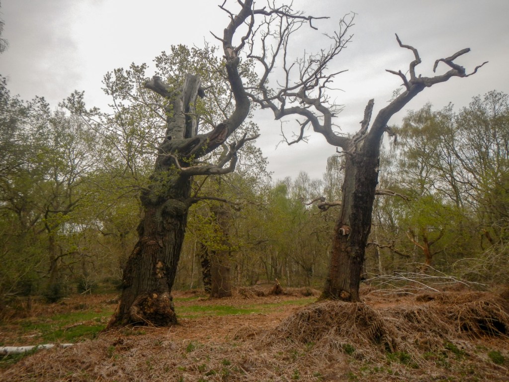
If the ancients disappear before the young oaks have the chance to age and decay then it will be disastrous for the ecology of the landscape. In order to avoid this, a two-pronged approach is being taken; the ancient oaks are being supported and nurtured to preserve their heart wood and prolong their lives and some of the young oaks are being “veteranized” – the aging process is being artificially speeded up. Examples of veteranizing include removing bark to expose under-layers close to the ground, building artificial nesting cavities in the trunk, breaking / fracturing some large branches and removing rings of bark.
All that remained was to stroll into Edwinstowe past a large number of impressive ancient oaks and then past a village cricket match. The end of the route is marked at the church; the legend tells that this is where Robin Hood married Maid Marian. I had hoped to visit the church and see the “Sherwood Forest Measure” – the foot measure used for measuring forest lands is actually one and a half feet long. However the church was locked.
I walked through the centre of the ancient Royal village to reach The Dukeries Hotel for my last night before moving on. I’d certainly added significant mileage to the waymarked route as my GPS device had measured a walk of over twenty miles on each of my six days on the trail.