28-30 March 2025
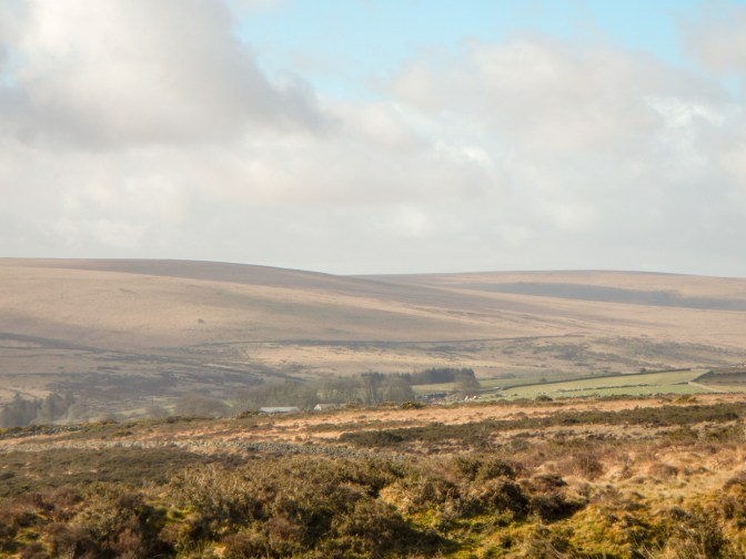
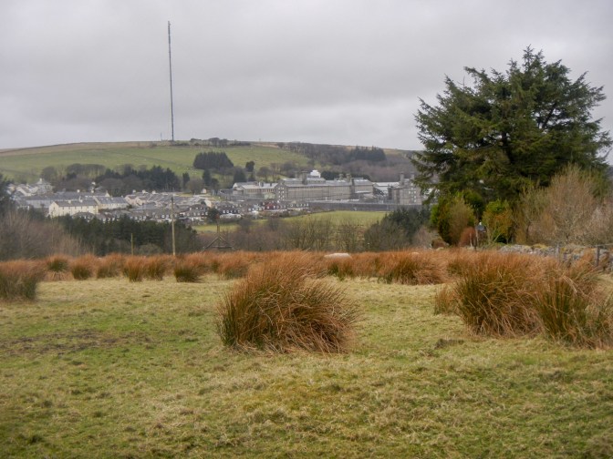
An air of excitement and anticipation was evident early on Friday morning in the car park at Postbridge. I had just driven from Exeter in glorious spring weather; the open expanses and tors of Dartmoor were looking at their best; the young people about to embark on the expedition which was the final requirement to gain their D of E Silver Awards were gathered by the school minibus; a weekend of adventure, challenge and teamwork lay ahead of us.
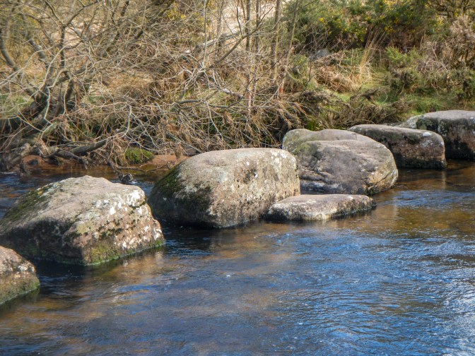
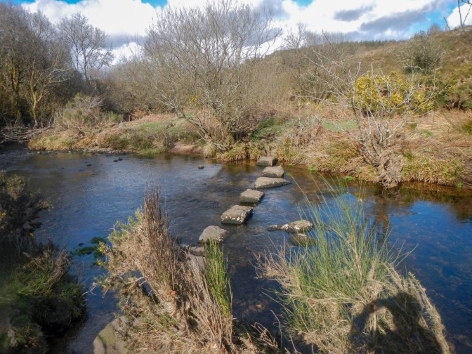
The challenges began almost immediately when the girls’ team realised that their planned stepping stone crossing of the East Dart River wasn’t possible for them carrying their weighty rucksacks. I met them approaching from the opposite bank of the river.
They opted to retrace their steps and cross the river more safely over a bridge.

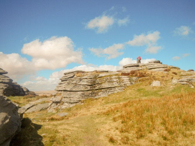
I met them again at the Bellever end then took the opportunity to bag my first tor of the expedition – Bellever Rocks on the west bank of the East Dart River. It’s not on the LDWA list but is listed on https://www.torsofdartmoor.co.uk/index.php and is an interesting and extensive pile of stones well hidden under the trees.
While the team returned to the path of their planned route, I made a direct ascent of Bellever Tor from where there were extensive clear views to enjoy as I ate lunch.
I lingered over lunch, although had some concern as I studied the trackers that the team seemed to be circumnavigating Laughter Tor rather than taking their intended route to the summit. However, they got there in the end. I met them again as they were heading towards Bellever Tor and I was making my way to Laughter Tor.
From the summit of Laughter Tor, I headed back towards Dunnabridge close to my parked car but turned the opposite way from the car park then on to the stony bridleway towards the West Dart River.
I reached the stepping stones crossing the West Dart as it meets the River Swincombe. These looked tricky, although the water level in the river was low. I saw a woman without a pack hop nimbly across but her partner loaded with a rucksack fell as he didn’t quite get across one of the more difficult parts. Fortunately he picked himself up and all that appeared damaged was his pride. I took the easy way and crossed in the water – it wasn’t too deep and there was no risk of being swept off my feet. I sent a message to the other supervisors, concerned as to the route for the team who I thought wouldn’t manage the stones carrying their heavy rucksacks and would be unhappy to paddle and get wet boots as I had done.
A further set of stepping stones crossed the River Swincombe before the path reached the minor road below Sherberton. These were manageable – even for me! I continued, picking up the Dartmoor Way path then its continuation on a minor road all the way to our overnight campsite at Huccaby Farm. The boys’ team was already settled with tents pitched by the river and the expedition assessor had erected her tent well away from them and conveniently near the field gate from where her car and the farm (with basic facilities) was easily accessible.
I had a long trek on the road to collect my car, meeting the tired girls’ team who had decided to divert rather than attempt the stepping stone crossings.
We had a cold night with a frost. The girls insisted they had ice on their tent in the morning, although I didn’t see it and was fortunate only to have condensation on my tent.
After I had packed my tent, I made the twenty minute trek to Week Ford to assess the crossing. The girls’ team had planned their route to traverse here and given their relatively slow speed we didn’t want them having to retrace steps so early in the day. I made it across on the stones and retraced my steps back over the stones (the return crossing was definitely the easier direction). Both teams were still at the campsite when I reported back that I believed the crossing on the stones would be possible for them.

I drove round to Princetown, taking the minor road from the town past Tor Royal Farm (our next campsite) and parking in the marked area further along the lane.
The visibility was very clear once more, very different from when I had been crossing the moor in that same area in February. I felt positive and was looking forward to bagging a few tors while keeping an eye on the girls’ team.
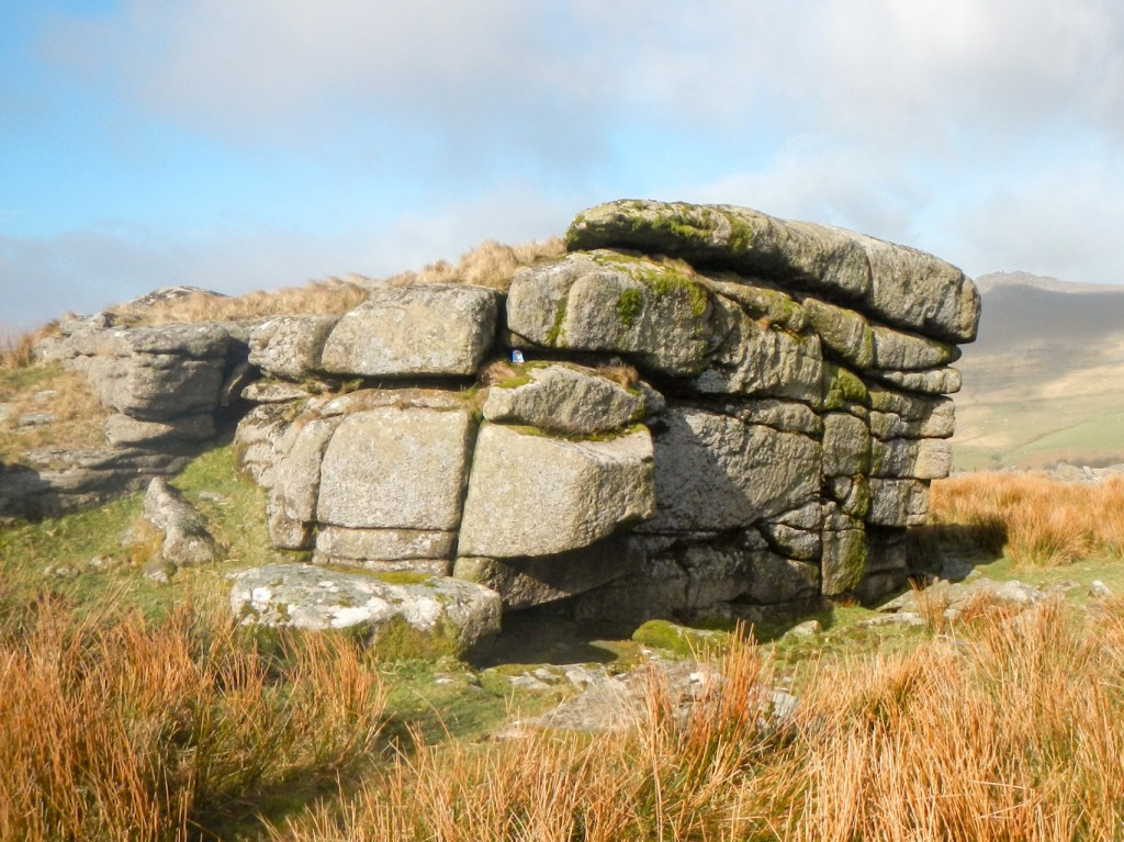
I found Strane Tor easily – it is a reasonably sized tor and surprisingly not marked on the OS map.
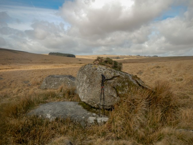
I reached Royal Tor soon afterwards. The stones are marked on the 1:25,000 map to the east of the summit although it is Royal Hill that is named on the map and not the outcrop.
I could see on the tracker that the girls had crossed at Week Ford and were on their route. The boys were on the Dartmoor Way, although soon to turn off on to the bridleway towards Whiteworks. I descended to the Dartmoor Way but left it to traverse southwards cross country and attempt to intercept the boys’ team. My interception was aided by them opting for a rest break; they all seemed happy and I even took a photo of the group using the phone of one of the team (including the huge teddy bear they had brought with them). Carrying and photographing the bear had been deemed to be the “purpose” of their expedition!
I was soon on my way again and looking at Higher Swincombe Rocks on the opposite side of the River Swincombe above a reservoir. I decided against crossing to the tor as it would have involved a fair amount of descent to the river and ascent on the other side of the valley. My priority was to try to meet up with the girls’ team somewhere near the ruins of Swincombe Farm. The meeting was made easier by this being the spot they stopped at for what was to be their extraordinarily long lunch break.
The ruins provided good shelter from the wind. I had already eaten lunch while they were heating boil in the bag meals. We discussed their onward route plans along the Dartmoor Way (which they were already following) to Princetown. What could go wrong? Feeling happy that they could manage easily I set off for a bit more tor bagging of outcrops to the north of their route.
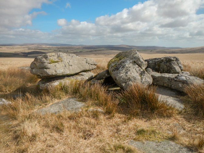
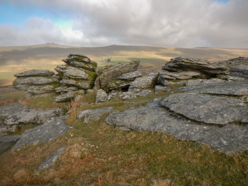
Ground Tor turned out to be an impressive outcrop that isn’t marked on OS maps. It’s not on the LDWA list either. Not only are the stones striking – a significant granite slab – but views to the west, north and east encompass North Hessary Tor, Longaford Tor and Bellever Tor amongst others.

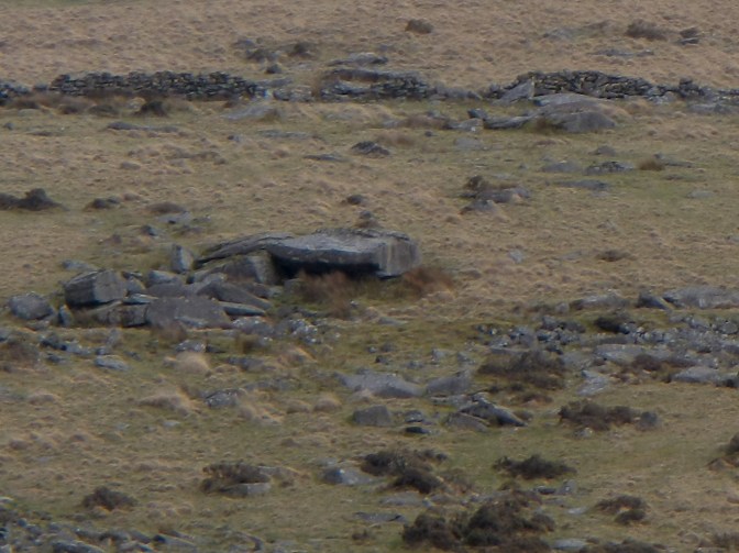
Feeling very pleased with my “find” I headed off towards Blakey Tor with high hopes. This tor has only been marked on OS maps since March 2023, although it is on the LDWA tor list. I hadn’t been checking the girls’ group tracker or my phone and was surprised to receive a phone call from the assessing teacher explaining that the girls had strayed completely off track. There were lots of missed messages on my phone! It appeared that the team had followed me rather than keeping to the Dartmoor Way route!
I was in a very good position to retrace my steps and intercept them, which I did. To my relief it wasn’t that they had followed me – they had stayed far too long eating lunch for that to happen. They had just taken the wrong path. Sadly they were oblivious to this and had thought that they were getting close to Princetown! This was when I found out that they had “forgotten” to bring a compass.
They weren’t keen to retrace their steps so instead we agreed that they would head south across pathless terrain to reach the Dartmoor Way path. I agreed to lead them on this route – especially as their navigation in terms of following a bearing was limited without having a compass. Suffice to say they were less than impressed with the bog hopping and tussocky nature of the route! We also had a difficult fence crossing – it appeared to be a spot that was used to cross as there were helpfully placed rocks but there was no stile. Eventually to their delight we reached the Dartmoor Way – but the yomping had definitely sapped their energy.
What could go wrong? Clearly potentially quite a lot so I decided to follow the team closely and leave the “minor” tors to another day. Princetown was reached without any further navigational issues, followed by a brisk walk up the gravel track to South Hessary Tor. I left the team to navigate to the campsite by themselves and set off to retrieve my car from the car park.
I pitched my tent just before the rain started – apparently it was rain that was only affecting the Princetown area -bad luck for us! However we were able to cook and eat under a sheltered area provided in the campsite – there were two and the students quickly settled at the more “luxurious” one!
The night was less cold. The students were all well aware of the situation with the clocks going back and were up and about promptly. Two of the supervisors managed to forget…. but then made heroic efforts to be ready to leave in record time.
I drove to the big car park beyond Merrivale – the end-point as I wasn’t keen on yet another long walk after everybody else had finished. I walked on the edge of the moor next to the road down to the Merrivale bridge – fortunately the road was very quiet with little other traffic than various school minibuses no doubt out with teams training for the upcoming Ten Tors events.
Once over the bridge I accessed the moor by going over the first stile. I could see Over Tor which is on the LDWA list and bagged it (plus the nearby Church Rock) then ascended the hill up to the huge rock piles of Great Mis Tor via Little Mis. I hunted for the Frying pan, which I had been told was obvious although I never remember seeing it. I didn’t see it again so clearly don’t have a good enough imagination.

I tracked both teams and could see that they were safely on their routes to Great Mis. The boys arrived first and had to wait at the checkpoint as they were early – well actually they ran around playing some form of hide and seek. One of the other supervisors arrived – he had just done a reconnaissance to look at the feasibility of crossing the River Wakeham west of Great Mis as that was the boys’ intended route – report was positive. The girls followed soon after and only had a short break. Their planned walk was to above the River Wakeham and then follow the river down to the road and cross over Merrivale Bridge.
I decided to follow them in person as there was concern that if they began to deviate at any point then it would be a late finish. There was no path but they coped well over the clitter as we descended the tor. They were less enthusiastic about the boggy bits lower down.
Lunch followed on the grass near the Merrivale Inn. Some tourists in a car were clearly very lost as they asked us how they could get to Widecombe in the Moor! I had a quick check on the ongoing route for the team and found that we could access the moor from the open land to the east of the quarry as they had planned.
Soon we were off. The team seemed to have got the hang of navigating – they were looking at the map, following features such as walls and streams and augmenting this with some use of the compass (not forgotten after yesterday!). However two of the team members were becoming very tired and required the encouragement of others. It was encouraging to see how well they supported each other.
We reached Roos Tor which was where we discovered that one of the struggling girls was wearing five layers of tops and two layers of trousers. Having stripped off to a more appropriate amount of clothing matters improved. The message received by supervisors to report that there was an ice cream van in the finish car park may have been of some help too!

Great Staple and Middle Staple Tor followed in quick succession – there isn’t much ascent needed for these from Roos Tor. We all headed off towards Cox Tor, the students enquiring about trig points and their purpose. The assessing teacher was waiting on Cox Tor and provided the debrief at that point, rather than at the end where parents would (hopefully) be waiting. Overall both teams were deemed to have performed satisfactorily including learning from mistakes. They were free to descend to the car park, the ice cream van and an opportunity to rest. Even the most tired students found a “second wind”.
As for me it had been an interesting weekend. I had hoped to bag some more tors but that wasn’t the reason why I was there and the girls’ team had required more support than I had envisaged. Despite their tiredness and the various trials and tribulations involving stepping stones that were too difficult, wrong turnings etc., I hope that for at least some of them the experience will be a springboard to further adventures on expeditions in the future. Volunteering in this way is definitely worthwhile; the teacher running the weekend made it very clear that these expeditions are only possible if there are volunteers who step up to assist.
