8-9 April 2024
We spent 8 April travelling along the scenic coastal road from Overstrand to Snettisham, planning to check-in to the Rose and Crown at Snettisham in plenty of time to walk to the RSPB site and view the wader spectacle predicted to happen soon after 5pm. This only happens a few times each year at Spring Tides when the tide rises rapidly and high enough to fill the bay of The Wash estuary with sea water so the birds are forced to abandon their rich feeding grounds on the mud flats as they are covered with water.
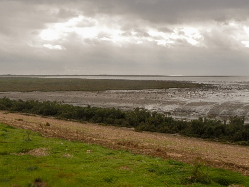
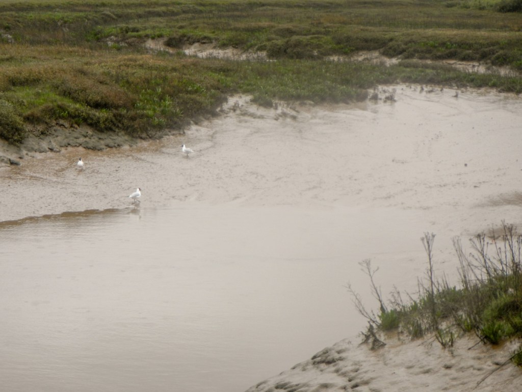
However I had plans for some subsidiary adventures too. I had spotted a public right of way marked on the Ordnance Survey map from Burnham Deepdale to Scolt Head Island and was keen to try to walk there. I’d looked at some information on a blog site and noted that people had managed the expedition across the mud flats at low tide, although the trip did appear tricky. Most people going to Scolt Head Island travel on the ferry which runs two hours each side of high tide but only during the summer. Low tide was just after 1pm; we arrived at the start of the footpath around 11.30am so that if it proved possible I could attempt the crossing both ways on the ebbing tide. Almost immediately, the route was over mudflats. Sadly for my plans there was no safe route even over the first creek and I could see on the map that this was small compared to a crossing further on along the route. I got very muddy searching for a possible crossing point.
As I gave up and returned to solid ground, I stopped and talked to a fisherman dressed in waders who had been digging for worms ready for a fishing competition later in the day. He explained that the area has become increasingly deep with silt over the years and that although on the map this looks like a path, the reality is different and the creek crossings would involve wading through chest high water. I didn’t even ask how, in those conditions, it is possible to follow the route so as to avoid being sucked down in deep mud. This adventure clearly wasn’t going to happen, but that’s sometimes how it goes when trying to do something potentially exciting in previously uncharted territory.
Hence, we continued our journey to Snettisham in time to witness the whirling spectacular as the waders (mainly oyster catchers at this time of year) are forced to abandon the water-covered mud flats and fly in large flocks to the lakes within the RSPB reserve.
It was difficult to know what to expect and we were fortunate that the display was due to be repeated at late afternoon high tide the following day. Hence I considered this display as an introduction and looked forward to seeing a further spectacle the next day – more to follow as in my opinion the second display was much more impressive.
The next day, the weather had changed. Instead of being sunny, it was cloudy with rain showers and much more windy. I decided to catch the coastliner bus to Thornham and walk back along the coast to reach Snettisham beach area in time to explore the RSPB reserve before the next predicted “spectacular”.
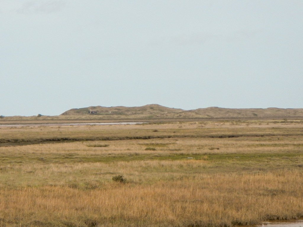
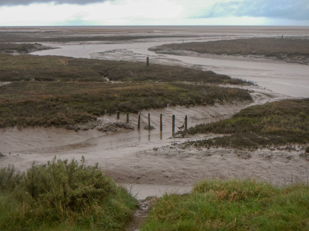
The coast walk to Hunstanton was impressive. The salt marshes are huge and the paths raised from the marshland on dykes. Sluice gates control the water – until the 1880s, when the area was drained for grazing, the marshes extended much further inland. Salt marshes are an increasingly rare and endangered landscape threatened by both drainage for grazing and by sea level rises. They are dominated by salt-tolerant plants such as sea lavender and home to red shanks which build their nests among the plants as well as the many wading birds which feed on nutrients in the mud along the sinuous creeks.
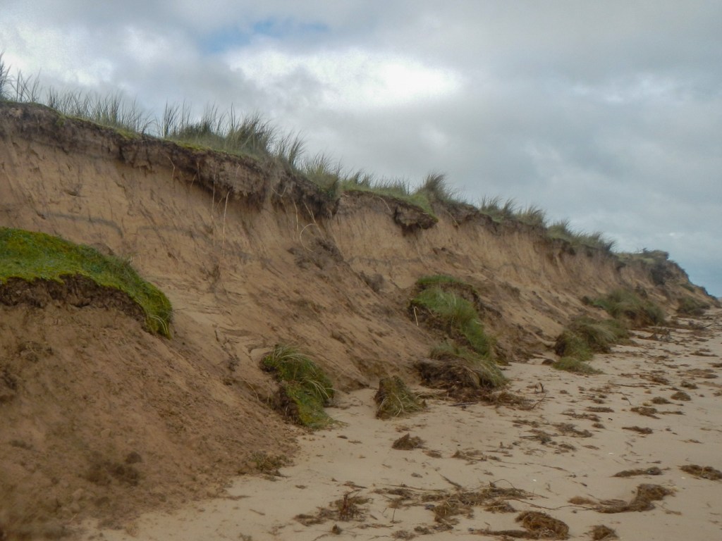
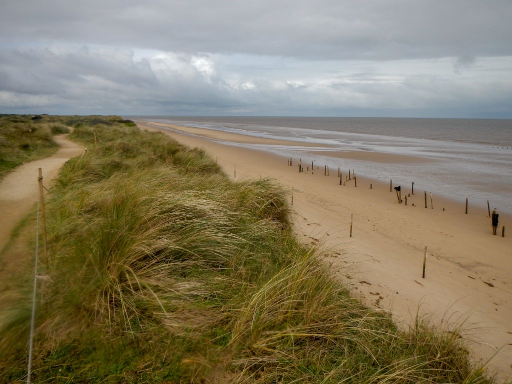
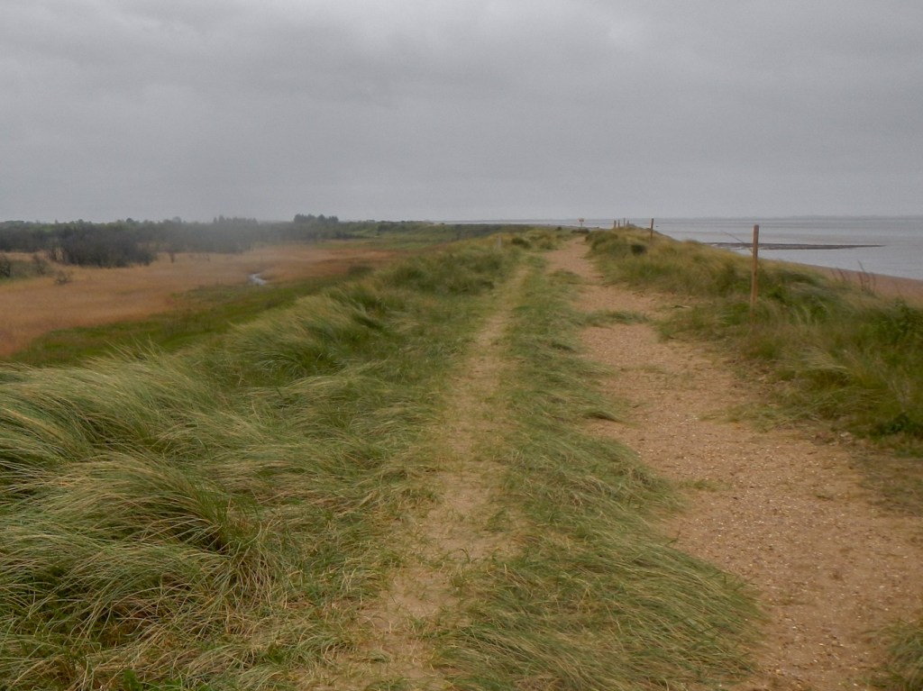
I reached a long 4km strip of sand dunes, a natural flood defence, protecting the land behind (coastal villages and marshes) from flooding. This is a fragile environment and the plants holding the dunes together are easily damaged by trampling hence notices advising visitors to keep to the paths in order to reduce the erosion risk as well as to avoid disturbing ground nesting birds.
I passed an information board close to the point where one of the two local Bronze Age structures constructed from oak wood in 2049BC was excavated in the late 1990s. It was named “Seahenge” by the press although it wasn’t at the sea when it was built and isn’t a henge. It was originally built on salt marsh which nowadays, following coastal erosion, is part of the beach. Its purpose is unknown although various ideas have been proposed.

Soon I reached Old Hunstanton, first the golf course and then an enormous number of assorted beach huts.
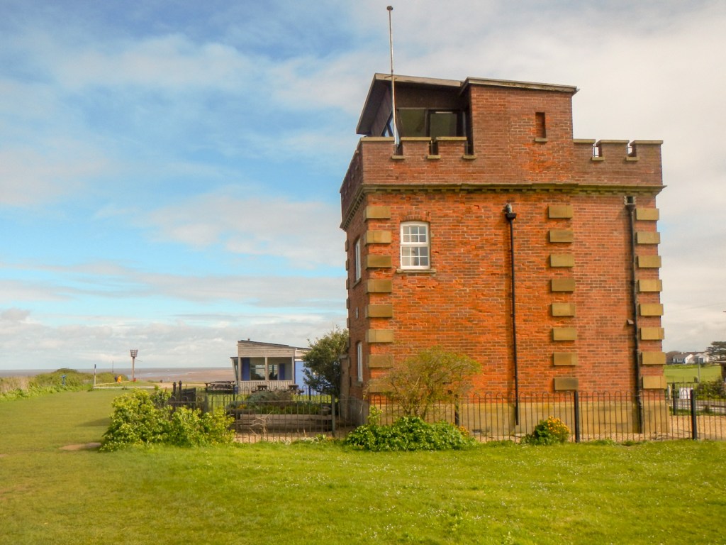
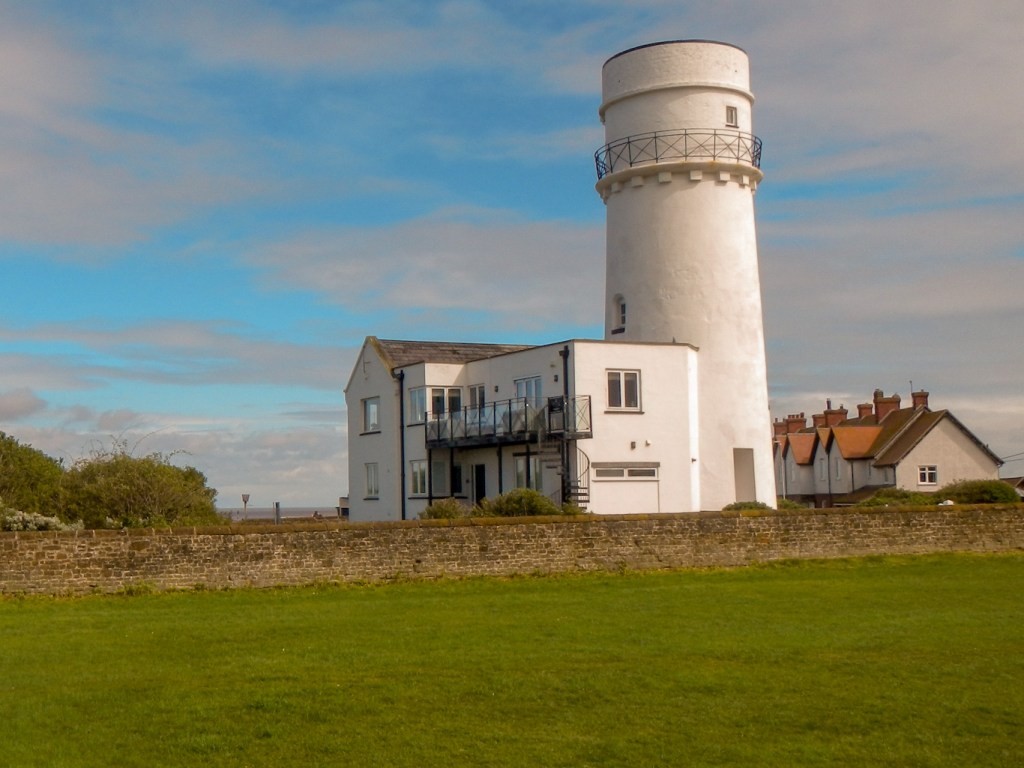
I climbed the path on to the cliff, passing an old watch station which has been converted to holiday accommodation and a lighthouse which also appears to have undergone conversion to become a holiday let.
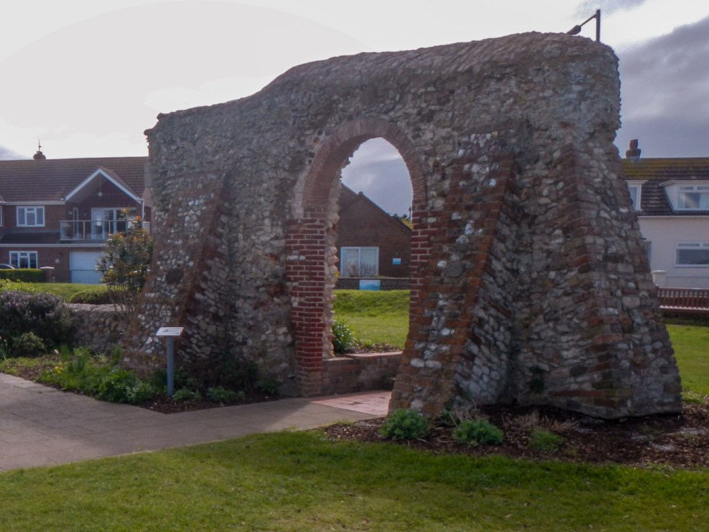
I passed the ruins of St Edmund’s Chapel which was erected in 1272 in memory of St Edmund who landed at Hunstanton in 855 to be crowned King of East Anglia. He led an army against Viking invaders but was defeated, captured and martyred and became the first patron saint of England. Legends tell of a wolf which guarded over his severed head.
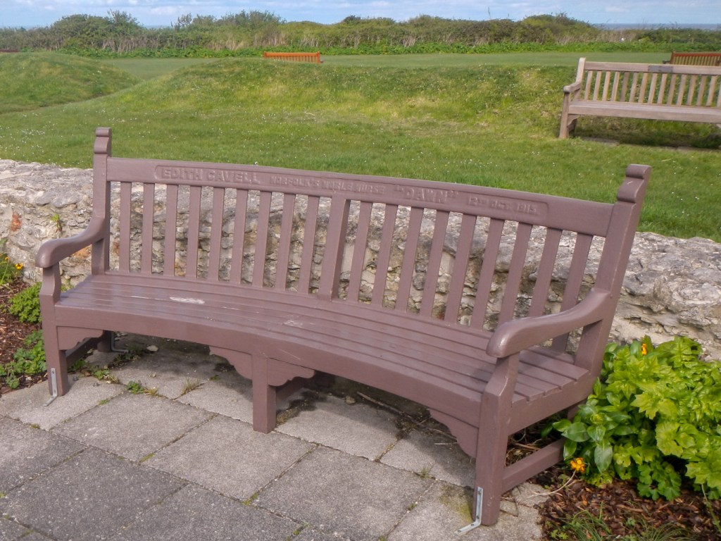
The Garden of Remembrance laid out around the chapel ruins was initially designed by Revd. A.A. Toms who lost both his sons in World War 1. There is an interesting bench in memory of Edith Cavell, a Norfolk nurse, who was executed by a German firing squad in October 2015.
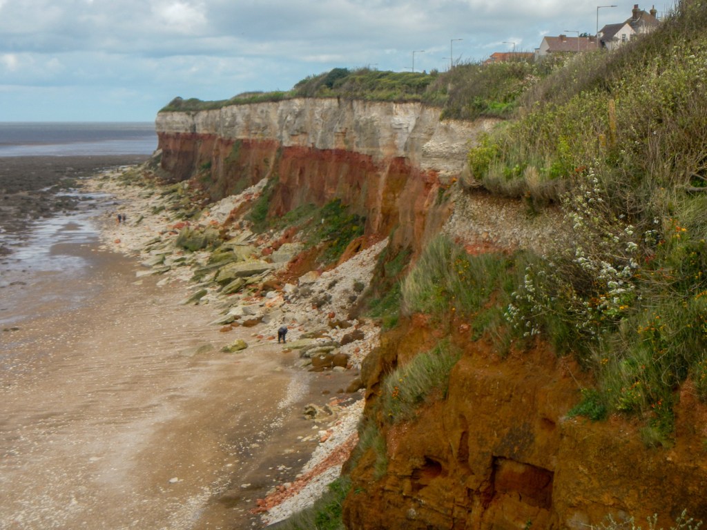
I spotted my husband, sheltering from the wind in one of the ornate Victorian shelters. We walked together to look at the famous and eye catching red and white striped cliffs. Even in these windy conditions, there were fossil hunters on the beach – coccoliths – microscopic plants; bivalves – similar to cockles and oysters; belemnites -similar to cuttlefish; ammonites – similar to nautilus; brachiopods – similar to clams; echinoids – sea urchins; and shark’s teeth fossils have all been found here. The stripes in the cliffs are caused by layers of different-coloured rock. Carrstone is the brown layer and consists of sandstone – sand cemented together by iron oxide. In places where the cement is stronger, the rock is darker and less crumbly. The red chalk layer is also due to staining by oxidised iron and there is also a non stained white chalk layer.
Hunstanton was developed as a seaside resort by Henry L’Estrange in the mid-1800s, the chief selling points being the only resort on the Norfolk coast where the setting sun can be seen over the sea and the place to see the striped cliffs. Some remnants of Victorian heritage remain including the funfair and the remnants of the pier which had a roller-coaster history – three major fires and one episode of being washed away in a storm.
We decided it was too windy to eat outside so retreated into one of the many popular cafés for lunch. My husband had bought a return bus ticket to Hunstanton but I continued my walk after lunch. The wind seemed even more blustery or perhaps I was walking in a more exposed place. It took all my strength to remain upright and walk as near as possible in a straight line. Fortunately I was being blown inshore rather than off the precipitous top of the promenade.
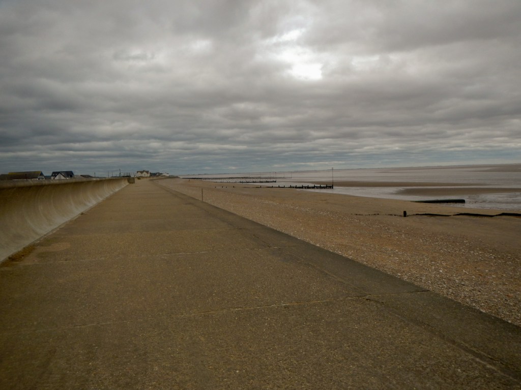
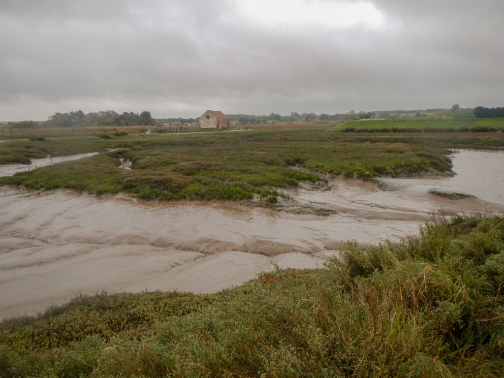
Eventually the route turned inland for a few hundred yards or so – this was easy as the wind helped my progress. However the respite was short and the path turned to be parallel to the coast again, this time following a new route called the “Elizabeth Way” (Heacham to Kings Lynn via Sandringham) as well as the Norfolk coast path / King Charles III England coast path. The official path was on the top of dykes all the way to Snettisham but, in many places, it was possible to follow tracks just behind the dyke and so sheltered from the unpleasantly forceful wind.
After I reached the road near Snettisham Beach, my path continued crossing the road and remaining close to the shore. I passed a very long line of cottages, chalets and static caravans, which were in various states of repair or dilapidation as I continued on to the bird reserve. Once more, I was doing battle with the wind.

I arrived early and took refuge from the wind in a conveniently situated bird hide. However soon I decided to brave the elements again and wandered round, including crossing an area where the path was flooded. I visited a few other bird hides including a very swish new looking hide called “Knots’ Landing” where I could see many black headed gulls on the lake.

I saw a number of bird watchers, a father with children who was whiling away the time until the “Spectacular” by teaching them chess tactics, and a friendly lady waiting for others in her group – she explained that she wasn’t really a birder but had arranged to meet her keen bird watching friends in the hide.
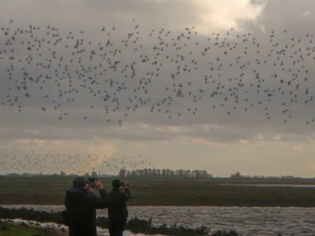
I made my way back over the flooded path (struggling to remember exactly where I had crossed and managed to avoid getting wet feet) to reach the outdoor benches which were advertised as the prime viewing point. Unsurprisingly, as the predicted “spectacular” time was still over half an hour away, there was plenty of space to sit. Before long I was suffering with cold due to the wind chill so retreated to a nearby hide to add some more layers of clothing under my outer windproof and waterproof layers.
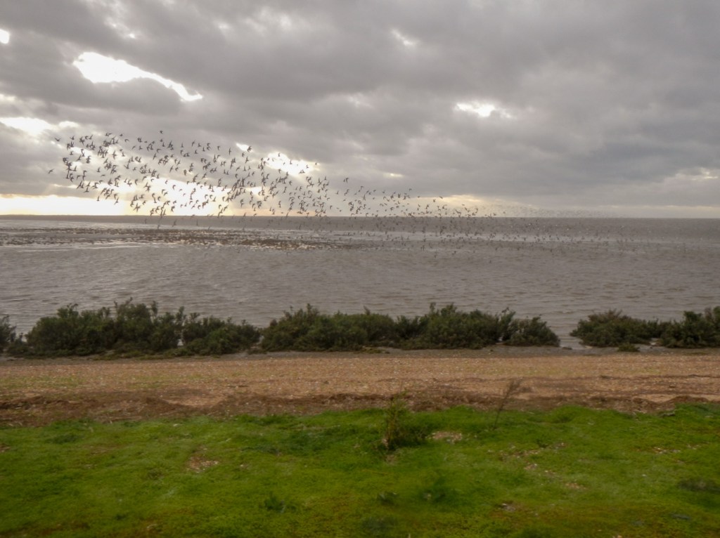


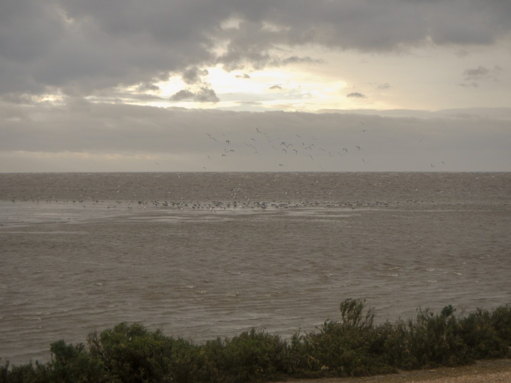
When I arrived back at the viewing point, a few birds were flying inland in small groups. However after a few minutes, I was rewarded for my perseverance and patience when I spotted a huge flock of birds in the distance. The flock seemed to move as a unit and the “bird cloud” formed undulating curves across the sky; there were also curves and swirls as the flock changed direction before re-landing, presumably on mud that was still not underwater. I could see water pouring over the rivulets within the mud flats and forming areas of waterfalls and rapids depending on the local contouring of the mud. The spectacle continued for some time with huge flocks appearing to form curves of black in the sky. When the birds were near, it was possible to see individual dots moving in the massed flocks.


Eventually, most of the birds had gathered on the few remaining promontories of exposed mud. Soon the grand finale took place as, in four or five huge flocks, the birds flew almost overhead to the lakes behind.
There is a sequel – when the tide recedes and the mud flats are exposed again. At this time the flocks of birds return onto the intertidal area. However it would have been dark by then and moreover I still had a couple of miles to walk back to the village in time for dinner. I was fortunate to see a couple of muntjac deer, grazing by the roadside until they spotted me and darted into the wood.
I’m delighted that I had a second opportunity to see the whirling wader spectacle and that it was so impressive on this occasion.

It looks like a great area to visit. It is a shame that it is not possible anymore to cross on foot. You were wise to not try further.
LikeLike