21-23 February 2024
I caught the 07:22 bus from a bus stop just round the corner from my overnight guest house. The single journey flat fare is still £2 which seemed a bargain for a ride of over an hour to Rochester. The route was by no means direct and even passed through Allhallows near where I had walked the previous day.
Once at Rochester, I had a quick look at the cathedral and the exterior of the castle. However, I was keen to reach Ramsgate as I wanted to book on to a tour of the Ramsgate Tunnels. On the train, I noticed that instead of the vast flat wetlands, I gradually reached more populous areas of Kent including typical orchards and oast houses converted into dwellings.
Ramsgate Tunnels https://www.ramsgatetunnels.org/ is a charitable volunteer led venture and part of Ramsgate Heritage Regeneration Trust which is committed to regenerating Ramsgate’s heritage, including land, buildings, archives, collections, and ephemera for the benefit of residence and visitors. The Tunnels have been open to the public now for almost ten years.
Before my booked tour, I spent time looking round the fascinating museum located just inside the tunnels. There is plenty of information outlining the history of the tunnels (both the Victorian railway tunnel section and the air raid precaution deep tunnel system) as well as some social history and artefacts relating particularly to the Second World War.
Ramsgate is in a vulnerable position only 35 miles from the French coast. Hence during the First World War, it was the most bombed seaside town in UK in addition to facing shelling from the sea. Underground shelters on the east and west cliffs had been used during these raids. In 1936, with concern about further war, work began on plans to construct a new underground protection system with easy public access from all but the most sparsely populated or extreme outskirts of the town. When the plans were put to the council initially they were deferred but, following Germany’s occupation of Austria in 1938, the scheme was brought before the Council again. It was agreed to submit it to central government for approval and funding. The scheme was presented to the Home Office but rejected as being premature and not in line with National plans. However the Mayor persisted in lobbying central government and a 3¼ mile semi-circular network of tunnels was dug beneath Ramsgate using the skills of local Kent miners. The network was the biggest civilian deep shelter system in UK capable of sheltering 60,000 people, although Ramsgate’s civilian population at the time was approximately 33,000. It was only ready three months before outbreak of war.

August 24th 1940 was Ramsgate’s worst day of the war. The town received more than 500 bombs from a squadron of German aircraft approaching RAF Manston, and 1,200 houses were destroyed or damaged. Allegedly the leading aircraft was shot down over the harbour and in vengeance the Germans decided to release their bombs over Ramsgate. Remarkably only 29 civilians and 2 soldiers were killed, 10 were seriously injured and 40 slightly hurt. Countless lives had been saved by the careful planning of the Borough Engineer and the persistence of the Mayor.
The tunnels built into the hillside, are an average height of just over six feet and up to 90 feet below ground. Where they are 30 feet or less below ground, the walls are reinforced with concrete. Compasses, candle light and wires were used to aid accurate tunnelling and the maximum discrepancy was only three inches! The entrances consist of wide steps down into the tunnels and two ninety degree turns in each set of steps protect the tunnels from blasts and ensure light does not shine out of the entrances. The tunnels were lit dimly with 40W electric lights – only alternate bulbs were turned on as the electricity bill was enormous. Sanitation was by means of chemical toilets in alcoves. First Aid posts were lined with brick in order to be more hygienic.

The connecting old railway tunnel section was used as emergency housing for those who had lost their homes and had nowhere to go. There was even an improvised dance floor – but dances weren’t allowed to go on late as it had an adverse effect on people’s working the following day.

Our very enthusiastic tour guide, Gary, told us many stories and anecdotes about life in the tunnels. The Trust hosts a monthly reunion of wartime Ramsgate residents, affectionately known as Tunnel Rats. This is also an important time to learn more about the social history of the tunnels from those dwindling numbers of people who lived through the experience. The information is documented and catalogued.
The tour was definitely worth doing and brought home to me the phenomenal hardships suffered by and the amazing resilience of those living through the war. Gary was a wonderful guide, bringing this whole chapter of history to life. It was a rainy and windy day but this experience is superb and I think worthwhile for anyone to visit who is in the area, not just something to do if the weather isn’t good enough for other adventures.
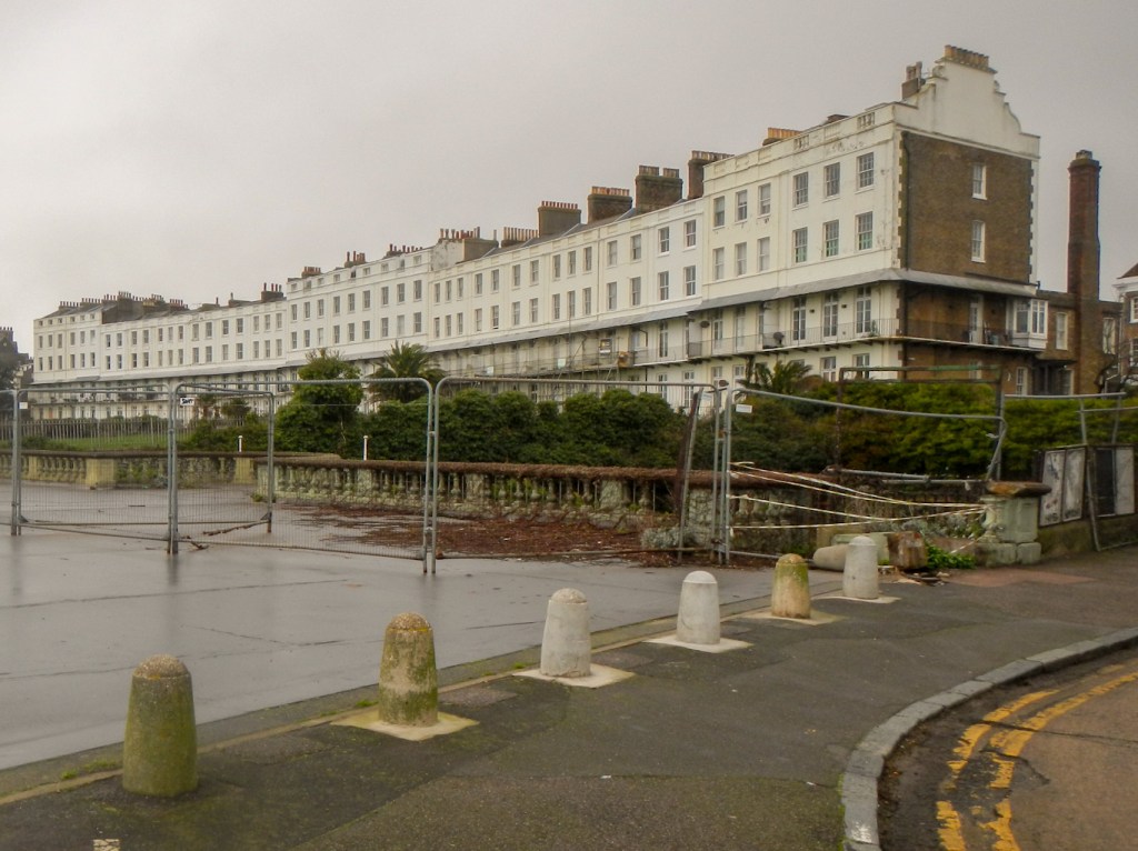
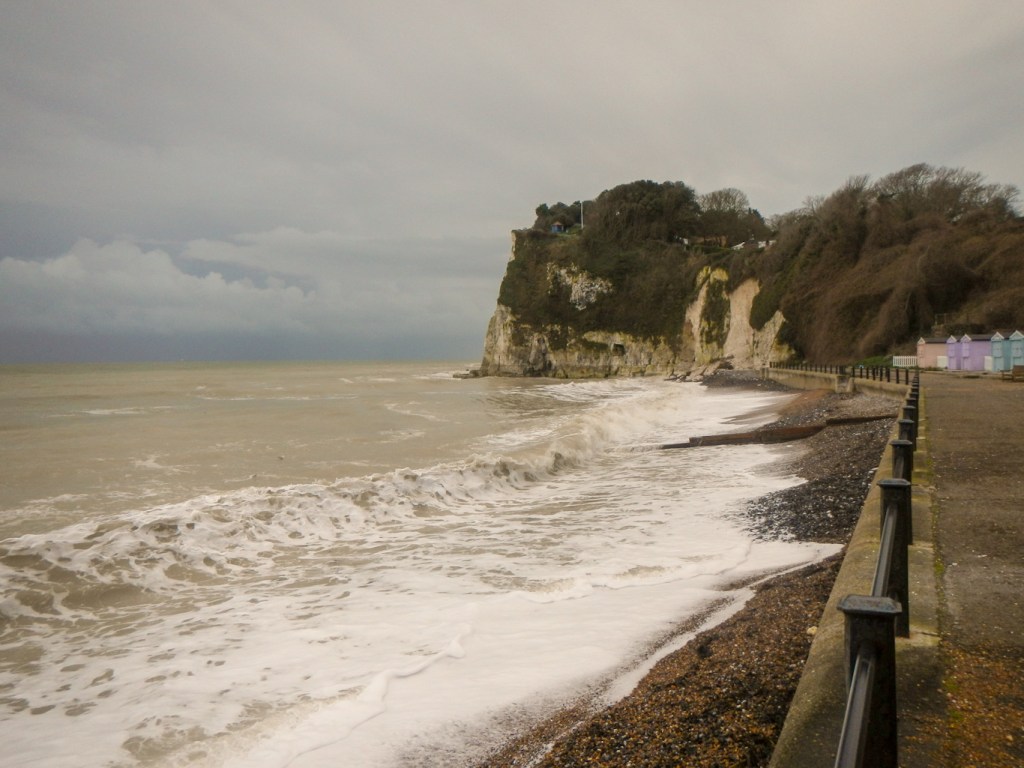
Actually the next day had an even worse weather forecast, including a yellow met. office warning for wind and rain. However, I decided to continue my planned eighteen mile walk along the coast path to Deal. As I walked west, I saw some restored Edwardian Promenade Shelters and the impressive classical style Victorian Royal Crescent designed by Mary Townley. Fortunately this survived both World Wars.
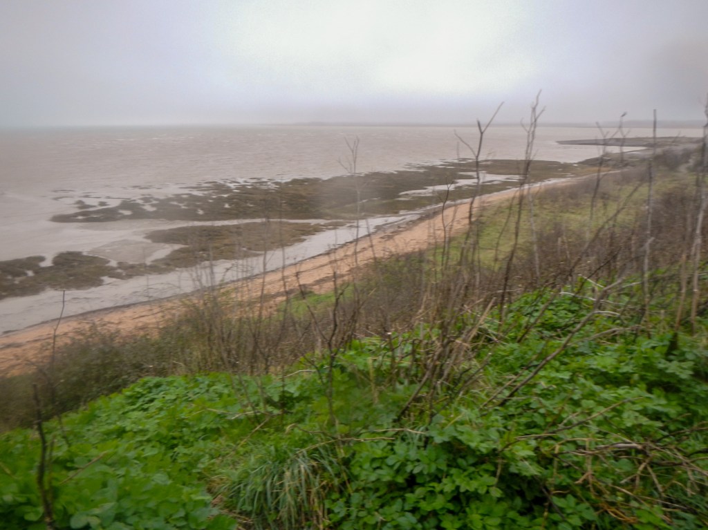
My walk continued around part of the Pegwell Bay National Nature Reserve. This stretch of windswept coastline includes chalk cliffs, mud flats, saltmarsh and sand dunes, and is an important habitat for bird species. Saltmarsh and mudflats as well as a stretch of foreshore are restricted access in order to preserve the wildlife.
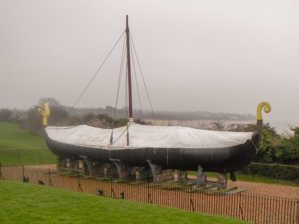
The Hugin is a reconstructed longship which was a gift from the Danish government commemorating the 1500th anniversary of the arrival of Hengist and Horsa, leaders of the Anglo-Saxon invasion, at nearby Ebbsfleet.
Unfortunately a diversion of the coast path (appeared to be longstanding) for commercial reasons, meant that I had a long trek on a cycle path between a busy A road and an unsightly industrial estate. I was also shocked by the amount of litter in the verge – presumably thrown out of the windows of passing vehicles. Only a few metres away from all this rubbish is the important and sensitive National Nature Reserve.
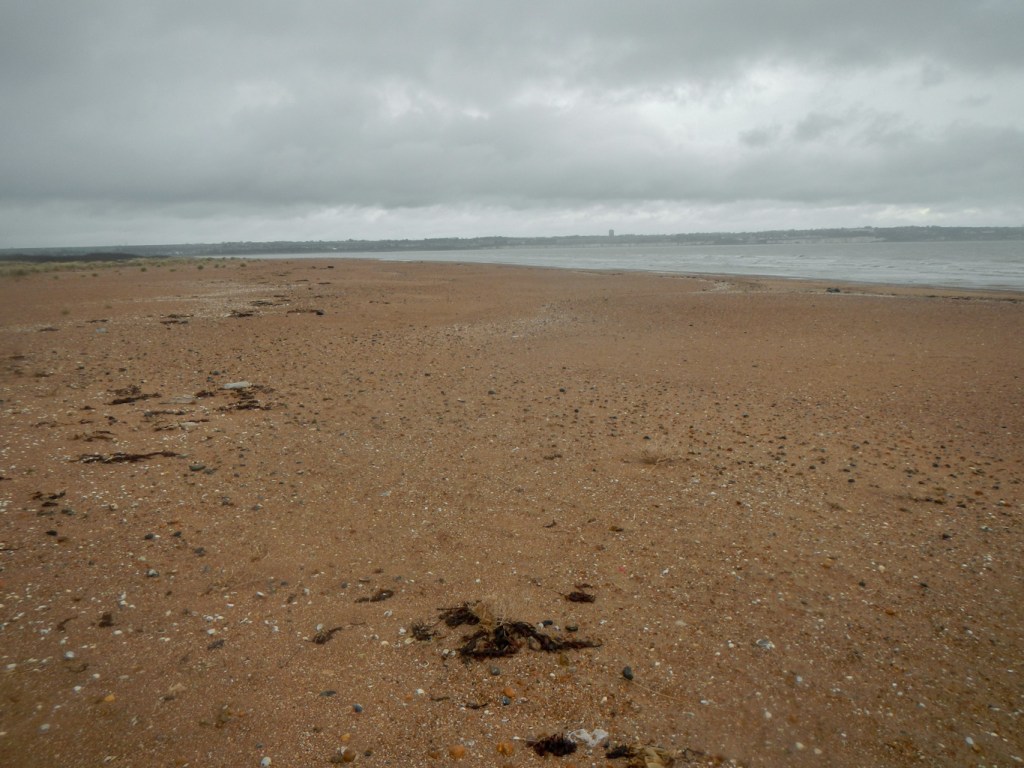
I was relieved to reach the Grade II listed bridge over the River Stour at Sandwich. The route of the coast path went back on itself over marshland and fields complete with a flood defence system. As the crow flies, I was less than three miles from where I had started in Ramsgate. Fortunately the onward route wasn’t as convoluted and I followed the shoreline past Sandown Castle ruins and all the way to Deal where I was staying overnight.
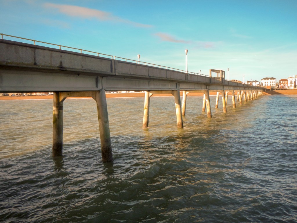
The next day was more cold but started bright and dry. Although I had ventured out the previous late afternoon following my arrival, to walk to the end of the pier, I made a second excursion to the end of the 313m long pier. The views were much clearer.

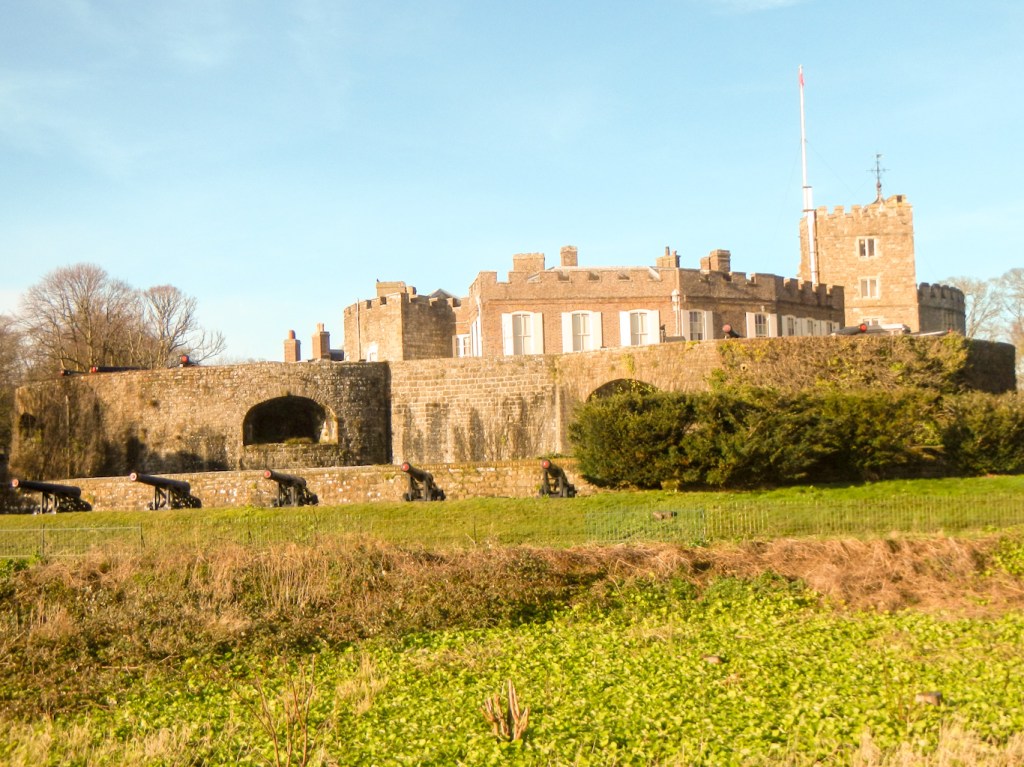
I walked past Deal castle, like Sandown Castle at the northern end of Deal and Walmer Castle just to the south, an artillery fort constructed by Henry VIII between 1539 and 1540. It formed part of the King’s Device programme to protect against invasion from France and the Holy Roman Empire, and defended the strategically important Downs anchorage off the English coast. In 1648 it endured a hard-fought siege between Royalist and Parliamentarian forces during the English Civil Wars but it gradually became of less military importance and its military role ceased by 1800.

Part of the coast line south of Kingsdown and Oldstairs Bay is an SSSI and AONB. There was a climb up on to the cliffs and then down into St. Margaret’s at Cliffe before a further steep ascent.
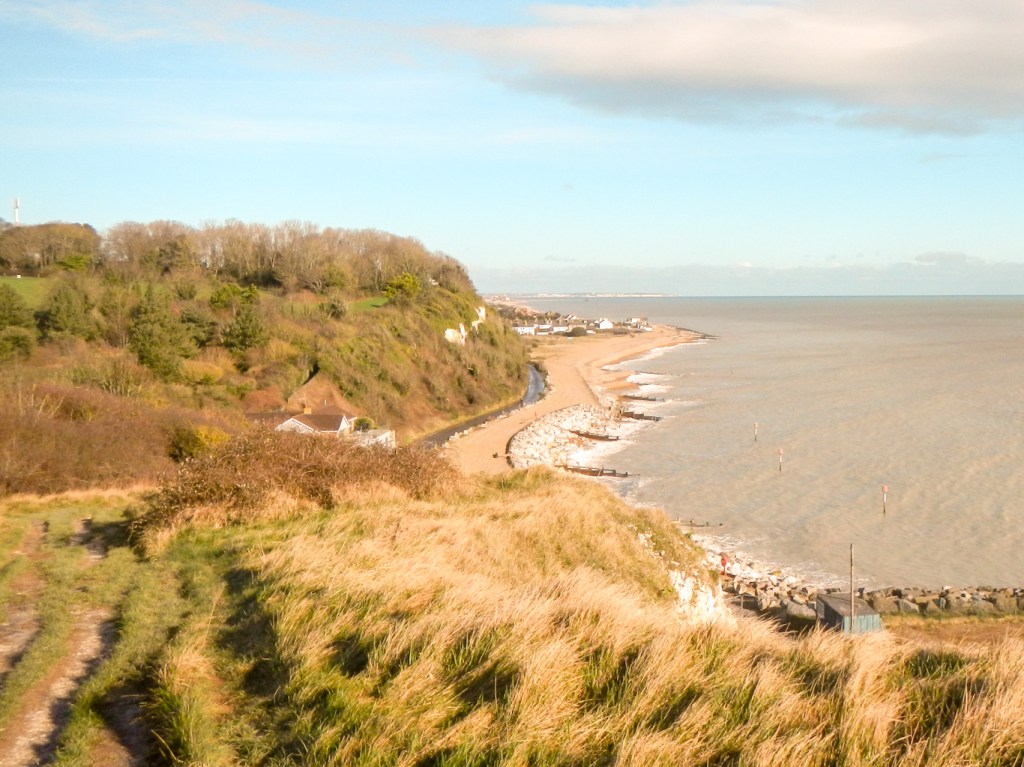
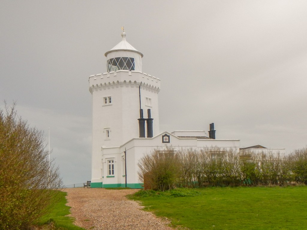
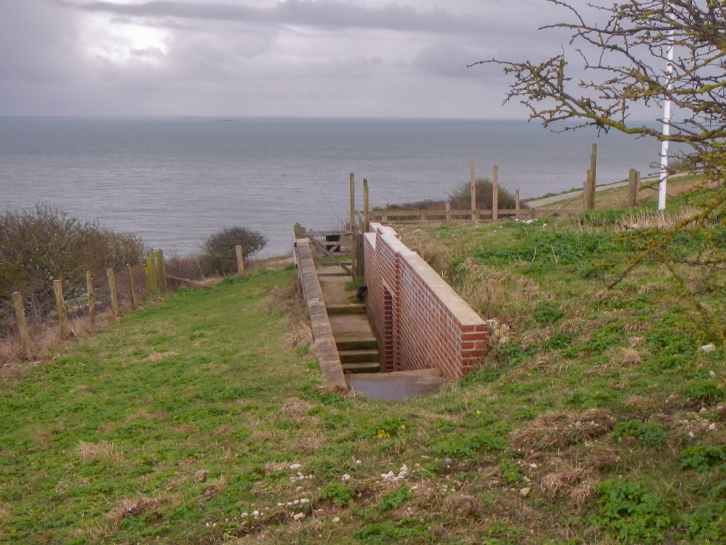
Soon I reached South Foreland Lighthouse – sadly closed for winter. I walked on along built paths, constructed to reduce erosion by the many people walking on this stretch of coastline. I arrived at the entrance to Fan Bay Deep Shelter. Unfortunately this was also closed for the winter season. Completed in just 100 days, it provided shell- and bomb-resistant accommodation for the soldiers serving on the nearby gun battery in the Second World War. Given the number of people wandering round the area, I’m surprised it isn’t worth their while to open during the winter months; there appeared to be sufficient potential trade.
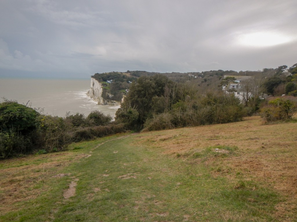
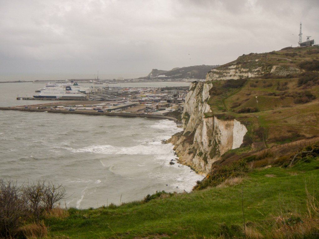
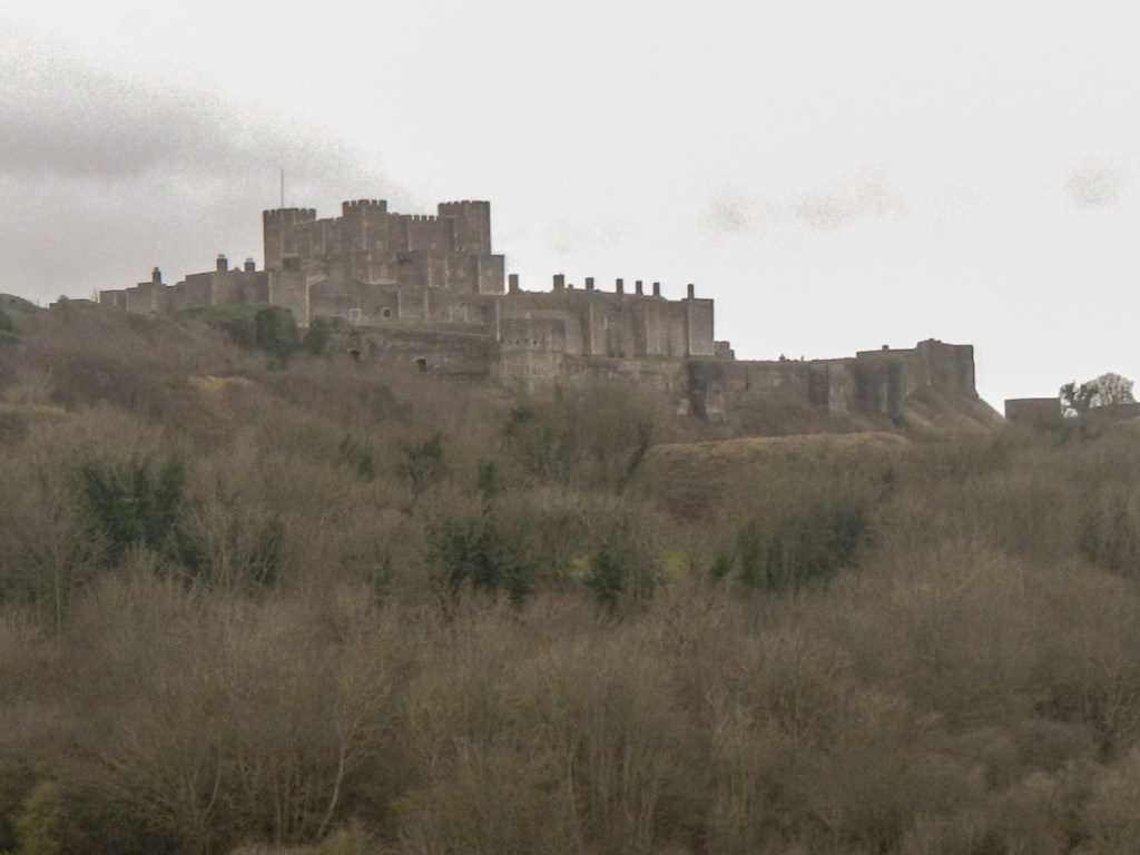
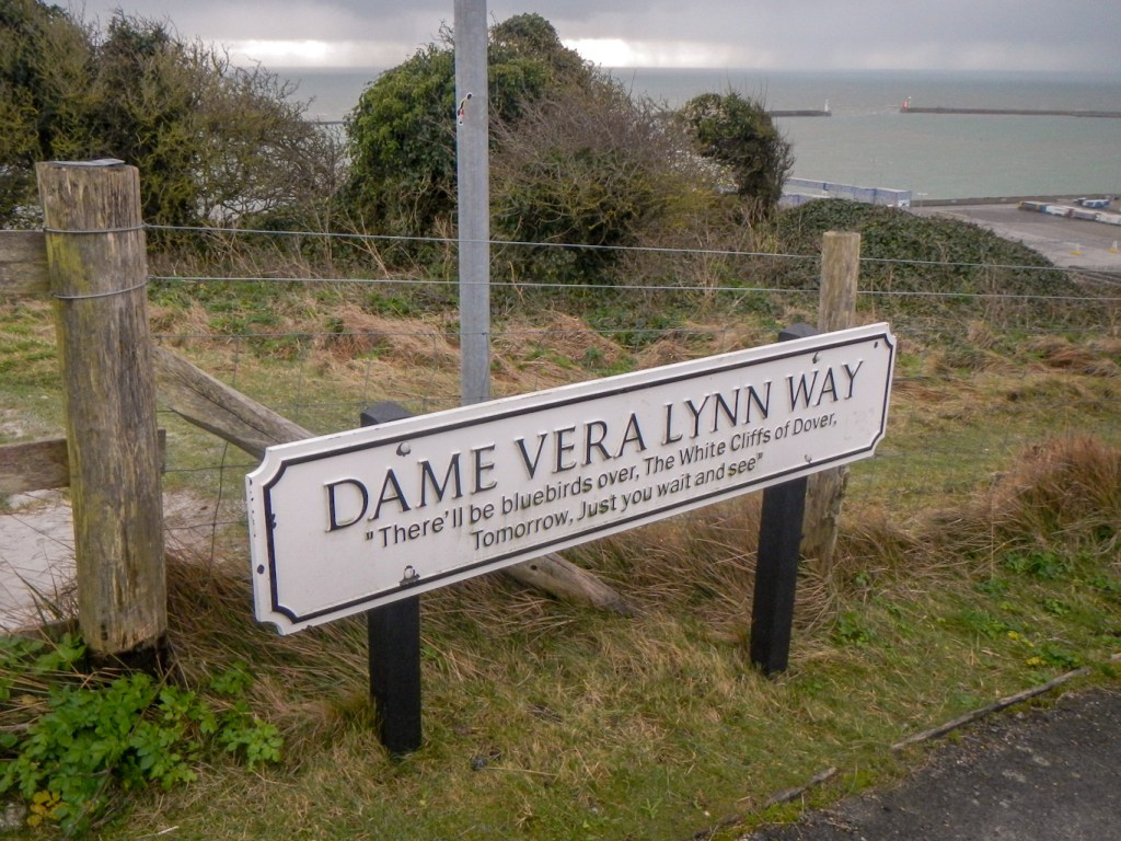
I continued to walk past view points of the white cliffs and of Dover as well as Dover Castle before descending the aptly named Dame Vera Lynn Way to reach the town. Dover Castle commands the Strait of Dover, the shortest sea crossing between England and continental Europe, a position of strategic importance throughout history. Hence it is likely that the first castle on the site was an Iron Age Hillfort. In medieval times it developed as a great fortress. Over the next 800 years its buildings, defences and tunnels were adapted to meet the changing demands of warfare, right into the era of the Cold War and nuclear weapons.

It began to rain as I descended into the town where the museum was open and I looked at fascinating displays focussing on the history of the area from pre-history to the present day.
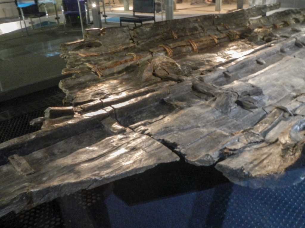
The most notable exhibit is the Bronze Age Boat – at 3,500 years old it is the world’s oldest known seagoing boat. It was painstakingly excavated and preserved, now taking pride of place in carefully controlled conditions behind glass, the centrepiece of an exhibition about the Bronze Age and about the boat.
Given that my “adventure” concentrated on looking at defending and protecting this length of coast, I was particularly interested in the exhibition that looked at this topic and also explored crossing the channel. The museum visit, although unplanned as I had arrived at Dover very early for my booked train, was a fitting end summarising much of what I had seen and learned over the previous couple of days.
