20 February 2024
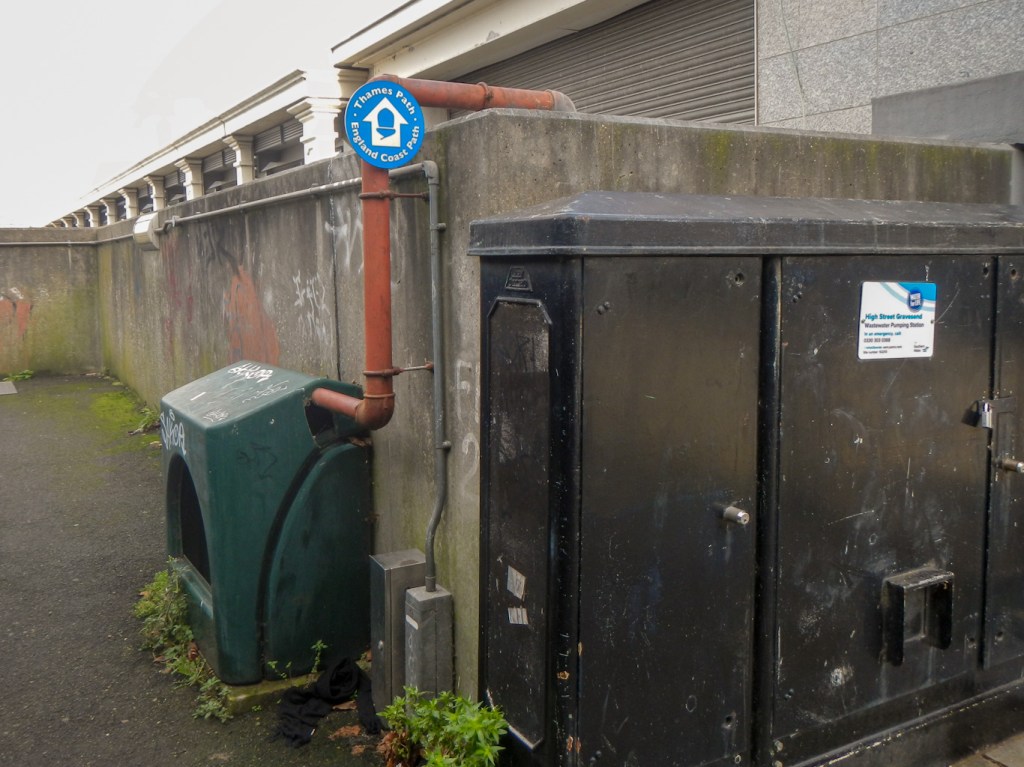
I wondered what Bill Bryson would have said about Gravesend as I walked along the England Coast Path, past a variety of what appeared to be scrapyards and light industrial units, out of the town. It definitely isn’t the most auspicious part of the new King Charles III National Trail.
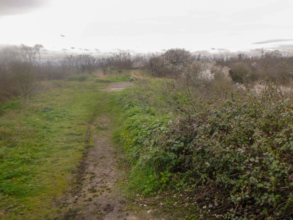
Once I had passed the Port of London Authority Buildings, I was soon out on flat, open land including coastal grazing marsh, intertidal mudflats, saltmarsh and lagoons. It seemed as though I was in the middle of nowhere, even though I was less than twenty five miles from the centre of London.
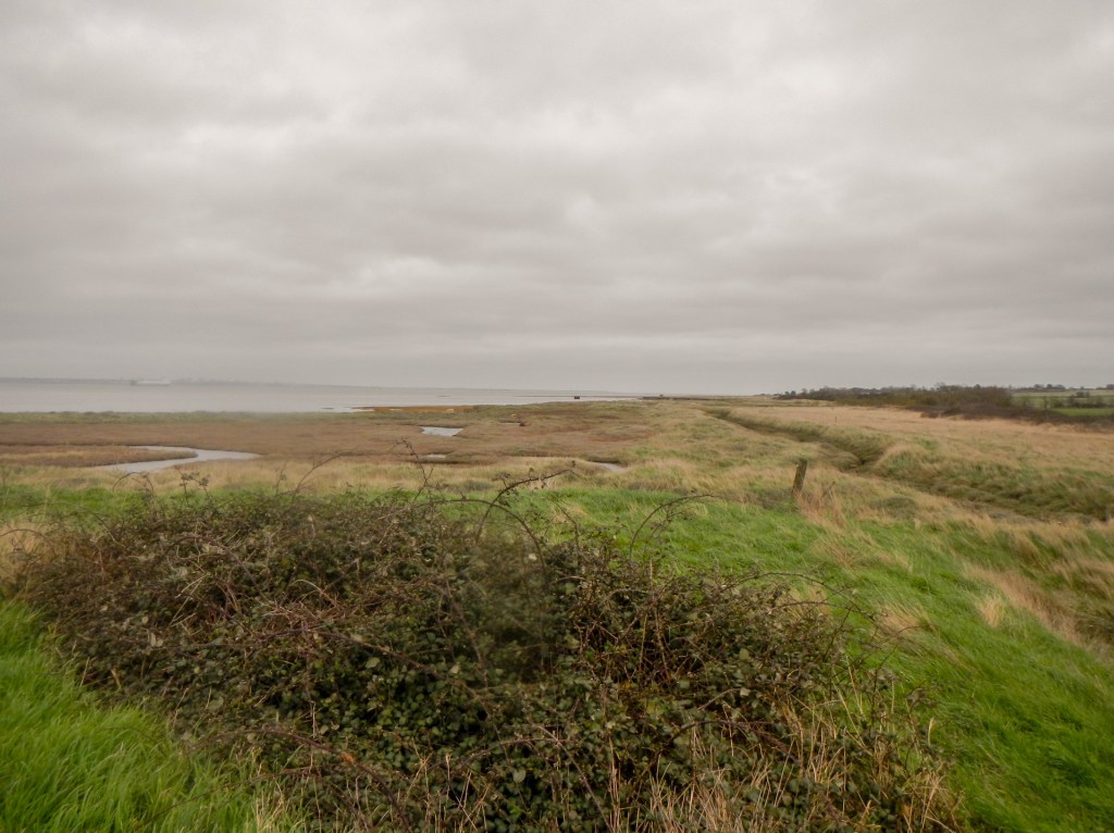
The marshes have been recognised as one of the most important natural wetlands in northern Europe, and they are monitored by local landowners and wildlife custodians. According to the RSPB, up to 300,000 migrant birds use the mudflats of the Thames marshes as a haven each year in their migratory journeys between the Arctic and Africa. Much of the area has special designations including Sites of Special Scientific Interest (SSSI), Special Protected Areas (SPA) and Environmentally Sensitive Areas. Signs showed the birds I might spot including plovers, terns, gulls, swans, egrets, avocets, dunlin, ducks and geese. Indeed I spotted many of these even without the benefit of binoculars which I had forgotten to pack.
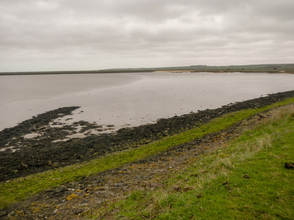
During six hours walking almost eighteen miles from the edge of Gravesend to the Holiday Park at Allhallows-on-Sea, I didn’t pass any other settlements. Most of the time, I could see some built-up areas across the Thames Estuary but on the North Kent side there were flat wetland areas all the way to the horizon.
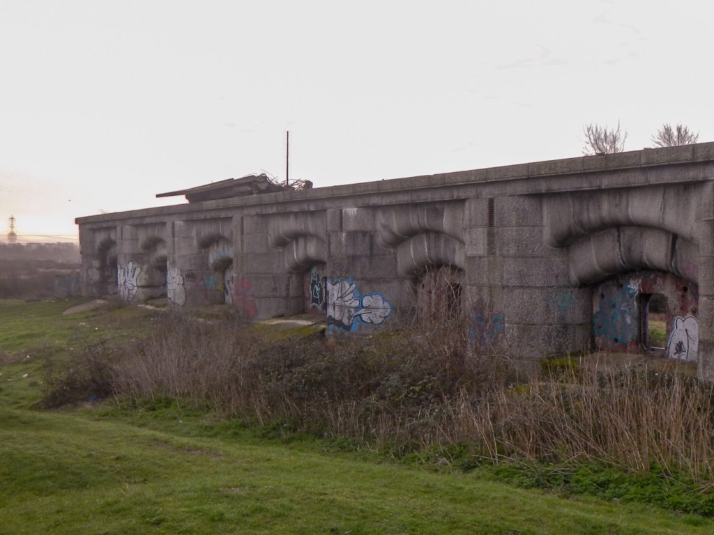
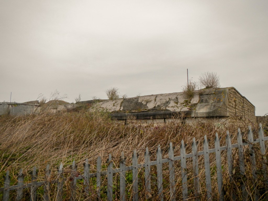
I passed two disused forts at Shornemead and Cliffe. Both were artillery forts built in the 1860s to guard the entrance to the Thames from seaborne attack. Cliffe Fort is notable as the site of an early guided weapon system. Since 1999, it has been owned by Robert Brett & Sons Ltd, whose aggregates works adjoin it and is not accessible to the public.
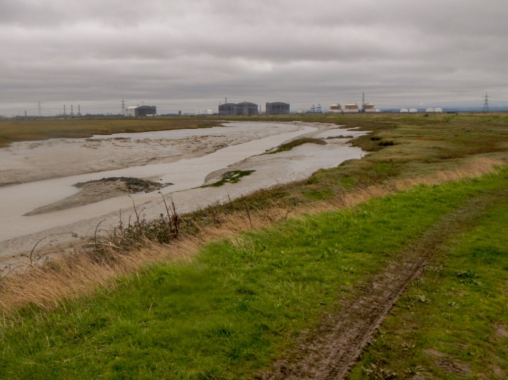
After passing Allhallows, I was soon walking along the bank of Yantlet Creek and then the path crossed over on to the Isle of Grain, which is no longer an island. It is almost all marshland and is a major habitat for diverse wetland birds. However there is a disused oil refinery, a power station and a liquefied natural gas import facility as well as the UK’s third largest container port.
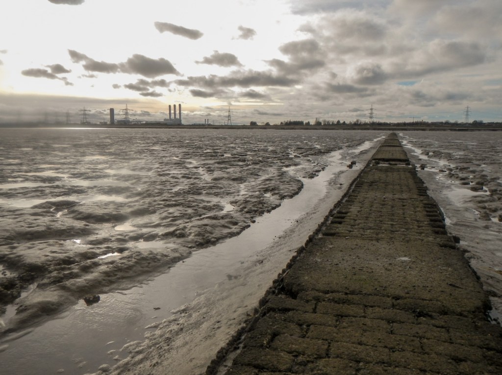
I was delighted to reach the sea at Grain at about 3pm. My early start soon after 7am had been worthwhile as I had arrived just before predicted low tide.
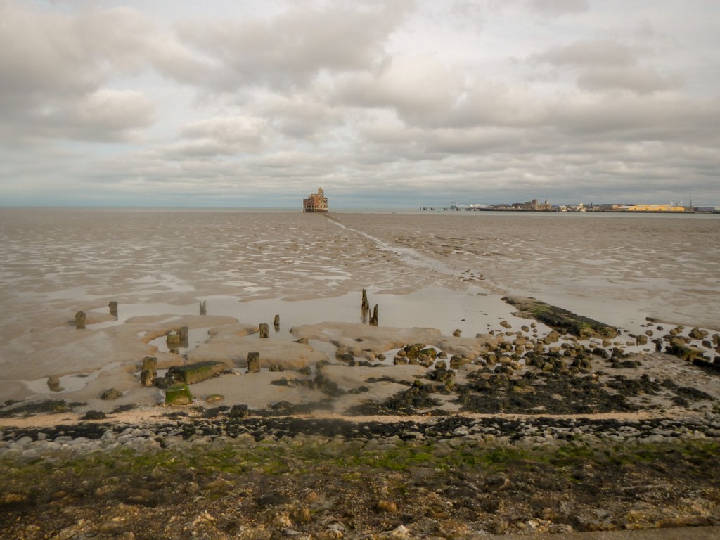
I wanted to walk to Grain Tower a mid-19th-century gun tower accessible only at low tide along a quarter mile long causeway. The causeway isn’t intact and I would have got wet feet if I hadn’t been wearing my walking boots and gaiters. However the ground was firm along the line of the causeway so I wasn’t in danger of sinking into the mudflats.
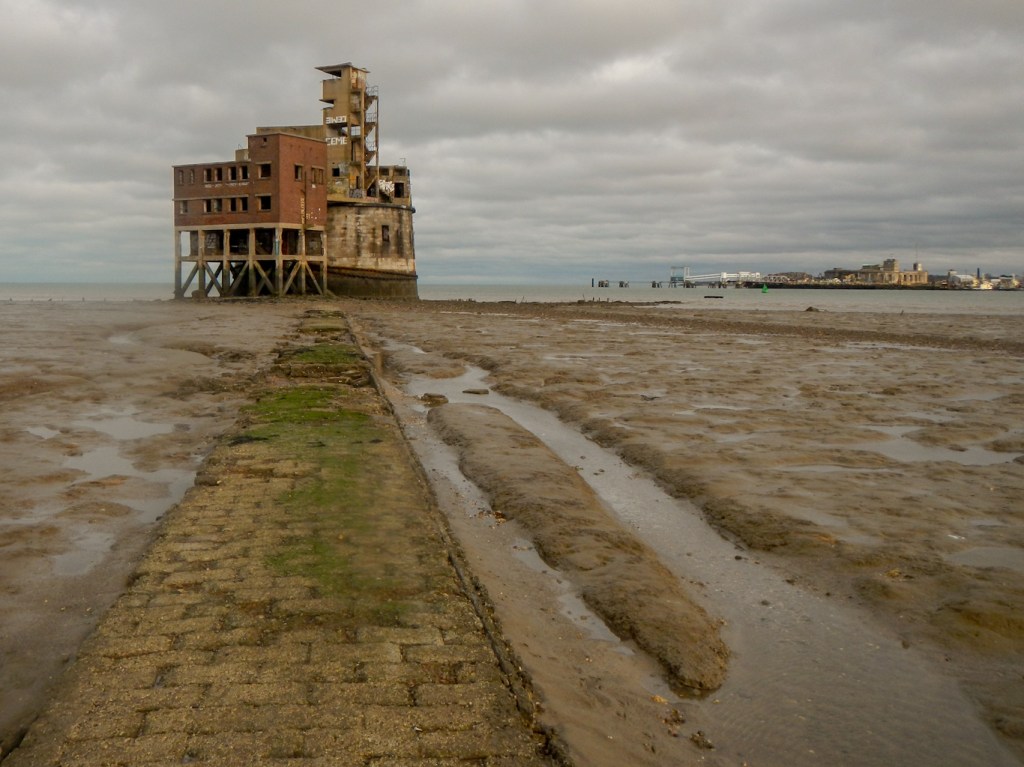
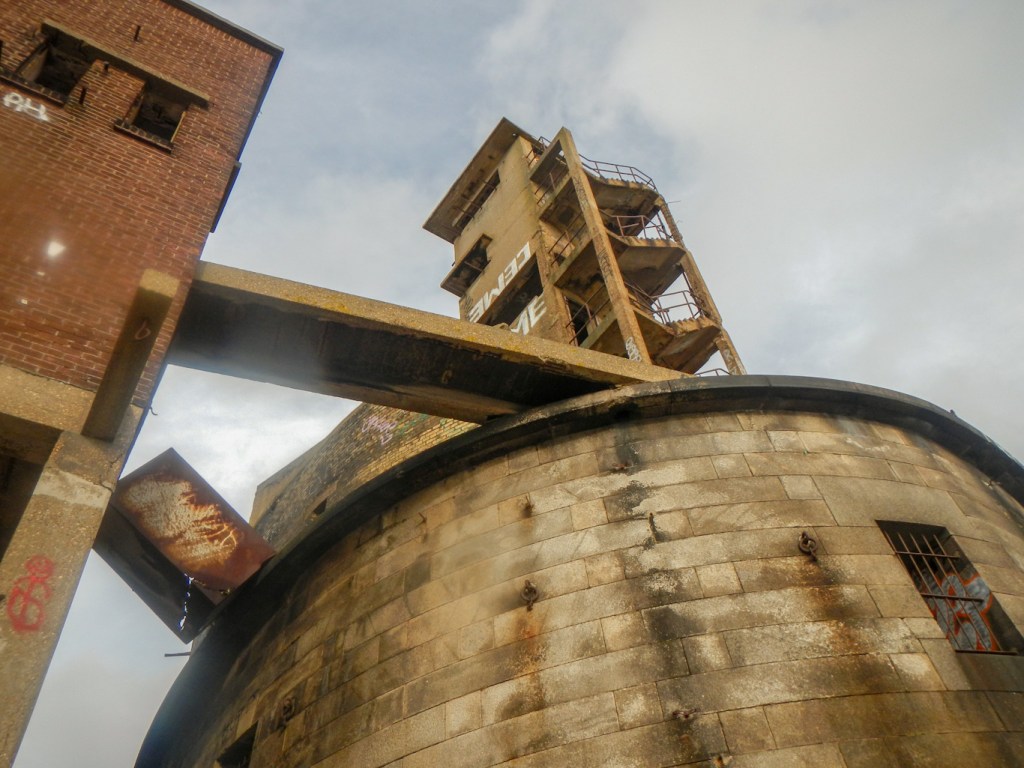
Grain Tower was built along the same lines as the Martello towers that were constructed along the British and Irish coastlines in the early 19th century and is the last-built example of a gun tower of this type. It was designed to protect the important dockyards at Sheerness and Chatham from a perceived French naval threat during a period of tension in the 1850s. Over the water I could see Garrison Point Fort at Sheerness.

By the end of the 19th century the tower had gained a new significance as a defence against raids by fast torpedo boats. It was used in both the First and Second World Wars, when its fabric was substantially altered to support new quick-firing guns. It was decommissioned in 1956 and remains derelict although it was designated as a Grade II listed building in 1986.
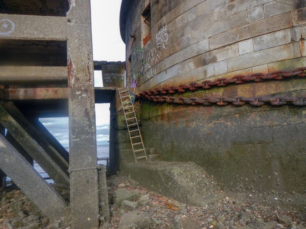
There didn’t appear to be a safe way into the tower – there was a rather unstable looking ladder. Besides which, any bits of the tower could collapse.
I took some photos from different viewpoints on the ground. I saw a massive chain wrapped round the base of the tower. This dates from the First World War, when the Grain Tower found an additional purpose as one end of a boom defence stretching across the Medway to Sheerness. Even from the ground the tower seemed to be a sombre and eerie place. I soon made my way back to the promenade.
I found some abandoned concrete bunkers west of Grain Tower set back from the beach and also dating from the 1860s.
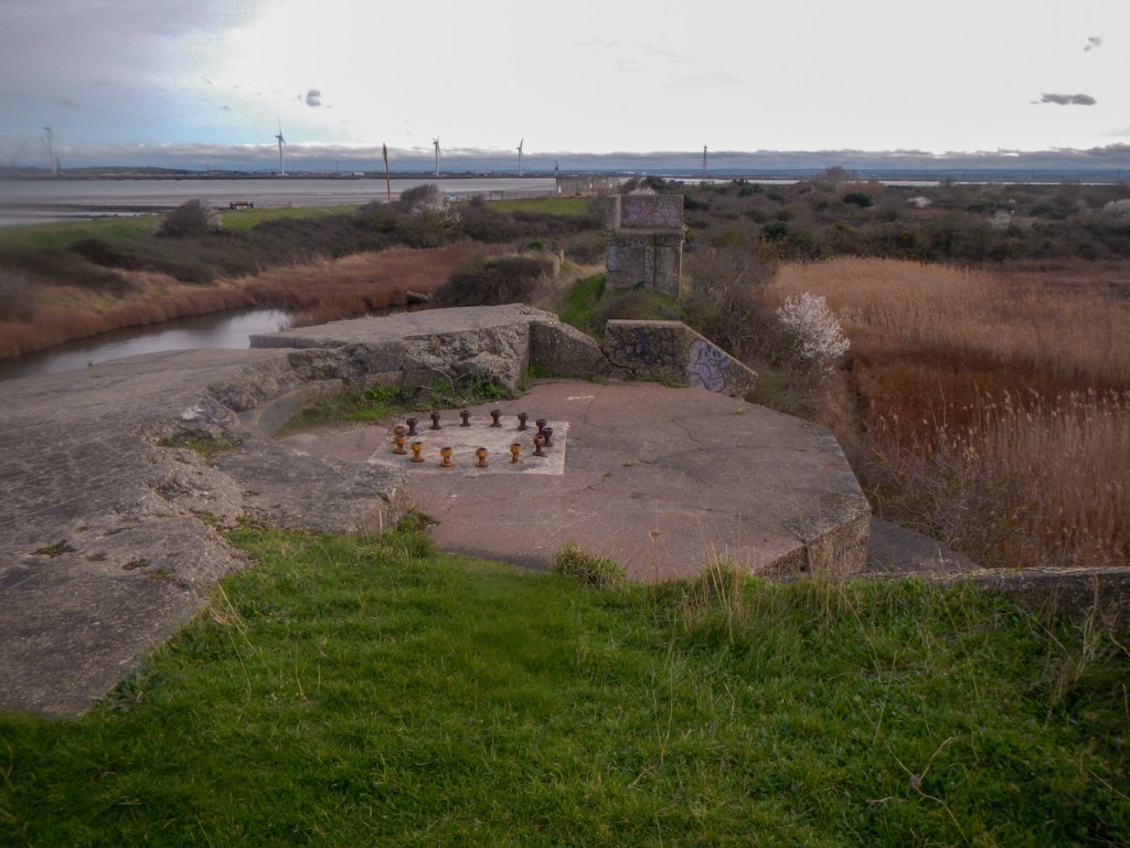
I wandered in a northerly direction parallel to the coast to reach Grain Fort. The mostly demolished fort has been incorporated into a coastal country park. It was constructed in the 1860s to defend the mouth of the River Medway and Thames against the threat of French naval attack, supporting both Grain Tower and Garrison Point Fort at Sheerness. It was altered and upgraded during proceeding conflicts, including the First and Second World Wars, but like Grain Tower, was decommissioned in 1956. Above ground only remnants of the front of the fort can be seen including filled-in gun pits.
Since my visit, I’ve discovered an amazing website: https://beyondthepoint.co.uk/ with lots of information about Grain and other lost and overlooked structural heritage in UK. Run by Joe and Liam who research, explore and document hidden heritage and exclusive locations, it is an Essex based organisation but has grown to cover sites throughout UK and even some sites overseas. The details about Grain Fort explain that more substantial sections of the fort survive as two sets of subterranean tunnels, including the main magazine, caponiers, and an ammunition lift but sadly these aren’t accessible to the public. It’s definitely worth exploring their website to look at the information and photographs.
I strolled back through the village to check in at my booked accommodation https://www.thelodgeisleofgrain.com/ where I received a warm welcome from the owner Henry. A fabulous place to stay: really good value, a fridge in the room, close to a small Co-op to buy food and equipped with a microwave for cooking. It had everything I needed for my overnight stay and perfectly located for me after my day’s “adventure”.
