2 October 2023
I am fascinated by maps, which is one reason why I decided to use maps as the basis for my challenge – to have “an adventure” based on each one of the 204 Ordnance Survey Landranger maps. A map is a representation of a place and not an objective depiction of reality. It is a symbolic interpretation of place and highlights the relationships between elements in space, either perceived or actual. The appearance of the map and the symbols that are selected to appear depend on the map maker and on the purpose for which the map is being made. Hence two maps of the same place can appear very different – for example the London Tube map is very different from the street map; an orienteering map for an area looks very different from the Ordnance Survey 1:50,000 map for the same area.

“The map is not the territory” is a phrase coined by the Polish-American philosopher and engineer Alfred Korzybski. He used it to convey the fact that people often confuse models of reality with reality itself. The map is a model and is not “reality”. I’ll have to remember this – my explanation to my husband when I get lost is often “Well, it didn’t look anything like the map.” However, actually I do have to admit that this is often an excuse for my ineptitude rather than a reason!
One of my other interests apart from going on adventures is collecting old maps – mainly one inch to the mile Ordnance Survey maps. It is fascinating to see how settlements, roads and railway lines change over the years.
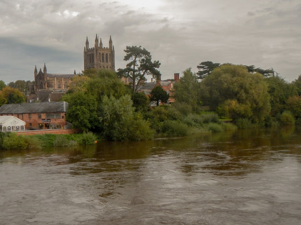
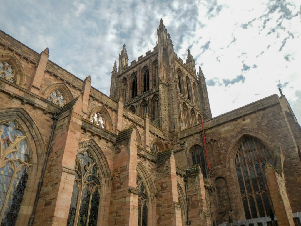
I was keen to visit the Mappa Mundi housed in Hereford Cathedral. It’s a map of the known world probably drawn in around 1300. Measuring 1.59 x 1.34 metres (5’2” by 4’4”), the map is the largest of its kind in the World and is constructed on a single sheet of vellum (calf skin). It depicts the history, geography and destiny of humanity as it was understood in Christian Europe in the late thirteenth and early fourteenth centuries. Literature, mythology, plants, animals and religion are all represented.
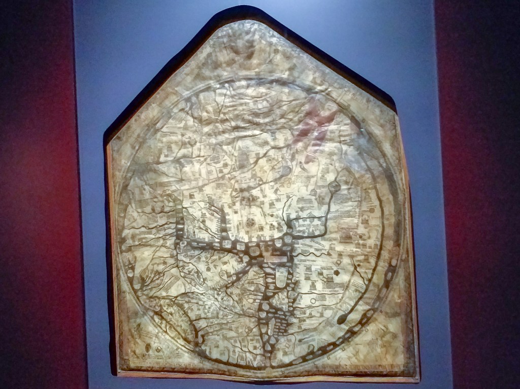
The inhabited part of the world as it was known then, roughly equivalent to Europe, Asia and North Africa, is mapped within a Christian world view. Jerusalem is in the centre, and east is at the top. East, where the sun rises, was where medieval Christians looked for the second coming of Christ. The British Isles is at the bottom on the left.
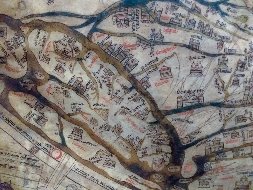
Superimposed onto the continents are around five hundred drawings of the history of humankind and the marvels of the natural world, including some four hundred and twenty cities and towns, fifteen Biblical events, thirty three plants, animals, birds and strange creatures, thirty two images of the peoples of the world and eight pictures from classical mythology.
All the writing within the circle representing the known World is in Latin and the text outside this border is in Norman French. However there is a useful copy in the exhibition with text translated to English.
It’s possible to linger in the exhibition hall and view the original map and various copies for as long as you want (until closing time!). When I visited there was a knowledgeable member of staff who was happy to explain features of the map.
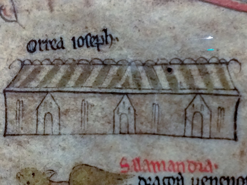
There is so much to see on this single sheet that it would be possible to spend hours looking at it and still be able to go back and notice more. One of the highlights for me was the depiction of The Pyramids as a British country barn – this is thought to have happened because the Egyptian Pyramids were described as huge grain stores; the only grain stores known to the map artist were British barns. I was also fascinated by the schematic representation of Moses’ journey to the promised land – the Red Sea is parted with a pathway through it and the journey through the wilderness shown as a looping line just as happens in reality when one is lost in a remote location and trying to find the route. I was also pleased to be able to find Exeter on the map in addition to some other places in Great Britain – the Clee Hills and Snowdon as well as the expected cities.
It’s definitely not the sort of map of use when you’ve lost your way. In fact researchers think that it never had a purpose as a navigational tool. Its real purpose can only be surmised – perhaps it was made to impress or perhaps it was educational to teach natural history and classical legends, and to reinforce religious beliefs.
I’ve discovered that it isn’t even necessary to travel to Hereford to see it as there’s an amazing interactive model to play with on line: https://www.themappamundi.co.uk/mappa-mundi/ although nothing can beat seeing the real thing.
While I was there, I also went to see a section of the Chained Library, the largest surviving chained library in the world, as the same admission ticket covers both attractions. It contains about 1,500 books on many subjects, dating from around 800AD (the Hereford Gospels) to the early nineteenth century. It is possible to view the books for research purposes but this has to be booked beforehand. The required book is moved to the reading room and of course it’s necessary to wear gloves to protect the manuscript from damage.
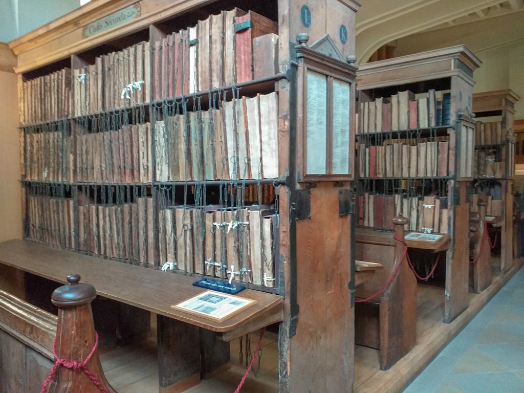
The chaining of books was a security system used in European libraries from the Middle Ages to the 18th century. A chain is attached at one end to the front cover of each book; the other end is slotted on to a rod running along the bottom of each shelf. The system allows a book to be taken from the shelf and read at the desk, but not to be removed from the bookcase. The books are shelved with their page edges, rather than their spines, facing the reader; this allows the book to be lifted down and opened without needing to be turned around as this would lead to the chain becoming tangled.
I also visited the cathedral itself (no charge!). There’s lots to see including the shrine to Bishop Thomas Cantilupe.
I recommend the café too. It was lovely to sit outside drinking coffee in the oasis of calm in the Chapter House Garden.
