2-3 August 2023
I planned this adventure as a fairly short walk on the South West Coast Path near Trevone and Trevose Head. It was part of the path that I remembered having some awesome coastal scenery and cliff features when I walked the entire South West Coast Path in 2010. However, in the end, I travelled down to Cornwall with my husband and the one day walk turned into a three night stay at a superb campsite near Padstow – https://denniscovecampsite.co.uk/ – together with two exhilarating full day walks.
My husband wasn’t planning to walk with me and especially not when he saw the weather forecast for my first day – gusty westerly winds and a fair bit of rain. However, I was up at 06.15am and brewed up for breakfast wearing full waterproofs, handing food and beverages over to my husband still cocooned and dry in the tent.
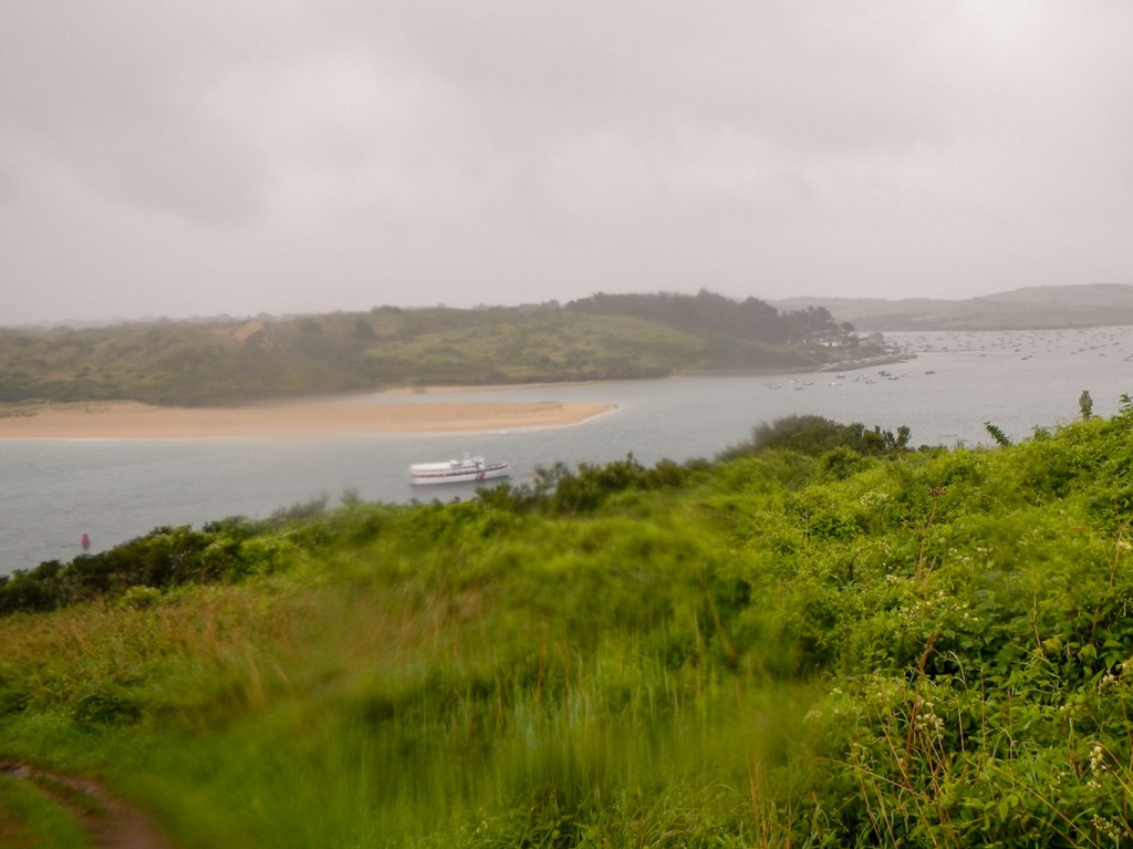
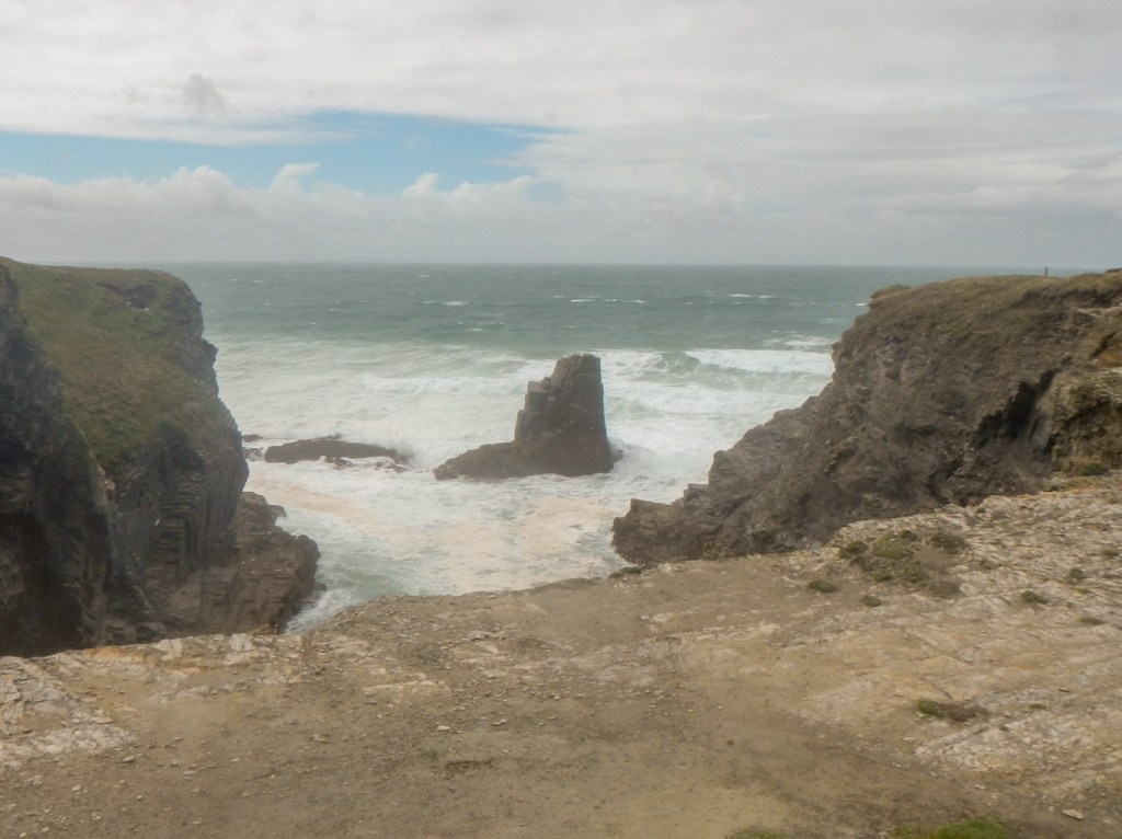
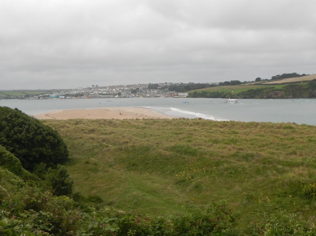
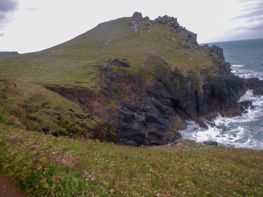
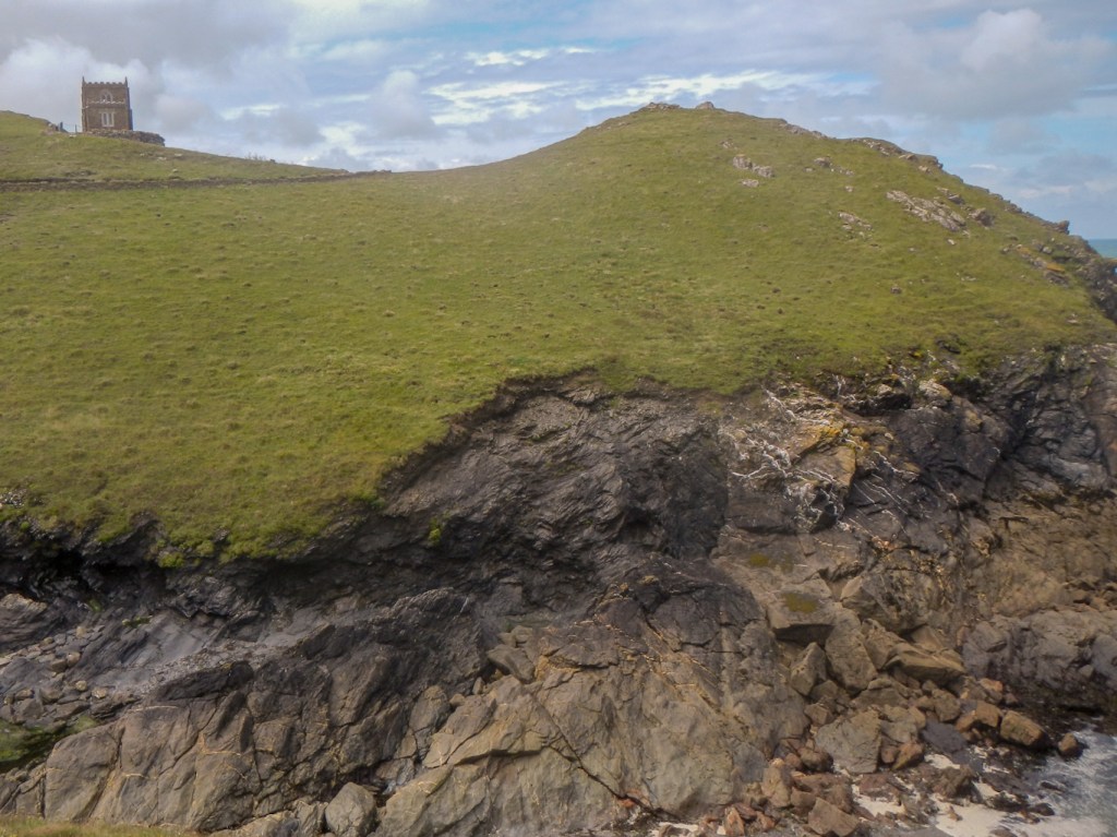
I walked away from the campsite at 07.50am. The wet and windy conditions meant everywhere was remarkably quiet for August. I had only seen two runners and a few dog walkers by the time I had battled against the wind for a couple of hours to reach Trevone. I had seen a corn bunting though and hadn’t missed the fabulous cliffs including the impressive round hole near Trevone with its sheer sides and breakers visible as the sea entered the collapsed sea cave.

As I approached Trevone Beach, the rain stopped and the weather brightened. Optimistically and, as it happened, prematurely I stripped off my waterproofs before diverting to climb the hill up to the well stocked farm shop https://www.theshoptrevonefarm.com/ , where I was tempted by a hot sausage roll to eat immediately and a delicious filled sandwich for later.
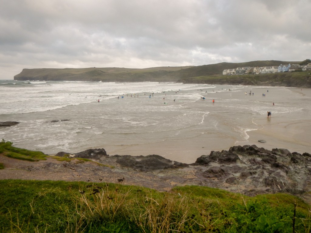
Suffice to say, my waterproofs were on me again before I was clear of the village. The brief break in the rain had tempted out some other walkers. At Harlyn Bay, there were even people out surfing.
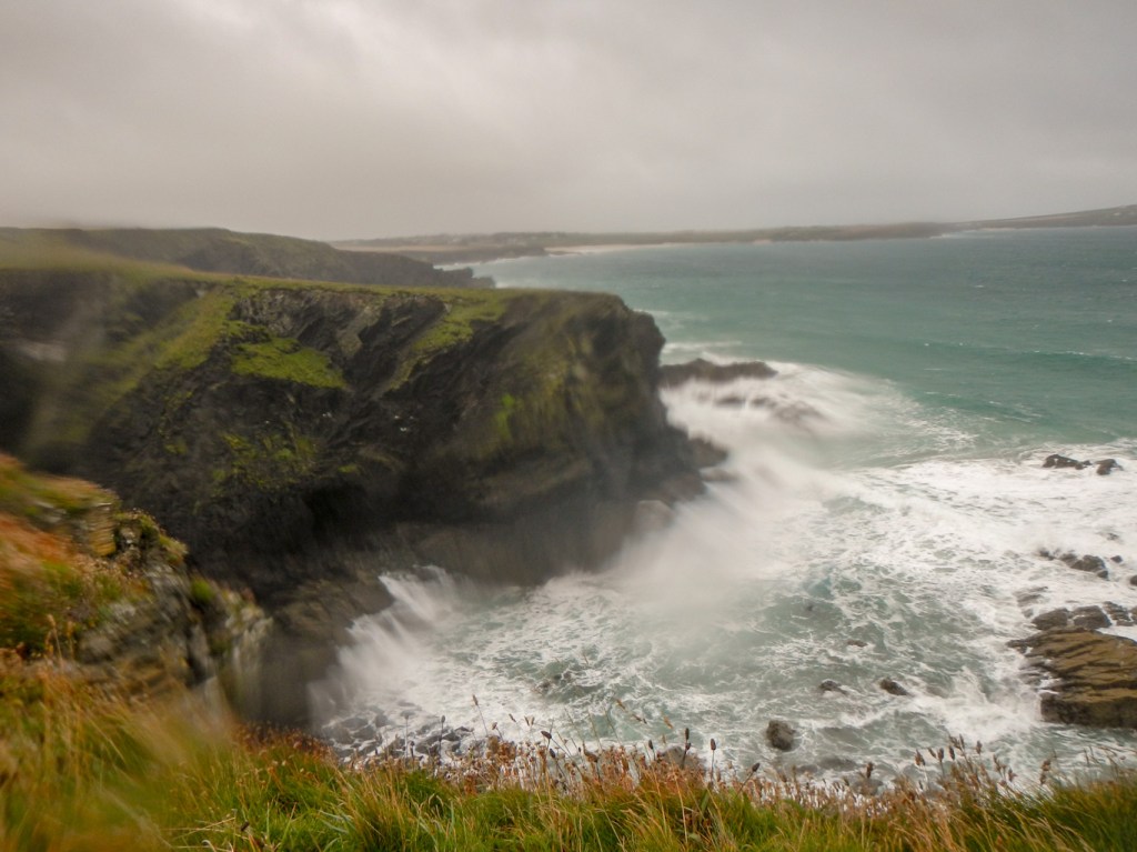
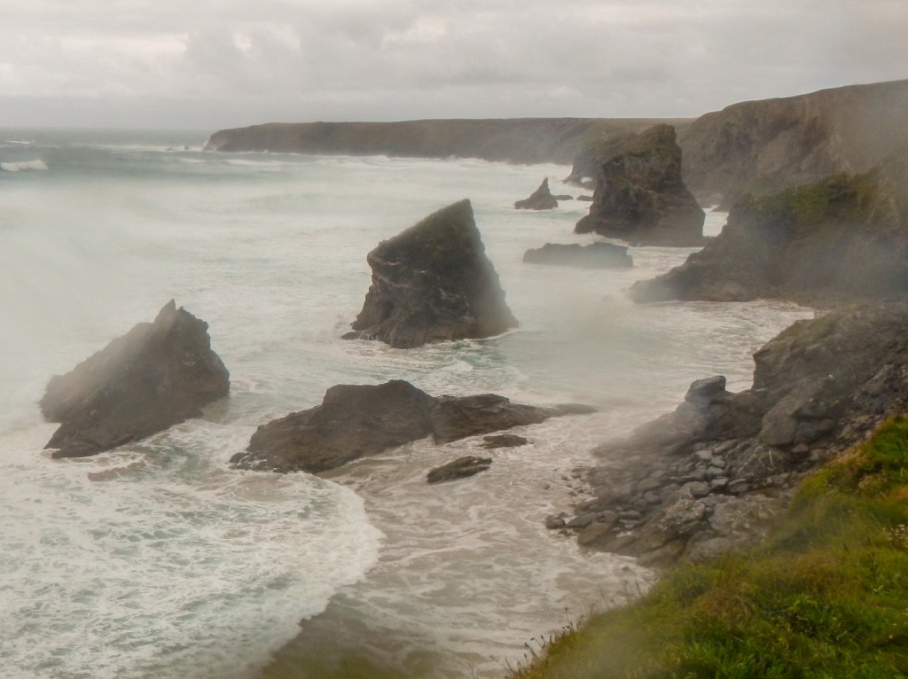
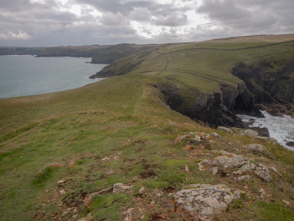
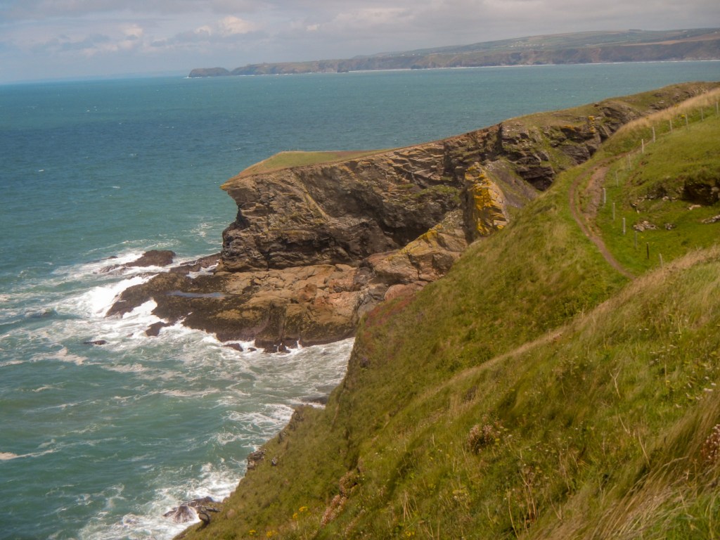
I continued to enjoy battling against the wild weather and taking in the constantly changing scenery of cliffs, stacks, arches, rocky shorelines and sandy bays.

I stopped to eat my luxury sandwich before rounding the headland near Trevose Lighthouse. This was particularly breezy and I struggled against the gusts although I wasn’t actually swept off my feet. Another walker had already warned me it would be windy near the lighthouse.

I spotted a herd of cattle ahead. They were on the path but I was fortunate to tailgate some very confident walkers from East Devon who had no qualms about passing through the field.
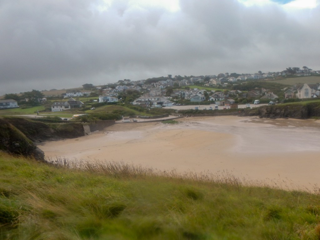
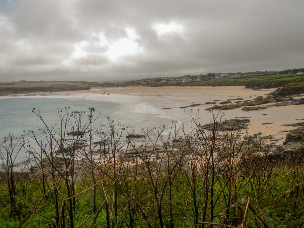
The conditions were too rough for anyone to be in the sea at Constantine Bay and the beach was more or less empty. The lifeguards were keeping an eye – presumably to advise potential surfers to keep out of the sea. Treyarnon Bay and Porthcothan Beach were also quiet although the cliffside shop and café at Porthcothan were doing a roaring trade.

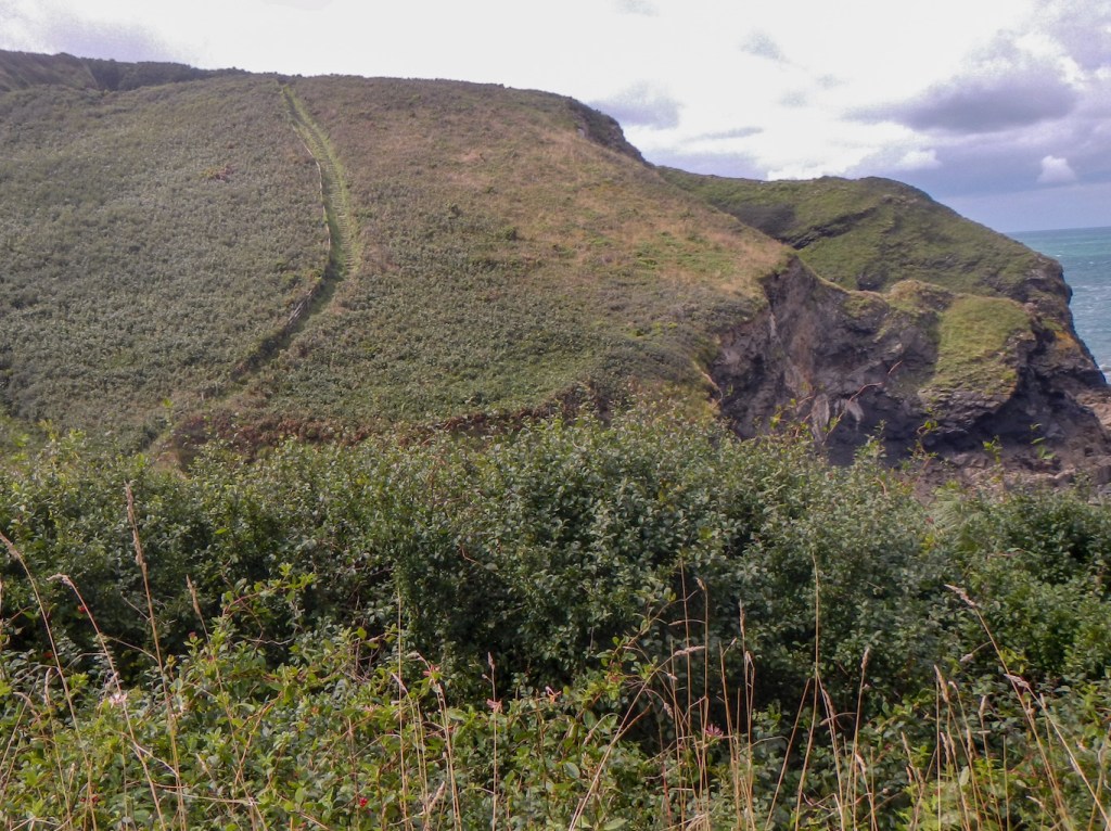
I’m sure that Pentire Steps and particularly Bedruthan Steps in August would usually be overrun with tourists. However I was able to enjoy the cliffs and rocks with barely another person in sight.

I just had a short onward walk to Mawgan Porth where I was fortunate to have only a ten minute wait for what seemed to be an amazingly convoluted bus journey back to Padstow. The bus driver did a heroic job, squeezing past vehicles on narrow country lanes with only inches to spare and I had a birds-eye view of it all from the front of the top deck.

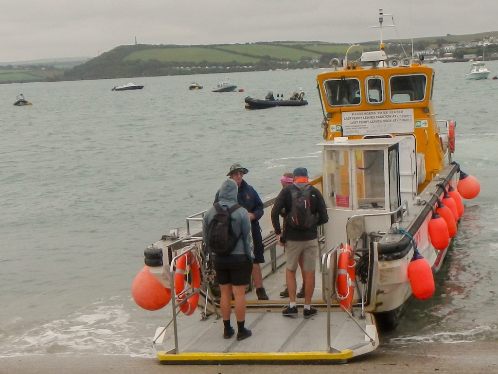
The weather had improved by the next day. I headed off to catch the first ferry from Padstow across the Camel Estuary to Rock. There were only two paying passengers making the crossing at 08.00am but several people on the other side waiting to go to Padstow.
A climb over the dunes followed, initially past a golf course.
There were many more people out and about than on the previous morning. Before long I arrived at Polzeath, where there were crowds of people surfing. There were several shacks near the beach advertising lessons, surf board hire etc.
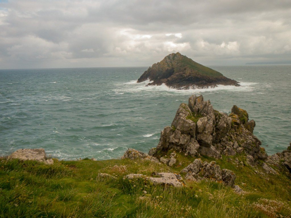
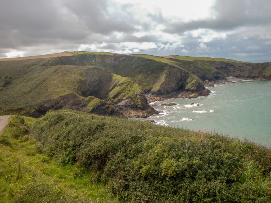
I climbed the hill and cliff edge path to craggy Pentire Point and then followed the cliff top path to reach the Iron Age Fort on the Rumps promontory. It was well worth taking the diversion to explore the promontory.
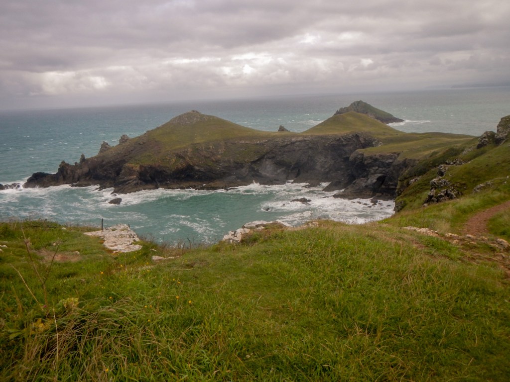
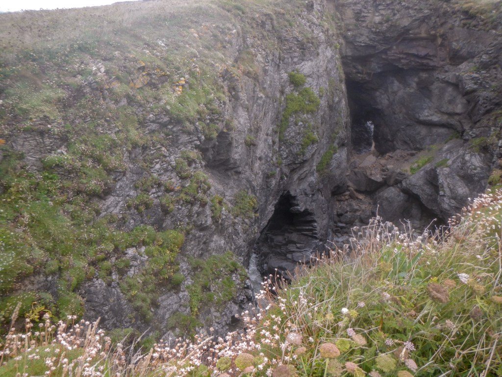
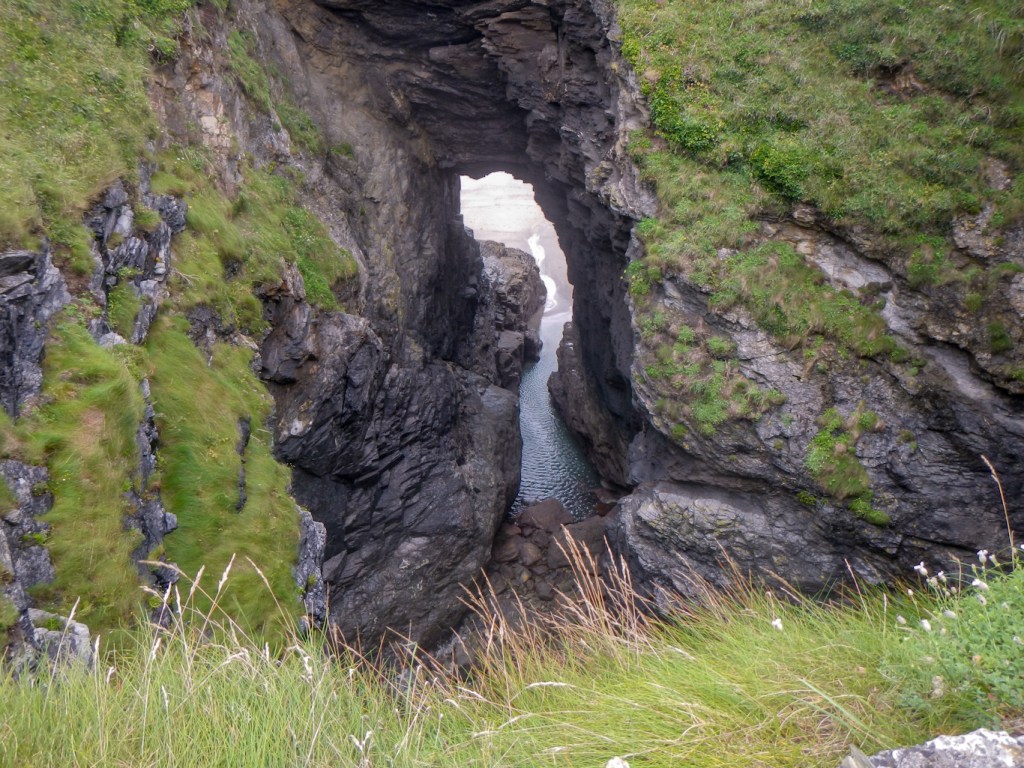
I made my way further along. The awesome Lundy Hole is right next to the path; I hadn’t remembered this impressive feature until I arrived there. There’s no warning before suddenly arriving at a “window” in the cliffs – a wonderful surprise.
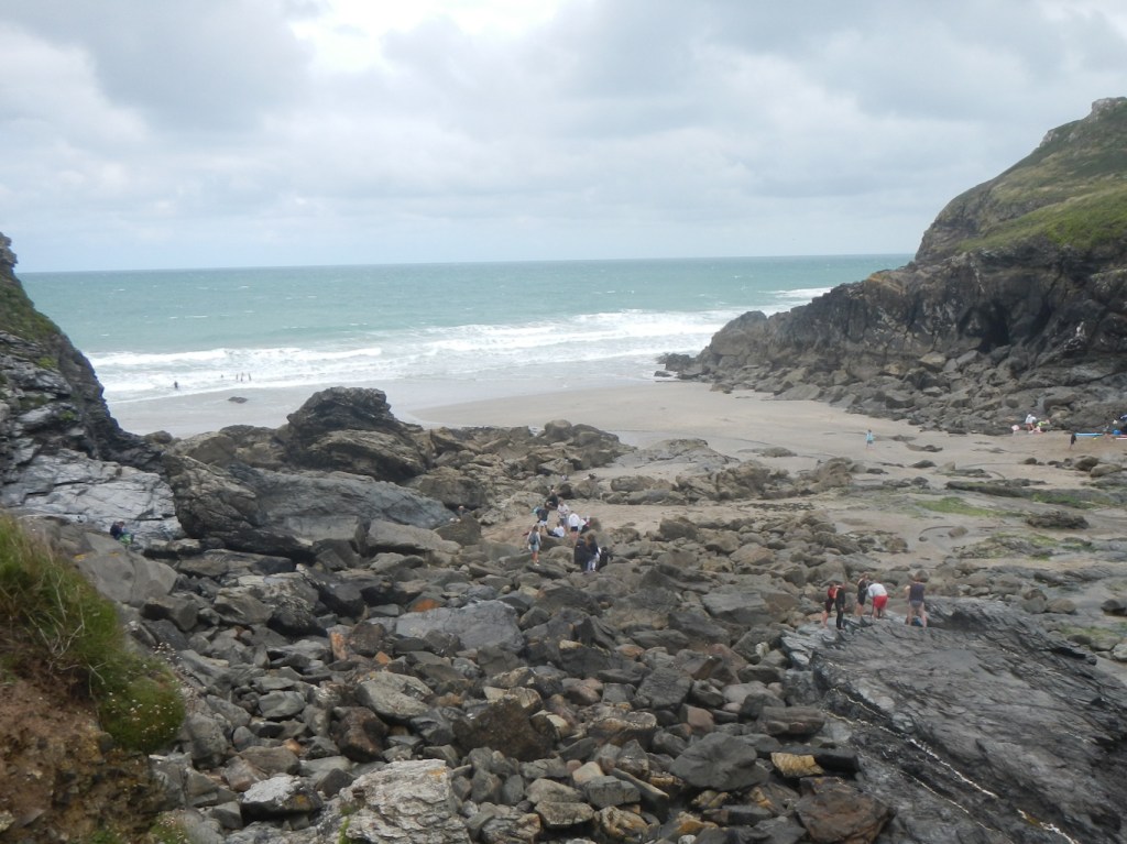
Views of the cove at Lundy beach follow – an idyllic place with sand and rock pools which was comparatively busy given the better weather than the previous day. As it involves a reasonably strenuous walk from the nearest car park, I suspect it doesn’t tend to get too overcrowded though.
I met a few “full trail” walkers walking from Minehead to South Haven Point including an intrepid solo woman walker carrying a full pack with tent. She explained that she had spent the previous day sheltering in her tent but was now on her way again with a heavy rain soaked tent in her pack.
The path seemed to undulate more and more. I passed some fenced off mine shafts – old antimony mines which together with pilchard fishing were for many years the livelihood of the small village of Portquin ahead.
Doyden Castle perched on the headland was built in the early 19th-century for Samuel Symons as a secret spot for drinking and gambling. It’s now a holiday home owned by the National Trust – certainly renting that to stay sounds like an amazing adventure!
The path becomes something of a roller-coaster between Portquin and Port Isaac. I told some walkers approaching me that they had a big hill ahead – their response was that they thought they’d just completed the hilly part! I stopped for a short break and turned to look at the sea – noting a seal swimming in the bay and diving before coming up for air again.
The approach to Port Isaac seemed busy but this was nothing compared to the crowds swarming the streets of this quaint fishing village, home to the TV series Doc Martin. This was a shock as I’d only walked through the village in winter previously. I gave up any idea of stopping at a café and made my way up the hill to the bus stop. On examining the timetable, the bus appeared to be arriving in about thirty minutes so I bought a coffee from a somewhat quieter café near the bus stop. Sadly I realised belatedly that this wasn’t the correct stop for that bus although it was for the following one an hour later, so I had rather a long wait.
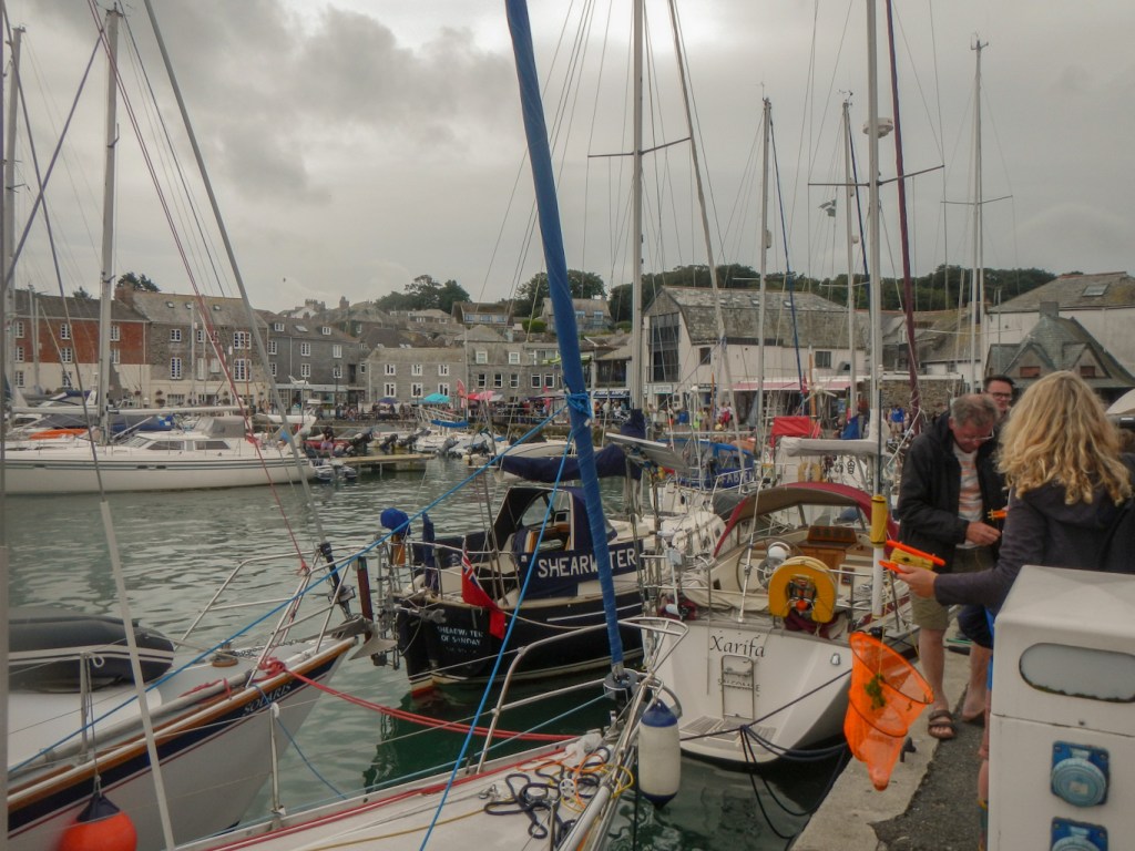
Suffice to say it was an interesting and circuitous journey which appeared to be routed along every narrow lane between Port Isaac and Wadebridge. The skills of the bus driver in squeezing past huge cars coming the opposite way were second to none. At one stage, the entire busload of passengers applauded him! Fortunately a bus from Wadebridge to Padstow waited for us to arrive so I had an immediate connection. My husband met me at the bus terminus in Padstow and we headed off to buy the fish and chips that I was more than ready to enjoy after all my exertion – sadly not from Rick Stein’s as planned because they were too busy and had just stopped taking orders, but there were plenty of alternatives.
This is definitely a scenic part of the South West Coast Path and not too busy (except at Port Isaac and at Rick Stein’s fish and chips) – even in August.
