15-30 June 2023
Land of the fjords, the North Cape, the Lofoten Islands, midnight sun, northern lights and the coastal Hurtigruten voyage. This seems to be as much as the majority of British tourists discover in Norway. Our aim on this trip was to explore part of Norway off the beaten British tourist trail and only mentioned in passing in the main guidebooks available in UK. We had visited a few of the ports previously on the Hurtigruten expedition and had marveled at the scenery we had noticed both on brief stops and during our time on board.
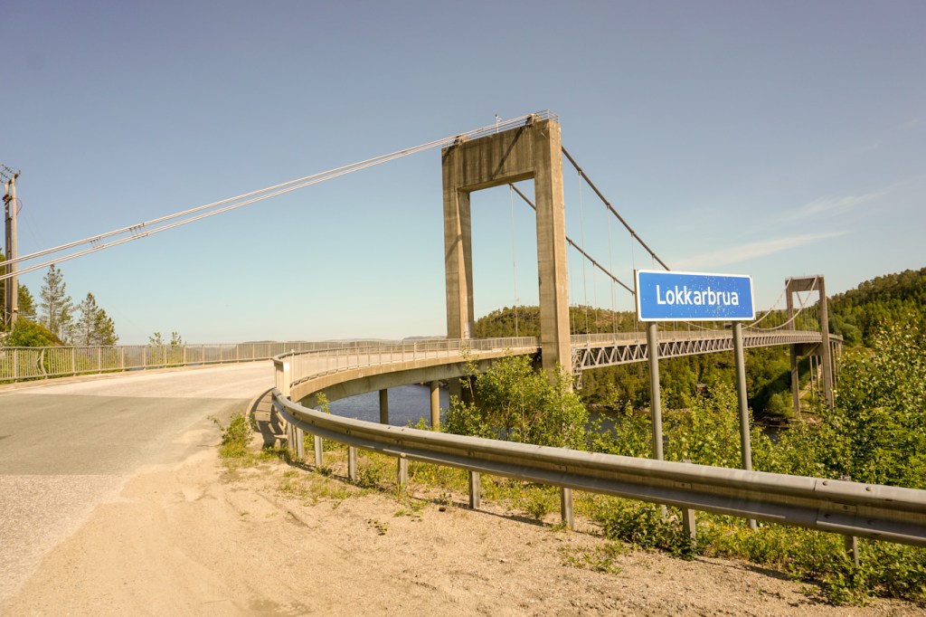

It wasn’t until after we had made our arrangements to spend just over two weeks travelling by hired car from Trondheim to Bodø that we found out that most of our trip was to be along Kystriksveien. This route includes 420km billed as a National Scenic Route, is advertised as one of the World’s most scenic routes and also has several ferry crossings which link the coast together. The pamphlet and on-line information outlining the route advises travelling slowly and taking detours.
We soon realised that, although we were travelling at the start of the short main summer holiday season, the route wasn’t crowded, accommodation wasn’t full and, in general, there was space on the ferries. We also discovered that nearly everybody else travelling was Norwegian with just a sprinkling of people from Germany, The Netherlands and elsewhere in Scandinavia. Seeing other British tourists was a rarity. Many of the other travellers were in camper vans. Fortunately virtually everyone in Norway understands and speaks English – nowadays it’s taught from the early school years and young people watch many English language TV programmes as well as using English language internet sites. However our main problem was accessing adequate maps to enable exploration on foot of specific mountainous areas on our days staying in places en route – they weren’t sold at all outside the larger towns and tourist offices have short opening hours including many being closed completely at weekends. In addition, some museums had short opening hours and unpredictable closed days that we were only aware of when we arrived at them. That’s clearly the downside of traveling away from the main tourist trails – in retrospect we should have tried harder to buy good large scale maps in UK before we travelled.
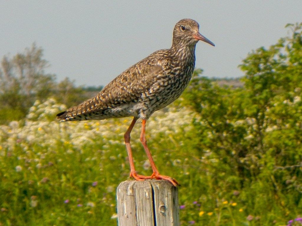
Certainly every day and every place was different. We achieved much of what we were planned but were also able to seize some opportunities as they came along. We never needed to worry that it would be dark – north of the Arctic Circle it was light all day and, even at our most southerly point in Trondheim, there was just a short period of twilight. We were treated to awesome views of coast, mountains, water, rock and snow as well as a single sighting of a white tailed eagle (but no reindeer despite all the warning signs). As we travelled north the snow on the mountains increased.
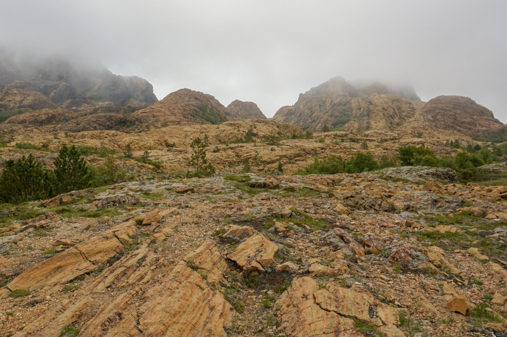
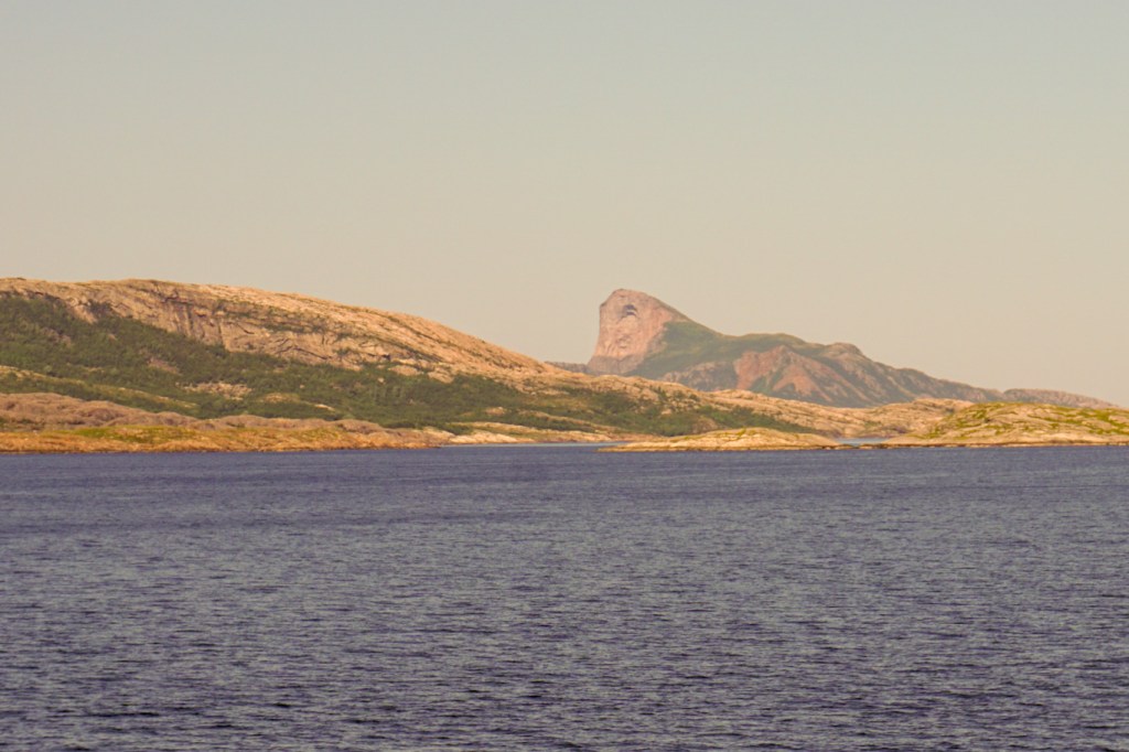
The early part of our journey was dominated by amazing geology. We took the ferry to Leka. On landing, the island scenery looks much like that of the mainland. However the west side of the island is entirely different. It appears at first sight to resemble a volcanic landscape but in fact was formed in a mid-oceanic ridge 500 million years ago. A fragment of the oceanic crust was then forced up on land when America and Europe collided 400 million years ago. This is the MOHO – the boundary between the mantle and the crust. It is Norway’s Geological National Monument and displays a section through the oceanic crust better than anywhere else in the world.

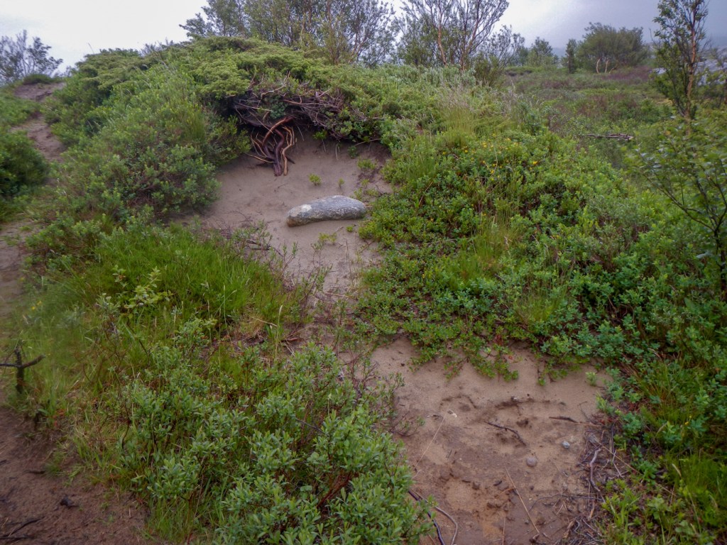
There is more to Leka than geology: Herlaugshaughen is the largest Viking burial mound in Norway and may even contain a ship. The area of coastal heath land at the north end of the island includes more than fifty burial mounds from Bronze and Iron Ages. There is also an area of protected coastal wetland, rich in bird life.


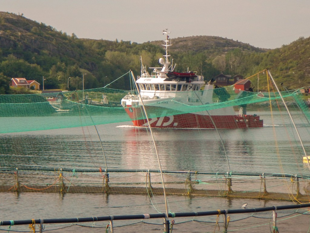
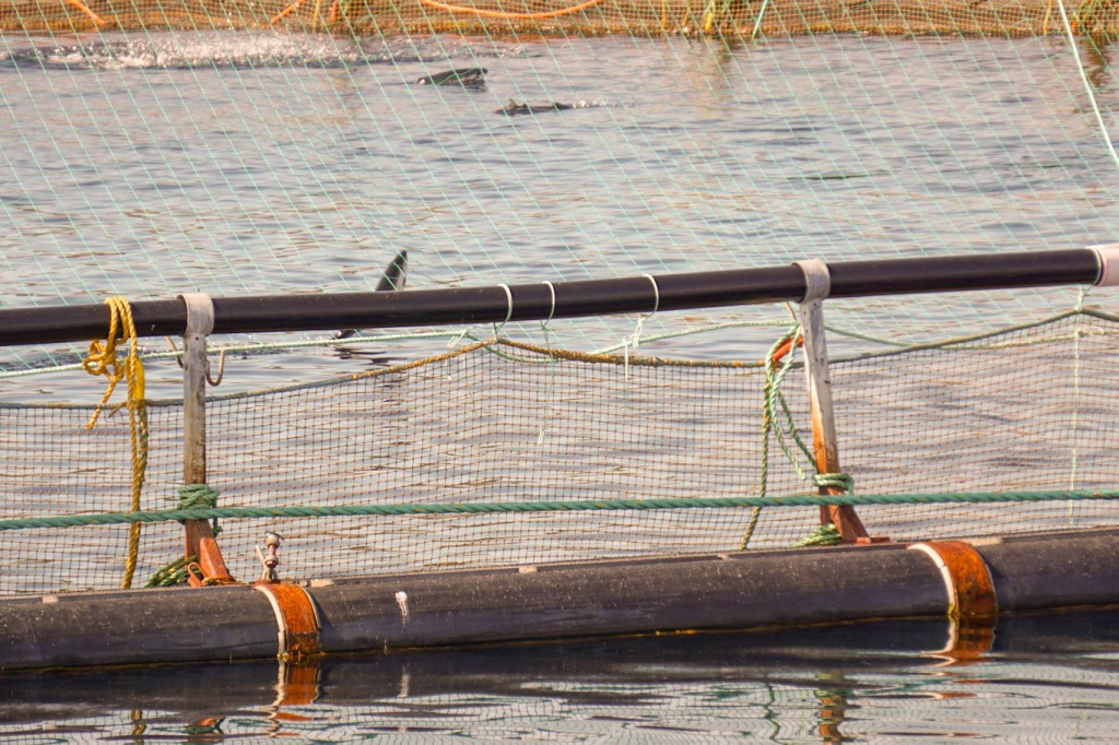
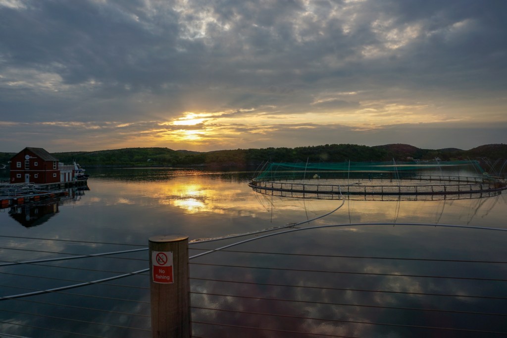
We stayed at an aquaculture training centre for three nights. Here we were able to explore an exhibition outlining the history and development of this significant Norwegian industry. Salmon jumping in a couple of the pools provided constant entertainment in the view from our accommodation.
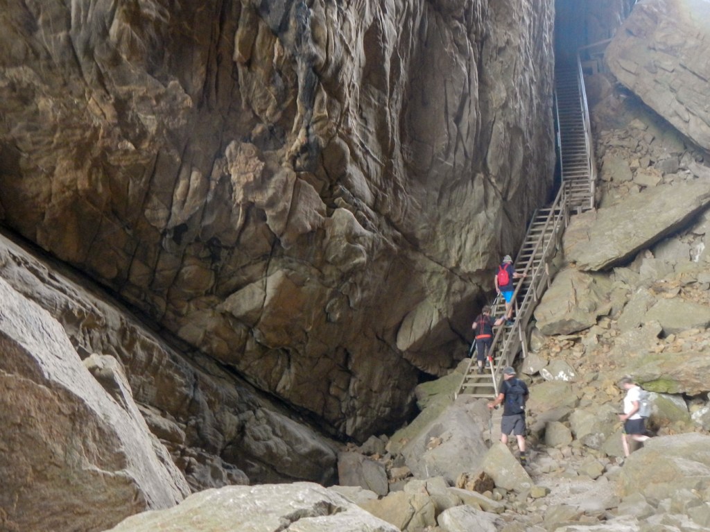
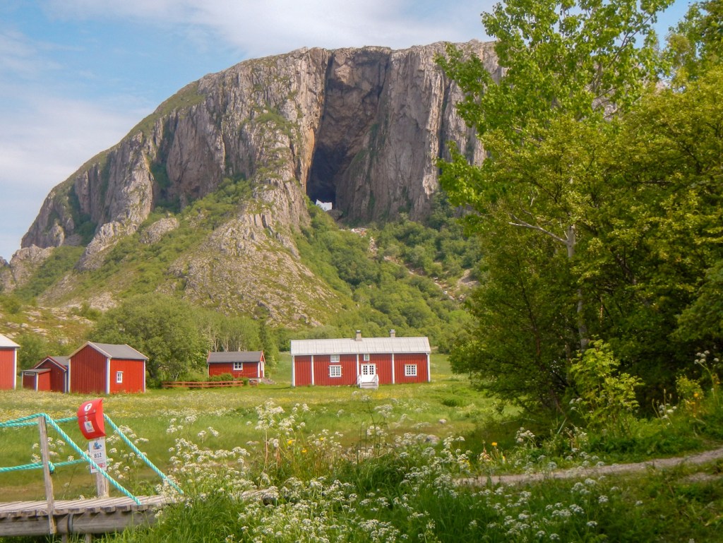
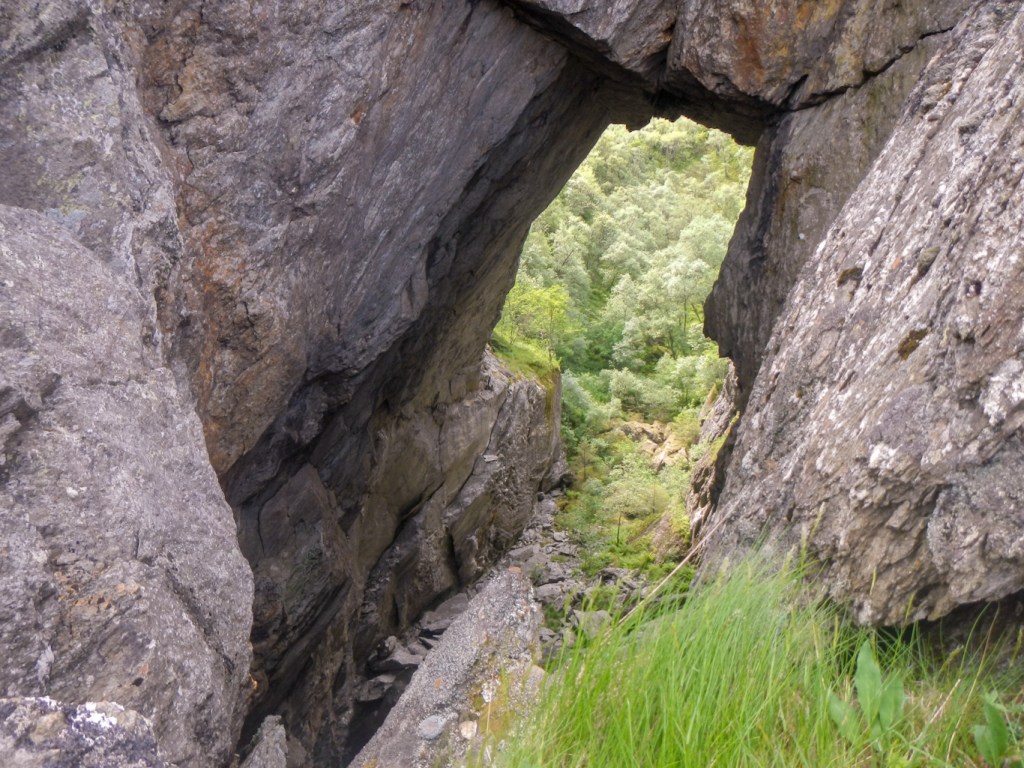
The aquaculture centre also provided the base for us to walk up the mountain Torghatten and through its iconic hole, with a fantastic view of the archipelago opening up. Sadly some path renovations in progress meant that we had to return via our outward route, but we were still able to make a low level circumnavigation of the mountain on a track and path.


We enjoyed a second walk in the Brønnøysund area to the summit of Tilrumshatten, from where there were views over the huge strand-flat (shallow water with multiple areas of land) and also towards Torghatten. We even discovered the remains of some second world war German fortifications.

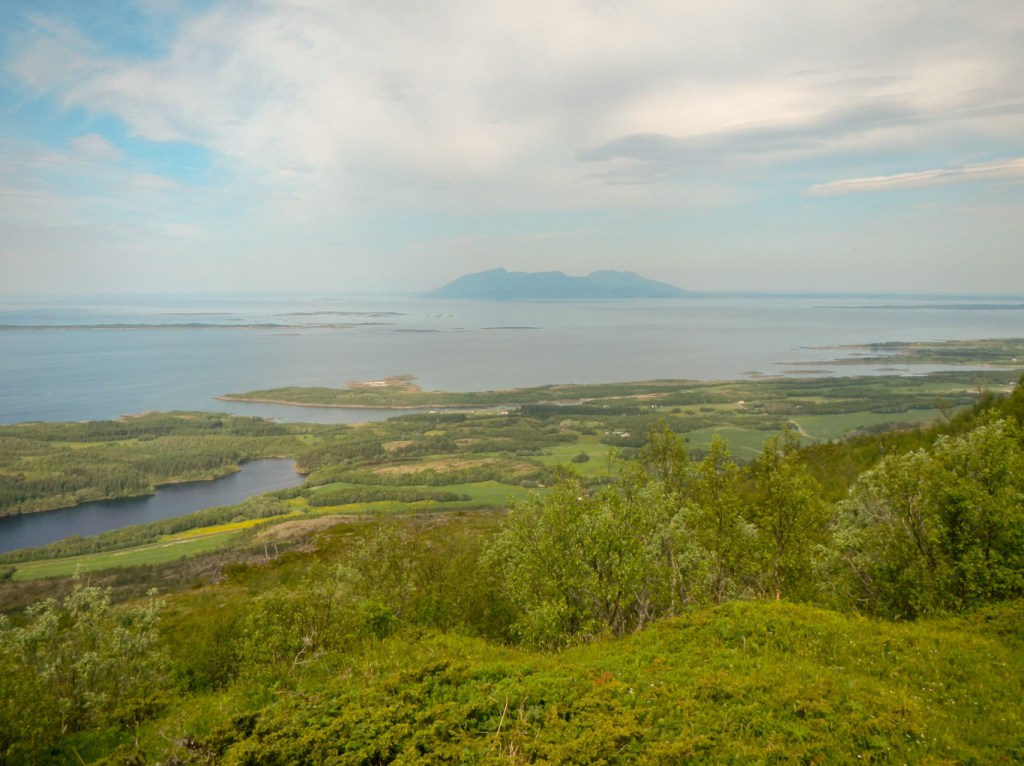

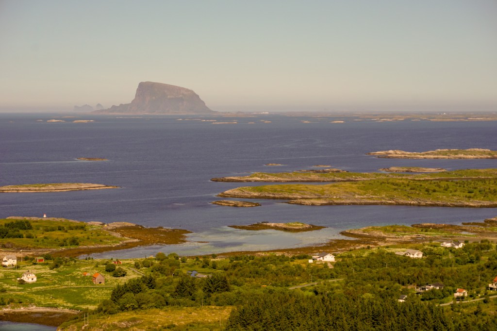
Our next destination was Vega. It’s a UNESCO World Heritage site with dual status – both cultural due to the islanders’ interaction with nature, especially tending wild eider ducks and geological. Today the main island of Vega is surrounded by 6500 islands, islets and skerries. Most of the World Heritage Site is in this area off the main island.

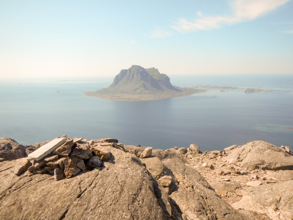
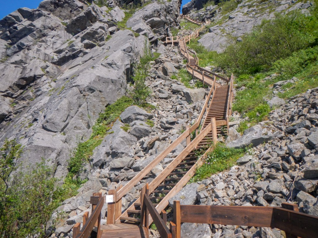
I was able to climb more than 1400 steps to the summit of Ravnfloget. This gives an awesome view of the island of Sola rising 432m above sea level; the granite cliffs are highly resistant to erosion. There are also fabulous views of the strandflat. At the summit, I was able to watch a group climbing the via ferrata – their guide explained to me that he had been one of those who had been involved with building the “stairs” up the mountain.

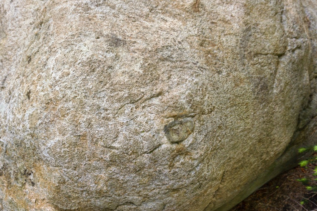
The next day it rained. Nonetheless I was keen to explore a route along the west side of Vega below some high granite cliffs to reach a remote area of sheep pasture. I noted smaller black rocks embedded in the granite – these are sedimentary rocks which fell into magma deep within the earth’s crust and embedded without melting. I had planned to climb over the pass to reach an area of active inland sand dunes where “Aeolian” processes (shaping of land by the wind) are still at work. The risk of climbing over wet rock alone was off putting so reluctantly I retraced my steps. During my walk back, I heard a rockfall so was relieved that I had left the potentially less stable rocky area. However it was possible to approach the dune area from a track on the far side of the pass. Unfortunately much vegetation has started to grow over the dunes so continued reshaping is not as pronounced.
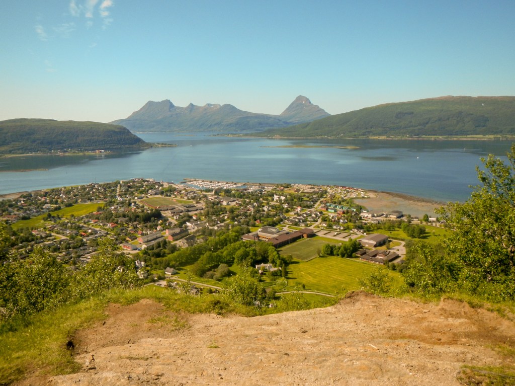
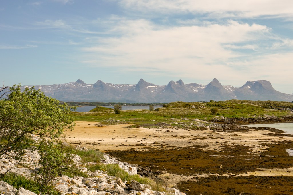
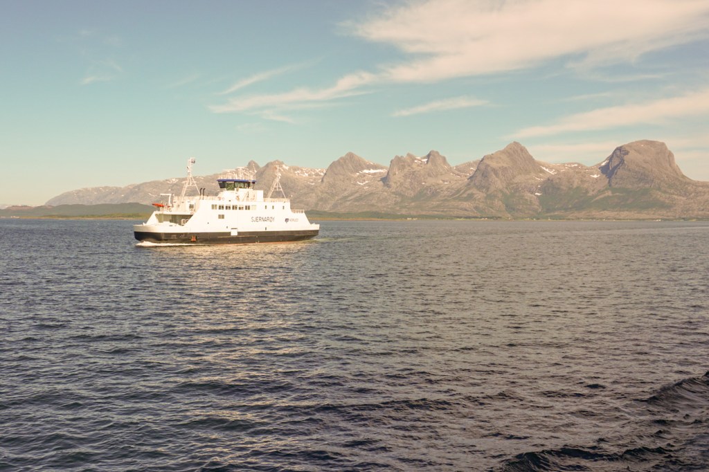
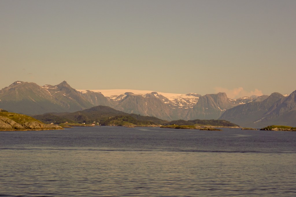
Leaving Vega was the first minor hiccup with transport as the ferry we had planned to catch didn’t run – mechanical problems with one boat. Hence we had rather a long wait. Our next destination was Sandnessjøen from where there were superb views of the Seven Sisters mountain range. We didn’t climb any of them but we did enjoy a memorable day travelling to and driving round the nearby island of Dønna, looking at the sights as we went. We also crossed by bridge to Herøy from where we returned by ferry to the mainland. We could have spent much more time exploring and walking on these islands. The views over to the Seven Sisters are magnificent.

We spent two days journeying north, stopping at viewpoints and places of interest as we went. During our ferry crossing from Kilboghamn to Jektvik, we crossed the Arctic Circle and were officially in the land of the midnight sun.
I was looking forward to the 28km journey from the ferry point at Jektvik to the next ferry from Ågskardet. This crosses a remote area of coastline which is inaccessible to vehicles apart from via the ferry points. It is effectively an “island” community as it is surrounded by sea and by the Engenbreen ice cap and glacier. The Engenbreen glacial arm is the lowest on the European mainland and part of the Svartisen glacier. However, while we were on the ferry to Jektvik, news reached us that the ferry from Ågskardet wouldn’t be running. It’s only a thirteen minute crossing from Ågskardet to Forøy but there had been an accident: the ferry had collided with the linkspan, putting both itself and the linkspan out of action. The ferries on the route to Jektvik were deployed to cover not only their own route but to make an approximate 90 minute additional journey from Jektvik on to Forøy. This was the only way to travel on as there is of course no road off the section to link with the main road system. Needless to say we had a long wait at Jektvik but in the circumstances the ferry company achieved a superb result with everybody being transported to where they wanted to go – in the end! All the people waiting seemed to be remarkably good humoured about the entire issue. Our reward was an amazing ferry ride on a section of sea that isn’t normally part of a ferry route. There were magnificent views of the glacier, with crowds out on deck admiring the awesome and normally inaccessible views (only usually seen by people chartering a boat or in their own vessel).

Eventually we reached our overnight stop at Glomfjord. Our helpful waiter/ hotel receptionist filled us in on the history and strategic importance of the town. The village is based around the Glomfjord hydroelectric power plant, which was the target of the 1942 commando raid Operation Musketoon. This was a strategic operation to remove power that the Germans required in order to smelt aluminium that they needed to build aircraft. Norsk Hydro began construction for fertilizer production here in 1912, with power production starting in 1920. The conglomerate of industries in Glomfjord today includes specialist trace metal production.
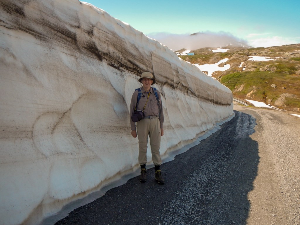
This was the place where we really needed a large scale map to enjoy our walks to the full. However we had to make do with photographs we took of the information boards describing the best walks. We managed to drive to the Storglomvann Dam and follow some waymarked trails in glorious sunshine. We also walked to an area where unusual Stone Age polished stone carvings are sometimes visible on the rocks. We followed the path to the site but couldn’t pick out the shapes – they are only visible in certain light conditions. It was only when we returned to Glomfjord that we realised how fortunate we had been to enjoy the sunshine and heat on the high ground – the valley was shrouded in damp and cold cloud.


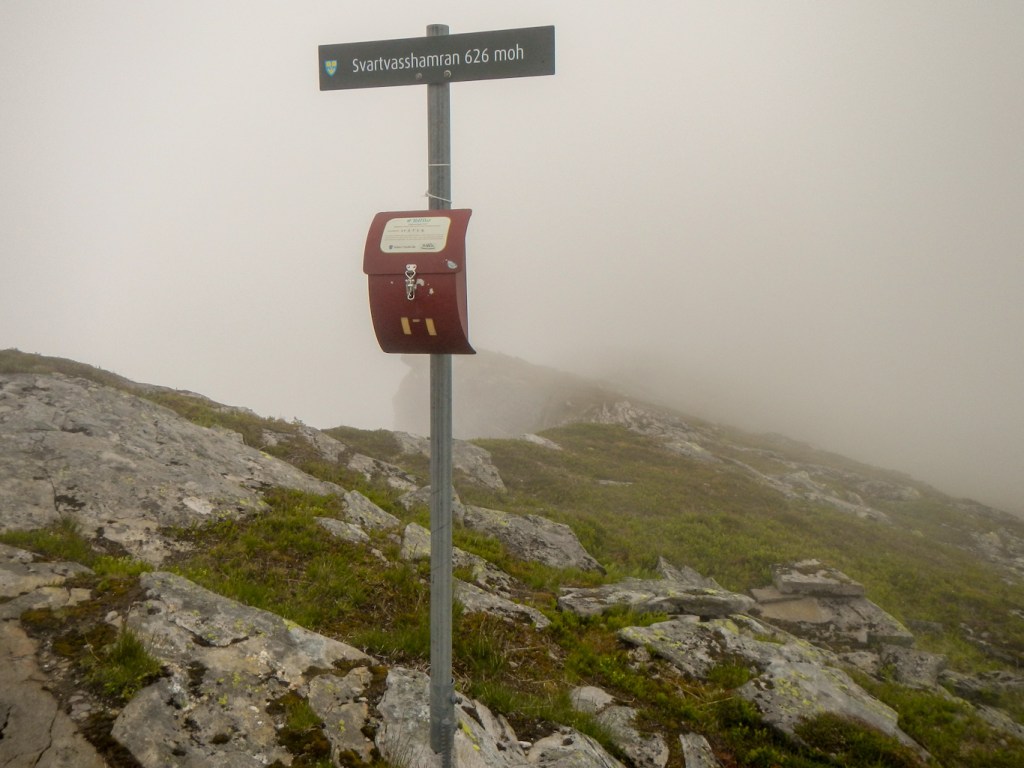
In our quest for a large scale map, we headed to the larger town of Ørnes. We were still out of luck but enjoyed a visit to the local museum including a section with English translation and a short film in English giving details and background about Operation Musketoon. We spotted a walk up to a peak above the town and spent the afternoon climbing a good marked path to what would have been a spectacular ridge – sadly the cloud descended just before we arrived.
We just had one more day on the road to reach Bodø. The cloud had lifted and so we enjoyed stunning views and amazingly warm weather given our position north of the Arctic Circle. We left the main road to drive to Gildeskål and visit the twelfth century church dedicated to Thomas à Becket. The enthusiastic guide gave a fascinating account of the architecture and interior – including an explanation of exactly who sat in which pews – a very hierarchical system.

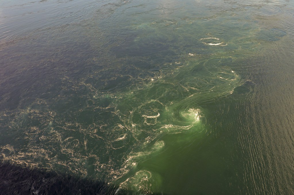
Rejoining the main F17 route, a stop at Saltstraumen to see the world’s strongest tidal current marked almost the end of our journey. We had managed to time our visit to coincide with the mid tide – the predicted flow was ten knots, although at spring tides it can reach twenty knots. Even at ten knots, we were able to see many whirlpools and see the rib boats in the water far below the high bridge, as they were swept by the currents. I remembered my own visit there several years ago on a rib – we were on a short Hurtigruten voyage from Bergen to Bodø and my daughter and I had joined an off-boat extra expedition. I’m not sure that the current impressed us much that day as we were more excited about being supplied with immersion suits to wear and being assigned front seat on the rib. However I do remember seeing a white tailed eagle.

We reached Bodø and returned our hired car before booking in for what we thought would be the final night of our holiday. A flight to Oslo followed the next day, but I’ve written this blog on a rainy Sunday afternoon in a hotel close to Oslo airport as SAS cancelled our flight home. They’ve supplied a hotel and meals and we will get some compensation – but I need to get home as I’ve a further adventure planned and booked to start at the end of the week. My concern is that it involves another journey on SAS planes. The current prediction on the delay is over 48 hours so we will reach home on Tuesday rather than on Saturday evening. The best laid plans……
Unfortunately I ran out of time to collate the photos – hence the rather delayed post as I had to pack and get ready for the next adventure!
