5 March 2023
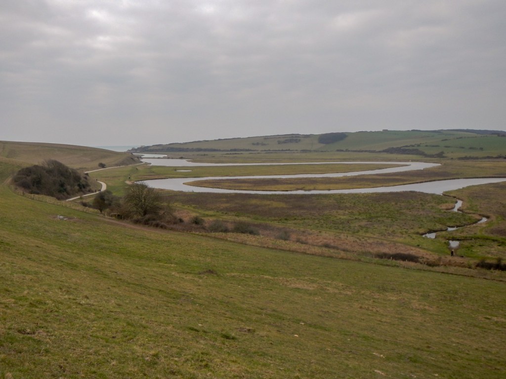
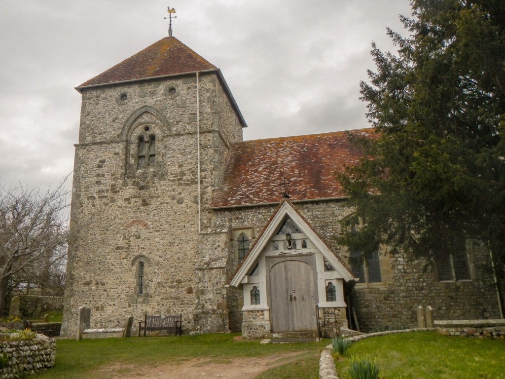
It was a longer journey than I had expected from the Dungeness area so I wasn’t dropped off at the car park at Exceat near the meandering Cuckmere River until almost 10:30am. Despite the late start, I avoided the quicker but busier path near the river and started climbing almost immediately over Exceat Hill, where the site of the eleventh century church is marked. I was rewarded for my efforts with fine views into the Cuckmere Valley.
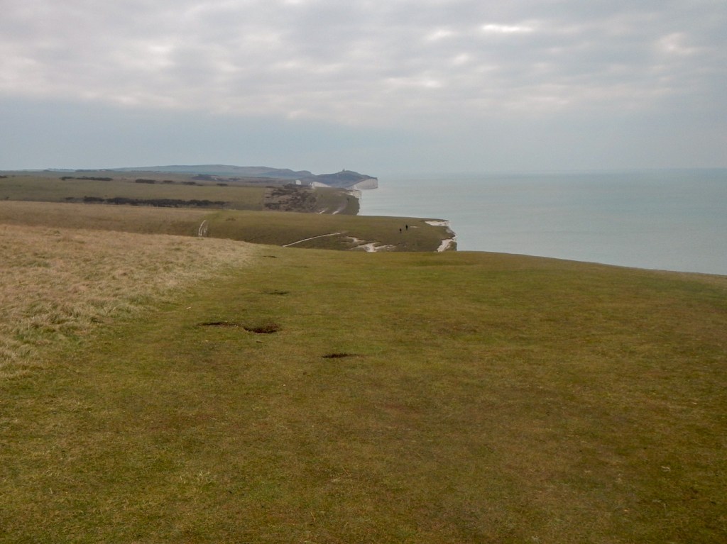
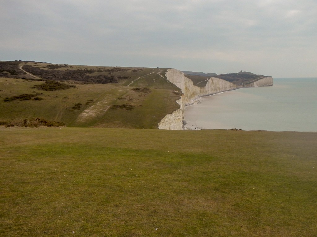
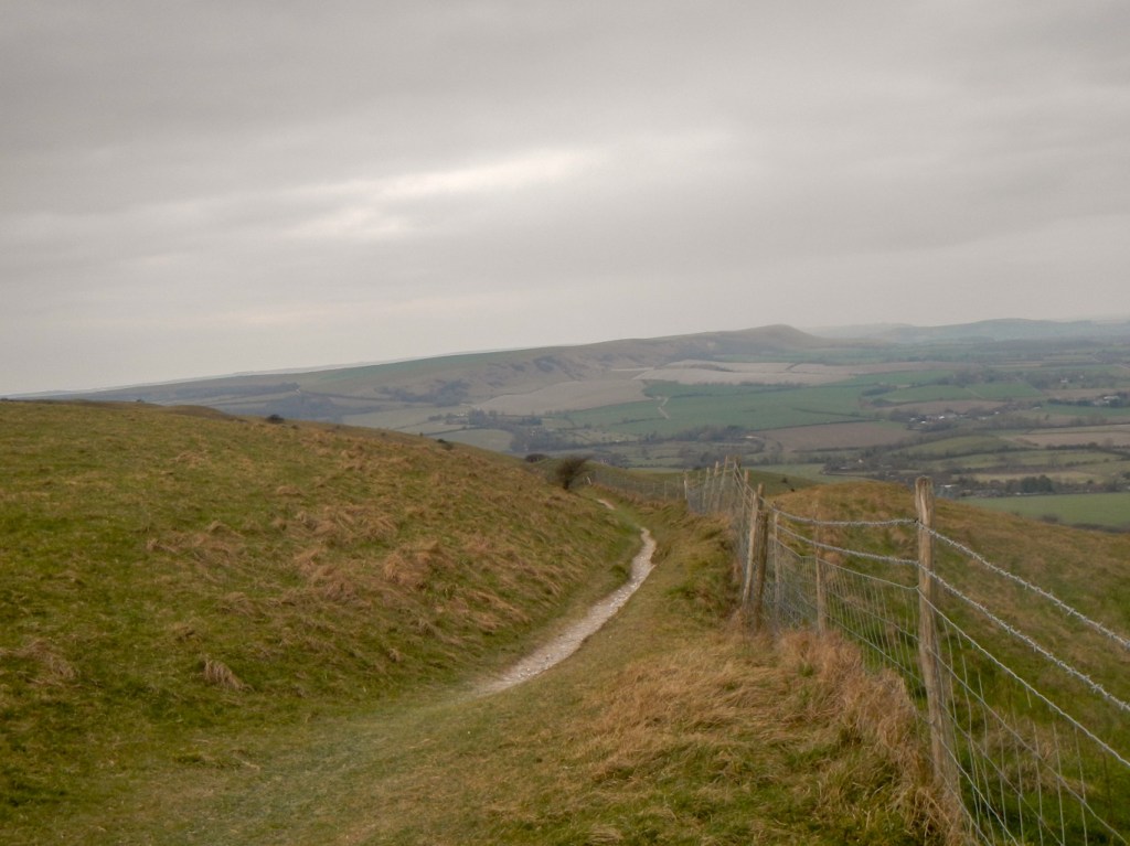
The path returns to the valley before rising again almost immediately over Haven Brow. It is a superb surface to walk on – springy grassed chalkland and I was walking at a cracking pace overtaking all and sundry. The walk continued to be airy with superb panoramic views behind, ahead and inland to my left. It is an undulating route over the spectacular “sisters” interspersed with dry valley bottoms. The “sisters” arrived in rapid succession and I lost count of the numbers – Haven Brow and then Short Brow, Rough Brow, Flagstaff Brow, Flat Hill, Baily’s Hill and the final “sister” who appears to be unnamed but is graced with an obelisk recording the dedication of land to the National Trust in memory of two brothers killed in the First World War.
I was almost at Birling Gap when I saw a familiar figure walking towards me – my husband had driven round and parked at Birling Gap to complete his own shorter walk. He realised that I’d left my phone in the car in my haste to start walking so he was carrying it in the hope of seeing me and handed it over. I arrived at Birling Gap within an hour of leaving Exceat car park!

I continued with a push uphill and further fine walking. The cliffs are crumbling and I was shocked to see many people posing for photographs so close to the fragile cliff edges which have broken off in chunks in the past and no doubt this can happen again.
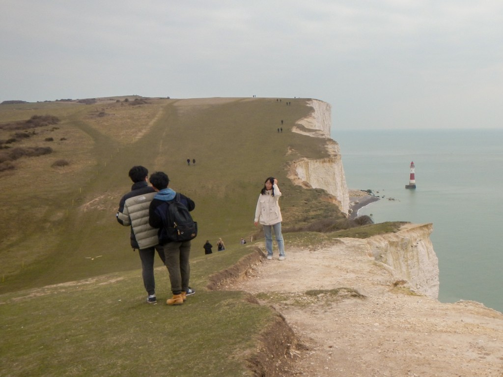
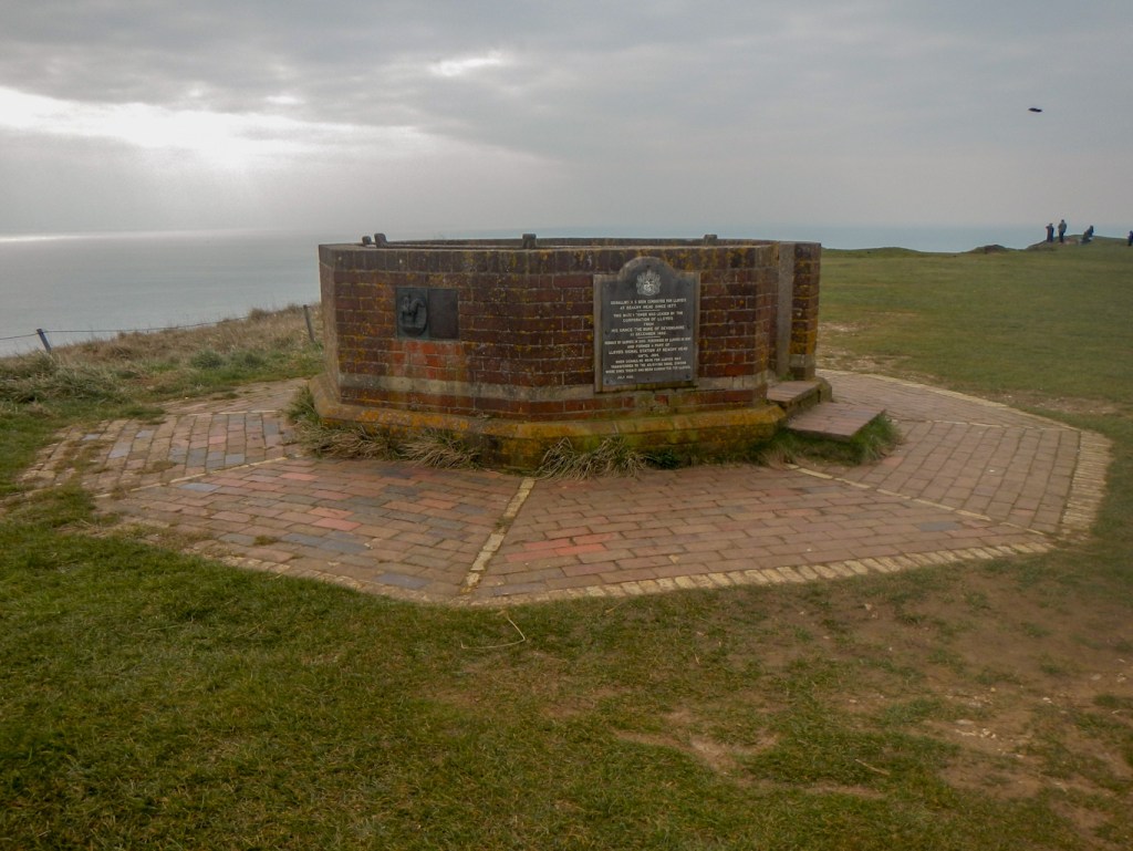
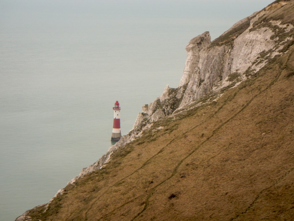
I reached Beachy Head where there’s a plaque on the remnants of the Beachy Head Signal Station. Close by is a memorial commemorating men of RAF bomber command during the Second World War. The planes passed over this point as it was on the major operational route. There are fine views of the iconic red and white lighthouse far below.
At this point I met a couple who told me that they are planning to walk the entire England coast path in stages. It’s always a privilege to meet other walkers and hear about their plans and ambitions. They were heading in the opposite direction towards Birling Gap.
Unfortunately I deviated away from the South Downs Way as I followed acorn signs which turned out to be part of the England coast path rather than those for the South Downs Way. However it did result in giving me a good view of the coast around Eastbourne.

I realised well before descending the full way to Eastbourne and managed to divert uphill to regain the South Downs Way where the inland bridleway meets the coastal footpath. This was my route to reach Alfriston where I was booked to stay overnight and my husband would be arriving with the car following his shorter walk.
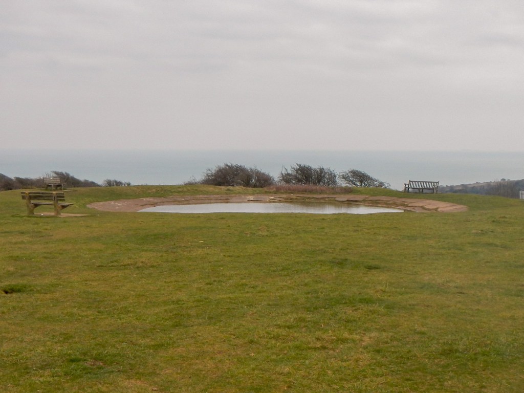
The inland route is undulating like the coastal route. The rolling chalk downland allows fine views. I stopped for lunch on an exposed area next to a dew pond as it was scenic and I spotted a convenient bench. Unfortunately despite adding an extra layer of clothing, the bitter wind led to me feeling extremely cold by the time I restarted. It took a good couple of miles to warm up again.
The route descends to Jevington where a blue plaque commemorates the birthplace of banoffi pie at The Hungry Monk (now a cottage as the restaurant closed). The church has a fine Saxon tower.
The route continues ascending out of the village up an enclosed bridleway. A solitary cyclist overtook me slowly, battling against the slope to get to the top. He made it and cheered triumphantly at the summit accompanied by some applause from me as well as from some other passing walkers.
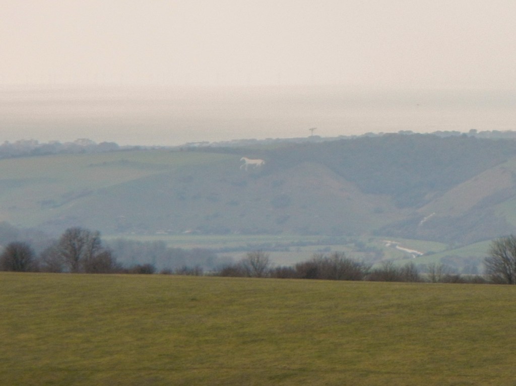
I emerged on to the bare crest of the downs. There are far-reaching views to the sea and to a distant chalk white horse carved into the hillside. Closer at hand are deep dry valleys. I was aware that I passed over the top of the chalk figure of the Long Man of Wilmington. It’s a pity that it isn’t visible from the path especially as it is said to be England’s largest chalk figure. I note that it should be visible from The Wealdway footpath – but that will have to wait for another visit.

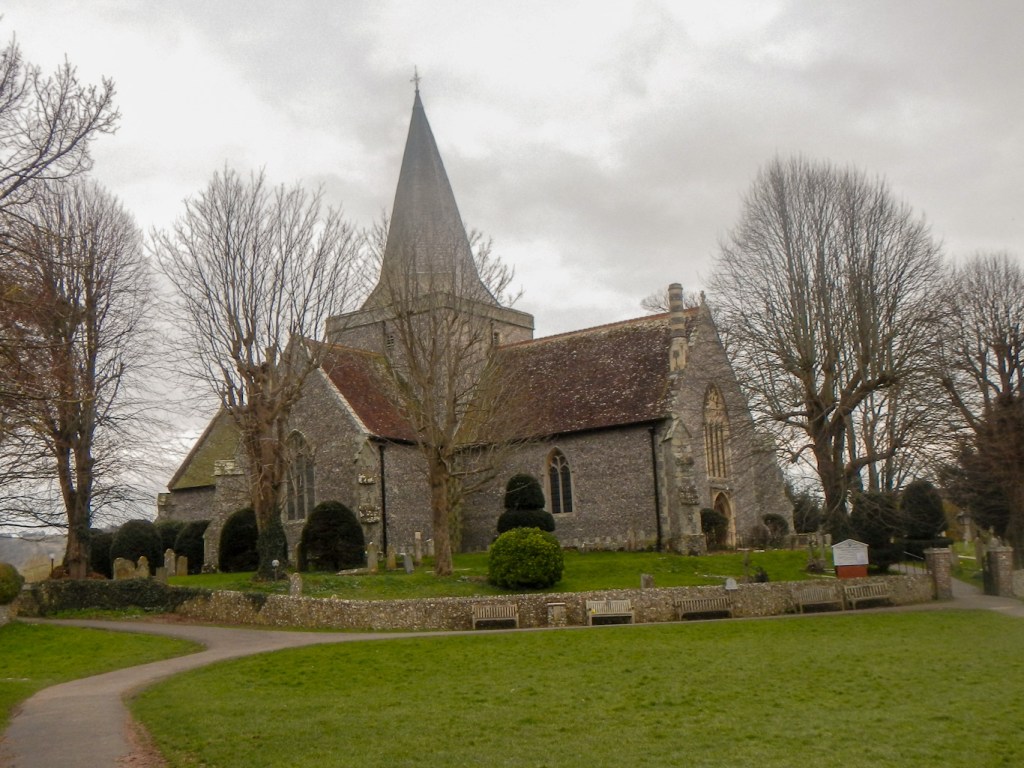
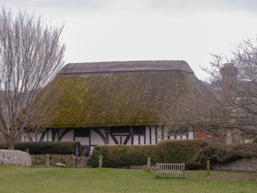
At last I was on the gradual descent to Alfriston. As I crossed the footbridge to reach the village, I stopped to look at brown trout swimming below, my attention drawn to them by some people standing on the riverbank. I walked past the large 14th century church of St Andrew often referred to as “the cathedral of the Downs”. Close to this is the thatched, half-timbered Clergy House which was the first building bought by The National Trust – in 1896 for only £10!
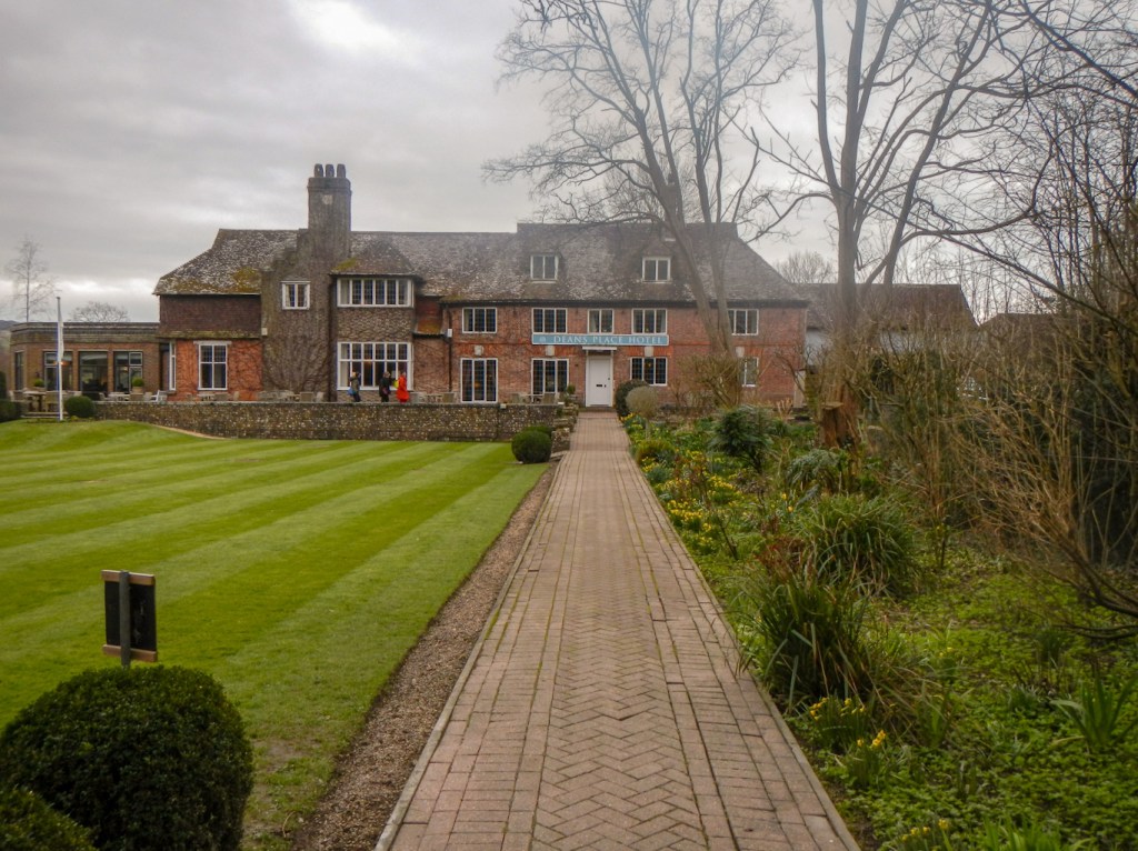
I was heading for Deans Place Hotel for a very luxurious overnight stop. It’s an AA four star hotel with huge and well maintained gardens. There are even paddocks for guests to bring their horses while riding the South Downs Way. Despite my late start, I arrived before 4:30pm having walked more than sixteen miles over undulating terrain in under six hours inclusive of all my breaks.