9 February 2023
I arrived in Milton Keynes planning to complete the twenty-five mile challenge walk set by the Milton Keynes Parks Trust. The only barriers I could see to finishing were poor waymarking, lack of daylight hours in early February or it being too far to manage due to my recent ankle injury. How wrong I was! I didn’t walk it all but this was because there was so much to look at. It was an absolutely fascinating journey.
Seeds of doubt about my pre-conceptions of Milton Keynes were sown the evening before as I enjoyed a meal out with my sister and brother-in-law, who have lived here for over thirty years. They reside not far from the lake in Willen, which I had assumed, whenever I visited, was the most scenic part of this new town (granted city status in 2022). However, they enthusiastically informed me about various features to look at all over the city and where I might want to take my time to look at the sights.
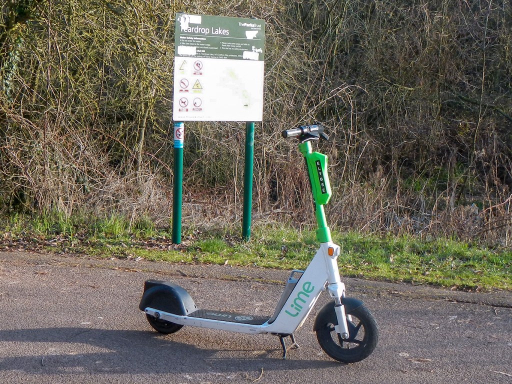
I’d already done a bit of research and discovered that the city was named after the small village of Milton Keynes towards the east. Its original planned area incorporated the existing towns of Bletchley, Fenny Stratford, Wolverton and Stony Stratford, along with another fifteen villages and farmland in between. Clearly, however, much of the land was rural until the late 1960s. This presented the opportunity for the city to be built on a grid system rather than the usual radial pattern typical of settlements growing over time. The city has a central business and shopping district but most grid squares are designed as semi-autonomous units with their own local centre. As I was to experience, green spaces pervade the whole with linear parks along flood plains and waterways, providing both a natural landscape for leisure and a vital flood management asset. In addition to the roads, a separate network of shared pedestrian and cycle routes (redways) enables segregation of motor vehicles from the more vulnerable cyclists, pedestrians and scooter riders.
The formal new town designation order was made in January 1967 and the first estate was being built in 1968. An OS map of the area in my collection, published in 1968, of course just shows the previous scattered settlements and farmland, little changed from my earlier maps dating from as early as 1929. How different the current map looks!
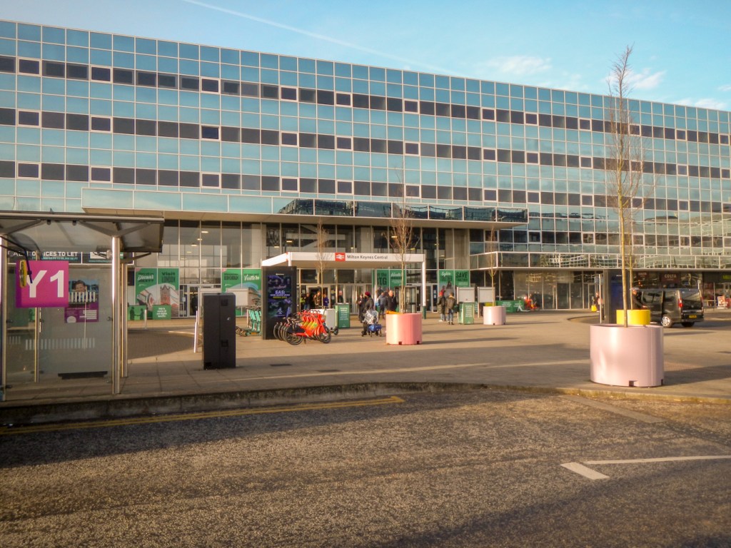
I stayed at the National Badminton Centre in a “rural” part of Milton Keynes, but only about ten minutes walk from the central business area and railway station. After an early breakfast, I strolled to the bus station area adjacent to the railway station to catch a bus from location Z1. It all seemed very straightforward. I needed to disembark at Westcroft Roundabout East so asked the driver to tell me when I was there – fortunate foresight as there are roundabouts everywhere and, to the uninitiated, most of the roads look very similar to each other. I rapidly discovered just how friendly and helpful people are in Milton Keynes, when a lady getting off the bus informed me that mine was the next stop. She needn’t have worried though as the helpful bus driver had remembered and called to me as soon as we reached the stop.
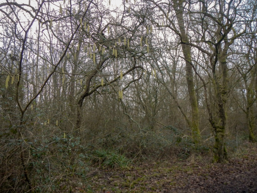
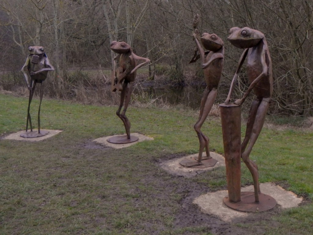
I could see that I needed to cross a main road to reach the start point of my walk in Howe Park Wood. I counted myself fortunate that there was a pedestrian underpass route, not realising at that stage just what a pedestrian friendly city I was walking through. Within a couple of minutes I was within the ancient woodland of Howe Park. This woodland was recorded in the thirteenth century and possibly as early as the eleventh century. Ancient large oak trees may reflect a medieval past as a deer park. It’s now an area of Special Scientific Interest where almost three hundred species of moths have been recorded and even the nationally rare black hairstreak butterfly. I was treated to my first sighting of a Milton Keynes outdoor sculpture – the frog musicians – there are more than 220 public artworks throughout the city. I could hear much birdsong and saw many birds including tits, chaffinches and robins.
My walk continued with a succession of interesting sights and a constantly changing landscape unfolding before me. In the main, the route is well signed. Where I went wrong was generally when I diverted from the route to look more closely at a feature of interest and then decided to cut back to the path further ahead rather than retracing my steps.
The city is continuing to grow and I walked very near one building site. I missed some path diversions in place during the building works.

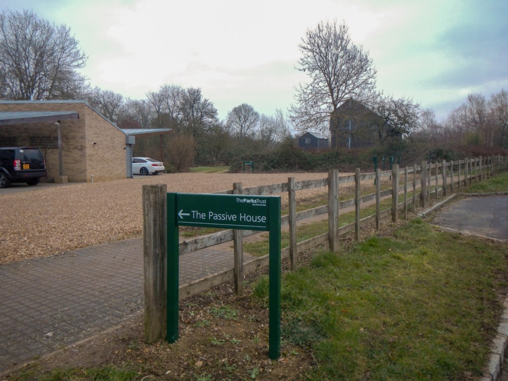
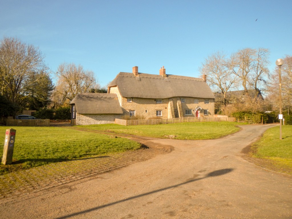
Ancient churches, historic village houses and village greens dating back to the old long established settlements have been preserved. Close to this are futuristic eco-friendly projects such as the Howe Park Passivhaus.
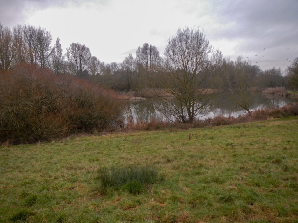
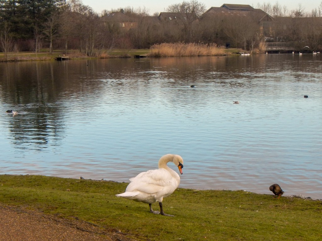
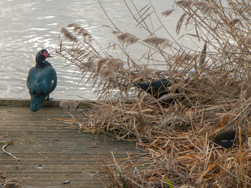
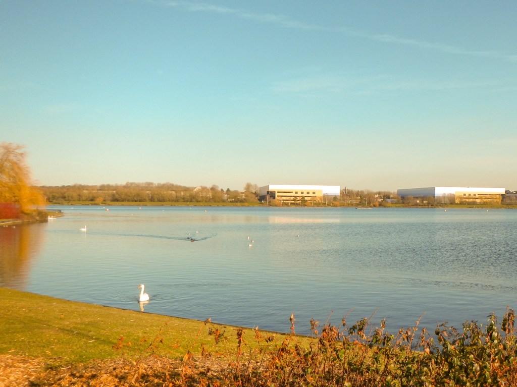
I followed the course of streams along grassy valleys and walked around the edges of large and small lakes, where there were many swans, ducks and geese as well as heron and moorhens. Kingfishers live along the banks but I wasn’t fortunate to spot one.

Underpasses took me below the main grid roads and it wasn’t ever necessary to cross these busy roads.
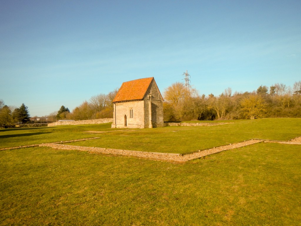
Evidence of previous settlement in this area was provided as I passed by the site and remains of a medieval Benedictine Priory at Bradwell. Nationally it is significant because it contains the greater part of the medieval precinct of a priory, a relatively unusual survival, with a rare standing building – a dedicated pilgrimage chapel decorated with fourteenth century wall paintings. Sadly but not unexpectedly the chapel was locked so I couldn’t look at the wall paintings.
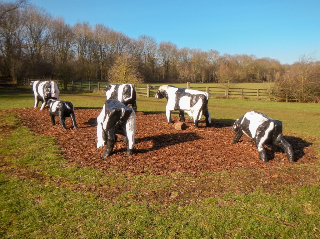
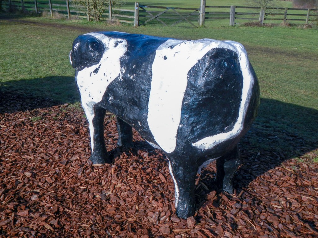
However, within minutes, I was looking at the modern iconic concrete cows. They’re not the originals which are very valuable so now sited at the museum. However they do look impressive particularly from a distance. Up close they are less realistic!
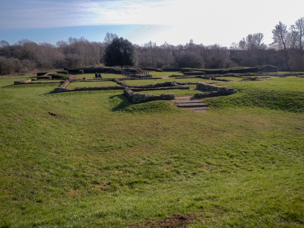
The remains of a Roman Villa are well preserved within yet another area of parkland. In fact excavations show this area was inhabited from 800 BC.
My sister had explained that there’s a hummock which is a viewing point for a windmill. The windmill can only be seen by climbing the hummock. I diverted off the path to climb various hummocks but still missed the windmill. However I did see a “warm space” in a building near one of the hummocks. I avoided the temptation to visit for a cup of coffee as I suspected it would be hard to leave quickly. Besides, I was actually warm anyway after all the walking!
There were many other people out on the paths – initially including children walking to school but later mainly dog walkers, individuals and small groups apparently out walking for leisure, people carrying shopping bags, runners and a few cyclists. Almost all offered a word of greeting – certainly my initial impressions of a friendly community continued.
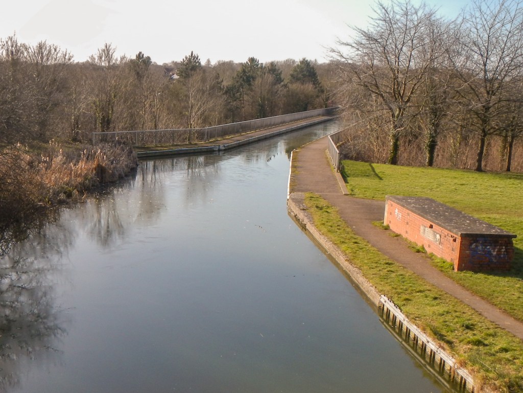
I reached the Grand Union Canal near an aqueduct and followed the towpath for a short time before diverting to the ruined St Peter’s Church, some of the walls dating back to the twelfth century. Adjacent to it are below ground remains of the seventeenth century Stantonbury Manor.

I returned towards the canal and soon reached the Black Horse Pub where I stopped for a cup of coffee.
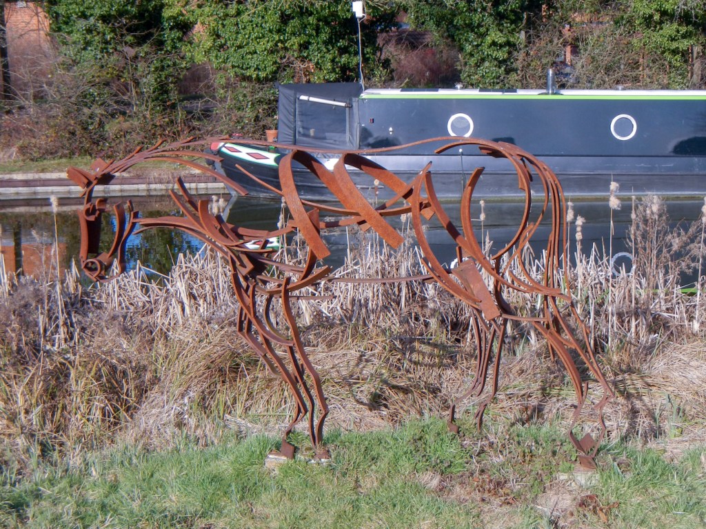
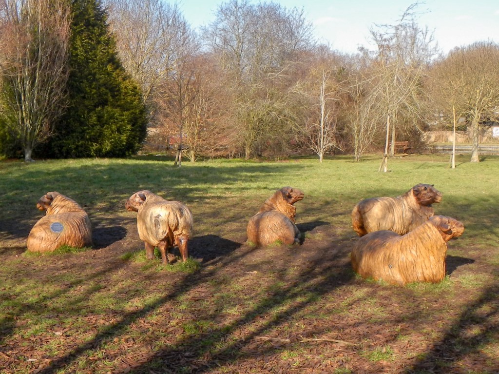
Next it was on along the canal to Great Linford Park. This too is an area rich in archaeology and 7th century Saxon finds have been unearthed from below St Andrew’s Church. There are also modern sculptures including some chainsaw-carved wooden sheep.

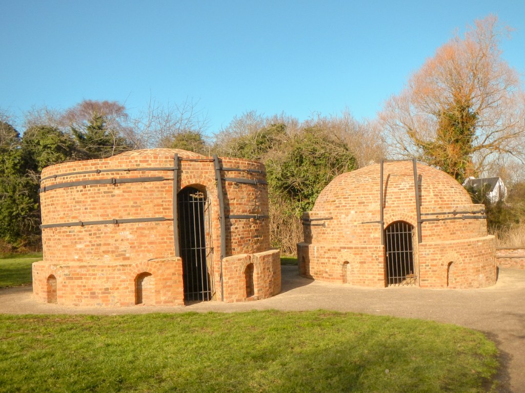
En-route to Willen, I passed Victorian brick kilns. The clay soil means that historically this has been a brick making area.
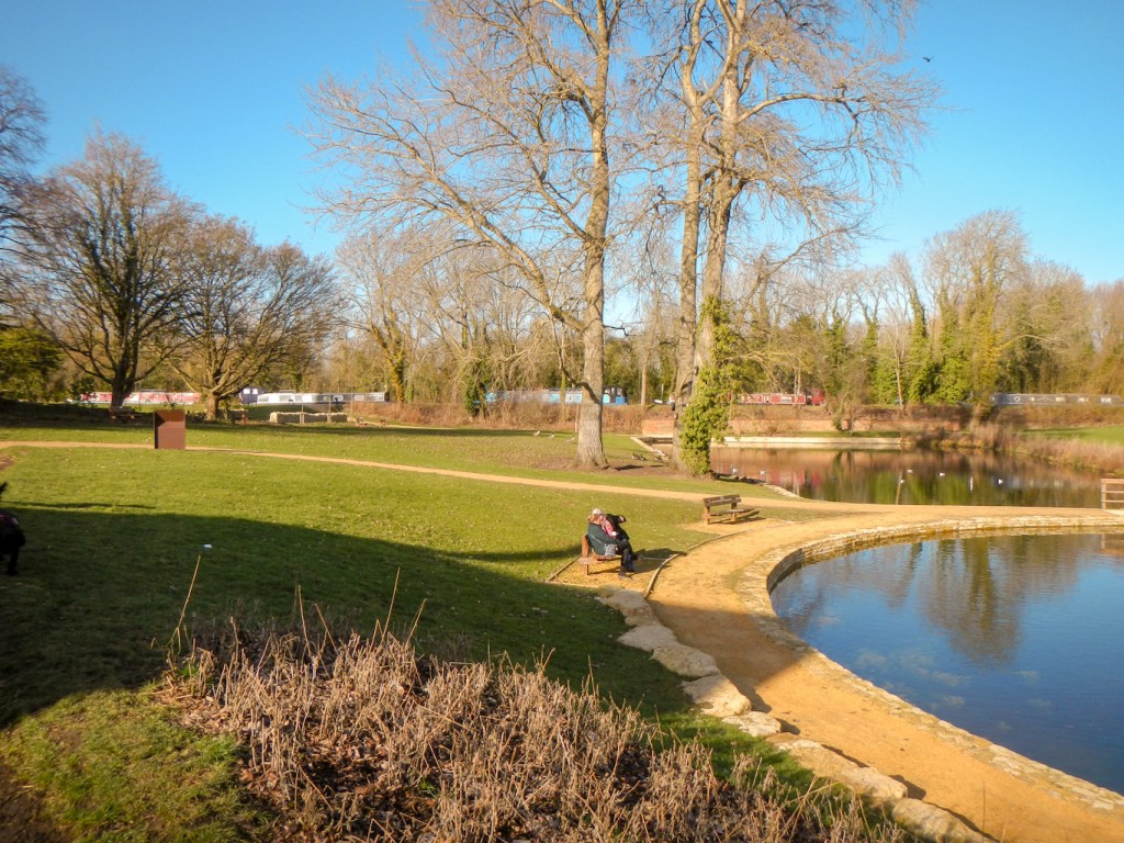
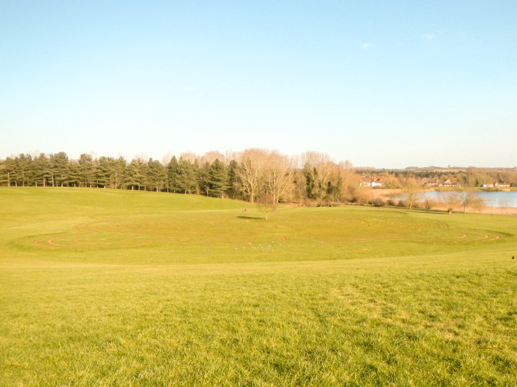
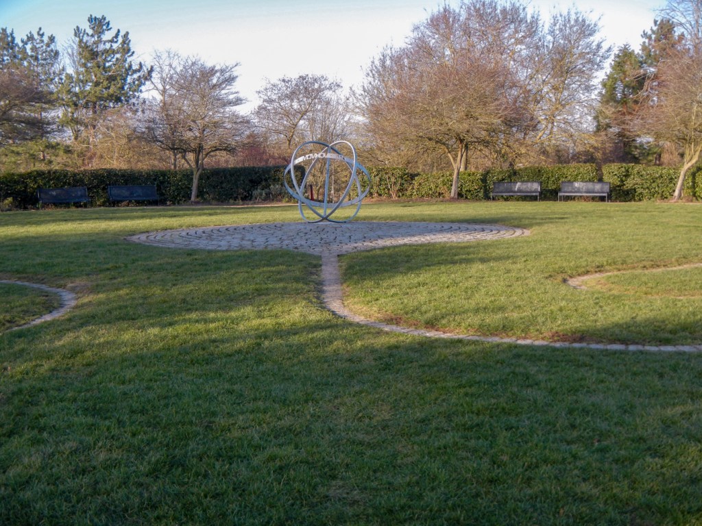
At Willen, apart from the two huge lakes, the major points of interest I saw were the Peace Pagoda, the Labyrinth and the Medicine Wheel.

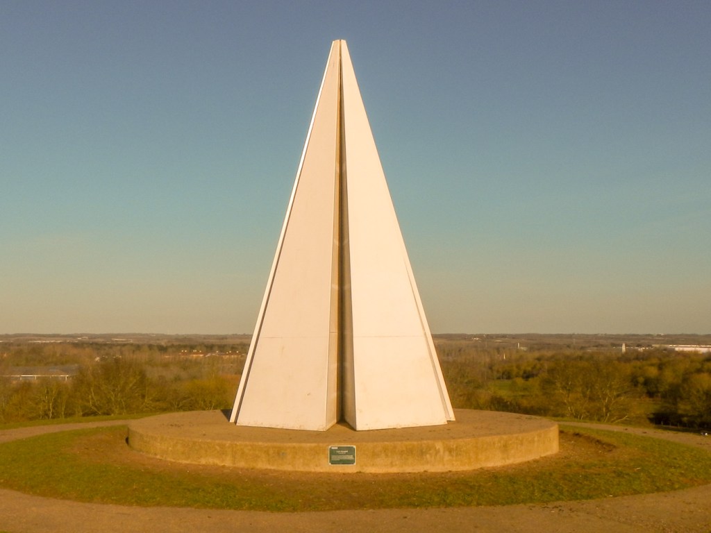
Somehow I became distracted and missed a turning as I journeyed past the closed Gulliver’s Land theme park. I ended up negotiating the Campbell Wharf Development, buildings still under construction. However soon I was in Campbell Park and made my way towards the belvedere topped by the light pyramid. There are real sheep here too!

As I had deviated from the route, I hadn’t passed the Labyrinth or visited the Milton Keynes Rose and both these shouldn’t be missed. I circuited round to them having descended from the belvedere.
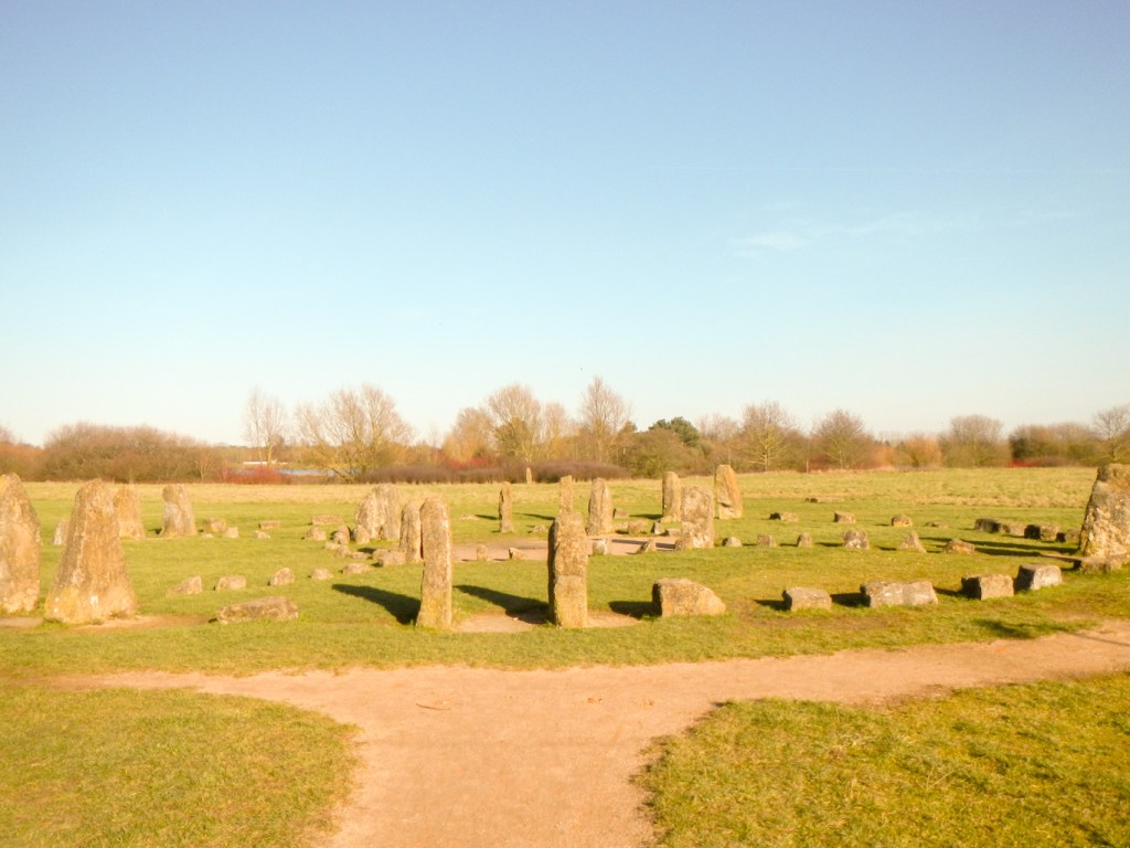
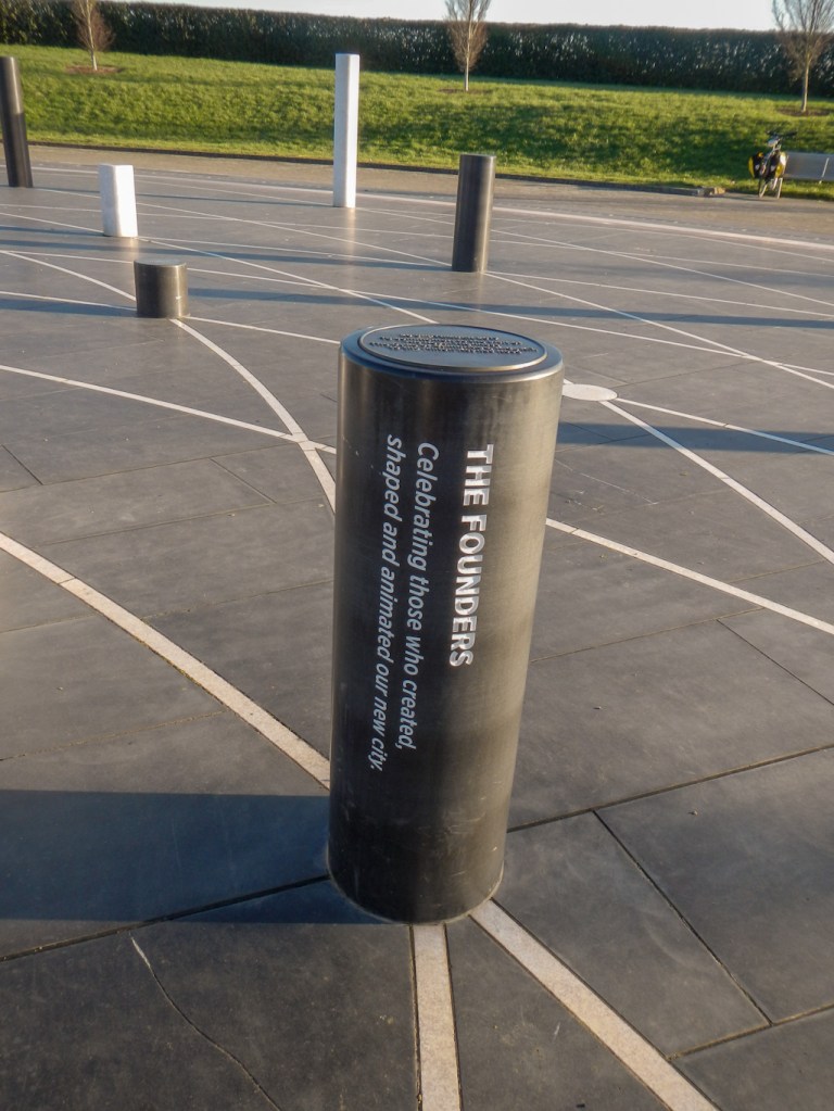
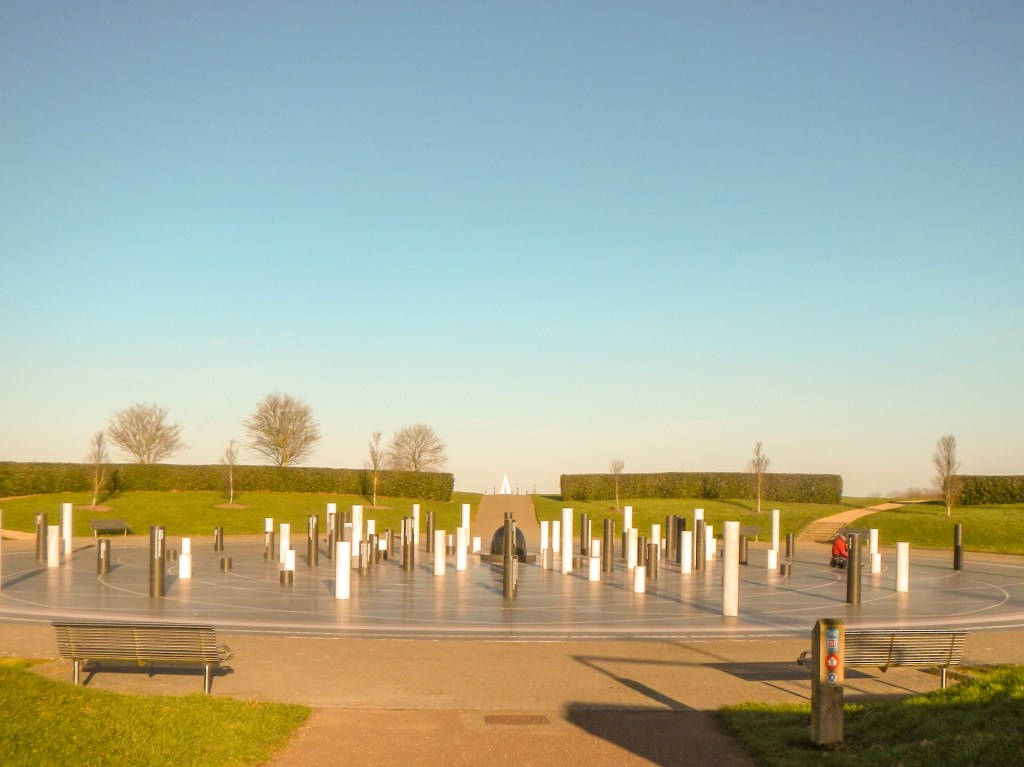
The Milton Keynes Rose was an unexpected highlight. Sixty eight of the one hundred and six granite pillars have been dedicated with details of significant anniversaries and events, the remainder still blank for future dedications. This felt like a special place for remembrance and celebration, located in a peaceful corner of the park and yet so near to the city centre.
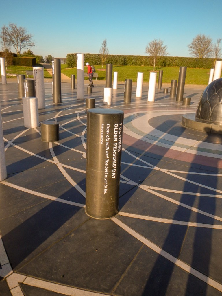
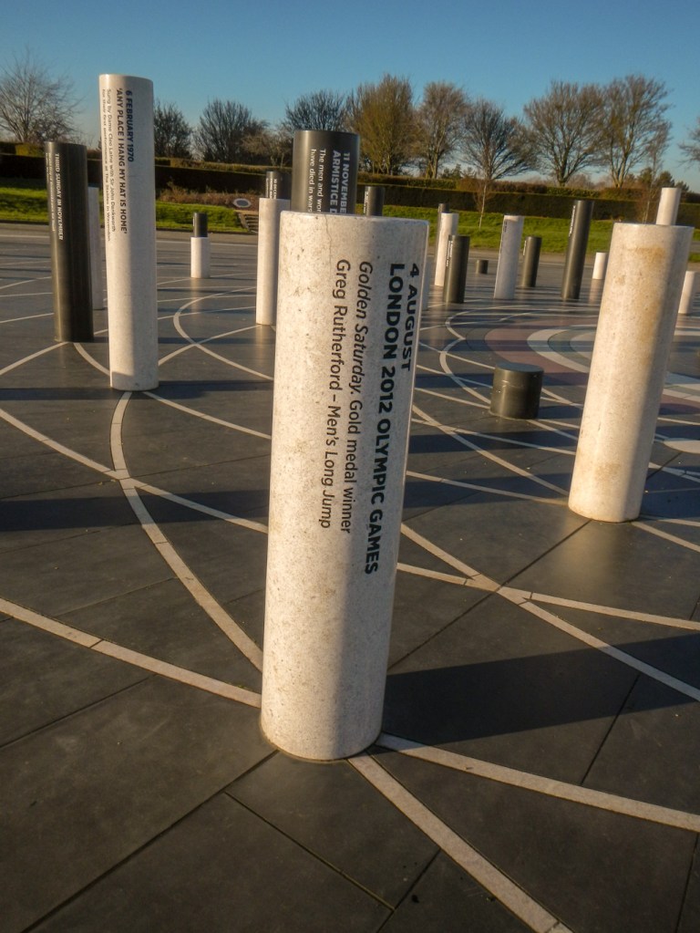
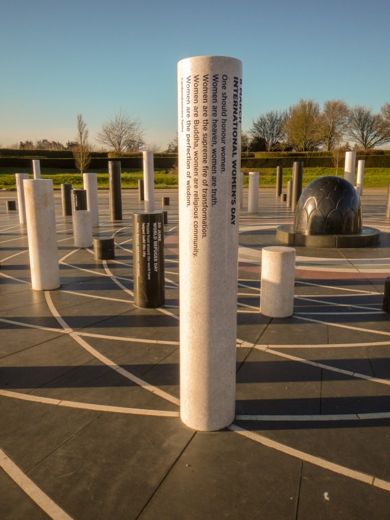
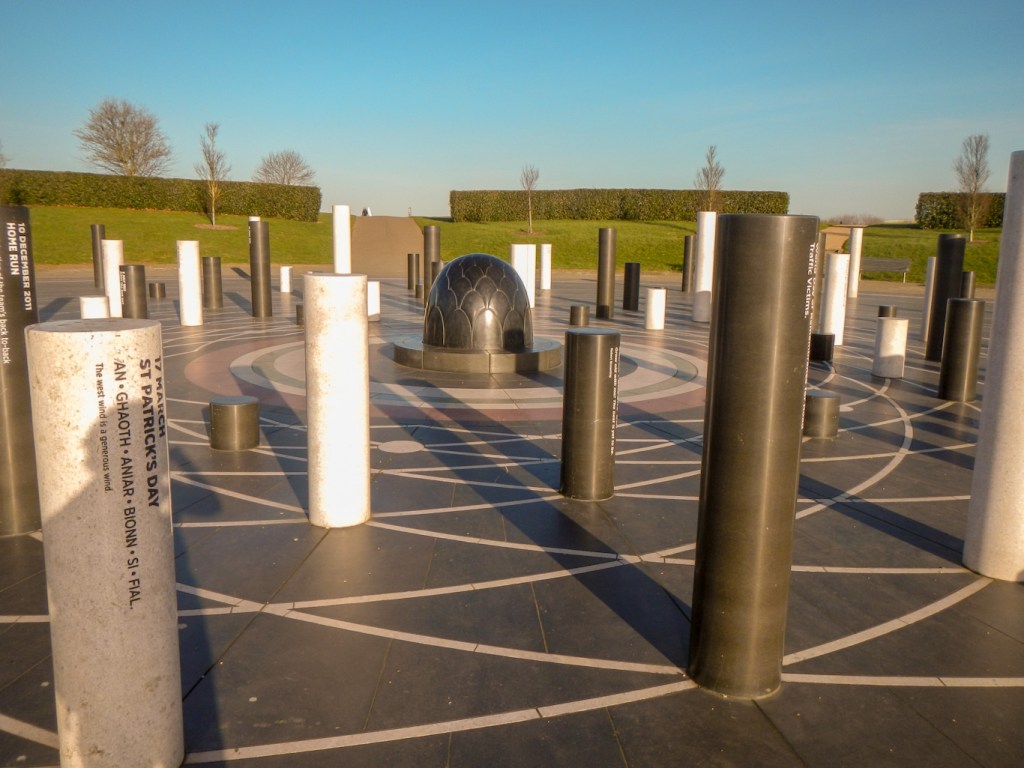
The challenge walk continues for about another six miles, passing close to the original small village of Milton Keynes, past the Open University campus and around another large lake. However, I had already walked twenty miles with all my meanderings and diversions. Hence having reached the Milton Keynes Rose, a significant place for residents and visitors, I chose to end my trek and head towards the nearby central area.
The Light Pyramid on the belvedere is in line with the eastern end of Midsummer Boulevard, right at the point where the sun rises on the solstice. I made my way along Midsummer Boulevard through a street market and past the big shopping centre towards the railway station where my Milton Keynes adventure had begun. This wide Boulevard was aligned so that on the longest day of the year, the sun would rise at the east end and shine down its length to reflect off the windows of the railway station at the far end. However unfortunately the line is now blocked by the shopping centre building. When construction of the city began in the early ’70s, the lead architect Derek Walker decided to shift the city grid plan a few degrees from north-south / east-west, realizing that doing so would allow the streets to align with the sunrise on the summer solstice.
Definitely Milton Keynes is more than concrete cows and, as I discovered, holds significant archaeological secrets, sites of national natural significance and a modern grid system which is astronomically aligned. As the city signs declare: “Milton Keynes: Different by Design”.

That looks a fascinating walk. I’ve never been to Milton Keynes and never realised the amount of green space. I can see myself getting the train down there for a couple of days exploration. Thanks for bringing it to our attention.
LikeLiked by 1 person
Hi Kathryn, I work for The Parks Trust – the charity that manages MK’s parks – and would like to thank you for producing this fab blog. It really captures the variety of the city’s greenspace and outdoor features. If you are ever in the area again, please look us up and we’d be delighted to take you for a cuppa! Best, Bernadette
LikeLiked by 1 person
Thank you Bernadette. I was very impressed by the green space, the way that pedestrians and cyclists are segregated properly from motor vehicles, and the friendliness of other people using the routes. I was also impressed by the absence of litter and graffiti. It was a very enjoyable and interesting walk. I’m rarely in the area even though my sister and brother in law live in Milton Keynes but I will contact you if I’m around again.
LikeLike