16 September 2022
The wind was blowing hard as we set out from Ferryden, overlooking the treacherous South Esk estuary. Amazingly, washing wasn’t blowing off drying lines with pulleys rigged up high above the foreshore. Surely all that washing must have been double if not triple pegged and as for the situation if the line broke, I suspect all the clothing on the line would be lost. I think the cottages opposite were originally fishing cottages and the lines for drying nets, but nowadays they appear to serve well as washing lines.
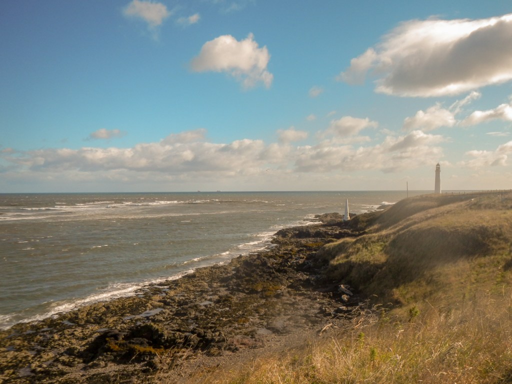
As we headed towards the prominent 39m high white tower, engineered, like so many lighthouses, by the Stevenson family, we were relieved to have the powerful wind on our backs, aiding our progress. We learnt that during the Second World War the lighthouse tower had been painted black so as not to provide a “helpful” daymark for the enemy. As we walked along the path, we also discovered two prominent daymarks to guide shipping on the narrow navigable channel between treacherous rocks on the one side and equally dangerous sandbanks on the other.

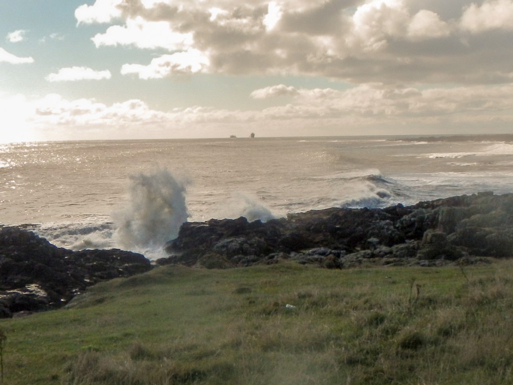
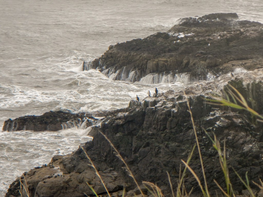
Looking at the surface of the water, it was possible to see various currents which further increase the hazards of this estuary. Even nowadays, any crew that is not familiar with the estuary needs to be guided by a local pilot.


The wind and state of the tide made for impressively powerful breakers over the prominent rocks.
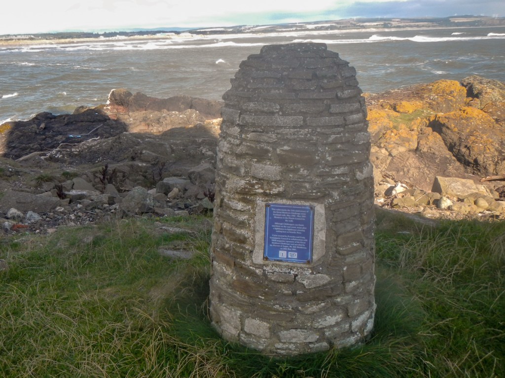
Soon we were passing to seaward of the lighthouse, noting a prominent cairn to the TGO challenge, an annual backpack from various points on the west coast of Scotland to the east coast and culminating in a completion celebration in nearby Montrose. It’s something I would be keen to try to enter sometime, although prospective entrants always outnumber the places available.
After walking over some grassy fields seeing further huge waves breaking over the rocks, we spotted a large number of cattle (bullocks) in the field ahead. We decided to deviate along a path which headed inland then follow a few small lanes. This allowed us the sight of trains speeding along as well as one stopped at a signal on the main line between Aberdeen and Edinburgh. Whether they were four-coach HSTs or three-coach 170s or something else (which apparently they wouldn’t have been unless they were the sleeper or the daily train going right through to England) didn’t really bother me. However my husband was keen to explain about the different trains and their merits….
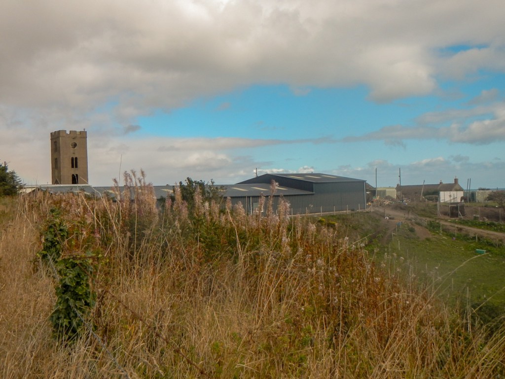
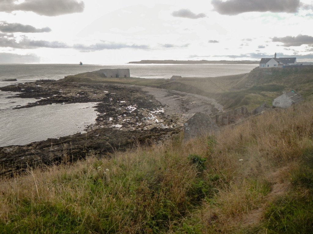
We got ourselves back on to the coast path at Usan where we saw ruins of cottages and a prominent tower; presumably this was an abandoned fishing village and in fact the sign on the gate indicated that the area is used nowadays for processing wild salmon.
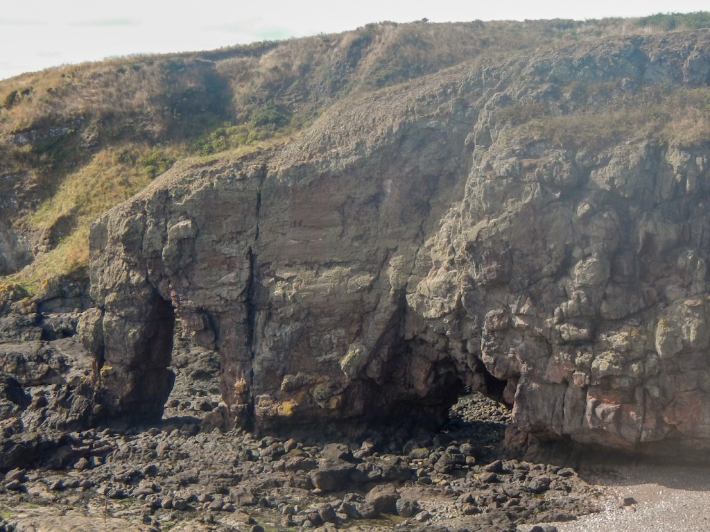
A narrow footpath uneven round the edge of a harvested grain field with just sprigs of straw remaining, was not ideal terrain for my recovering ankle. However as we turned a corner, we saw the unmistakable outline of an elephant shaped rock. At least it was unmistakable if you knew you were looking for it and viewed from the right angle.
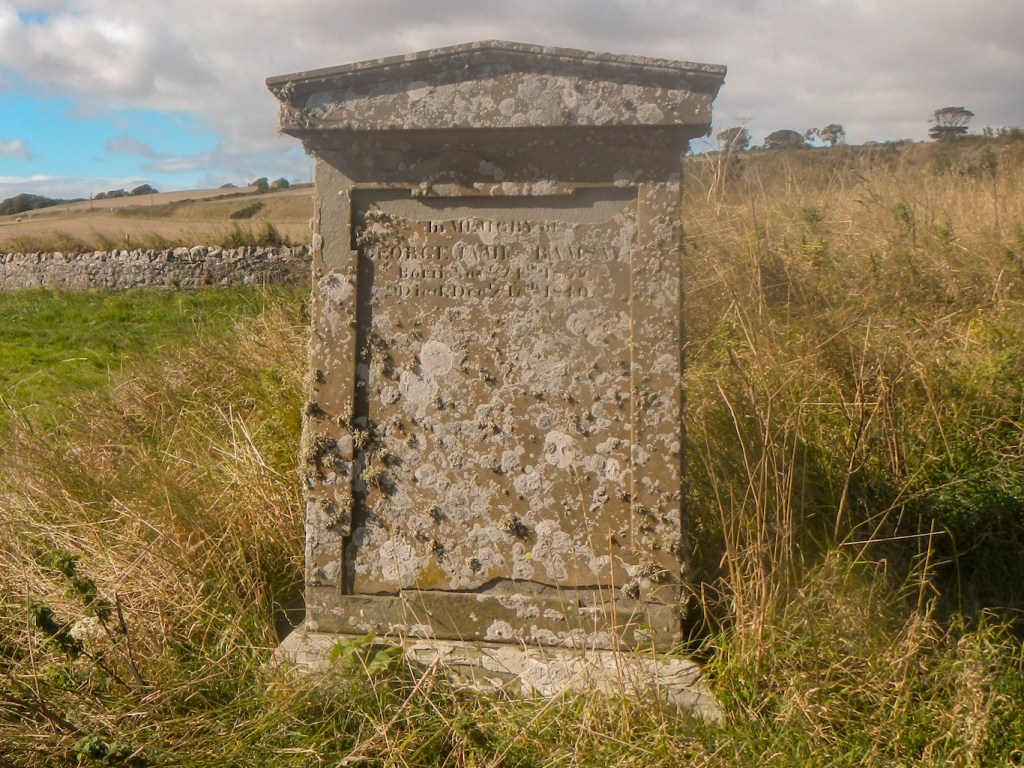
Having followed the cliff path as it turned towards land, we discovered the chapel of St Skae dating back to the twelfth century with adjacent cemetery. We were intrigued to notice a gravestone inscribed “In memory of George James Ramsey Born November 24, 1859 Died December 17, 1840”. It’s a large stone and I guessed was the grave of an adult – maybe it was meant to be 1759-1840. However on searching the internet George James Ramsay was born at Craig, Angus, on the 24th Nov 1839 and died just over a year later on December 17 1840. I wonder why the parents accepted this error on their son’s gravestone – maybe they were unable to read. Anyway it’s a huge stone for such a young child.
We followed the path further and passed the west side of Elephant Rock – which also resembles an elephant.
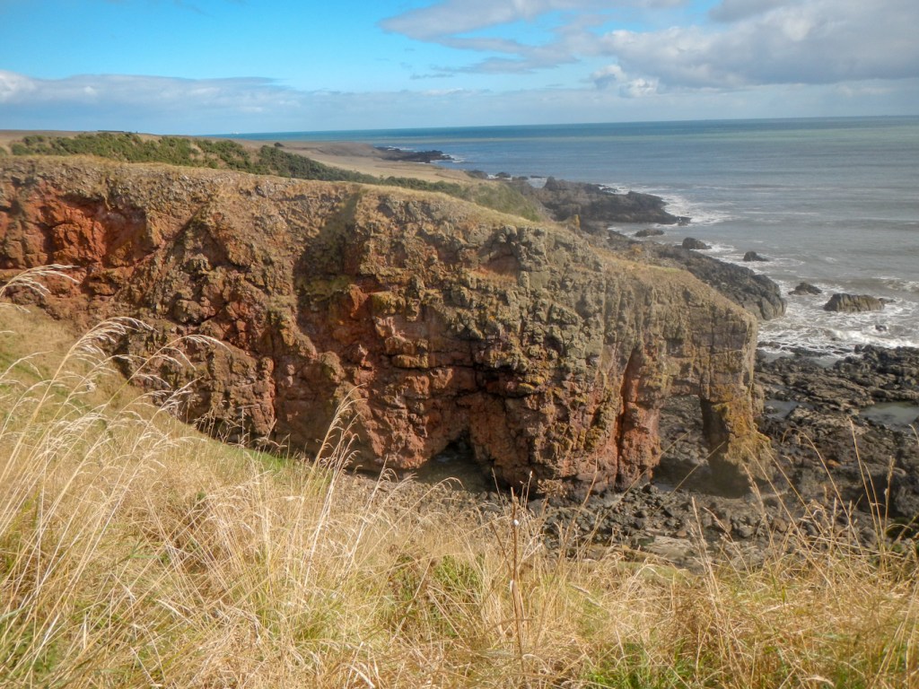
The route continued above ruined salmon bothies of a salmon fishing station on Boddin Head. There were views to a lime kiln on the point itself and views onward towards Lunan Bay. Unfortunately it started to rain, so we donned waterproofs quickly, remembering the speed of onset of the heavy rain shower the previous day.
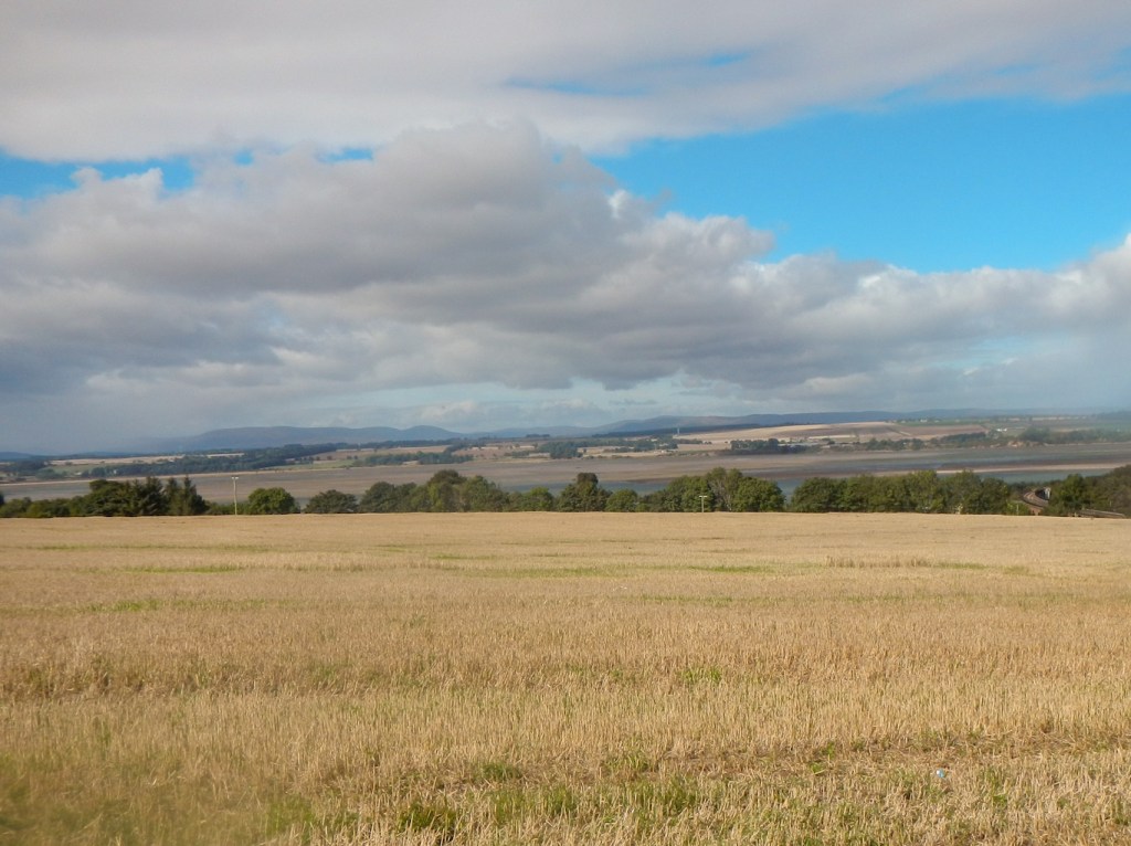
The return route was shorter, along quiet lanes. There were good views of the Montrose Basin before we walked downhill back to Ferryden. Oddly, the bench at the viewpoint looked over the road and not over the view. We imagined a council worker who was told to fix the seat at a certain point but didn’t quite understand the rationale for it was to look at the view when seated rather than to observe traffic on the road.
This walk was about eight miles and certainly provided varied features of both physical and human interest in a relatively short distance.
