23 August 2022
The plan made before my ankle fracture had been to walk around the entire coastline of Holy Island, Anglesey, as well as making the short but steep climb to its highest point, the 220m high Holyhead Mountain. This would have been a walk of about twenty-six miles, but fairly straightforward to manage in August with sufficient daylight hours. It would have followed my completion of a mountainous traverse from south to north Wales on the Cambrian Way, which I have postponed. However, I realised that I needed to account for the fact that I am still only ten weeks post ankle surgery following my unstable fracture with ligament rupture. My plan, still ambitious in the circumstances, was to split the walk into two halves and complete it over the two consecutive days that I was spending in Anglesey with my husband.

Holy Island is connected to Anglesey by a road and rail bridge as well as a second separate road bridge, a similar arrangement to the connection of Anglesey to mainland Wales. Holy Island’s main claim to fame must be that of being a major ferry terminus between Great Britain and the Republic of Ireland. My husband dropped me off on the north of the island at Penrhos Beach and set off by car to explore some of the area himself. I had decided that I would prefer to walk alone as I would perceive less pressure to maintain a certain pace and could have frequent rests as needed.
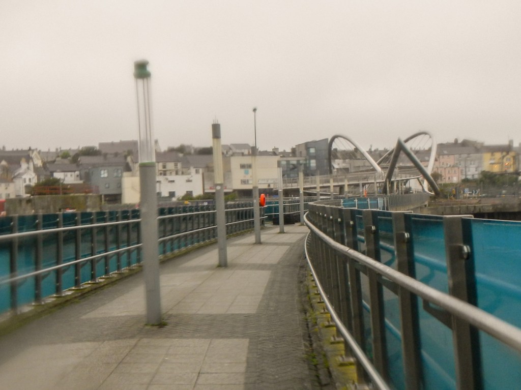
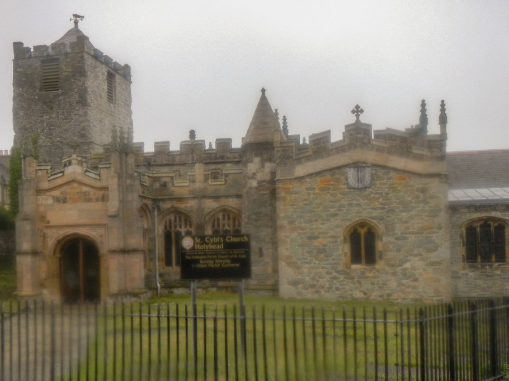
The walk began by passing a pleasant beach before some pavement walking prior to reaching the dock area in Holyhead. There was an interesting modern walkway bridging part of the old inner harbour and almost passing through the railway station. I emerged on a main shopping street and turned towards St Cybi’s Church which was built within the walls of a fort of the late Roman period.
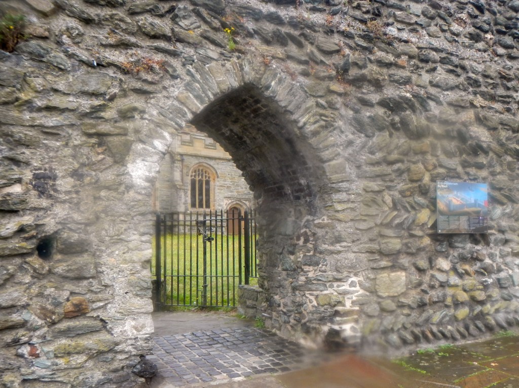
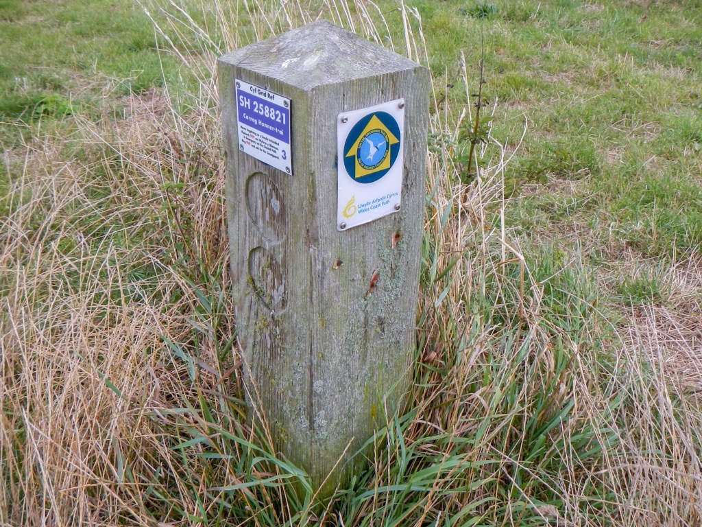
The church is actually the official start and end point for the circular walk round the entire coast of Anglesey encompassing Holy Island too, itself now part of the 870 mile long Wales Coast Path. Hence waymarking is generally good and the marker posts even include OS grid references as well as the helpful advice to phone 999 and ask for Coastguard in case of emergency.
I have to be honest and say that by the time I was walking along the promenade on the north side of Holyhead, my pace was already decreasing and my right ankle painful. The weather was still murky and damp, so the Jehovah’s Witnesses sheltering with their pamphlets on a covered seating area at the beginning of the promenade called after me to say they hoped the weather improved. After having a rest on a similar covered seat at the opposite end of the promenade, I proceeded up a narrow lane and turned on to a path towards a small bay. A group of kayakers was getting ready to launch – from the conversation I overheard they appeared to be on a paramedic course, so I made sure I wasn’t limping too much!
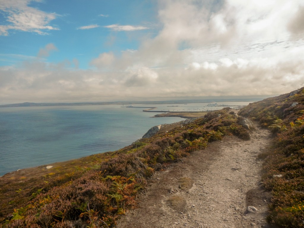
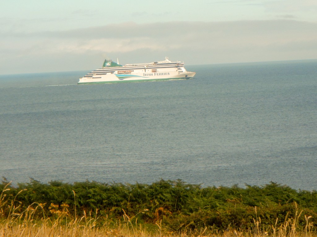
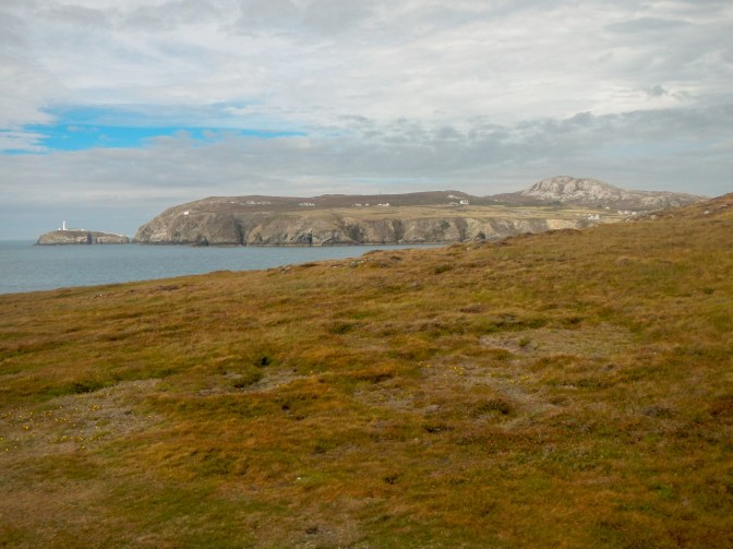
I entered the Breakwater Country Park. The path was rocky in places. I enjoyed excellent views of the 2.39km long breakwater, which was built between 1846 and 1873 using rock quarried from rocks near where I was walking. It’s the longest breakwater in Europe. I saw a couple of the large ferries from Ireland approaching Holyhead. The path continued to be rocky as I approached North Stack, before turning south. Unfortunately, after taking a further rest, I left my camera on the ground. Fortuitously I realised after ten minutes walking when I saw a view of South Stack lighthouse in a gap between two hills and stopped to take a photograph. Reluctantly I turned back and fortunately found my camera lying where I had left it.
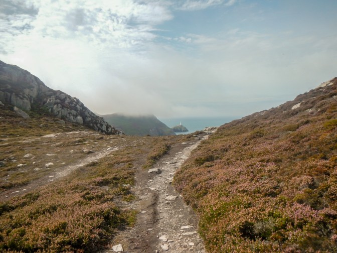
The path became more rocky and it was difficult to pick the easiest route as there were alternative lines that had become eroded. I struggled with a particularly steep piece of path that I’m sure would have been avoidable by taking a different line. I saw someone ahead sitting on a rock. It was my husband at the lower end of the diversion to reach the summit of Holyhead Mountain. He had been up already, having driven to the RSPB South Stack Visitor Centre. Apparently at 10am when he arrived at the centre, the visibility had been negligible but now the weather had improved and visibility excellent. He dissuaded me from trying to climb to the summit however as he said that the path was steep and rocky with loose stones.
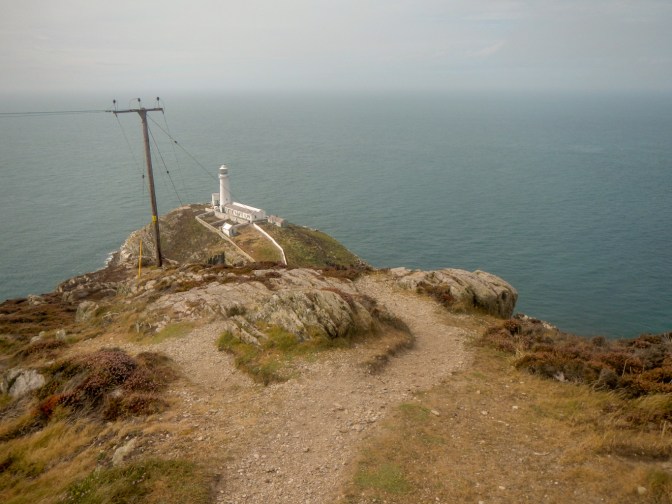
We walked together towards South Stack. There were a few more people on the path. We ate our packed lunches together on a point overlooking South Stack lighthouse. There were an enormous number of people! It was amazing compared to the few walkers I had seen on the path in the breakwater area. After lunch, we descended to a lane and a multitude of parked cars. Most of the “crowds” had clearly walked only a couple of hundred metres at most.
After enjoying a welcome cup of coffee at the RSPB centre, I decided to continue on the second half of my day walk. Initially the path followed the road – I was even offered a lift by someone in a camper van (maybe because I was limping!). I declined – graciously. Soon the path continued along some field edges adjacent to the road before branching off towards some lower level cliffs.
The Range area that I entered is part of the RSPB South Stacks reserve. However it doesn’t have a visitor centre so of course it was much quieter than the main section. The coastal heathland is an extremely rare habitat and much work is put into maintaining it as such. It’s used to graze sheep using a ‘close shepherding’ regime due to the area being open common land – this means that a shepherd and sheep dogs are out with the sheep during the day while they are grazing, and the sheep are returned to their field at night. The Range is grazed for up to 40 days between December and February. This is to ensure that the sheep do not eat any of the precious flowering plants that grow in the spring and summer months. Most of the rare south stack fleawort lives on The Range growing in grassy areas. The sheep eat the grass so the seeds of plants like these can grow. Without the grazing, machines would need to be used to cut the grass back. Machines are used however to cut back some taller denser areas of heather in order to preserve the habitat.
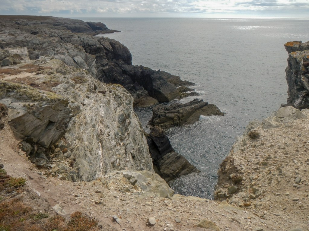
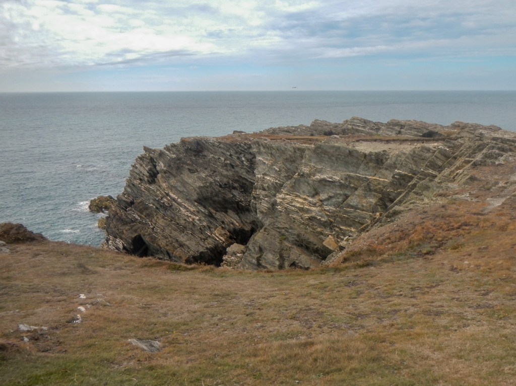
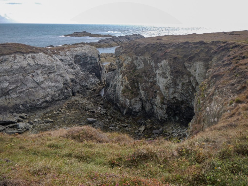
There were excellent views from The Range back to Holyhead Mountain and the South Stack lighthouse. The coastal scenery within the range is equally scenic including multiple stacks and geos. There is also a headland with a fort marked; however it’s just off the path and my ankle wasn’t conducive to me taking any diversions, especially if it was liable to be rough underfoot.

I reached the road near the popular beach at Porth Dafarch, where many people were making the most of the afternoon sun, including paddle boarding and kayaking in the sheltered area of sea within the bay.

Next the route followed the road with just a couple of off-road sections with some grazing cattle nearby where there was a path along the clifftop. Unfortunately I was struggling with my ankle and my pace became very slow. However, as some walkers coming the opposite way said, at least I was able to get out again after a fashion. I was delighted to see that my husband had parked the car in the first car park I reached at Trearddur, so I didn’t actually walk as far as the bay. He was nowhere to be seen but I had a key so I was already sitting in the car as he approached from the direction of the village centre a couple of minutes later.
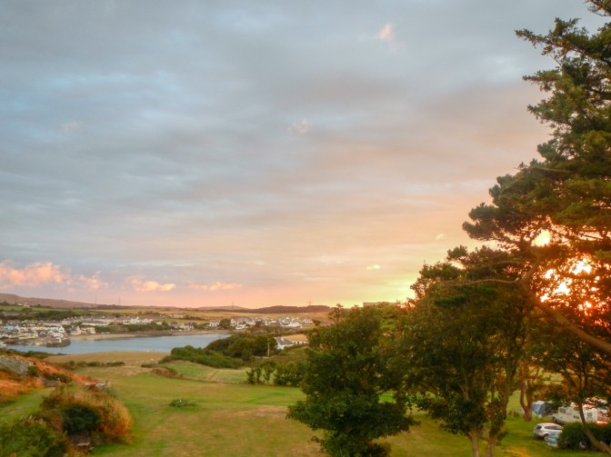
I felt that I couldn’t walk another step at that stage. My husband dropped me off in Cemaes on “mainland” Anglesey as we passed through before taking the car to our nearby hotel and himself walking back the short distance to the village. We ate fish and chips as we overlooked the harbour. Even after a long rest, I struggled to walk back to the hotel and my husband went on and fetched my crutches from the car to help over the final stretch. However it was a lovely sunny evening and I did manage to leave our hotel room later to capture a view of the stunning sunset.
As for the second half of the walk, unfortunately I hadn’t recovered sufficiently by the next day to walk a further thirteen miles so that will have to wait for another visit. Ironically that meant I didn’t get to St Gwenfaen’s well with its reputation for healing (which could have been useful for me). I also missed out on seeing sea arches near Rhoscolyn. In order to complete my circumnavigation, the plan had been to explore the south part of the Holy Island coastline, cross Four Mile Bridge to “mainland” Anglesey and return to Holy Island via the Stanley Embankment to walk through the Penrhos Coastal Park to Penrhos Beach. Incidentally, Holy Island also has a number of fascinating monuments “inland” including Bronze Age standing stones, Neolithic burial chambers, prehistoric hut circles and even the remains of an Iron Age fortification on the summit of the Holyhead Mountain. There are plenty more potential adventures “waiting to happen” on this small island off an island, so it’s difficult to believe that it only measures fifteen square miles.
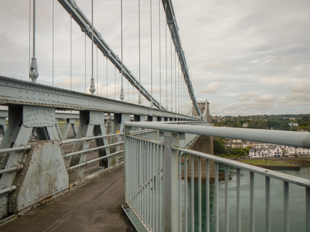
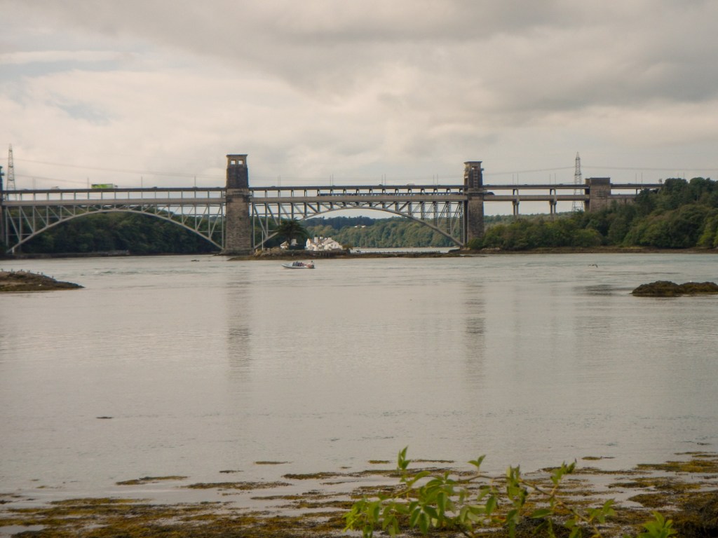
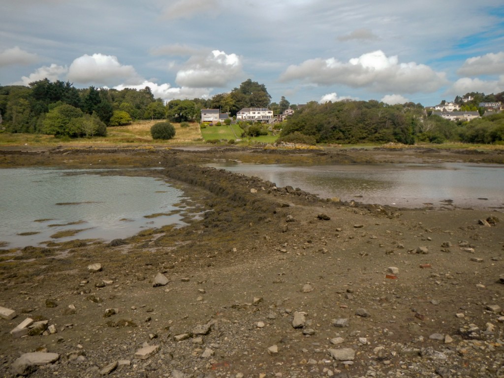
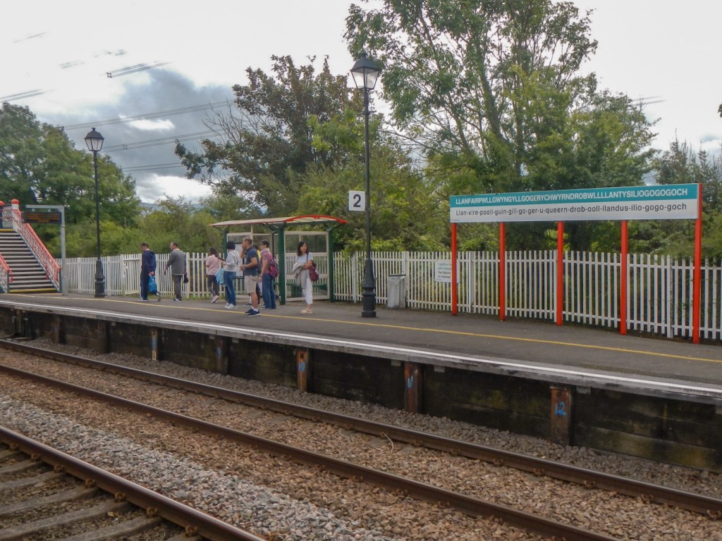
Instead, my husband and I toured round part of “mainland” Anglesey by car and had short walks at various locations – including the fascinating copper mining town of Amlwch, the old suspension bridge over the Menai Straits, an interesting woodland (we didn’t see the red squirrels that are sometimes spotted) with a small causeway to Church Island as well as the station at Llanfairpwllgwyngyllgogerychwyrndrobwllllantysiliogogogoch. Incidentally this is the longest one-word place name in both the United Kingdom and in Europe as well as the world’s second longest place name, the longest being in new Zealand.
There is a lot more to see in Anglesey too including various tidal islands so I will need to try to return one day……
