20-22 May 2022
It’s already nearly the end of May and my tent hadn’t had an outing this year. Good weather seemed to be arriving in Devon this weekend so I decided to spend some time wild camping on Dartmoor. The new hourly service on the recently reopened line to Okehampton meant a south to north crossing would be option using the railway service. Firing on Merrivale Range both day and night on Friday dictated my direction of travel.
It wasn’t an auspicious start – pouring rain on Friday morning so I was waiting for my train clad in complete waterproofs – though as it happened this was the only time I needed to wear my waterproof trousers all weekend.
Blue sky appeared as I walked up the road to access the Two Moors Way track beyond Stowford bridge so I stopped to remove my waterproof trousers. This wasn’t going to be a repeat of May 2021 when I walked on tracks over the south moor that were more like rivers than paths. On that occasion, I’d missed out Black Tor although clearly I’d walked past it trekking in the driving rain from Western beacon to the trig point on Butterdon Hill.
Having “bagged” Black Tor, I went on my way to search for Creber’s Rock which I’d been unable to find last May. It was an easy discovery in these clear conditions – I could see the clear rock outcrop on the side of the hill and headed straight for it.
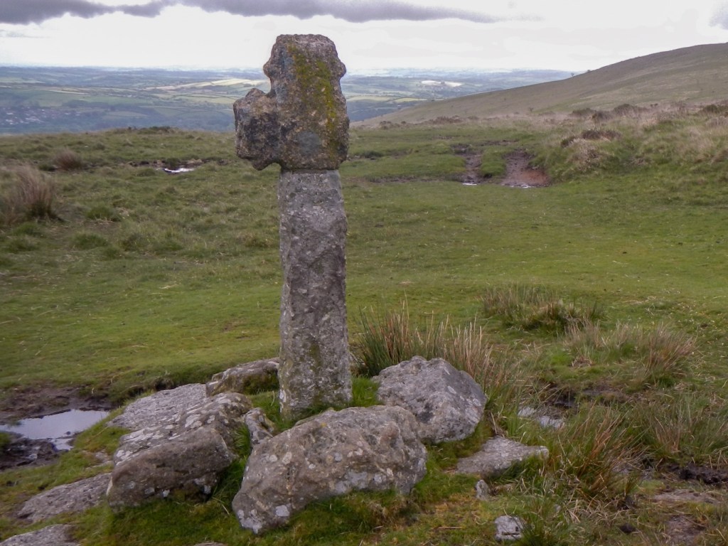
I couldn’t resist photographing Spurrell’s Cross. It is very damaged but unusually it had two spurs projecting from the head and each of the arms. English heritage date it to the medieval period. It’s sited at a busy intersection of several trans-moor tracks including the old monastic track running from Plympton to Buckfast Abbey.
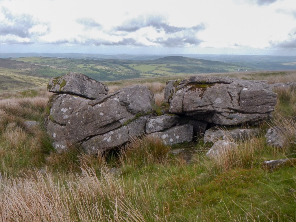
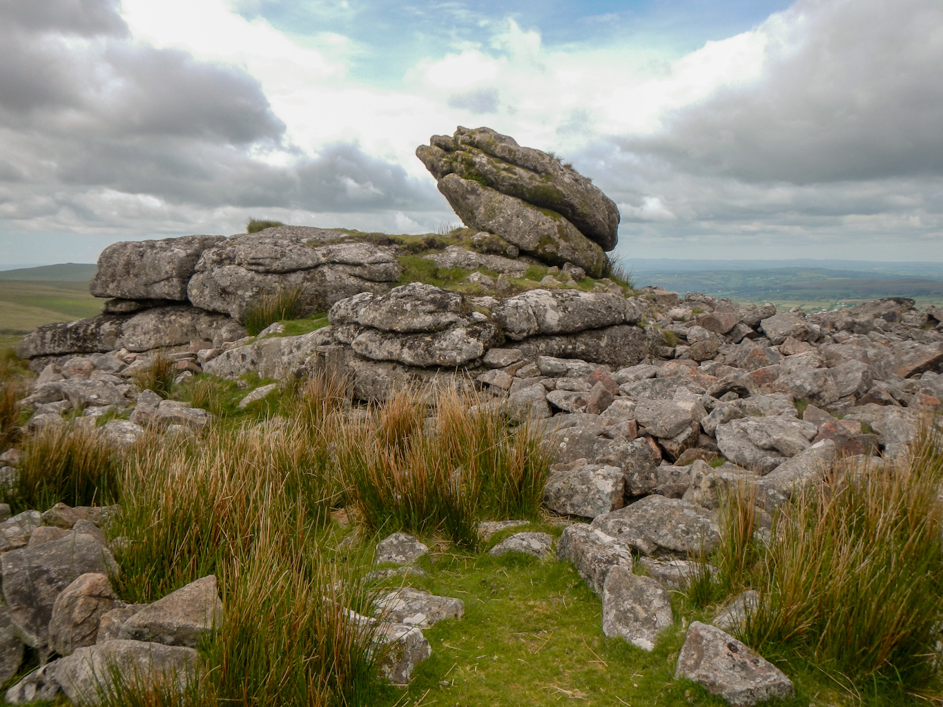
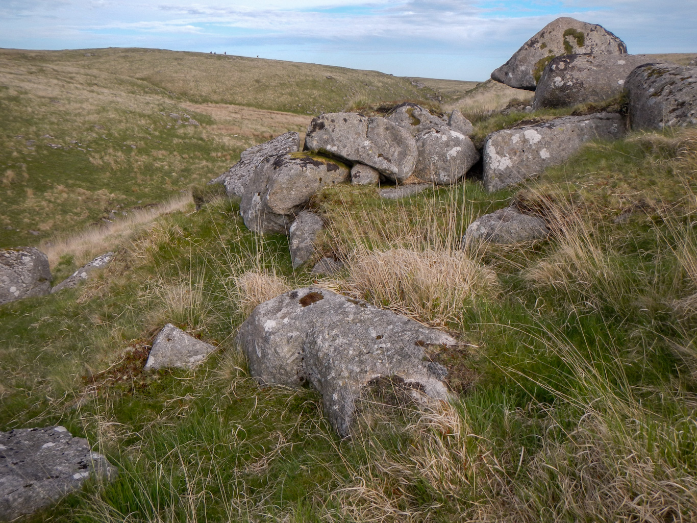
I walked on across the moor, soon finding Wacka Tor – a prominent outcrop but not marked on the Ordnance Survey map.

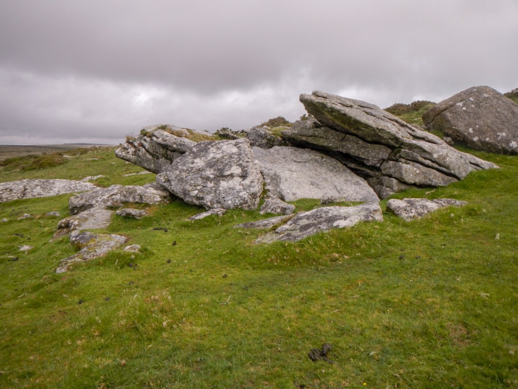
My next objective was Old Hill Rocks – these aren’t on the LDWA list but are in the Tors of Dartmoor database – https://www.torsofdartmoor.co.uk/tor-page.php?tor=old-hill-rocks This was where I ate lunch, with a view east towards the Avon valley.
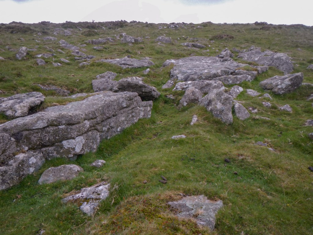
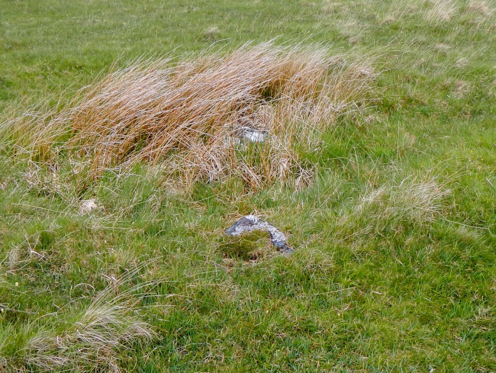
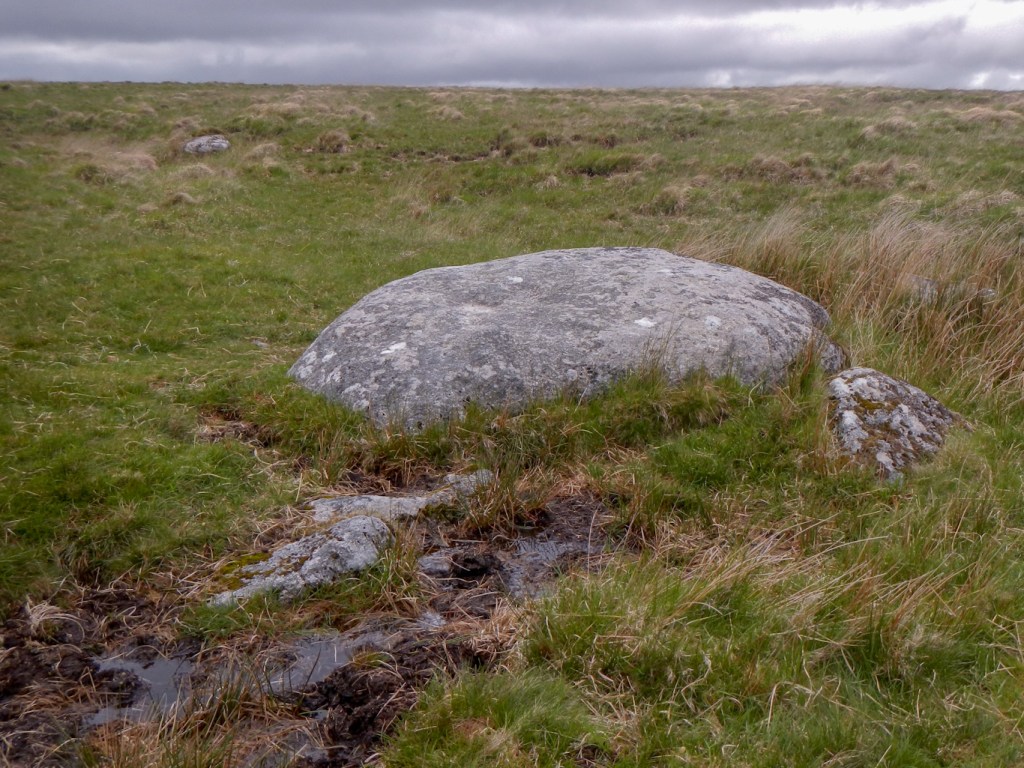
Zeal Rocks on the LDWA list aren’t on the Tors of Dartmoor database. This should have sounded warning bells as the database is incredibly comprehensive. I arrived at the given map reference and took a photo of what was there.
I’d already spotted a group of walkers on the disused tramway to the west and that was where I was heading to follow it and meet up with the Two Moors Way route. One person at the back seemed a long way behind. However I caught the group as they were donning waterproofs for a shower that turned out to be over almost as soon as it started. I still had my jacket and waterproof rucksack cover in place so didn’t need to stop. It became evident that the backmarker was a supervisor, trailing the group. I thought that they had headed south on the Two Moors Way but in fact they were following me and even turned off on the same route as me towards Red Lake Ford. Evidently they did better than me at finding the path and managed to pass me as I was bog hopping over tussocks.
After I stopped at Cracker Stone (not on the LDWA list) they were well ahead of me, not to be seen again.
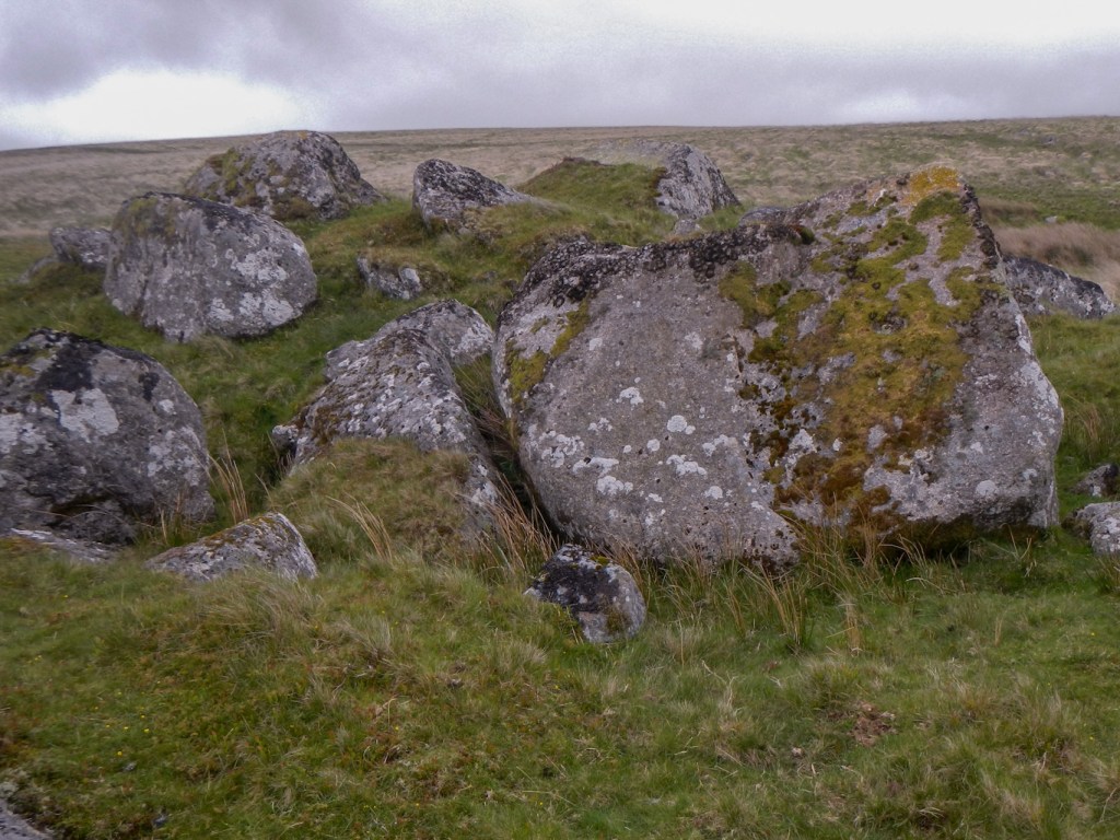
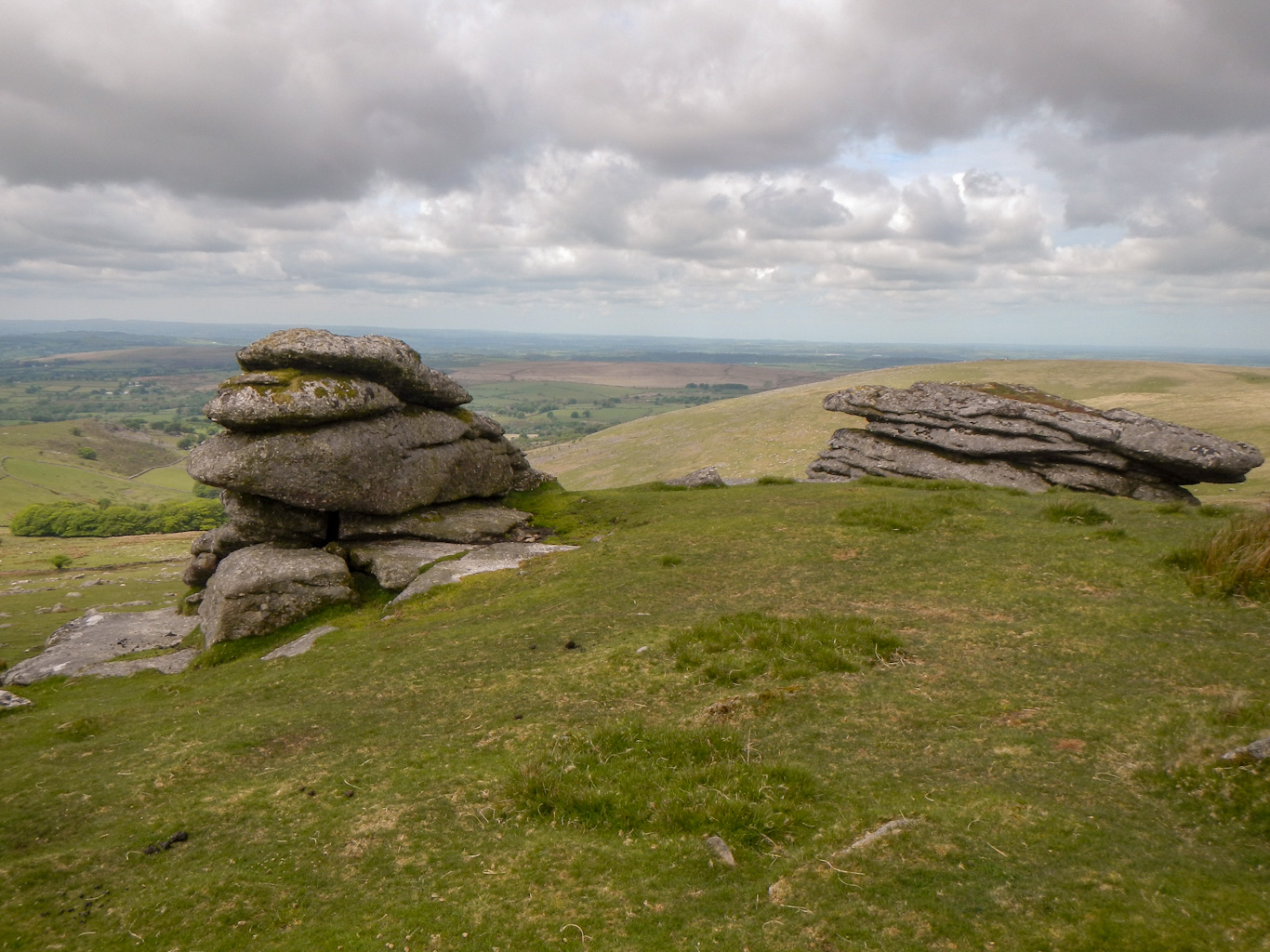
A further similar large group (with a supervisor in tow) passed me as I was taking photos of Erme Pits Rocks. That’s not on the LDWA list either.
My next objective was to find the inscribed “A Head” stone – I had the ten figure grid reference. I definitely found the right stone as it’s so similar https://www.torsofdartmoor.co.uk/tor-page.php?tor=a-head-stone but missed the inscription.
I’m also sure I found the “Broad” stone and thought I could see a faint inscription on it – but my close up photo didn’t pick it up so I’ve just included the photo of the whole stone.
With all the time spent looking for stones, it was getting late so I headed directly for Plym Steps where I crossed the river easily and looked for a camp spot on the other side. Soon my tent was up and water collected ready to “cook” dinner. Unfortunately that was the time when the cattle on the other side of the river decided to cross at Plym Steps too. They looked very frisky so I threw everything back into my rucksack and took my tent down. The cattle were ever closer as I made an escape bid, carrying my packed tent to save time needed to fit it back into my rucksack.
I fled upstream around the base of Lower Hartor. The cattle if anything seemed to be heading the opposite way and may have gone straight past my camp area anyway – but I wasn’t taking chances.
My trekking poles were packed as were my gaiters. Unfortunately the ground was marshy and somehow I ended up stepping into some water – fortunately not muddy, smelly bog water. Retrieving myself from the predicament, my trousers were soaked up the entire leg length. Luckily I managed to hold my tent out of the water.
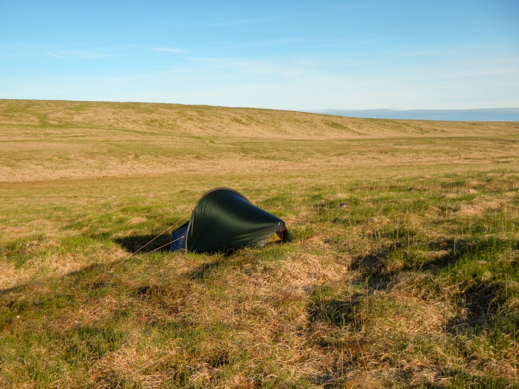
I made my way on to higher ground and found a camping spot just south of Evil Combe, overlooking Calveslake Tor across the river. I was able to wring water out of my trousers, socks and walking boots. Despite my sodden state there was nothing for it but to pitch the tent again and set up the stove. I put my trousers on a rock to dry but then realised they’d dry more quickly on me. Thank goodness for modern easy dry fabrics!
I was certainly ready for my soup, bolognaise (rehydrate in the bag) followed by a generous portion of dried fruit and coffee.
The night was magnificently clear with a wonderful star spangled sky, free of light pollution. Fortunately the cattle at Calvelake Tor showed no signs of wanting to cross the river.
Despite my late finish, I was up early – although not at the crack of dawn as first light is before 5am. It was a lovely dry day, although with some morning chill. My trousers stashed in a polythene bag overnight to avoid making the inside of the tent wet, were almost dry; not so my boots – but I’ve had worse and at least I had spare socks.
I made my way towards Princetown. Lots of tents were pitched near Nun’s Cross Farm – I wonder whether that was the groups that had passed me the previous day.
I passed the Plume of Feathers and campsite – sadly now closed seemingly a casualty of Covid. The route past North Hessary Tor, Rundlestone and Great Mis is familiar to me so I didn’t need to look at the map. I skirted Great Mis, heading directly to Dead Lake Foot apart from giving a solitary bovine a wide berth. I was able to cross the River Walkham easily in these fairly dry conditions and noted another walker making the crossing just upstream. From that point it was just a case of walking on a compass bearing to Lynch Tor, where I enjoyed lunch whilst admiring the view west towards Mary Tavy and Lydford.
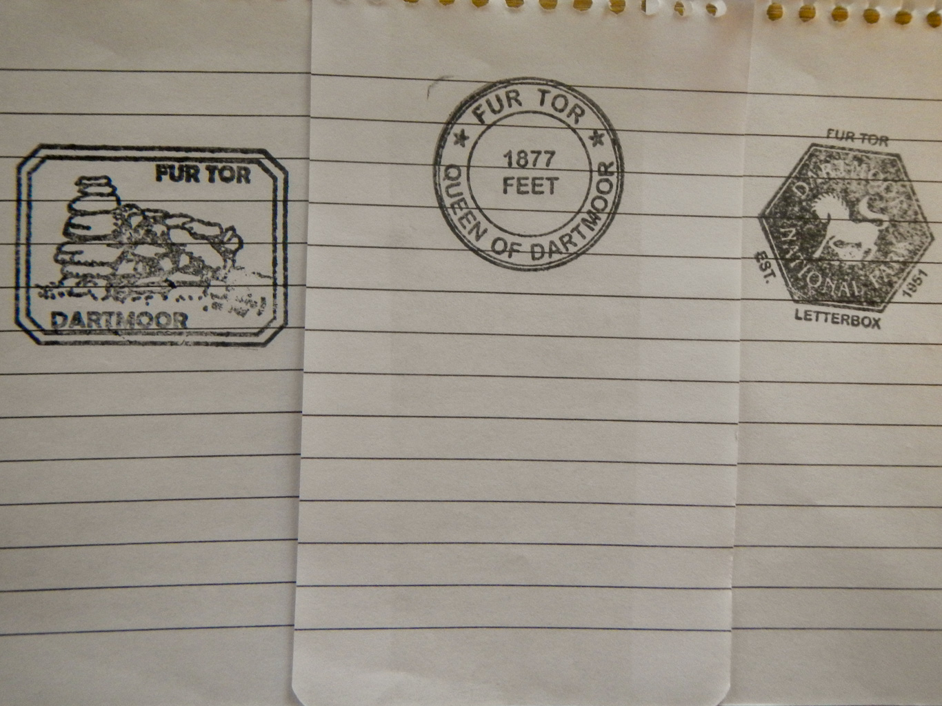
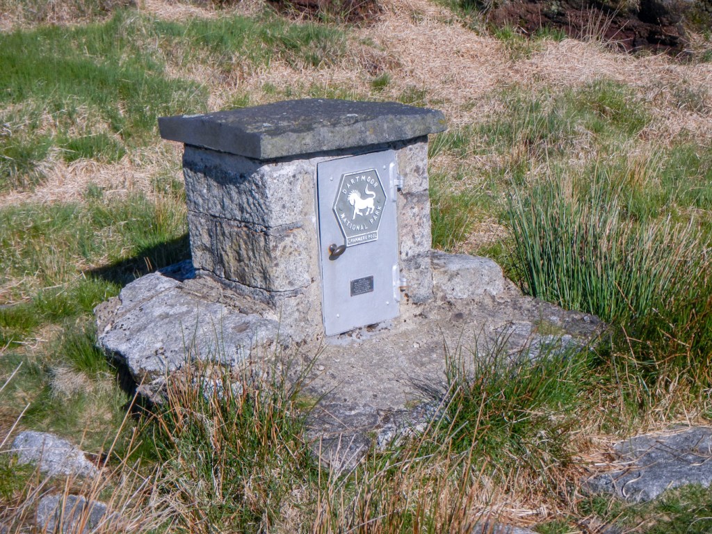
After lunch, I turned towards the main moor. Fur Tor is huge and I could see it on the horizon. Notwithstanding the ease of route finding, it’s a long trek across featureless moor. Two walkers were leaving as I began my push uphill to reach 572m. The views on this clear day were excellent. Luck was on my side and quite by chance I noticed a black box under an overhanging rock. It was an incredibly well kept Dartmoor letterbox complete with three rubber stamps including one proclaiming the tor as the queen of Dartmoor and a very impressive bound visitors’ book. I’ve visited Fur Tor and bagged it previously but didn’t find the letterbox that day.
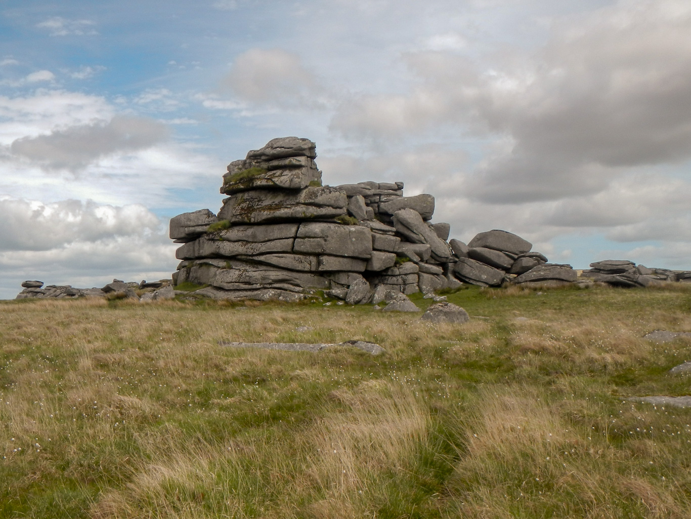
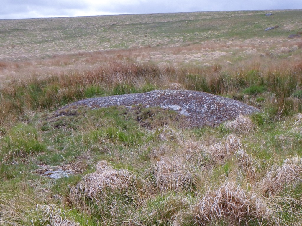
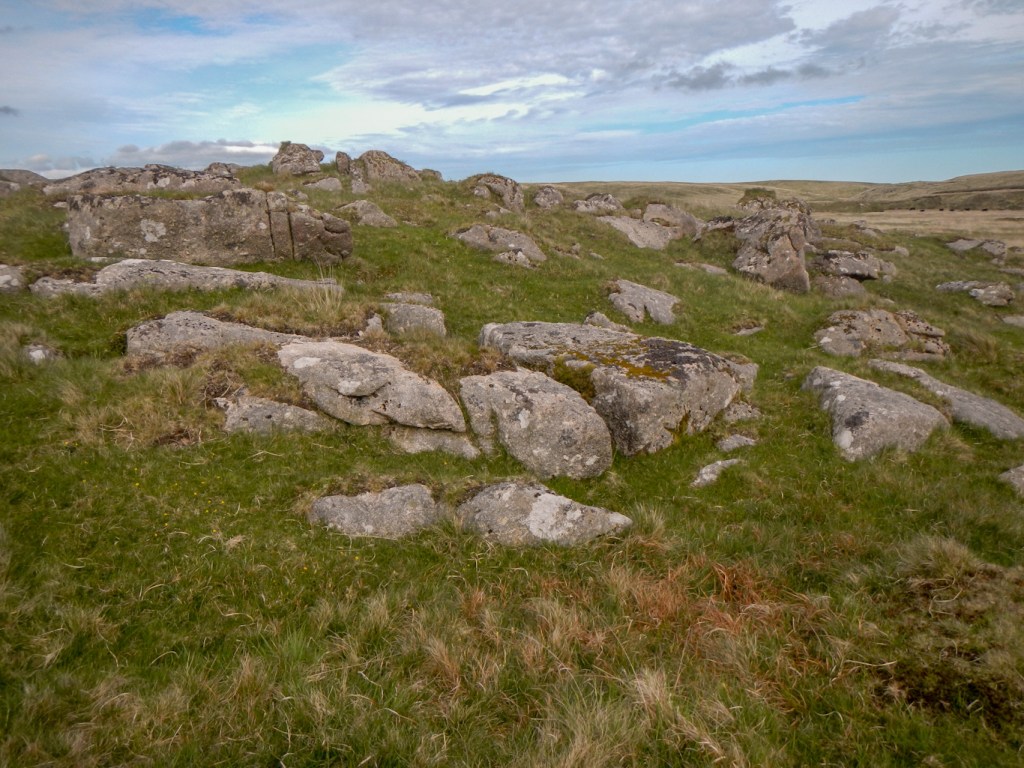
Soon I was on my way again contouring as much as possible towards Cut Hill Outcrop. It’s neither on the LDWA list nor marked on the OS map. However the Tors of Dartmoor database notes a possible letterbox under the platform. I found the platform easily but sadly no letterbox.

I headed further east across tussocky moorland, thick with bog grass, crossed Cut hill Stream and reached the East Dart more or less opposite the obvious Kit Rocks outcrop. As I crossed the stream on some well placed dry stones a couple of walkers reached the same spot and crossed after me.
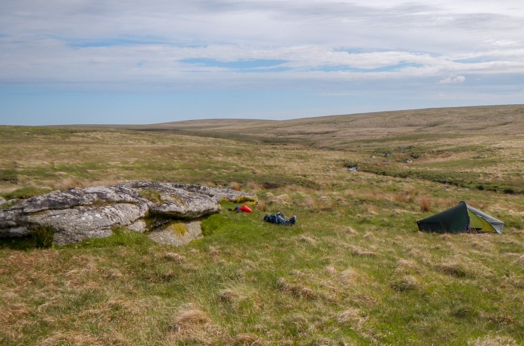
Kit Rocks looked a wonderful camp site – there was just enough flattish grass for me to pitch my small tent plus near to water, good views and no cows anywhere near. It was a great spot to air the tent and enjoy a brew. After my refreshment I left my sleeping bag, mat, spare clothes and stove in the tent and headed off to explore the rocky outcrops just downstream.
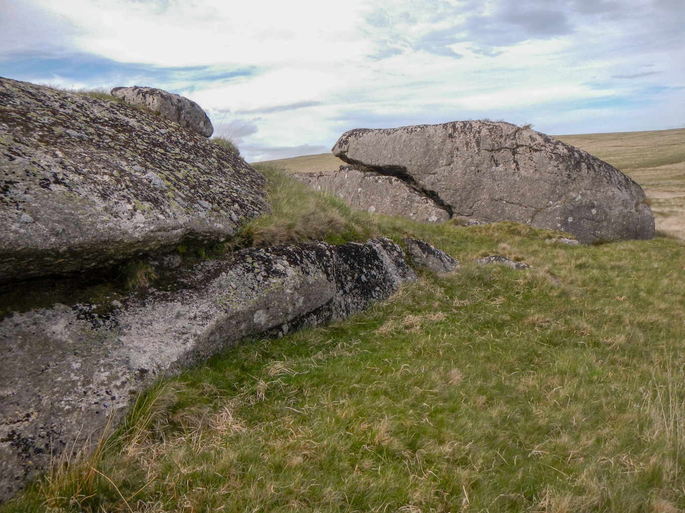
At Kit Steps I re-crossed the river to reach Broada Stones and Sandy Hole Rocks North. I also looked down river towards Sandy Hole Rocks South, but decided it was time to turn back given I had left my tent unoccupied.
I saw some cows, but they appeared to be all on the west side of the river and a comfortable distance away from my campsite anyway. I cooked and ate my meal, collected water ready for the morning and all seemed well. it wasn’t until just before 8pm that I noted some cattle gradually approaching. They retreated and then re-approached but overall their direction of travel seemed towards me. I certainly wasn’t keen on the hurried type of escape I had made the previous evening – besides which I was settled and it would take longer to pack on this occasion.
Eventually (well actually only after a short time) I made the difficult decision that I needed to move on before darkness fell. I packed quickly but carefully so I could fit everything in the rucksack. The obvious direction of travel was to head north, starting my walk planned for Sunday – either that or head for Fur Tor where I know there is space to camp but I wasn’t certain I could get to Fur Tor before dark and it would put me further back for the next day.
It was a lovely evening and the sunset was stunning, but I had more on my mind. I walked over a lot of marshy ground with thick layers of long grass as I followed the upper East Dart valley northwards. I was anxious to get my tent up again before dark so headed further east to some higher ground. I found an area where the ground was firm enough to take my tent pegs and the long grass not too thick. It was really just a random spot in an expanse of moor.
At least I’m getting plenty of practice putting up my tent. The night past uneventfully except that I’m sure a fox came close to my tent. The early morning sky was a stunning mix of colours. When I woke it was very clear with plenty of sun so my tent aired out well as I ate breakfast. Despite being in such a generally boggy area, even the footprint seemed dry when I packed it away just before 08.00.
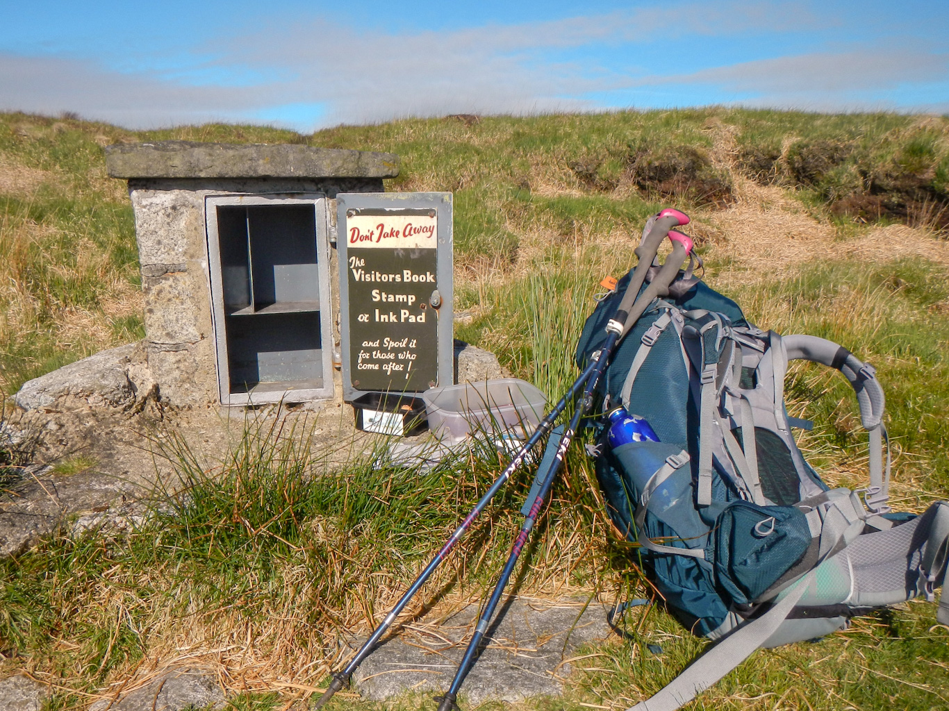
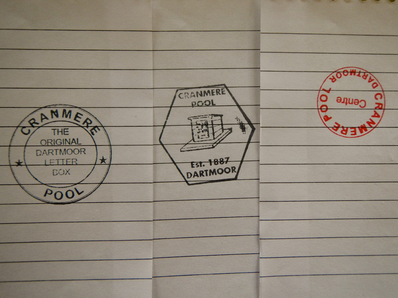
I think I was first visitor of the day to Cranmere Pool letterbox. It was so easy to find in conditions with excellent visibility. The rubber stamps had increased from two to three since my last visit at the end of November 2020 and there was an impressive bound Visitors’ Book just like the one on Fur Tor. There were also two stamped addressed envelopes – I couldn’t tell from the book when they’d been left but I took them to post as is traditional. I put them in a Royal Mail post box in Exeter yesterday evening so they should be winging their way to Cerne Abbas now. As I left the site, I saw another person appearing from the west – in the amazing fine weather yesterday I’m sure the centre of the moor was well visited.
It’s a pity the cows hadn’t “moved me on” an hour or so earlier as I could have reached Cranmere Pool to camp – I’m sure that in the current dry conditions I would have found a large enough dry spot.
I made my way north – picking up a path which, although faint at times, took me straight to the track at Ockerton Court. It had taken me less than twenty minutes from Cranmere Pool.
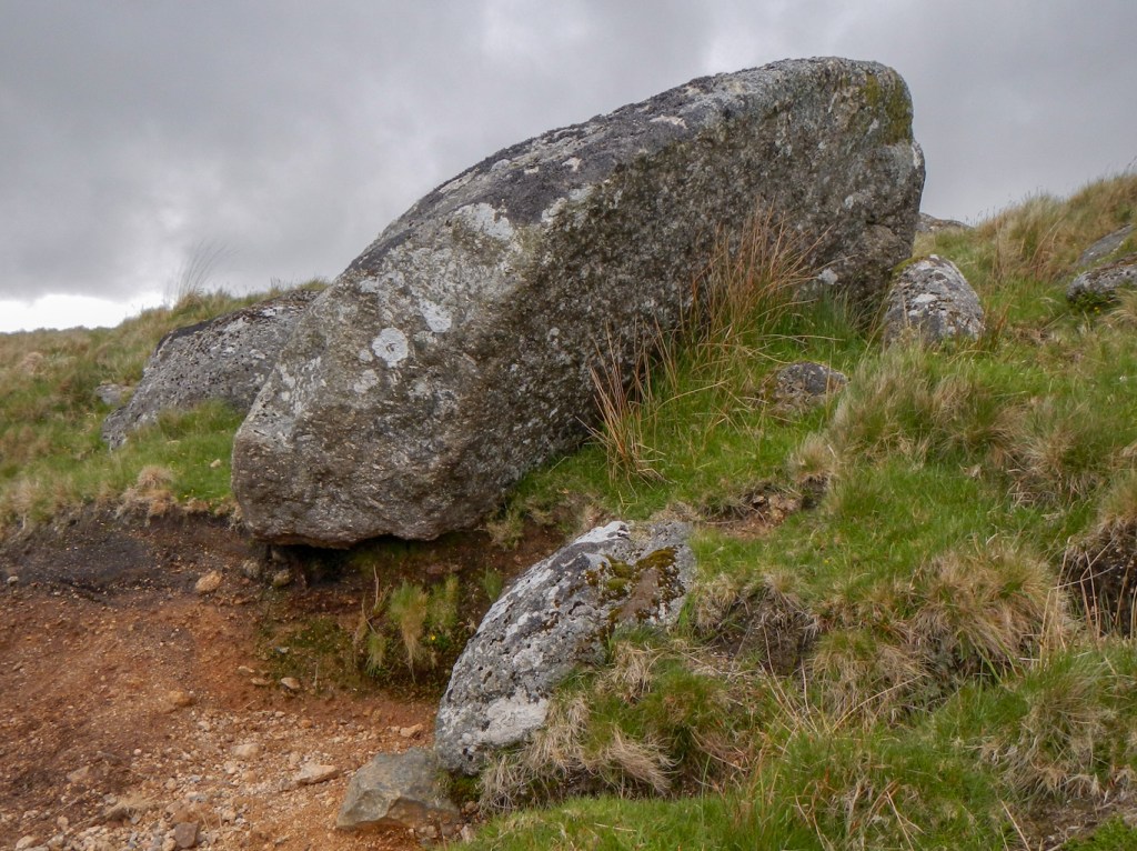
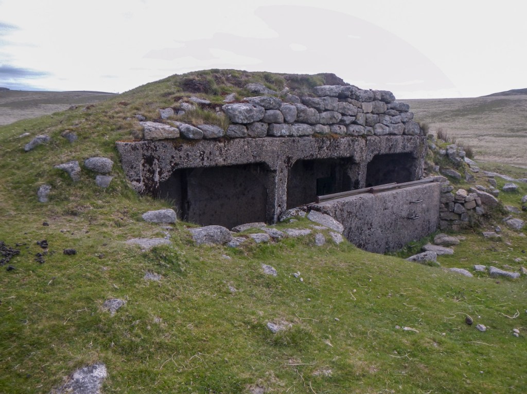
I’m not sure why I’d never previously climbed up to Little Hill. It’s a prominent outcrop just after the ford on the track to East Okement Farm. Not only is there the granite tor but also an early twentieth century covered shelter built into it by the military.
As I regained the main track, I met a fellow backpacker who had spent the night on Steeperton Tor and was rushing home “in time for Sunday dinner”. He asked where I had camped and was fairly dismissive of the cow problem having camped near cattle in the past. I’ve just checked on-line and read some scary stories, so I’m not going to change my mind!
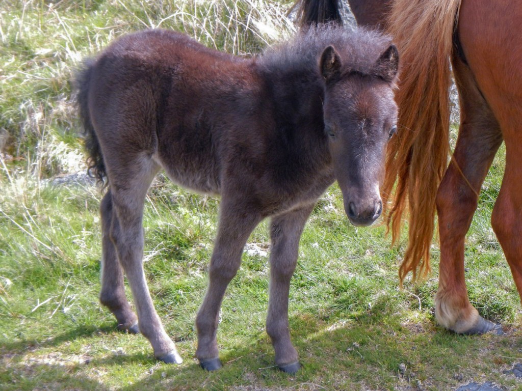
It was so warm that I was soon down to my T shirt and even applied sun protection cream. I met some very docile looking ponies and photographed them. As I walked on the track towards Belstone, I overtook a very valiant young man carrying two backpacking rucksacks – his partner who was limping behind had injured her leg from “too much walking yesterday”. Thankfully they were nearly back at their car.
I turned off the track to go more directly towards Okehampton, not missing the opportunity to bag Cleave Tor, with a short diversion. On my way I stopped at the side to let a horse and rider pass the other way. The friendly rider stopped and asking where I had walked commended my “bravery” for venturing on the moor alone overnight – citing the cows so I recounted my tale. Cleave Tor is very imposing but strangely not a granite tor. There are superb views from the top and a large grassy area that looked cow-free. Having checked, I see it is in the permitted camping area.
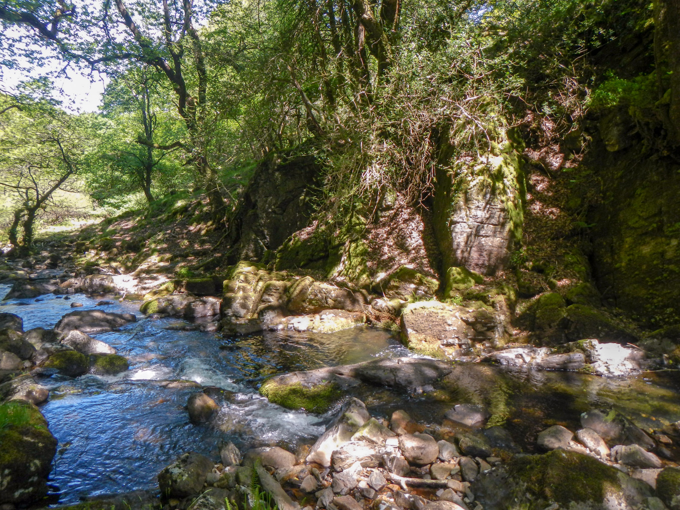
From there, it was downhill to the footbridge over the East Okement and then steeply through the West Cleave Gorge. I spotted an impressive waterfall.

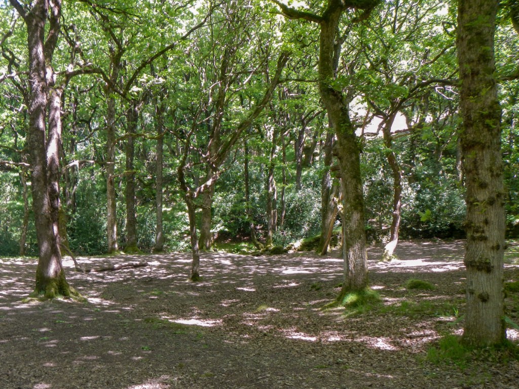
Even if I kept walking, I would miss the next train so I stopped for lunch rather than have to wait over half an hour at the railway station. It was lovely and shaded in the wood.
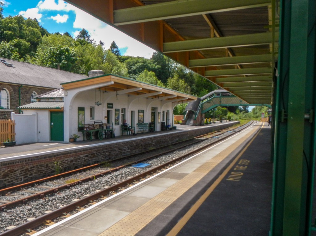
I wasn’t expecting such a big upward climb on the path running near the A30. However eventually I reached the footbridge over the busy dual carriageway and was soon at Okehampton Station. The station buildings are impressively traditional in appearance. It looks like it’s a popular journey now with numerous people waiting for the train even in the middle of a Sunday afternoon.
In the end a memorable expedition – bagging eight more tors on the list as well as several not on the list, and visiting two of the most traditional Dartmoor letterboxes. I’d rather not have met so many cattle, especially near where I wanted to camp but at least none of the encounters had proved too close for comfort – merely inconvenient.
