28-29 April 2022
A short stay in Southwold gave me two full days to explore this part of the UK with my husband on our first visit to the area. I designed / adapted circular walks both north and south along the coast paths and wetlands then completed the circles by walking inland over lowland heath and through forested areas. The whole expedition was within the Coasts and Heaths Area of Outstanding Natural Beauty – a nationally significant landscape, on par with a National Park.
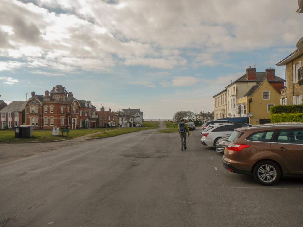
The town of Southwold itself includes many fine Georgian, Regency and Victorian buildings, interspersed with green spaces, thought to have been left as fire breaks following a fire that destroyed the town in 1659.

Adnams Brewery, opened in 1872, is prominent in the centre of Southwold and the various craft beers including the best selling Ghost Ship are easily available in the area.
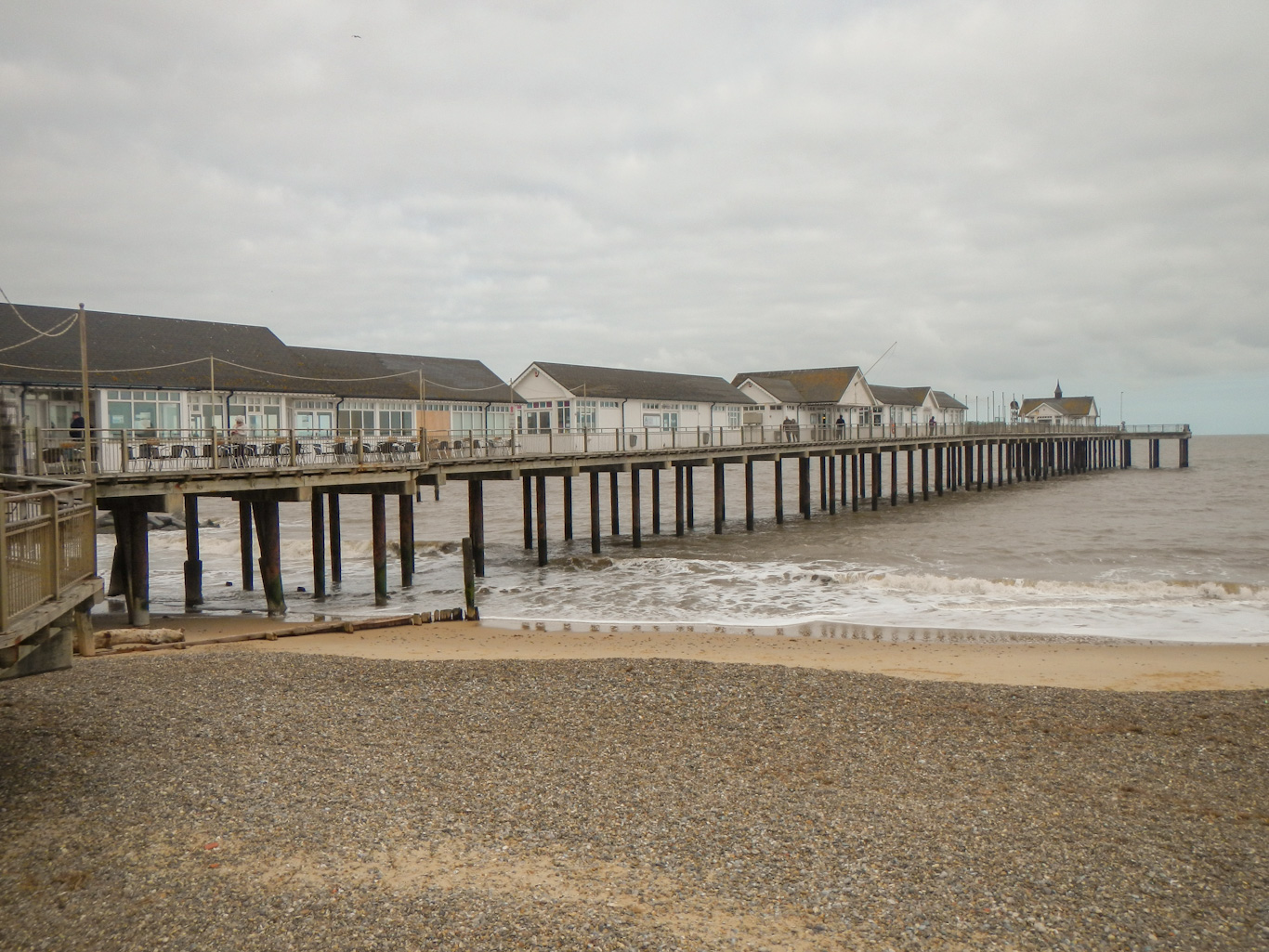
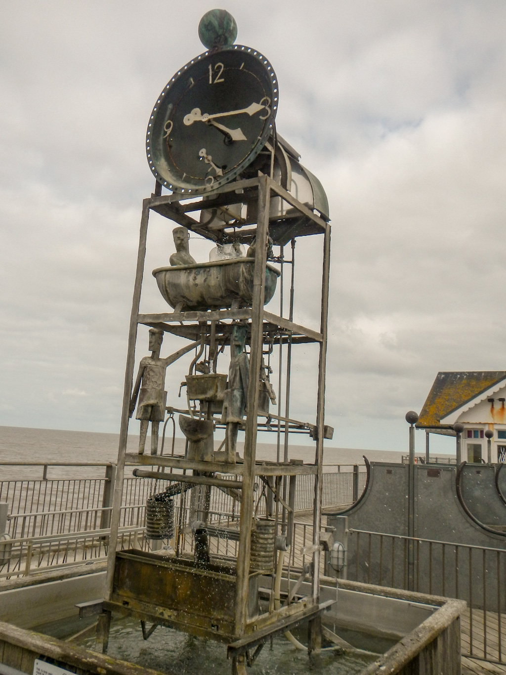
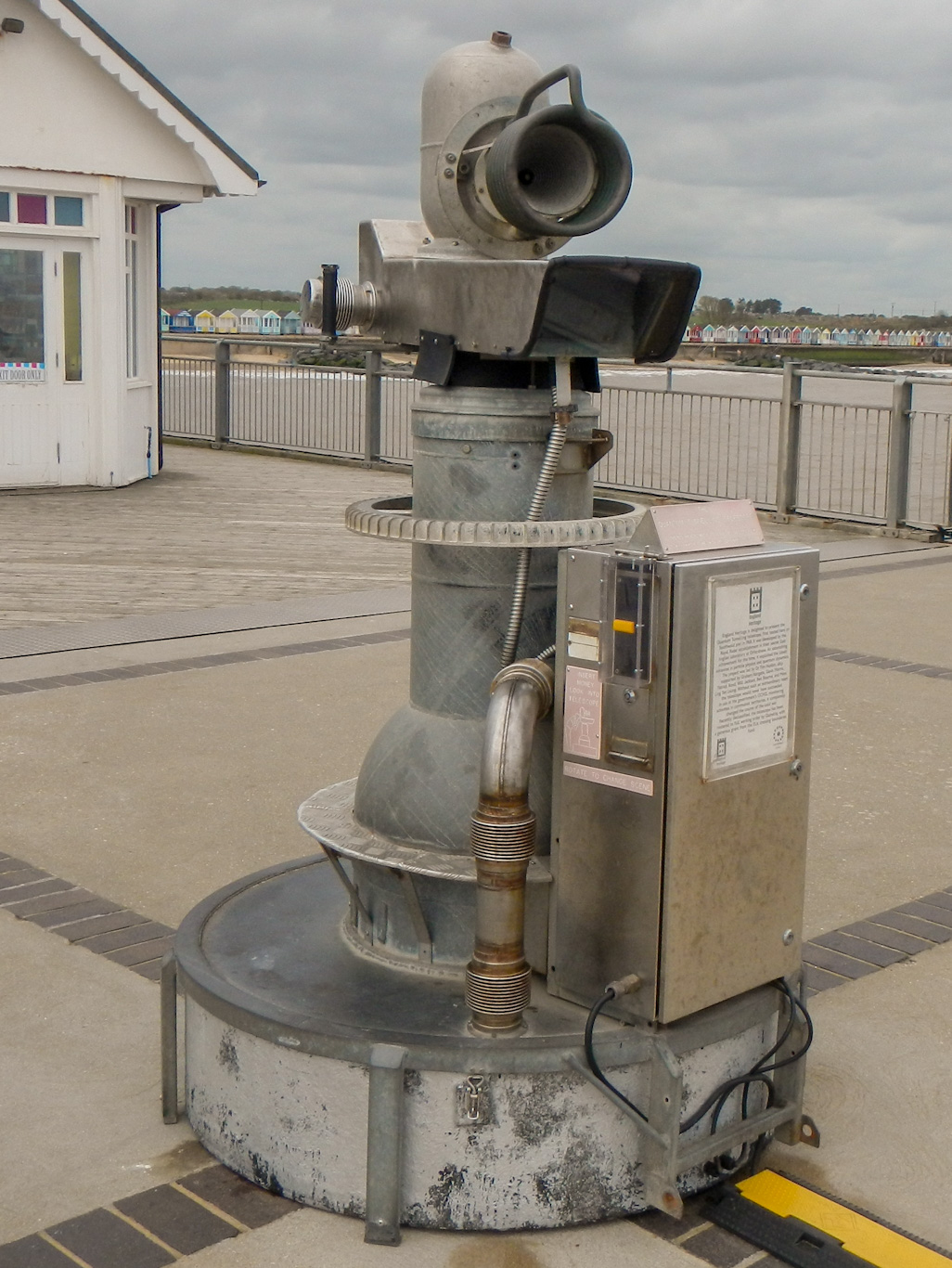
Southwold Pier is certainly worth a visit too – wooden buildings and traditional amusements evoke memories of past seaside holidays.
The pier is approached past a building with a wall covered by an enormous mural celebrating George Orwell’s links with the town.

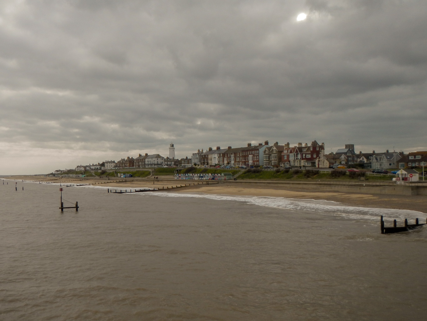
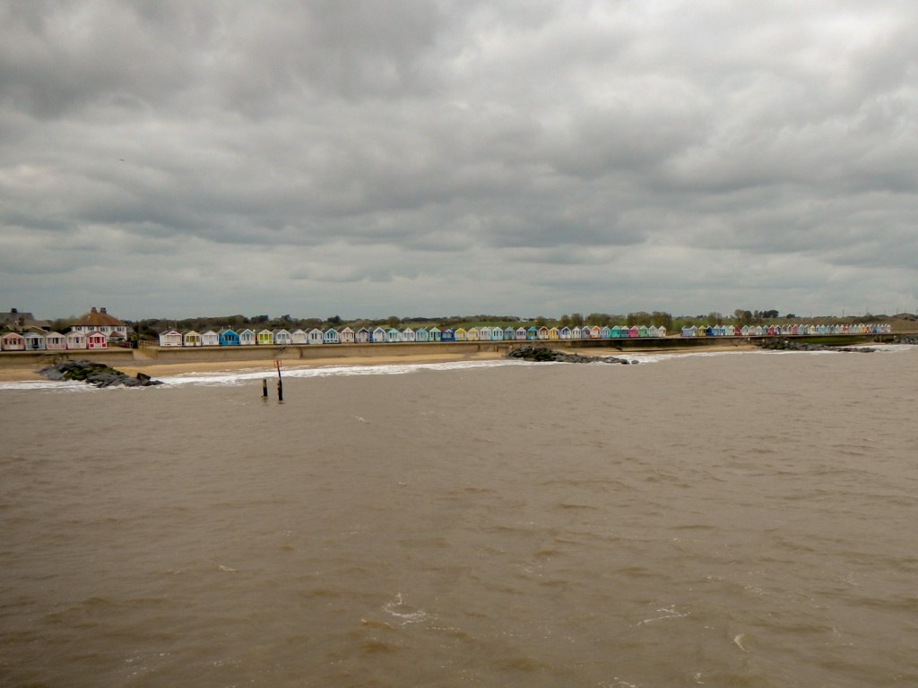
Multiple brightly painted beach huts complete the impression of the traditional seaside holiday.
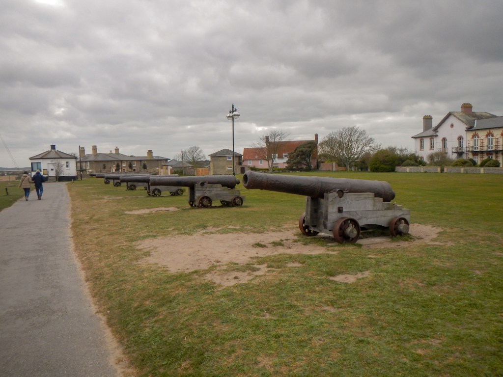
There is a wonderful view of the coastline from Gunhill Cliff, where the ancient town defences were located – the cannons were presented to Southwold by the Royal Ordnance in 1746.
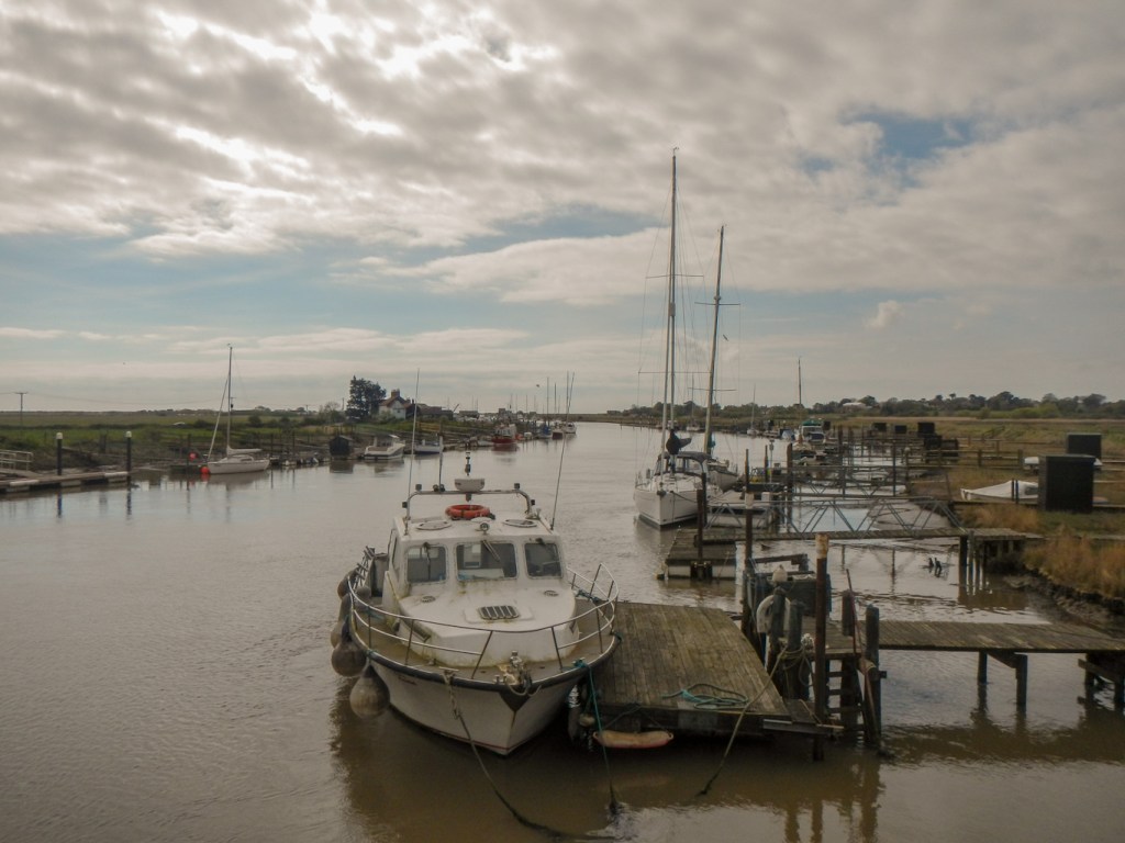
Southwold Harbour continues to be used by small fishing boats – it’s possible to buy fish from small kiosk shops on the harbourside. There are also many pleasure craft moored and the whole area is a hive of activity including small boat yards.
Our first main walk led south crossing the River Blyth on the Bailey bridge (bridle path) and then following the riverside path to Walberswick. A flood marker on a shed is a reminder of the vulnerability of this low lying land.

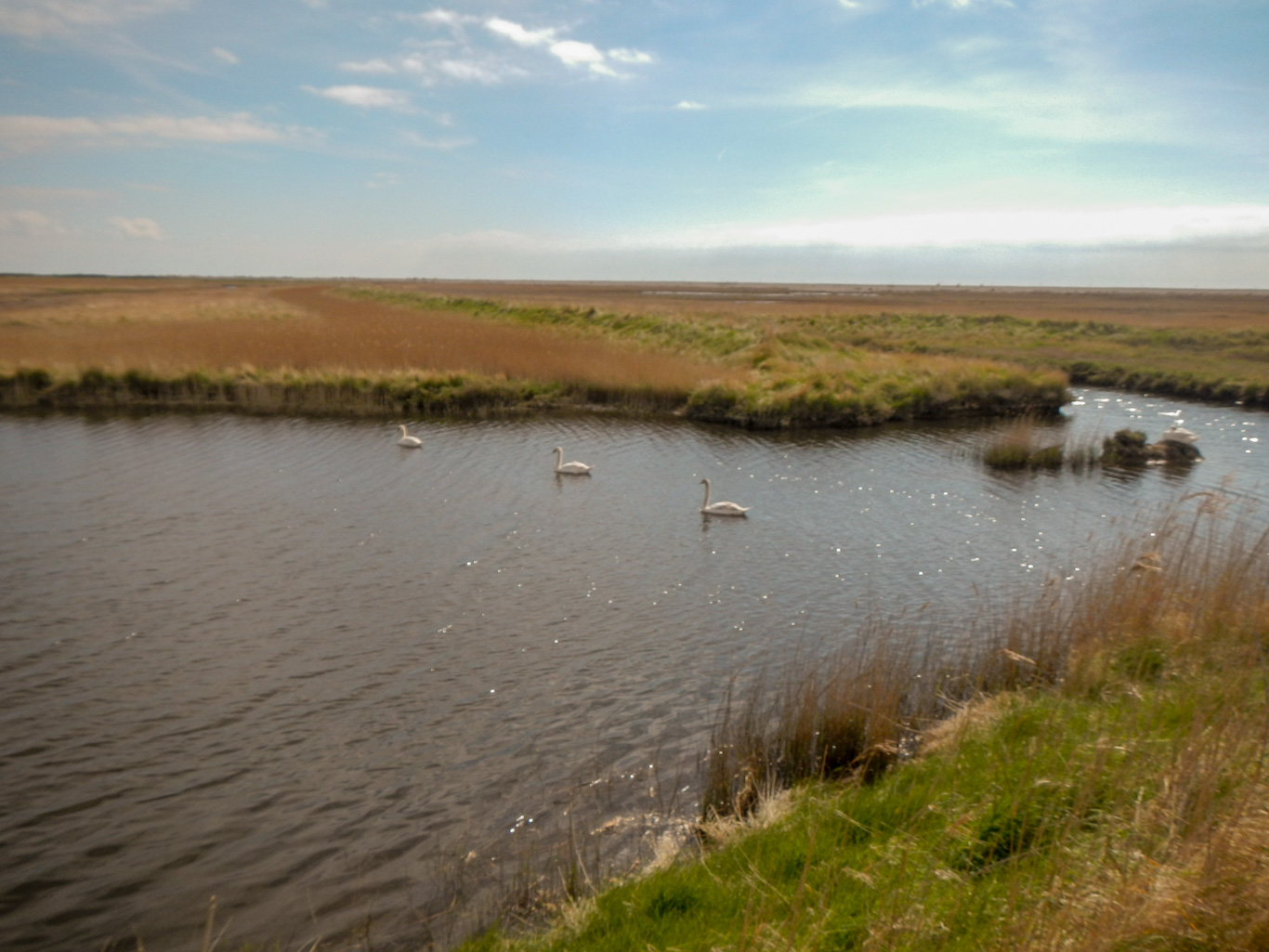
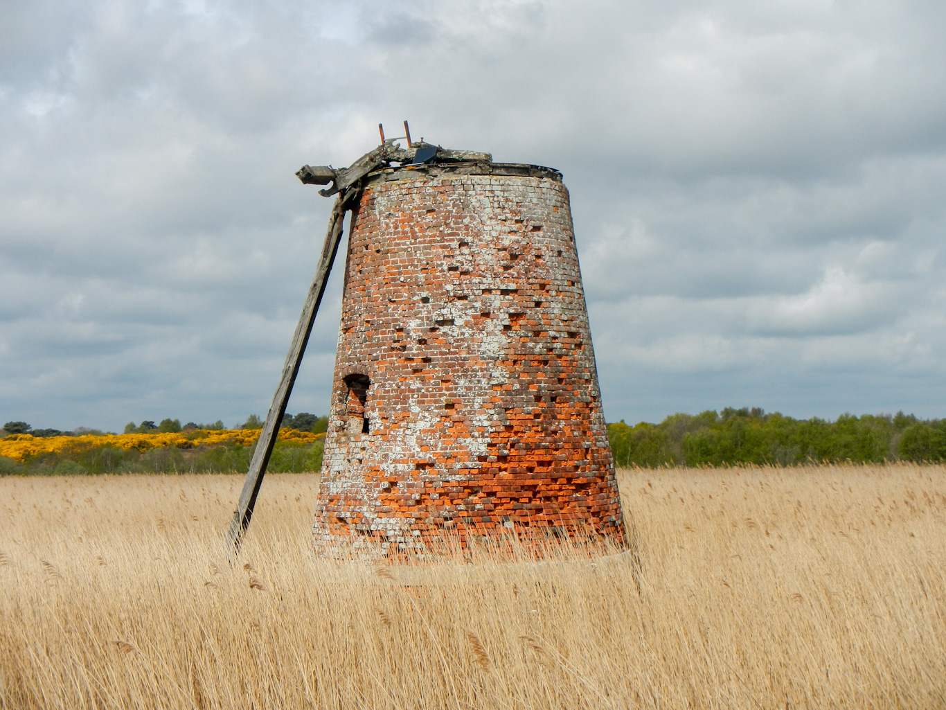
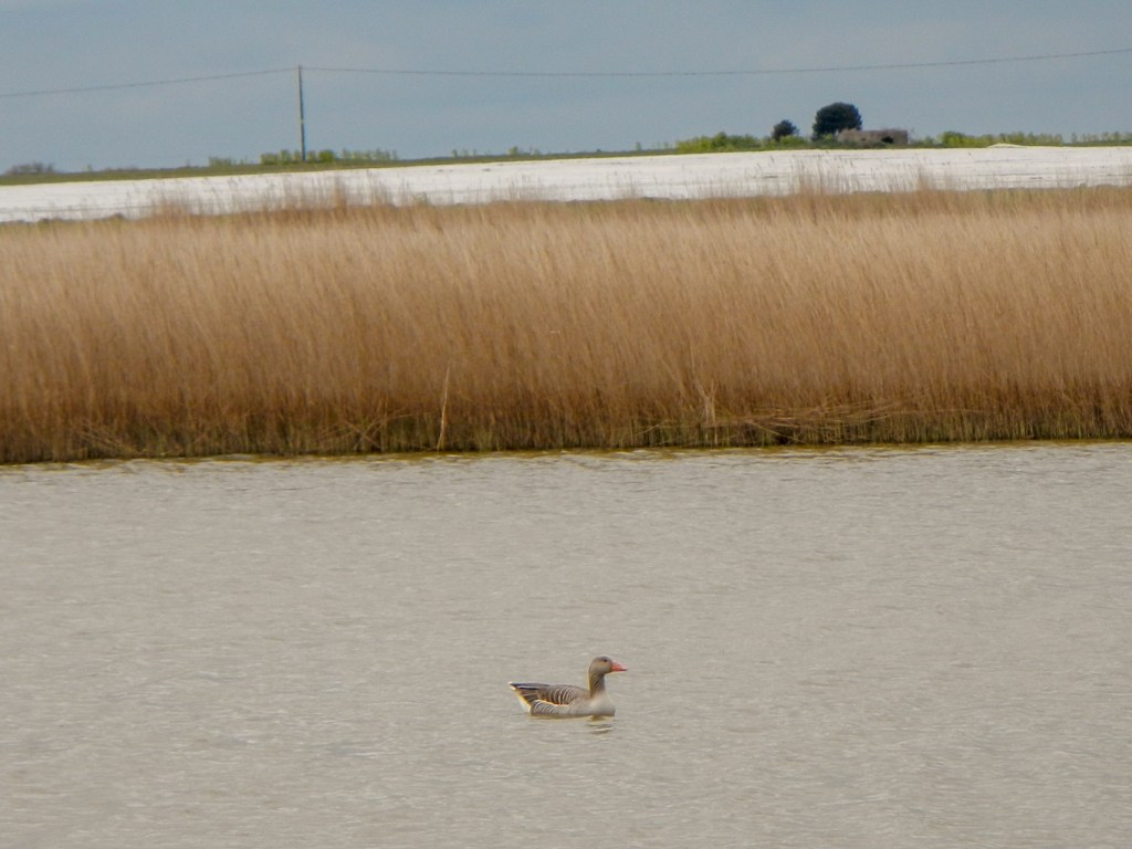
We continued to follow the Suffolk coast path over Westwood Marsh. We spotted several swan families and passed the derelict late eighteenth century mill. It was a three storey mill with a scoop wheel and also used to drive a pair of mill stones to grind feed for horses.
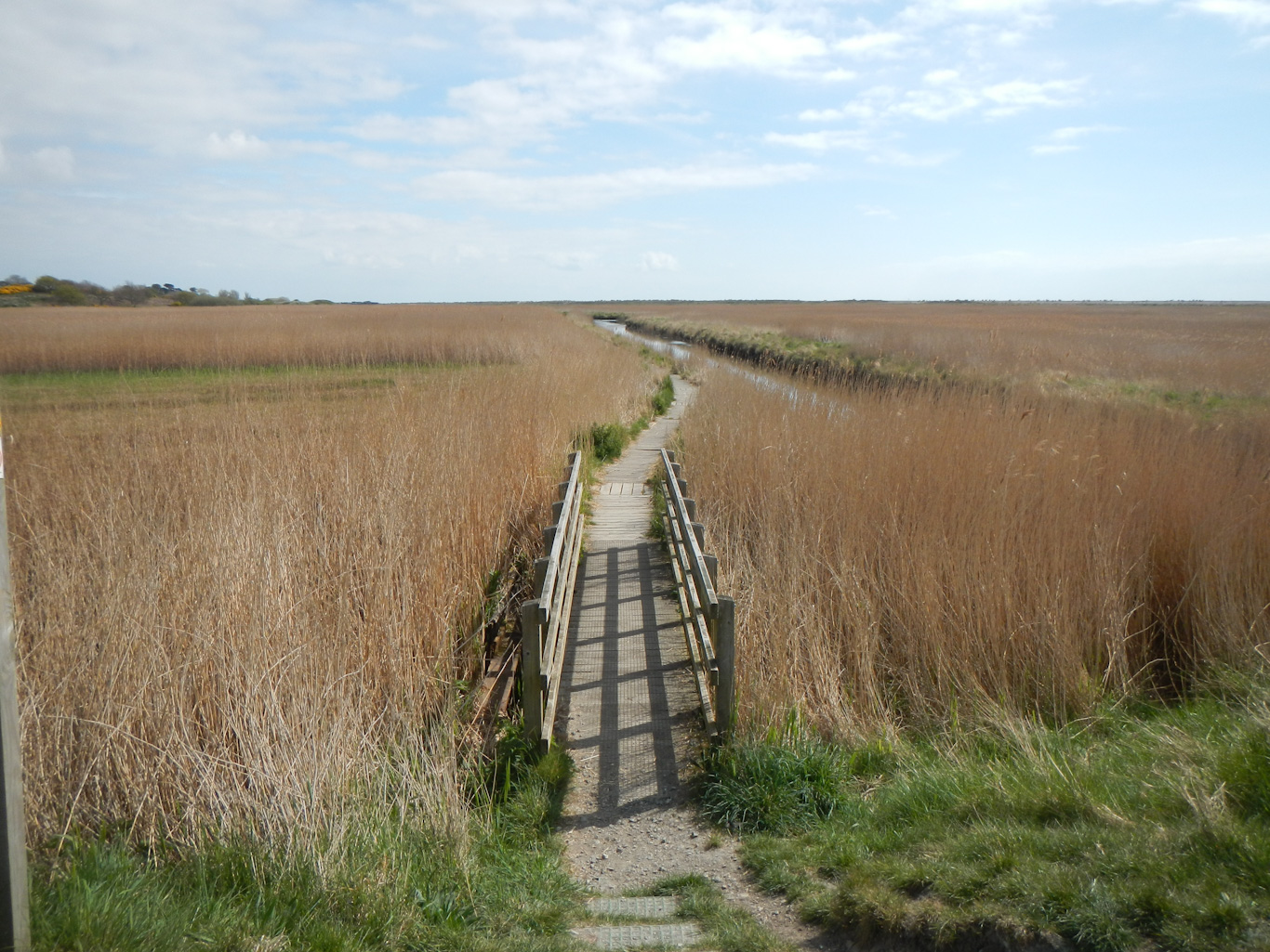
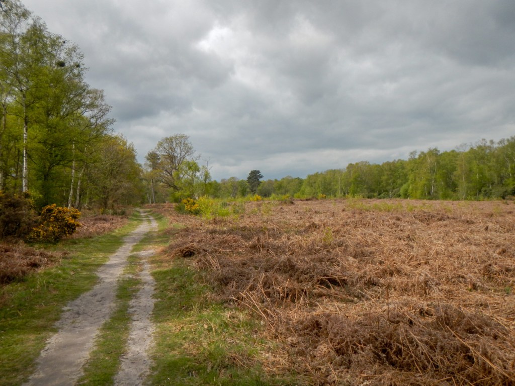
Our path skirted the edge of Dunwich Forest before reaching the village of Dunwich and its beach.

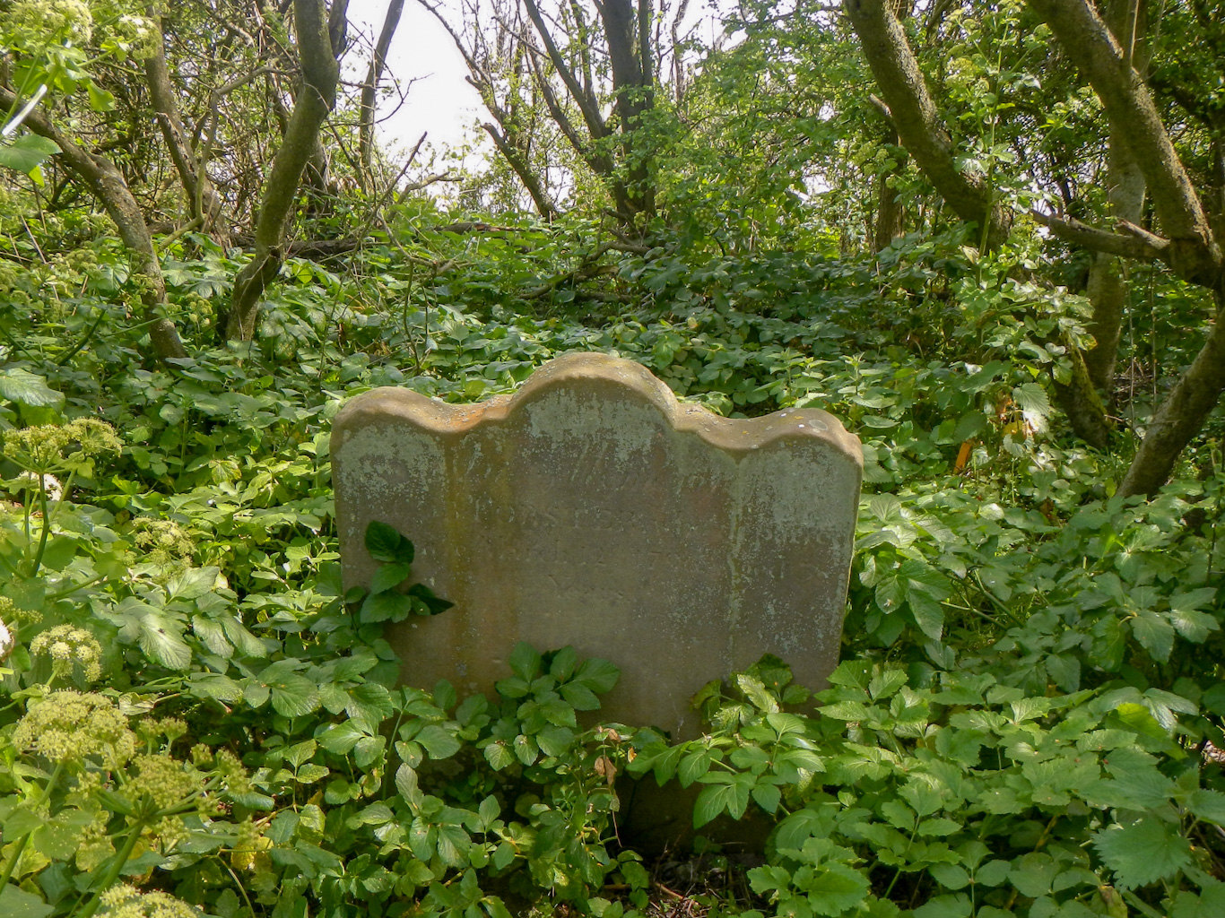
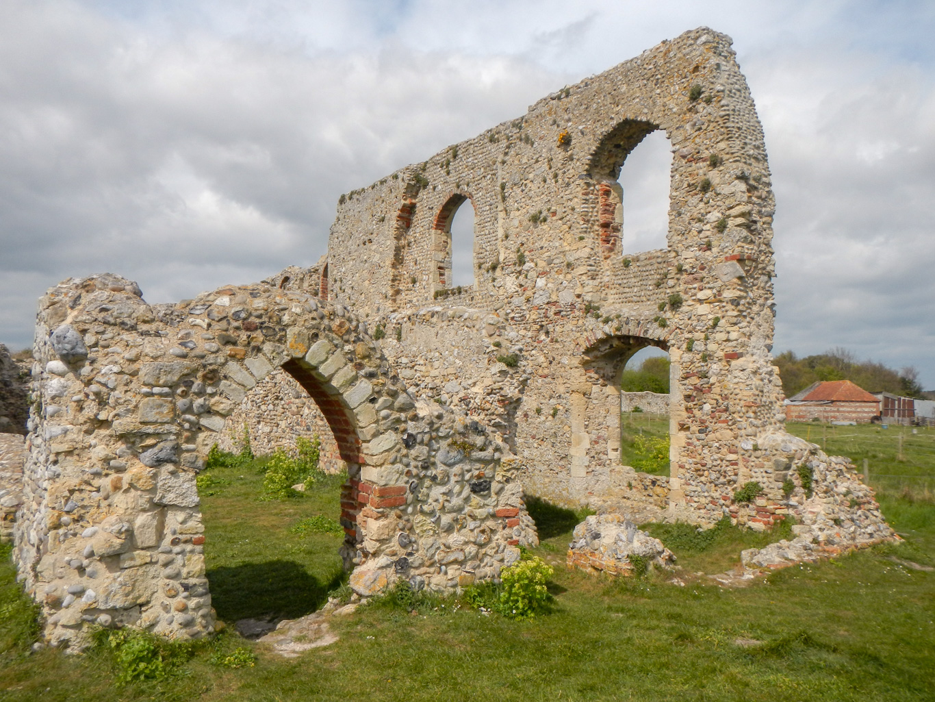
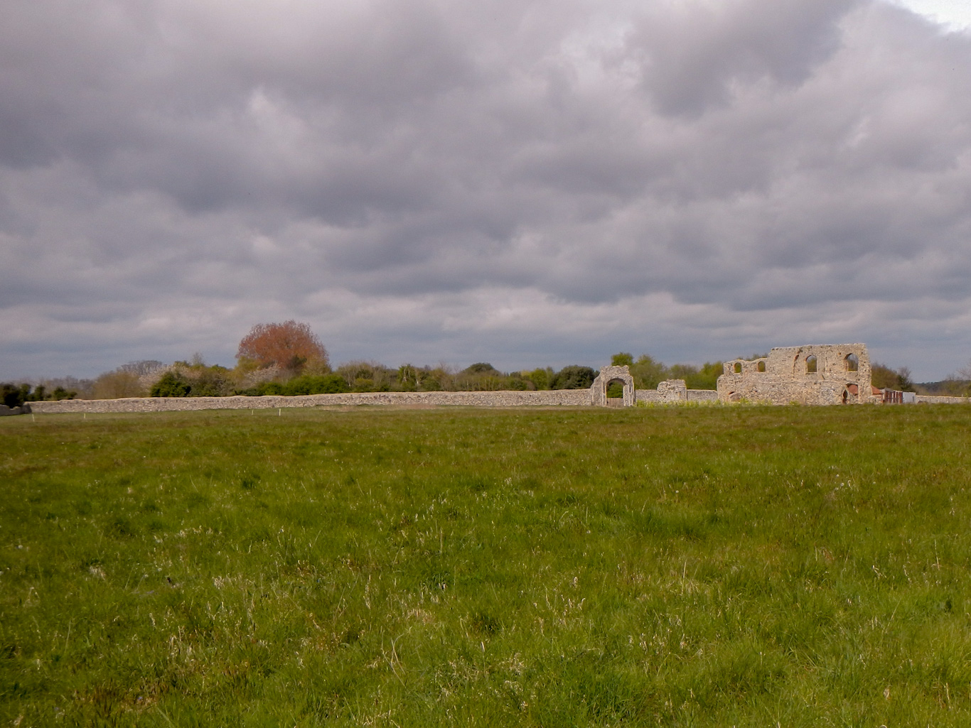
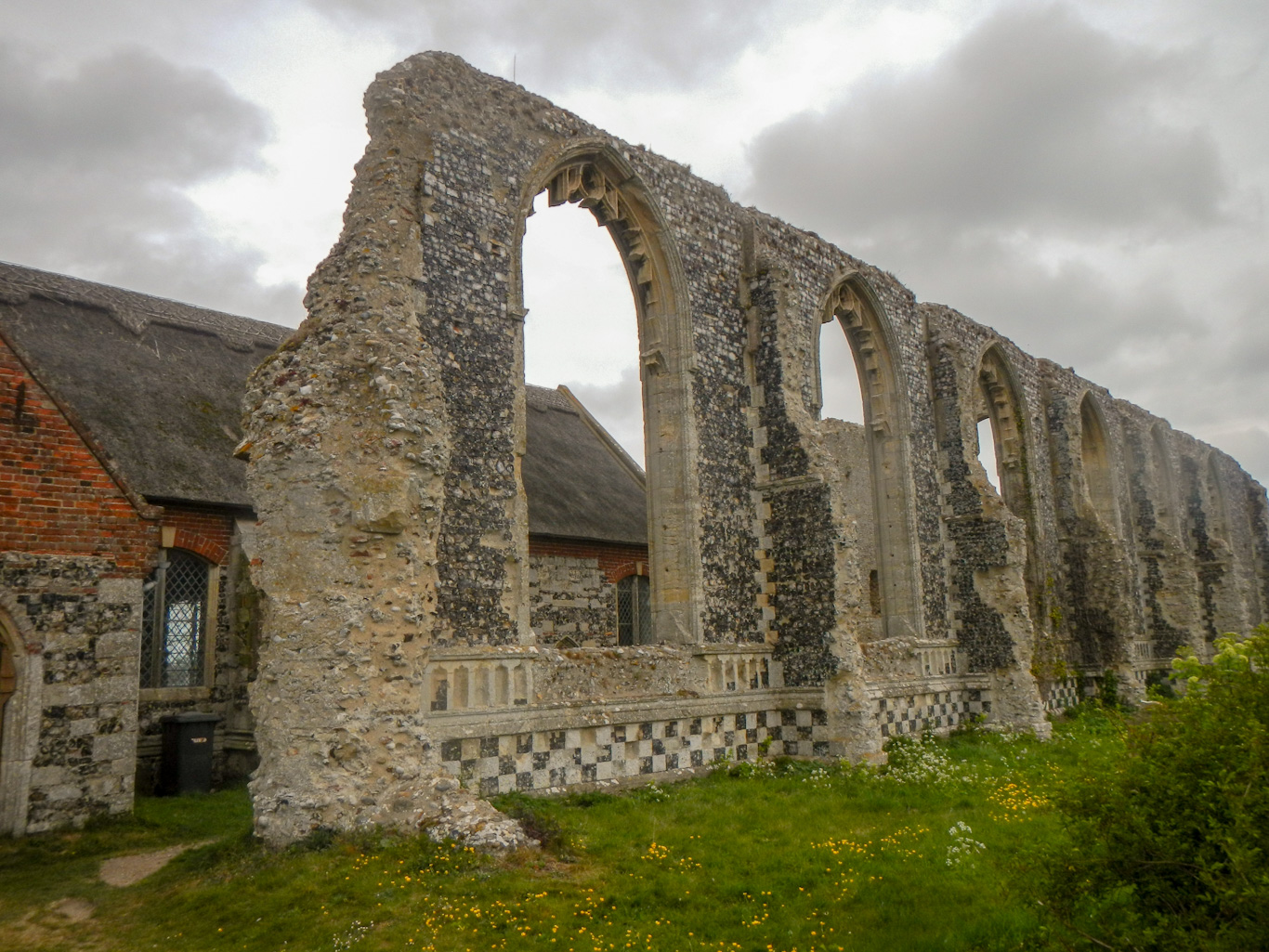
Current day Dunwich stands half a mile inland from the thriving thirteenth century port town. However the original town and the medieval Blackfriars monastery as well as St Nicholas Church, St Peter’s Church, All Saints, and St Katherine’s Chapel all lie on the sea bed nowadays and have been explored by marine archaeologists. We walked beyond the village to look at the remains of the 13th century Greyfriars monastery built to replace the monastery that was swept away by the sea. We also saw the last surviving gravestone from the medieval church of All Saints. Greyfriars itself although built well inland at the time now lies perilously close to the sea.
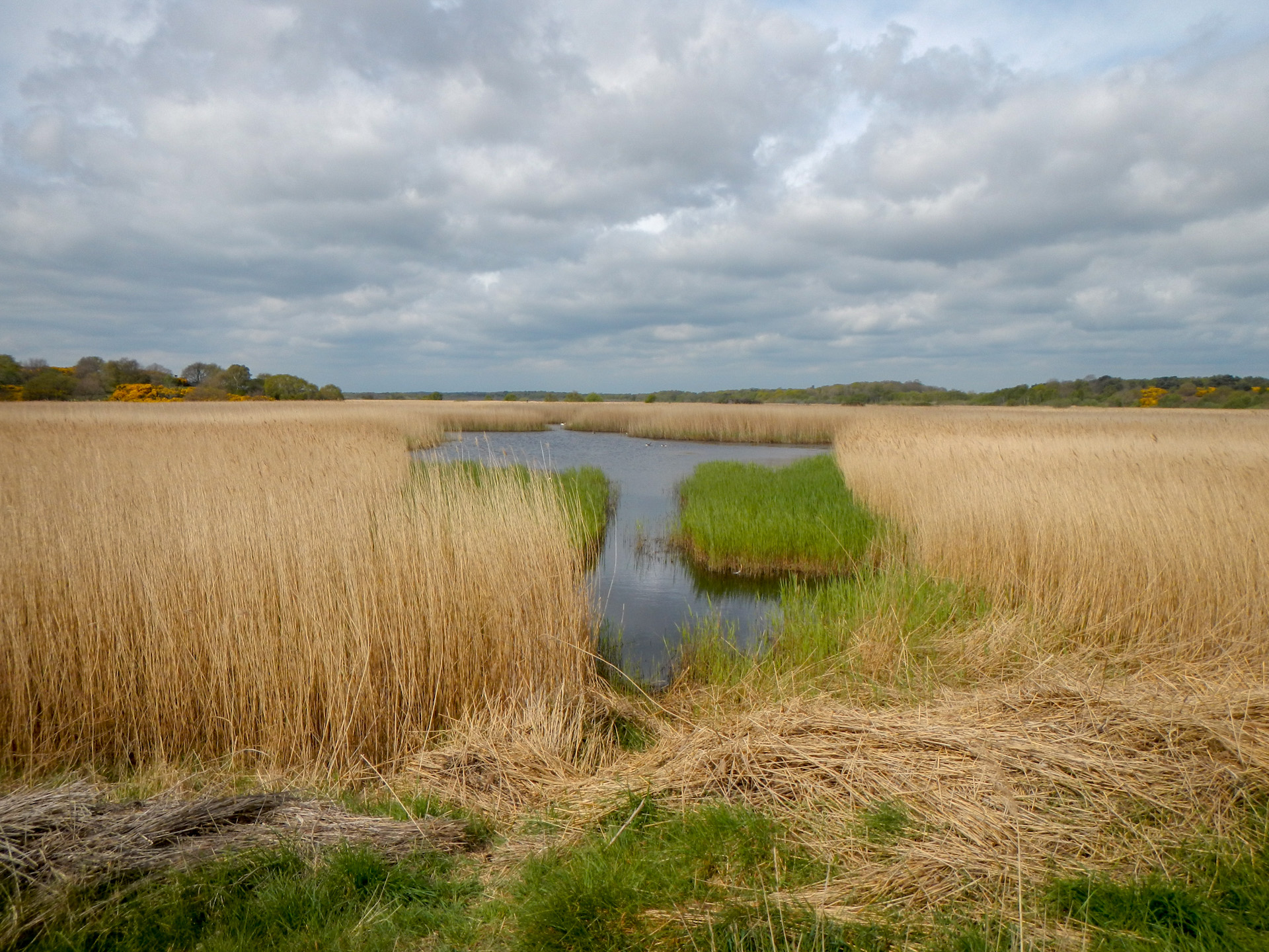
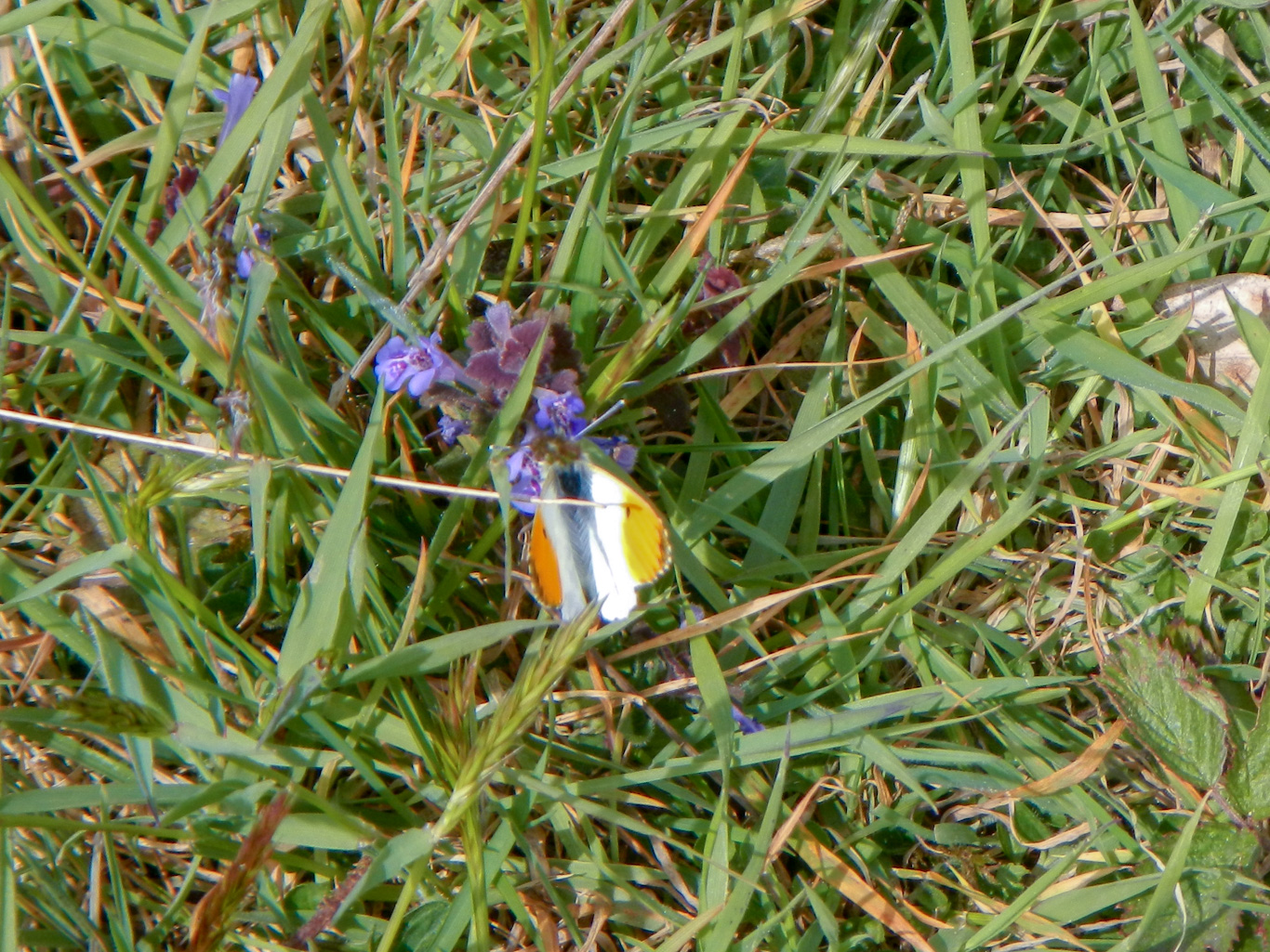
I was keen to walk further to explore Dunwich Heath, an area of rare lowland heath, and even further to look at Minsmere where four of the National conservation area priorities are evident in close proximity: reedbeds, lowland wet grassland, shingle vegetation and lowland heath. However my husband thought he had gone far enough allowing for the return journey and persuaded me to return with him. Besides which, all these habitats were already included on our route in addition to ancient woodland of Greyfriars and the mixed broadleaf and coniferous wood of Dunwich Forest.

We enjoyed a wonderful return walk to Southwold following the route of part of the Sandlings walk through forest and heathland as well as passing further areas of wetland and reedbeds.
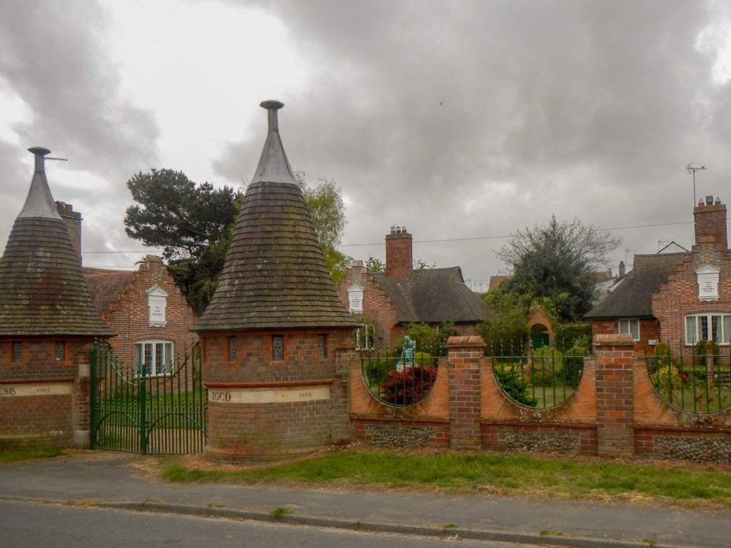
The following day, our walk from Southwold headed north. We followed the route of the Suffolk coast path, which is actually some distance inland at this point. Features of interest include the Grade 2 listed Reydon Almshouses dating from 1908 with distinctive gatehouses and sculptures. We also noted large fields of asparagus.
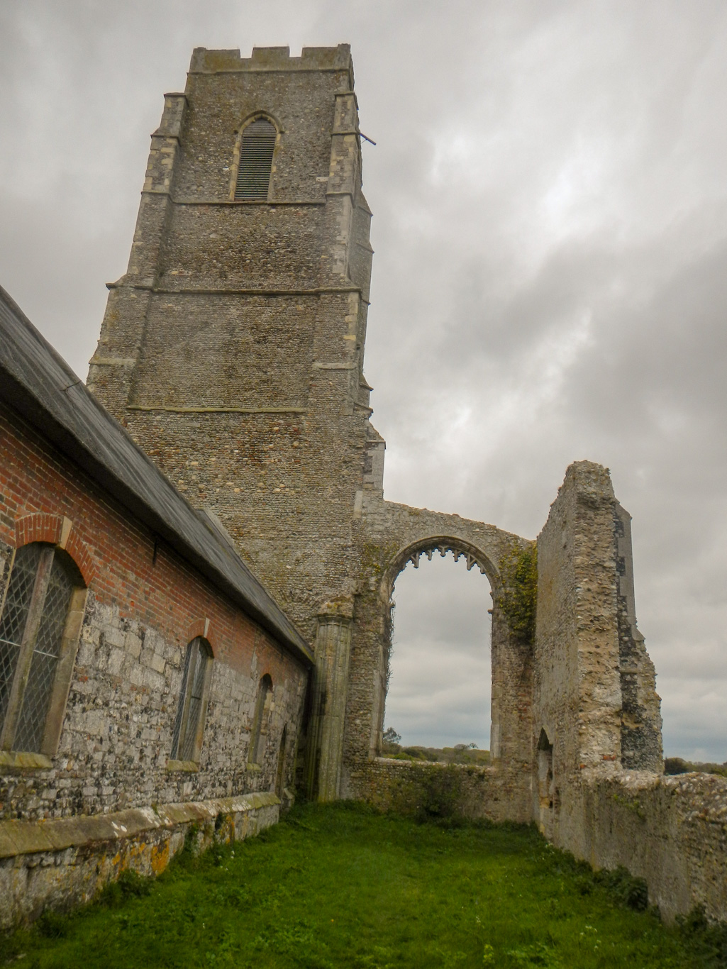
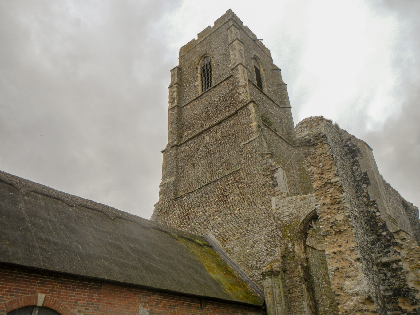
Our turning point was Covehithe. This was a prosperous town in medieval times and the extensive ruins of the former church of St Andrews are evidence that this was a large and important centre. The original church was rebuilt in the 15th century but was derelict by the mid 17th century with the town gone due to coastal erosion. A new smaller thatched church was built within the confines of the old and utilising the 15th century tower.


Our return walk was down to Covehithe Broad before heading along the foreshore. Having checked the tide tables, that was why we had decided to attempt the beach part of the walk later in the day. An electric fence protects the ground nesting birds both at Covehithe and at Easton Broad.
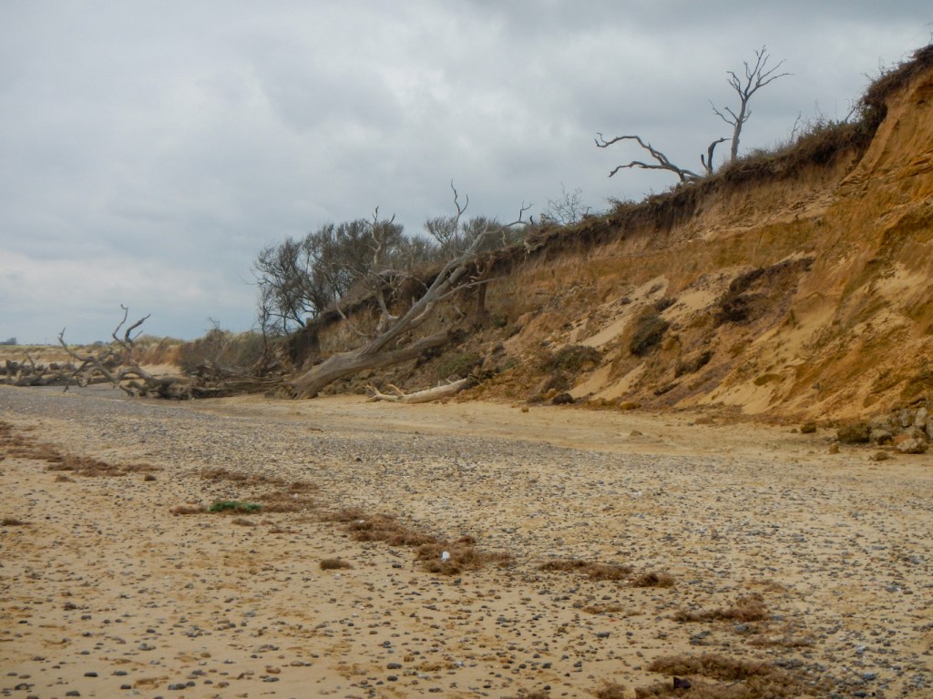
As we walked further towards Southwold, we saw much evidence of coastal erosion with remains of trees scattered across the beach having succumbed to tidal erosion of Easton Wood, perched on the cliff edge.
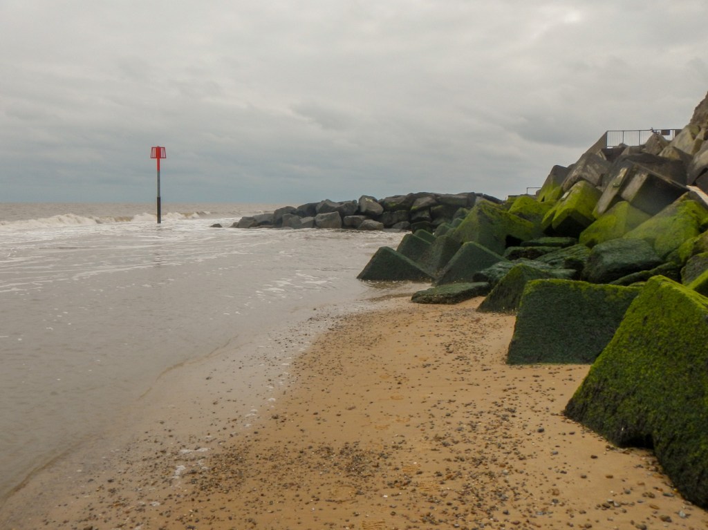
A notice at Covehithe had warned that the beach route to Southwold was not passable. As we walked nearer to Southwold, we thought that there might be a way through. However only a matter of metres from the north of Southwold, the end of the sea wall has collapsed and indeed the route appeared to be impassable.
All that we could do was retrace our steps northwards before managing to take a route around field edges and emerge on to the B1127 road. Fortunately our walk along this fairly busy road was short and we followed a footpath leading towards the route we had taken in the morning at a point just north of Reydon. This provided us with our return route to Southwold.
The Suffolk Coasts and Heaths turned out to be a fascinating area including a mixture of landscape types providing important wildlife habitats. In addition the region has an interesting human history encompassing both marshland reclamation and coastal erosion.
