22 April 2022
These places are right on south the edge of the map. In fact the walk actually extends south on to two more maps as the start point village of Salford extends from the north east corner of map 163 to the north west corner of map 164. It’s one of those places that doesn’t lend itself to map reading using the standard paper 1:50,000 maps as to cover the entire walk of about six miles three maps would be needed. However, I have passed signs to the Rollright Stones many times and I have said that I must go and look at them sometime – the awkward location for using paper maps certainly wasn’t enough to put me off. It’s possible to park a car very close to the stones but in the interests of “exploration and adventure” that isn’t really my aim. It would also mean missing looking at the site in the context of the surrounding landscape; this is so much more easily achieved at walking speed than at car driving speed.
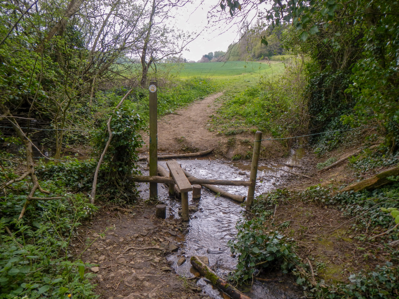
I started my walk at the village of Salford. My route was essentially an elongated oval, in an anti clockwise direction up to the stones and back crossing many stiles. There are a few small wooded areas but mainly I saw open views over fields and towards distant hills.
There are three groups of stones, dating from different periods;
- The Whispering Knights are the remains of an early Neolithic burial chamber, probably dating to around 3,800 BC, built by the first farming communities in the area. The stones are huge – raising such massive stones using only levers and ropes was a considerable achievement.
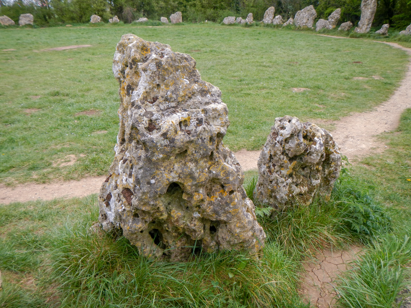
- The Kings Men stones are a ceremonial stone circle probably over a thousand years more recent than the burial chamber, dating from around 2,500 BC (late Neolithic). The circle was used for communal ceremonies. The stones, now numbering about seventy, but originally thought to be over a hundred, are local limestone boulders probably found within 500m. Using antler tools, wooden levers and fibre ropes, twenty people could have built it in a month. Some of the lichens growing on the stones are thought to be 400-800 years old – definitely not to be disturbed.
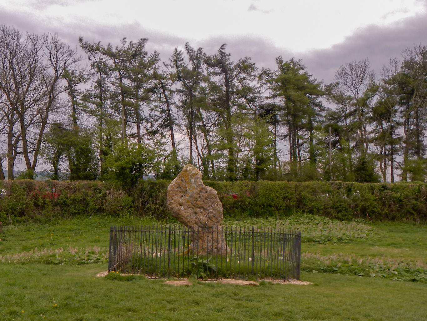
- The King Stone is probably up to a thousand years more recent than the stone circle, thought to have been erected as a permanent feature to replace wooden markers at the site of a Bronze Age cemetery dating to 1,800 – 1,500 BC.

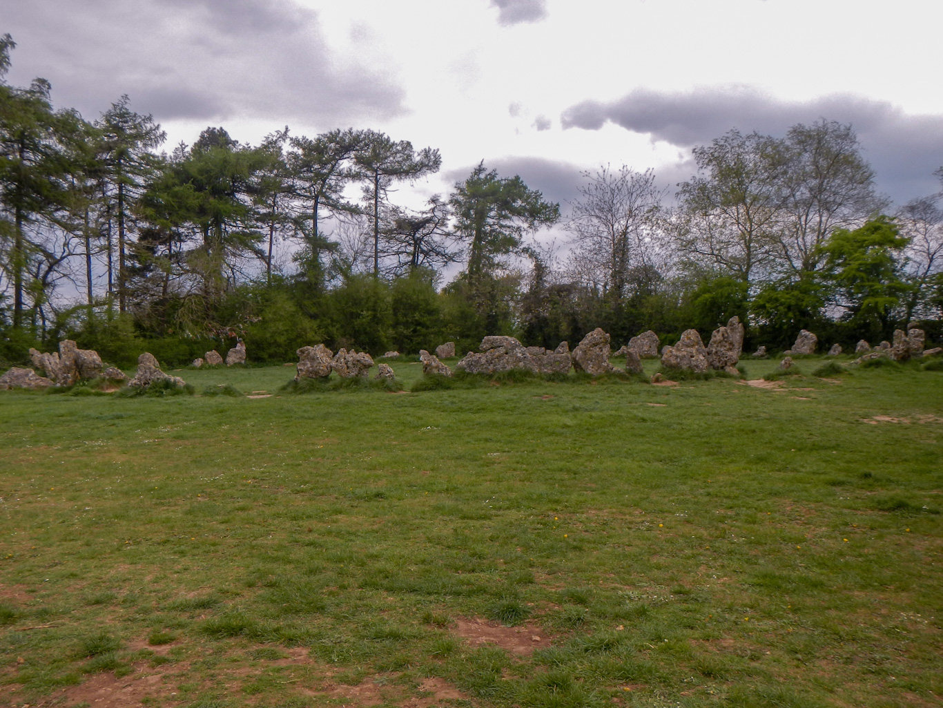
Also in the area around the stones there are other remains: a further Neolithic burial chamber, Bronze Age round barrows, a late Bronze Age or early Iron Age trackway and field boundary, an Iron Age farming settlement and a Saxon cemetery.
It’s amazing to think that this area which is now so quiet (apart from the road bisecting the sites and the many visitors) was a significant centre for all these early communities over many thousands of years.
Many legends have developed to explain the stones – the main legend is that the stones represent knights plotting against their King before a witch turned them, the King’s men and the King himself into stone.
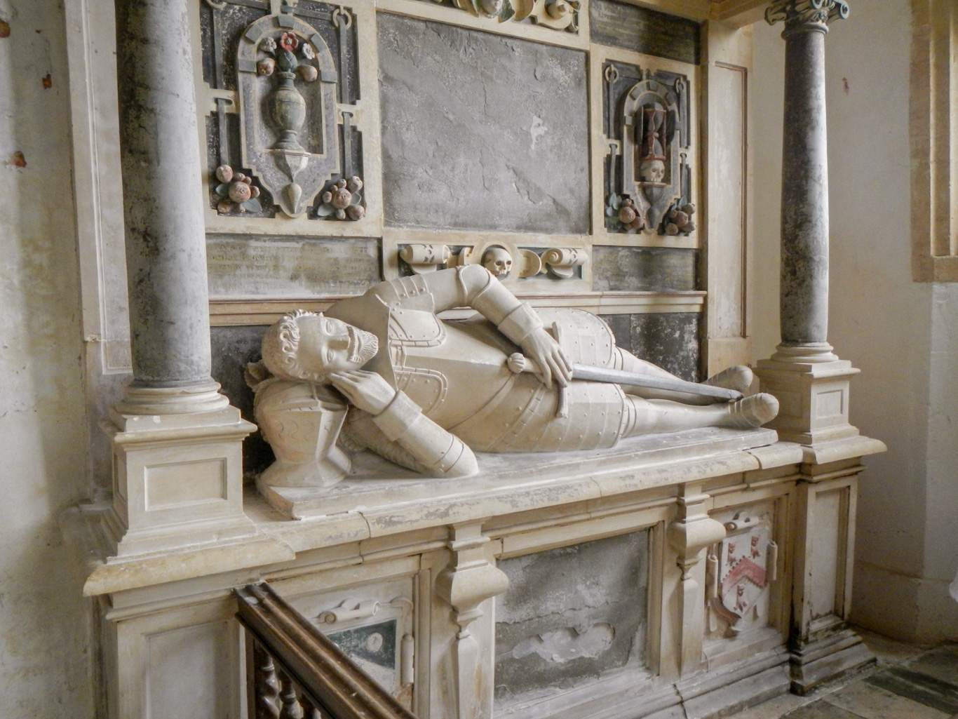
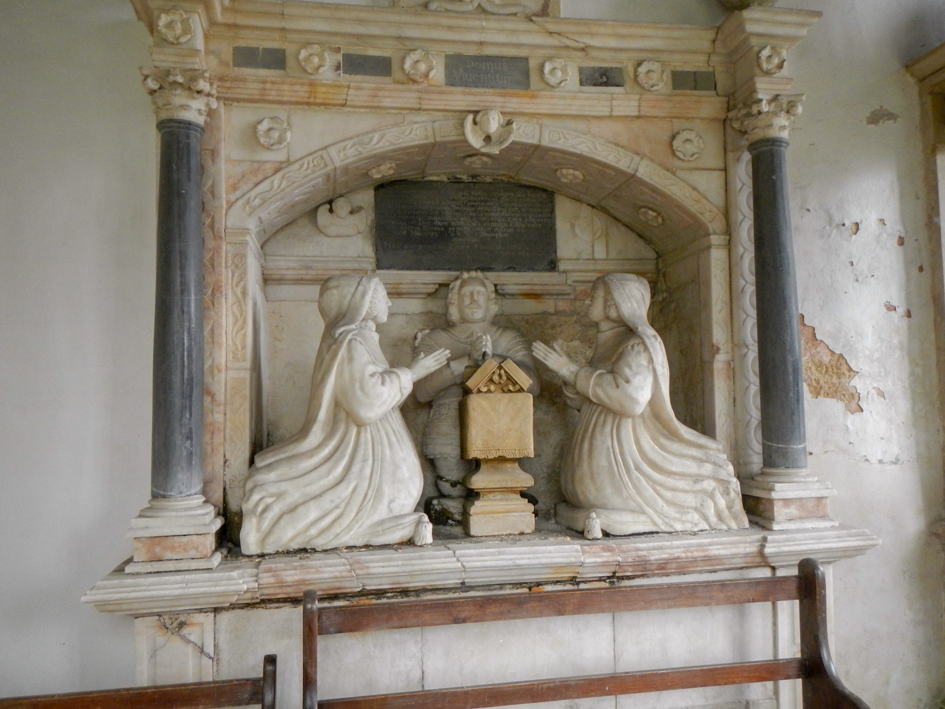
The primary aim for my “adventure” had been to visit the Rollright Stones, steeped as they are in ancient history and embellished with legends. However it turned out that a major highlight was yet to come on my return route to Salford. The village of Little Rollright is almost hidden in the bottom of a small valley and accessed only by a single small lane and a footpath. The small and simple church stands on some slightly higher ground. There are two fascinating and well preserved seventeenth century wall tombs set into the north wall of the chancel. One knight has his helmet as a very hard pillow and the other appears to be flanked by two wives.
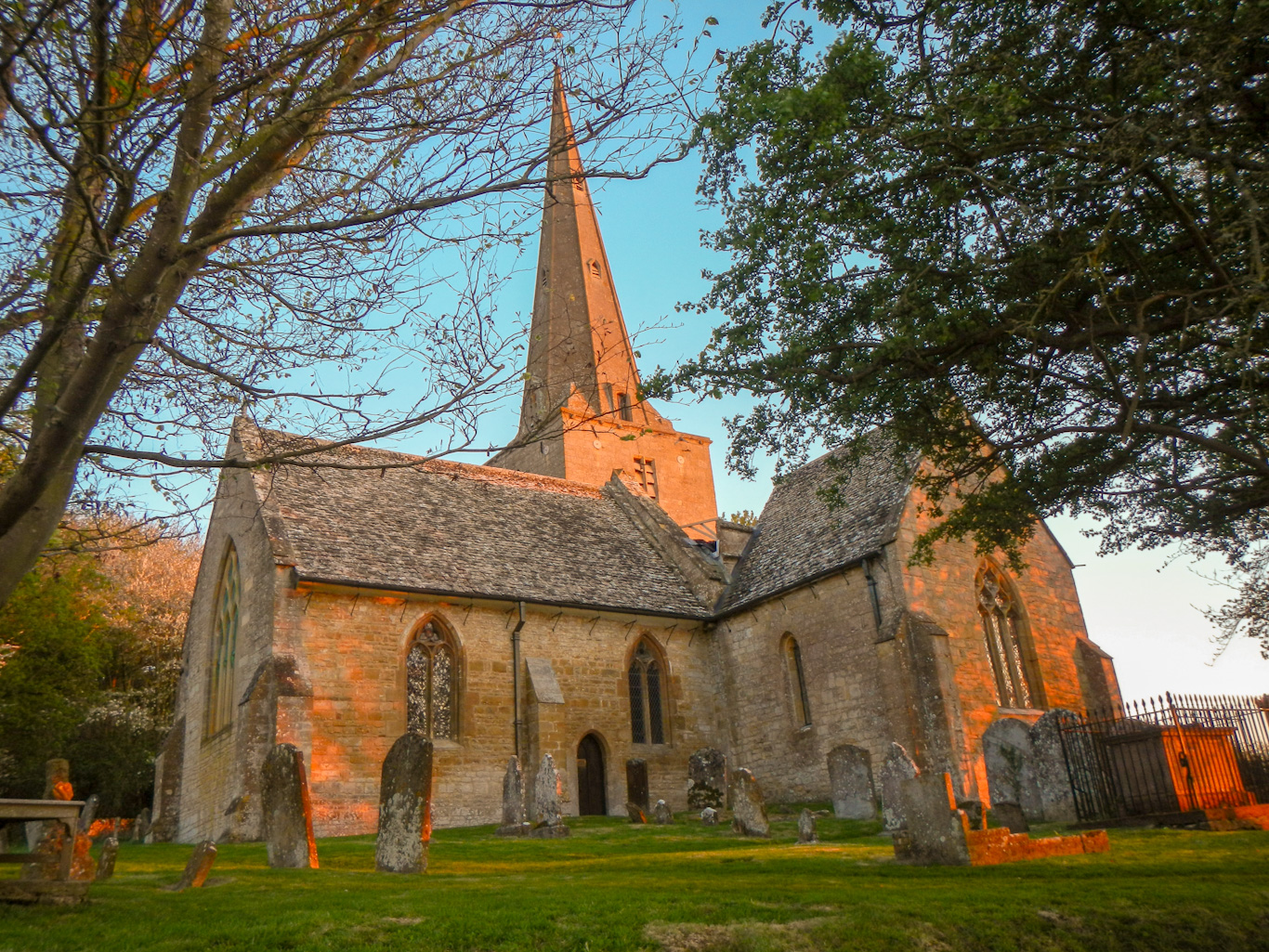
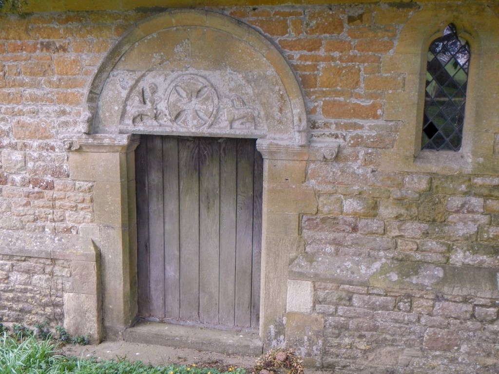
Inspired by the interesting tombs I saw at Little Rollright church, I extended my walk to look at the church in Salford. Here the twelfth century north doorway on the outside of the church attracted my attention. The doorway features a carved tympanum with figures of a centaur drawing his bow and a lion flanking a Maltese cross. The centaur is almost certainly a depiction of the Zodiac figure of Sagittarius, while the lion is probably Leo. I also spotted the base of a medieval cross in the churchyard.
All in all this was a fascinating short walk, including two village churches with interesting, quirky historic features as well as the enigmatic Rollright Stones which had been my focus for the “adventure”.
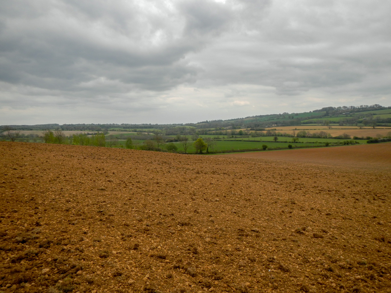
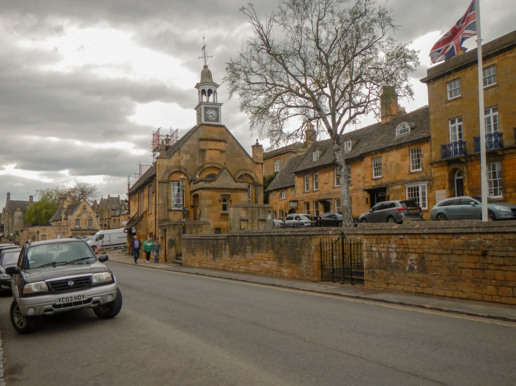
I had made such good progress that I was going to be too early to arrive at my B+B in Weston-sub-Edge (on the edge of map 150). The weather was superb with some afternoon sunshine so I stopped off at Dover’s Hill (on the west edge of Map 151) to admire views across the Vale of Evesham and further. I also strolled down the hill on The Cotswold Way to the historic Cotswold market town of Chipping Campden. The High Street includes buildings dating from the fourteenth to seventeenth centuries and is said by G.M. Trevelyan (English Historian) to be “the most beautiful village street now left on the island”.
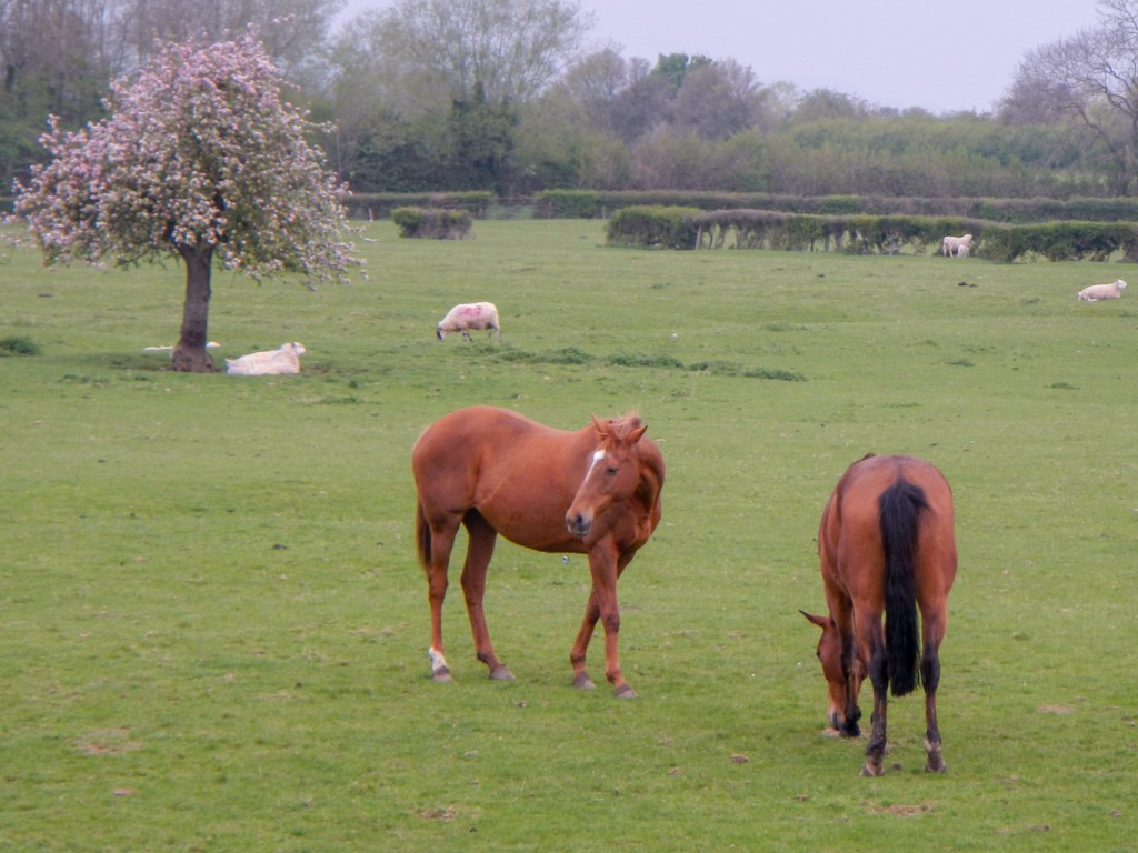
This adventure, so near to the edge of the map, transcends the artificial 1:50,000 map boundaries of the Ordnance Survey. The trend continues. Dover’s Hill (map 151) is actually in the parish of Weston-sub-Edge (village on map 150). I therefore make no apology in mentioning my excellent bed and breakfast at Manor Farm – many thanks to Lucy. https://manorfarmcotswolds.co.uk/ The renovated farm dates from 1624. Views from the bedroom window are excellent on to a field with many lambs and sheep as well as two fine thoroughbred race horses (at this time of year). Lucy also cooks a delicious locally sourced breakfast.
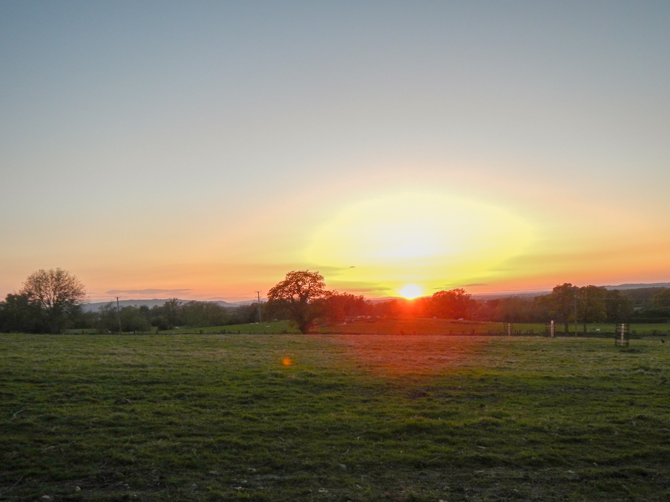
In addition I was extremely fortunate on the first evening of my stay to have time after dinner to walk up to the unspoilt village of Saintbury. There are a few walking routes – I turned off the main road (B4632) on to a byway which is a continuation of the Roman Ryknild Street and subsequently turned on to a small footpath. Disappointingly the church is closed for repairs so I didn’t see the medieval wall paintings. However I was there at the right time to view a stunning sunset across the Vale of Evesham – a magnificent end to my day!