29 January to 3 February 2022
The Isle of Wight seemed to be an excellent destination at this time of year given it is warmer than most of the rest of UK. I was also keen to visit outside the main tourist season to enjoy some quieter walking. Amazingly, it’s possible to book a through train ticket all the way from Exeter despite some of the journey being on water.
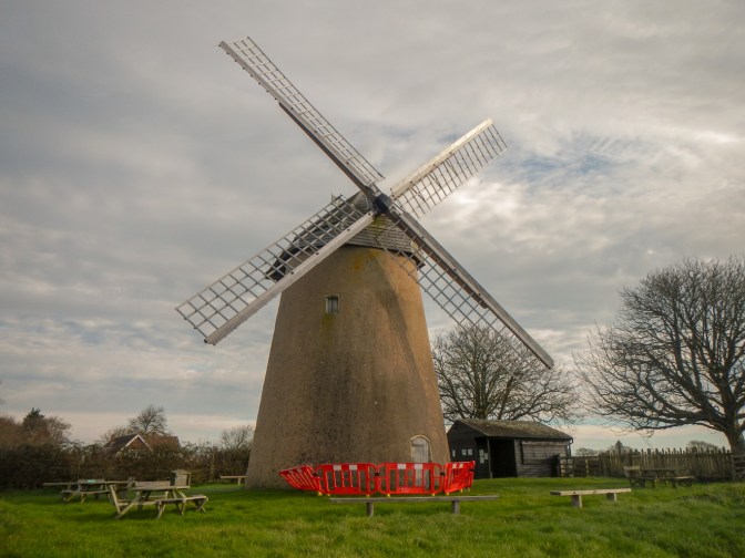
I’d visited twice previously – once a family day trip over fifty years ago travelling outwards on a ferry and then returning by hovercraft – indeed to date had been my only hovercraft journey. A second visit had been a youth hostelling expedition with my friend Ann. We’d taken the ferry. My memories are vague but I know we visited Bembridge windmill the first day and then gradually walked along the south coast of the island, staying at a few different hostels. We definitely went in the sea at Sandown or Shanklin. We visited the “theme park” at Blackgang Chine where we were amazingly impressed with the distorting mirrors. Later in the week we ventured on the chairlift down to Alum Bay, where we filled tubes with layers of coloured sand. After that we walked inland over the downs to Newport where we stayed at a temporary youth hostel in the castle grounds. It was a tremendous adventure for us at the time and it’s a pity that this sort of adventure isn’t possible for teenagers nowadays due to perceived safeguarding issues (not to mention Covid of course).

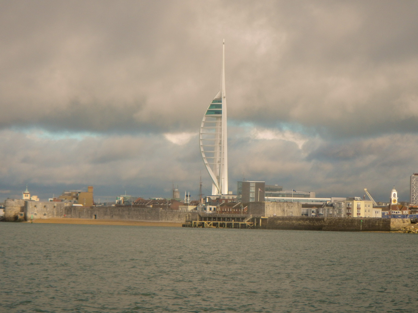
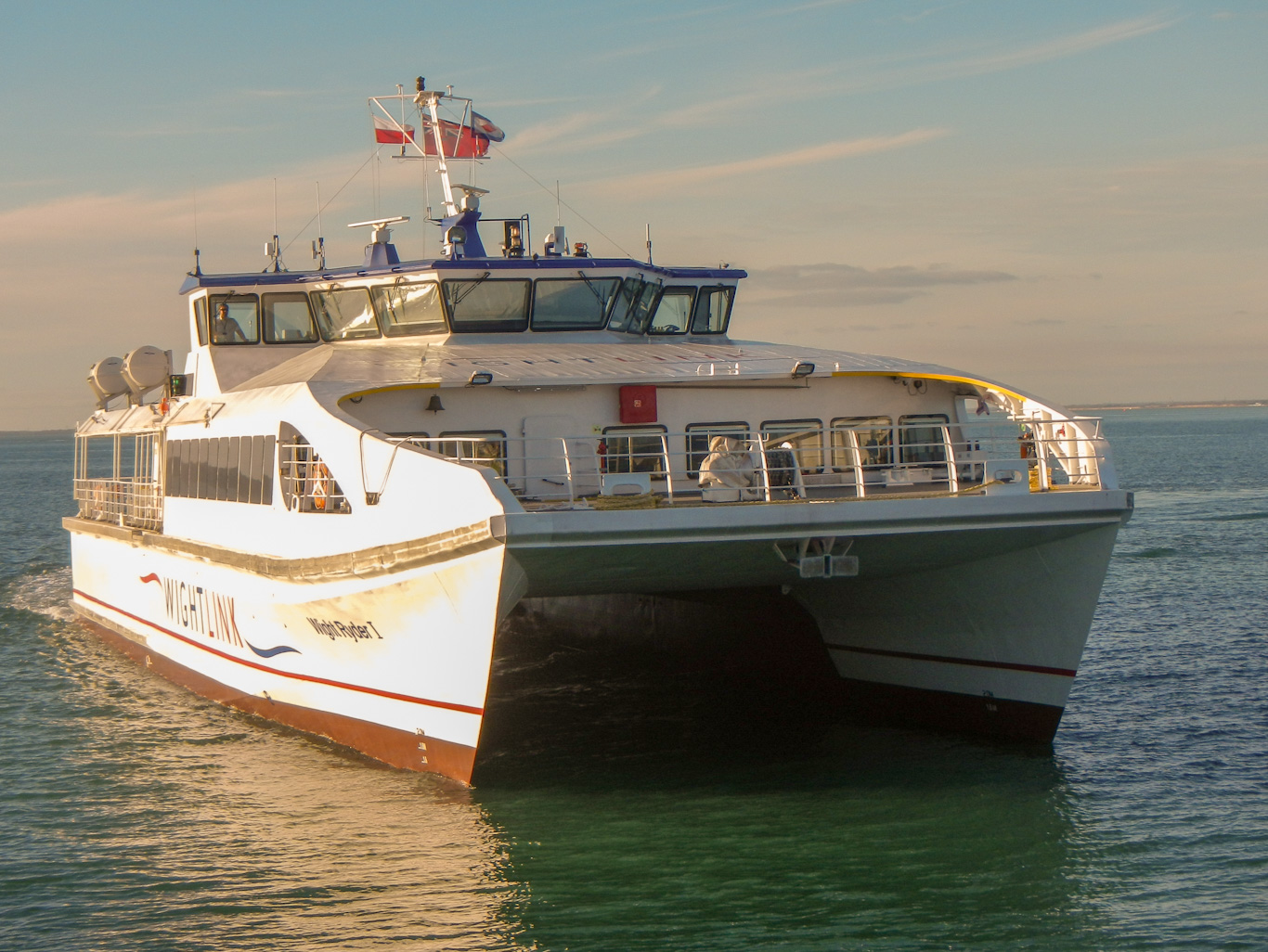
The adventure this time began with the hovercraft flight, taking just ten minutes from Southsea to Ryde. The hovercraft was much bigger than the one I remembered from previously. Also there’s a swish terminal building rather than a waiting area outside on the pavement. It’s still an exhilarating experience with excellent views from the window and a rapid way to cross the water. According to the Isle of Wight official tourism website the Isle of Wight Hovercraft is the last remaining commercial hovercraft service in the world so it’s not an experience that’s possible anywhere else! It was quite windy on Saturday although fortunately not as windy as further north in UK where there were weather warnings. The hovercraft did toss a bit on the swell.

Anyway just minutes later we were hovering on dry land up the sandy beach at Ryde. After taking a few photos of all three hovercraft in the current fleet, I said bye to my husband who was staying in Ryde while I trekked round the coastal path circumnavigating the island.
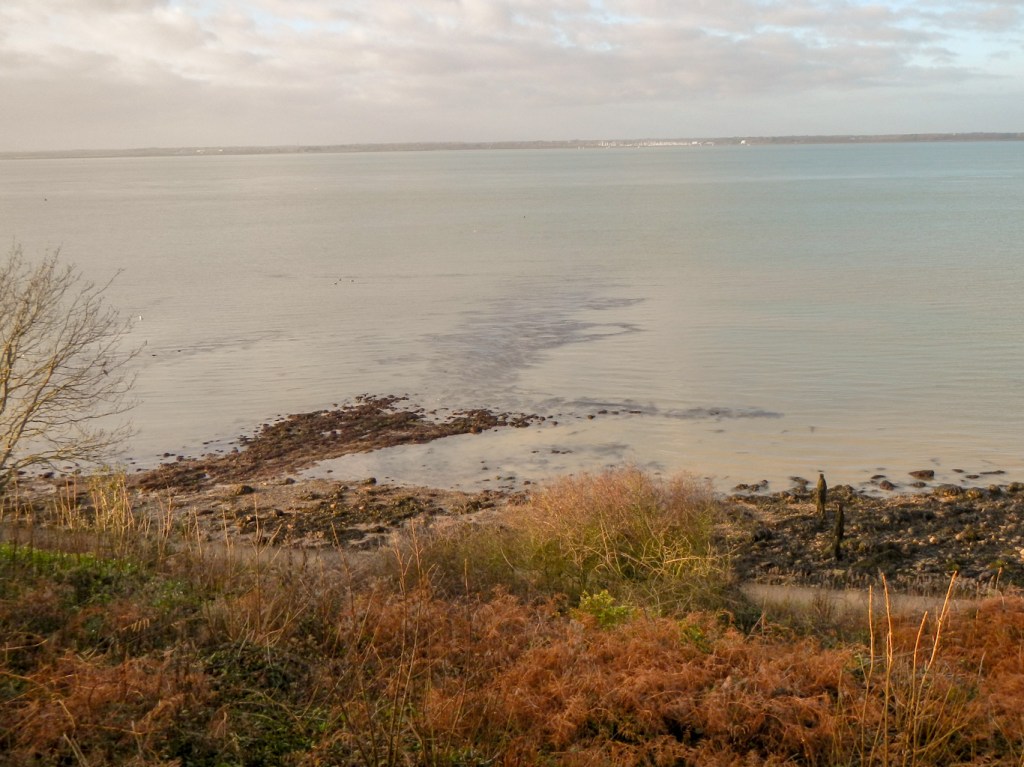
I just had to walk to my booked accommodation at Cowes, approximately eight miles round the coast. Unfortunately, the path here isn’t very close to the coast so I only caught occasional glimpses of the sea.
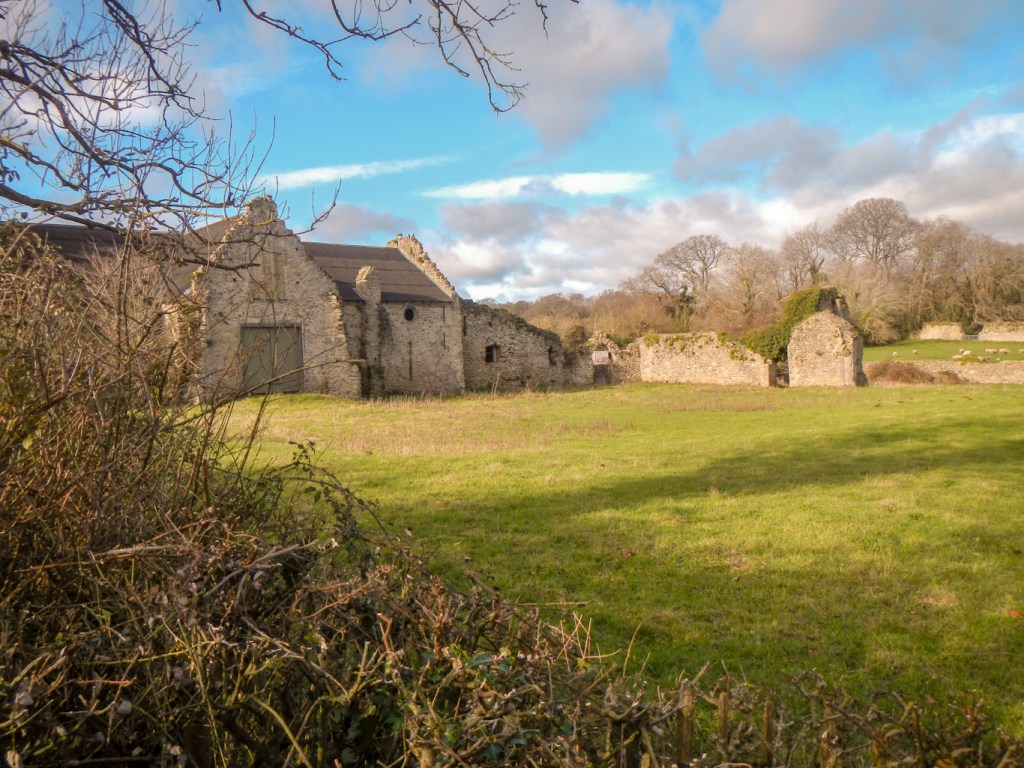
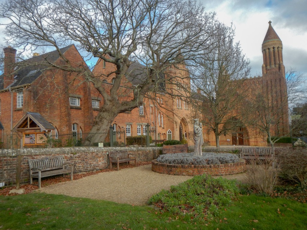
Having found a convenient seat to stop and eat my packed lunch, I visited Quarr Abbey. The original abbey was opened in 1131 by a small group of Cistercian monks. The abbey was dissolved by Henry VIII in 1537 and the ruined buildings can be seen from the path. The new Benedictine abbey, built in 1912 is just a short walk from the path. It offers a lovely café but having already eaten lunch I just stopped for coffee. If only I’d realised I would have bought lunch there. Sadly I didn’t buy anything from the brilliant monastic produce shop either as I didn’t want to have to carry it almost all the way round the island.
I didn’t get anywhere near muddy paths so my trekking poles and gaiters remained in my rucksack all day. The weather was dry and seemed milder than on the mainland – confirmed to me by noting daisies growing in the grass (in January!) and seeing someone mowing their lawn.
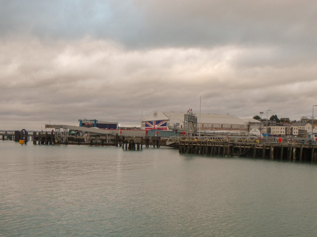
I arrived at East Cowes at about 3pm so, with the chain ferry and only a short walk on the other side, I set off to the esplanade to explore the rest of East Cowes. I saw the Columbine Shed which has a slipway designed especially for launching seaplanes, developing from the work of Sam Saunders. Saunders Roe built the world’s first hovercraft SRN1 and it was launched on its first sea flight on 11 June 1959 from the Columbine Shed. The company went on to become the British Hovercraft Corporation. The doors of the shed were painted with the Union Jack in 1977 to celebrate the Queen’s Silver Jubilee and repainted 25 years later.
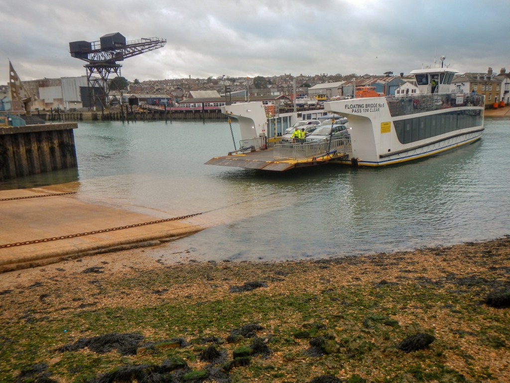
I walked back to catch the chain ferry for the short crossing over the River Medina. The walk round would have been over eight miles. the first “floating bridge” was established in 1859. I had a good view of the Union Jack painted on the Columbine shed.
Cowes itself was bustling with activity. I wandered along the main street and soon found my hotel situated right next to the Red Funnel ferry terminal and a marina with lots of boats.
The sunrise seen from the breakfast room the next morning was stunning. Just a pity that breakfast wasn’t earlier so I could have been outside to see it. The waitress told me that the sunset from Totland (near my destination) is the “best in the World” so I was hopeful for a continuing clear day.
My walk began along a surfaced promenade, the high tide splashing over the walkway at times. A few hardy souls were swimming in the sea. I passed Cowes Castle, club house of the Royal Yacht Squadron. I saw one of the Red Funnel ferries in transit.
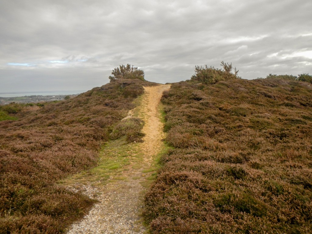
Soon the route became more interesting, continuing on to a very muddy cliff top path. My boots and trousers were covered in mud before I realised just how sticky, slippery and deep it all was. I was already so muddy there was little point putting on my gaiters. Others passed me, trail running through the squelchy mess.
The path descended to cross a ford – which washed and cleaned my boots a bit. There followed a stretch of gravel. Next the path descended to the foreshore to cross another stream. Unfortunately in the high tide conditions this was impassable so I deviated and then re-joined the path. More mud followed but then a stretch of road walking. After that I was back in fields – and read a notice explaining about the historically small ridged fields with preserved hedgerows. Soon I was back on tarmac again, passing the preserved town hall at Newtown (there’s no town here though).
The route didn’t go down the estuary to the nature reserve as it needed to get to the other side of the estuary. I did deviate inland a couple of hundred metres to stock up with some food at the excellent and friendly village shop in Shalfleet. I spotted the only red squirrel I was to see on the entire expedition – but it moved too quickly for me to photograph it.
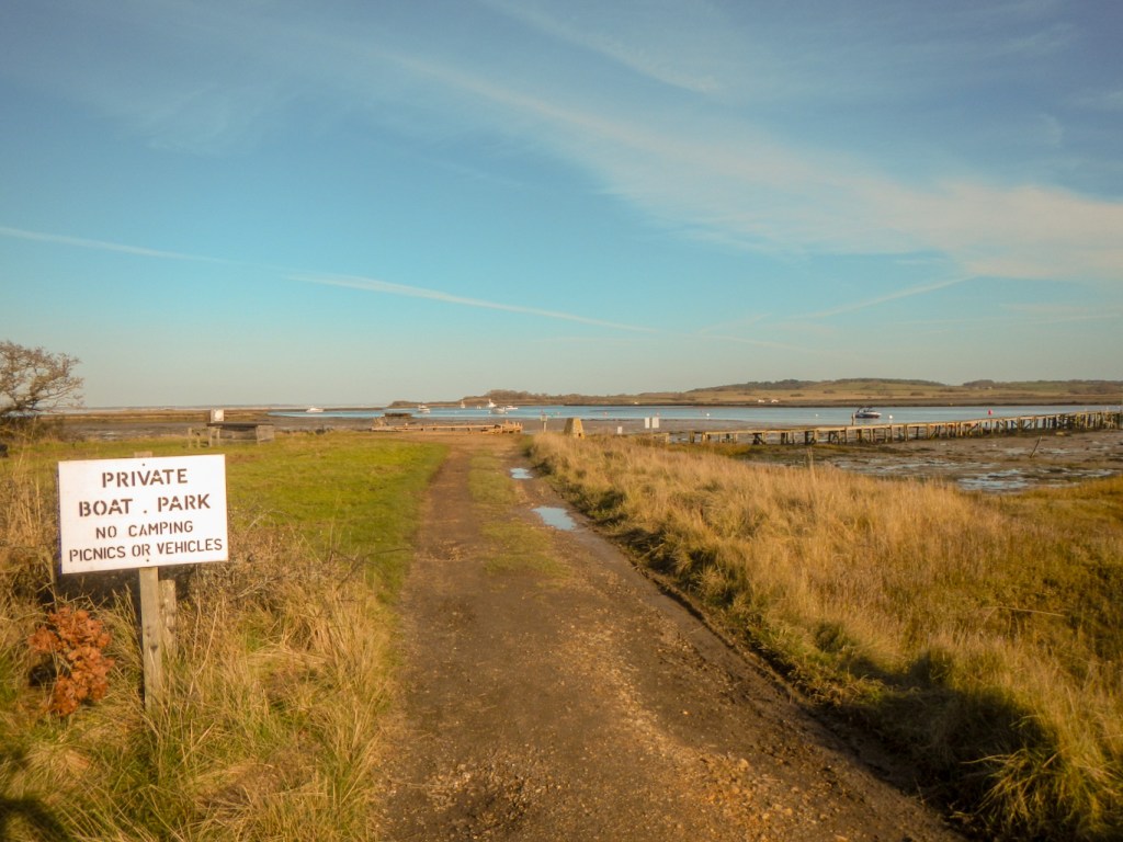
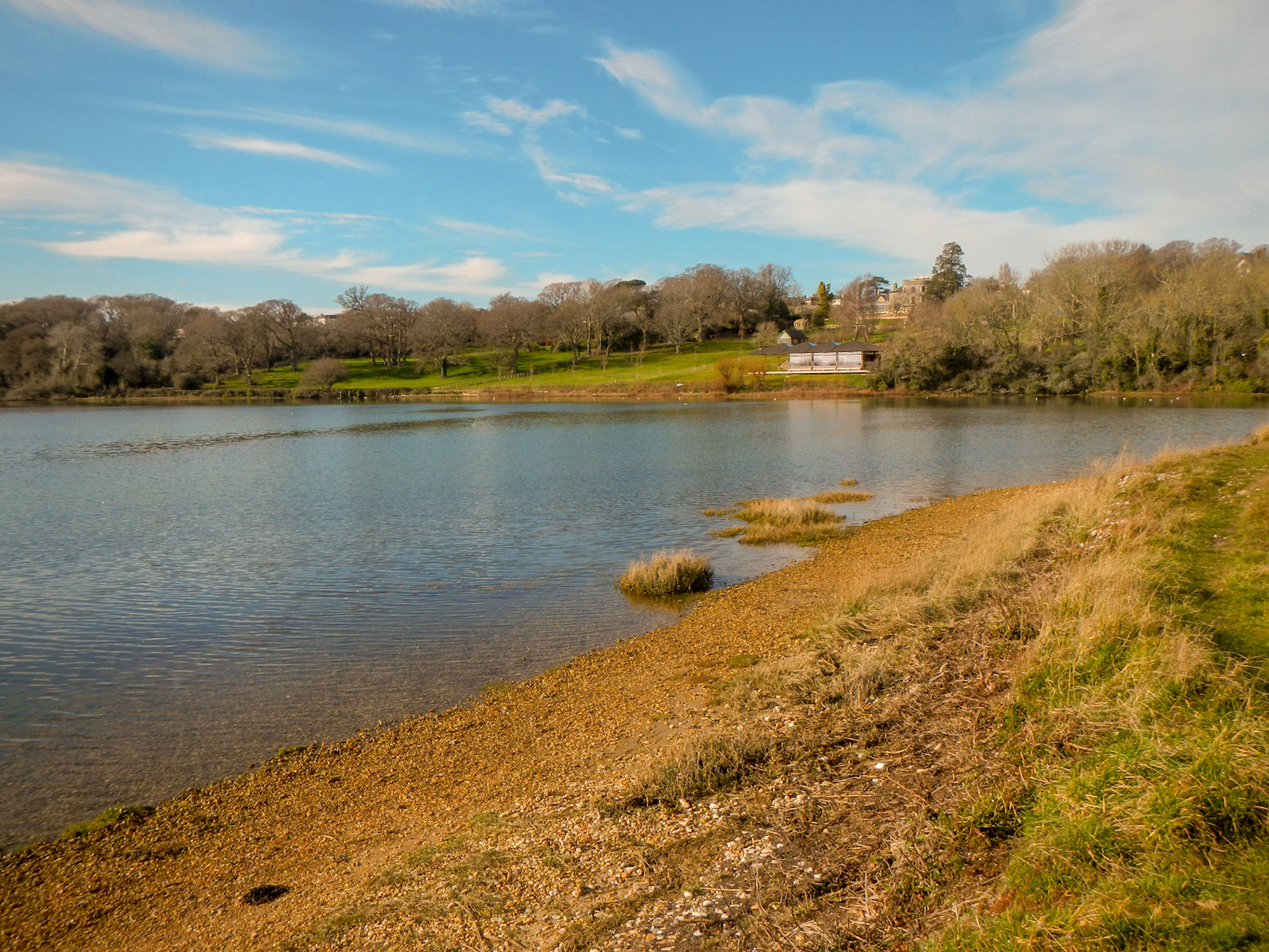
A long route on forest tracks followed until I arrived at Hamstead Jetty having rounded the estuary. This would have been a wonderful spot to stop for lunch, but the notice said picnics are banned!
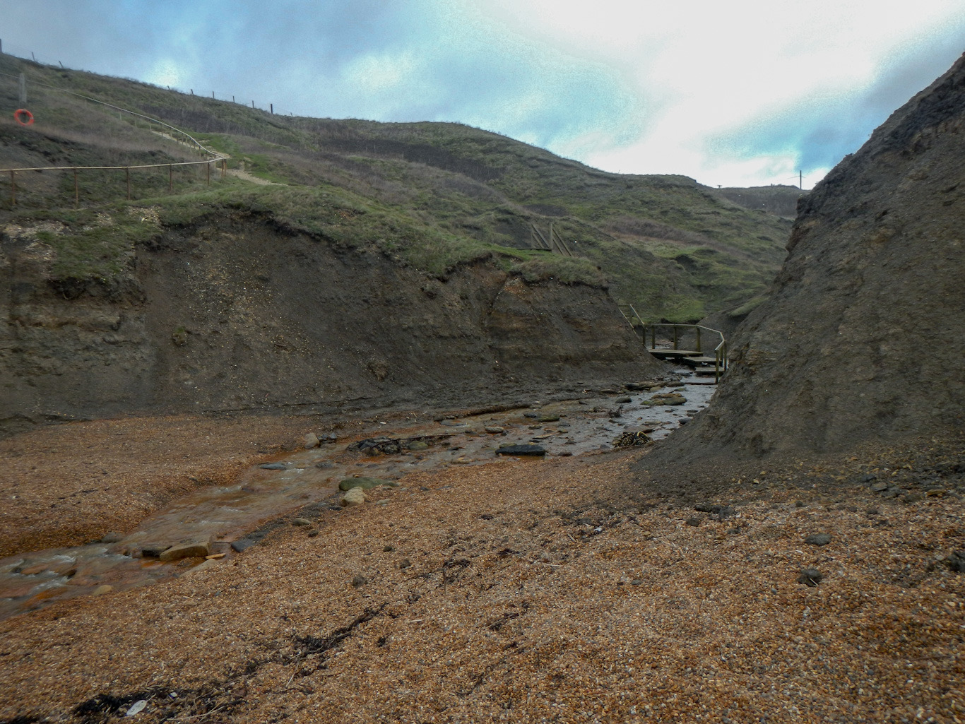
I had to wait a bit longer for lunch, which I ate near Hamstead Ledge after crossing some more boggy ground, partially with the help of board walks.

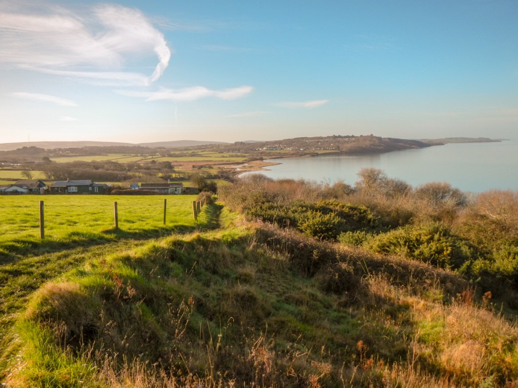
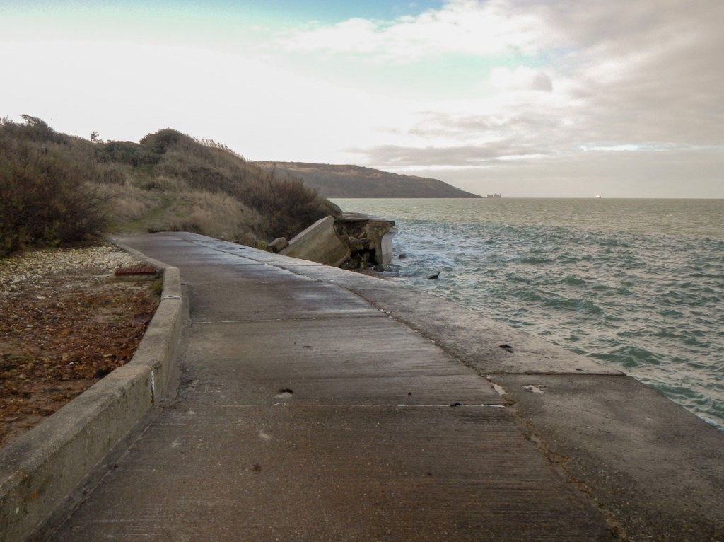
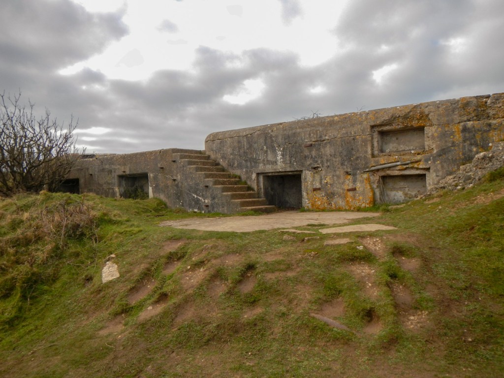
Further along the coast, I reached Bouldner Cliff – there’s a lot of interest here including a submerged Mesolithic settlement under the sea. It’s an area at risk of being destroyed by coastal erosion though. This seems to be the case everywhere on the island, which must be slowly becoming smaller. Just inland is the preserved Bouldner battery dating from WW2.
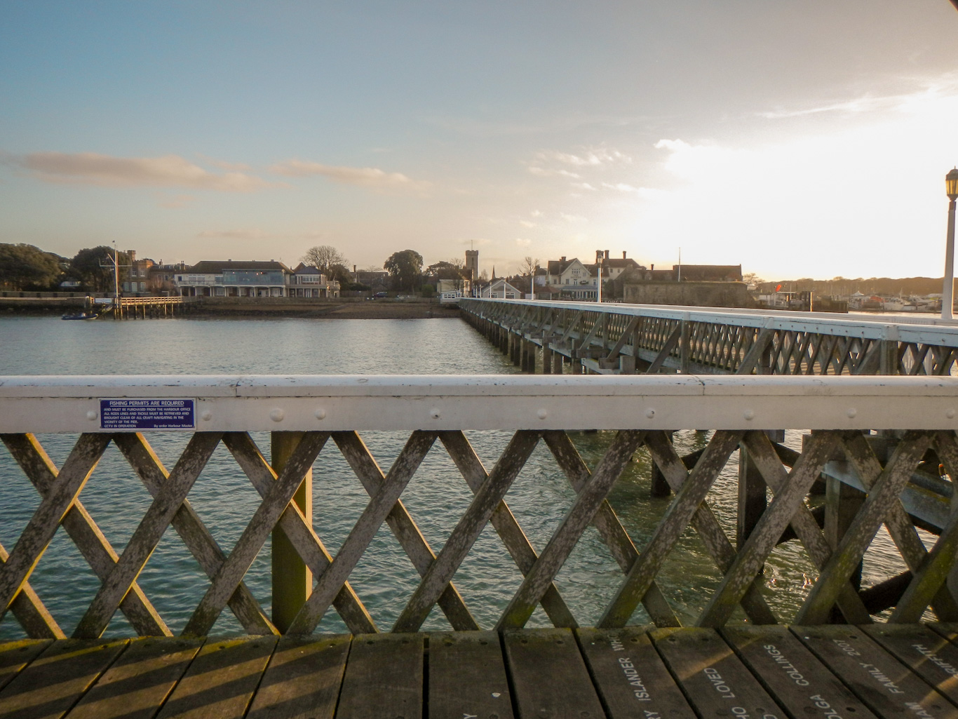
Eventually I reached Yarmouth where I walked along the Grade 2 listed pier. It’s the longest wooden pier in England.

I was concerned that there wasn’t much daylight time left so I hurried through the Fort Victoria Country park. It would have been a wonderful sunset from Totland Bay but sadly there was no way I could get there in time. having reached the main A3054 just before Colwell, I ignored the route back to the coast which would have to wait until the next morning.
It had been difficult to find accommodation which was open during January so I had a long deviation to my bed and breakfast at Weston Manor. By the time I arrived at this rural bed and breakfast without street lights, it was definitely dark and I was wearing my head light. I realised that I’d picked an amazing place to stay – the bed and breakfast forms part of a grade 2 listed Manor house, with a unique private Victorian Chapel currently being refurbished and listed with English Heritage. Unfortunately the nearby pub wasn’t serving food and there wasn’t anywhere else they could suggest within reasonable walking distance so I was pleased that I’d bought plenty of supplies at Shalfleet.
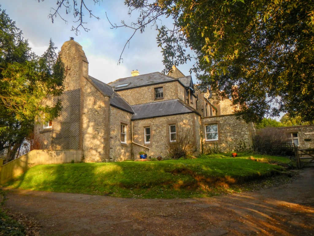
Next morning, I started by retracing my steps to Colwell. I wondered whether the large modern looking Catholic Church with school next door was linked to Weston Manor. Having researched this on return home St Saviour’s was built in 1923 to accommodate the ever growing number of Catholics in the West of the Wight who could no longer fit for Sunday mass into the chapel at Weston Manor. Apparently Weston Manor was the home of the Ward family who donated the land for the church, school and presbytery to the Church. Definitely a good place to stay:
https://weston-manor-bed-breakfast.business.site/?m=true
I popped into the shop in Totland village to replenish my dwindled food supplies before heading to Colwell Bay where I could look back along the coast to Fort Albert.

It was high tide and the sea splashed over the sea wall. I reached Totland Bay via a short path diversion where the sea wall had been eroded and broken.
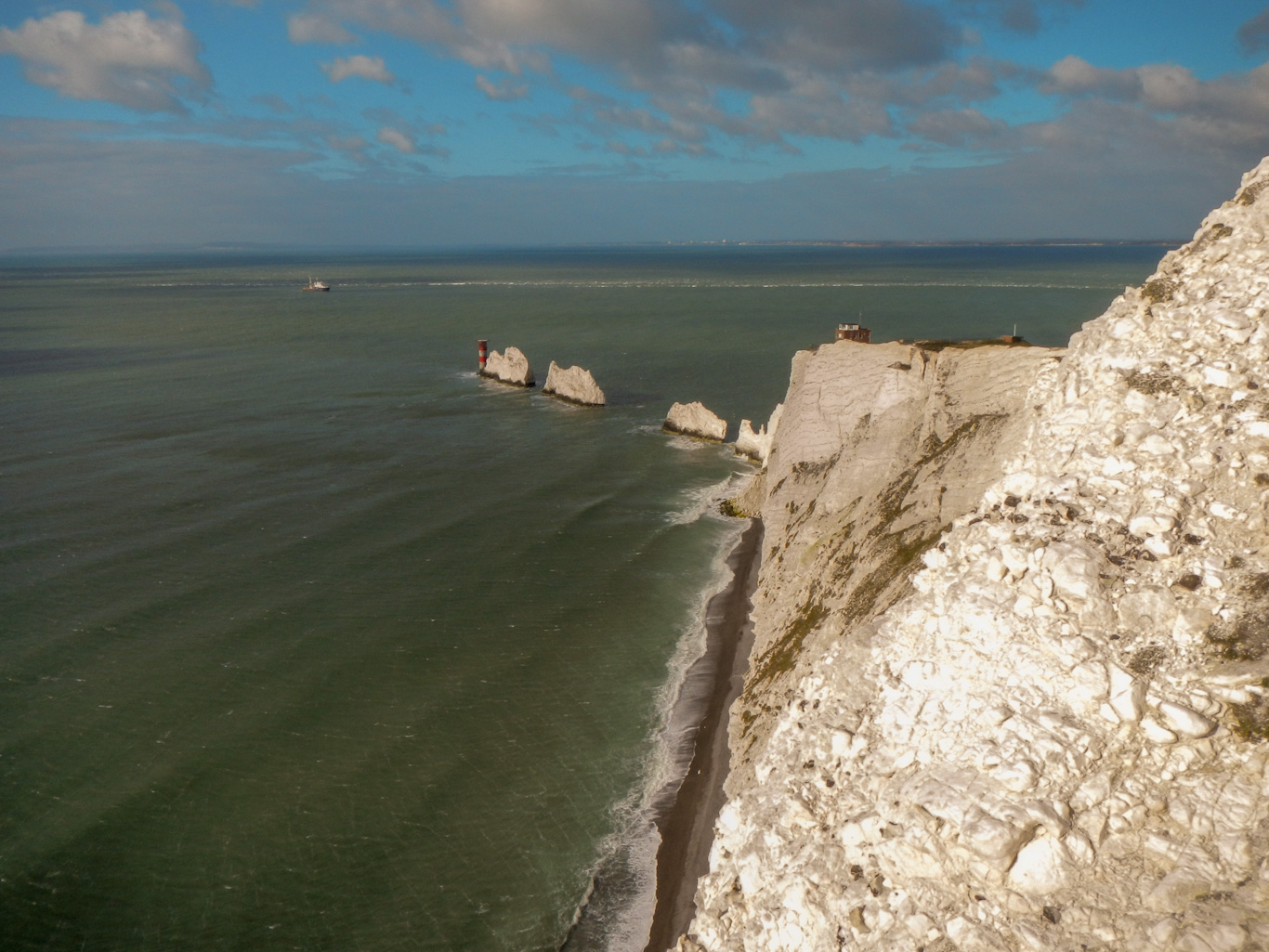
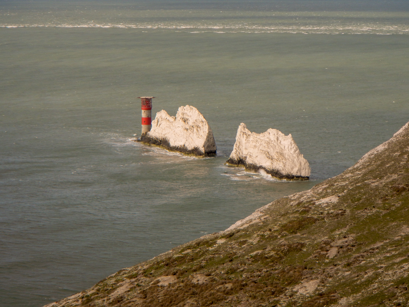
I even got my first view of the Needles Rocks and lighthouse. It’s such a pity that I hadn’t been able to set out an hour earlier from Cowes the previous day as I surely missed a stunning sunset.
My walk today was shorter so I knew that I had time for diversions. I was soon on Headon Warren where I made certain to visit both the largest Bronze Age burial mound in the area and Hatherwood Battery, one of the many nineteenth century Palmerston Forts on the Isle of Wight, built to counter the perceived risk of French invasion.
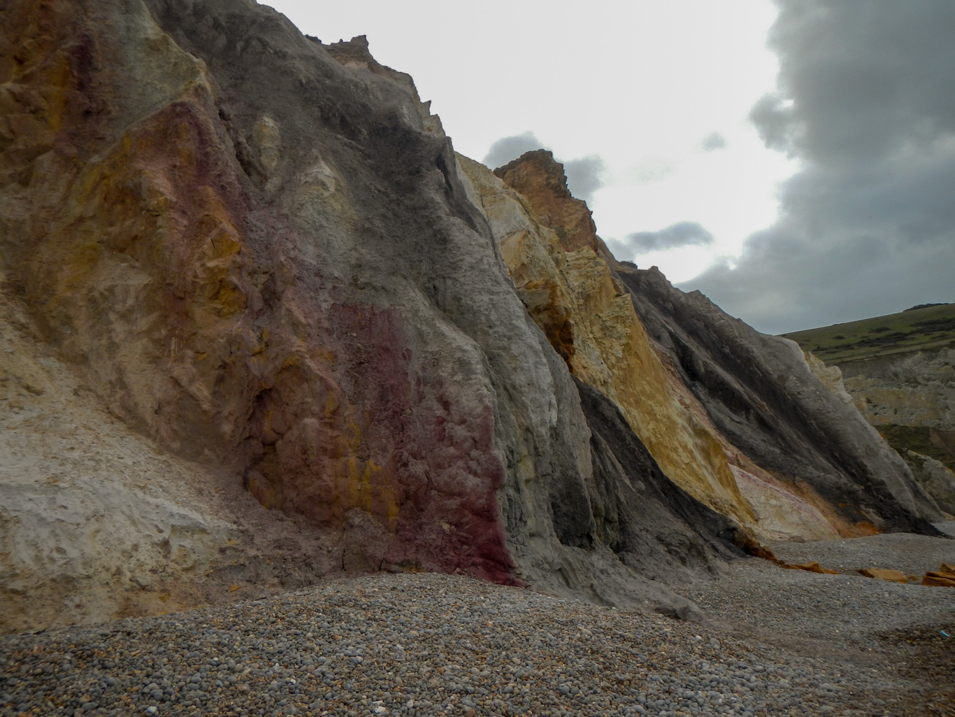
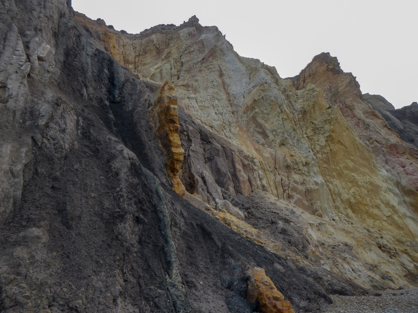
Next I headed for Alum Bay. Of course in January the chair lift was closed so I walked down many steps to reach the beach and view the multi-coloured sandy cliffs.

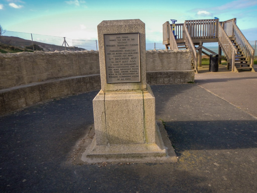
I ascended back up to the huge empty car park provided for customers of the amusement park. The interesting Marconi monument marks the site of the Needles wireless telegraph station.
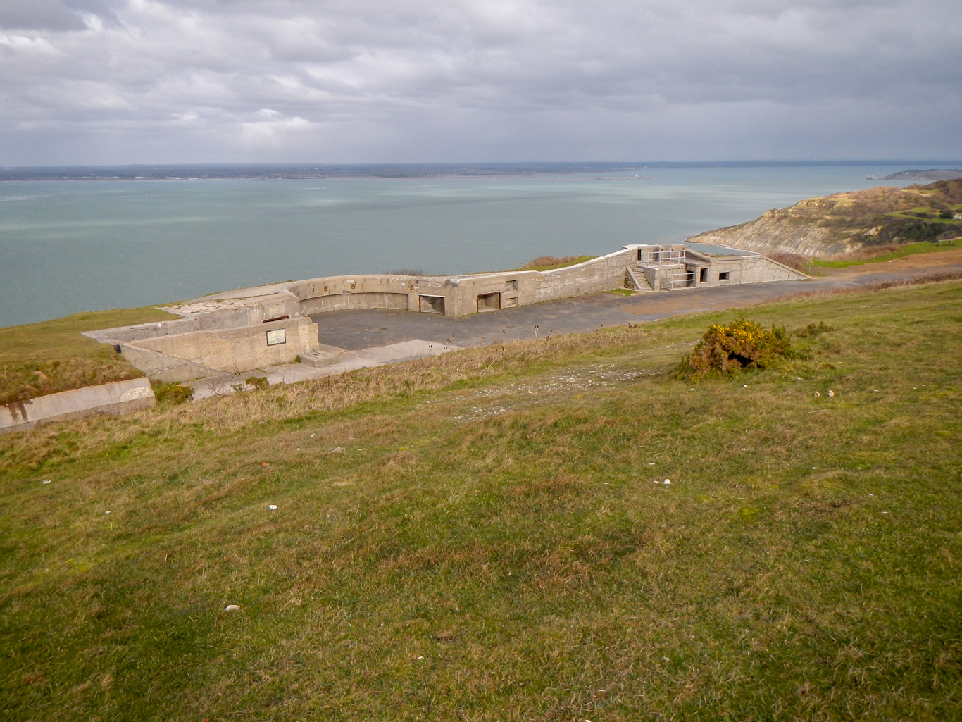
Next I followed the coast all the way to the Old Battery on the headland (under the care of the National Trust). I ascended to the Coast Watch station then ventured out to the view point nearest The Needles, from where I was almost blown away. From there I continued round the Headland, exploring the New Battery as I went.

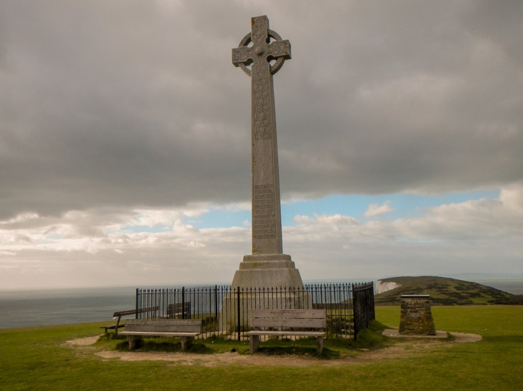
There followed an exhilarating walk along the well drained chalky ridge of West High Down, with superb views to both the north and the south. This culminated in the high point where there is a huge stone Celtic Cross commemorating Tennyson. At this point I was actually less than a kilometre from my start point for the day at Weston Manor.
I descended to Freshwater bay, noting the Fort Redoubt (now private) on a promontory. There was an information board about the seventeenth century polymath Robert Hooke who came from Freshwater. One of his many fields of interest had been in palaeontology and no doubt this was helped by discovering many fossilised remains near his childhood home. In fact later that afternoon I walked along a section of beach where many fossilised dinosaur foot prints as well as a fossilised forest have been seen.
I arrived at my destination in Brighstone before 4pm and was looking forward to booking in to my accommodation at Three Bishops Inn then wandering round the village and perhaps looking at the village shop and church. Unfortunately I arrived to be told that there was a problem – no LPG as it had run out and so no heating and no hot water. I would have been willing to forgo these for a roof over my head. However the landlady wouldn’t hear of it and arranged for me to stay a couple of houses down the road at Wolvesey House – the main problem being that Margaret the owner was at work until 6pm. I was offered food as long as it could be cooked in a microwave or oven – so opted for an early dinner just in case circumstances changed and all cooked food became unavailable.
Actually Wolvesey House was amazing and Margaret was a brilliant hostess offering lots of extras like elderflower fizz, chocolates and fruit in the room. In retrospect it was my best night of the whole time in Isle of Wight. I wondered why I hadn’t booked this in the first place – and then realised it’s because it is normally only available for stays of two nights or more. However if I had realised what I was missing then I might have worked out how to spend two nights there…… In case anyone reading this doesn’t want to lose out, the website is: http://www.wolveseyhouse.com/
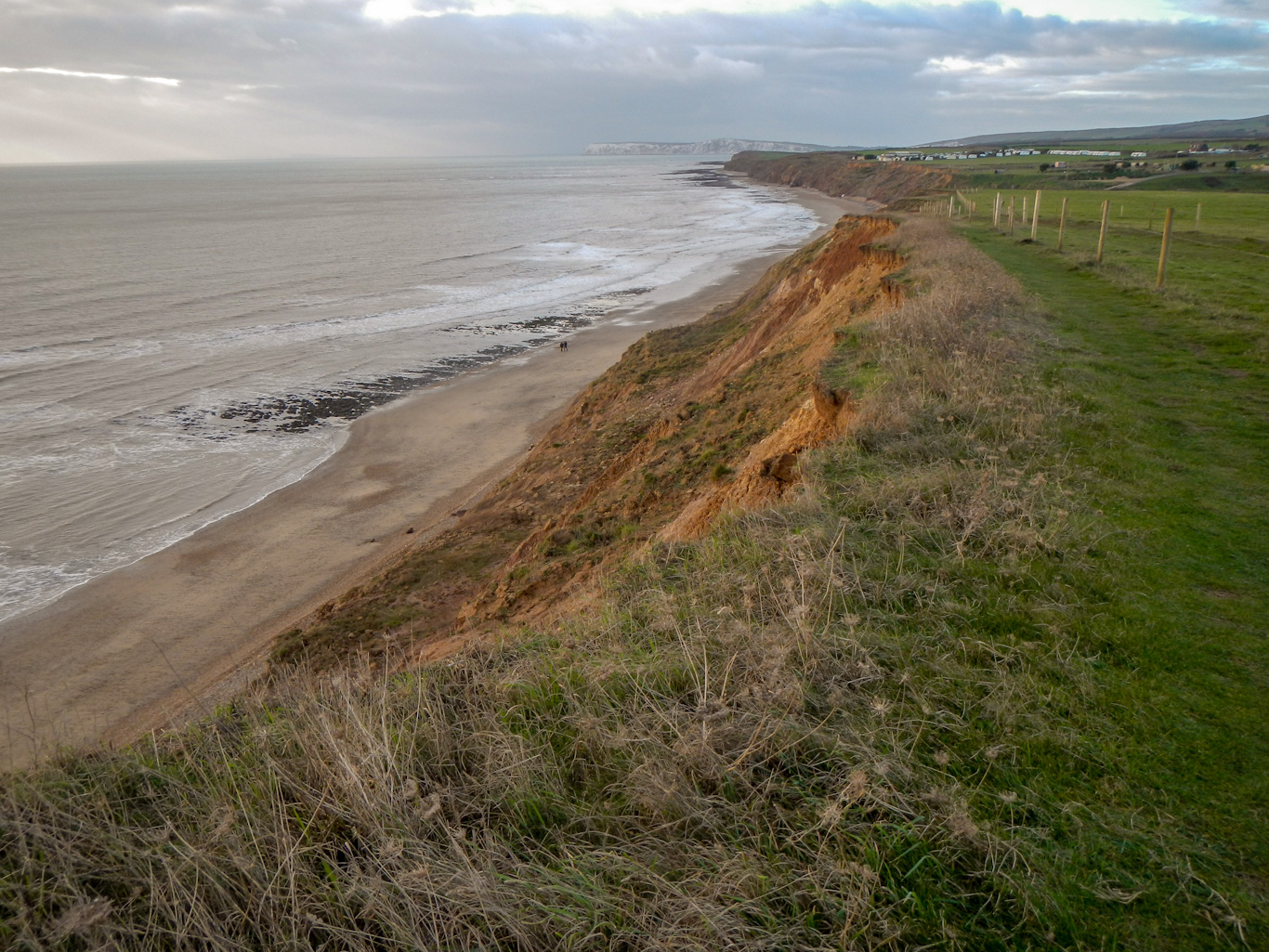
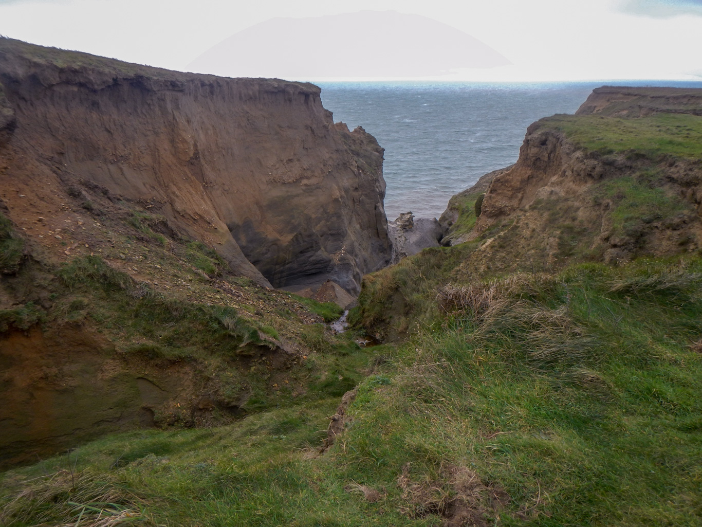
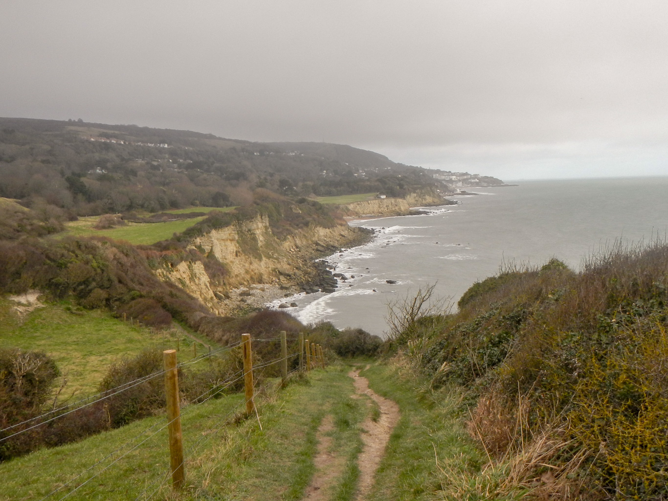
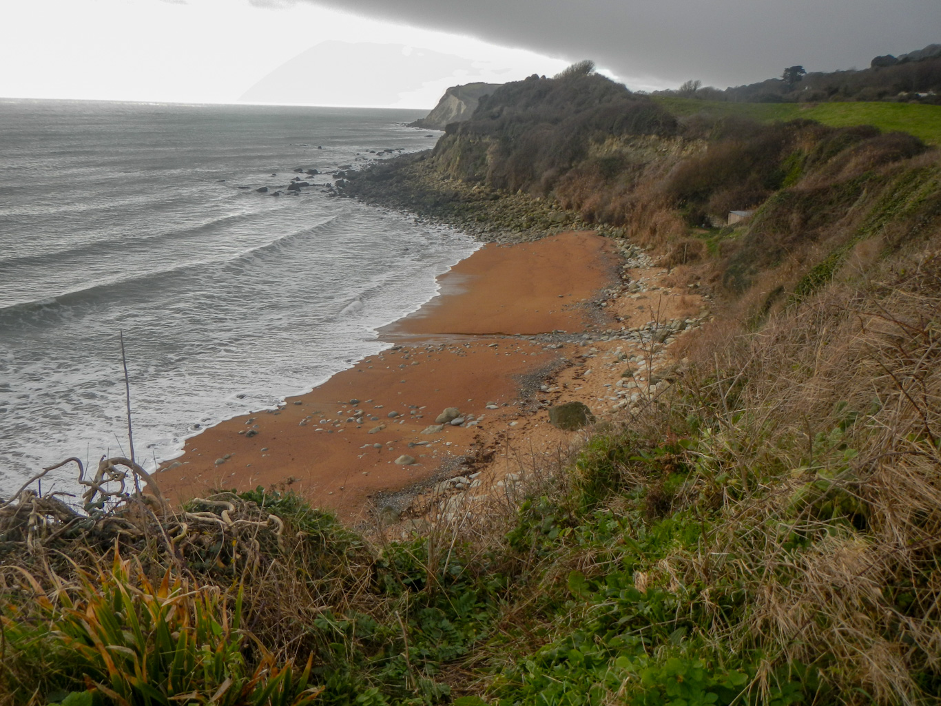
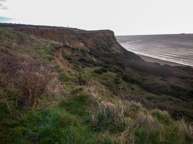
Feeling well refreshed after my shorter walk the previous day and my excellent accommodation, I left just before 9am. it was still windy but clear with good views. The tide was in. I walked on the cliff top around various chines. A chine is a steep-sided coastal gorge where a river flows to the sea through, typically, soft eroding cliffs of sandstone or clays. As the walls of the chines and cliffs are so unstable and erode continually, the strata are clearly visible. There was certainly much evidence of unstable crumbling cliffs and I guess that bits of coastal path I walked on during my 1970s visit to Isle of Wight must be in the sea now.

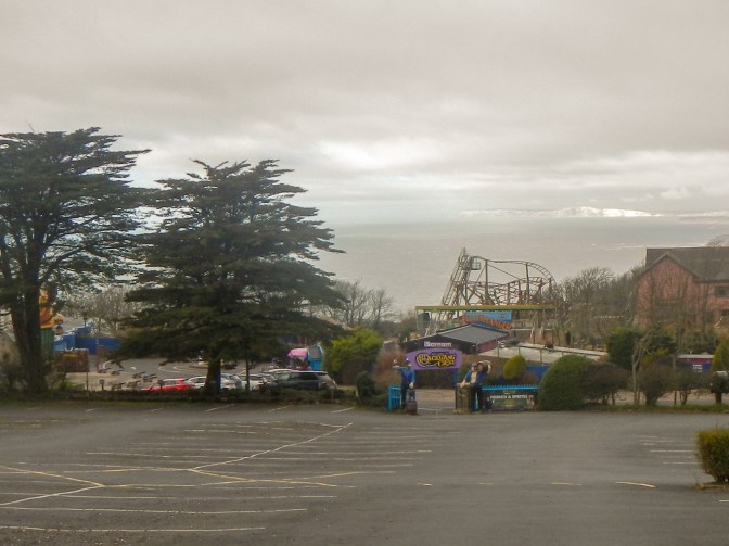
I passed the huge Blackgang Chine – there was even a theme park there in the 1970s and I believe its the UK’s oldest theme park – I could see a helter-skelter which certainly wasn’t there when we had visited all those years ago.
The undercliff was below me as I rounded the upper part of the headland near St Catherine’s Point. In view of cloud on the hill I didn’t climb to St Catherine’s Oratory, an octagonal tower which was a medieval lighthouse and known colloquially as “the pepperpot”.
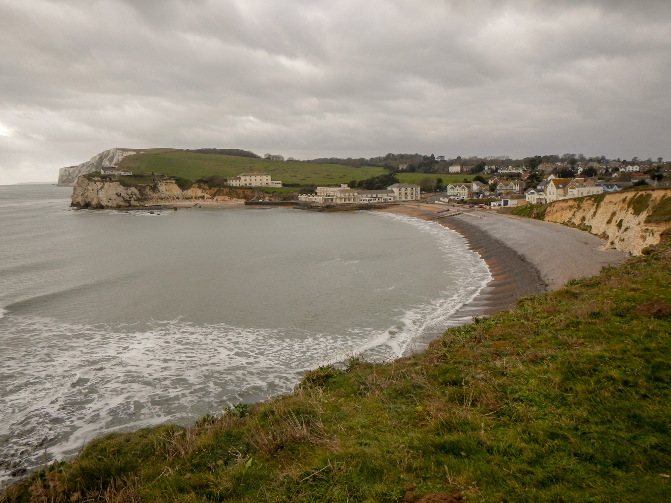
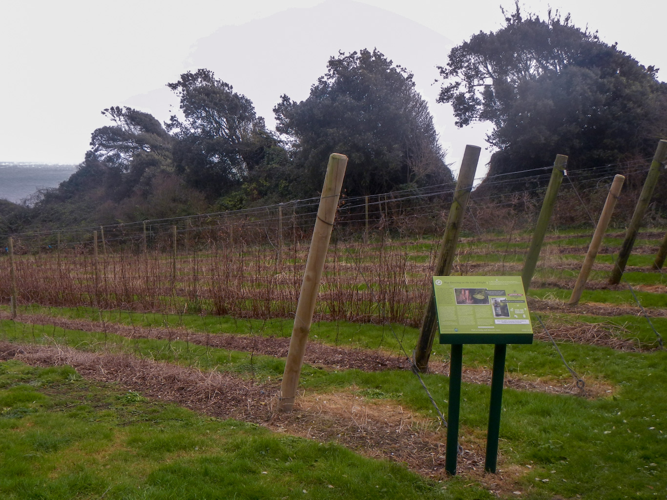
This area is the largest single area of landslip topography in Western Europe. After descending to St Lawrence, where there is what looks to be a brilliant village shop and café but it’s closed on Tuesday afternoons, I was in the warmer undercliff area itself. The micro climate conditions mean it is on average 5 degrees warmer than anywhere else in UK. Hence the Ventnor botanic garden has a host of tropical and subtropical species not grown outside anywhere else in UK. There was also the only hop yard on Isle of Wight. I descended further to the attractive privately owned Castle Cove before reaching the seaside town and Victorian health resort of Ventnor.
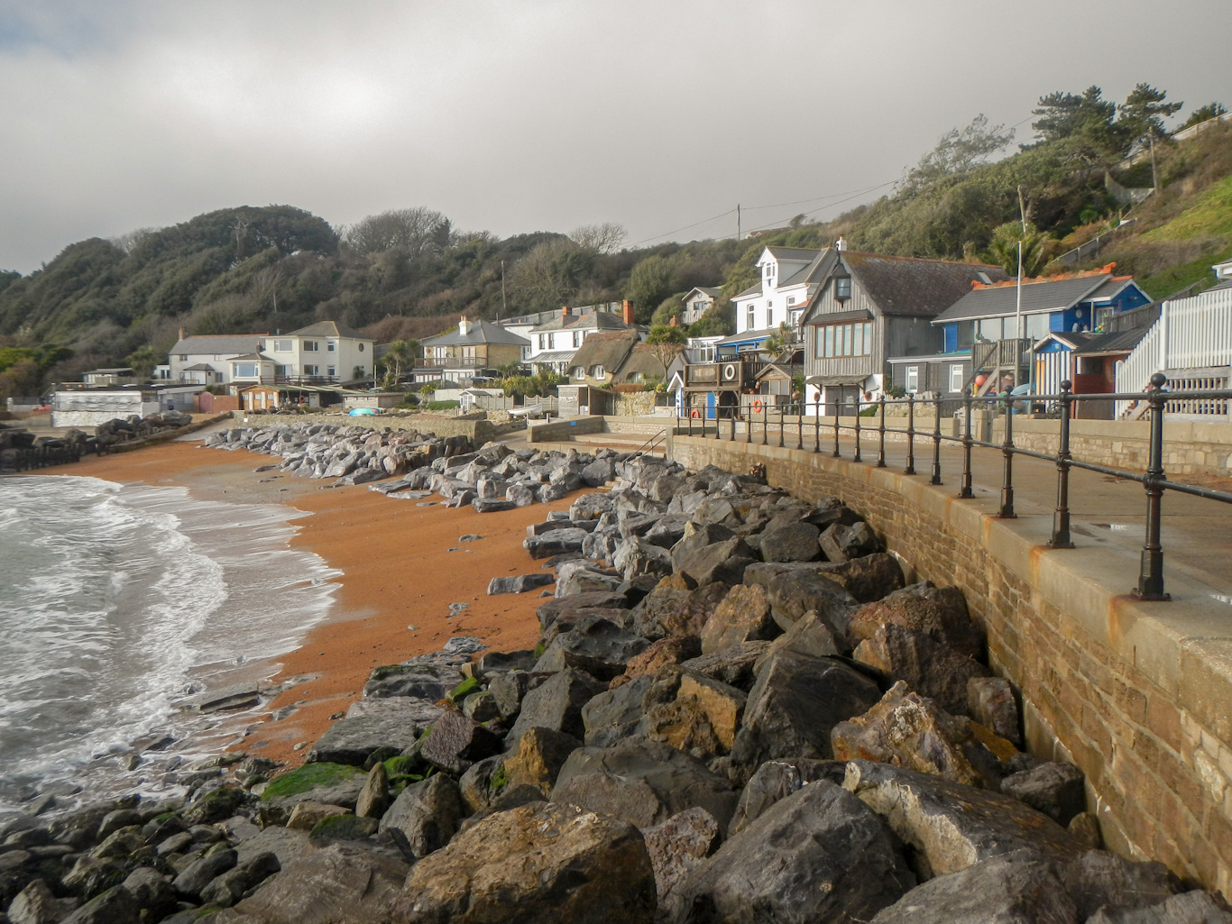
To be honest, Ventnor looked as though it had seen better days. The café where I tried to stop for a drink and snack was just closing at 14:10 so, like two customers just ahead of me, I was turned away. I walked along a sea wall which had won a Concrete Society Award and noted posters about the rare Glanville Fritillary – a butterfly species seen only on the Isle of Wight.

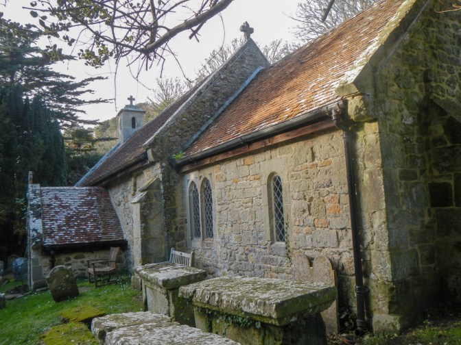
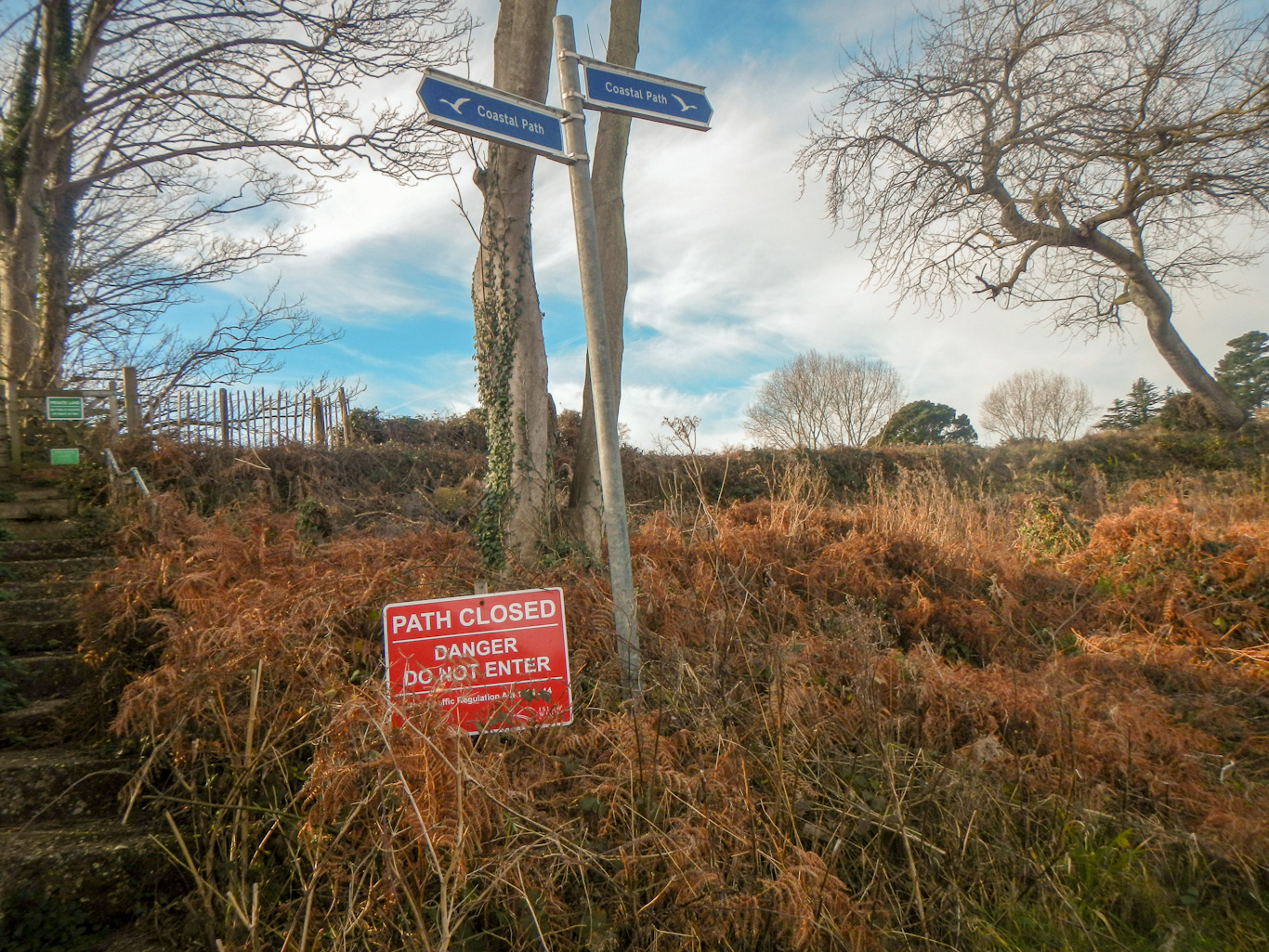
Unfortunately before I reached Bonchurch, there was a path closure due to subsidence and no signed alternative. I ended up ascending to a road and navigating round, making sure not to miss descending back to the 11th century Bonchurch Old Church dedicated to St Boniface. He is said to have brought Christianity to this part of the island.
The onward path was open but it wasn’t long before I reached the next path closure. If I’d realised I would have followed the road from the church. There was a steep and arduous climb up to the road along a path angling away from my route direction.
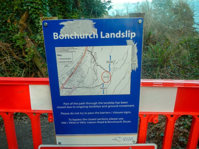
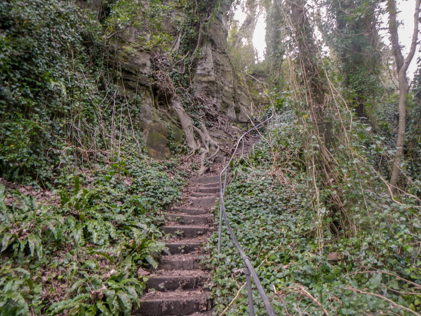
I almost didn’t go back to the coast path at the next turning as I thought there was no guarantee of getting through. However this would have meant missing a major landslip feature and I didn’t want to miss it. The long descent included passing through a narrow gap in the rocks. Fortunately there weren’t any more diversions on this stretch.
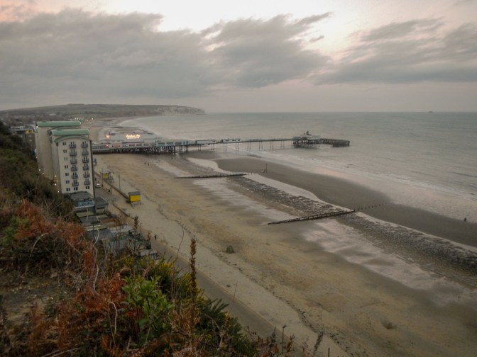
I arrived at Shanklin eventually and ended up getting caught walking round in a circle due to a further diversion. However having ascended to a high walkway, the onward walk to Sandown was without incident. I could see the pier lights ahead of me and knew that was near my destination.
My hotel was half closed. It was difficult to find anywhere open for dinner. Eventually I settled for the restaurant at what looked to be a fairly new Premier Inn.
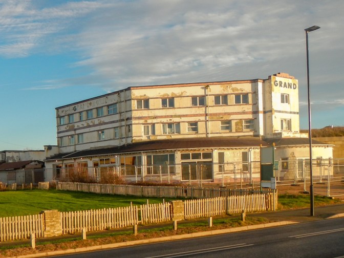
Next morning, breakfast service started at 09:00am but I definitely wanted to be on my way before then. I settled for instant porridge in my room, the wandered up the High Street (partially closed by road works) to buy some lunch food from a supermarket. It was a lovely morning with the sun rising over a blue sea. However Sandown still looked quite run down, exemplified by the permanently closed and ironically named “Grand Hotel”.
The walk over Bembridge Down was superb, although I was frightened off from ascending to the 360 degree viewpoint near Bembridge Fort as there was a herd of cattle. The views from where I did get to were pretty good.
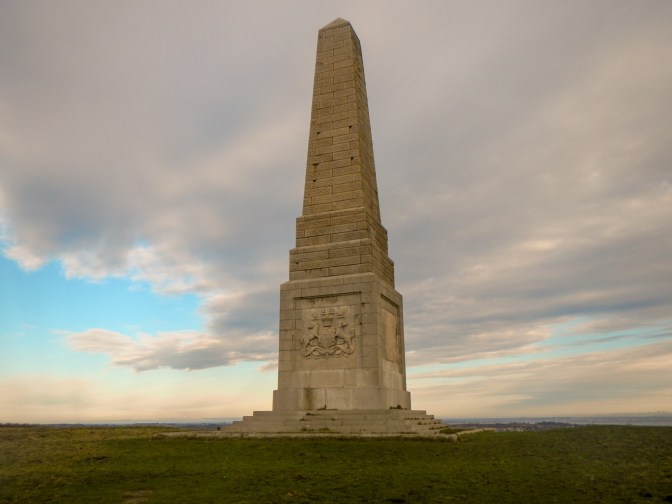
I followed the signs into a field to look at the monument to the Earl of Yarborough first Commodore of the Royal Yacht Squadron at Cowes. I should have ignored the signs to proceed down this field as I had to leave the path to keep away from another herd of cattle – I’m sure it included a bull too. Following the quiet road round to the viewpoint on Culver Down then re-joining the official path near the end of the metalled road looks like it would have been a better option.
I did divert off the path to go and look at the outside of Bembridge windmill and returned to the coastal path a different way through an area of ancient woodland. This meant that I did part of the coast path twice as I had detoured off at a later point on the path.
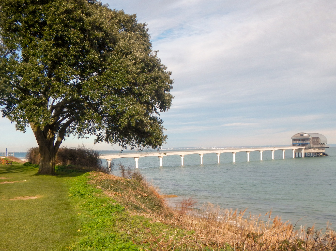
I tried to take a marked path nearer to the coast than the official path round Foreland but it was closed due to erosion. Then, having arrived at the lifeboat station, I followed the marked and signed route. However I cam up against a further path closure so retreated again. Eventually I reached Bembridge Harbour where there were many amazing houseboats – huge wooden superstructures built on floating platforms.
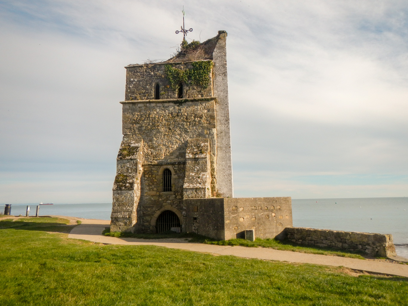
I was glad to be off tarmac to cross the estuary on a causeway, before diverting slightly off route to St Helen’s Church. It’s the last remaining part of the ancient church that once stood here, and now serves as a marker for those at sea.
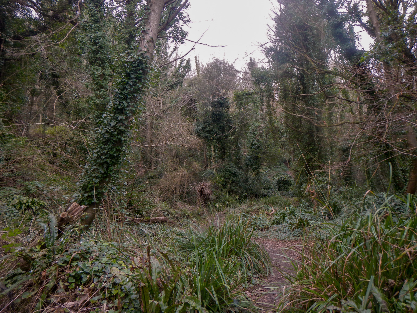
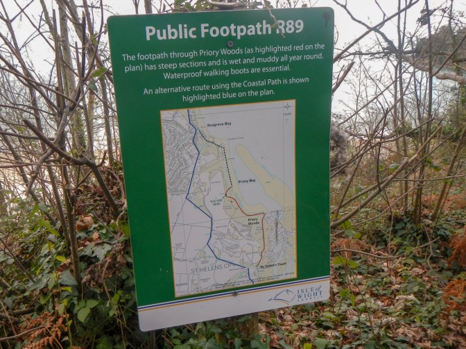
I spotted a signed path through Priory Woods. it looked like a more interesting route than the official route. The Council had been kind enough to provide a sign with warning of the muddy conditions and that walking boots are essential. It was true as I was soon wading through sticky gelatinous mud that was ankle deep at times. However I reached the far side safely and paddled in a stream and at the edge of the sea to remove the worse of the mud. Some walkers in pristinely clean trousers and boots approached coming towards me asking whether there was a way through so I said yes but as long as they didn’t mind being as muddy as me afterwards.
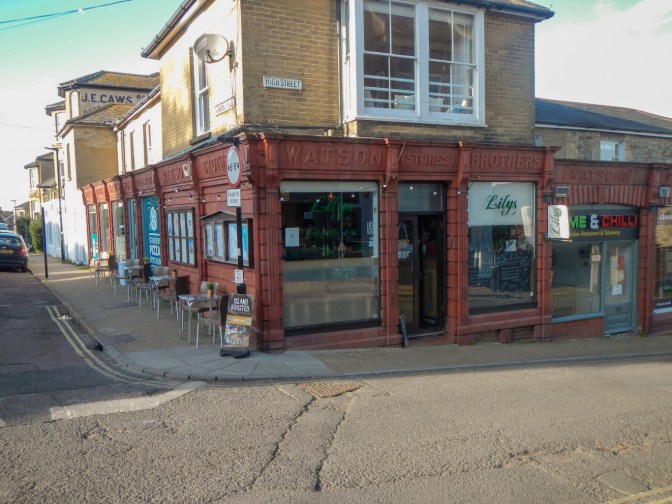
I followed a surfaced path and reached the village of Seaview. My husband had recommended stopping for coffee and cake at Lilys. I was there well before their 3pm closing time. indeed this was a brilliant recommendation – incredibly friendly, welcoming staff even though I was so muddy and a delicious piece of blueberry sponge.
Suitably refreshed I started on my final trek round to Ryde where I had started. I’d texted my husband and he thought it would take less than an hour. This was correct – no more path diversions, no more mud – and I was soon in Ryde.
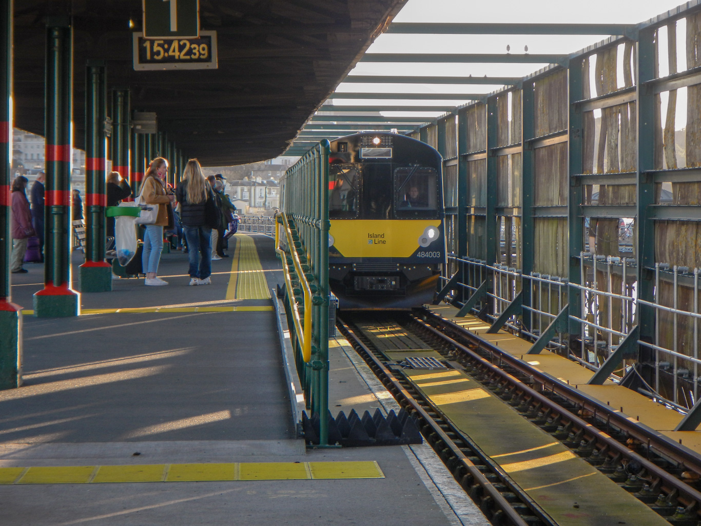
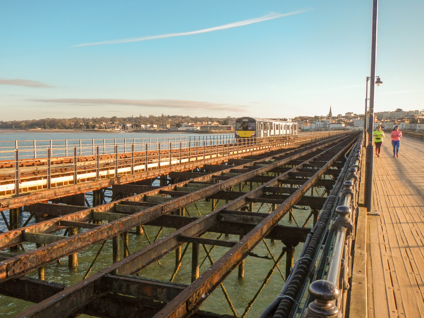
Having dumped my rucksack at the hotel, I finished the circumnavigation by walking the short distance to the hover port with my husband and then we walked down Ryde pier, noting that this is a triple pier with roadway, disused tramway and railway. The pier is 681m long (Southend pier is longer) and is the World’s oldest seaside pleasure pier.
The journey back the next day started with the return hovercraft ride – this time we knew which side of the hovercraft to sit in order to enjoy the best views.