3 January 2022
I love this approach to drive on to Dartmoor from Ashburton. Suddenly the vista opens up with views of multiple tors and I feel a sense of anticipation as I drive to a start point ready to set off on my exploration. The odd thing is that despite now having bagged over 200 tors, I hadn’t visited, during this current tor bagging project, the very obvious Yar Tor and Corndon Tor seen here to the right of the road . This was the day to remedy the omission. I drove into Dartmeet to park in the huge and almost empty car park. Looking at the cars, everybody else seemed to be kayaking rather than walking.
I was soon out of the car and on the path leading straight on to the moor. Previously I have kept to the riverside path here but this time I began climbing almost immediately to reach Cub Rock. It’s not named on the Ordnance Survey map or included in the LDWA list. However it’s a definite outcrop and affords a good view down onto the East Dart River.

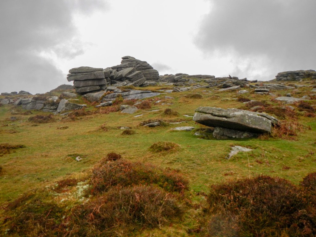
I climbed further and arrived at the large Yar Tor, with excellent views especially over to Corndon Down where I would be going next. Near the summit, I also saw the first of several stone cairns. This one seems to have been rearranged to form a spiral maze.
From Yar Tor I continued in an easterly direction, losing only a little height. I passed a World War 1 memorial cross inscribed:
“TO THE GLORY OF GOD AND TO THE DEAR MEMORY OF EVELYN ANTHONY CAVE PENNEY LIEUT. Q.V.O. CORPS OF GUIDES FELL IN PALESTINE WHILST GALLANTLY COMMANDING HIS MEN JUNE 8TH 1918 AGED 19. LOOK UP AND LIFT UP YOUR HEADS“
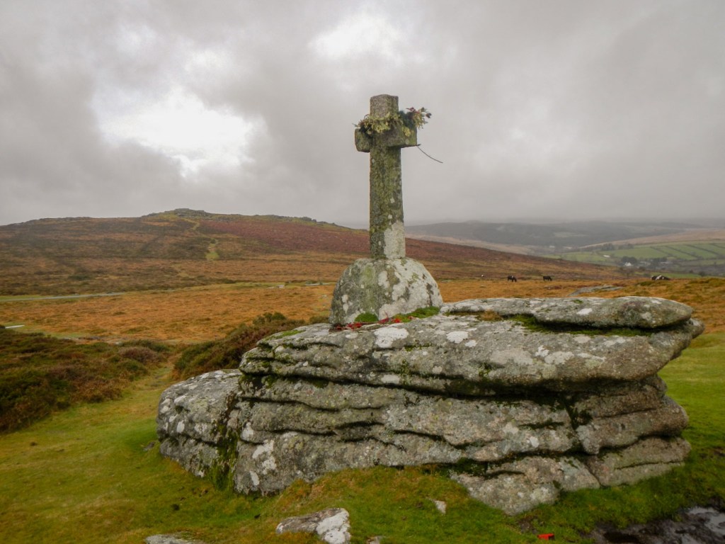
It’s deservedly an impressive memorial to Lieut. Cave Penney who was sadly killed while still only a teenager and a salutary reminder of the sacrifices made by members of the armed forces.
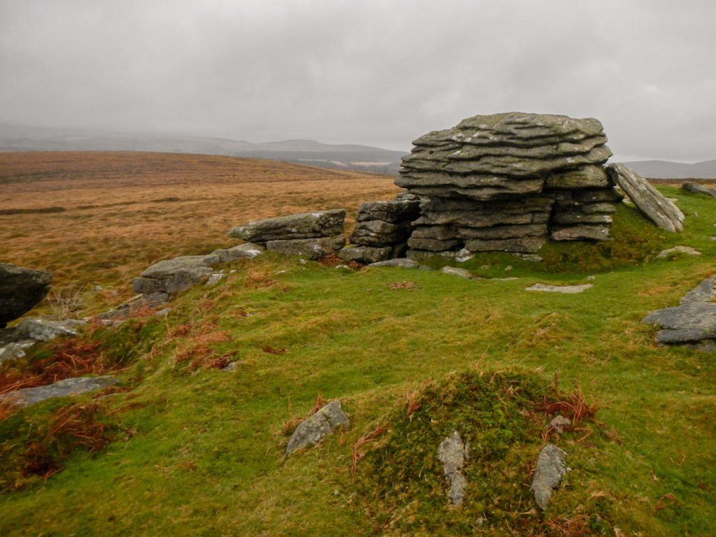
I climbed up to what was the highest point of my walk. Corndon Tor boasts a few large outcrops.

From there I made my way north along the ridge of the down where there were a further few relatively well preserved bronze age stone cairns.

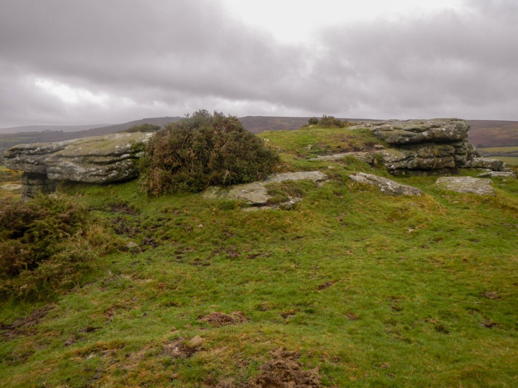
I found Cathanger Rock easily. Unlike the other tors I had visited on this day, Cathanger Rock is a discrete outcrop and it was very obvious as to which rock I needed to touch to “bag” it. It was my third tor of the day from the LDWA list.
My next objective was Rowden Tor. I walked in an easterly direction to meet a narrow lane which I followed and then climbed on a track back on to an area of open moor. The tor was obvious but arriving there proved more problematic as I had to give sufficient berth to a group of cattle.
The obligatory photo taken, I hurried off the moor partly because it had started raining in this open exposed area and partly to put distance between myself and the cattle. As I walked down the lane to meet the central route of the Two Moors Way, I spotted Wind Tor. I was almost tempted to climb it but, although I knew my walk today was shorter than most, I wanted to ensure I left sufficient time to find some tors in the Dart Valley where there’s no path marked on the map.
I saw a couple of walkers coming towards me and then a small group with multiple dogs. However soon I turned off the lanes on to a path between houses at Jordan. There was a footbridge over the Western tributary of the River Webburn. The path followed the fast flowing river downstream through deciduous woodland to emerge at Ponsworthy. Despite it being a dull day, there were wide ranging views of tors to see from Sherberton Common. Multiple cars were parked on the corner near the obvious Bel Tor – unfortunately this one is on private land guarded by a herd of cattle.
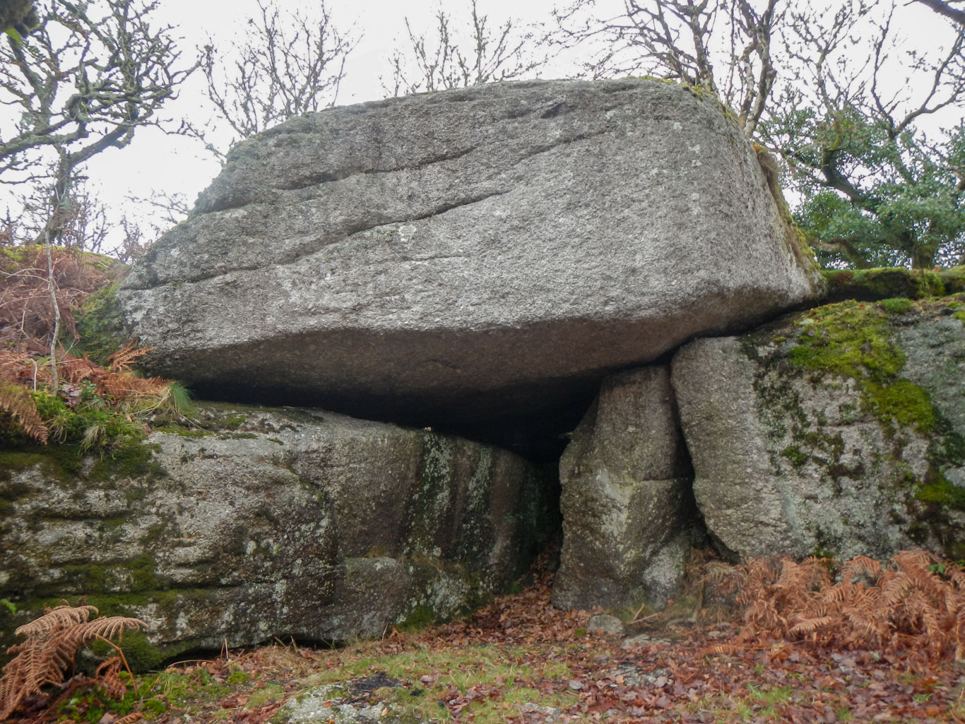
Many of the occupants of the cars parked appeared to be making the short outing to Mel Tor. I skirted that one, having been up it previously, and followed vague paths near a boundary wall. This included a very boggy stream crossing but was otherwise surprisingly easy. I was surprised to see a couple of walkers ahead of me as I neared a path branch to the upper part of Luckey Tor. The pair didn’t turn off to the upper part of the tor where I went. It didn’t even seem that large from the top. However on returning to my previous path and heading downhill the view from below showed a huge and impressive towering cliff-like tor. Remains of fires suggest that this is unsurprisingly a popular spot for illicit summer barbecues.
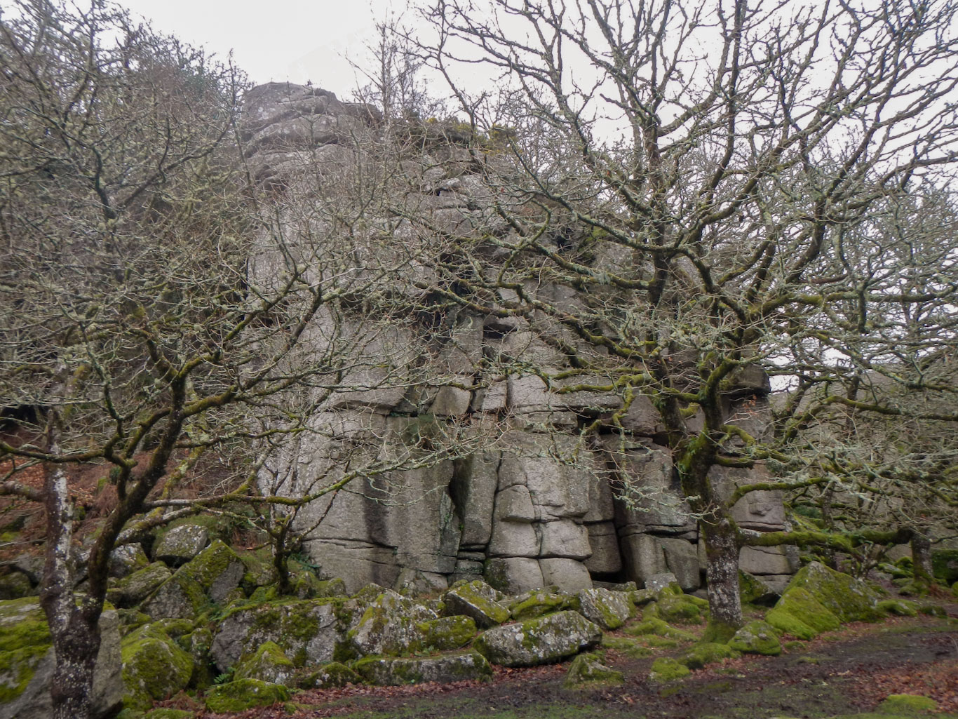
I crossed a stream and used my Sat-map to guide me up a steep slope to the almost inaccessible outcrop of broken blocks that makes up Rowbrock Tor, much of which is obscured with vegetation.
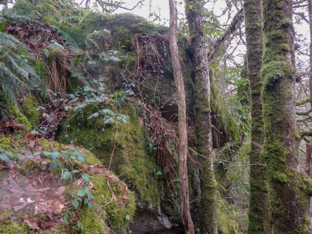
Despite the distance being only a few hundred metres, it was hard work to make my way to Vaghill Tor. This turned out to be quite a scattered outcrop with a few rock piles. Having reached some land that was a bit more open, it was easier to walk to the rockpile of Little Vag Tor.


I descended from there to follow a very waterlogged path close to the turbulent Dart River which was barely staying within its banks after all the rain of the past few days.
Within a few minutes, instead of fighting through vegetation on the steep and deserted slopes of the Dart Valley, I was back in “civilisation”. The car park at Dartmeet was a little more full than in the morning and there were a few people wandering near the village.

I had ticked off a further five tors from the LDWA list so now my official total stands at 208.
