18 November 2021
We were staying in a hotel near Paddington and returning to Exeter today. I had decided to complete this walk “on the way home” so I was carrying a heavier rucksack containing my clothes and other bits and pieces that I had needed in London for the past few days. I had an early start, leaving the hotel soon after 07.00 so was grateful that breakfast was available promptly. My walk began with a trek of just over two miles to Victoria Station, predominantly through Hyde Park past the “Winter Wonderland” under construction and just touching the bank of the Serpentine. This was almost as quick as catching the tube and minimised Covid risks.
I was early at Victoria. The illuminated notice for my train mentioned some short platforms, but not which ones and advised listening on the train. Once the platform at Victoria was announced, I was quickly through the barrier. The really long train was just arriving and I decided to make for near the front on the basis that it would probably be front carriages for Holmwood Station (the start of my walk) if this was one with a short platform.
I cowered behind a pillar as a river of people swept off the train and rushed towards and past me. It was incredible that so many people were on a single train.
I boarded the train a few minutes later, getting on the fourth carriage from the front. A few more people followed after me but that the train was not crowded is an understatement. Soon we were past Clapham Junction and heading through suburbia to the rural hinterland.
Eventually we arrived at Box Hill and Westhumble Station where I would be ending my walk later. Two stops on is Holmwood and there had not yet been any on-train announcements (or any sign of a train manager to ask) about short platforms. Finally the announcement was made just before Holmwood – fortunately it would be possible to alight from the front five or six carriages, so I was in the right place.
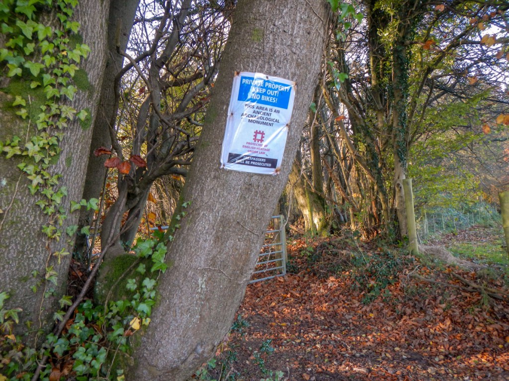
There was only a small stretch of pavement before I turned on to a green way. The path turned to go more steeply uphill through a field of cows. I kept close to the hedge to avoid them but this only meant a minor amount of extra distance. I passed along a well marked path through fields of horses, emerging on a road near Anstiebury Hill Fort. On the map, this appears to be an impressive example of an Iron Age camp but there were notices stating that it was private property and trespassers would be prosecuted. Hence I walked around the wooded area on the road, passing The Plough Inn open for coffee (I resisted the temptation).
I turned up a track and started to make my way up Leith Hill. I passed a delightfully located cricket pitch and then entered the large area of land in the care of The National Trust. There is a complex network of paths through mixed woodland and I merely headed upwards (there was one bit where I was slightly concerned as I had to go down to get to where the next bit of hill seemed to be).
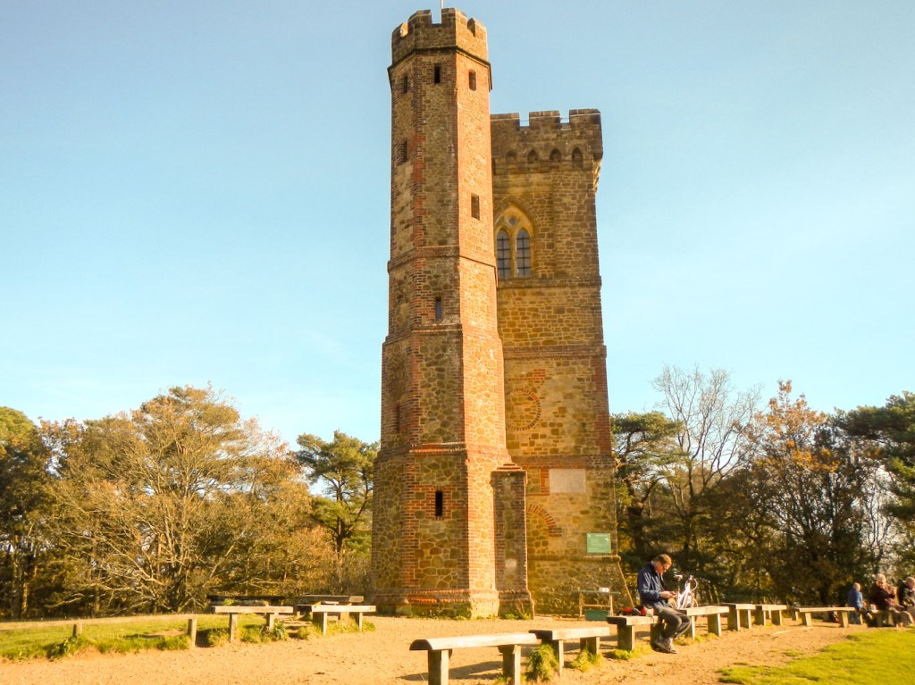
I was soon on the summit of Leith Hill – at 965 feet it’s the highest point in Surrey. The kiosk at the bottom of the tower (built in 1765) was open for drinks and food but sadly the tower itself was closed so I couldn’t climb to the top. From the top it may have been possible to see London landmarks to the north. At ground level, the views were quite hazy to the south over the fields and woodlands of rural Surrey. The view to the north was less open due to the extensive woodland.


There followed a long stretch of walking following part of the Greensand Way, the whole of which follows a ridge across Surrey and Kent. The sandstone rock, containing the green coloured mineral glauconite (also known as ‘green sand’), gives the route its name.
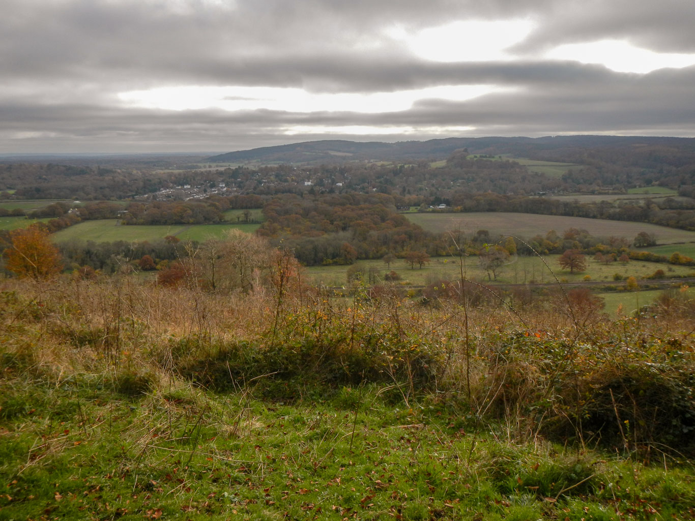
Eventually I descended to the A25 at Westcott and crossed this to make my way on minor roads and tracks under a railway line (not the one I travelled on) and then up a steep hill on to the North Downs Way. This is a national Trail so well waymarked with the familiar acorn logo. Once up on the path, I stopped for lunch, admiring the view over the valley from the conveniently located bench. I could even make out the tower on Leith Hill.


The path soon left the main ridge, just after a further area with a bench and more fine views, to reach some minor roads. I passed a huge church seemingly in the middle of nowhere. Later the path descended round the edge of a large vineyard to reach the busy A24 dual carriageway trunk road.


Signs advised proceeding up to the roundabout to cross the road under a subway, which I did. Instead of following the North Downs Way signs back along the other side of the road, I turned up a side road past a large hotel. Soon there was a footpath on the right, which ascended steeply on slippery eroded chalk. As I ascended towards the top of Box Hill, the path flattened out a bit with excellent views behind me.
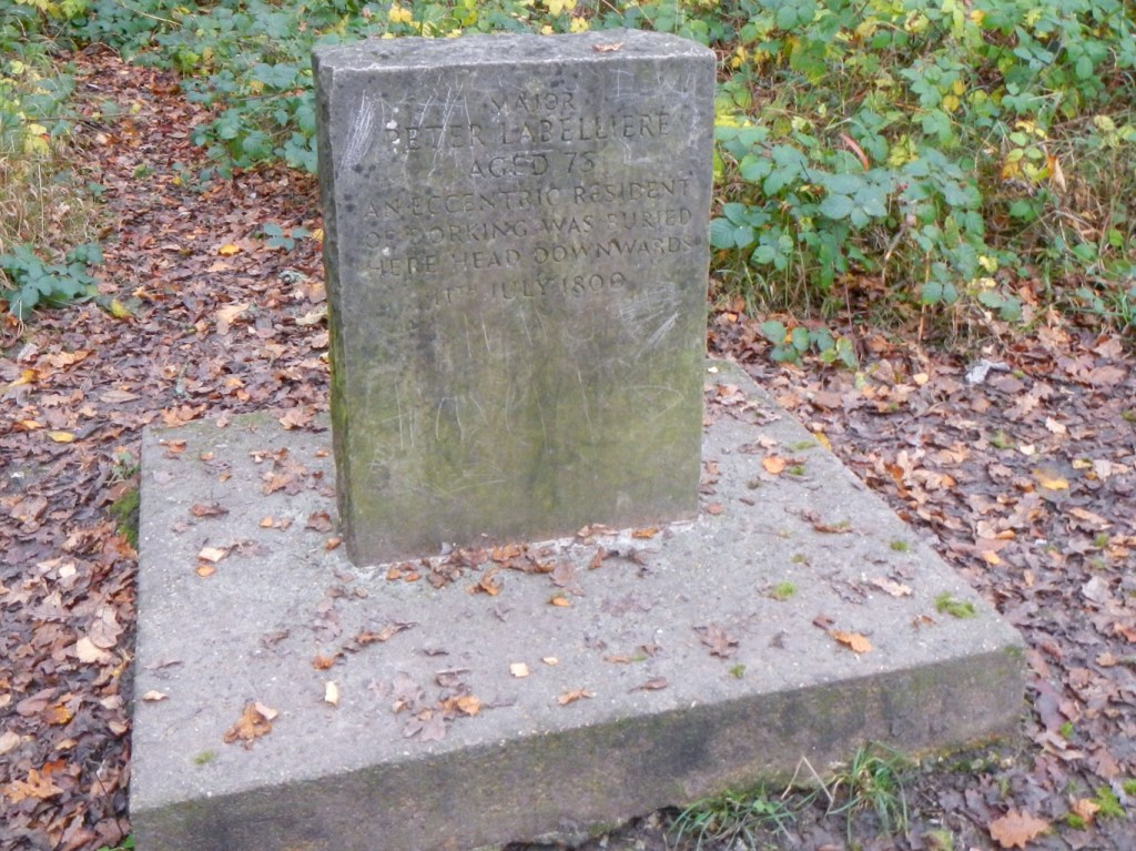
I passed an unusual grave next to the path. This is where Major Peter Labilliere, a retired Marine and latterly an eccentric resident of Dorking was, according to his wishes, buried head down without any church rites on 11 June 1800. He was reported to have said that the world was “topsy-turvey” and that it would be righted in the end if he were interred in this way. A crowds of thousands from the local area and from London climbed the hill to watch. Apparently the month (July) on the current stone is wrong as is the spelling of his name. This stone is a replacement dating from the late 1950s several metres to the east of the burial site.
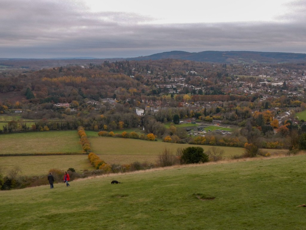
I walked on up to the large car park and visitor centre then to the spectacular viewpoint, from where I could see Leith Hill that I had walked up earlier.
I also looked at the remains of Box Hill Fort. This was built towards the end of the nineteenth century as part of the London Defence Scheme. The scheme comprised thirteen military installations spreading a length of seventy two miles, representing a last ditch attempt to save London from potential invasion from the south and east.


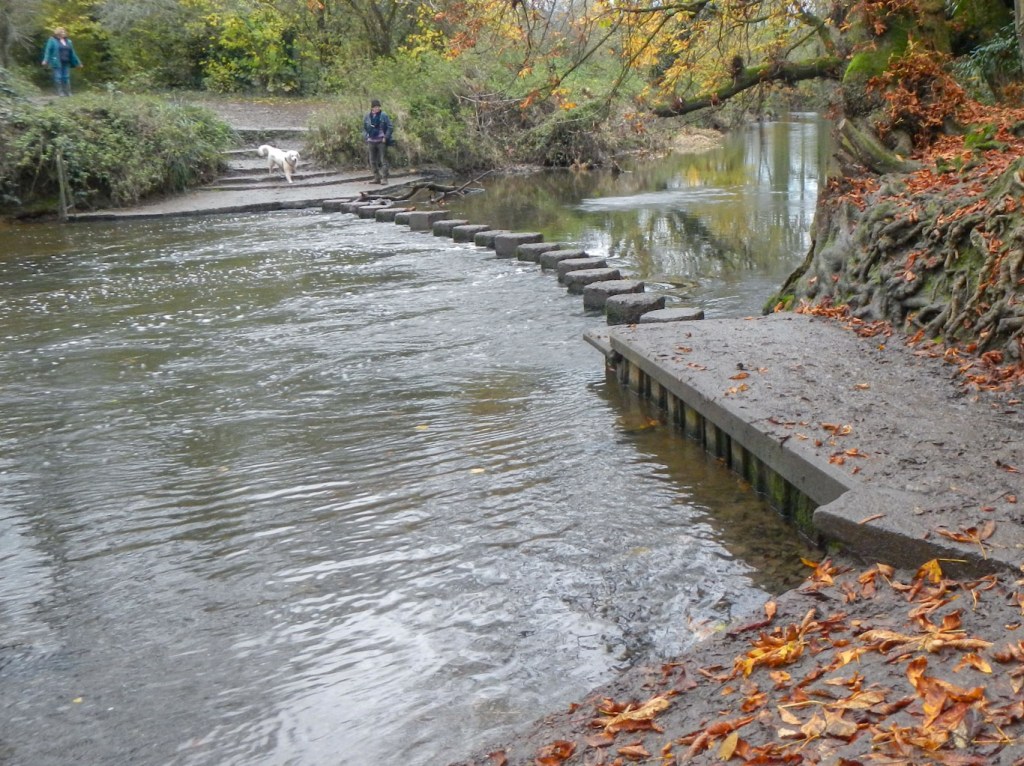
I returned to the viewpoint to follow a steep path down the other side of the hill to where I had ascended. I am pleased to say that I managed the stepping stones with ease and didn’t have to revert to the bridge diversion.
I walked along the cycle and foot path next to the A24 to cross back under the subway and wander through the village of Westhumble to reach the railway station for my train to Clapham Junction and then to Exeter.
