26 October – 1 November 2021
This route also strayed on to maps 164 and 175 but not sufficient to count. The story actually starts on map 184 in Salisbury, but I’ve already done that one in the Imber perimeter walk.
26 October started with me completing the couple of hundred metres of The Clarendon Way to Salisbury Cathedral. By 08.25 I was already on the front seat of the top deck of the X5 bus to Swindon via Pewsey. In fact I was the sole passenger for the first hour of the journey all the way to Pewsey. I’m not sure why I bothered to keep my mask on! It was a wonderful journey starting with views of Salisbury, including Old Sarum which dates back to the Iron Age and then travelling through several villages with some picturesque thatched houses to the large village of Pewsey with a history dating back to the sixth century. Even after Pewsey, I had no concern about social distancing – one elderly man had ventured to the upper deck and there were a further few passengers on the lower deck.
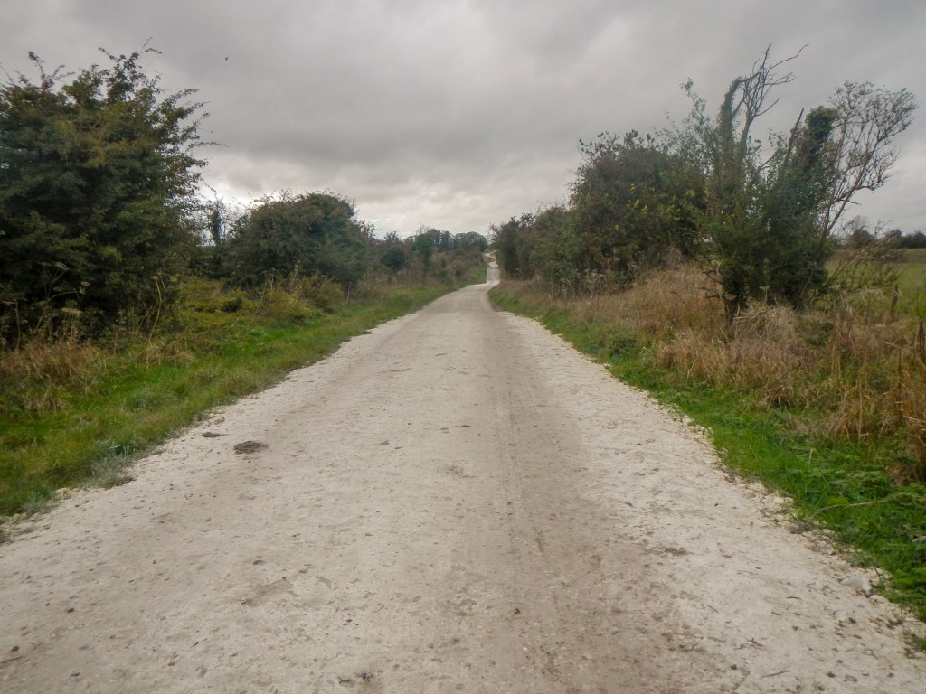
I left the bus at Marlborough, a market town with a famous school. This was where I would be spending a night but first I was to walk to Avebury to wander around this area steeped in prehistoric monuments. I made my way from the Victorian Town Hall up the hill, past Marlborough Common and the golf course. The views across the downs were superb and I was soon in remote and undulating countryside surrounded by race horse “gallops”, fields of cattle and sheep, and patches of woodland. I had to detour once to get around a field of cattle. Eventually I was heading down a slippery chalk track (Green Street) which was once part of the main road from Marlborough to Bath.
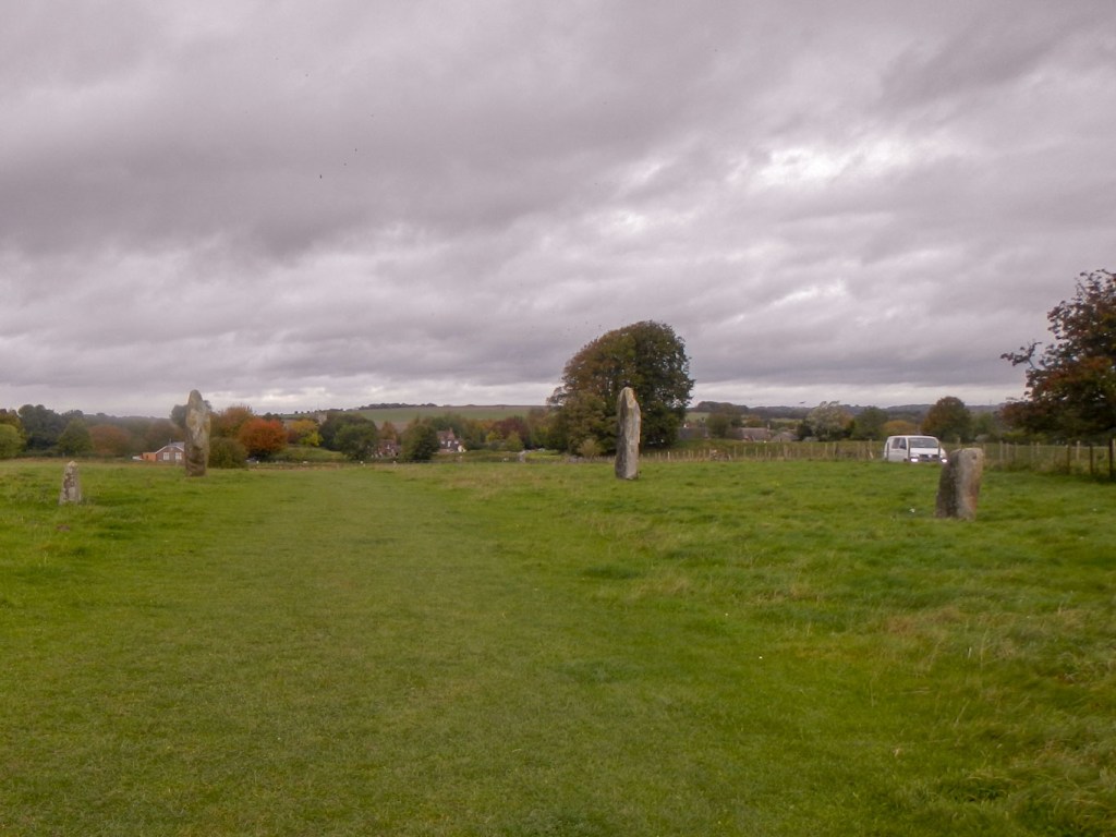
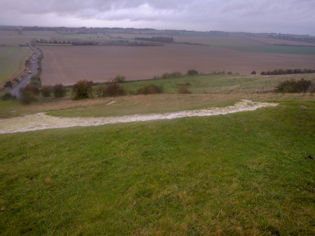
Avebury was relatively busy, but there was still plenty of space in the picnic area where I ate my lunch and then set off to explore this amazing area, initially making a circuit of the main stone circle and henge.

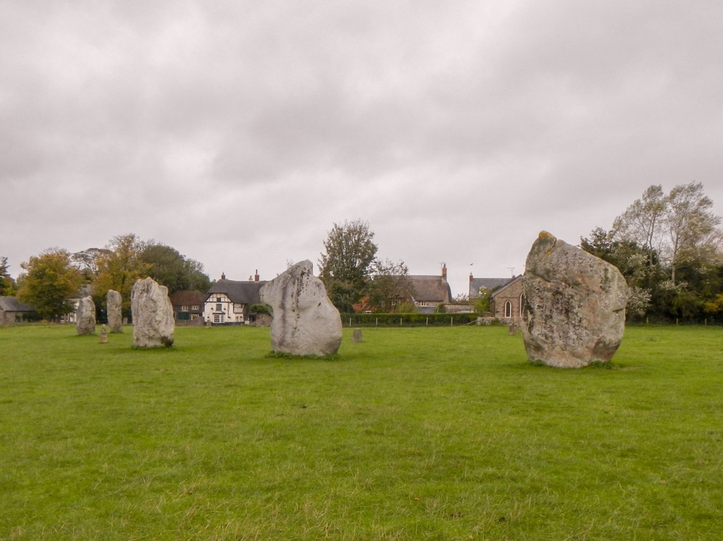
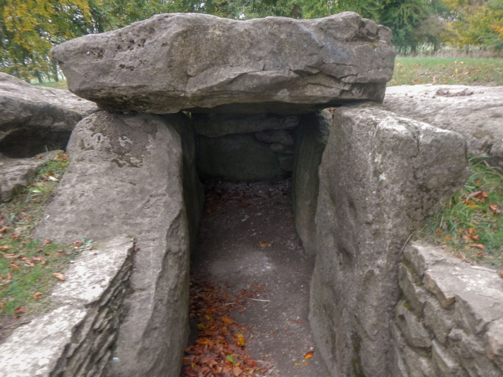
The stone circles and henge monument are particularly unusual, not just because it is the largest stone circle in the world but also for the fact that it is the only stone circle with a village built partially within it.
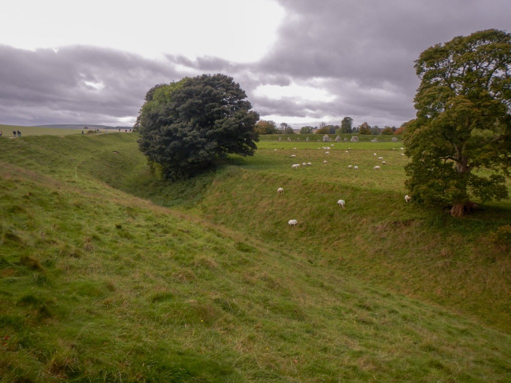
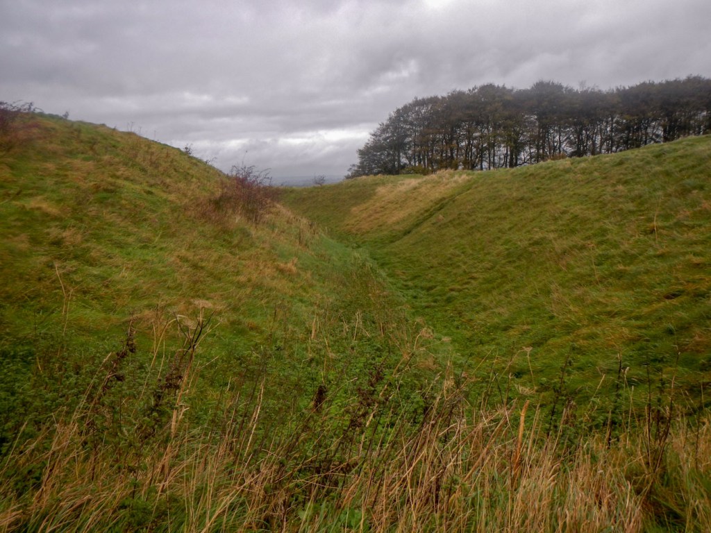
A henge is a circular Neolithic earthwork, consisting of a bank with a ditch on the inside. The henge at Avebury is exceptionally large at just over three quarters of a mile in circumference and it would have been originally up to 29 feet deep . The large outer stone circle contains two smaller inner circles within it. The stones themselves are of a local sarsen stone. The building of the circles and henge was believed to be in the late Neolithic period from 2,850 to 2,200 BC. It is amazing just how much of it remains – despite the removal of stones in the past for later building projects. Unlike Stonehenge, it is still possible to walk right up to the stones and touch them.
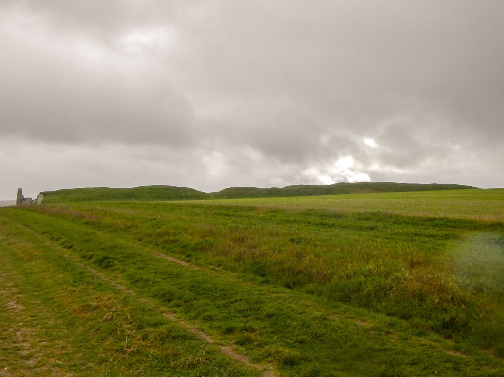
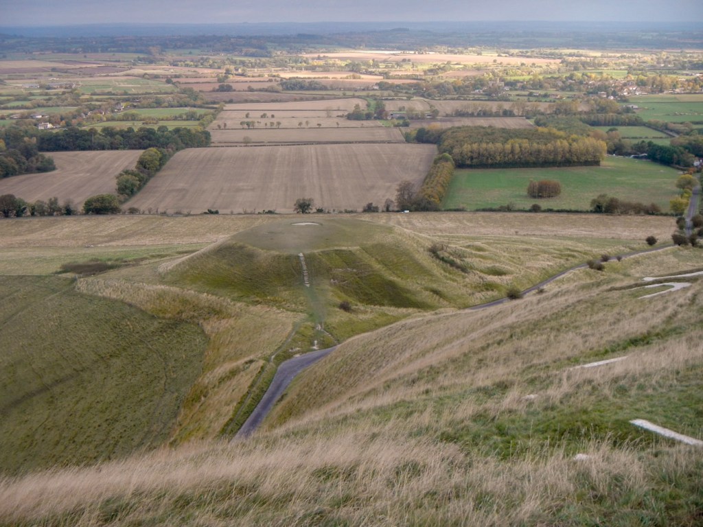
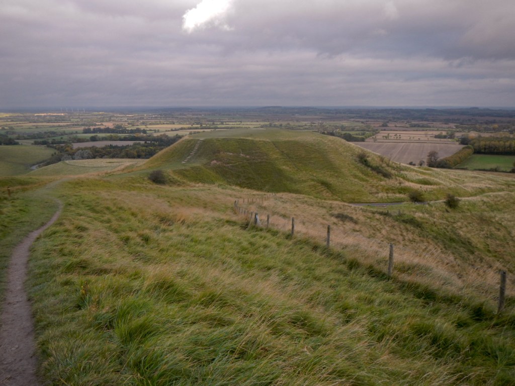
Next I headed off towards the car park and then a very muddy footpath to Silbury Hill. As a child, I remember clambering up the hill, which seemed huge, and then slipping and sliding down mainly on my bottom. Clearly this, repeated by many children, was a recipe for disastrous erosion of the hill and now it’s out of bounds and the best views are from a viewing platform. Silbury Hill is the largest artificial prehistoric mound in Europe. it was probably built over a short period between about 2,470 and 2,350 BC, but its purpose, or its meaning for the late Neolithic people who built it is a complete mystery. In order to try to understand more about it, there have been three major excavations, the most recent in 1968-70. None of the tunnels were fully backfilled, and unfortunately in May 2000 a 14-metre deep crater opened on the summit. Further survey showed that the tunnels inside were collapsing. The crater was temporarily filled with polystyrene, but something more permanent had to be done to stabilise the hill. Further research still in progress is using non-invasive methods.

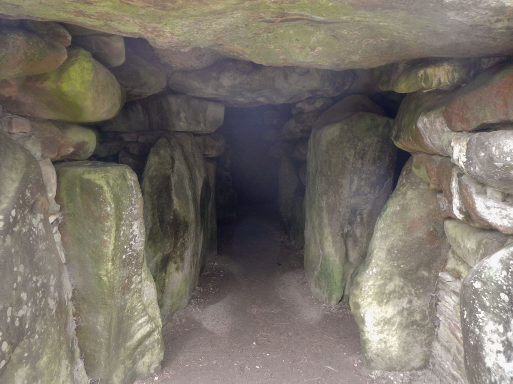
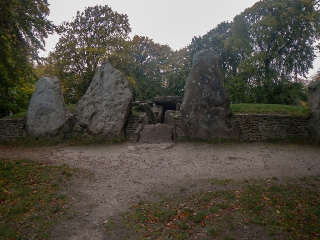
From Silbury Hill I walked on through this Neolithic “theme park” to West Kennet Long Barrow, built around 3,650BC. It is huge – just over 100 metres long with a maximum height of 3.2 metres and width of 25 metres. Although it is now covered with turf it would originally have had bare chalk sides and would have stood out against the landscape. It consists of a core of sarsen stones capped with chalk rubble from the surrounding quarry ditches. At least 46 bodies were buried in it and it was eventually closed around 2,000 BC. Nowadays, members of the public can enter the impressive chamber of the barrow.

It was only another short walk to The Sanctuary site. This was a ceremonial temple, probably built around 2,500 BC. Originally it would have been a complex circular arrangement of timber posts and standing stones. The components are now indicated by concrete blocks and posts. When archaeologists excavated the site in 1930 they found many objects such as flint tools, animal bones and pottery fragments, suggesting that Neolithic people were placing offerings in and around the standing posts.
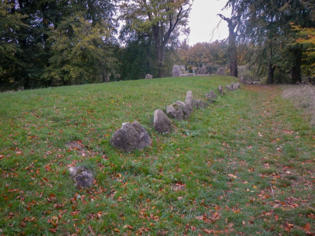
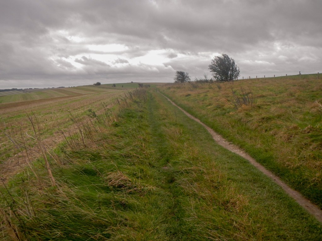
From The Sanctuary, it is only a few steps across the road to Overton Hill with its bronze Age cemetery of at least twelve round barrows. This also marks the start of The Ridgeway National Trail so I decided to walk this bit to save time the next day (when I would need to walk from Marlborough to reach the Ridgeway as the first bus isn’t until the middle of the morning).
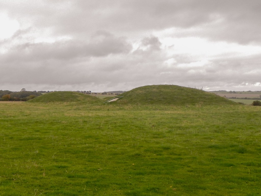
Barrows on Overton Hill 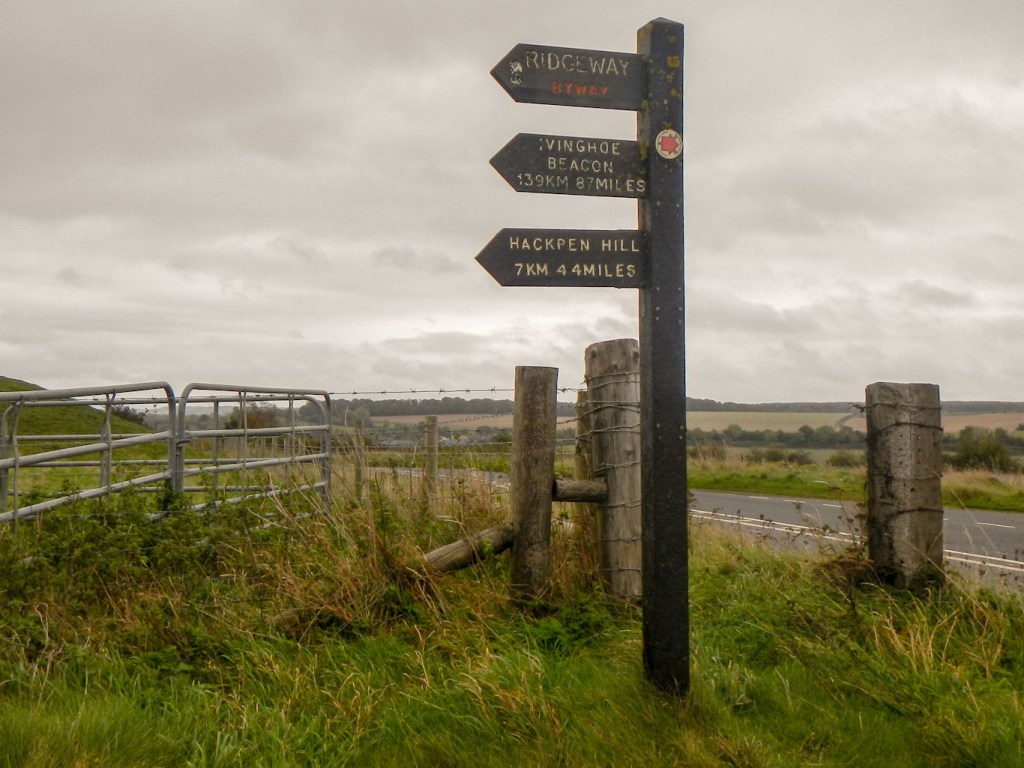
Ridgeway start point
I walked up the hill on the well defined Ridgeway track as far as the Green Street turning where I turned left to walk down the track to Avebury for the second time that day. I turned left as soon as I reached the henge. It was much quieter than previously. I strolled around this sector again before turning off to explore the West Kennet Avenue which appears to link Avebury and the Sanctuary, and was erected sometime after the initial construction of both. As well as marking the route to Avebury, the stones seem to have acted as grave markers for some members of the Avebury community. Like the rest of this area, archaeological work to attempt to understand more about the avenue is ongoing.
Although I had visited the main sites, there is more to see, but it was time for me to make my way to the bus stop next to the Red Lion Inn. There I met a couple who had walked from Devizes and we talked about long distance walking and marathon running. Sadly their bus arrived and it wasn’t until then that I discovered that they are also top class long distance sailors and the man has many wins in competition – I wish we had had longer to talk. Soon after that, my single deck bus arrived for my journey back to Marlborough.
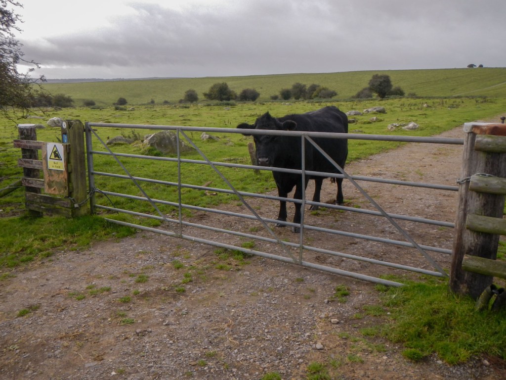
27 October began with an early start from Marlborough after eating porridge in my room. I had a very pleasant walk over the downs, taking different paths from the previous day. I was almost on the Ridgeway next to the turning down Green Street, when I was confronted with cattle and had to take a diversion.
The weather was warm for the time of year although intermittently drizzling rain – nothing that needed waterproofs though. I passed a dew pond – an important water source in this chalk landscape.
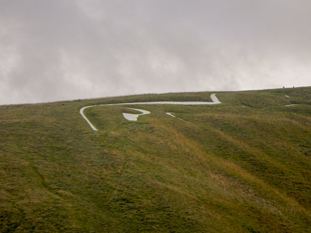
I made a diversion to Hackpen White Horse cut to commemorate the coronation of Queen Victoria in 1838.
Soon after this I met a single walker heading towards me – she was planning to complete her east to west traverse that day.
The path traversed the hill fort at Barbury Castle.
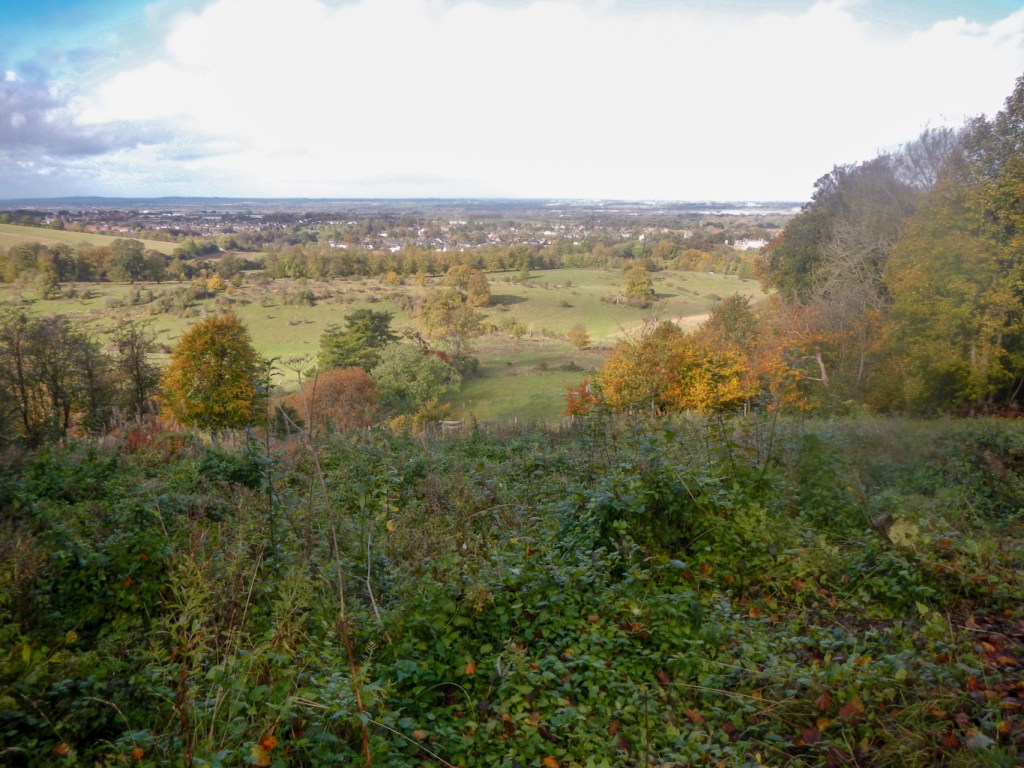
Further on I diverted to walk over another impressive Iron Age hill fort, just off the Ridgeway path at Liddington with wonderful views over Swindon.
Eventually I reached the turn off to Ashbury and made my way to the Rose and Crown for a well earned rest.
28 October also began with an early breakfast of porridge in my room. I had too long a day and too much to see to wait for breakfast at 08.00am. The Ridgeway was almost empty of people. I saw a single Volkswagen camper van in the car park above Ashbury and I think that the occupants were still asleep inside.
It was still really only twilight when I reached Wayland Smithy. This long barrow is named after the Norse God of smiths and is set just off the Ridgeway path in a glade of trees. No one was there except myself and the whole site indeed had an air of mystery.
It wasn’t far before I arrived at the large hill fort of Uffington. Here I was entertained by three red kites swooping, hovering and, at times coming quite close to me.

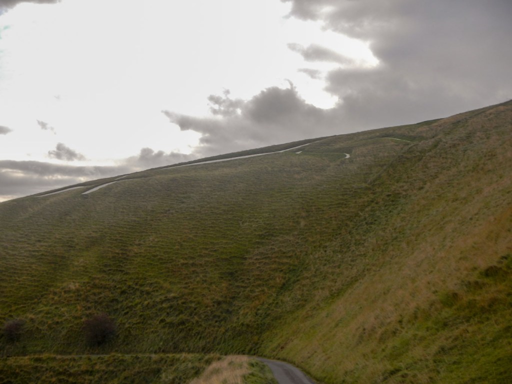
I turned off the path to visit the impressive and large hill fort with a trig point near the summit which is the highest point in Oxfordshire. I walked further to try to see the chalk white horse. Unlike the one at Hackpen, it is fenced off to avoid visitors trampling on it. However it is much older – probably over 3000 years old – the oldest chalk cut hill figure in Britain. At close range, it’s only possible to see part of it at a time but there is definitely such skill in the way it was cut that there is a real sensation of movement.
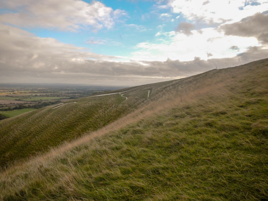
A long way down lies Dragon Hill, a small roundish hill with a flattened top. It is said to be the site where St. George, England’s patron saint, slew the dragon. The blood poisoned the ground and left a white chalk scar for all to see. I did walk all the way down to Dragon Hill, up to its summit then returned via the Manger; downhill from the White Horse this is a dramatic dry valley with steep rippled sides left from the retreating permafrost during the last Ice Age. The ripples are known as the Giant’s Steps.
I spotted a couple of hill forts further on but these were much smaller and less defined. I also saw a man doing the Ridgeway the other way – as I pointed out he had a much harder job than me fighting against the prevailing wind.
I was fortunate to meet one of the volunteers who keeps an eye on The Ridgeway and helps to preserve its character. He was cycling on the path as he does every week (on different parts) and introduced himself as Chair of the Friends of the Ridgeway Association. Thank you for all that you do!
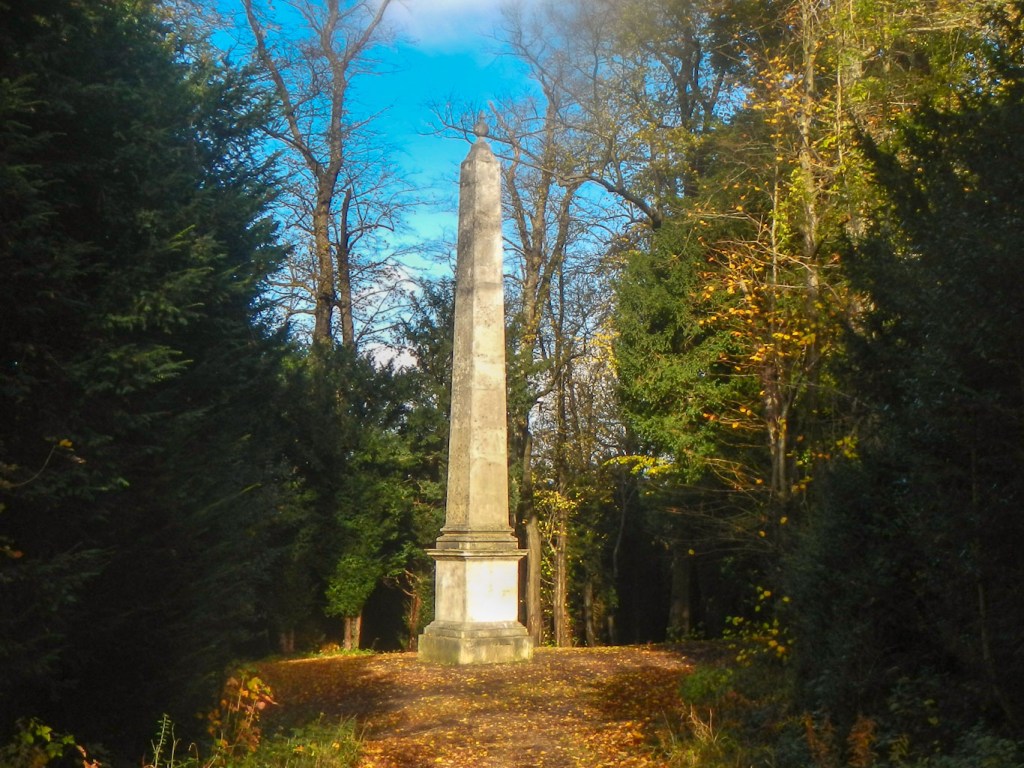
Soon I passed the massive Lord Wantage monument – commemorating this distinguished soldier who was one of the first to receive a Victoria Cross in the Crimea War.

I found a memorial bench with a wonderful viewpoint over the Harwell Science and Innovation Campus, where my husband worked many years ago. I had been reminded to look out for the buildings and in particular for the huge circular structure of the Diamond Light Source which is the UK’s national synchrotron light source. The intense beams of light can be used to investigate the structure and properties of a wide range of materials from proteins (to provide information for designing new and better drugs), and engineering components (such as a fan blade from an aero-engine) to conservation of archaeological artefacts (for example the Mary Rose ship).
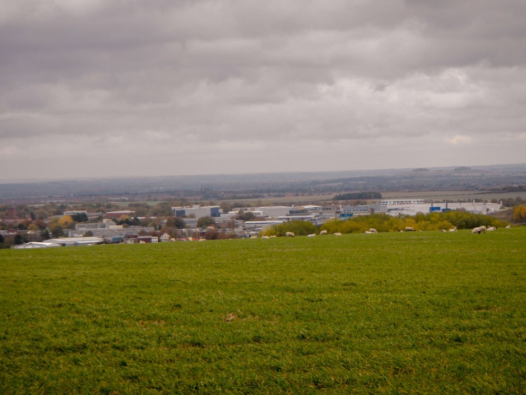
Views over Harwell 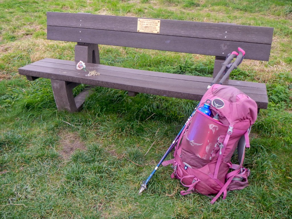
A convenient bench to eat lunch
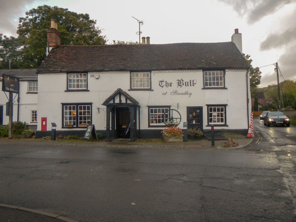
I enjoyed walking along an airy path with fine views most of the afternoon before descending to the affluent looking Berkshire settlement of Streatley which along with the adjoining Oxfordshire settlement of Goring, straddles the border. In any case it was Streatley in Berkshire where I stayed at The Bull Inn famous for being made one of the stops in Jerome K Jerome’s book “Three Men in a Boat”.
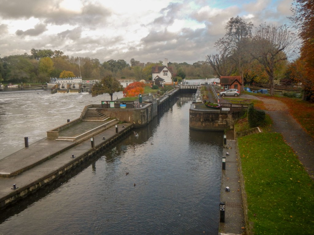
I strayed over the county border that evening to stock up with provisions from a shop in Goring. Next morning (29 October) I crossed the Thames again and then turned north on a route parallel to the river. Sadly the river wasn’t visible from the path initially as private garden frontages stretch down to the banks. However eventually, after passing through the village of South Stoke, the path did follow the river bank through a conservation area. Unfortunately it started to pour with rain, but at least that meant that I could actually wear my brand new waterproofs, which I had carried round for weeks and even managed a whole expedition to the Lake District without needing to wear them.
Clad in my new waterproofs, I remained dry and was surprised as to how leaky my previous waterproofs must have become compared with these. i’m not used to staying so dry in the rain.
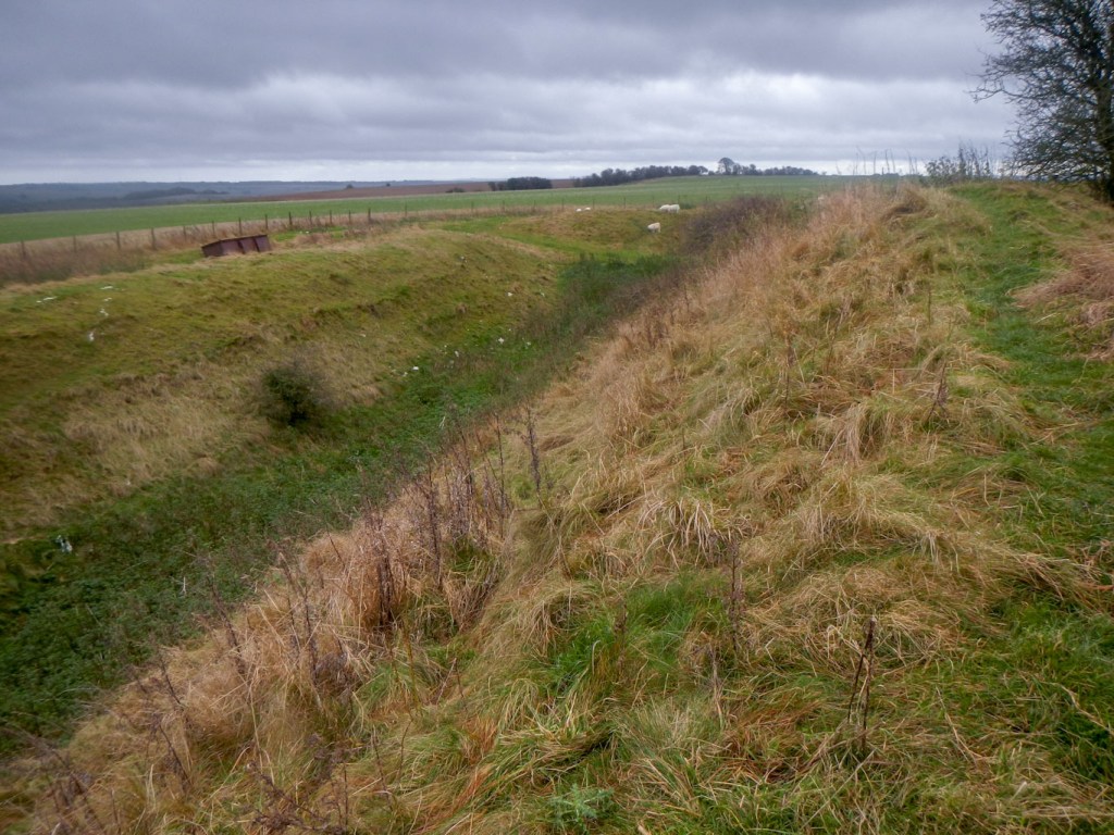
The route turned away from the Thames, following the course of Grim’s Ditch. Linear features labelled Grim’s Ditch appear in several places on the maps of the whole Ridgeway area. The work is thought to be several structures rather than a whole and believed to date from the Iron Age as pottery shards have been unearthed in excavations during the 1970s and 1980s. It was probably created during a period when the landscape was clearer of scrub and the dense woodland than today as the straighter sections would have required clear lines of sight. The ditches are huge and their purpose not really known, although they were possibly boundaries between different tribal groups. Clearly the structure was thought to have been important as it would have been an imposing feature in the landscape and would have needed many man hours of labour to create and maintain. There are similar structures elsewhere in the country.
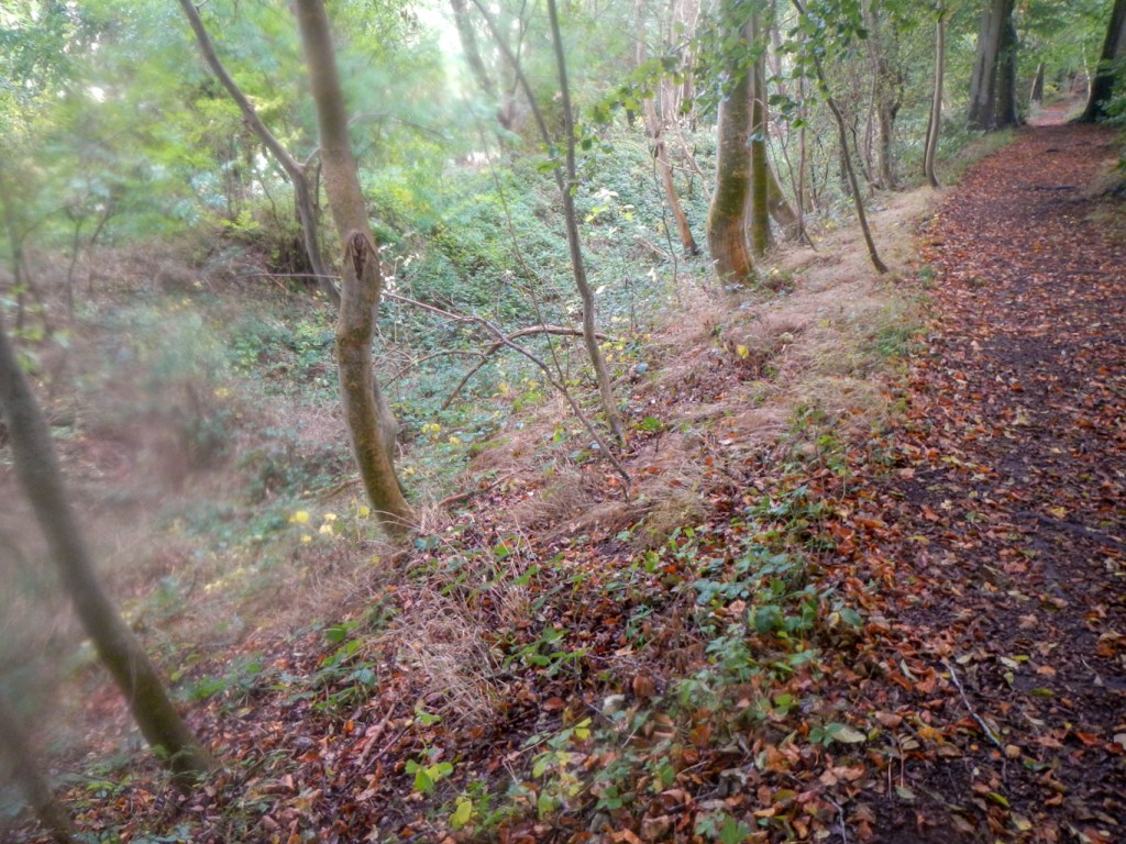
Nowadays the Grim’s Ditch provides a convenient if somewhat eroded bridleway, making navigation easy. The land I was walking over is much more sheltered and less open than the scenery of the earlier part of the Ridgeway and there are many wooded areas – mixed woodland but predominantly beech.
Somehow I managed to miss spotting the White Mark on Watlington Hill. Apparently it was cut in the 18th century to give an illusion of a spire on the church when viewed from the squire’s home. In fact after passing the White Mark Farm and campsite, it didn’t take long to the tunnel under the motorway followed by a footpath and minor road directly to the back entrance of my booked accommodation at the luxurious 4 star Mercure Hotel. I even enjoyed a free upgrade to a courtyard room.
My daily distances to walk were gradually reducing day by day – a function of where it was easy to book accommodation rather than any specific planning to walk shorter distances. I enjoyed the now unusual buffet breakfast (30 October) at the hotel. Fortunately I got to it before very many people had arrived, as I noted people weren’t all sanitising their hands or wearing masks when they selected their food.
Once I left, I passed through a multitude of grass chalkland conservation areas. This part of England has a great concentration of this threatened and delicate landscape where there can be forty species of flower identifiable in each square metre of ground and a profusion of butterflies of many species (not at the end of October though). There are many signs of the long occupation of the area – for example several tumuli which appear to have been repurposed as a children’s play area to run up and down. A hill fort was largely obscured by trees. I walked along byways flanked by hedges including hawthorn, wild rose, juniper, blackthorn, sloe and blackberry. I detoured the short distance down the hill to Prince’s Risborough to buy some lunch provisions. The now ubiquitous but previously rare red kites were much in evidence even in the town. They were reintroduced from Spain in 1989 and breeding in the area since 1992, following their extermination by Man during the nineteenth century.
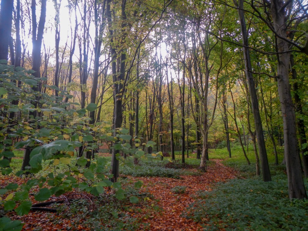
Mixed deciduous woodland 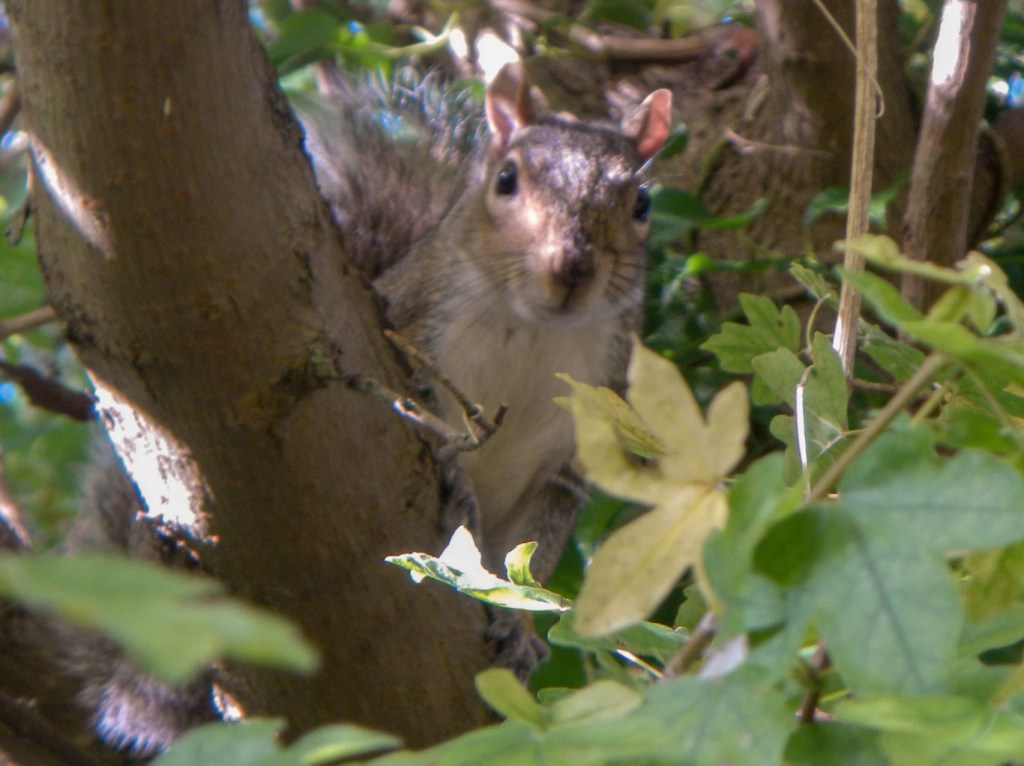
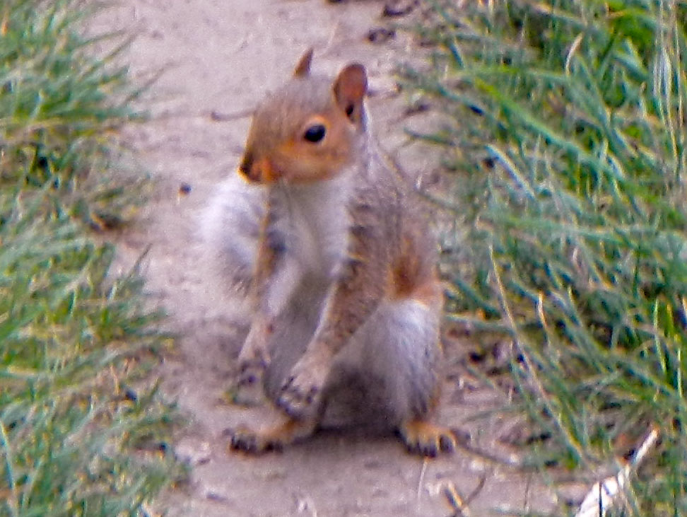
A shy squirrel 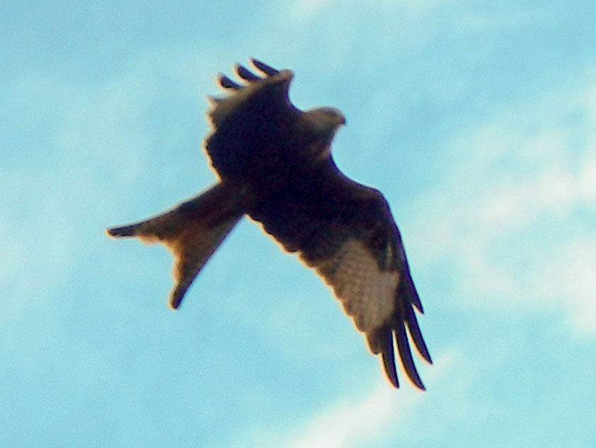
Red kite 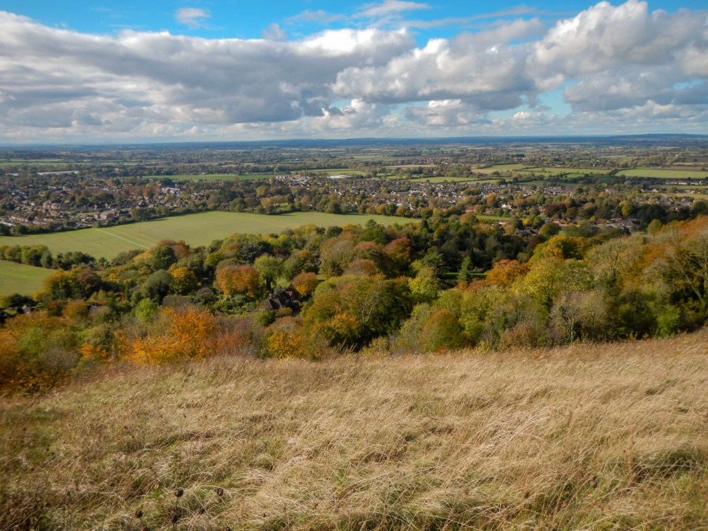
View over Prince’s Risborough
Suddenly I found myself walking along a path adjoining some rather daunting notices on the other side of the small fence telling me that this was designated as a protected site under Section 128 of the Serious Organised Crime and Police Act 2005 and specifically that crossing the boundary is a criminal offence. Fortunately I realised that it was because I was walking past Chequers, the country home of the serving Prime Minister since 1921. I had just arrived there sooner than I had expected. Oddly my Satmap seemed to go berserk and added ten kilometres to the distance I had walked for the day. However after spending some time puzzling over this, I decided to return the GPS to my pocket, just in case stopping walking and looking at it for a long period triggered any suspicion of unusual activity in the eyes of those who were undoubtedly studying my every move on the security cameras which must surely be concentrated on the footpath.
I could see the mansion itself in the distance separated from me by farmed arable land and cattle and sheep pasture. Having reached a corner, the Ridgeway took a left turn through a boundary and I realised that there was no fence at all separating the footpath from the land of the Chequers Estate and the scary warning signs about committing a criminal offence by crossing the boundary. At least I knew from the news that the Prime Minister was in Rome at the G20 Summit so assumed that security would not be quite as its highest level. I was relieved to see some other people walking on the path and nothing seemed to be happening to them. I resolved to keep my camera firmly stowed away in my rucksack hip belt pocket, just in case taking photos looked suspicious. However some walkers with American accents crossing the end of the long private driveway to the mansion clearly had no such qualms as they photographed themselves with the drive in the background.
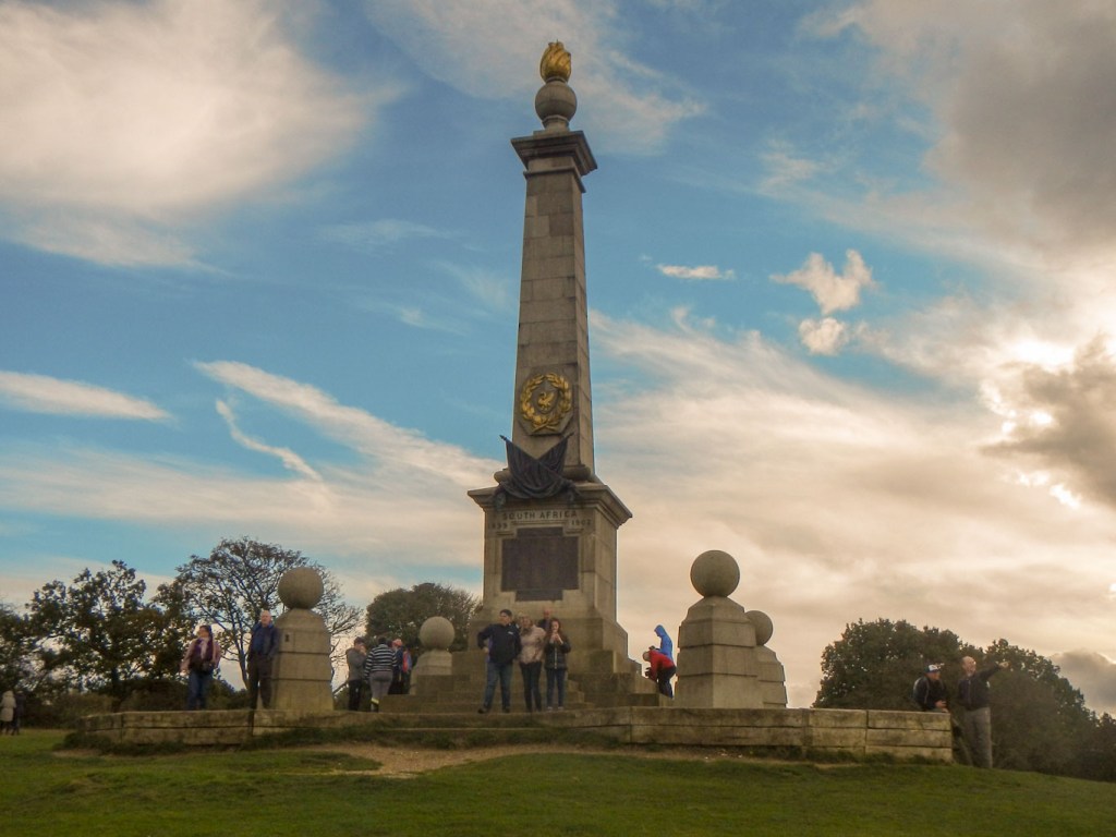
The way turned again and led through woodland up to a magnificent ridge and viewing area culminating in the Boer War monument at the north end of the ridge. This was a popular spot and I’m not sure how everybody had walked there but clearly not along the almost deserted route up a steep hill that I had taken from Chequers.
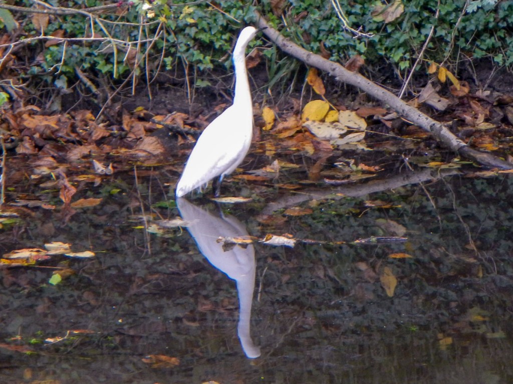
After leaving the monument, there are views to the north over the vale of Aylesbury. I descended to Wendover. The accommodation here had all looked prohibitively expensive so I had a walk of about an hour to Weston Turville where I had found somewhere to stay which wasn’t quite as expensive. This was a pleasant stroll along the bank of the disused Wendover branch of the Grand Union canal. I saw mallards, moorhens and even a little egret. A further footpath led across fields and past the church to arrive at my accommodation.
The next morning (31 October) the clocks changed and I had to wait until 08.00am GMT for breakfast. Even at 09.00am when I eventually departed to retrace my steps to Wendover, it was pouring with rain driven by a strong wind. However at around 10.30am the weather suddenly improved (as forecast). At least it confirmed that my new waterproofs are brilliant compared to the worn old ones! I could have delayed my start but I was due to reach Aldbury in time to be spruced up and meet a second cousin and his wife for a meal at 4pm at The Greyhound Inn in the village. That was where I was staying for the night and staffing problems meant that meals weren’t being served any later.
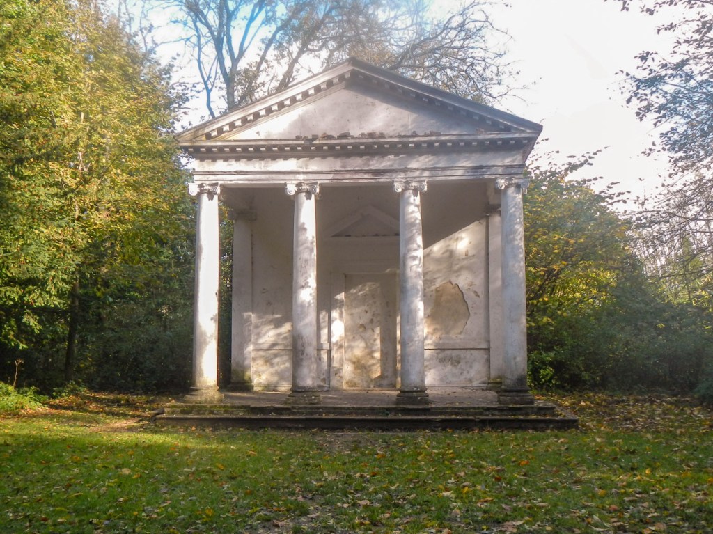
There were more chalkland nature reserves, further mixed but mainly beech woodland. I was concerned by a field of cattle but managed to get around and give them a wide berth. I really didn’t have far to walk and by the time I reached Tring Park I realised that I would, if anything, be too early. Tring Park, now managed by The Woodland Trust was once part of a larger estate which included the stunning Tring Park Mansion, originally designed by Sir Christopher Wren in 1685. Tring Park is also home to the second largest area of unimproved chalk grassland in Hertfordshire with much of the open parkland designated a Site of Scientific Interest due to the presence of locally uncommon and rare species. The grounds of the mansion and wider estate were formally landscaped in the 1720s by leading landscaper Charles Bridgeman. The Ridgeway passes through areas of mixed woodland including an avenue of lime trees. I diverted off the main path to look at the follies – a monument and a summer house.
After leaving Tring Park, I walked downhill, passing Tring Station and then turning off on a footpath before leaving the Ridgeway to walk past a golf course and over some fields to Aldbury.
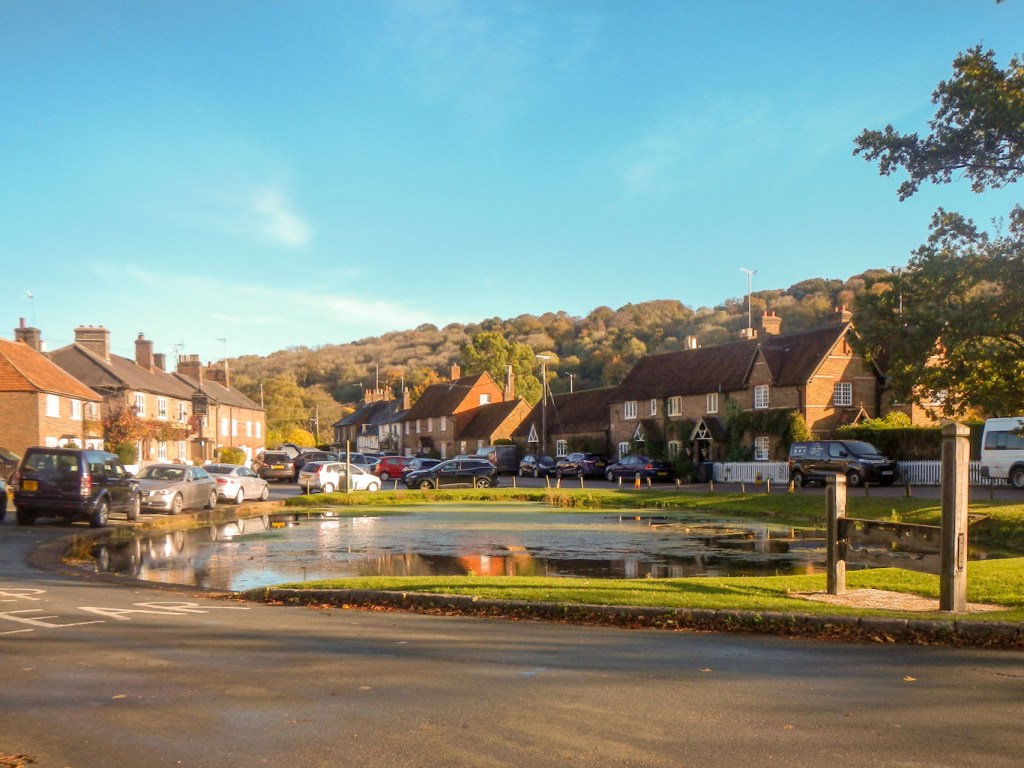
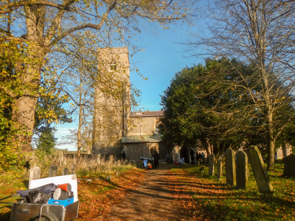
I had arrived far too early so I wandered round the churchyard looking for my grandparents’ grave, which I had never seen, although I had visited Aldbury many times. I found the right grave – eventually – complete with an inscription for my grandmother, although not for my grandfather. It had started as a grave for my great grandparents but many family members’ ashes had been interred there over the years. I shared a set of great grandparents with the person I was meeting later at The Greyhound. It was the final resting place for his grandmother as I saw the inscription as well as for his parents. His mother “Auntie” Mary, a lifelong resident of Aldbury, was my father’s cousin but I remember that my father had been evacuated to the village for part of WW2. My father, being an only child, the relationship was close, and “Auntie” Mary had been both my god mother and my favourite “Aunt”. I walked down to “Auntie” Mary’s home and then doubled back to the scenic stocks and duck pond, opposite The Greyhound where I was booked to stay.
The long term landlord Tim was extremely welcoming and helpful. I discovered later that he knew the family, but of course initially I didn’t realise his long term position in the village for 43 years and he didn’t know about my connections.
I enjoyed an excellent meal with my second cousin and his wife – we had a lot of news to catch up on, including a shared interest in islands around the UK especially in Scotland.
The weather on 1 November was perfect – a bit cooler but dry and sunny. I really only had a minimal distance of just over three miles to complete on the Ridgeway but plans to walk further and finish at Tring Station by 14.30 in order to catch trains home by a different route from my ticket following the Salisbury train crash the previous evening.
Aldbury is a frequent film location and today was no different with a team setting up in the churchyard as I left. It was fortunate I had looked for the grave the previous day – there was something I wanted to check on the inscription so I did visit again, but knew exactly where I was going which wasn’t in the way of the film crews.
I left the village behind to walk over a further conservation area of chalk grassland and mixed woods and on to the large Ashridge Estate. I enjoyed superb views including seeing the windmill near Pitstone and Ivinghoe in the distance. I walked on another length of Grims Ditch and also spotted what looked like a hill fort with defensive ditches. Soon I was climbing up Ivinghoe Beacon at the completion point of the Ridgeway. Like many long distance paths, it’s a bit of an anti climax – particularly as the sign on the view point has been removed.
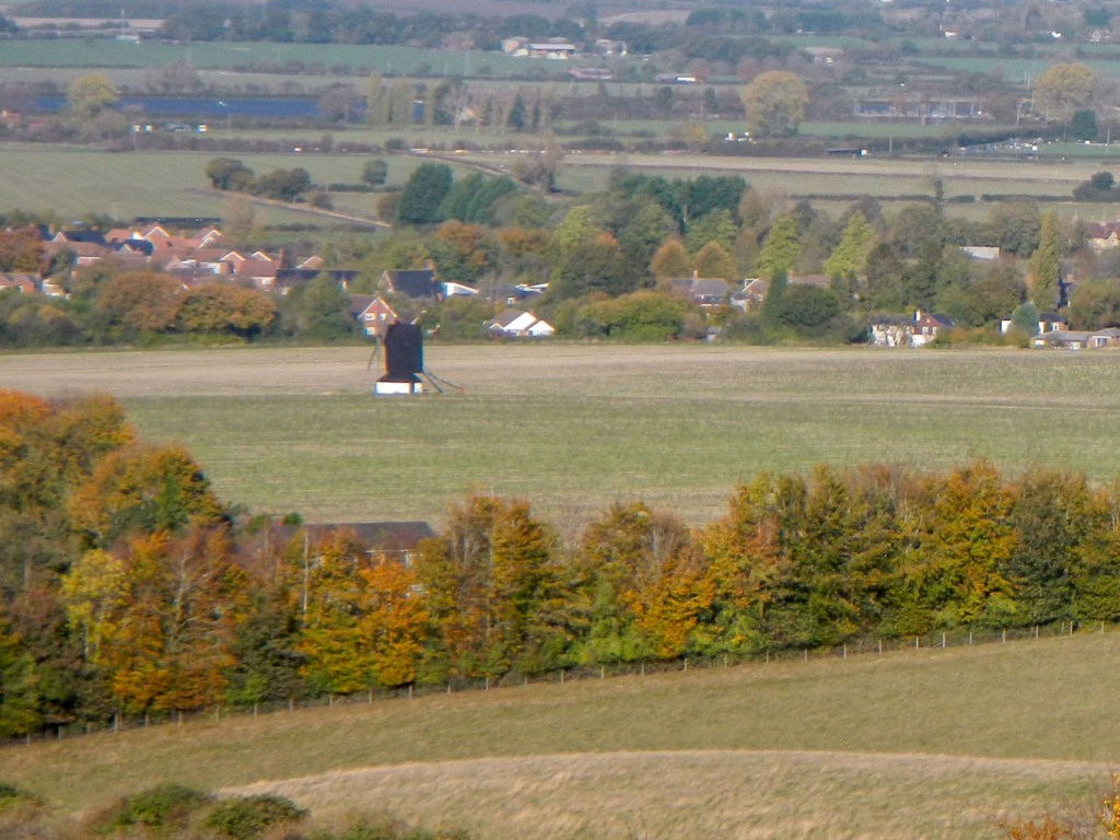
Ivinghoe and the windmill 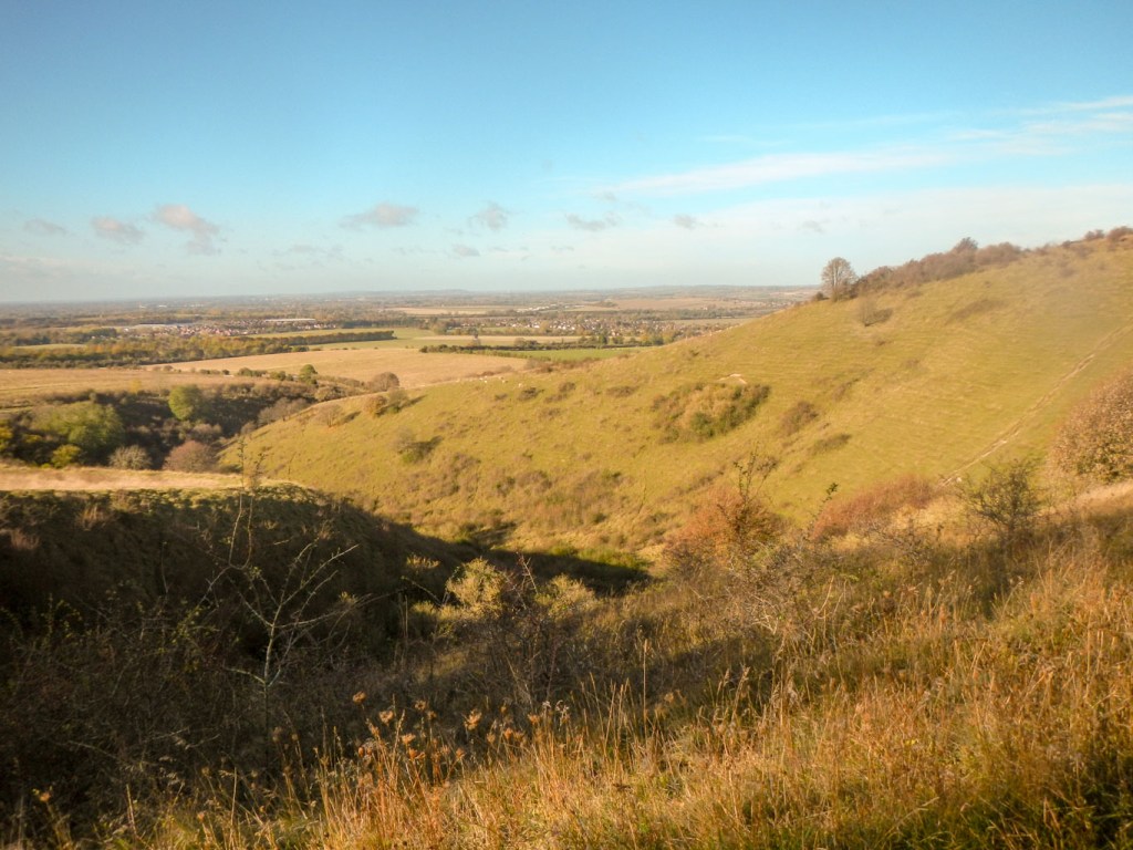
Iron Age ditches 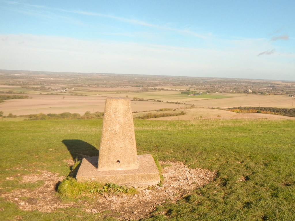
Trig point on Ivinghoe Beacon 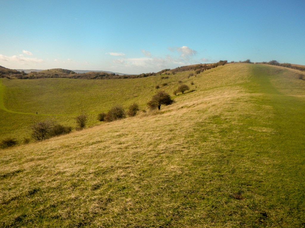
Ridge after the beacon
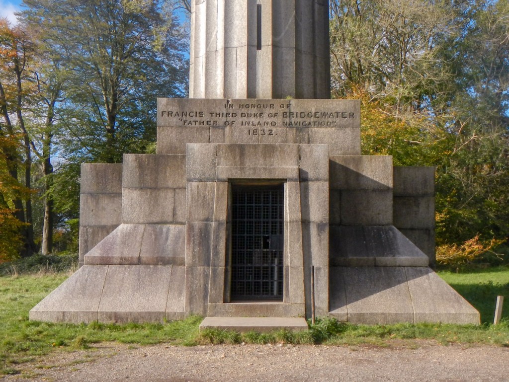
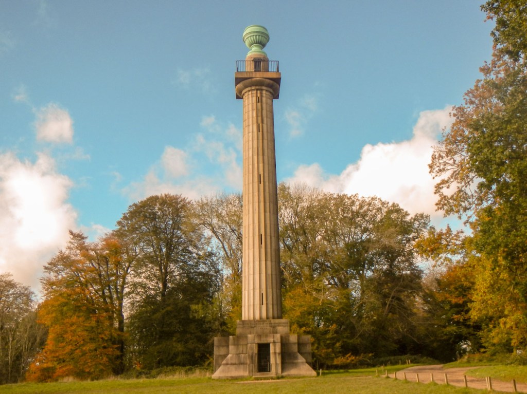
I saw a path to the right along a tempting looking ridge so followed that before turning southwards across some fields and soon into the mixed woodland of the Ashridge Estate. There is a sign to the Bridgewater Monument and I followed the major track to this impressive monument dedicated to the third Duke of Bridgewater who pioneered the construction of canals in the early part of the Industrial Revolution. For a moment I thought that it would be possible to climb to the top, then discovered that the people I had seen there were National Trust staff inspecting the monument. It turns out that the monument is open to visitors but just weekends to the end of October and only if the weather is suitable.
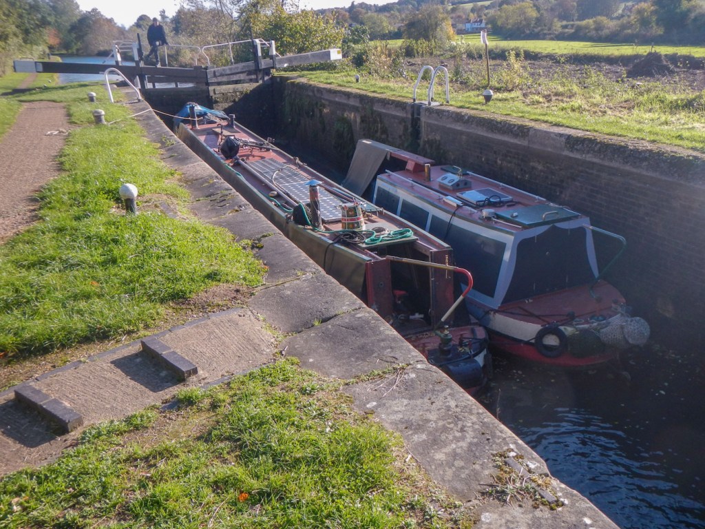
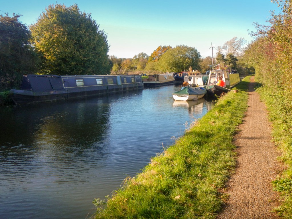
I continued my walk through the estate, passing a marvellous viewpoint overlooking Aldbury (my photo was out of focus) and then downhill out of the estate towards the Grand Union Canal. My expedition ended with a stroll along the tow path past many moored canal boats and a couple that were underway, including one going through a lock. I arrived at Tring Station to begin my train journey home.