25 October 2021
This walk is advertised as a 24 mile trek between the great cathedrals of Winchester and Salisbury. The leaflet I discovered suggests tackling it over four days but I decided to complete the whole lot in a single day, starting in Winchester. It does go on to map 184, but I’ve already covered this one with my Imber Perimeter Walk.
Fortunately the 05.19 train from Pinhoe was on time, as it wasn’t really much fun getting up so early! In fact, everything was so slick at Basingstoke, where I changed trains, that I caught a train to Winchester ten minutes earlier than my booked connection.
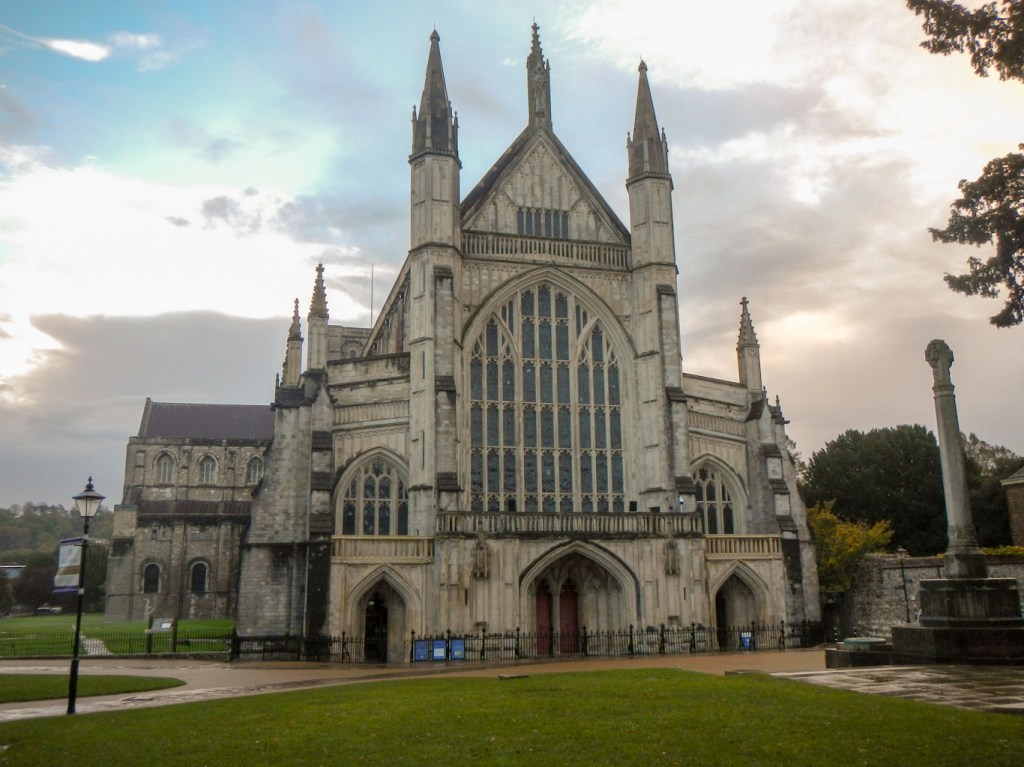
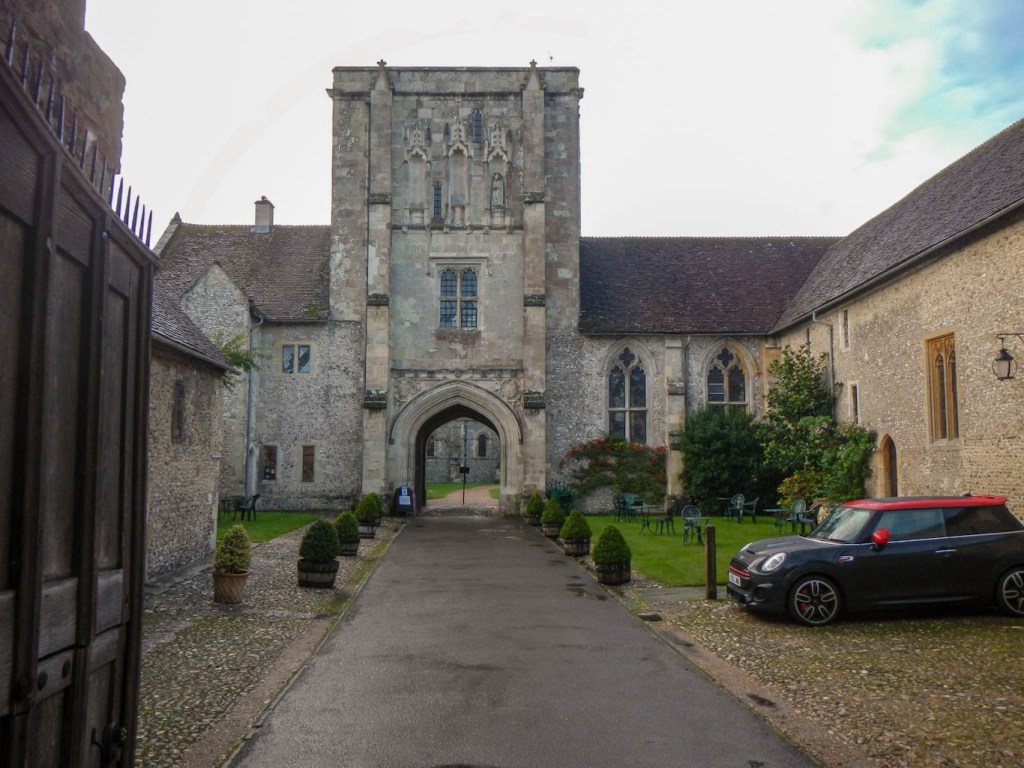
It didn’t take me long to walk to the Cathedral. The city appeared to be just in the process of waking up, with people scurrying to work and most of the shops still shut. I seemed to be the only tourist wandering round with a rucksack and camera, needing to look at signs to spot how to get to the cathedral. I walked past some cloisters, the huge entrance to the Bishop’s Palace and some picturesque old buildings to arrive at the water meadows. The meadow path was extremely muddy so, even though I was still in the city, I stopped to put on my gaiters as my clean trousers were at risk of becoming plastered with mud.
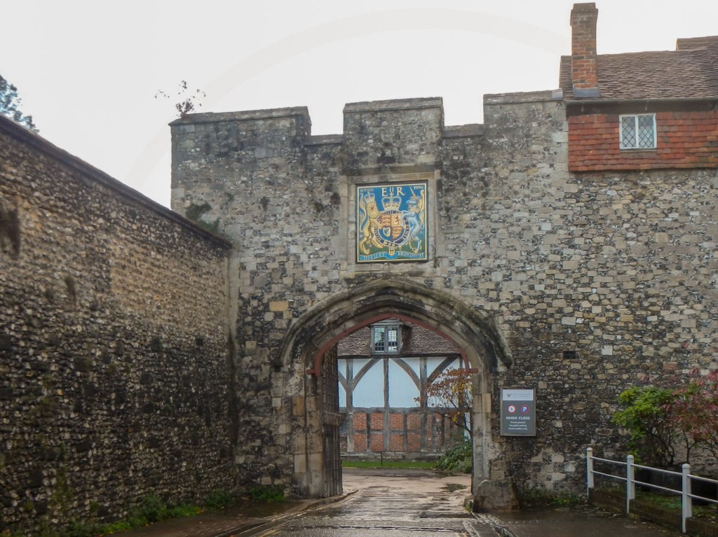
Gateway to Cathedral Close 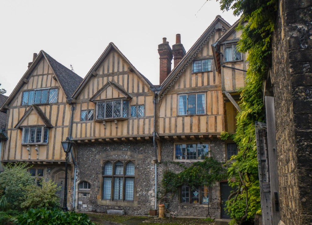
Buildings in central Winchester 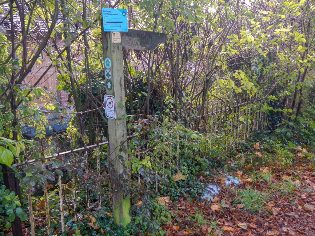
Signed path to the Water Meadows
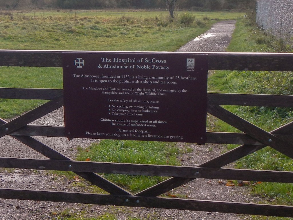
The route is well signed past the ancient Hospital of St Cross, apparently England’s oldest charitable institution set up by the Bishop of Winchester between 1132 and 1136. The Hospital was founded to support thirteen poor men, so frail that they were unable to work, and to feed one hundred men at the gates each day. In the fifteenth century, Cardinal Beaufort created the Order of Noble Poverty adding the alms-house to the pre-existing building.
Unfortunately, I ignored a sign which I thought pointed the wrong way as it didn’t match with the route I had marked on my SatMap. I crossed a golf course on a public footpath but was unable to find the path after this as marked on my map. I ended up walking more or less in a circle around a new housing development before deciding to head up a B road (with a pavement) and then back on to the route. This all lost me a fair bit of time and added some mileage, a mistake I would live to regret.
Once I was back on the route, I could have cut a corner to make up some of my lost time, but didn’t do so. I passed an area of ancient woodland then stopped for a brief lunch break at the edge of a country park, where many people were exercising their dogs.
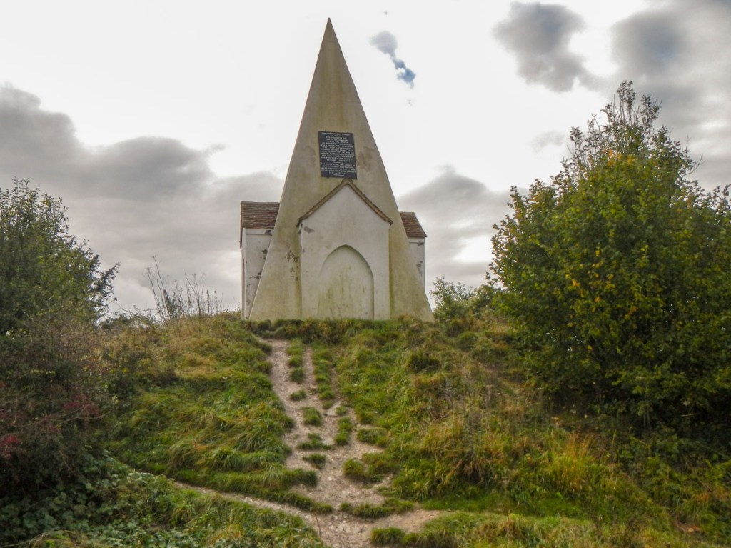
The Folly on Farley Mount 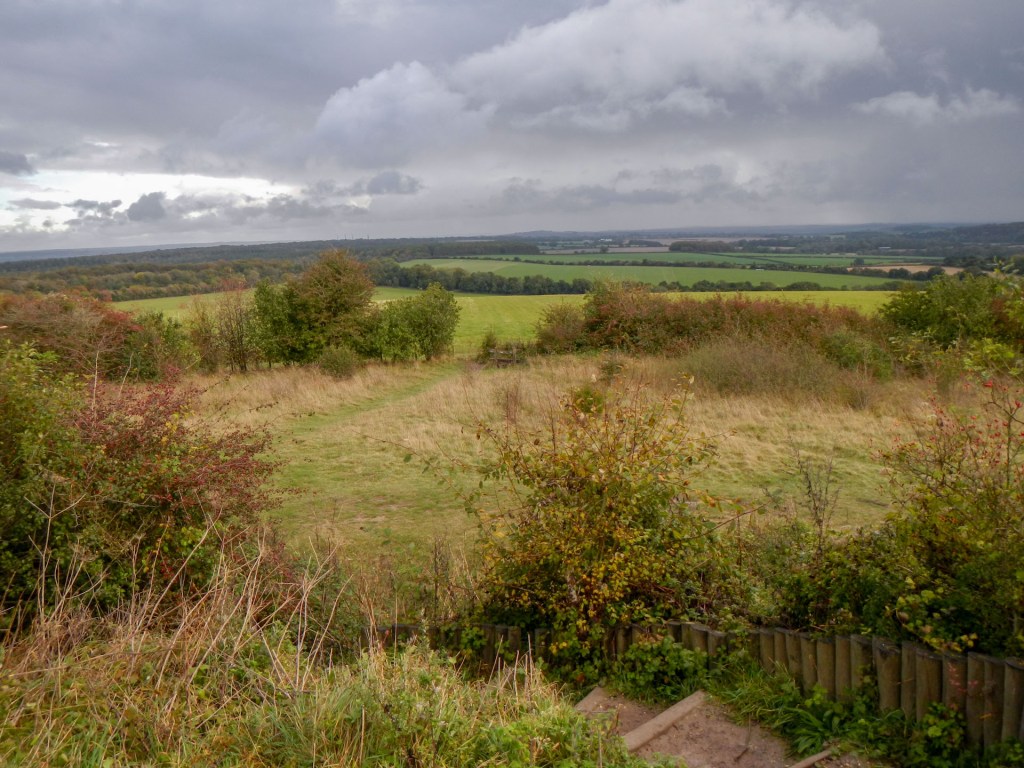
View from the Folly 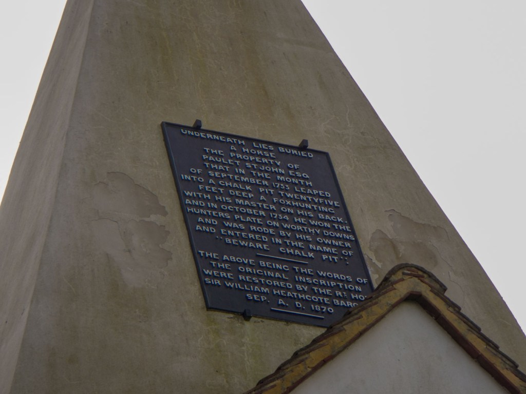
Plaque about the monument
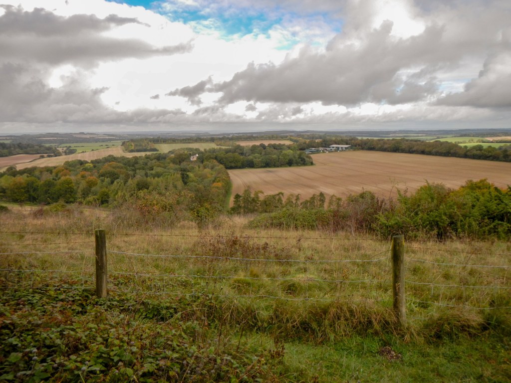
A highlight in the afternoon was a short detour to Farley Mount with far ranging views. At 174m elevation this is one of the highest points in Hampshire. On top of the mount is a pyramid shaped folly. This is a monument to a horse named ‘Beware Chalk Pit’, which reputedly carried its owner to a racing victory in 1734, a year after falling into a twenty-five feet deep chalk pit while out hunting. There were some further fine views to the north after I descended from the monument.
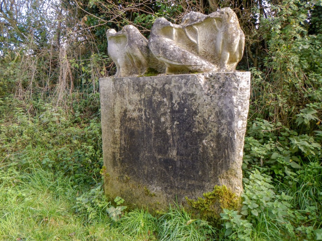
Eventually I reached the village of King’s Sombourne but it was so late that I didn’t stop to look round what appeared to be a delightful village. I wasn’t even tempted by the open village shop. I walked past what had been John O’Gaunt’s deer park and crossed a few wide waterways which when I looked afterwards discovered are all parts of the River Test. This is said to be Hampshire’s finest chalk stream but I’ve no photos as I was keen not to dawdle, becoming increasingly concerned about the amount of day light hours I had left to complete the walk. A sculpture stood outside the village as I approached Broughton, showing four birds on top of a stone block; with the base displaying a rather faded route map of the route – I did stop briefly to look at this and take a photo, if only to check that the map on the stone also confirmed I was only half way.
As I walked towards Broughton, I spotted an enormous dovecote in the church grounds to my left, but walked on without detouring the few yards to look at it. The time was 14.30; I had been walking for six hours since soon after 08.30 with just short breaks and, by all methods of reckoning, I only appeared to be about half way! I had about 3.5 hours of daylight remaining.
I found myself on a very straight road then a track after ascending a very steep hill on a slippery and rutted tree lined byway out of Broughton. This is the course of a Roman Road and reputed that Roman Legions can still be “heard” marching along it. At this stage of the day and with pressure of impending darkness, my imagination wasn’t up to hearing Roman soldiers! However I was soon across the county border and in Wiltshire heading for Middle Winterslow where there is a helpful map on the village green depicting the route through the village.
After just about leaving the village, there was an opportunity for a short cut, or at least a similar distance but on a surfaced road to West Winterslow. I didn’t take it, but soon regretted this as I was uncertain about taking what might have been a path, but was entirely unmarked, off the main track. With dusk approaching, I opted to keep on the main track (part of the Monarch’s Way) and then follow a minor road to Pitton. As I descended towards the road, a family group coming the other way stopped me to ask whether they were on the Clarendon Way. I explained that we were not and that I hadn’t taken the turning which was possibly the right way because it wasn’t clear – but very briefly as I didn’t want to waste any of the precious daylight.
Eventually I reached Pitton after braving a minor road that turned out to be quite busy. Unfortunately by the time I had passed through a large area of woodland and reached the site of Clarendon Palace, there was only just enough light to see the length of flint wall in the middle distance – this is the only remnant of the palace. Rather a pity that I had no time or energy to explore it as this was the place after which my pilgrimage route between the great cathedrals is named.
I had my headlight on to take a path which shortcut the track by crossing a field. There was still sufficient twilight to see the top of the 123m high spire of the cathedral silhouetted against the sky. There were a couple of late runners who passed me. I descended to Milford bridge – of course it was too dark to take a photo. As I walked towards the centre of Salisbury, I was fortunate to notice the Cathedral Hotel where I had a room booked. It was even more lucky that they were still serving evening meals and had plenty of tables available despite their Monday night 10% off food offer.
The route was meant to be 24 miles but what with various detours and a couple of wrong turns, my Satmap had recorded a walking distance of 49.2km – more like 30-31 miles. After an early start catching a train at 05.19am, I was exhausted and certainly ready for a meal and some rest.
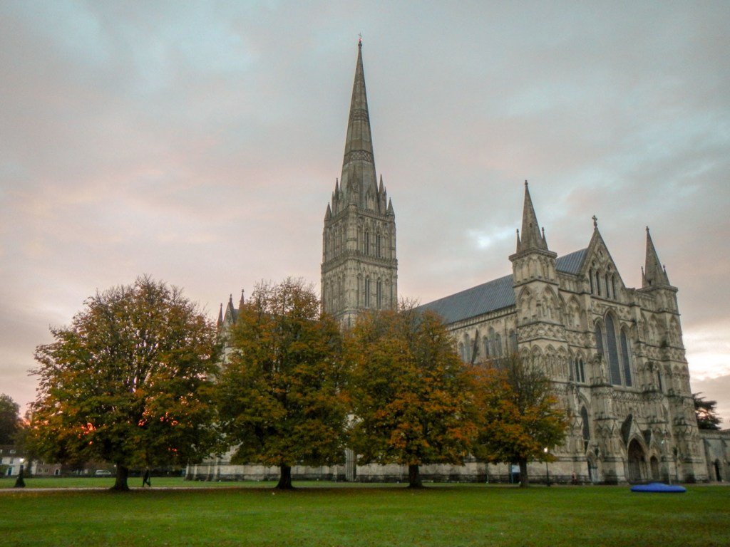
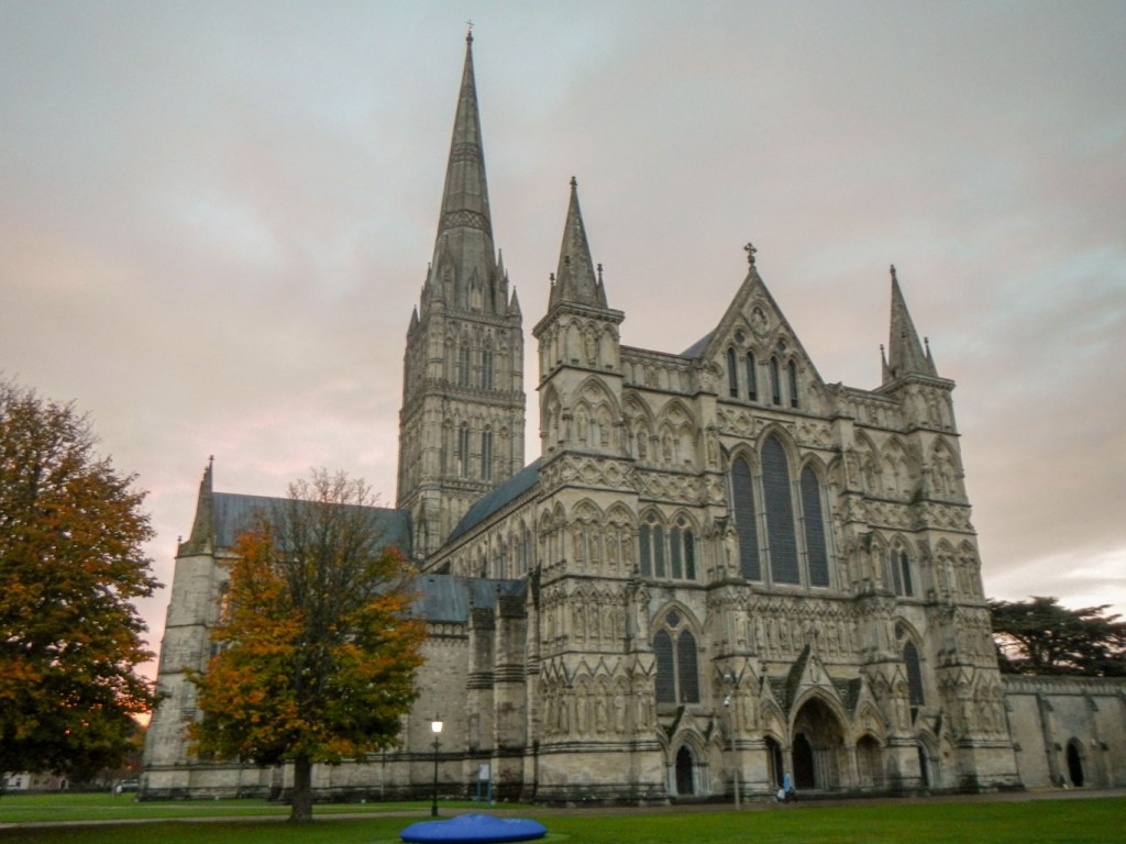
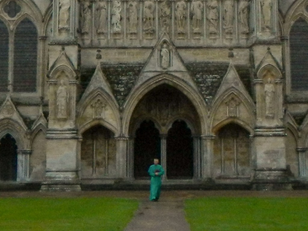
The final couple of hundred metres of the walk to the cathedral waited for the next morning. It was interesting to stroll round the city and cathedral before it became busy. The famous Cathedral Close was almost empty of people – just a single “professional” photographer with tripod, a few early morning runners, some people hurrying to work and a solitary figure walking from the cathedral wearing a green cassock. The museums flanking one side of the Cathedral Close were of course all closed – including a Medieval Hall and Edward Heath’s old home.
Arundells House – former home of Edward Heath 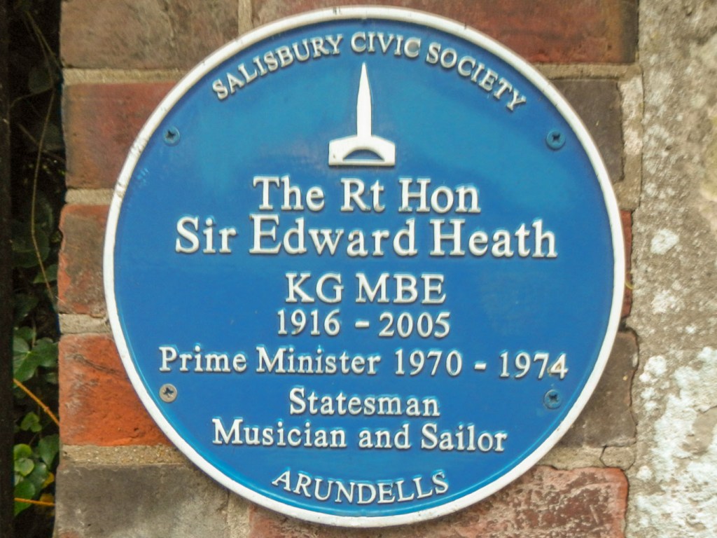
The blue plaque 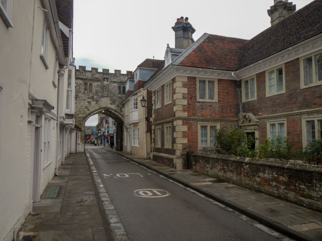
Gateway from the Cathedral Close
I left the peaceful environs of the Close and walked back through the wakening city. I spotted many interesting small shops along the historic streets. It was market day so the bustle of traders setting up their stalls was evident. Many of the maze of small streets clustered around the 15th century Poultry Cross have names including Fish Row, Butcher Row suggesting the medieval origins of the city as a market centre.
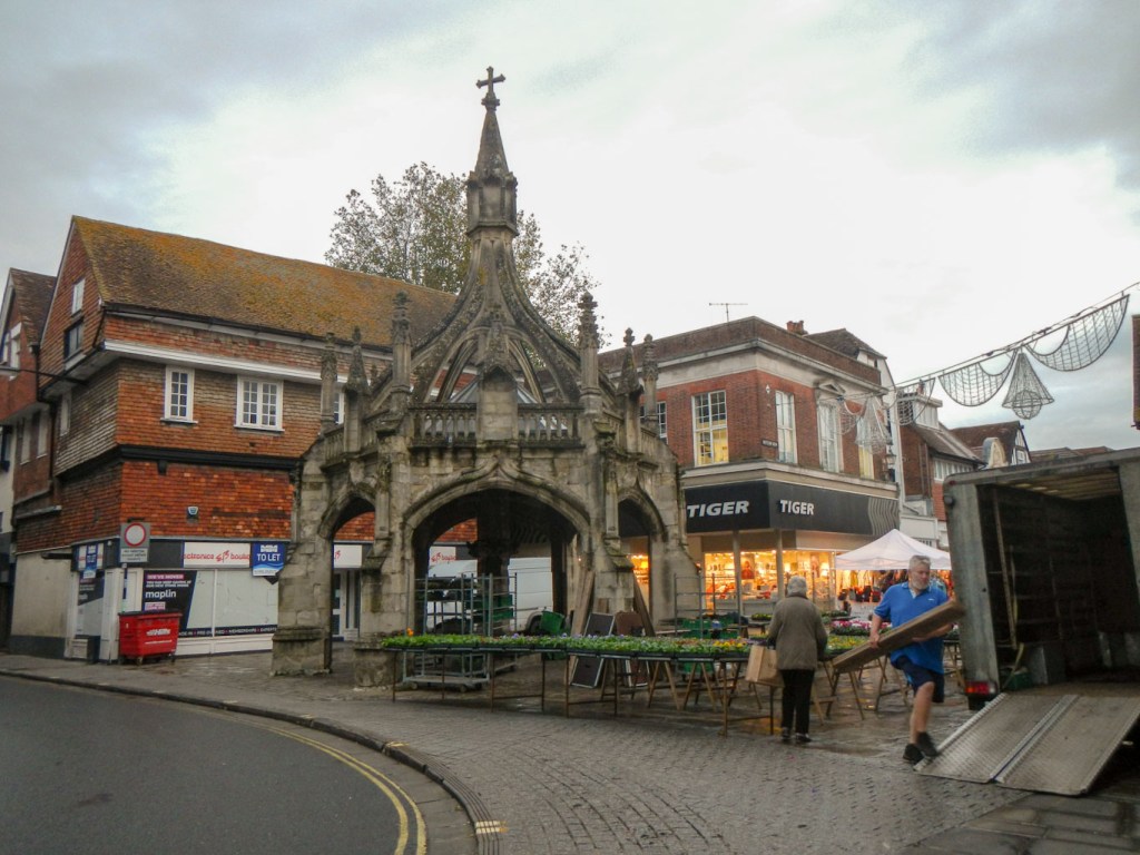
The Poultry Cross 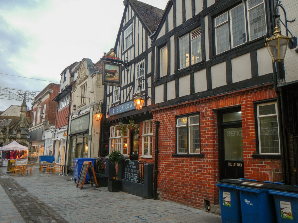
The Ox Row Inn 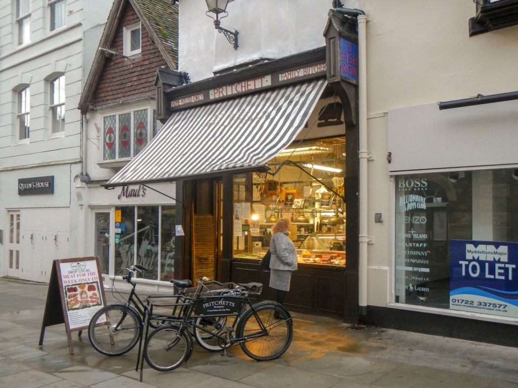
The traditional butcher (in Fish Row!)
However I was unable to explore further as it was time for me to catch the bus to Marlborough, to continue my adventures.
