15-22 September 2021
My only previous visit to the most south-westerly archipelago in UK was in 1990, just as I completed my pre-registration year to emerge as a fully registered medical doctor. This visit followed my retirement and after what is likely to be my last ever clinical session.
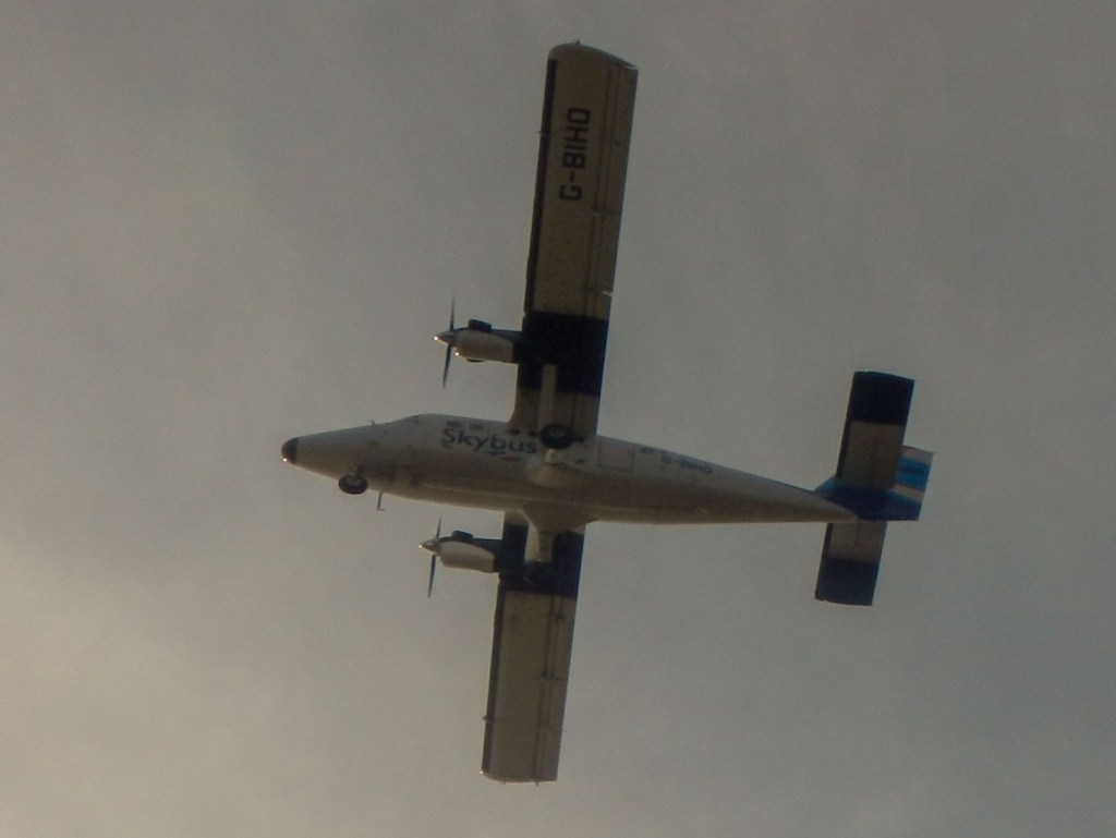
The adventure began almost as soon as we left home carrying fully packed and carefully weighed and measured rucksacks hopefully containing all we needed including a tent to spend a week camping on St Mary’s, the largest island of the group. Fortunately once at the airport, our luggage passed the weight test (under 15kg per person plus up to 3kg hand luggage) as well as the dimension test and we were soon boarding the twin otter configured to carry up to seventeen passengers.
The views flying over Devon and Cornwall were superb with just some cloud cover over parts of Dartmoor. It would have been helpful to have taken a map in hand luggage to aid recognition of the various places we travelled over, rather than struggling to remember our Cornish geography. With flying time of under an hour, we were soon clearing the low cliffs at the south east of St. Mary’s and touching down on the runway. The baggage arrived rapidly and we adjusted our luggage into carrying mode to walk to the campsite.
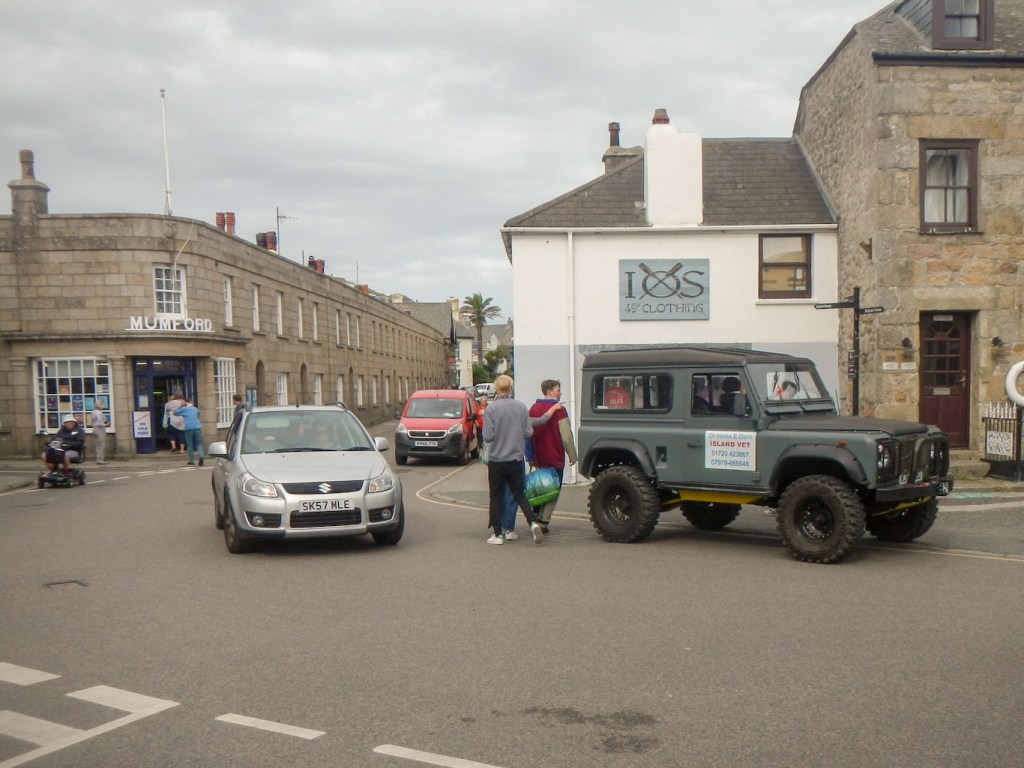
The island is remarkably undulating. We passed Old Town Bay, resisting the temptation to buy an ice cream, before climbing steeply over the hill and down to the largest settlement of Hugh Town.
We managed to buy a small gas canister for the stove (obviously we couldn’t carry stove fuel on the plane). There followed the steepest climb of the day up to the campsite, located right at the summit of the old garrison. We needn’t have worried about gas as the campsite shop stocked the larger size which was what we had really needed.
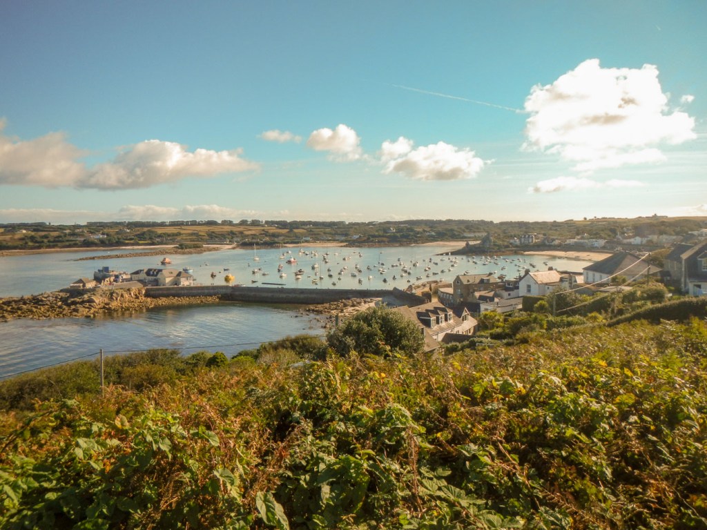
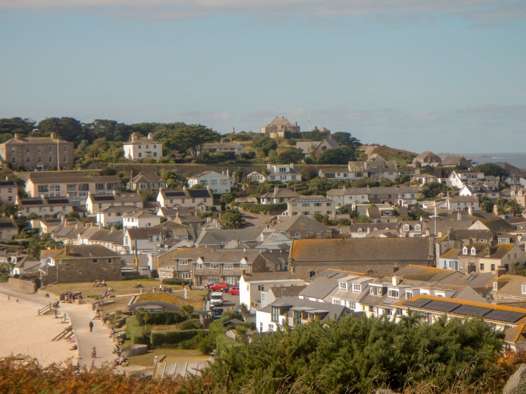
Hugh Town from Garrison 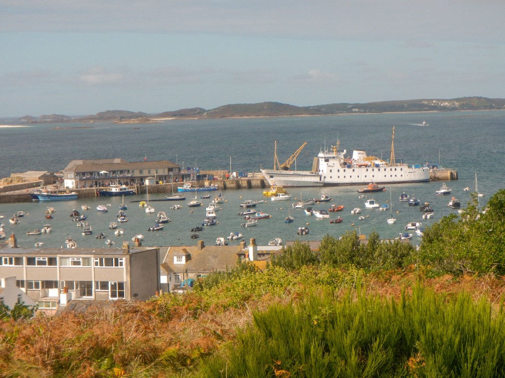
Arrival of Scillonian – the ferry to the Scillies
We puzzled over the campsite map to work out exactly where we were meant to put our tent – but got it right in the end. The areas for camping were divided with hedges so there were only two other tents that we could see from our pitch. The hedgerows included lots of brambles weighed down with large ripe blackberries, proving a welcome addition to my breakfast porridge each morning. We were warned by the campsite warden about the gulls, but some of the smaller birds were rather more hopeful than harmful.
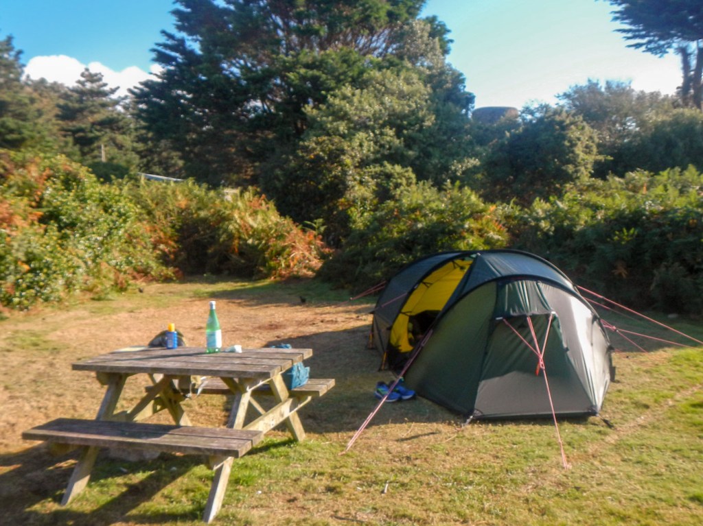
Campsite 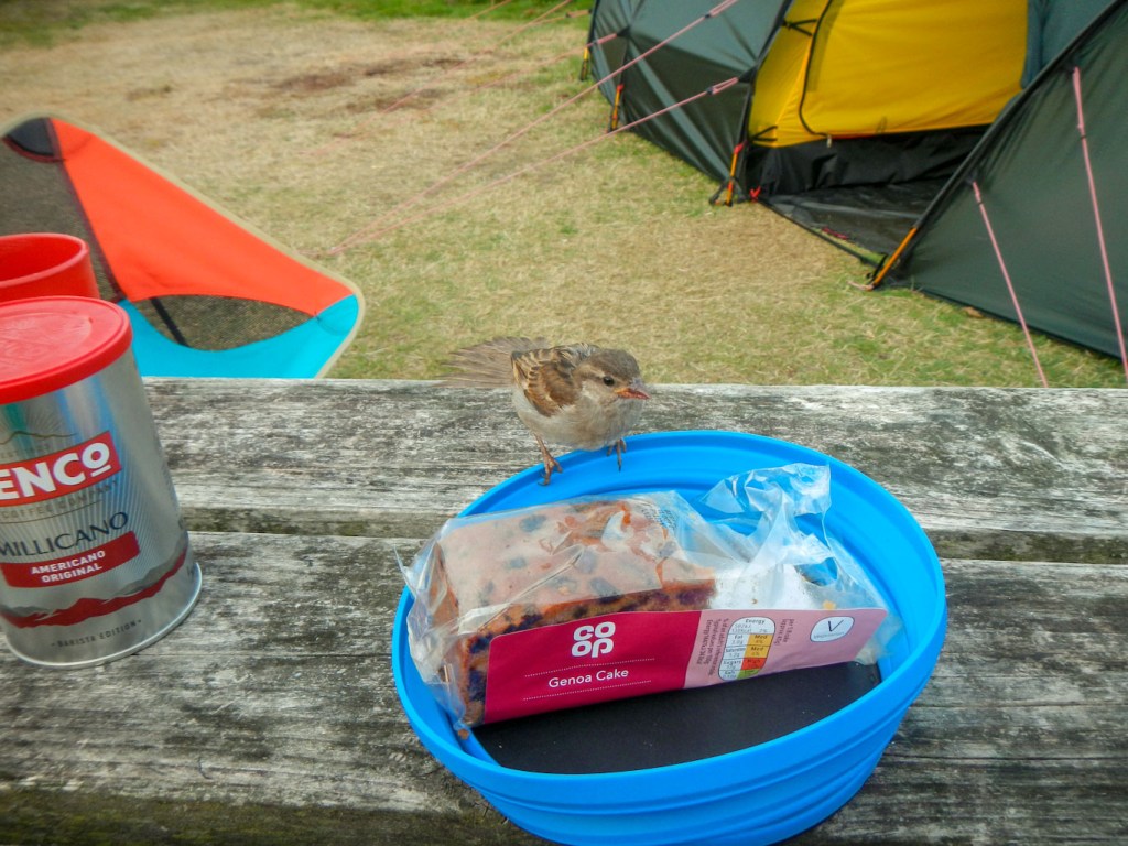
A very hopeful bird
A few of the highlights:
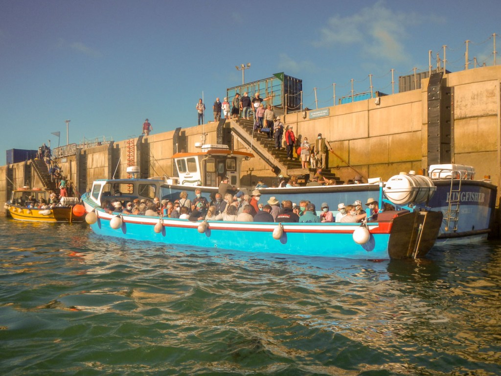
Boat trips to other islands:
These are advertised on a day by day basis and, particularly for Bryher, are governed by tide times. There is no quay on Bryher that is accessible at very low tide. When we travelled there the boat was within centimetres of being grounded to the extent that passengers in the bow end had to disembark before those in the stern. Having missed out on visiting Bryher when we were on the Scillies 31 years ago, this was a particularly important objective so it was unfortunate that the tide times meant it was a relatively brief visit.
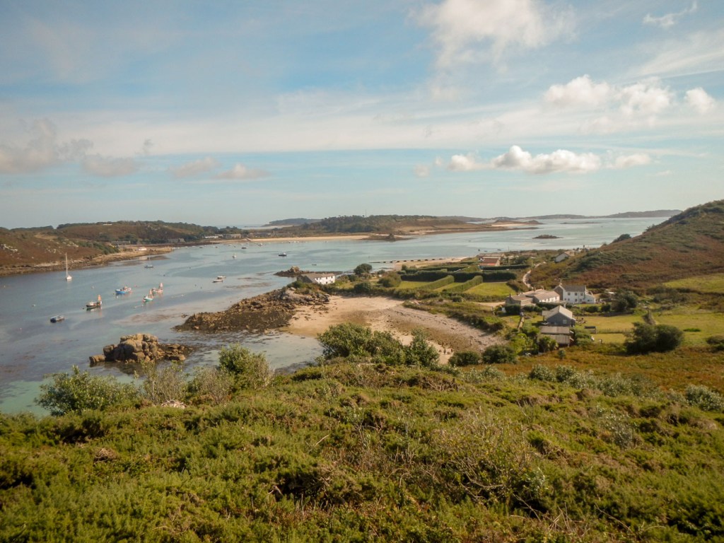
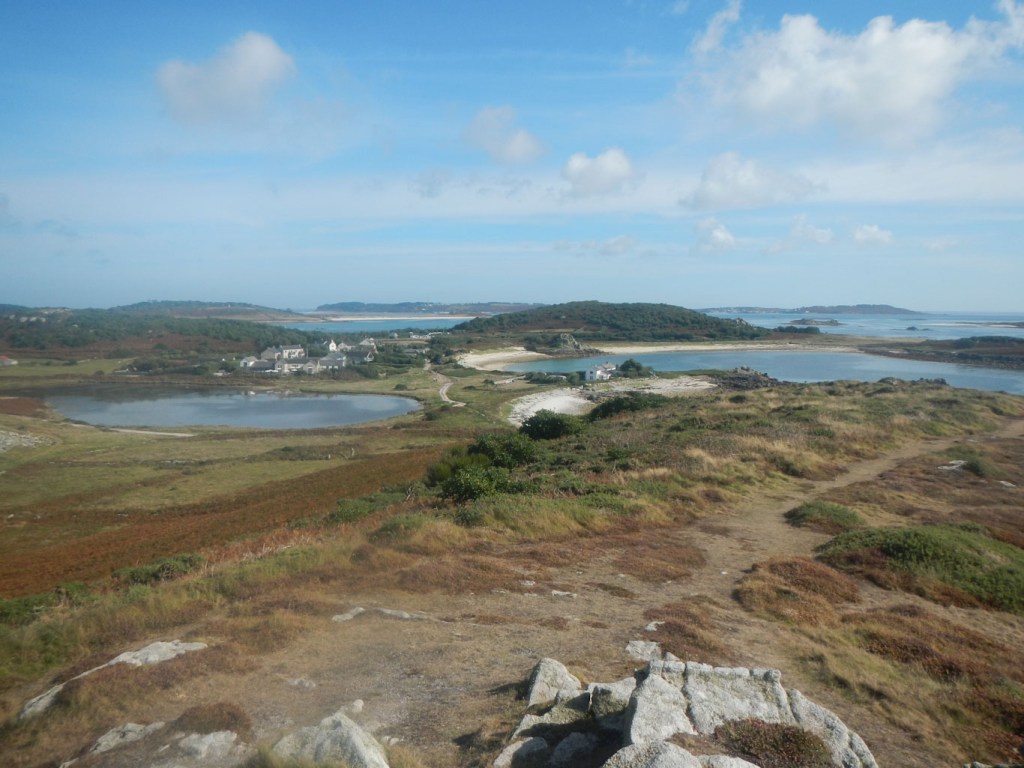
We also visited Tresco and St Martin’s on different days. St Martin’s we had camped on previously (and on St Agnes which we omitted this time). On Tresco, we decided to walk round the entire island, having previously concentrated on visiting the abbey and gardens.
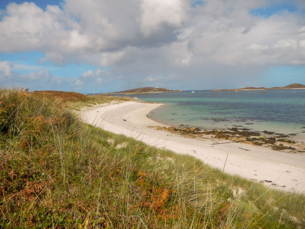
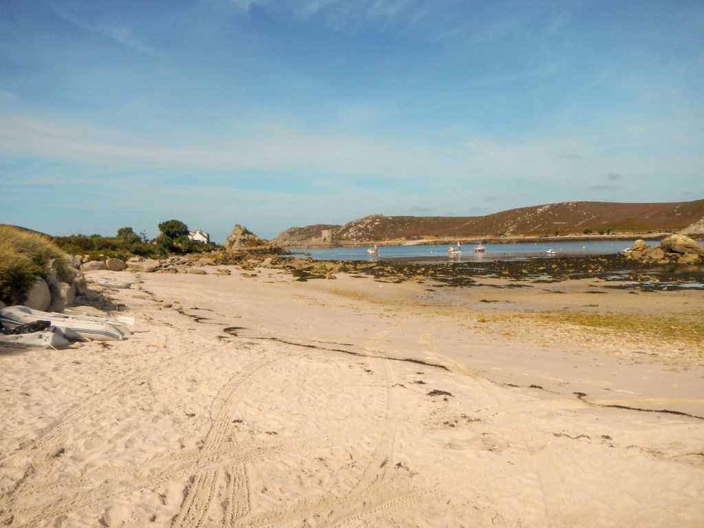
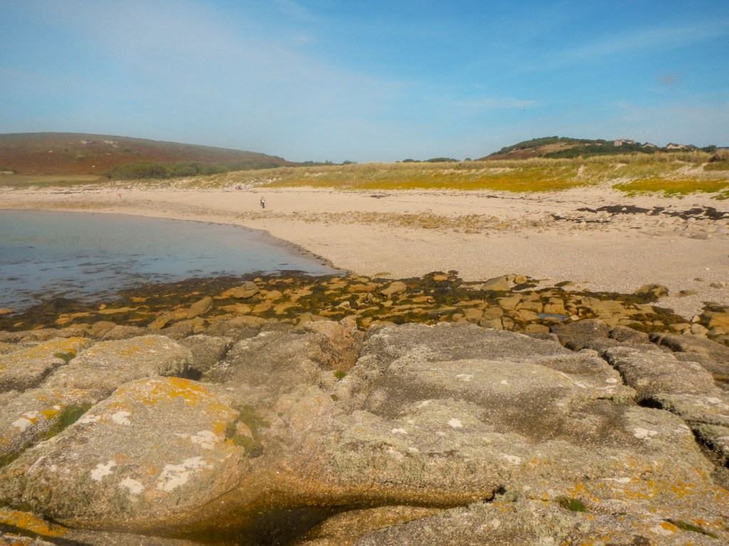
Huge deserted beaches 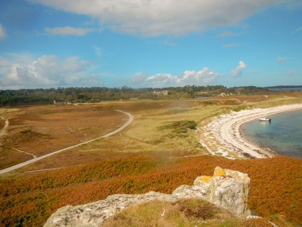
Abbey, “moor” and beach 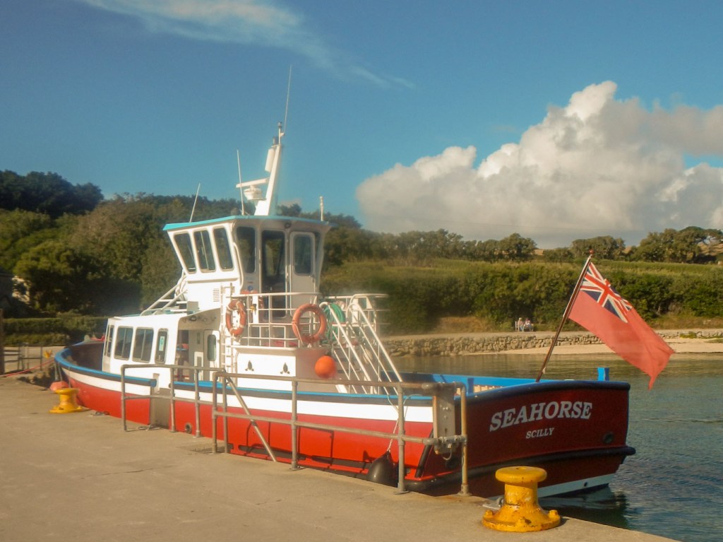
Tresco ferry 
Leaving Tresco
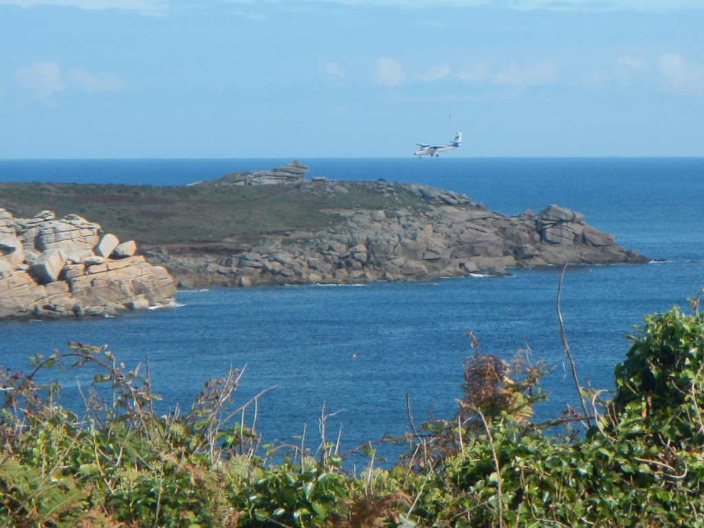
Sometimes pods of dolphins come close to the boats – sadly the only pod we saw was in the distance when we were waiting for our homeward flight at the airport.
We walked round St Martin’s and spotted some seals following kayaks near the Eastern Isles.
Second boat was already loaded for the outer islands as we left from St Mary’s 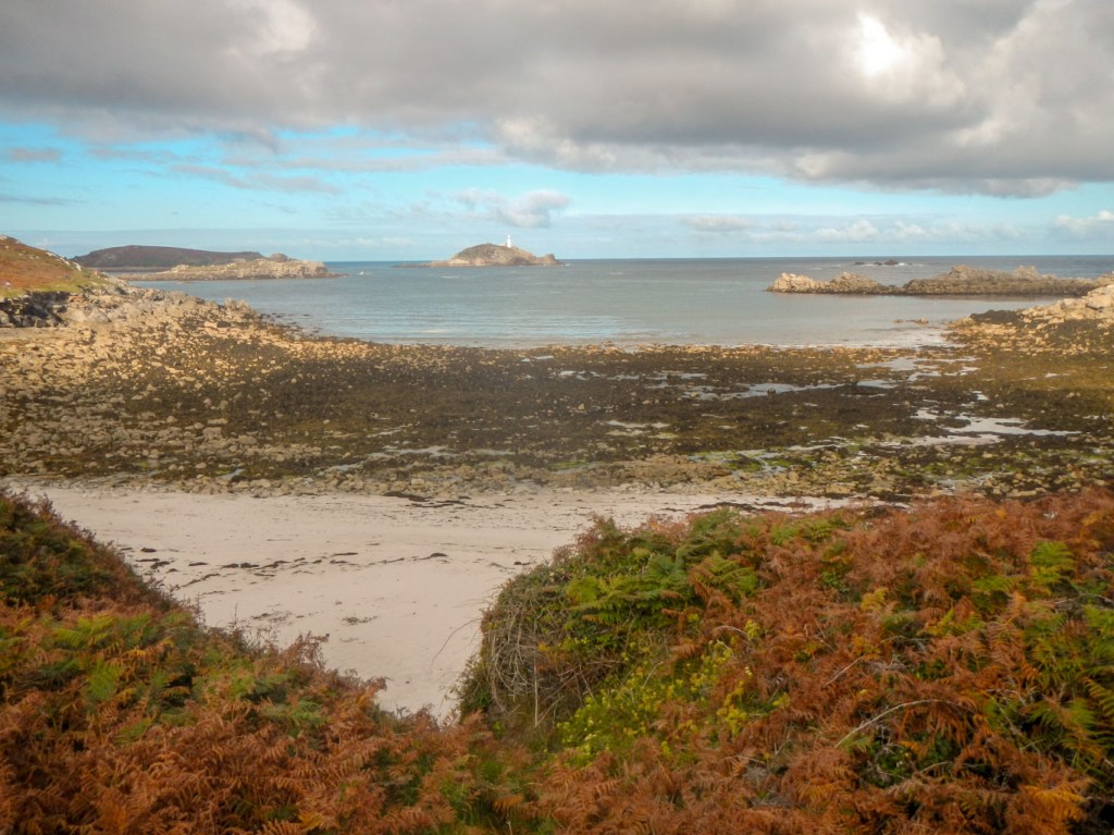
Beach and view to Round Island 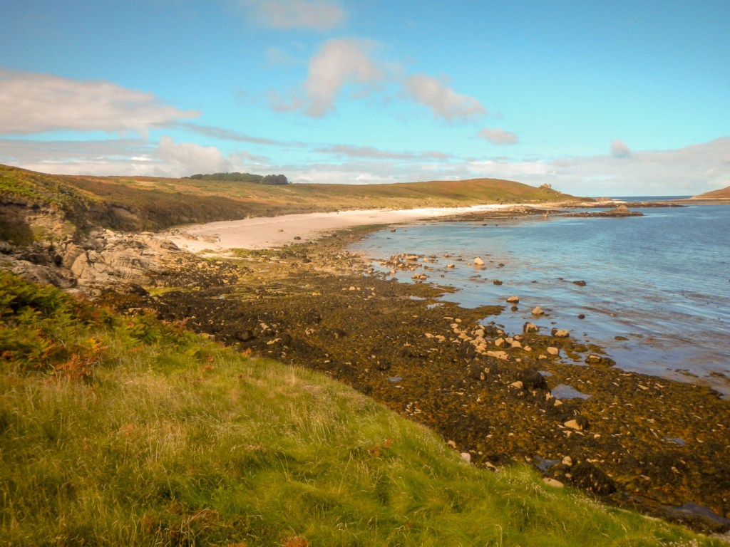
More huge beaches 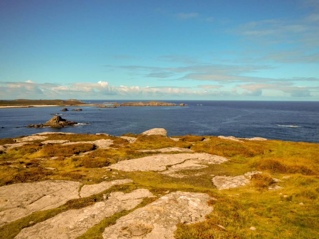
View from the Day Mark (highest point of island)
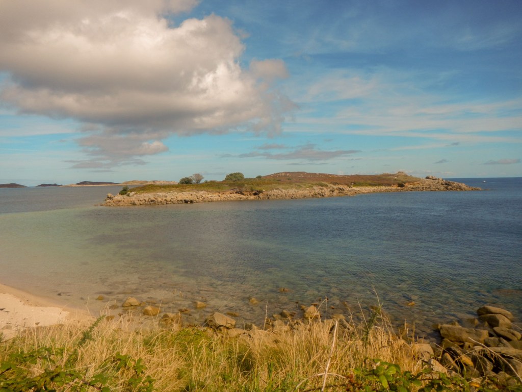
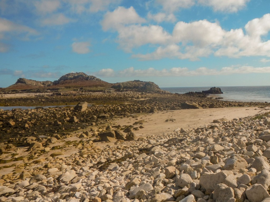
Tidal islands:
- Toll’s Island off the north-west coast of St. Mary’s looked entirely inaccessible the first time we passed it on our walk to circumnavigate the largest island. However it was a different story at low tide. The sand bar was uncovered and the extensive beach easily crossed to reach Toll’s Island. I even had the island to myself for a short time.
Toll’s Island inaccessible! 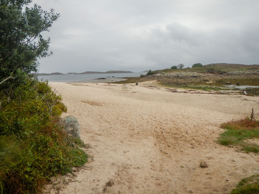
Toll’s Island – no longer an island 
View from the end 
Paths through the heather
- White Island off the north east coast of St. Martin’s was accessible during our walk round the island. It even had its own mini mountain range with extensive views. We could hear the sound of seals “singing” in the distance but were unable to spot them.
Causeway to White Island 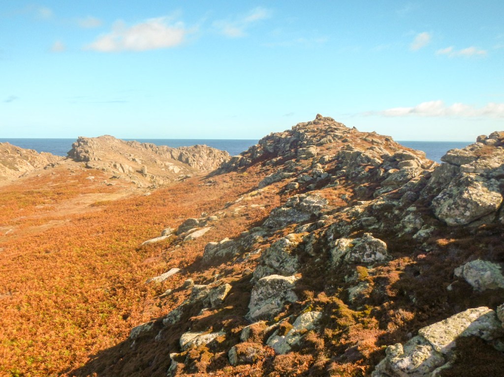
“Mountain range” 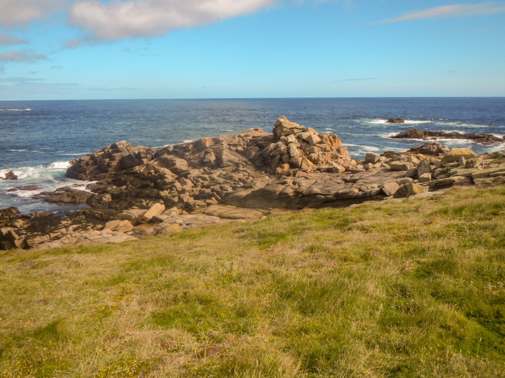
Tip of White Island 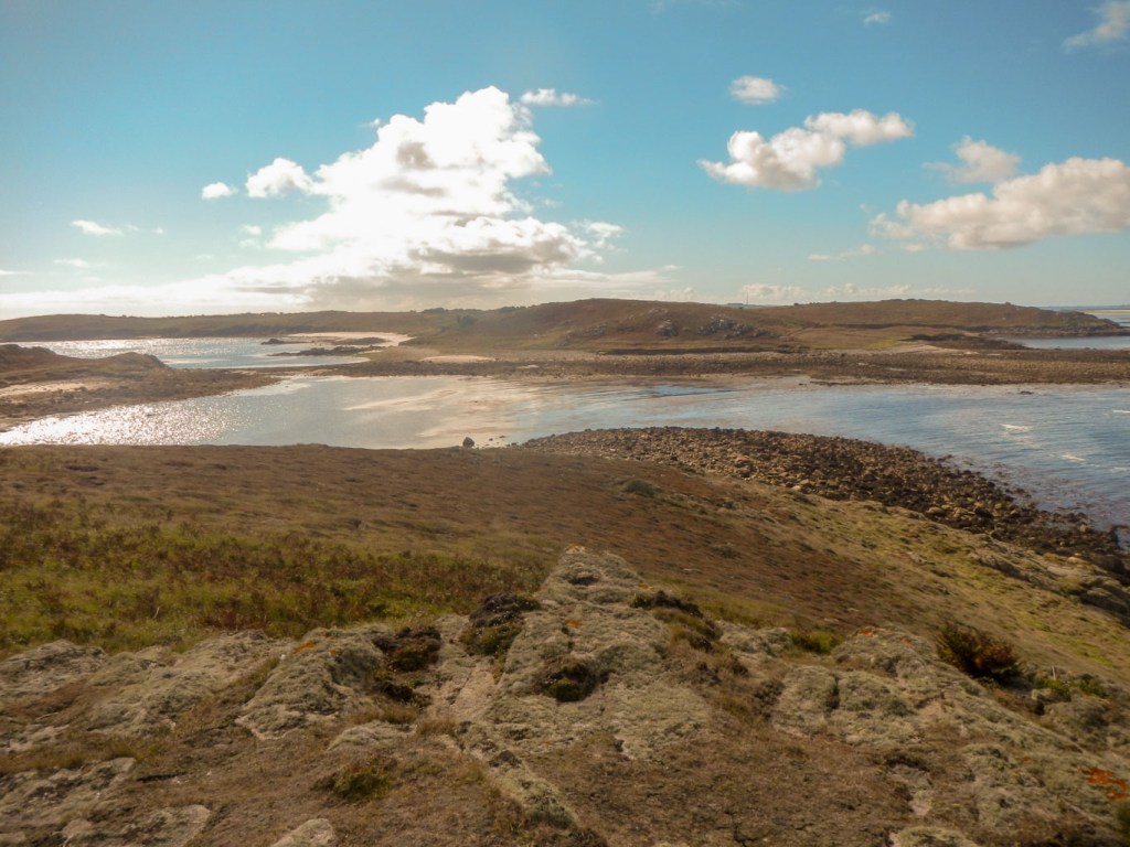
Causeway becoming covered
- Shipman Head off the north coast of Bryher. Sadly the tide times meant we only had two hours on Bryher. The climb to this island looked tricky so I decided against it as I was keen to get round the rest of the rugged island.

Sunset and sunrise:
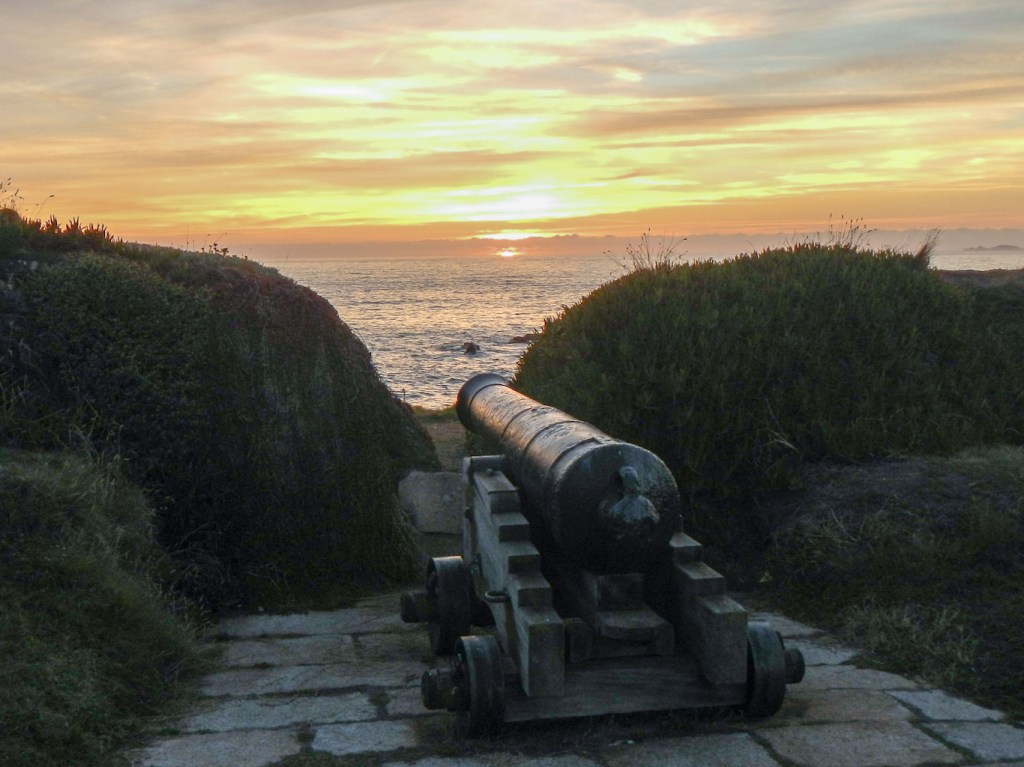
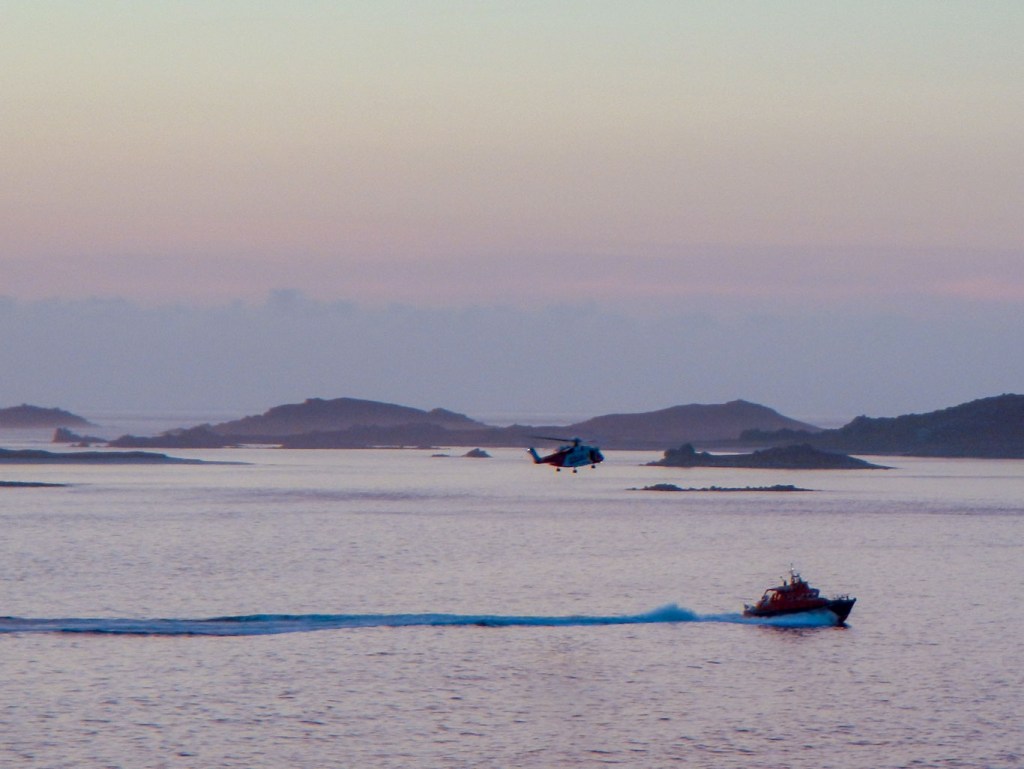
- We walked from the campsite down the hill to the west coast of the garrison peninsula to watch gig racing to St. Agnes. The highlight turned out to be a glorious sunset but we didn’t have our cameras. As the sun sank below the horizon, reflected light on clouds to the north and south resulted in an amazing rainbow effect. After this awesome display, a stroll down to the west coast became a daily event. Sadly there was no sunset to compare with that first experience. However on the final evening there was no cloud on the horizon so we did witness the sun dipping below the horizon. Immediately after this, while the sky was still red, we were treated to a display of helicopter flying as there appeared to be a joint lifeboat and coastguard practice. The coastguard helicopter hovered just above the lifeboat and later on the coastguard winched someone into the helicopter.
- Following perusal of the weather forecast, I selected a morning to wake early and walk over to a monument above Peninnis Head. From here, near a bench in memory of Harold Wilson commemorating his favourite walk (he is buried in the churchyard at Old Town as he retired to the Scilly Isles), there was a magnificent sunrise. I don’t remember ever having seen sunrise over the ocean previously (or indeed watching it anywhere), which seems rather a serious omission having had the opportunity for the last sixty years. It was certainly a magical moment and worth the effort.

Sunrise from high point above Penninis Head 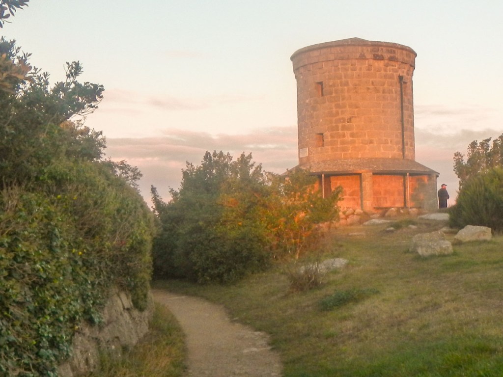
Early morning light on the Edward VII tower
Prehistoric remains:
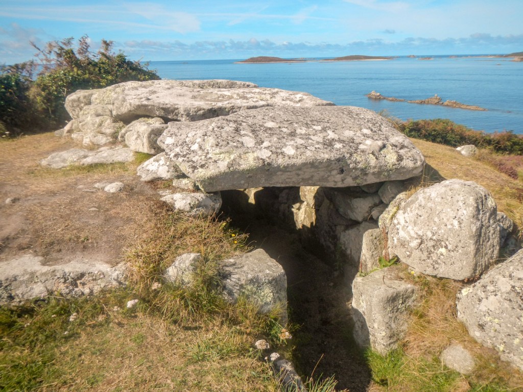
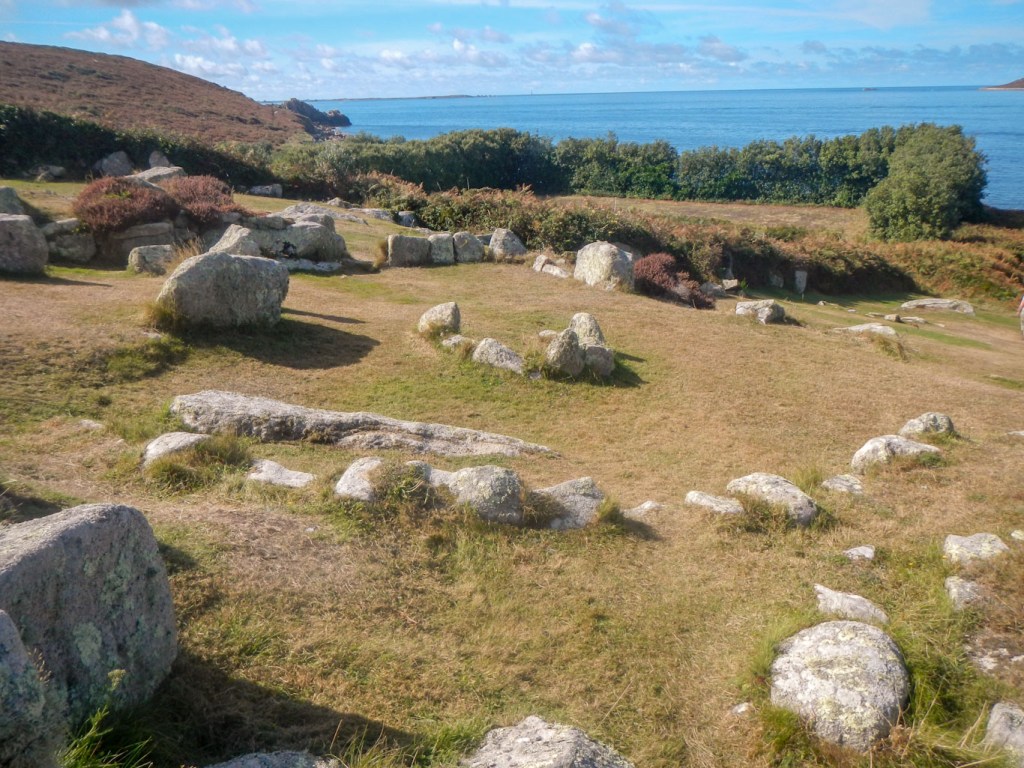
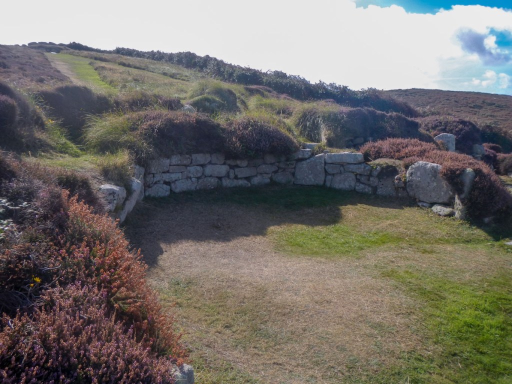
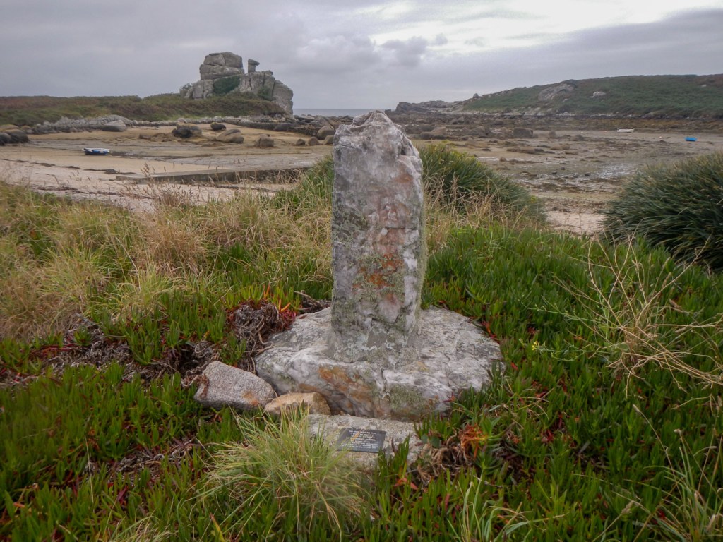
- As we walked round St Mary’s we discovered several well preserved Bronze Age burial chambers, known as entrance graves. These are characteristic of the Scillies and parts of Cornwall. Most comprise a roughly circular mound retained by a stone kerb and built over a rectangular, stone-lined chamber which is roofed with large granite slabs. Entrance graves seem to have continued in use on Scilly long after individual burial had become the usual practice on the mainland. Having realised what they look like, it is possible to pick out other less well preserved examples both on St Mary’s and on the other islands. In prehistoric times sea levels were lower so the current islands of St Mary’s, Tresco, Bryher and St Martin’s would have been a single land mass.
Bant’s Cairn 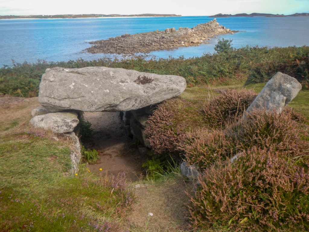
Innisidgen lower cairn 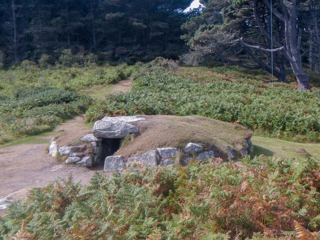
Innisidgen Upper Cairn 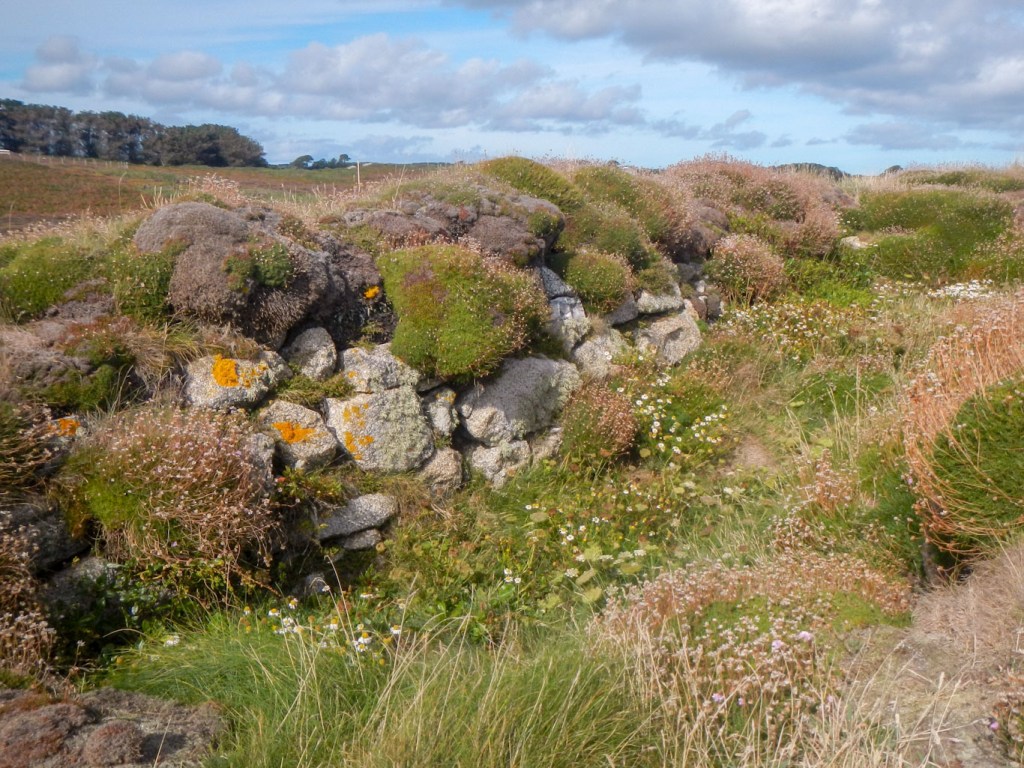
A collapsed cairn – there are many 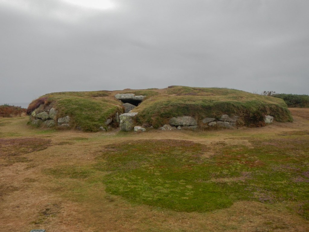
Porth Hellick burial chamber 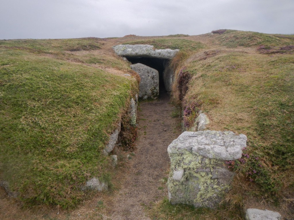
Porth Hellick burial chamber
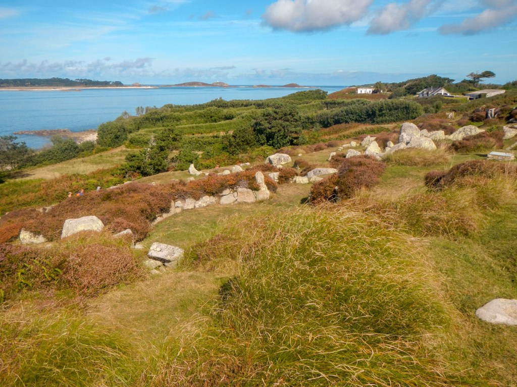
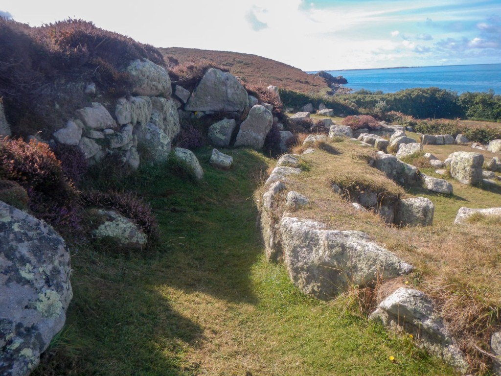
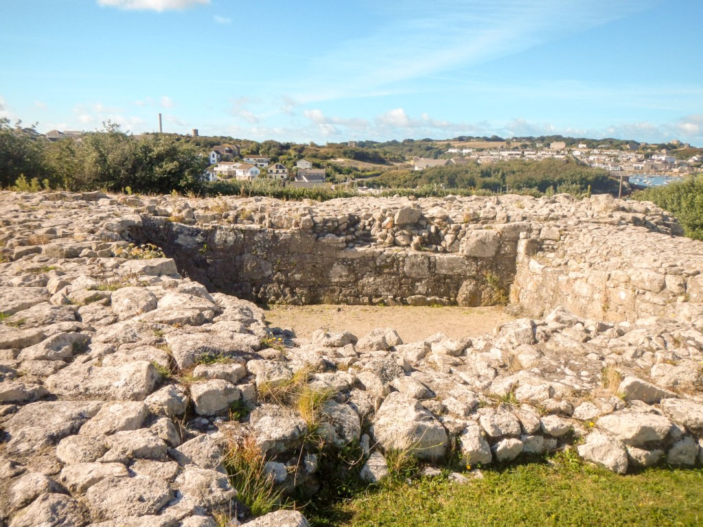
- Halangy Down Ancient Village – this later Iron Age to Roman settlement lies below Bant’s Carn at the south-west edge of Halangy Down. Excavation in the 1950s revealed eleven interconnecting stone built dwellings. The Iron Age and Romano-British inhabitants of the settlement here probably lived in much the same way as their Bronze Age predecessors. The whole complex reminded me of Skara Brae, a Neolithic settlement in the distant Orkney Islands.
Historic defences:
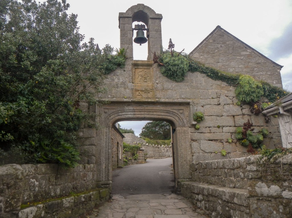
- Tudor defences seen on Tresco – By the 16th century the Isles of Scilly were a weak spot in England’s defences. If captured, they would have made an ideal base for England’s enemies so, in the late 1540s, work began on the defences, initially on Tresco. The Old Blockhouse was built to protect the harbour of Old Grimsby. The larger fort, now named King Charles’s Castle owing to occupation by Royalist Forces a century later during the English Civil Wars, faces across New Grimsby Harbour.
Remains of King Charles’s Castle 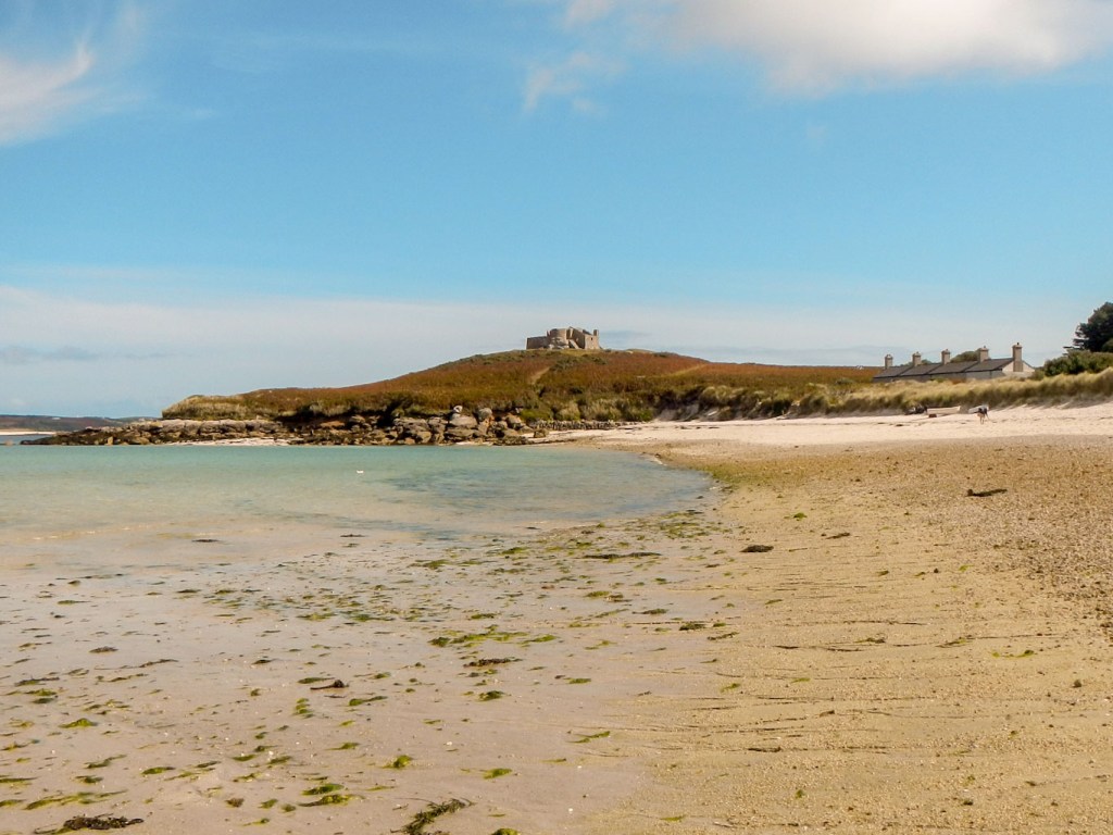
Blockhouse protecting Old Grimsby
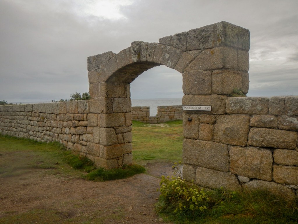
- Tudor defences on St Mary’s – the artillery battery known as Harry’s Walls was started in 1551 but never finished – it had been planned to defend the main harbour of the island.
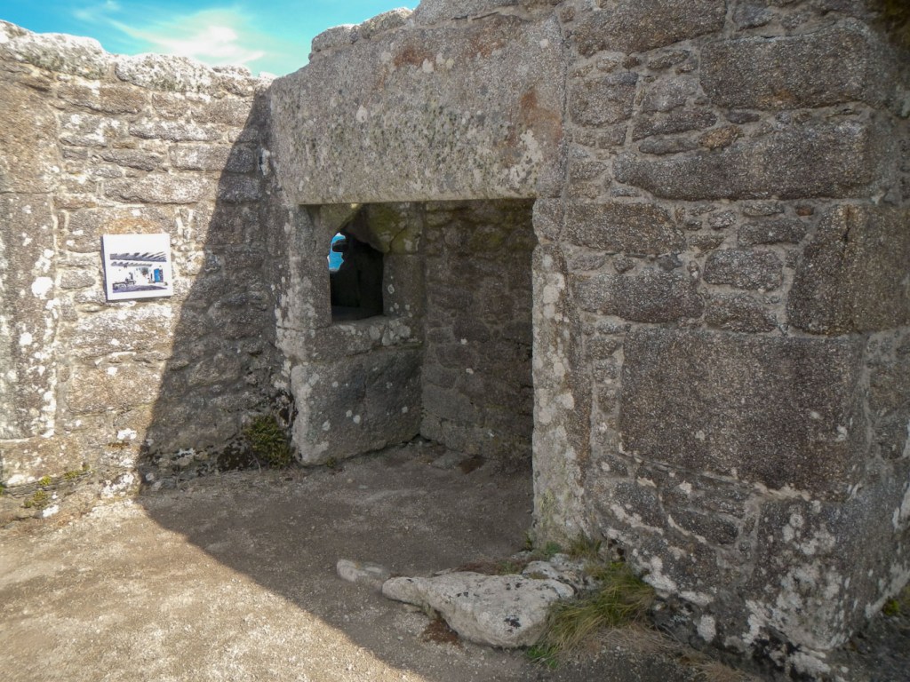
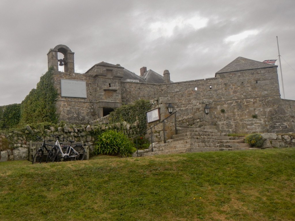
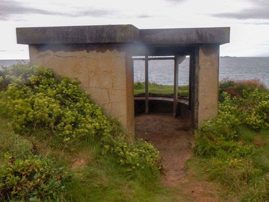
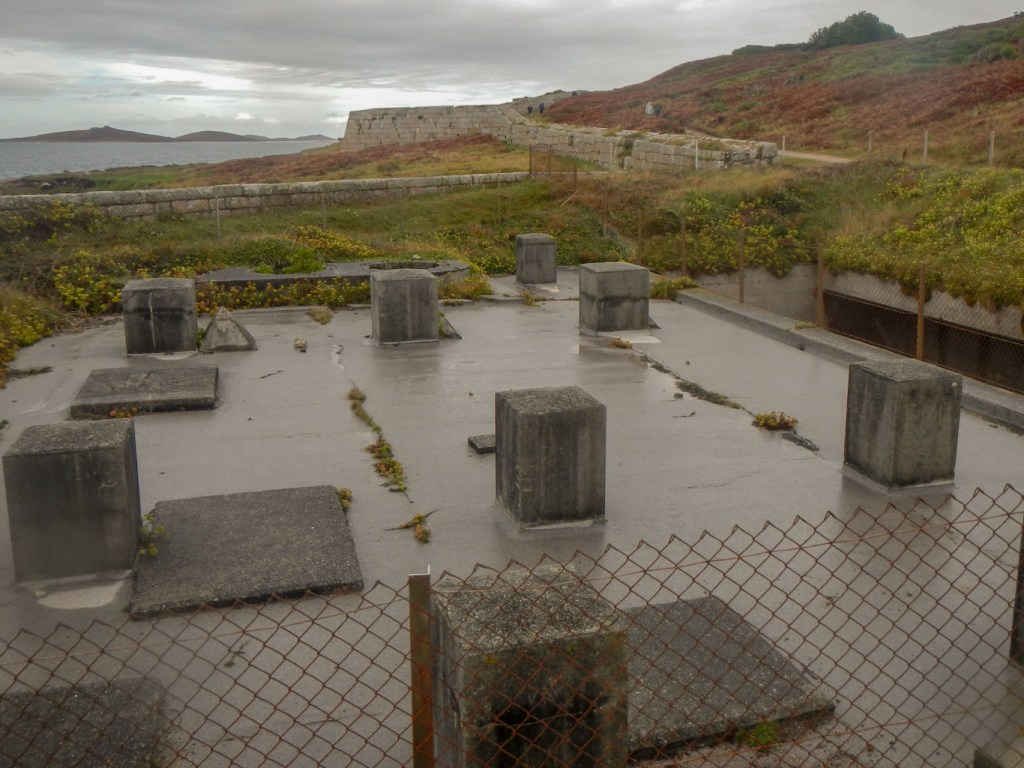
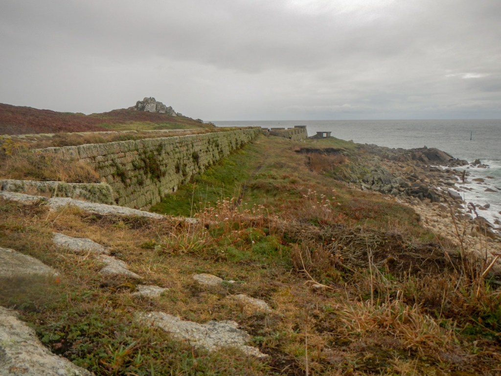
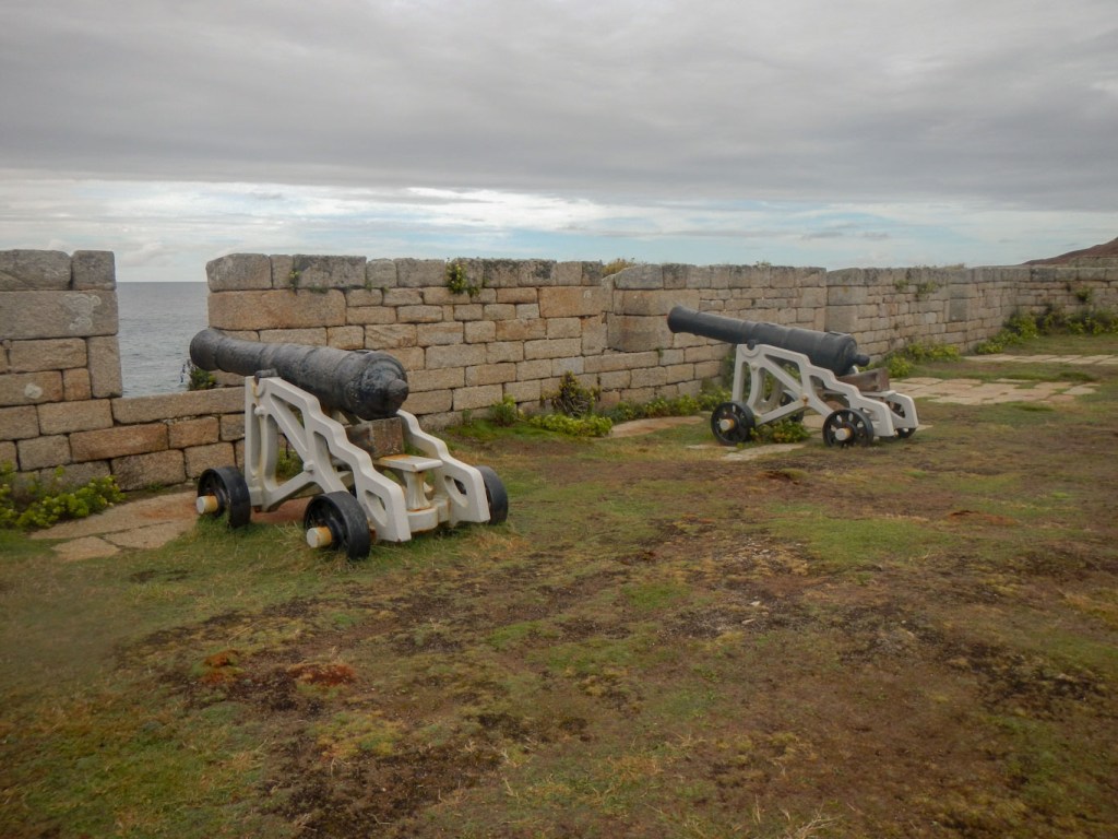
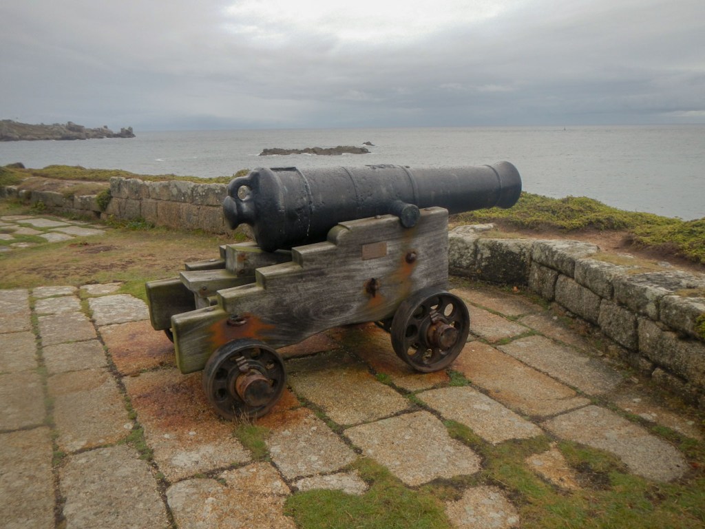
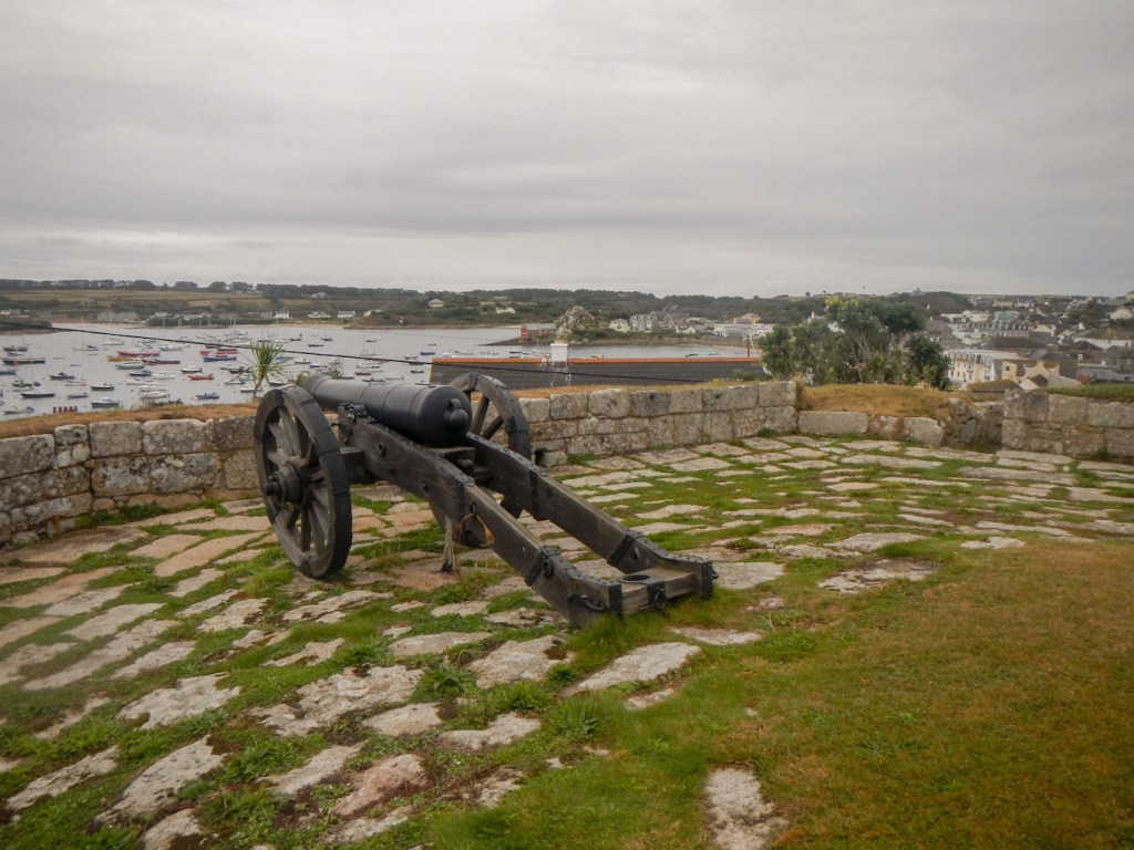
- The Garrison on St Mary’s – Our campsite was on the field within the boundary of the Garrison Walls so, in addition to our perambulation around the walls, we entered and left the garrison on a daily basis. English Heritage state that this is one of the most remarkable and impressive coastal defence systems in England. The original defences date from the 1590s, when the threat, which never materialised, was of Spanish invasion. The garrison became a Royalist stronghold during the English Civil Wars in the 1600s. Invasion by France or Spain remained a possibility during the 17th and early 18th centuries. The Elizabethan curtain wall was gradually extended until it surrounded almost the whole of the headland, with bastions covering every possible angle of approach from sea or land. The Garrison was used again in the First World War, when it was re-armed and accommodated almost 1,000 servicemen. In the Second World War the Isles of Scilly were at the forefront of the Battle of the Atlantic. Large numbers of servicemen were again stationed here and the Garrison was an important signal station, with pillboxes built within the 18th-century batteries.

- Cromwell’s Castle on Tresco – The impressive castle was built on a projecting shelf of rock in 1651, to guard one of the main routes of entry to the heart of the islands as well as the deep water approach to New Grimsby harbour. No fleet could hope to land troops on this side of Tresco unless it had first destroyed or captured the castle, but the chances of destroying the castle by gunfire from the sea were very slim. The fort was considered worth updating a century later, when a platform for cannon was added on the seaward side.
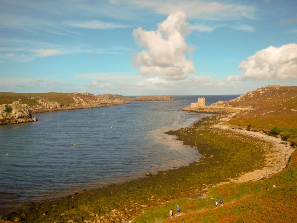
Cromwell’s Castle (on low rocks) and King Charles’s Castle above 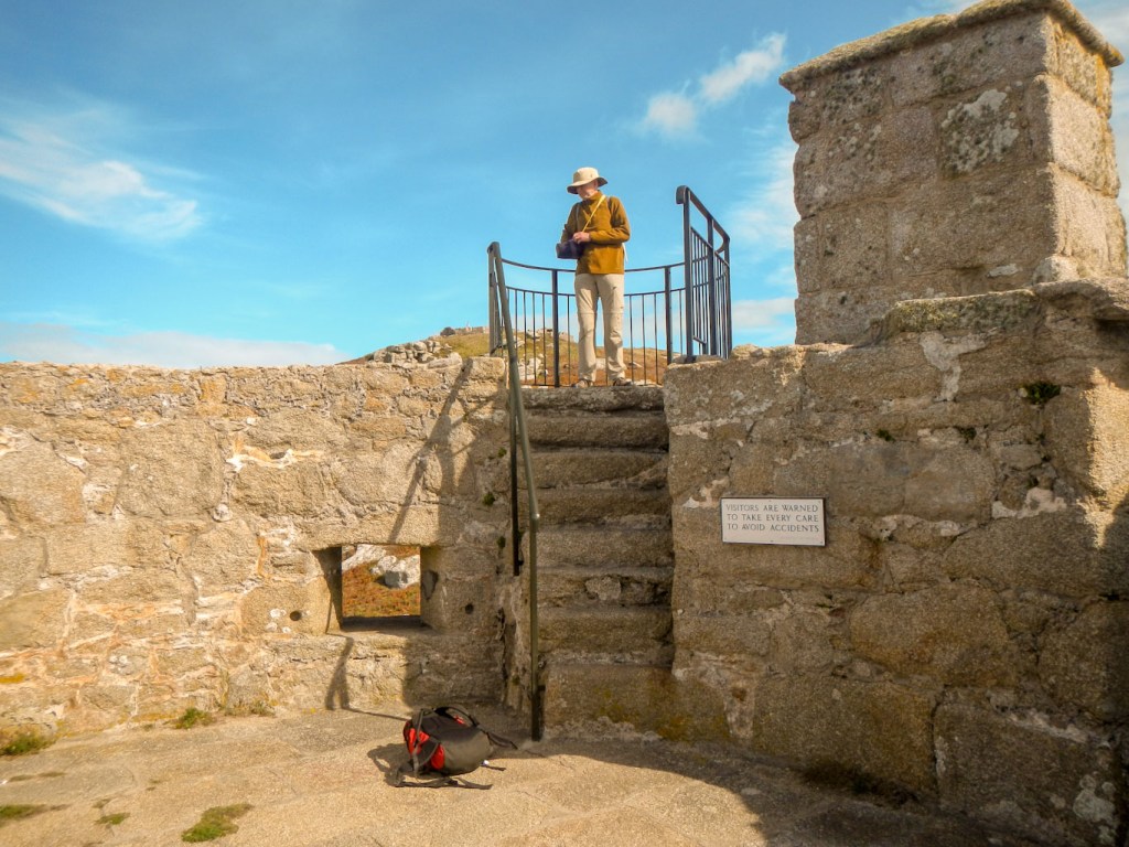
Cromwell’s Castle 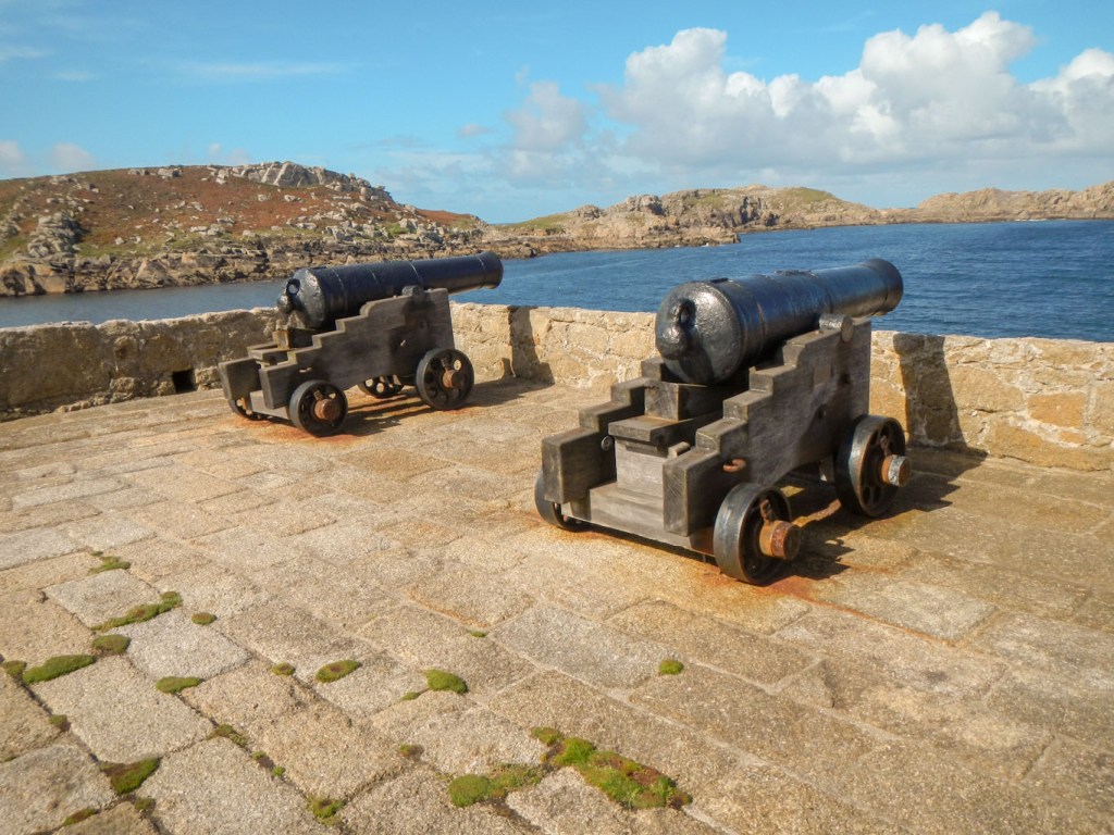
Cromwell’s Castle 
Cromwell’s Castle from King Charles’s Castle
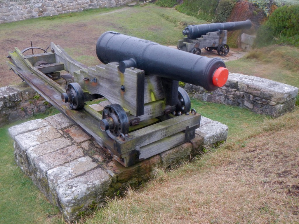
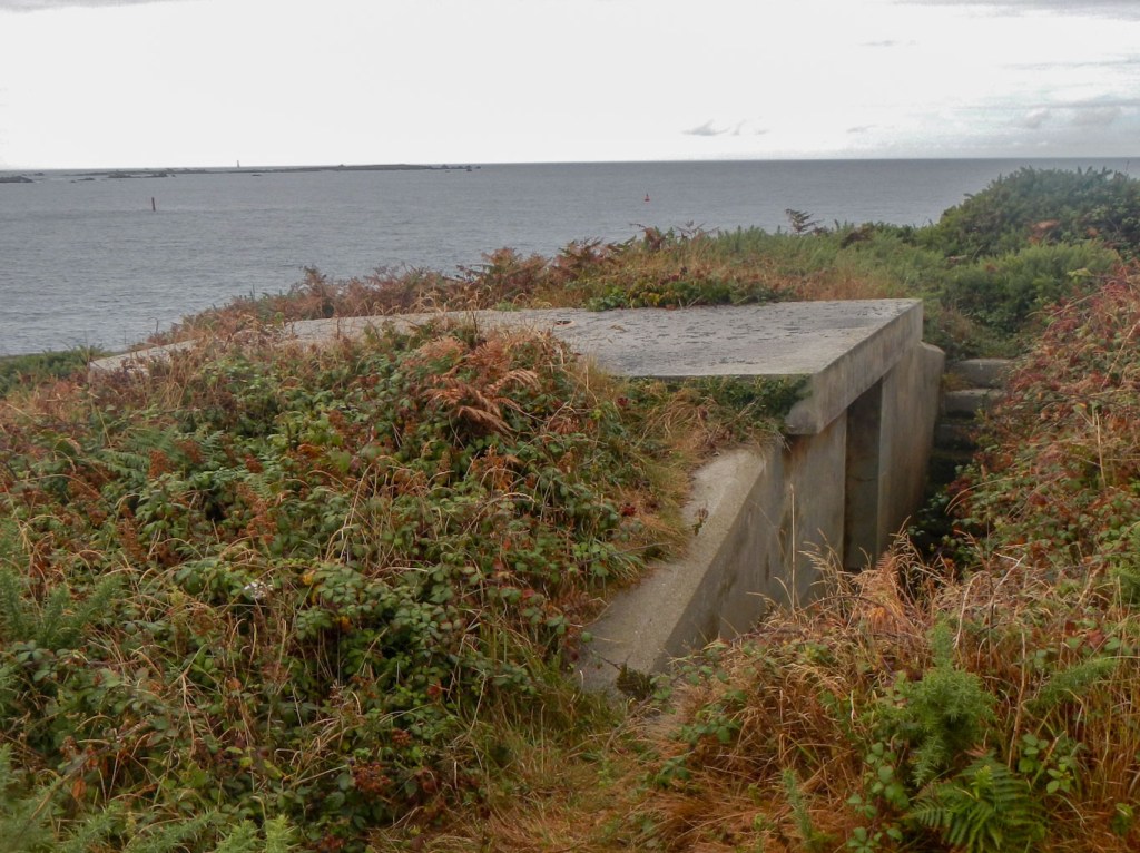
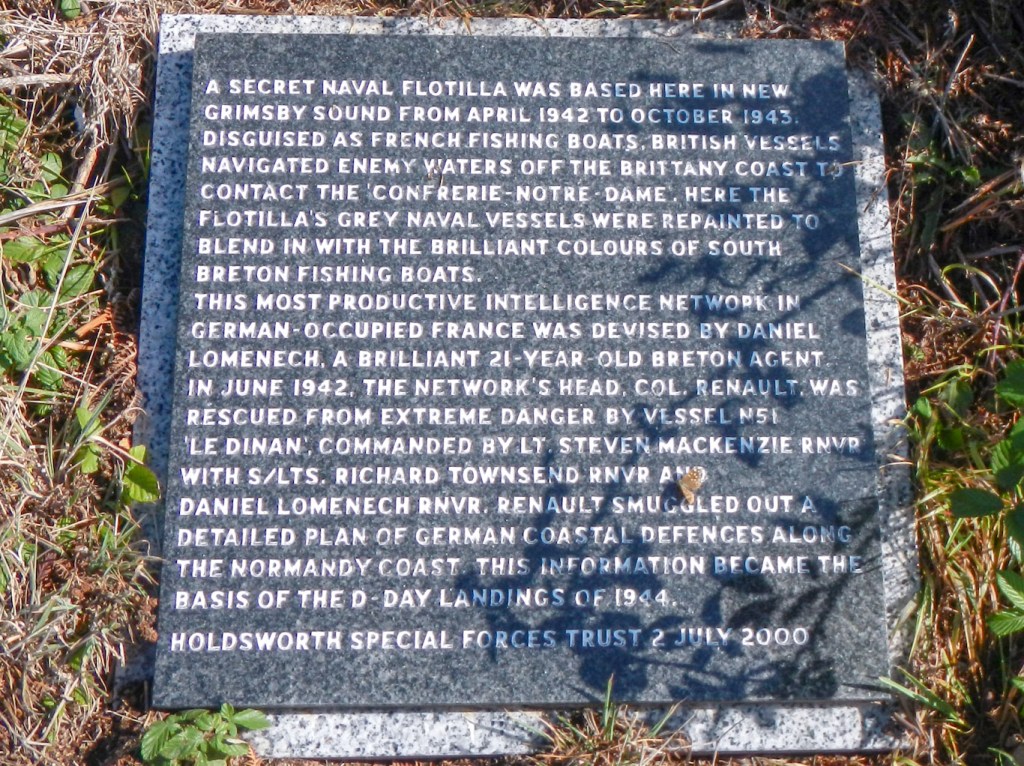
- 20th century defences – a few remains of concrete “pill boxes” as we walked round the islands as well as evidence for the importance of the Scillies in strategic D-day preparations.
Lighthouses and daymarks:
- There are six altogether, including the iconic Bishop Rock lighthouse seen in the distance from many parts of the islands. We walked past a few. Unpredictable seas and shallow rock reefs make for a deadly combination. There’s a reminder of this near Porth Hellick on St Mary’s commemorating the place where the body of Sir Cloudesley Shovell, Admiral of the Fleet, was washed up. In 1707 four of the Royal Navy’s ships were sunk, one of the greatest disasters in British maritime history. The estimated death toll was 1,400- 2,000, almost as many people as are living on the Isles of Scilly today.
- Peninnis Lighthouse on the southernmost tip of St. Mary’s.

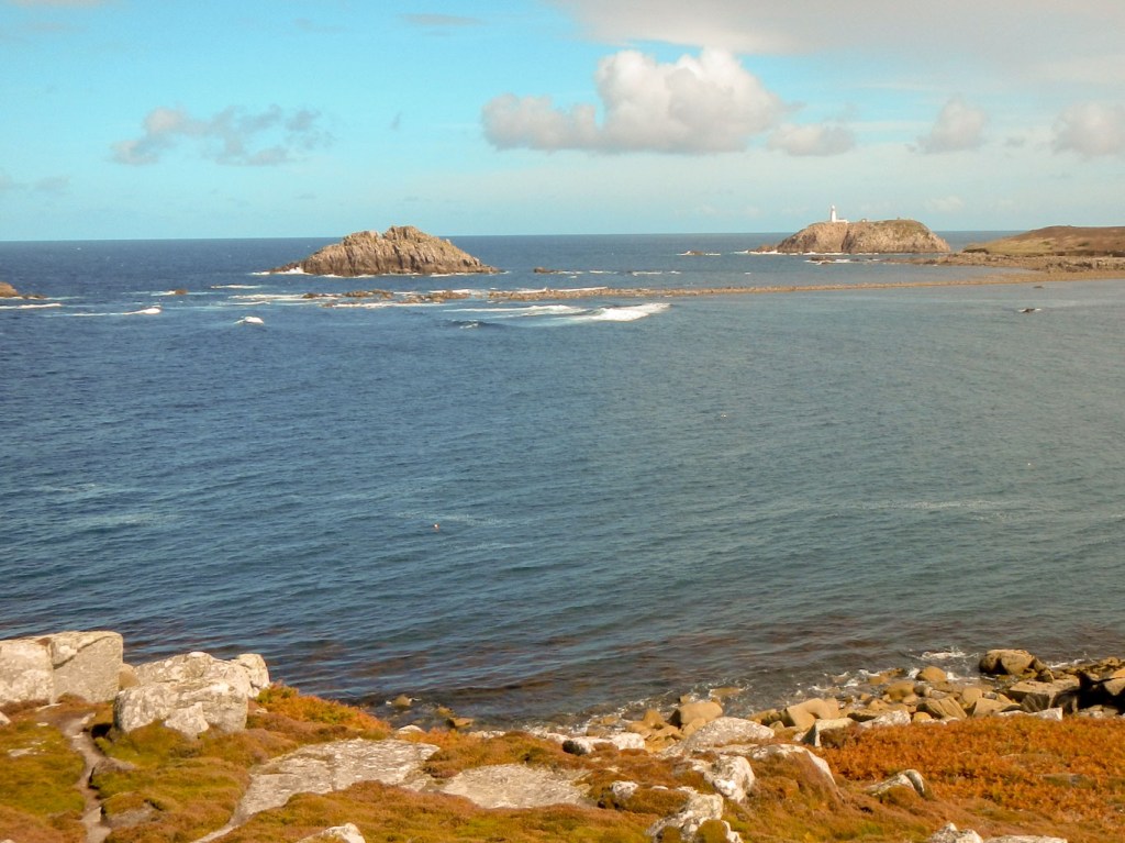
- Round Island Lighthouse near the northerly extreme of the archipelago, clearly seen from Tresco and from St Martin’s.
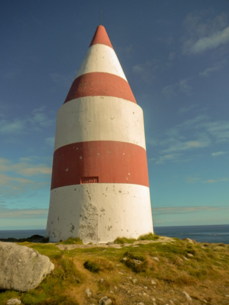
- The day mark on St. Martin’s Head.
Watersports:
- Unfortunately my booked beginner stand up paddle boarding lesson was cancelled due to wind, but there are plenty of opportunities to arrange activities – we saw many kayakers and dinghy sailing boats and there were rib and motor boats for hire for those who knew what they were doing. We’ll have to get some training and go back!
- Swimming – actually once I got in the water it wasn’t too cold and so even I was able to swim in the sea (without a wet suit!).
Local food:
- Fish and seafood caught locally – available in restaurants and as takeaways!
- Beer brewed at the most south westerly brewery in UK.

- Scilly spirit – Island gin – we passed the building in Old Town – but didn’t partake during this visit.
- A small tub of Troytown ice cream made on the farm on St Agnes was an almost daily treat – and we kept discovering new flavours; apparently there are thirty or so.
- All the free blackberries growing everywhere!
- Coffee and cake from many cafes – especially the Longstone Cafe which we discovered on the one rainy day. The choice of cakes was amazing….
However all too soon we were packing our bags ready for the flight home, hopeful that everything still fitted into the weight and dimension allowances.