21-23 August 2021
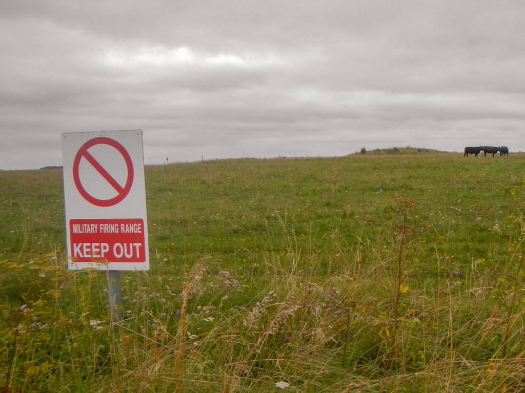
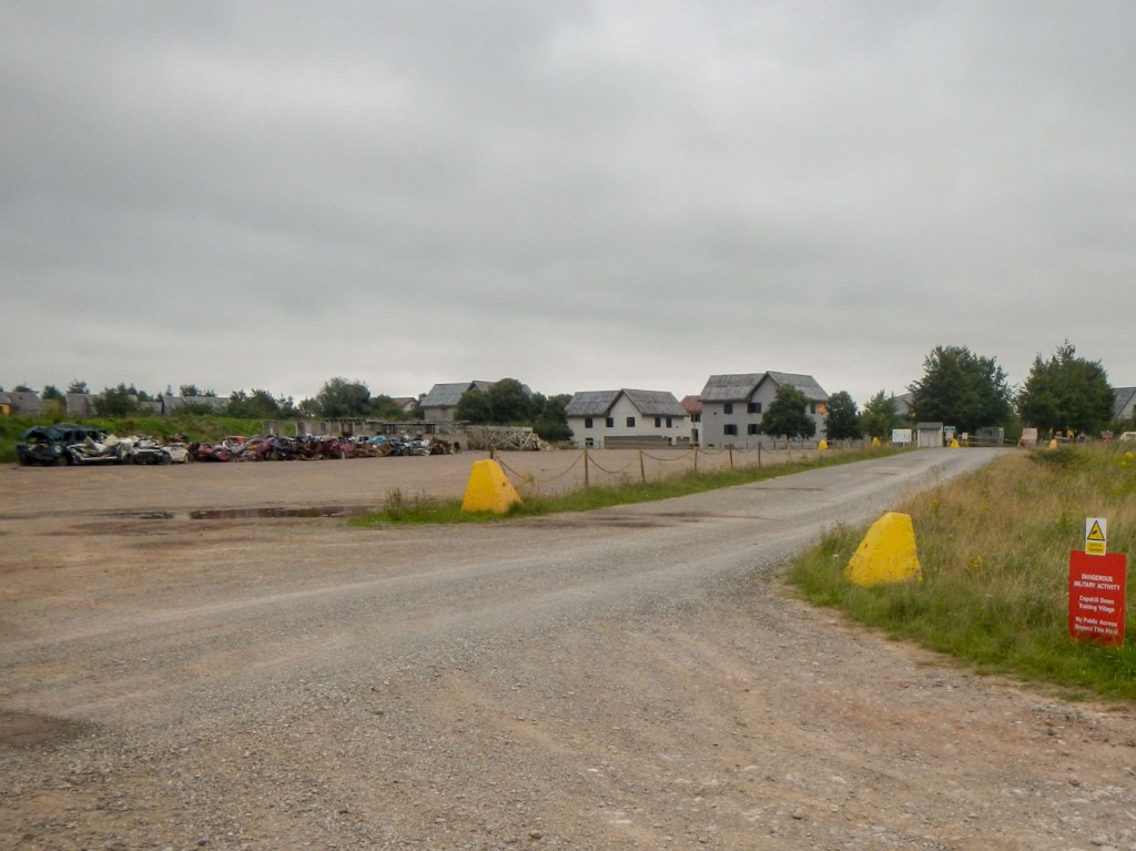
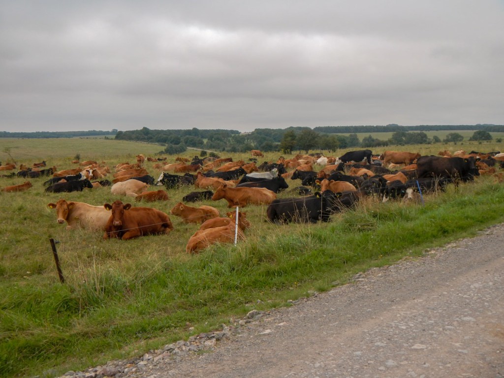
It’s interesting to note how many of my expeditions so far have been over MOD land – Cape Wrath, parts of Dartmoor and Lulworth Ranges. These are all large tracts of predominantly unspoilt open countryside. This expedition was no exception. Salisbury Plain has been associated with the Army since 1897 and, at 38,000 hectares it occupies about one ninth of the area of Wiltshire. Moreover Salisbury Plain (which is actually a plateau) is also an archaeological landscape of international importance. On the Army Training Estate there are approximately 2,300 ancient monuments and it has one of the densest concentrations of long and round barrows in Britain.
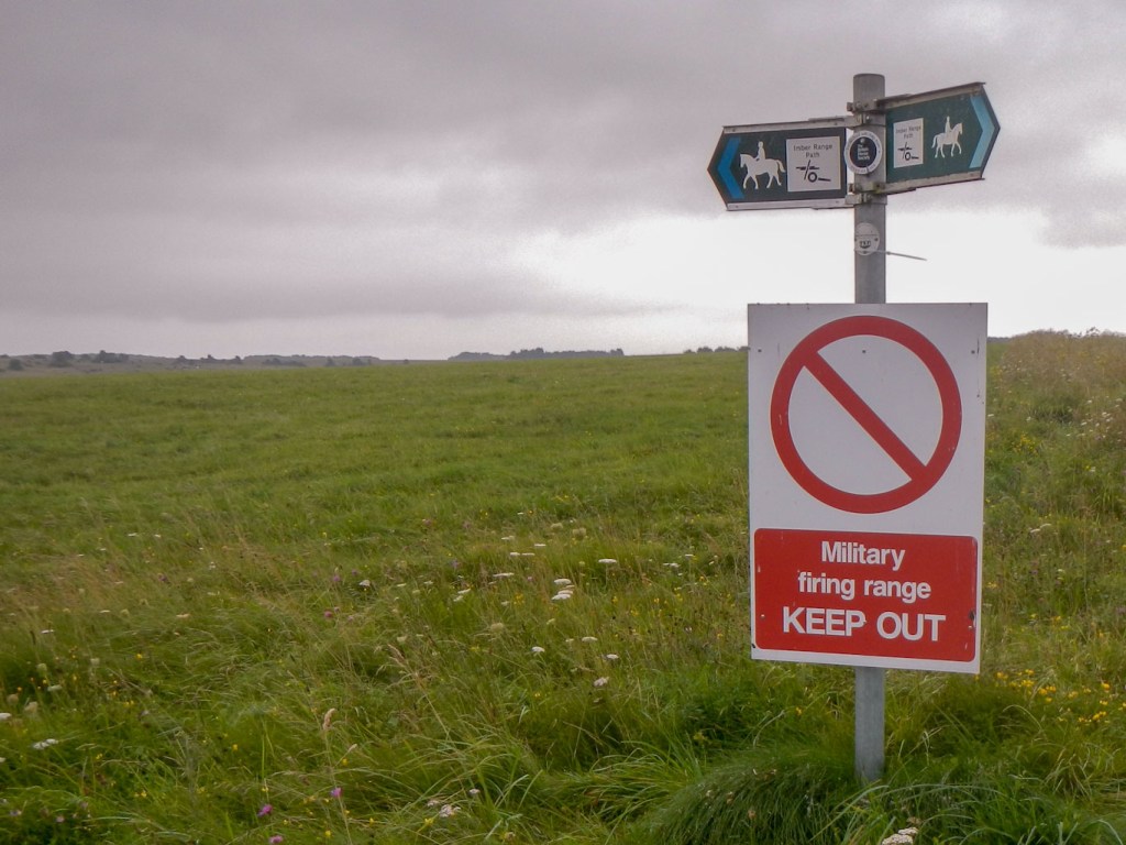
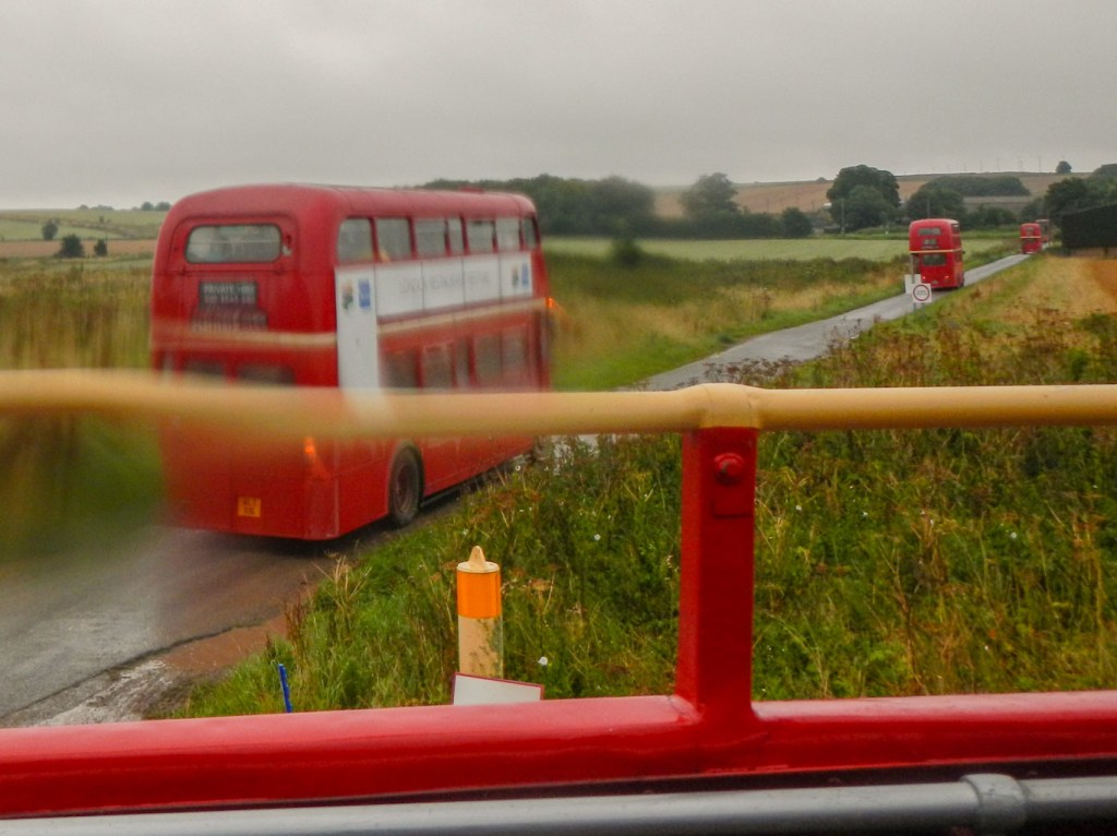
My plan was to complete an approximately thirty mile circular walk mainly following the perimeter of the Imber Firing Range Danger Area. However I discovered that on 21 August a special event was taking place – “Imberbus”. Apart from being a casualty of Covid in 2020, this has been an annual highlight since 2009. It would actually allow me to visit the site of the lost village of Imber (not usually accessible to civilians), where St Giles’s church is the main attraction. I would travel there on a London bus and also the bus would convey me on several roads that are within the military range and normally closed to the public. I opted to choose my dates so I could attend the Imberbus Event and then walk round the perimeter path over the following couple of days.
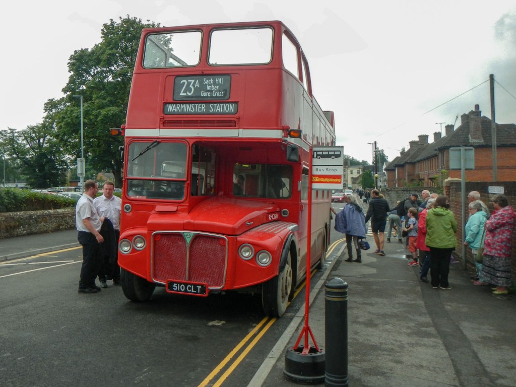
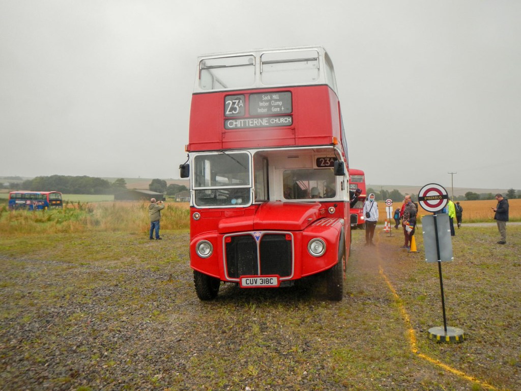
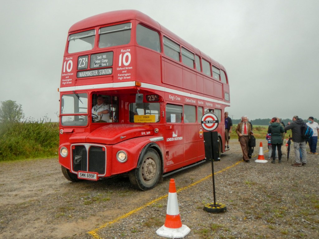
I arrived at Warminster Station on a packed train just after 10am. It seemed as if everybody piling off the train was going to Imber. Within seconds I had an Imberbus event guide in my hand and I’d bought my £10 all day rover ticket. There were several double decker red London buses parked near the station including an open top bus. Unfortunately it was pouring with rain but that didn’t seem to be putting anyone off. I pulled on my waterproof jacket and trousers and fitted the rain cover over my rucksack while I was waiting at the bus stop.
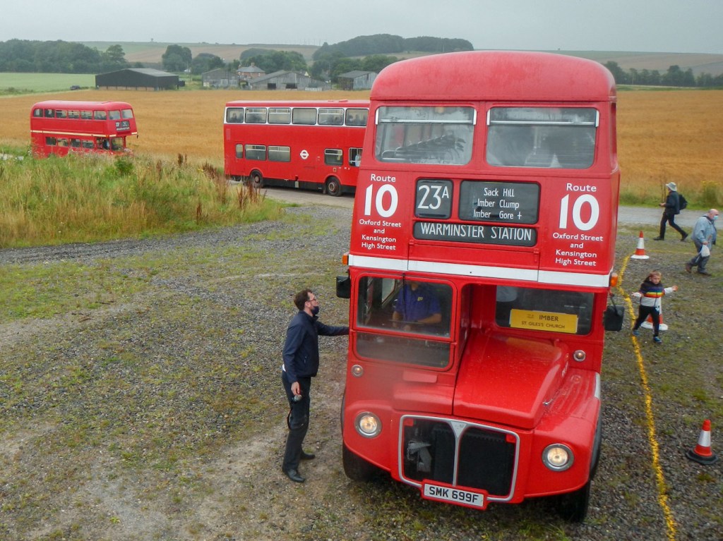
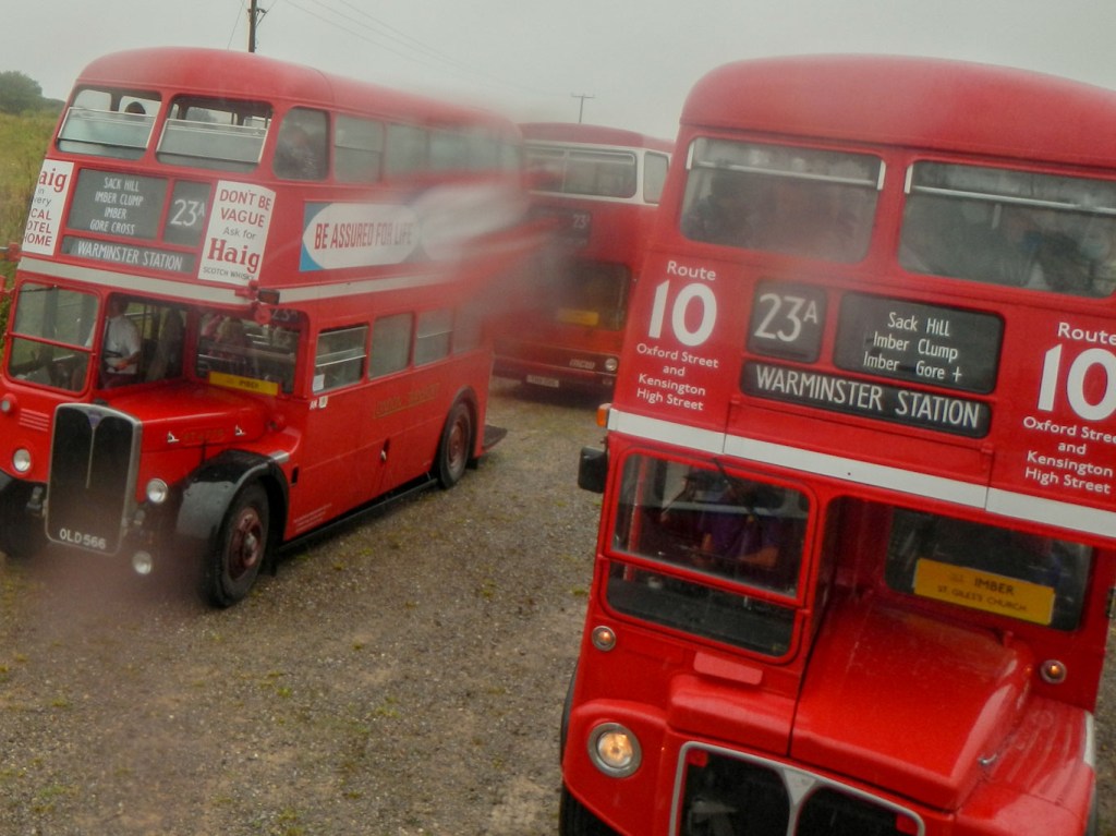
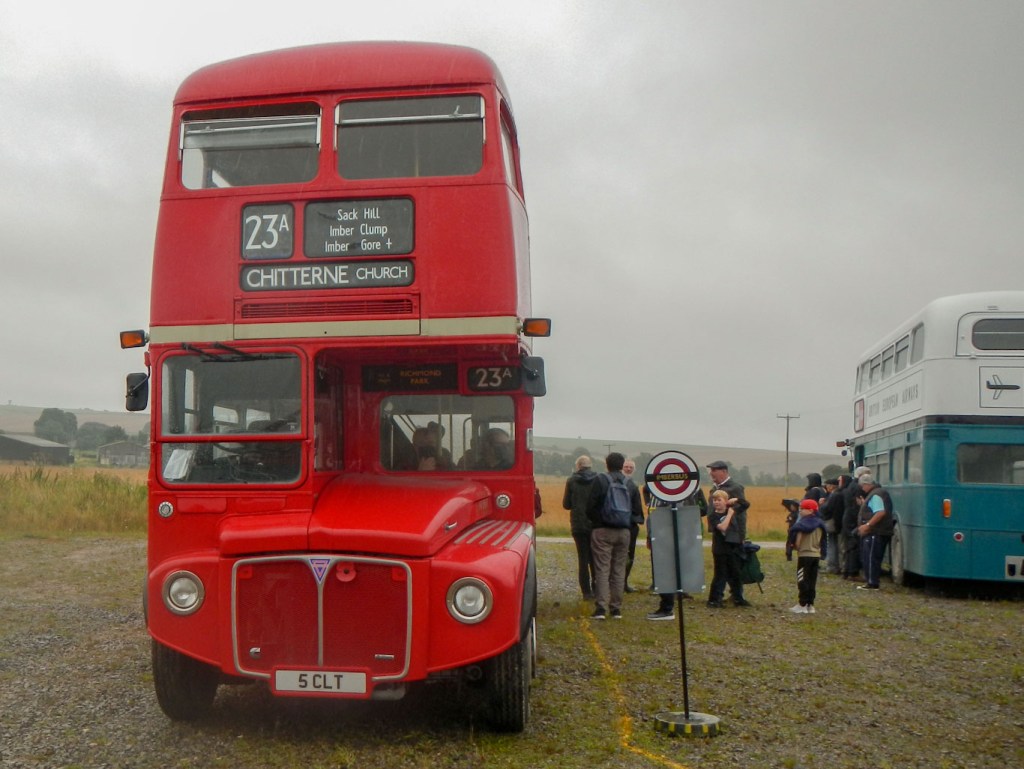
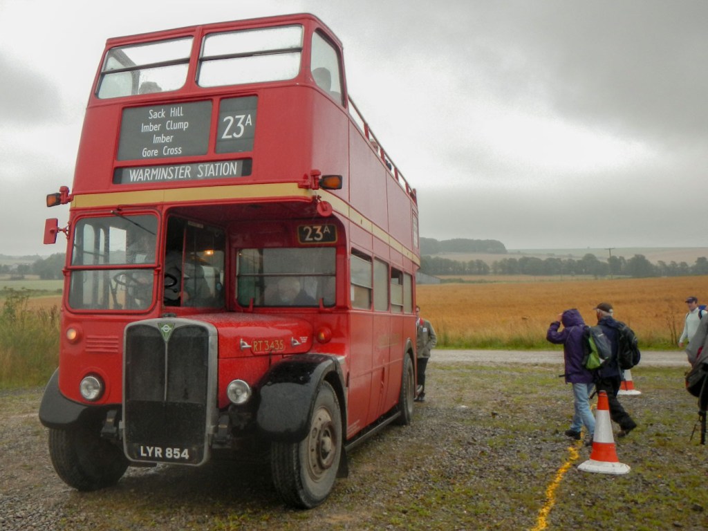
Within minutes, as buses were loaded with excited expectant passengers, I had reached my turn at the front of the queue and was climbing on to the upper deck of an old Routemaster bus. The first Routemaster buses in London appeared in 1956. All the Imberbus vehicles were number 23A but they had various destinations including Imber, Chitterne, New Zealand Farm Camp, Tilshead and Brazen Bottom. I found myself on the second row of seats on the top deck. The conductor came up to alter the destination panel, but initially it was too stiff to turn the lever. Anyway no one seemed to mind where they were going; we just wanted to go somewhere!
There was a mixture of people – some bus enthusiasts who were writing down the details of each bus they travelled on, people who just wanted a day out and to see Imber Church and some of the normally closed roads – both local residents and from further afield, a sprinkling of families with young children and some people who just seemed to be wondering what it was all about.
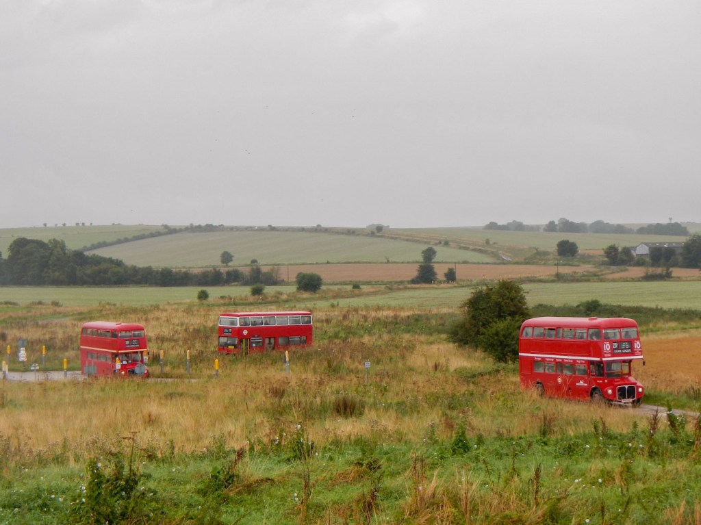
Soon we were off. The buses all headed initially up to Imber Church setting off in convoys of three. It must have looked rather incongruous going along the streets of Warminster, especially the open top buses on a rainy day. The bus seemed to struggle and chug up the steep hill to the MOD range entrance and I heard people commenting about whether we would need to get out to push. I could feel the gears going down and wondered whether there were any more gears left if it became steeper. The children became excited spotting dilapidated tanks and other vehicles as well as a Bailey bridge to the side of our track. The Iron Age hillfort at Battlesbury rose high from the surrounding land to the right.
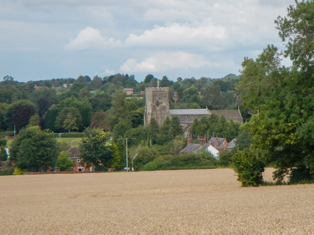
At Imber I decided to get out and have a look round the church (before it got too crowded). It was already quite busy! The church dates from the thirteenth century with a fourteenth century tower. It is just about all that remains of the ghost village of Imber (otherwise just shells of houses built for training after the original houses disintegrated), which was evacuated in November 1943 to allow training of American troops for the D-Day landings. When the villagers were forced to leave with only 47 days notice, they thought they might return once war ended. However the village has remained in military occupation ever since. It all sounds very similar to Tyneham on Lulworth Ranges (see blog for map 194). Albert Nash, Imber’s blacksmith, was said to be found weeping over his anvil following the announcement that they must vacate their beloved village. He didn’t live for long afterwards and the doctor recorded the cause of death as “a broken heart”.
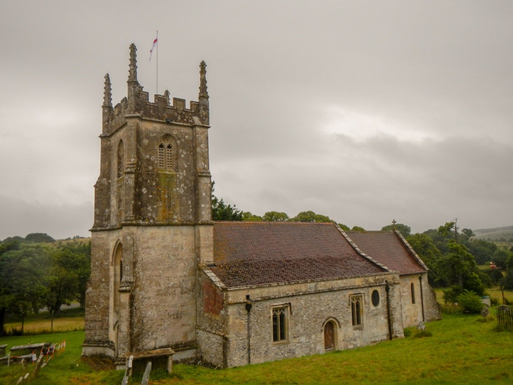
Inside the church, there are medieval wall paintings with a rare depiction of the Seven Deadly Sins, and a set of seventeenth-century bell ringing changes are painted on the north wall of the tower below the ring of six bells.
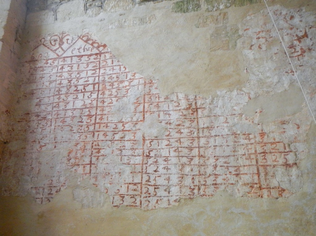
Ringing changes 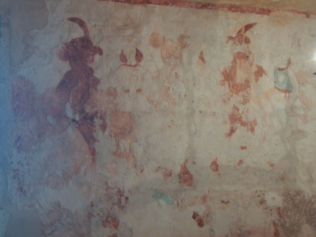
The seven deadly sins
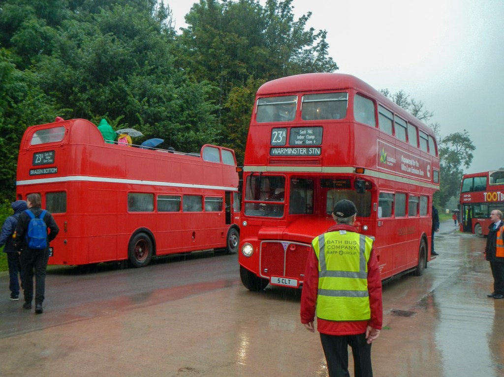
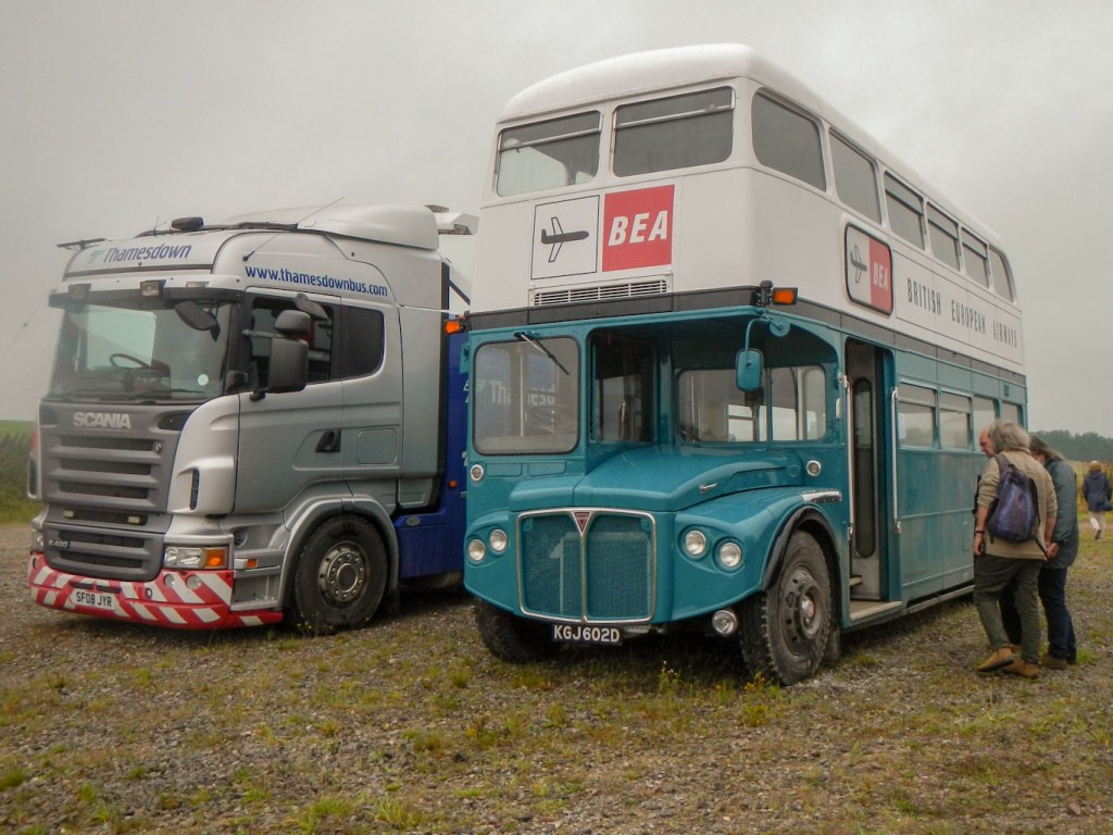
Soon I was on my way again. There seemed to be buses going past all the time and never long to wait for a bus. This time I got on the top deck of a 1950s open top Routemaster. There were only five of us on the upper open deck, which wasn’t surprising as it was pouring with rain. We travelled on roads which were at times little more than tracks, to get to Gore Cross. Here there was a breakdown truck at the ready and another vintage bus but this one was painted in a blue and white livery having been used by British European Airways. Apparently it was a spare bus in case one broke down.
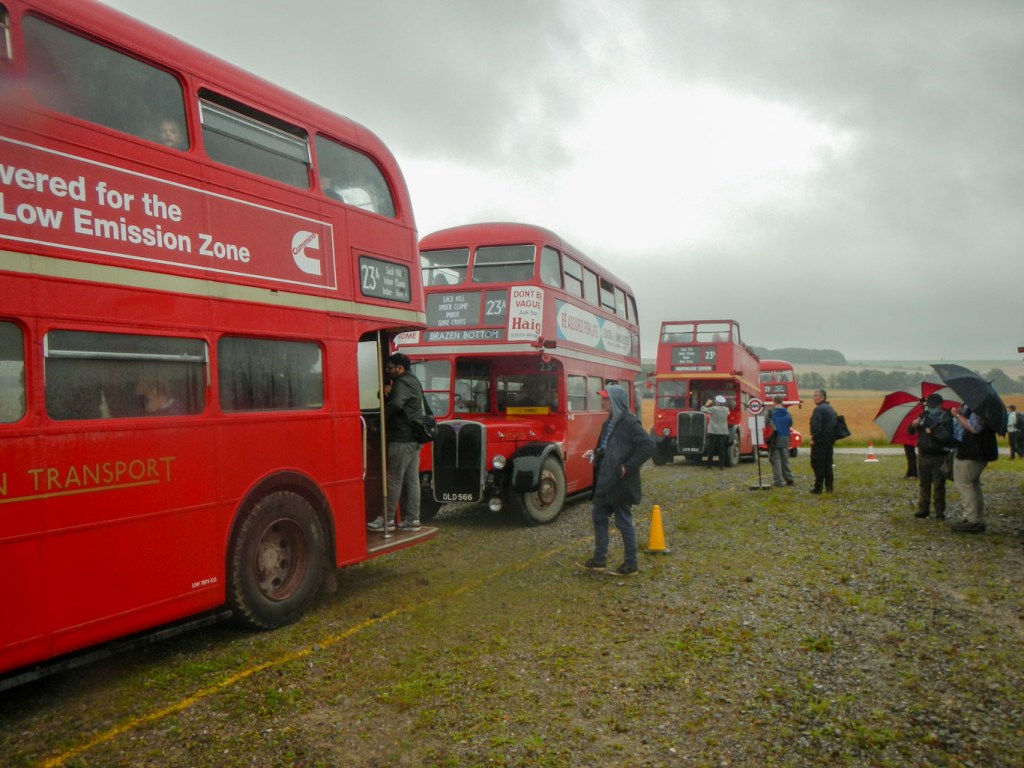
Gore Cross was being used as a “bus station” and interchange so from here it was possible to travel on to all the destinations, returning to the hub to travel somewhere else. There was great excitement as more and more buses arrived. I opted to stay on the same bus given how few people were travelling on it. By then we had gone down to three on the top deck; the other two had resorted to using huge umbrellas to try to keep the rain off. I did get off briefly while the bus stopped to take some photos of vehicles arriving.
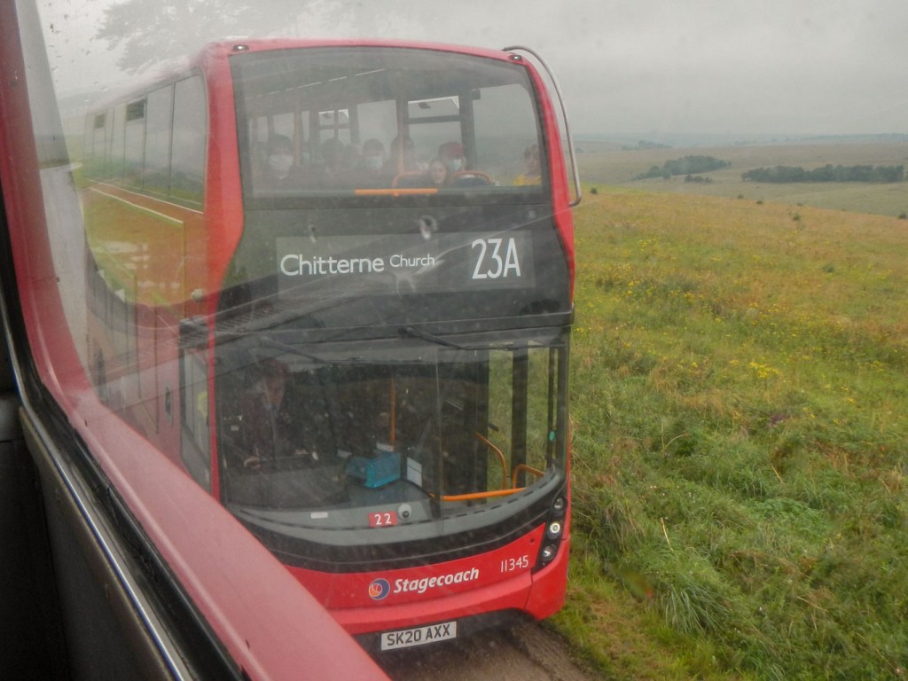
We headed for Tilshead, passing under some overhanging trees. Each time this happened our heads got soaked; on one occasion a branch came right down and was actually scraping over the seats! At Tilshead there were refreshments available, but I stayed on until Chitterne, where I finally disembarked to try to get on a warmer bus! There was a choice of buses and I travelled back to Gore Cross on the top deck of a closed top bus – this bus was busier.

Umbrellas on the open deck! 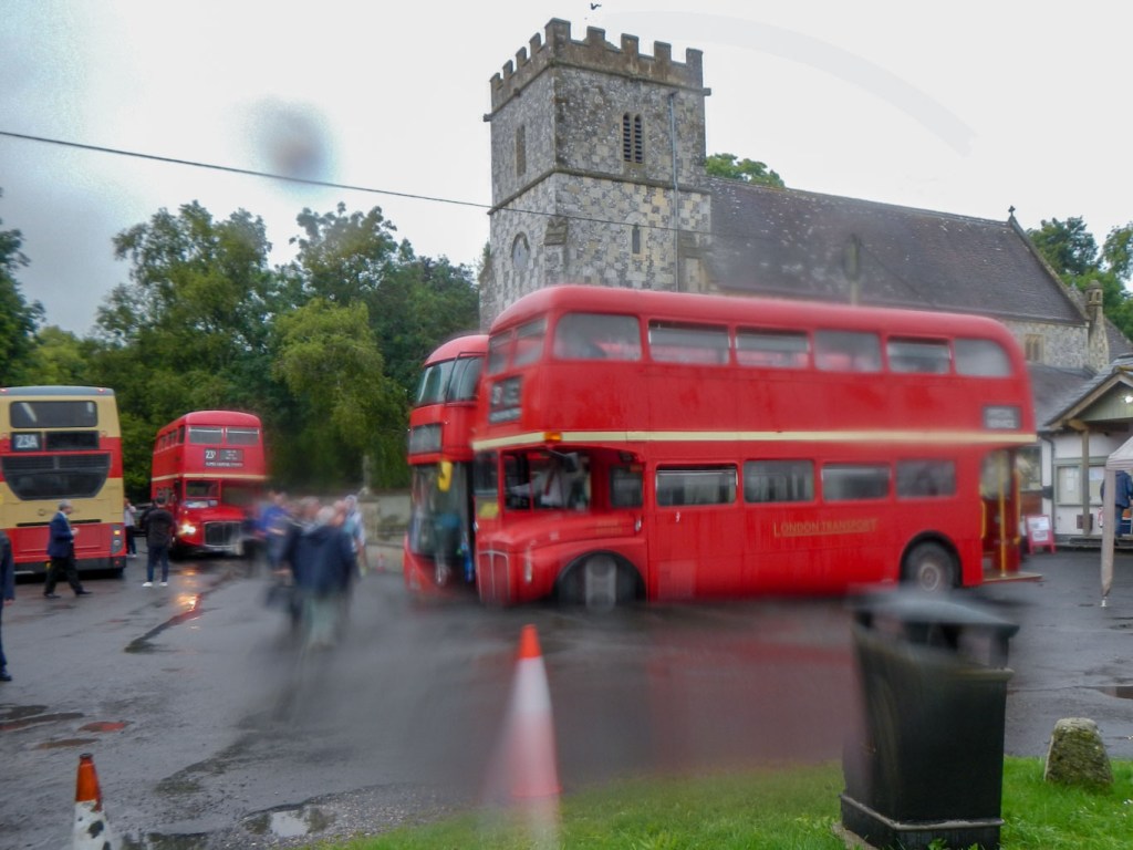
Raining at Chitterne too
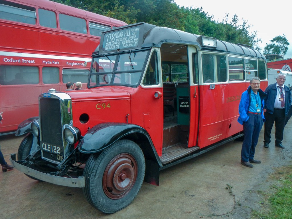
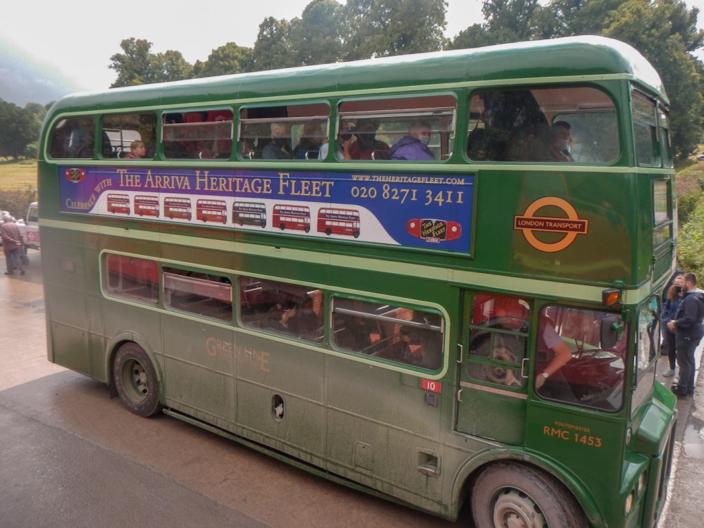
Next I went there and back to New Zealand Farm Camp on a different open top bus and then on another closed top bus to Brazen Bottom and the Lavingtons. Now I had travelled on every route. I spotted a Routemaster painted green – I think that’s London country colours and would have caught that for the ride wherever it was going, but I missed it. I ended up catching a bus to Imber village, where there was a single decker bus that looked very old. It wasn’t part of the service though and was just on the site for enthusiasts to look at. I caught another bus up to Gore Cross again then a more modern bus back to Imber village. After that I caught my final bus of the day back to Warminster. The immaculately clean buses of the early morning were now plastered with a fine layer of mud. Reluctantly I had to leave the bus day to allow time walk to Westbury on part of the perimeter path. I had booked accommodation there when everywhere I tried in Warminster was fully booked and it gave me a head start on my walk the following day.
Going up on the bus had certainly given me a perspective of the area I would be walking through over the next couple of days, as well as allowing me the privilege of a rare opportunity to visit some of the area inside the range including St Giles’s Church.
Fortunately the weather had improved and the risk of electric storms in the early evening didn’t materialise.
The highlights of the perimeter path:
- Westbury White Horse is huge and was carved into the hillside. Local records suggest that the horse was originally cut in the late 1600s, probably to commemorate the supposed Battle of Ethandun, thought to have taken place at Bratton Camp in AD 878. However the form of the carving changed and the current design probably dates from the second half of the eighteenth century. As I visited on a dry, sunny although windy Sunday, there were many paragliders taking off and landing within view of the white horse. I spent some time standing by the viewpoint trying to capture the “perfect” scene of a paraglider backed by the white horse. I also saw some people preparing hang gliders but didn’t see them take off. Further round the hill, a group of enthusiasts was flying radio controlled model aircraft.

Westbury White Horse – view from the road 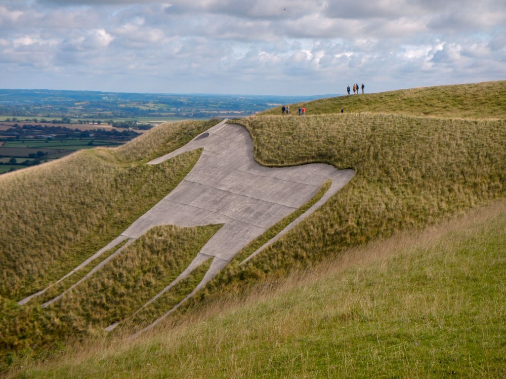
From the viewpoint – it is HUGE! 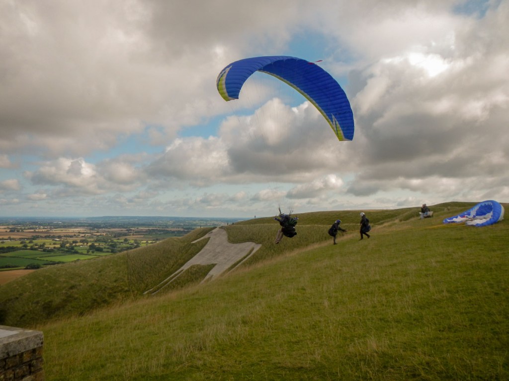
Many paragliders taking off 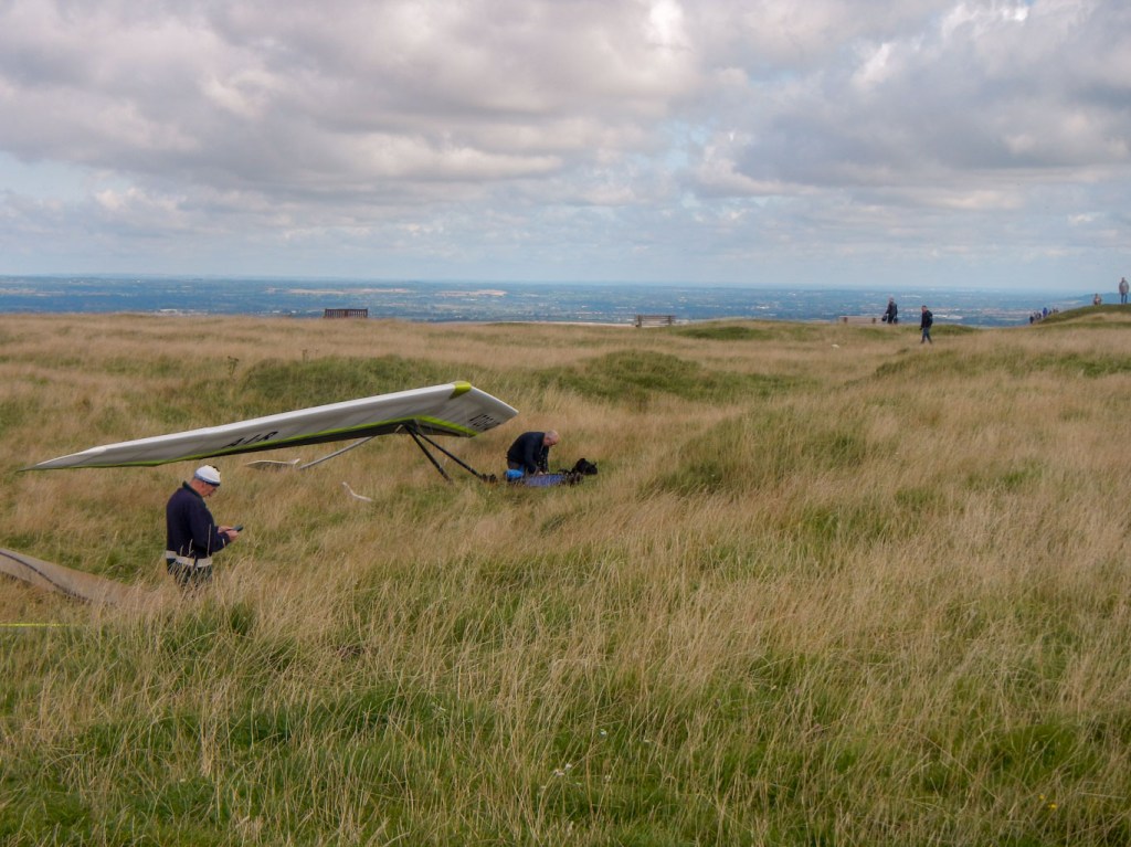
The hang gliders stayed on the ground
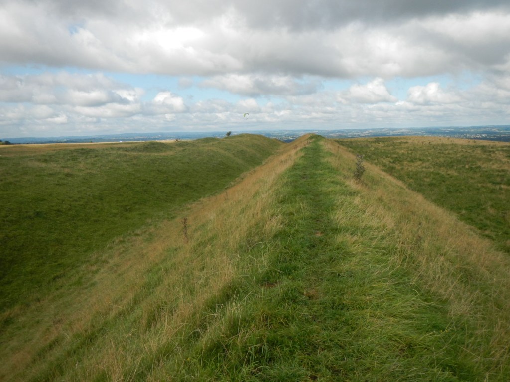
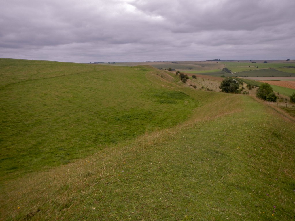
- Bratton Camp is a bivallate (two ramparts) Iron Age built hill fort on Bratton Down, at the western edge of the Salisbury Plain escarpment. The hill fort comprises two well preserved circuits of ditch and bank grazed by sheep. I walked around the entire perimeter. It’s slightly off route but I had plenty of time to explore.
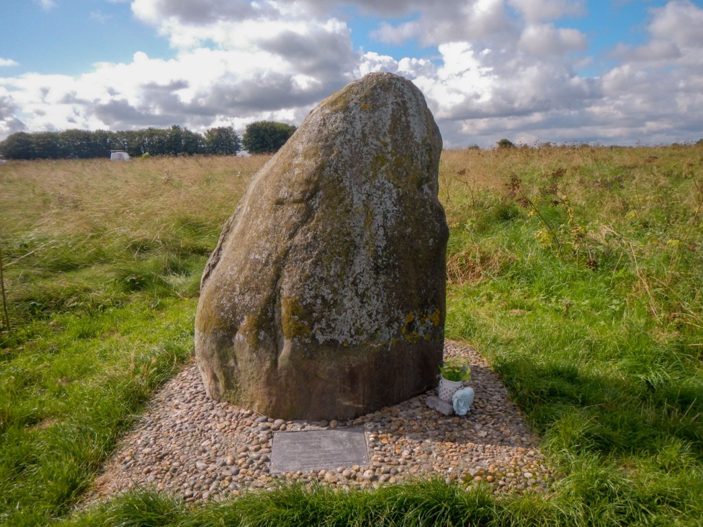
- Battle of Ethandun monument – this area is one of the possible sites of this important battle when Alfred the Great defeated the Vikings and saved Wessex from Viking rule, ensuring Anglo Saxon independence. The inscription on the monument: “TO COMMEMORATE THE BATTLE OF ETHANDUN FOUGHT IN THIS VICINITY MAY 878 AD WHEN KING ALFRED THE GREAT DEFEATED THE VIKING ARMY, GIVING BIRTH TO THE ENGLISH NATIONHOOD. UNVEILED BY THE 7TH MARQUESS OF BATH 5TH NOVEMBER 2000.”
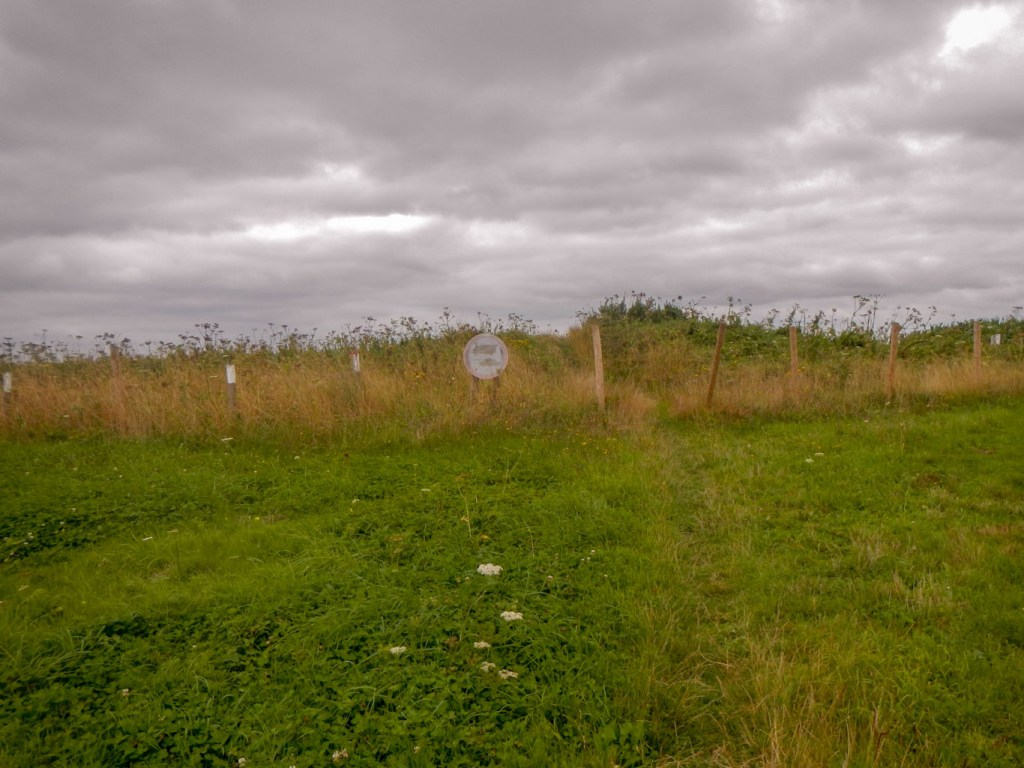
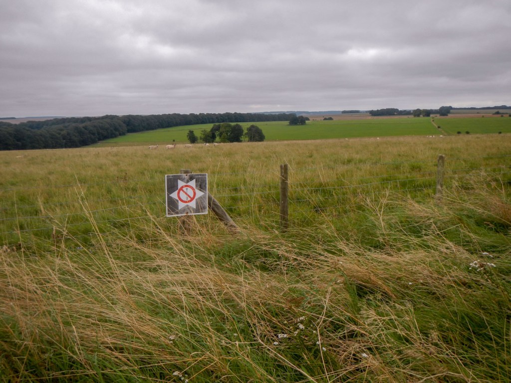
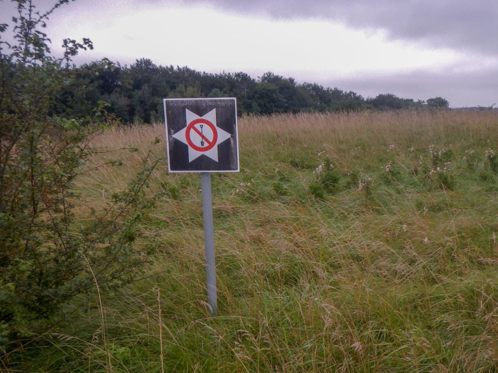
- Many round barrows, long barrows and earthworks – the clue that they are there is that there are MOD signs around them banning digging. It’s difficult to distinguish some from the undulations of the land but I suspect more obvious from the air. That may be partly why I saw quite a few private light aircraft flying round on the Sunday.
- Market Lavington – this village with many attractive buildings including a late 13th century church is just off the route, but I stayed there for a night. It was easy to walk there along a pleasant footpath with views across to the village. The village itself appears to be a thriving community including shops, a café, a doctors’ surgery, a care home, a pub, a community hall and even a museum. The Green Dragon, where I stayed is a 17th century coaching inn.
Church and village from footpath approach 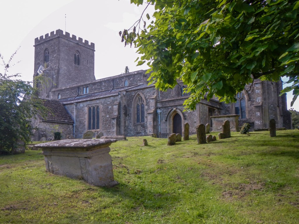
The village church 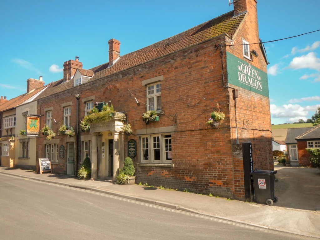
The Green Dragon 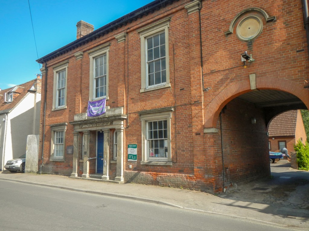
Interesting buildings and lots of activities
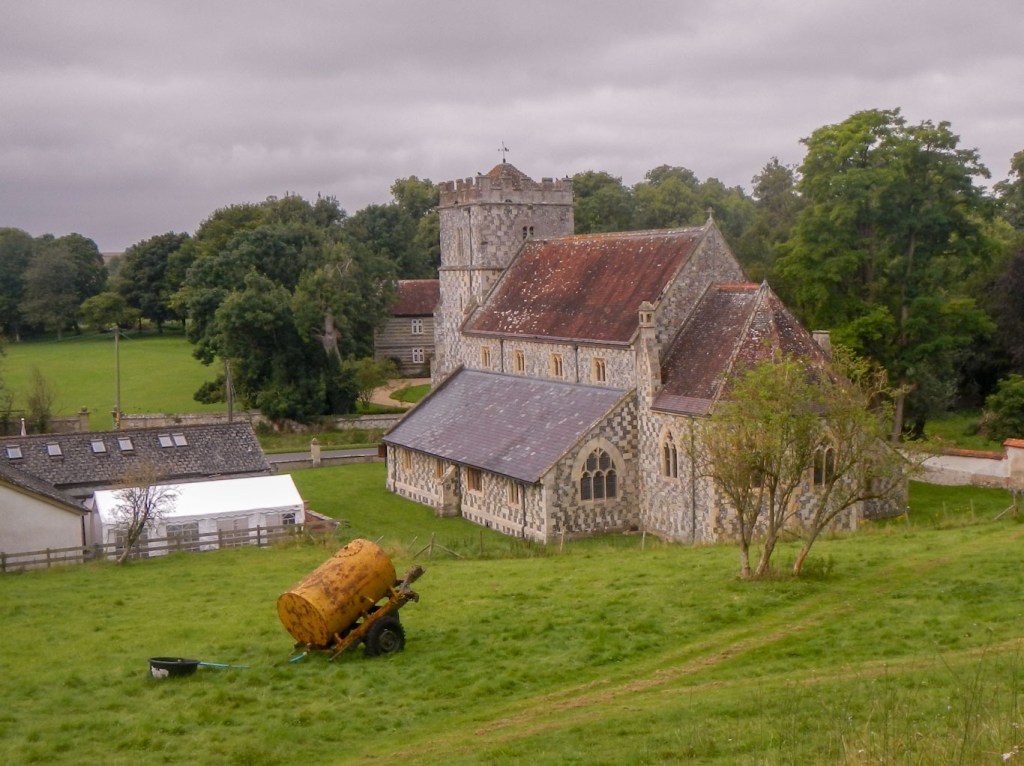
- Chitterne – the path seemed to go round the back of the village but there were views of the church with it’s interesting flint and stone chequer pattern. There had been two separate churches in the village but in the nineteenth century when these were in poor repair a new church was built. It was designed to have enough seats for the entire village community. The old churchyards were retained as the area around the new church wasn’t suitable due to risk of flooding. That would explain why I saw a graveyard well away from the church as I walked up a hill to leave the village.
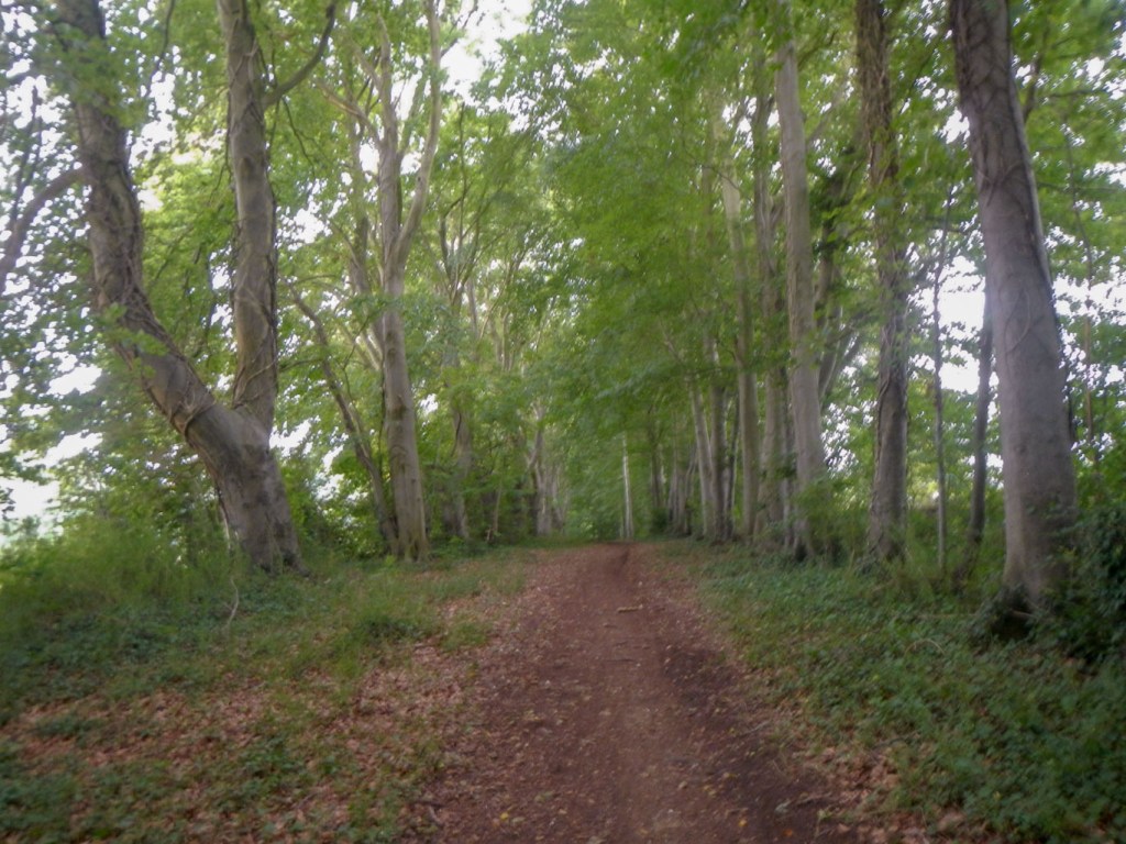
- Areas of unspoilt ancient woodland – I walked through one particularly impressive area of mixed woodland near Tilshead – it included avenues of beech trees, as well as examples of many other British trees including sycamores, birches and even a fine spreading horse chestnut.
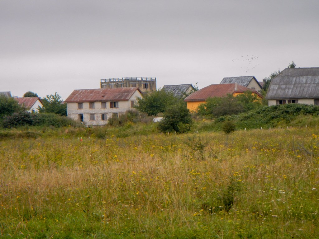
- Copehill Village seen from a distance – this was built in 1987 to resemble a German village in Bavaria. It’s used to rehearse urban warfare and close quarters battle. Access is forbidden except for special permission for wargaming, historical re-enactment – and I think it or something similar has appeared on Top Gear.
- Scratchbury and Battlesbury hillforts – these are walked in quick succession separated just by Middle Hill which is topped by a barrow. They both have impressive ramparts, which I was able to walk around. Both are Iron Age but with evidence of earlier occupation. Scratchbury has a single rampart and Battlesbury has two ramparts.
Siegfried Sassoon sums up eloquently in his poem:
“On Scratchbury Camp”
“Along the grave green downs, this idle afternoon,
Shadows of loitering silver clouds, becalmed in blue,
Bring, like unfoldment of a flower, the best of June.
Shadows outspread in spacious movement, always you
Have dappled the downs and valleys at this time of year,
While larks, ascending shrill, praised freedom as they flew.
Now, through that song, a fighter-squadron’s drone I hear
From Scratchbury Camp, whose turfed and cowslip’d rampart seems
More hill than history, ageless and oblivion-blurred.
I walk the fosse, once manned by bronze and flint-head spear;
On war’s imperious wing the shafted sun-ray gleams:
One with the warm sweet air of summer stoops the bird.
Cloud shadows, drifting slow like heedless daylight dreams,
Dwell and dissolve; uncircumstanced they pause and pass.
I watch them go. My horse, contented, crops the grass.”
Siegfried Sassoon, “On Scratchbury Camp” from Collected Poems 1908-1956. Copyright Siegfried Sassoon.
Scratchbury Fort 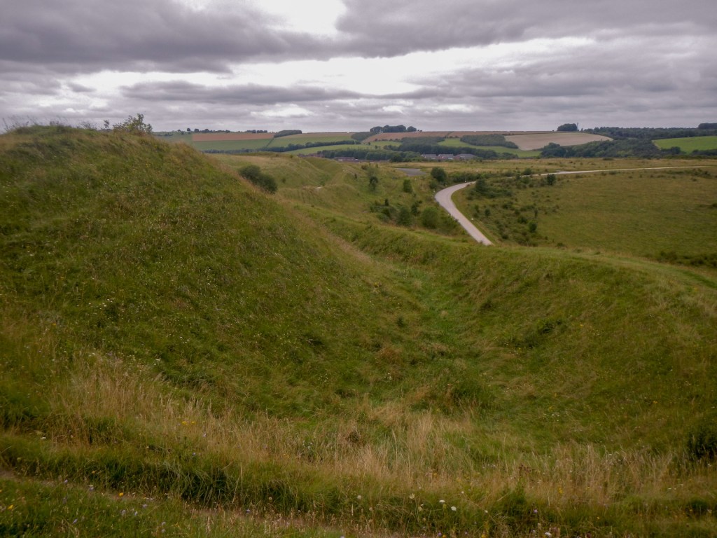
Battlesbury Fort
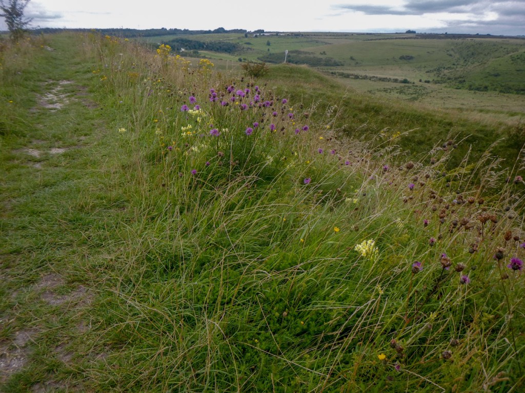
- Chalkland flowers and meadows – those that have botanical knowledge would apparently be able to identify 30-40 species in one square metre of ground. The thin low nutrient chalky soils in many places mean no single plant dominates and diversity is preserved. Typical species include bird’s-foot trefoil, yellow rattle, pyramidal orchid, wild thyme, kidney vetch, clustered bellflower and meadow saxifrage. This also supports a diversity of insects especially butterflies. To the uninitiated eye, this reveals itself as a wonderful profusion of colour on the ground even if being ignorant of the names of the flowers – shades of blue, yellow, pink, purple, violet and white.
- The entire experience – moving in swift succession from stark, isolated areas of inhospitable looking landscape to multi-coloured meadows to diverse woodland and interspersed with picturesque village landscapes and then the reminders of a major use of the area for military training such as shells of buildings, concrete roads crossing the plain and churned up unmetalled tracks. In addition, the plethora of prehistoric features, suggesting that in the past this now almost deserted landscape was highly populated by our distant ancestors.
- Selecting the time for the adventure – so that I had a rare glimpse of some of the normally inaccessible areas as well as the incongruity of about thirty vintage and modern London buses traversing the landscape. The bus day was excellent in setting the scene for and complementing the subsequent walk.
