6-13 August 2021
This was such an amazing week that I am unable to single out any one adventure. The whole experience was the sum of the parts and more…..
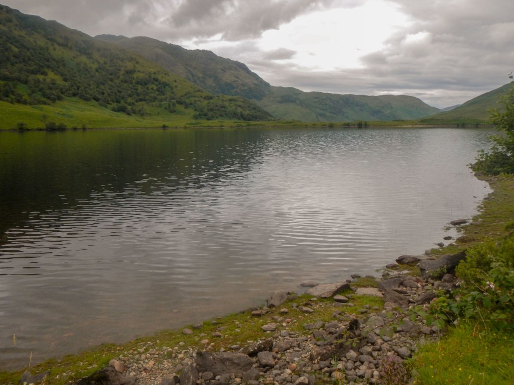
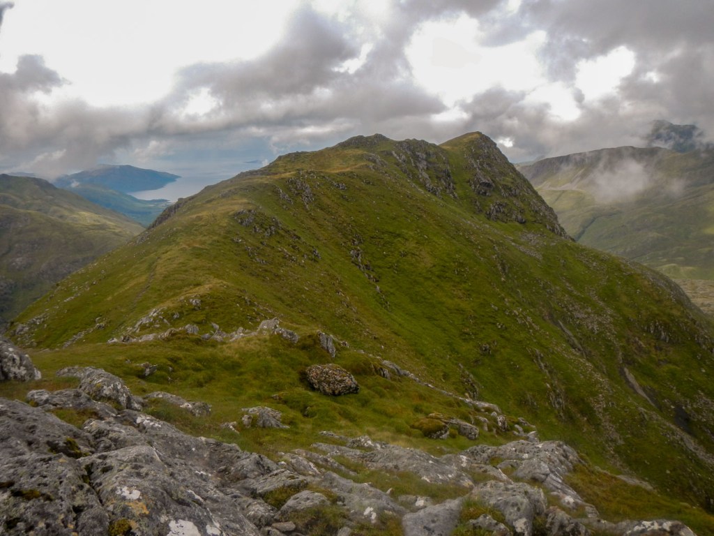
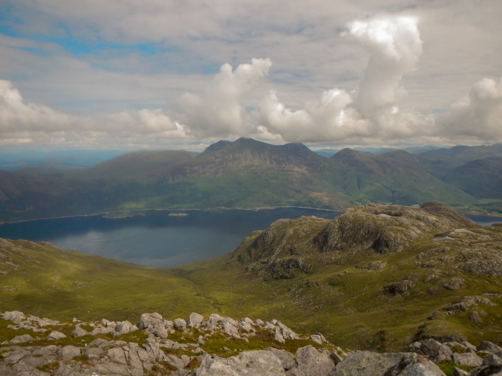
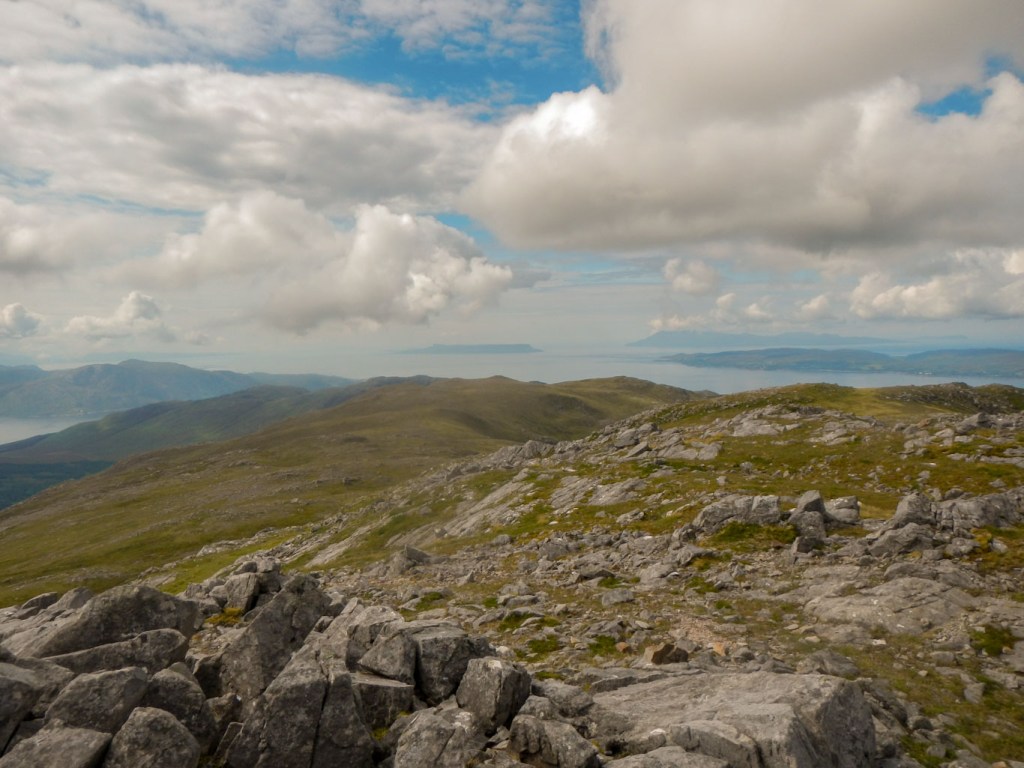
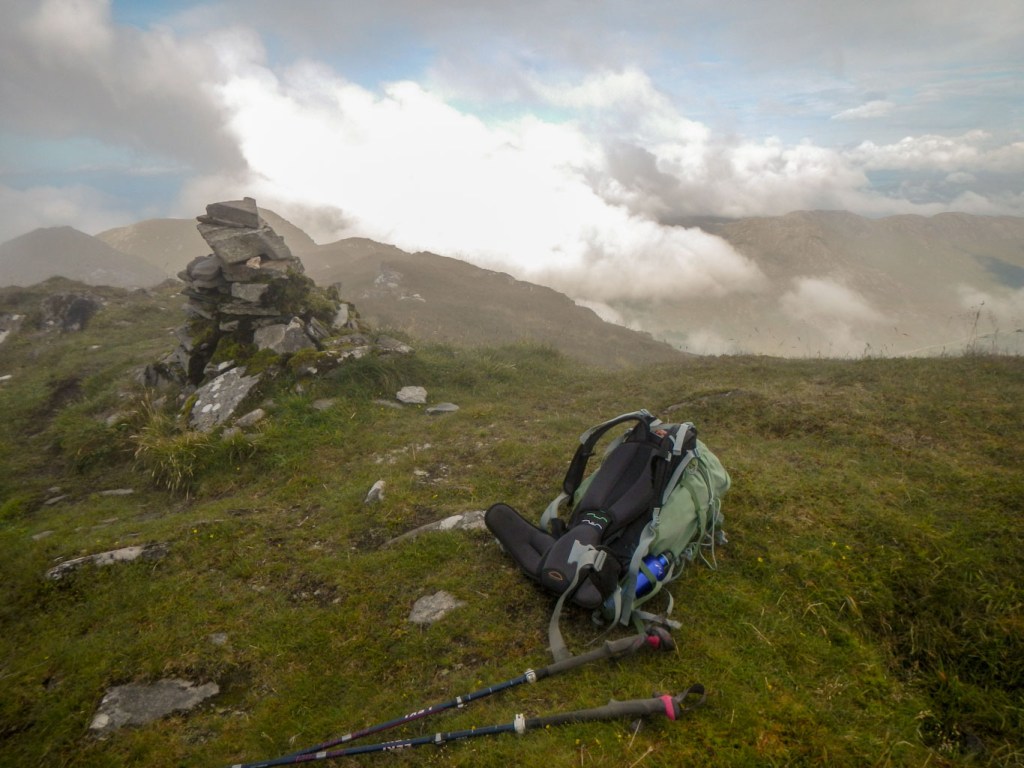
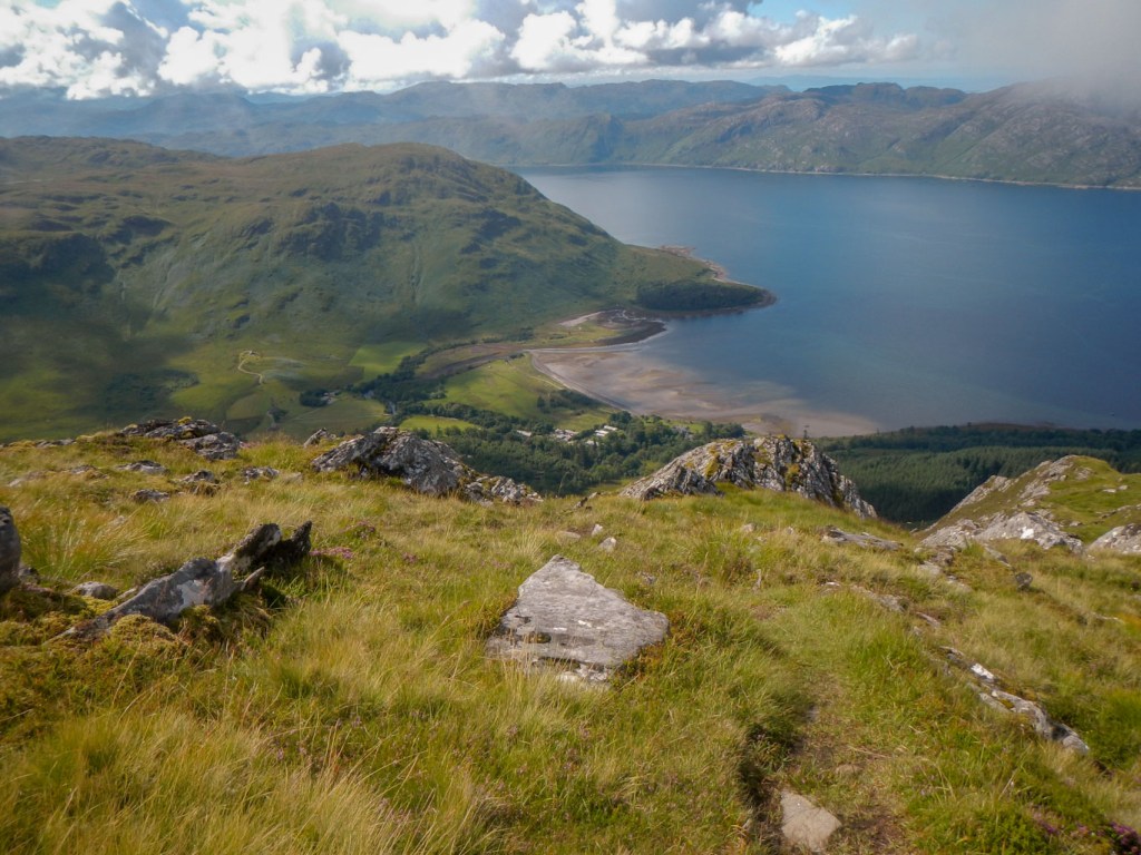
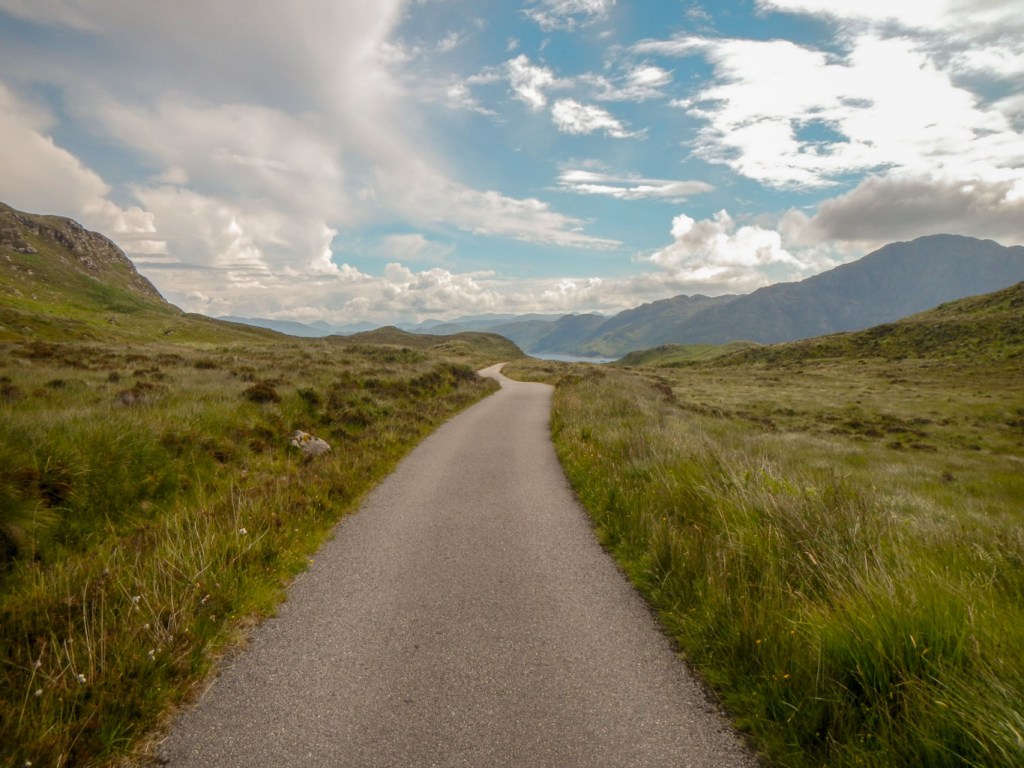
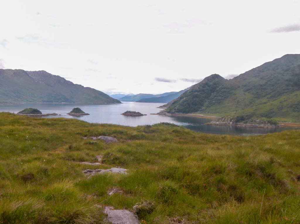
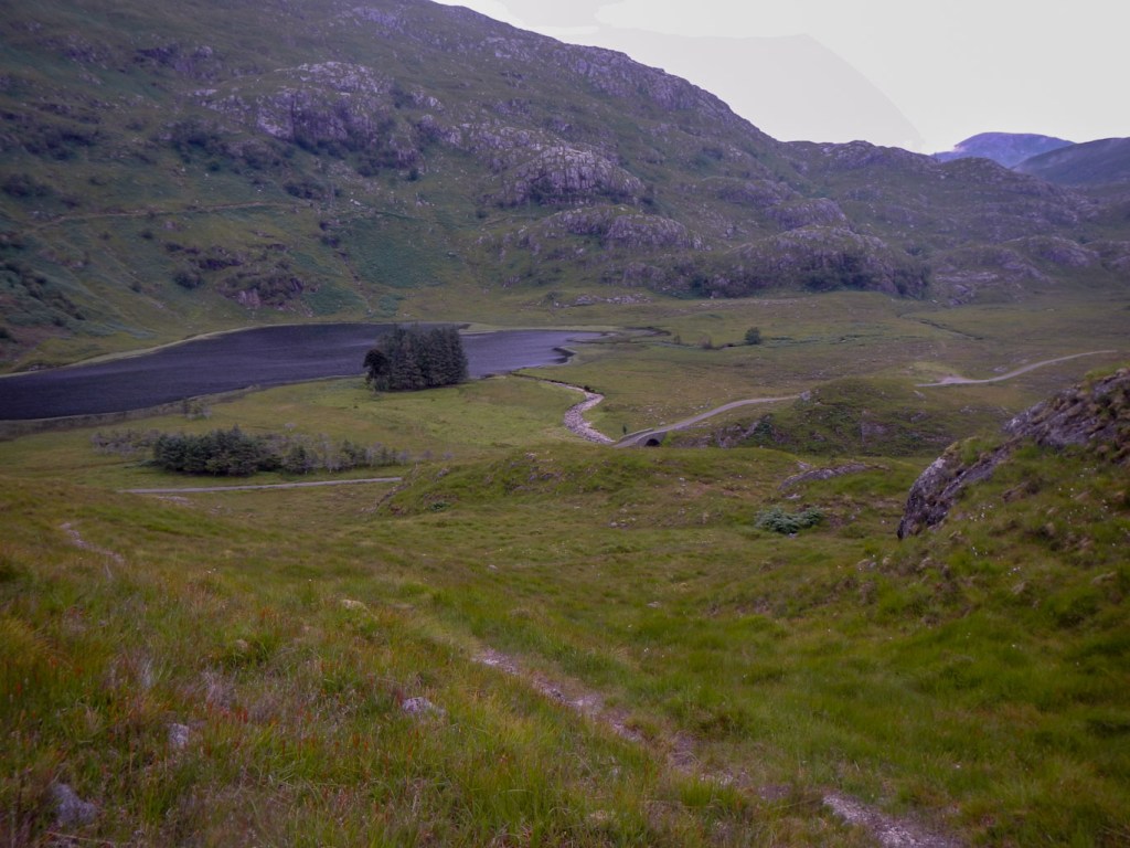
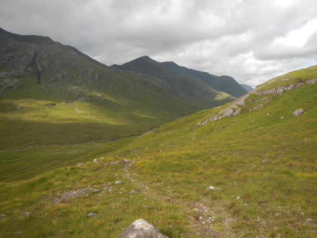
Friday 6 August: Ascent of Beinne Bhuidhe
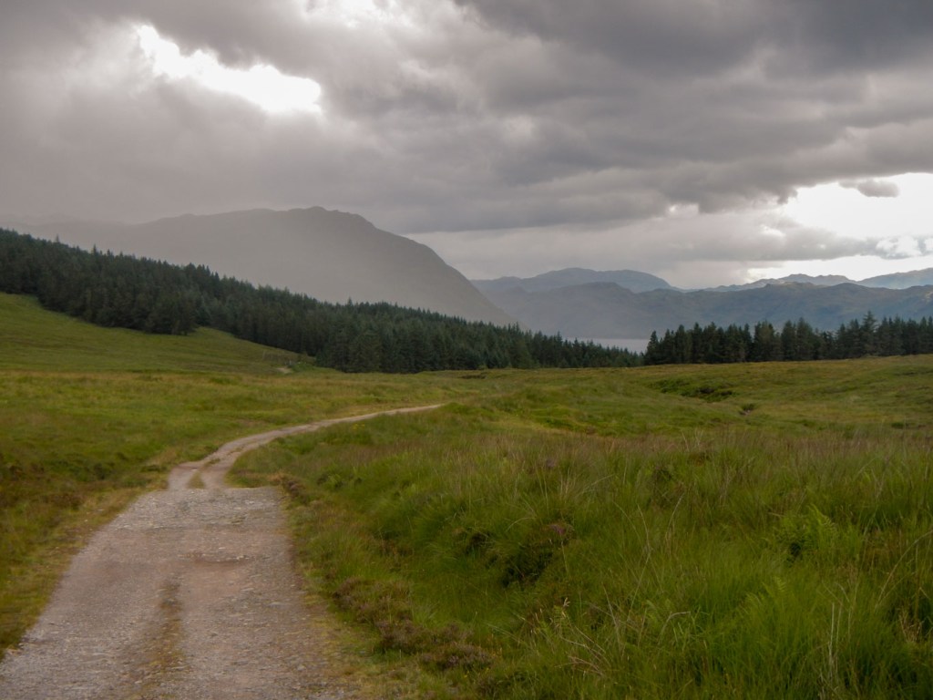
It was a beautiful morning with the cloud base above the highest mountains. I was on my way at about 07:30, leaving details of my planned route written on a slip of paper in my tent. The rangers and campsite warden check that each tent is inhabited in the evening and request that they are informed if anyone is planning to “bivvy” away from the site. I certainly felt secure to walk alone as it would be noticed if I didn’t arrive back by the end of the day.
Initially I had to walk almost to the point where I had camped the night before arriving at Inverie, but I was walking the opposite way and the clearer weather meant views were better.
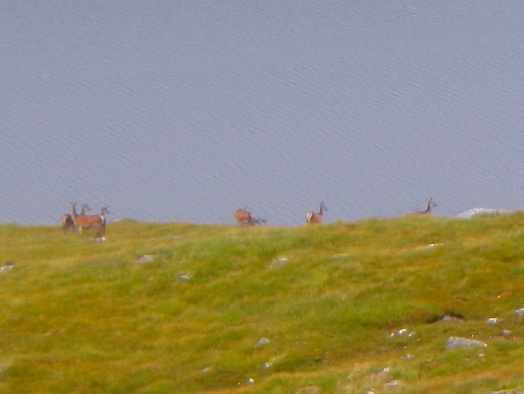
From the stalkers’ path, I could see the place to leave the obvious path and ascend to the ridge line. As I climbed I heard deer making warning calls and then spotted them higher up the mountain.
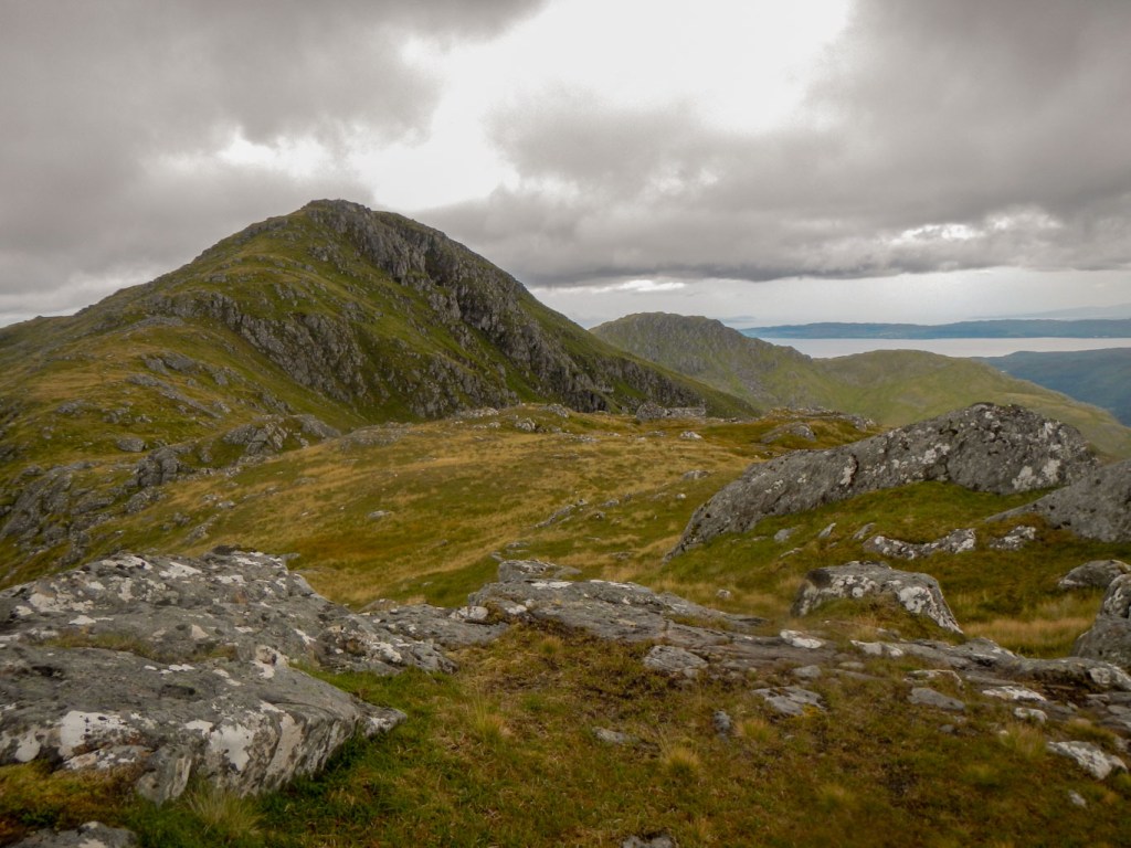
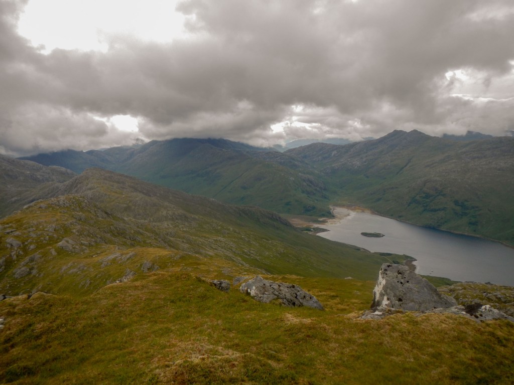
The view from the ridge was superb – I could see all the way to the head of Loch Nevis where I had been two days earlier as well as the headland that I had scrambled over because the tide was in too far to walk round. I enjoyed walking along the broad grassy ridge.
I reached the base of the ascent to Sgurr an t-Sagairt and was relieved that I had printed off the route description from Walk Highlands website:
https://www.walkhighlands.co.uk/fortwilliam/beinn-bhuidhe-knoydart.shtml
This explained that I needed to keep to the left of the rocky cone and follow a faint path, which I did. I was still concerned that I was going to reach an unclimbable rock face partway up, but fortunately all the choices I made led to a place where I could climb further. When I arrived at the top, the view back down the mountain made it all look very easy!
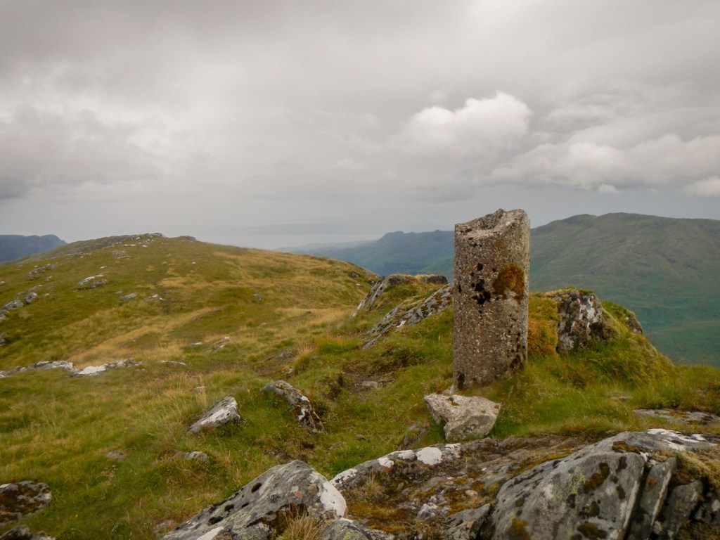
From Sgurr an t-Sagairt there was just a small dip and then an easy wide path to the dilapidated cylindrical trig point pillar at the summit of Beinn Bhuidhe – 855m and awesome views. There was also full phone and data reception and so began my routine of sending a daily text home from my high point.
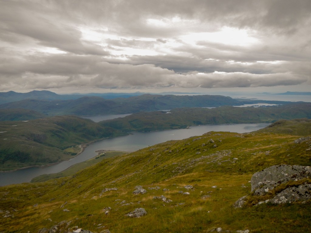
I was really impressed with the onward walk from the summit. It was a broad grassy ridge and an excellent airy walk with an amazing view ahead to Skye and the Small Isles.

The following descent was technically easy but relentless, steep and quite boggy even in the unusually dry conditions. I managed to reach the gap between two lochs, where the ground was flatter although even more boggy. There followed a further descent towards the Kilchoan Farmhouse. I found the descent more tiring than the ascent and was particularly relieved to discover a gate in the deer fence which cut a potential large diversion around the fence from my route.
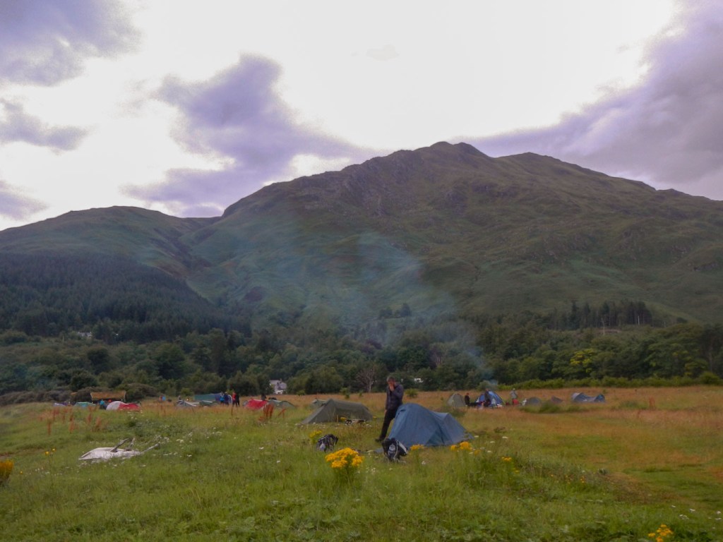
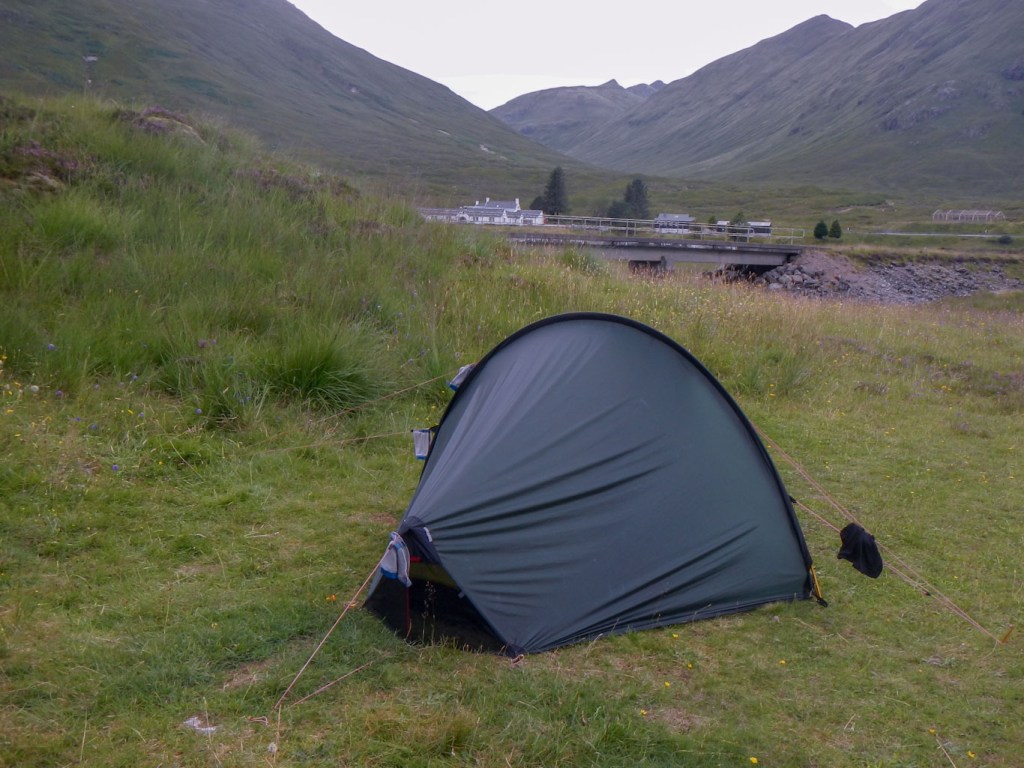
I was soon back at the campsite and was welcomed by the warden who spotted me straight away. it had been a brilliant initial full day walking from Inverie and I just hoped the rest of my planned walks would be as interesting.
Saturday 7 August: Ascent of Luinne Bheinn
Despite rumours, the correct pronunciation of this Munro is not Loony Bin (it is Loon-ya-ven) and has also been named the Hill of Anger or Hill of Mirth. It is seen prominently at the head of Glean an Dubh Lochain and easily visible from the campsite.
I heard an odd scrunching sound in the night and wondered what it was. I woke in the morning and looked out of my tent to find that the youths who had arrived on Friday evening with a dog having walked from Glenfinnan had pitched their tents within inches of mine. To their credit, they must have done it very quietly when they returned from the pub after I was already asleep. So much for the rule of being at least three metres between tents! When they emerged after I had already eaten breakfast they apologised and explained “We had to put up our tents in a rush”. The scrunching had been the sound of one of them rolling over on his sleeping mat. Anyway they were leaving that morning on the ferry.
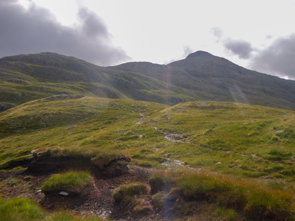
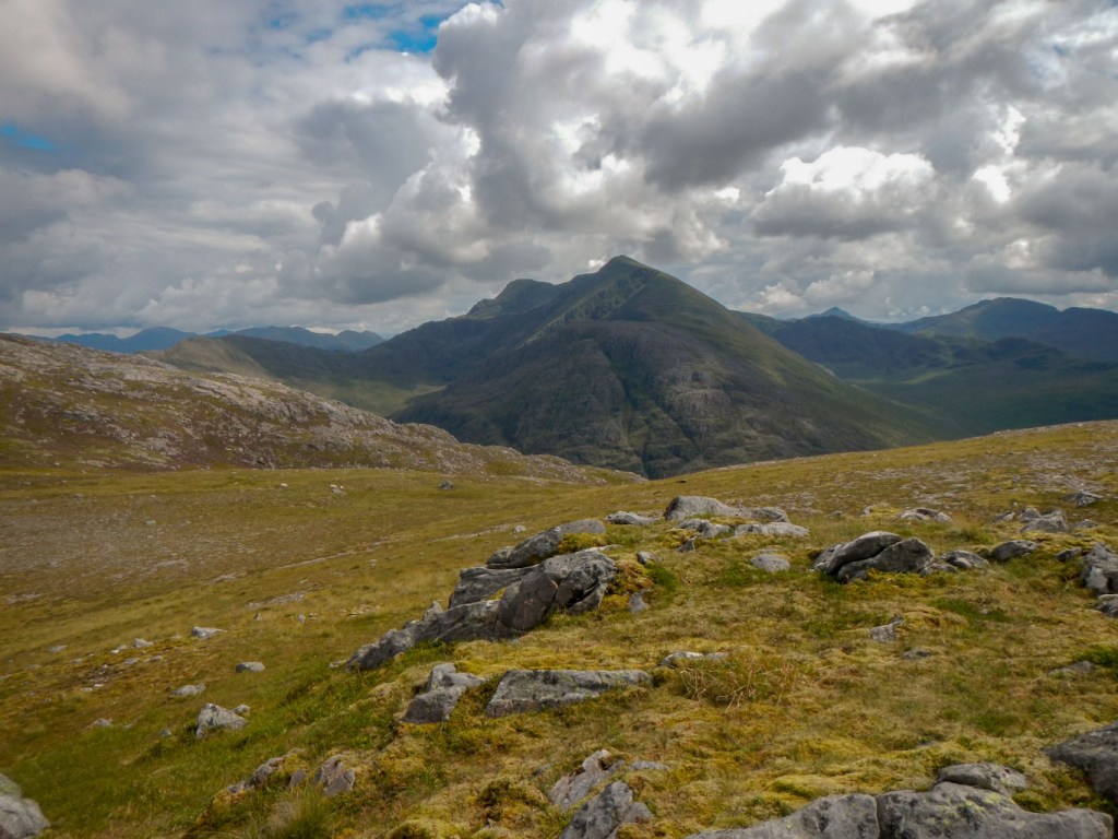
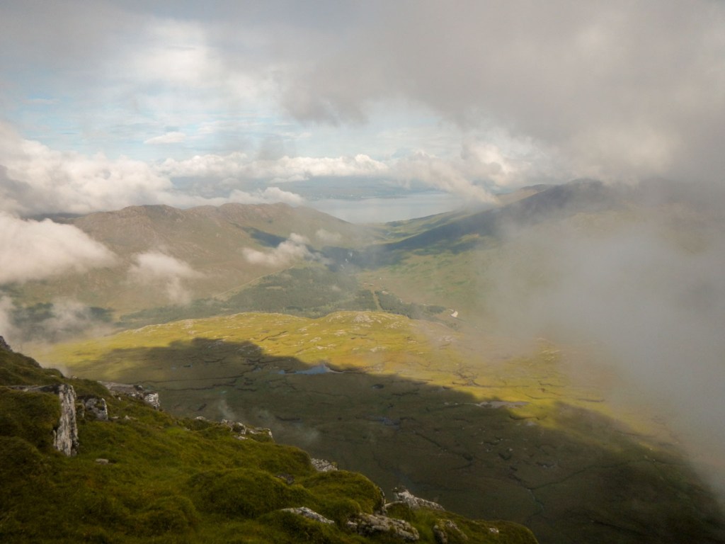
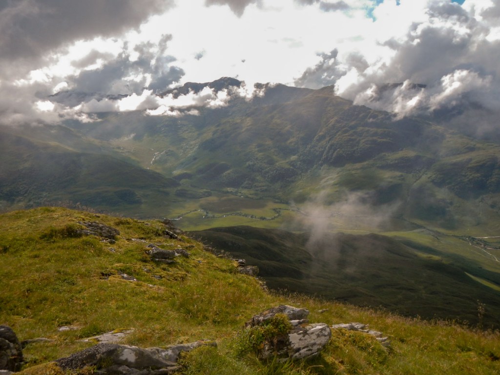
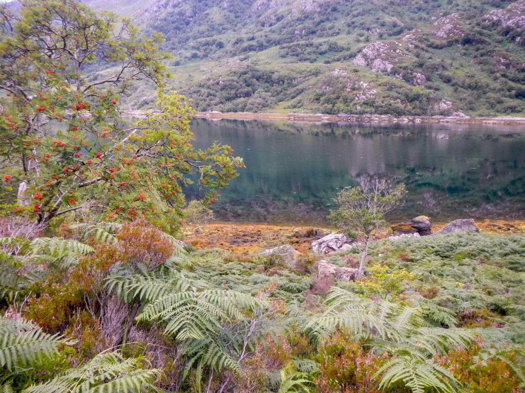
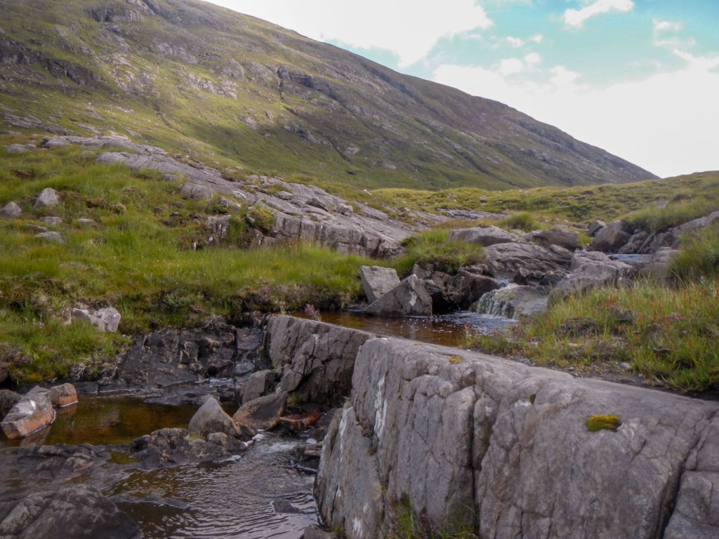
The weather seemed fine although it soon felt humid as if there was rain in the air. There was cloud intermittently covering the summit as I walked up the glen past the loch.
I left the main path to Barisdale near its highpoint. There seemed to be a path in roughly the right direction, although all the route descriptions stated that there was no path. Unfortunately it led me slightly astray so I ended up ascending a steep grassy bank to end up just below the final ridge.
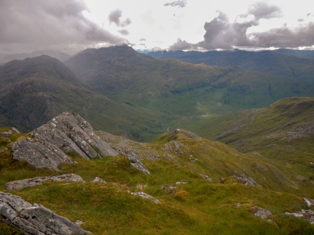
Luinne Bheinn from the glen 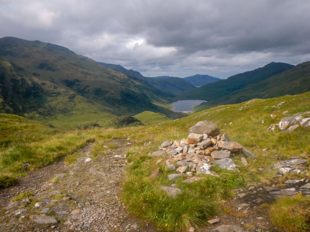
High point of the glen looking towards Inverie
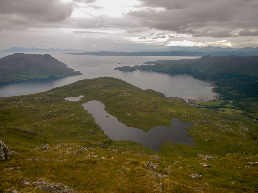
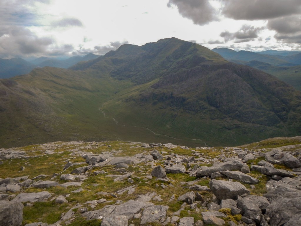
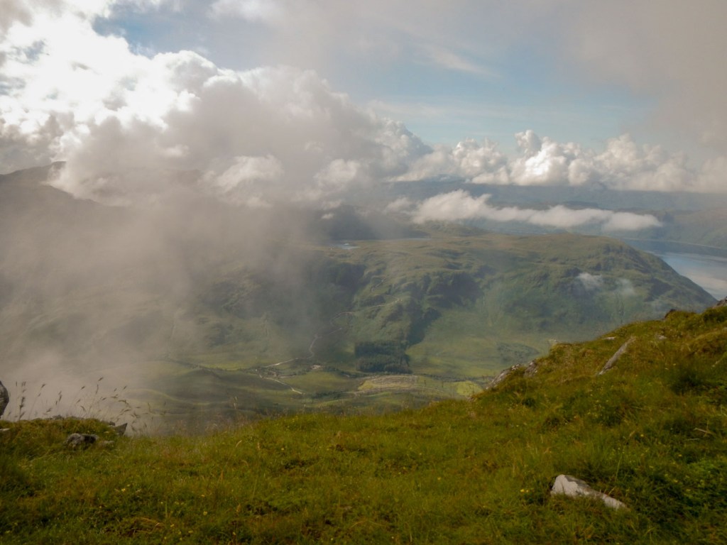
This ridge was impressive and I was fortunate to have good views. There is a cairn on the first summit that I reached 938m. The next top is the true summit at 939m. Finally I reached a summit to the east which felt higher than them all although is actually “only” 936m. I could see into Barisdale as well as towards Inverie. I also had good views to the other Munros in the area – Ladhar Bheinn and Meall Buidhe. The latter can be reached by circuiting round the corrie but fortunately in view of the weather later in the day, I had decided not to attempt the double. I made my customary text communication to family from the summit and ate my lunch.

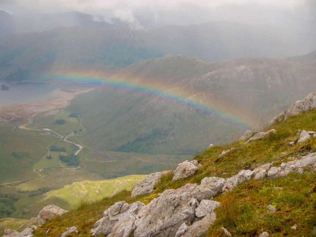
As I went back along the ridge, I saw an amazing rainbow over Barisdale – of course seen with mixed emotions as that means it’s raining somewhere close by.
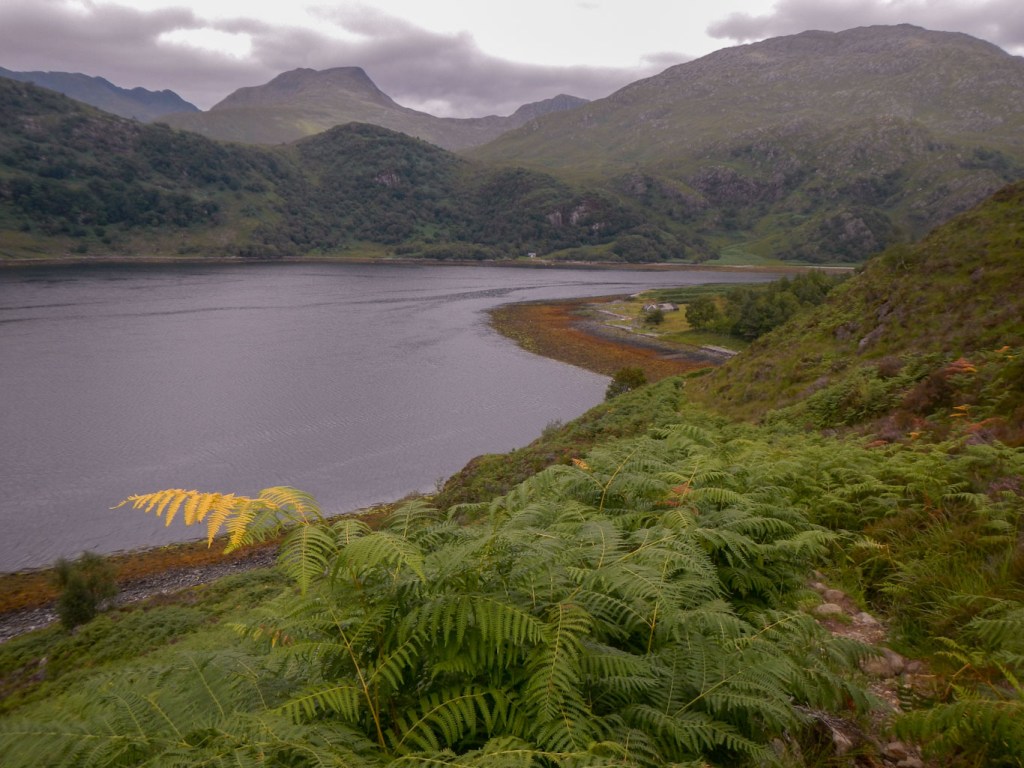
I discovered the proper ridge path further down – I had missed this on the way up. There were excellent views towards Arnisdale on the very north of Loch Hourne. It was a stony path with some steep steps.


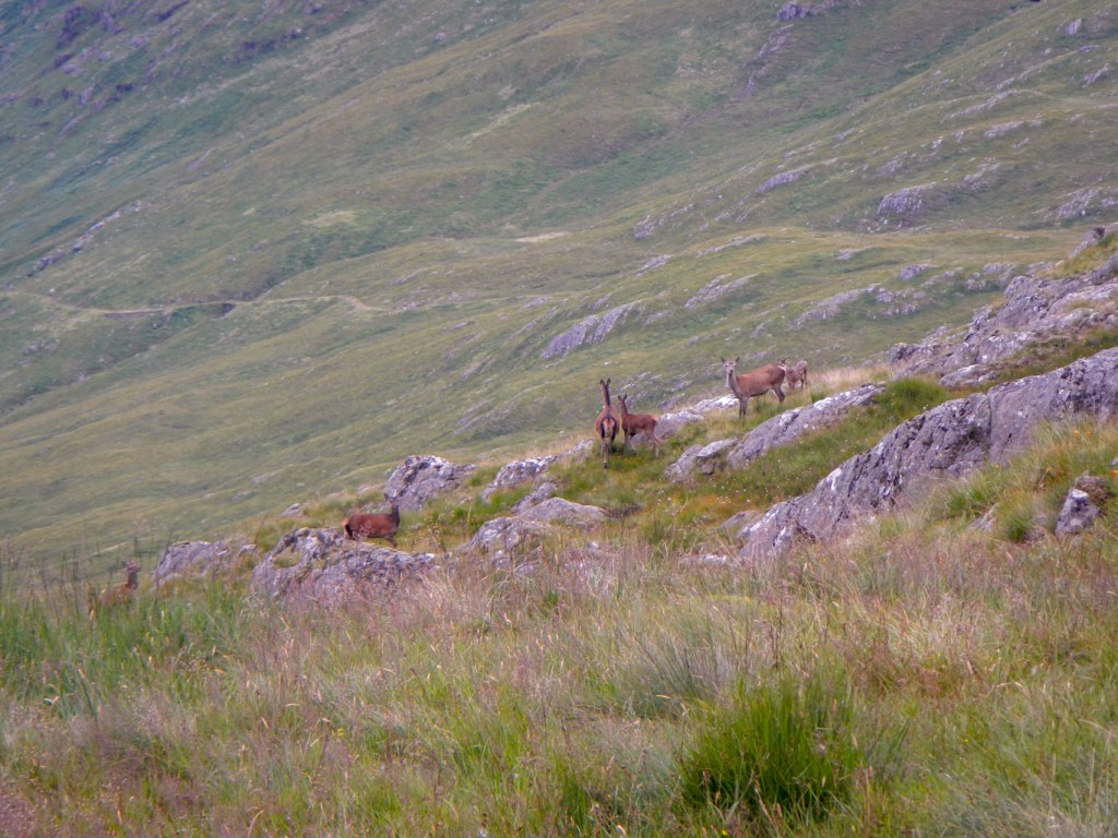
Eventually the rocky path fizzled out to nothing and I headed downhill in a more westerly direction, surprising a group of deer. As I was reaching a place where I could just about see the main path in the glen, the heavens opened, rain poured down and the visibility decreased. I lost the path and ended up meeting it below the high point.
I had a long walk back to Inverie. The rain stopped and the visibility improved but that meant it was wonderful weather for midges.
I had new neighbours in the campsite, although they were over three metres away this time – a couple in a small tent with their daughter in her early twenties who was impressively sleeping in a very rudimentary bivvy bag with a tarpaulin rigged up over it. The excitement continued – at 22.30 when I was in my sleeping bag two girls camping on the other side of the central campsite track to me screamed that there was going to be an explosion. Their stove gas cylinder had caught on fire! Fortunately another camper was a firefighter and he managed to put out the fire and make the scene safe, averting the explosion risk. The rogue gas cylinder continued to vent all night but thankfully was empty and safe by the morning.
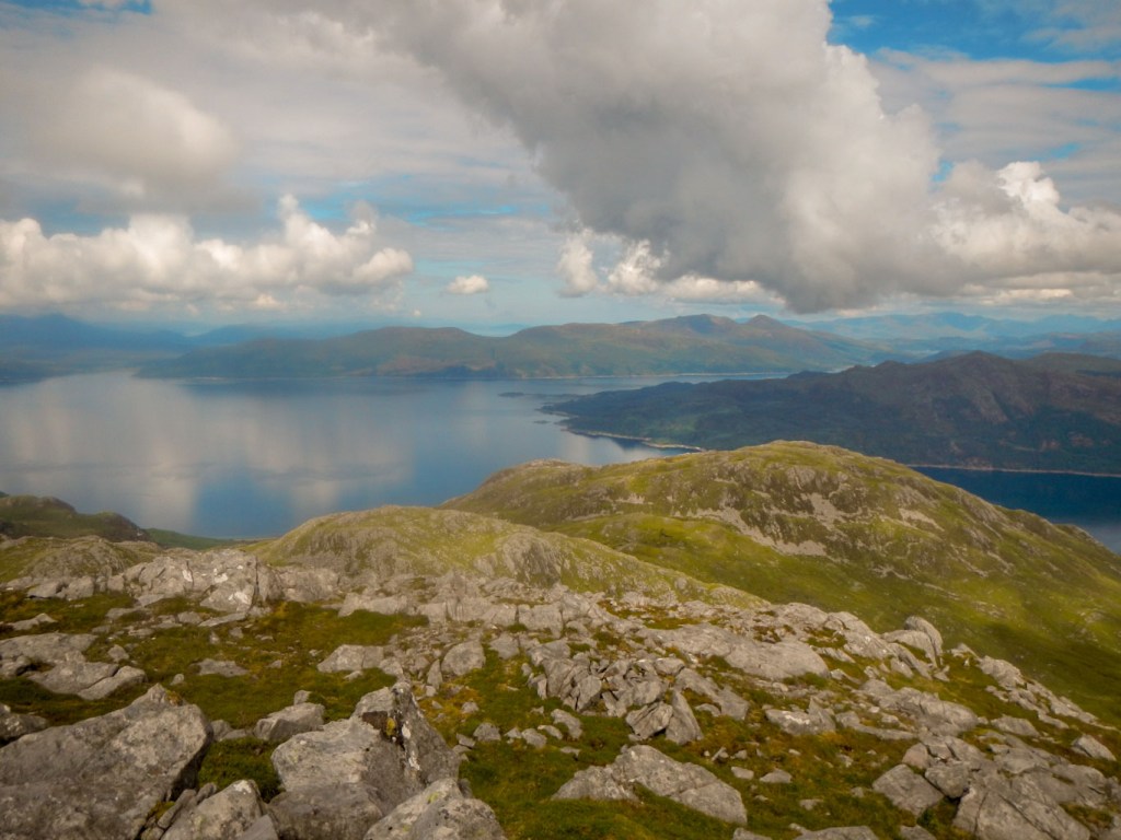
Sunday 8 August: Ascent of Beinn na Callich
This mountain is the most westerly of the main hills on Knoydart and is probably the most remote Corbett in the whole of Scotland, if measured as distance from the UK road network. I had chosen to do this walk on a Sunday as it is an area where there is deer stalking but not on Sundays.
The weather looked bright again in the morning. I was quite excited about the walk as it involved walking in a totally different direction to previously and was to a mountain which is not visible from the campsite.
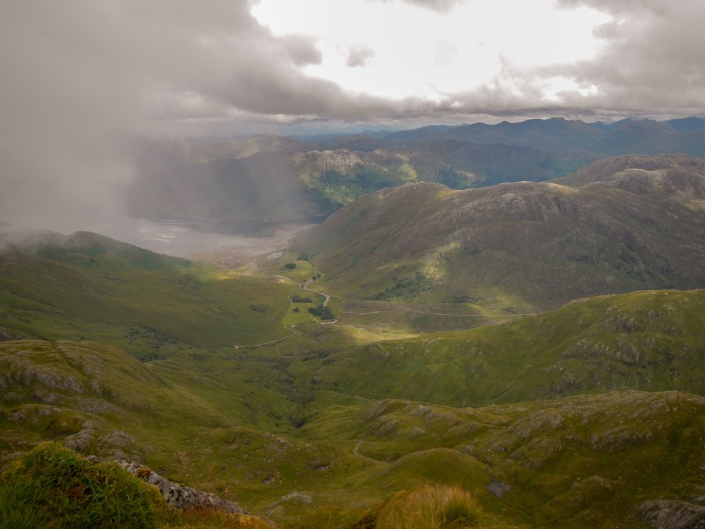
Early on there were excellent views behind me looking back towards Inverie Bay. Soon I was well away from the village and climbed past some extremely impressive waterfalls on Abhainn Bheag.


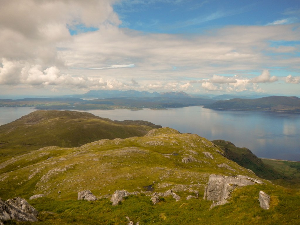
The footpath became less distinct as I climbed further but I found a route up on a spur which then led up to a superb vantage point at the summit of Beinn na Caillich (785m). The summit plateau is extensive. There are various miniature peaks on the plateau which give views at different angles and in different directions. Yet again I had excellent phone and data reception to send a text reporting to family that I had enjoyed another successful ascent. I stayed high for as long as possible to take in the scenery with an initial gradual ridge descent.

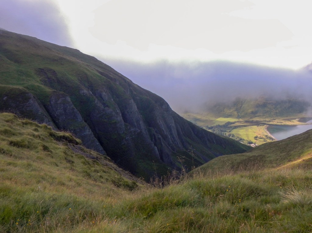
Further on the way became more difficult to follow on a very steep slope with numerous rocky outcrops. I could see the bridge that I needed to get to in the valley far below me. It took an inordinately long time to get there on the steep and uneven ground and I was glad to arrive at the track from where it was a straightforward walk back to Inverie.
As I walked, I could see rain showers over some of the other mountains. The ground was wet so it looked as though I had been fortunate to somehow dodge showers and enjoy a completely dry day. When I arrived back at the campsite people were talking about extremely heavy spells of rain. I had escaped them all, apart from one further heavy shower which started just after I had washed my socks and hung them on my tent to dry.
This is certainly a little visited but beautifully scenic part of Knoydart – I did not see anyone at all on the hills from the time I left Inverie village to when I returned. Definitely recommended!
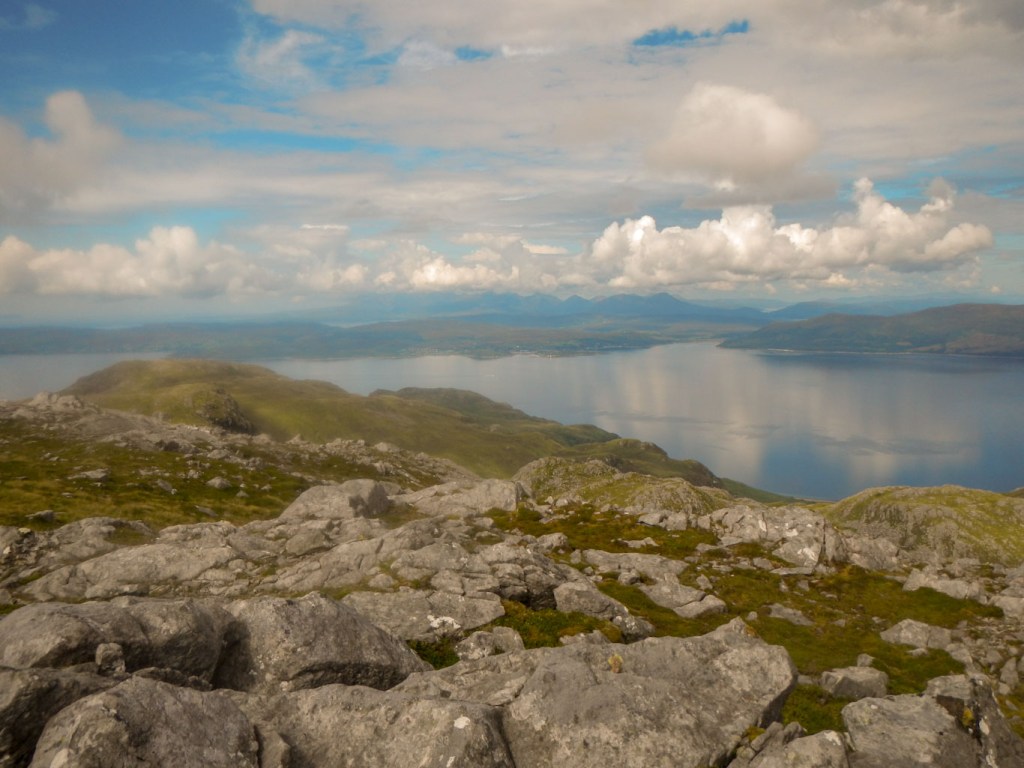
Monday 9 August: Ascent of Sgurr Coire Choinnichean followed by a walk round part of the peninsula
This Corbett is the mountain seen most prominently from Inverie, rising dramatically behind the village with the climb beginning immediately. I had left it to the end on the basis that it was the shortest walk of the four summits I had chosen to climb and the weather had been so good that I had wanted to complete the walks that take longer.
The path rises from the village through woodland with a clear path. Emerging from the woodland there is a stile. from there the only direction is up. The two route descriptions I had mentioned pathless moor. In fact there is a path and it wasn’t long before I saw a large ravine which can be spotted from the campsite. I was careful to keep high and not be led astray to drop into the gully.
The ravine – important not to drop into this 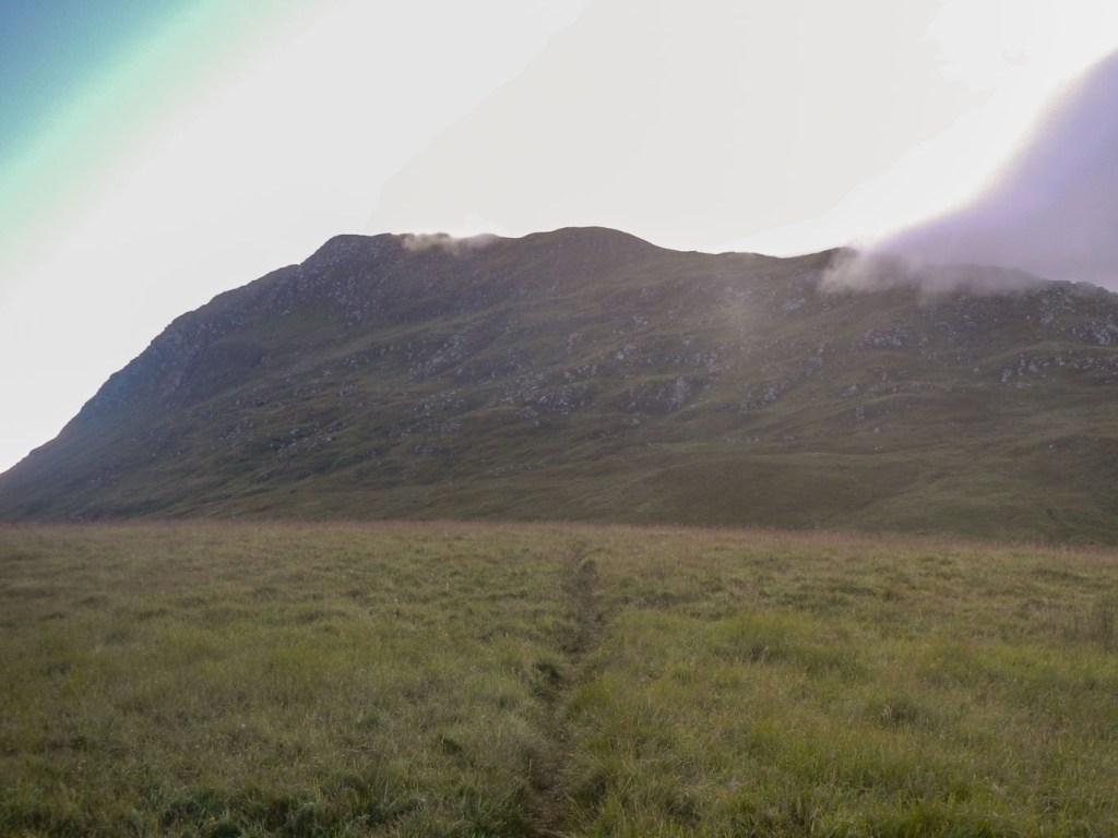
The flat area just above the ravine
The path leads clearly behind the ravine and then on up the ridge of the mountain. There are excellent views from the ridge which narrows in places with significant bilateral drops.

At the summit, there was intermittent cloud and I waited there for around forty-five minutes as it cleared initially in one direction and then in another so that gradually I was able to piece together a full panorama.
I had set off early and I think I was first to the summit (796m)that morning. However as I waited at the top two men arrived who had come in on the ferry for the day. They wasted no time and having taken photos of themselves they immediately started to go back down.

Eventually I followed to make my own descent. This was the only one of my summit walks where I had seen other people on the mountain. As I descended, I met three groups making the ascent – my new next door neighbours from the campsite who were there exploring in order to develop a business offering trail running holidays, a family staying at a cottage in Inverie – the children had pleaded with their parents to walk up a mountain, a resident of Inverie whose father was visiting and they were climbing with their dog.
View toward campsite 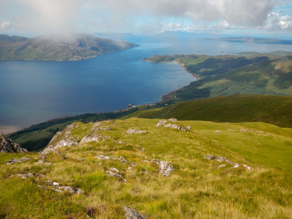
View toward village – the pier can be seen but the village hidden by the mountain 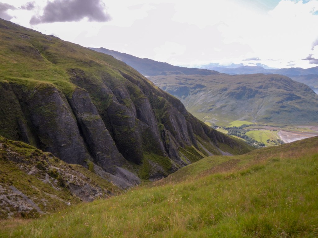
The ravine again – the light on this had completely changed from when I had climbed up earlier
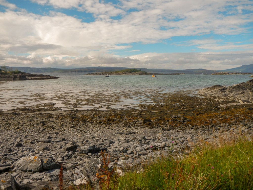
I was back in the village in time for lunch, but I had already eaten my sandwiches while on the mountain. I was tempted to coffee and cake at the café while I looked at the possibilities for walks in my remaining half day. My constraint was that I wanted to be back at the village in time to buy some chocolate and a final bottle of Knoydart Brewery beer as I didn’t want to carry this shopping on my walk. The shop closes at 7pm so as it was 2pm I had five hours.
I wondered whether I had time to make a circuit, walking on the road to the even more isolated community at Airor, before following a footpath to Inverguseran Farm and then returning to Inverie on a track, some of which I had walked the previous day on the way to and from Beinn na Callich. The other option was to walk out along the road and then take a path or two out to the coast before returning the same way. I decided to try the former and take the risk of not getting back by the time the shop closed as I could manage without the beer and I probably had sufficient chocolate stashed in my tent for the next leg of my expedition.

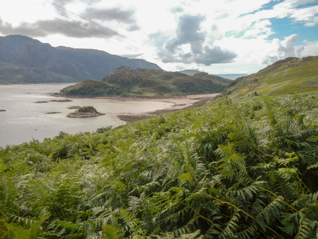
The road was incredibly scenic and of course almost entirely devoid of vehicles or of people. I walked briskly and ignored the turn-offs as I knew that time was limited. This was when I walked past the turning to the brewery without visiting and the turnings to a couple of interesting looking coastal areas. I also think there would be scope to find a pathless walking route along the coast, but I did not have time. I realised that in fact this expedition was my bad weather alternative for my stay – but there had been no weather that was too bad for me to need the option. In that case it would have been an activity that would have occupied a whole day. Clearly there are many more adventure options here and it would be worth returning in the future. Of course there are also more mountain routes that I had not explored, including two Munros……
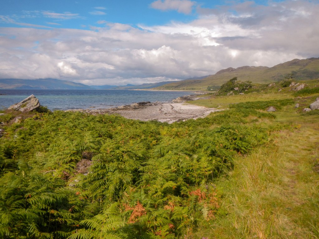
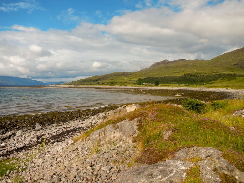
Eventually I arrived at the end of the road (Airor). from there I followed a footpath to Inverguseran Farm, bravely (for me) passing some Highland Cattle. Skye seemed to be very close across the water. I had to ford the Abhainn Inbhir Ghuiserein. I should have taken off my socks and taken the insoles out of my boots so they didn’t get wet but I thought I might get away with it – definitely a mistake, especially as I had taken off my gaiters too on the long road walk and not put them back on.
My feet were squelching in my boots as I reached the track to return to Inverie. Anyway I arrived back in plenty of time to go to the shop select my final bottle of Knoydart beer – it was a difficult choice between their Special Edition and the Heavenly Blonde but in the end I chose the former.
Tues 10 August – Fri 13 August – Return from the wilderness
I woke to discover the cloud base significantly lower than any other day that I had been in Inverie. At least there was some wind which kept the midges away and also meant my tent wasn’t soaked with rain or condensation.
I followed the route I had already taken on the ascent of Liunne Bhein to reach the col between Inverie and Barisdale. I only saw one other person between leaving the campsite and reaching the col – they didn’t see me even though I called “Hi” as they were apparently fending off a plague of midges wearing a midge head net. while taking down their tent from a wild camp.

Unfortunately the views were limited by cloud as I descended into Barisdale. A solitary walker coming the other way commented on how few people were out walking these hills and also told me he had seen otters while walking between Barisdale and Kinloch Hourn. I resolved to keep my eyes open….
There were a few people in Barisdale but the path from there to Kinloch Hourn was deserted. I saw lots of places where I thought otters should live but sadly no otters.
As I approached Kinloch Hourn, I knew that it wouldn’t be much further when I saw an elderly lady (I think with her daughter) approaching. She asked me whether I was looking for the campsite – apparently she had seen a notice for the campsite in the village but been unable to find it. However she assured me she wasn’t camping – very odd! A little further on there was an elderly man sitting in the middle of the path doing a crossword puzzle (accompanied by a younger man). “I think I am an obstruction” he stated but in fact there was plenty of room to pass at that point. I guess he was married to the lady who was looking for a campsite she didn’t want to stay at!
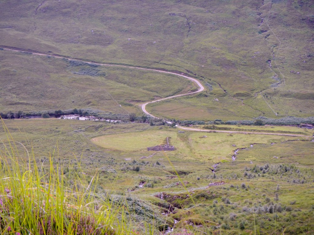
The tea shop at the B+B where I have stayed previously in Kinloch Hourn was closed. I walked on up the hilly lane and found a convenient place to camp opposite the start of the path to ascend Sgurr nan Eugallt.
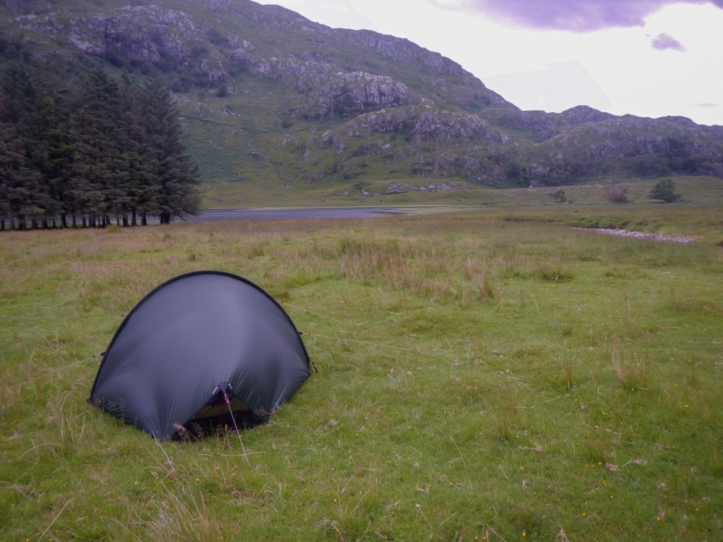
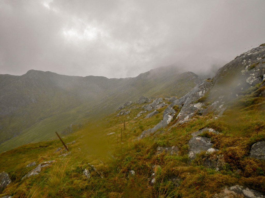
It was a superb spot apart from the inevitable midges. Next morning dawned dry but windy and the cloud had lifted a little so I packed up and started my ascent.
It was a scenic path and I was enjoying the climb even though it started to rain. By the time I reached the fence posts guiding me towards the final ridge it was raining a lot and very windy. I had ascended from the road at about 130m to around 700m but the summit was still almost 200m higher at 894m. Sadly the weather was deteriorating and given that there was rain, wind and cloud, I had to make the decision to retreat. Otherwise I risked being blown off the ridge.
Somehow on the way down, having found the path near the fence posts, I managed to take a wrong turning down a gully and lose the path. A study of the map showed it was best to try to keep going down towards the road as there seemed to be a way avoiding the rocks and cliffs. This meant that I ended up nearer to Kinloch Hourn and several metres below where I had started from that morning. I climbed back up the road and ate my lunch near the bridge only metres from my overnight camp.
My decision to turn back was certainly correct as the rain became progressively more heavy. In ten days of walking in this area it is actually quite unusual that the weather was good enough for me to fully complete all my mountain walks bar one. A few cars passed on the road and someone even offered me a lift. I declined and then wished I hadn’t done so as the rain became worse with no sign of any imminent improvement.
Trudging and squelching along the road, I noticed a Scottish Footpath Society sign to Cluanie. This was where I was heading but I was certain that I hadn’t walked far enough on the road to have reached the path that I had planned to take. I pulled the map out of my rucksack to study it. I realised that when I had planned the route, I had missed this footpath. It looked like a much better option than what I had planned as it involved significantly less road walking and avoided the need to ford a sizeable stream. The latter could be a problem after all the rain that had just fallen.
My delight soon turned to frustration as I spotted several large Highland cattle on the track. However I managed to circuit them at a distance and was happily on my way until there was another herd of cattle on the path further on. Fortunately I managed eventually to navigate around these too.
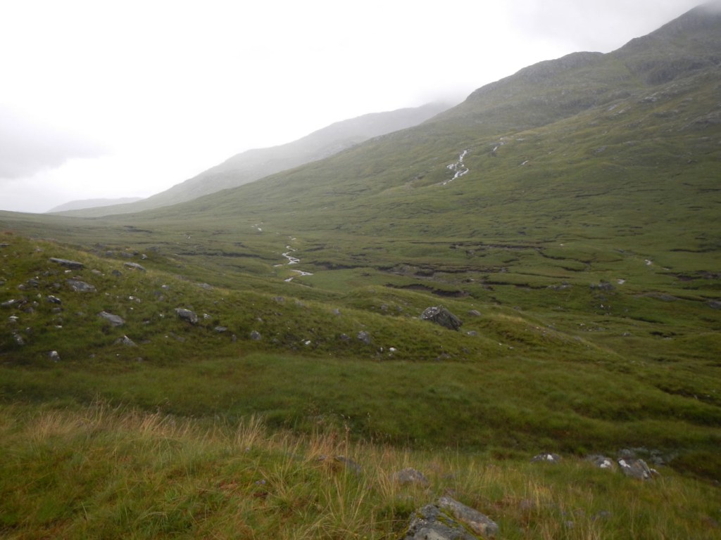
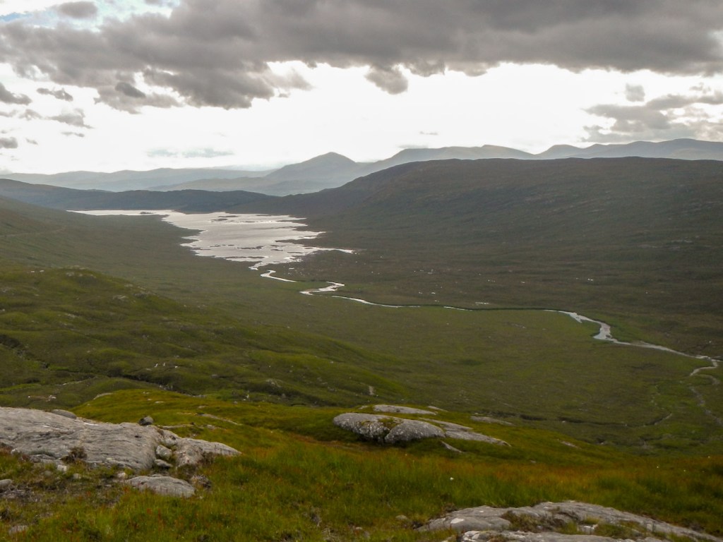
I found myself in the upper delightful wide Glen Quoich with a very gradual ascent on a clear path. I reached the watershed and was heading gently downhill in the upper part of Glen Loyne. The mountains rose steeply on either side of the broad U-shaped valley, while the river cut its way through at the base of the valley. The rain stopped and I discovered a wonderful patch of level ground to pitch my tent.
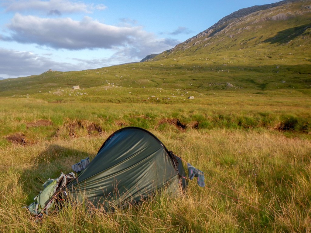
I was so pleased that I hadn’t accepted the lift now! After I had eaten dinner the sun came out – it was a beautiful evening apart from the inevitable midges. Occasionally the wind blew a little and I managed to dry out the base of my rucksack that had got wet in the earlier torrential rain.
Thursday dawned bright and sunny with some cloud. I had no idea about the weather forecast after a significant time without any electronic communication. However it looked ok!
I enjoyed my walk down Glen Loyne so much that I missed the turn off path – eventually I looked at the map and had to backtrack almost a kilometre up the glen. When I arrived at the turn off (for the second time that day) it was obvious – I had actually missed it as I had thought the fork was part of the path that I was already following down the glen.
The ongoing path was straightforward to follow over a broad bealach with an amazing view towards Loch Loyne.
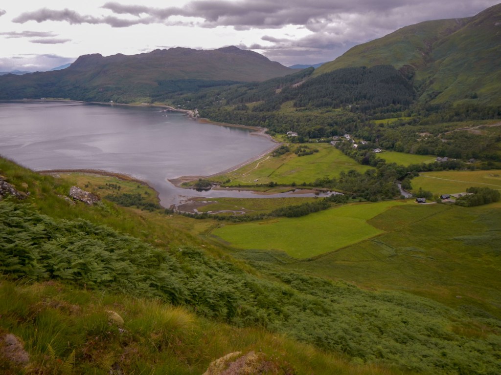
As I descended towards the old road, I met some walkers heading up towards Creag Mhaim (a Munro). They suggested that I was going the right way, explaining that the weather forecast was poor. Rain was expected from around midday. I thought that I should be more or less at Cluanie by then. It was an easy and scenic end to my walk on what had been the “Road to the Isles” until the Rivers Cluanie and Loyne were dammed in the 1950s.
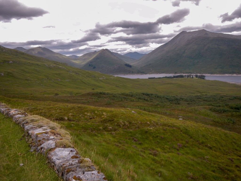
I reached the bakehouse opposite the Cluanie Inn at 12:15 – I had almost twenty four hours until my booked bus to Fort William the next day. I enjoyed sitting at a table to eat lunch and fortunately had the foresight to get my water bottles filled. Eventually I left, discovering that I could eat dinner at the Cluanie Inn any time until 9pm without booking.
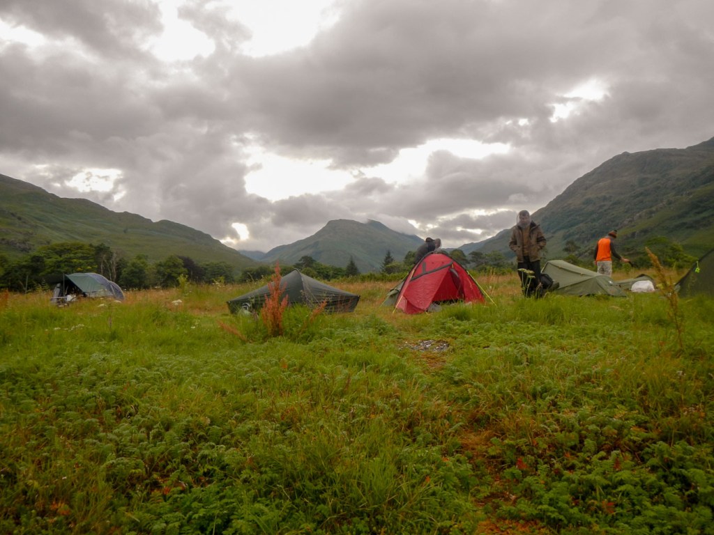
I decided to find a site to camp and shelter in my tent out of the way of midges (and potential rain) and then perhaps take my tent down (so it wouldn’t get stolen) to go for dinner . However having found a good flat pitch away from the road and main path, it started raining. In the end due to weather conditions I settled for my rehydrated bag meal at my tent. Well I had carried it from Glenfinnan and it made little sense to carry it home.
I spent that last afternoon and evening finishing reading my book. I have read it previously. This account had been part of my motivation to spend ten days exploring the Rough Bounds. “The Last Wilderness” by Neil Ansell is a phenomenal memoir on solitary walking over this wild landscape. I was intrigued to read about his experiences while I was walking through some of the same area. I had the three relevant 1:25,000 maps with me for my own navigation and enjoyed trying to track some of his wanderings. I was amazed by his knowledge of the wildlife and his ability to track different animals. His description of being lost in the middle of nowhere and spending ages battling through undergrowth and over rocks before finding that he has been in more or less the right place all the time certainly struck a chord with me. I was also intrigued to read his rather tongue in cheek thoughts about the purpose of midges – you will have to read his book yourself to discover what this is! Rereading his masterful account while travelling through some of the same places certainly gave me an alternative view on my own experiences.
As far as I could tell, the rain continued through the night and into the next morning. I was very fortunate that I managed to get my tent down during what was just about the only break in the rain. Sadly my time to leave the wilderness and return to the electronic world of computers, apps and smartphones had arrived.
