3-5 August 2021
Only a few short weeks ago I commented that Cape Wrath may be the last wilderness in the UK. However this later expedition turned out to be just as remote. The area I travelled to is known as The Rough Bounds, and is predominately a sparsely populated area of rugged mountains, made even more inaccessible by the long deep sea lochs indenting into the land. My challenge was to walk through South Morar and North Morar in order to arrive at the village of Inverie on Knoydart. This was to be the base for further adventures based on map 33.
The last part of my long train journey from Devon was on the West Highland Line from Glasgow as far as Glenfinnan. This has been dubbed one of the great train journeys in UK (if not the World). It includes passing through some gloriously remote moorland where sightings of deer are common as well as stopping at Corrour, the highest station on the British Rail network at 1,338 feet. From Fort William, the magnificent scenery continues including crossing the impressively curved Glenfinnan viaduct, now also famed as the Harry Potter train bridge filming location.
The helpful train conductor explained to me that I should stay in my seat to see the viaduct and then pick up my rucksack to walk to and alight from the central carriage of the train. The station platform is short so only one door is opened.
I was still sorting out my rucksack and pulling on my gaiters as the train left to go on to Mallaig. A helpful volunteer from the museum at the station pointed out the viaduct trail that I could follow from the station over the hillside towards the track under the viaduct. This would mean that I could avoid walking up the main road.
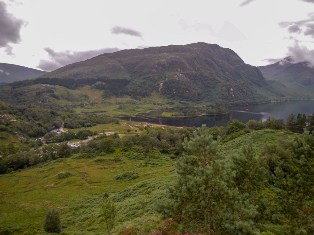
It was a steep hill to start my expedition but I was soon at a viewpoint high above Loch Shiel. I remembered that I had promised to send a text to my husband prior to leaving “civilisation” as we were aware that this could be my last opportunity to get any phone or data signal for several days. Unfortunately, the short delay to do this cost me the opportunity to reach the main viewpoint in time to take the perfect picture of one of the steam trains crossing the viaduct.
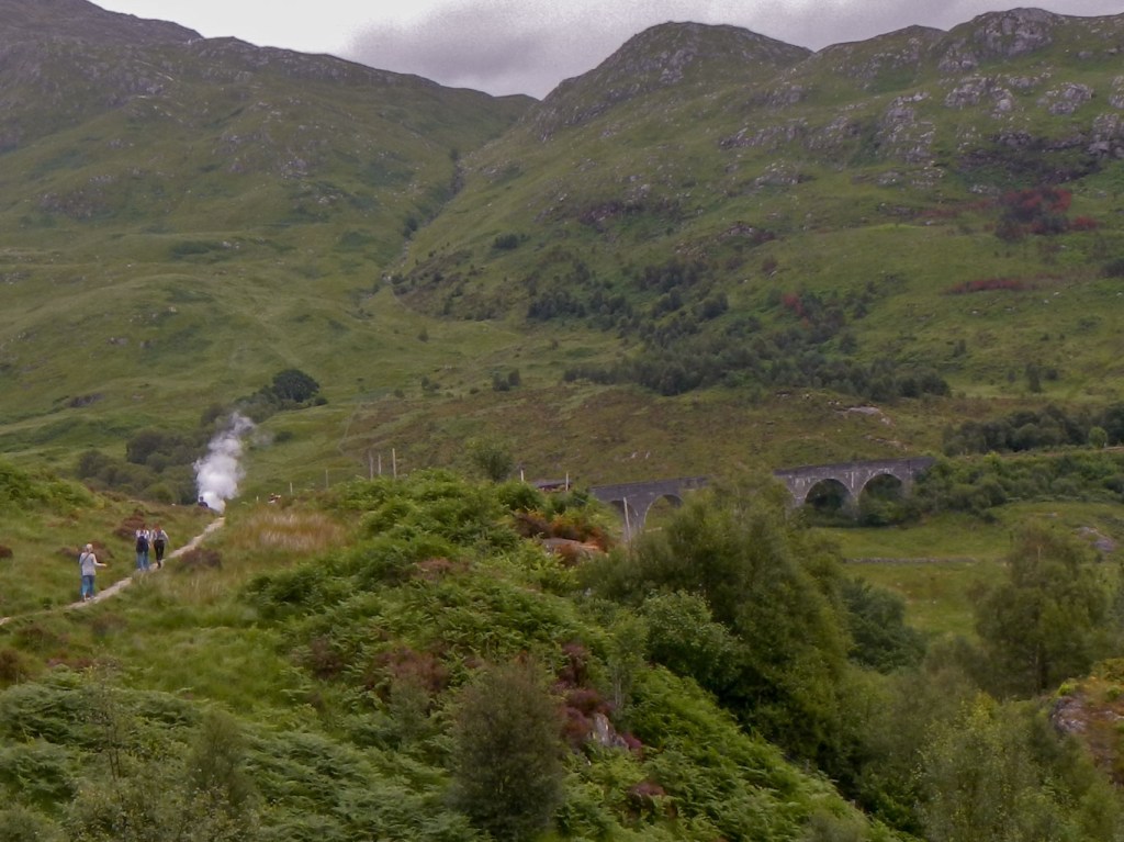
Steam train had already crossed the viaduct – see the plume of smoke 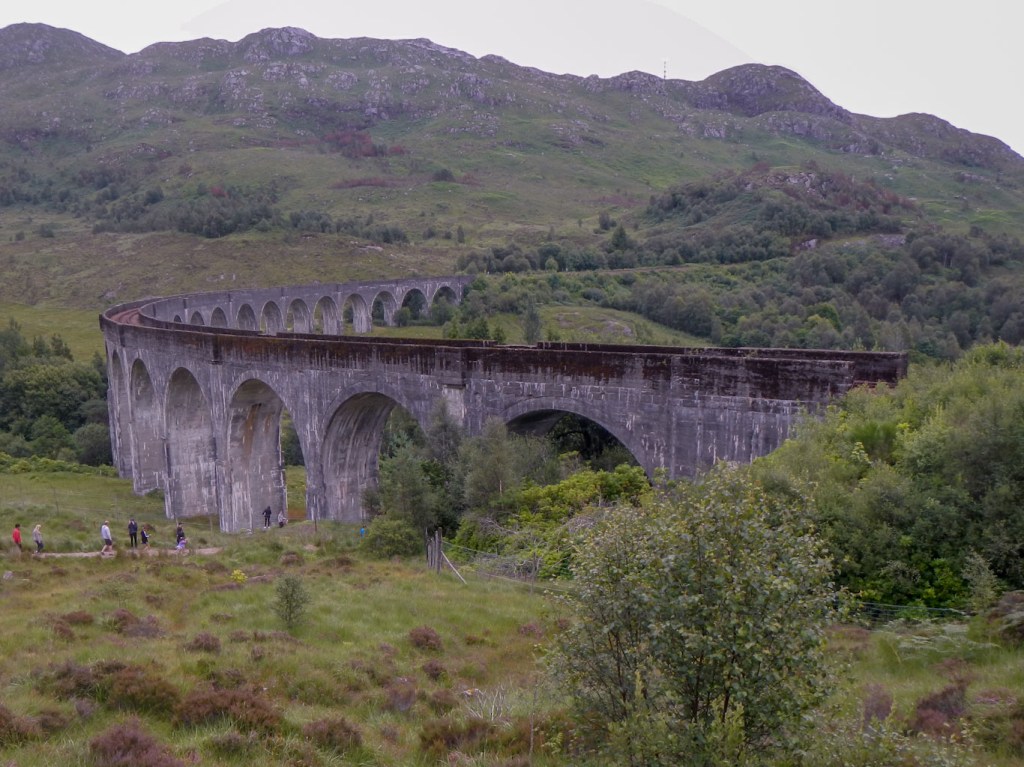
The impressive curved viaduct – this was where I should have been standing five minutes earlier!
I made my descent to the track in the valley. There were crowds of people looking at the viaduct as this is a popular tourist spot. At the track, I turned left away from civilisation. Within yards, there were no people at all as everybody else seemed to be turning right towards the car park and village.
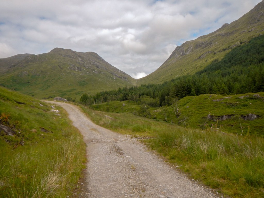
The track into the wilderness starts as a surfaced road but soon becomes a rough stony track and then a footpath. This is a route that I have followed previously when walking the non waymarked Cape Wrath trail from Fort William to Cape Wrath. I spotted a group of walkers in the lower part of the glen but once I reached the bothy building at Corryhully I was on my own.
In error, I forded the river at Corryhully but quickly realised that this was a mistake. Fortunately there was an easy way back with a small footbridge about a kilometre upstream. I continued on climbing up the glen on an ever steeper and progressively less obvious path, soon reaching the bealach (col) marked by a cairn at about 471m high above my start point near sea level.
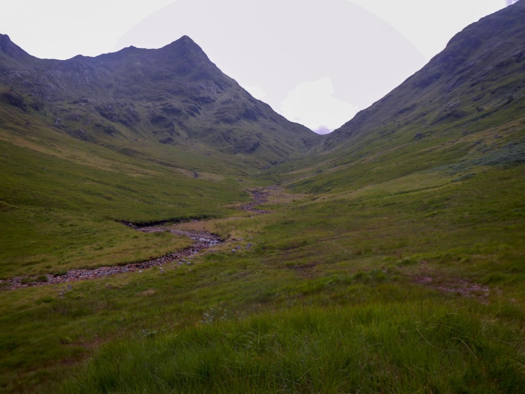
The footpath became even less obvious and easy to miss but I managed to follow it downhill over rough ground, glancing right towards the gorge of the Allt a Chaorainn. The cloud was covering the mountain tops and there was a shower of rain as my made my descent over slippery ground, picking my way carefully to avoid falling with my loaded backpack.
It was important to cross the stream well before the confluence with the River Pean. The map actually shows a crossing point in Glen Pean, but I knew from my previous walk and from route guides that it is necessary to cross higher. In fact, on the ground, following the trodden path, I arrived at a crossing point that was clearly the one that many previous walkers had used. The water level was extremely low and it was easy to cross without getting wet feet.
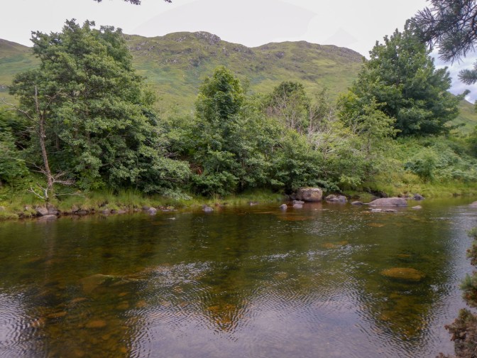
I set up my first camp on an area of flat moorland near the confluence and near the bridge over the River Pean. Apart from the inevitable midges, requiring protection both in the form of chemicals and my head net, it was a pleasant spot.

In the morning, there were even more midges and I just poked my head, protected by head net, out of my tent to boil my water and retreated inside the sanctuary of my tent to eat my porridge and drink my coffee.
My route passed along a forest track, before emerging near scattered settlements at Strathan, where I almost reached a minor road but turned off before that to head up the remote and scenic Glen Dessarry. It was an easy walk along a gently ascending track until I reached the stile at Upper Glendessarry. The stile had a cross piece missing and I couldn’t step high enough with my heavy load so I dropped my rucksack over before clambering across. A Scottish Footpath Society sign put the distance as sixteen miles to Inverie, but also warned that this was remote and dangerous terrain.
I remembered a tricky stream crossing in the upper glen over Allt Coire nan Uth, but this time with the recent low rainfall it was easy.
As I crossed the bealach, again marked by a cairn, I spotted a large group of slow moving walkers ahead of me. They turned out to be a group of eleven. This strikes me as a huge group to manage over this type of terrain. They were a group of volunteers with Raleigh International. Having spent two weeks working on the Re:Green project building and repairing deer fences to protect the Scottish rain forest and ancient woodland in Kintail, they had moved on to the expedition and youth leadership part of their adventure. I discovered that they were heading for Inverie as well and like me planned to arrive the next day. I also found out that their plan in the intervening night was to camp near the Sourlies bothy on the shores of Loch Nevis. At one time this had also been my objective for the day, but I had already decided that I had time to walk further and this cemented that plan in that I didn’t want to wild camp near a group of eleven other people.


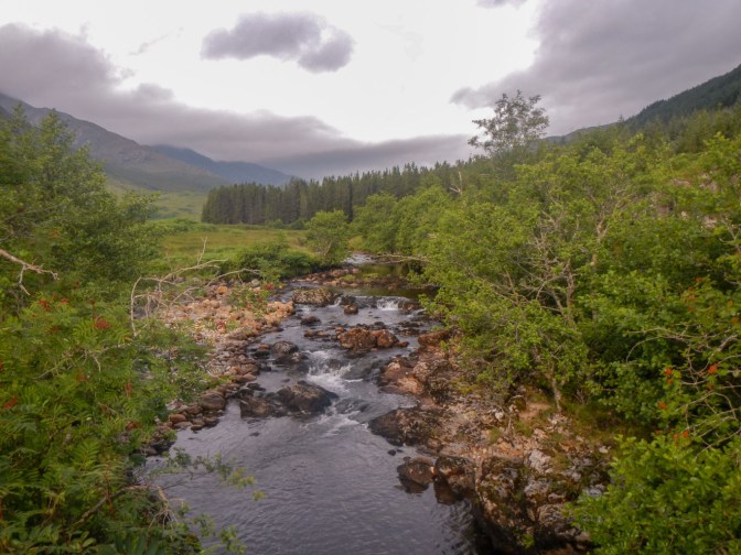
The scenery as I followed and crossed the Finiskaig River was awesome with wonderful views both up and down the valley. The bothy at Sourlies was closed for repairs. The tide was in, so I had to clamber across part of the headland rather than taking the easy flat walk along the fore shore. As I made my way over, I saw a group in a small boat land on the beach before heading out again on to the loch. my first attempt to get over the headland ended up reaching a rock face but at the second attempt I found a way through and barely needed to scramble.
I kept close to the foreshore to reach the River Carnach. Normally this is a deep and wide river and the bridge crossing essential. However the dry conditions meant that I ended up fording it – I thought I was crossing a tributary! I ended up arriving on the far side of the bridge. When I walked this way in 2015, the bridge was said to be in a dangerous condition and walkers were advised to cross at their own risk. Ironically now in 2021, when I had unusually been able to ford the river, the bridge has been replaced. This had happened in 2019 as an initiative between the Camusroy estate and various charitable bodies. I crossed over briefly to the other side and back, as I did not want to report that I had not made use of this new functional bridge.
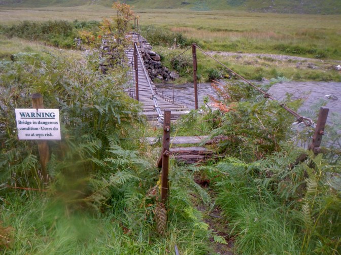
The old bridge with warning – 2015 picture 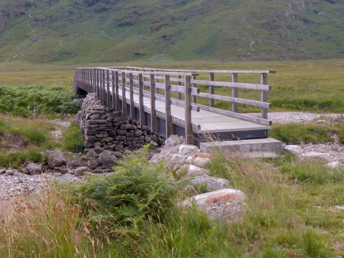
New bridge – note how much less water is in the river
The weather still looked ok as I walked past the ruined cottages at Carnoch. it was even sunny, although I did think that the clouds looked somewhat ominous. I was tempted to camp near the deserted settlement, but it was relatively early in the afternoon so I opted to hunt for the path which would lead me from sea level over the high Mam Meadail (549m). The path had many zig zags. Recurrently I was sure that I could see the highpoint and then, having arrived, the path continued higher and higher. The clouds were gathering and I had some concerns about them heralding an electric storm. As I reached the cairn at the high point, I was intermittently walking in the cloud, with consequent poor visibility. Suddenly it was pouring with torrentially heavy rain.

Fortunately the downward path in Glenn Meadail was distinct and easy to follow. I was able to descend reasonably quickly from the highpoint and spotted a flattish area of land just below the path at around the 300m contour. There was a slight lull in the storm which enabled me to pitch my tent but then the rain began in earnest again.
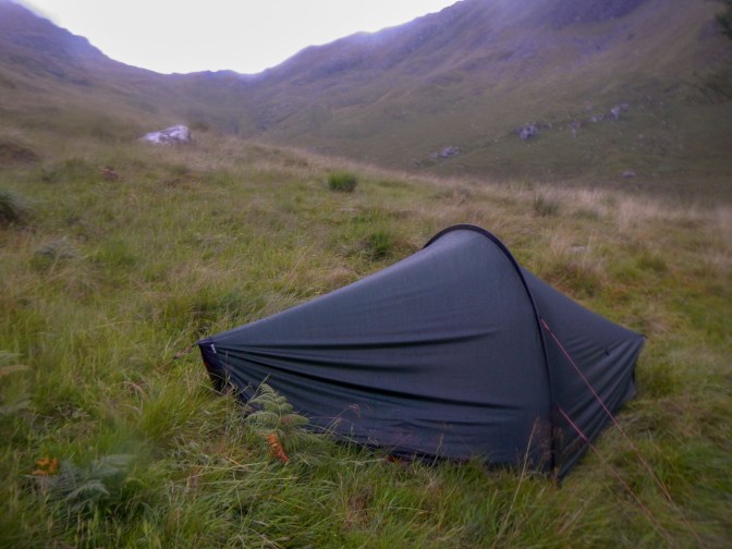
I flung everything apart from my boots, gaiters, trekking poles, waterproofs and rucksack cover, all left under the flysheet, into my tent. Fortunately everything that should be was essentially dry. Intermittently the wind buffeted my tent. During a lull in the storm I ventured out to tighten the guy lines and drain some water off which was collecting in a fold of the tent near ground level (the fold seemed an unavoidable consequence of not having a perfectly flat pitch). Any attempt to use my stove would be liable to lead to me getting significantly wet so I ate a meal of oatcakes, cheese, dried fruit and chocolate bars.
I kept warm and dry. I didn’t hear any thunder. However every time I woke in the night, I could hear the wind roaring and whistling and feel the constant buffeting of my tent. Amazingly I overslept! It wasn’t surprising that I didn’t hear the quiet beeps of the alarm on my watch but it was surprising that once daylight arrived I didn’t check the time more frequently. Anyway this was a blessing in disguise: I did not have a long walk to Inverie and the rain had more or less stopped so my tent dried off a bit in the wind. I was able to boil water for my porridge and coffee, undisturbed by midges.
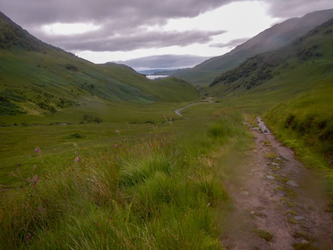
I enjoyed a scenic two hour walk down the glen, arriving at the Inverie campsite at around 11.00am. This gave me plenty of time to sort out all my things, wash my socks, enjoy a relaxed lunch including a hot brew and wander down to the village to stock up on provisions. I even managed to discover a point at the campsite where I had enough phone signal to make a voice call to home. The campsite warden was surprised when I mentioned this – it is unusual to make a voice call, although it is often possible to find a spot where a text will send. I restudied my maps to look at my options for the next four full days that I would be staying at Inverie.
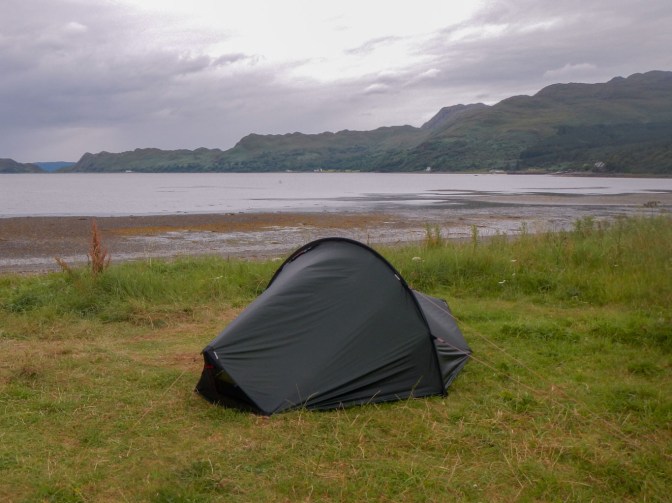
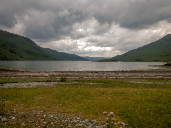
View to Loch Nevis from my tent 
View to Meal Buidhe and Luinne Bheinn from my tent 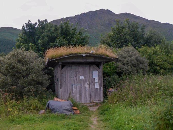
All mod cons – the composting toilet with turf roof and solar panel to generate electricity for the light
Later I strolled down to the village again and discovered an increased selection of food had arrived with the weekly delivery (by boat). This meant that I could buy fresh bread and cooked meat. The friendly shopkeeper explained that the delivery had been due in the morning but had only just arrived. Inverie is really more like an island community than a community on a peninsula. The road through the village is not connected to the National road network and almost everything arrives by boat and not over the mountain passes. I was to discover during my short stay that nearly everybody else arrived and left by boat and that it was unusual to make the land journeys that I was doing.
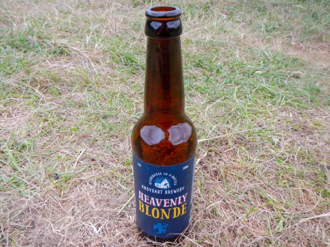
I also discovered Knoydart Brewery beer, opting to buy the Heavenly Blonde to try first. As a result, I had to visit the shop each day of my visit to buy a beer for the evening (except on Saturday I bought two ready for Sunday when I wouldn’t be in the village during shop opening times). Sadly I never made the hike up to the brewery to try to meet Sam and Matt who set this up in St Agatha’s Chapel on the other side of the village from the campsite. In fact I spent most of my visit thinking St Agatha’s was the chapel converted to a house between the camp site and the village, but I was wrong.

On my way back to the campsite, I walked around the “Knoydart in a Knutshell” walk. up the hill towards Sgurr Coire Choinnichean that I would climb another day and then headed up towards the boundary with the Kilchoan estate and discovered the “edibles” garden area near the Inverie River.
Inverie River near campsite 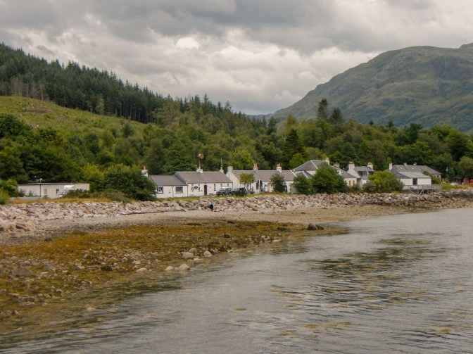
The village
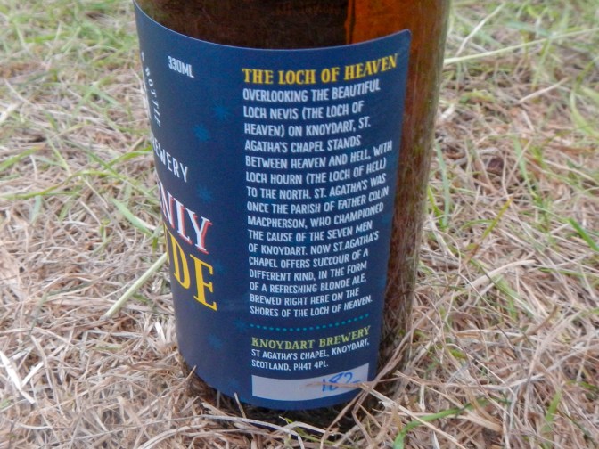
Nowadays the Knoydart Foundation set up in 1997 manages the peninsula on behalf of the community. There was successful buyout of the old Estate in 1999. The community gained control of 17,500 acres, residential properties, a hydro electric scheme and many old buildings. Interestingly two monuments in the area are reminders of a previous attempt by local people to stake claim to the land. The story is also outlined on the Knoydart brewery beer bottle labels above. In 1948, the seven men of Knoydart assisted by the parish priest, invoked the land settlement act, which permitted returning servicemen to farm under-used land as their own. The seven men, who were WW 2 veterans, staked a claim to 65 acres of arable land and 10,000 acres of hill land upon which to settle. The estate owner, Lord Brocket, a Nazi sympathiser, gained a court order to remove them. He sold the estate soon after but still managed to arrange for an enormous monument to his family, which still dominates the entrance to Gleann an Dubh Lochain behind Inverie Bay and Kilchoan.
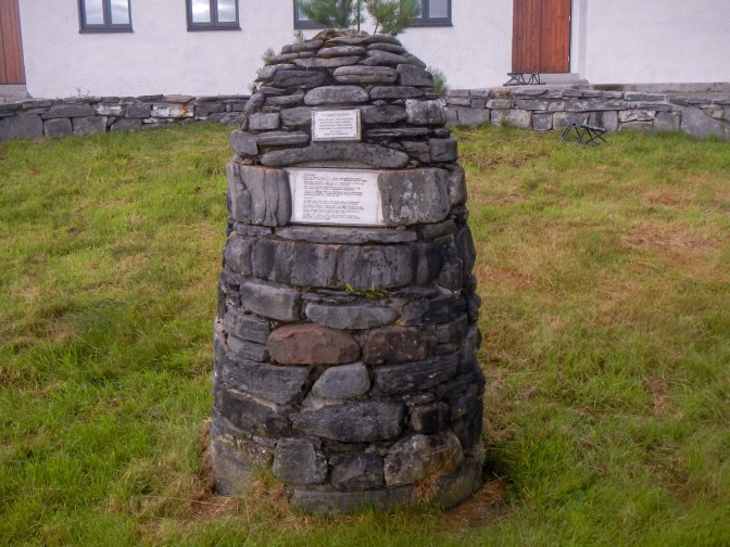
Memorial cairn for the Seven Men of Knoydart outside the Village Community Hall 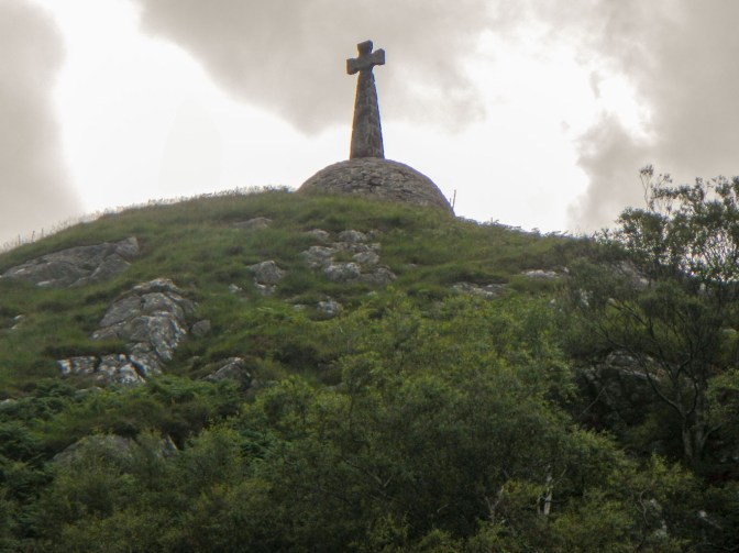
Stark outline of the memorial erected by Lord Brocket to remember his family
Even my journey to Inverie had been an adventure. It was also looking as though I would be enjoying plenty more adventures over the next few days. Inverie actually appears on two different 1:50,000 maps. Although my walk-in is on map 40, my subsequent adventures are all on map 33 which is where the story will continue…..
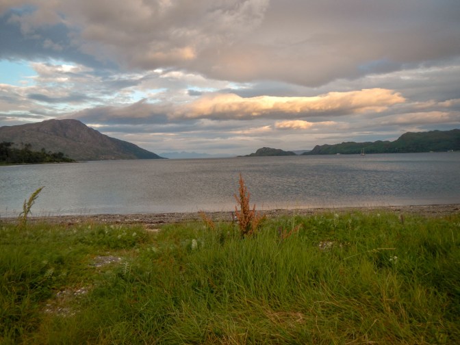
Morning skies from my tent 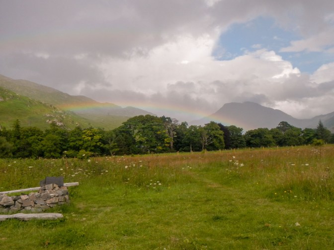
Rainbow seen from campsite 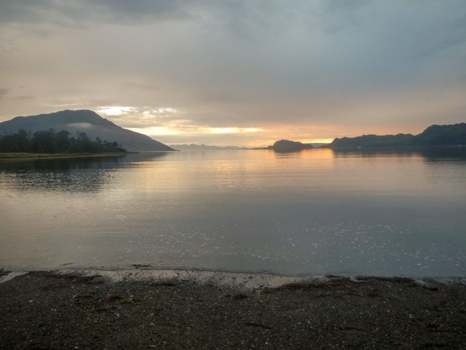
The sun sets over Loch Nevis (the loch of heaven)
