15-17 July 2021
This map is jam-packed with places for adventure! By 15 July I already had at least three adventures worthy of report based on map 9. In summary these are:
- Ascent of Ben Hope (most northerly Munro) – done 9 July – unfortunately cloud prevented the promised tremendous summit views but by walking from Alltnacaillich we had excellent views ascending the early part of the ridge. We also avoided ascending on the badly eroded and more crowded direct path.
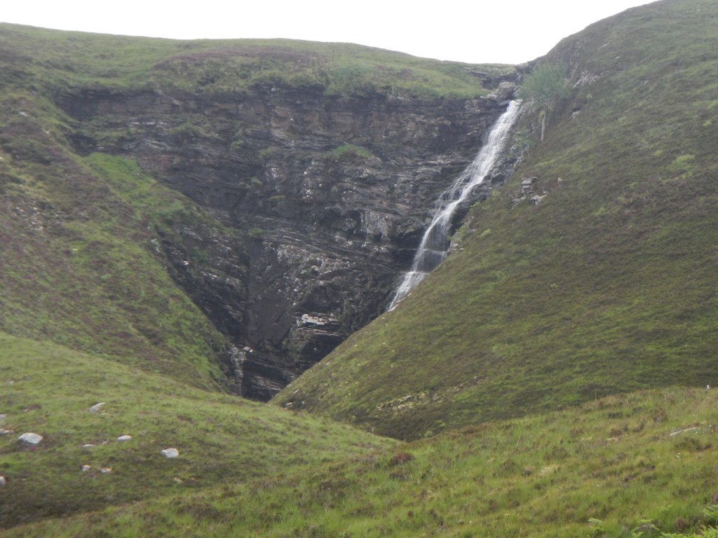
Waterfall near beginning 
Views from the ridge 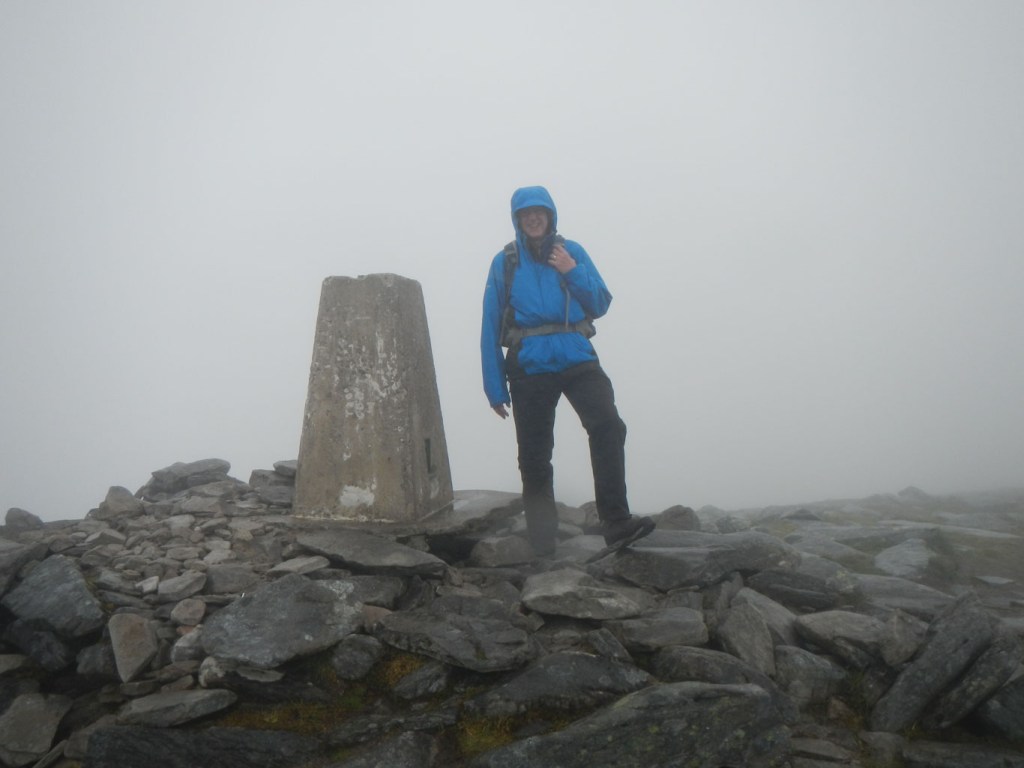
Summit in cloud
- Visit to Smoo Cave – done 13 July – the outer chamber is freely accessible but I also joined a tour into the inner chamber to learn more about the geology of this fascinating area as well as the work that is still under way to try to learn more about the human history of these caves.
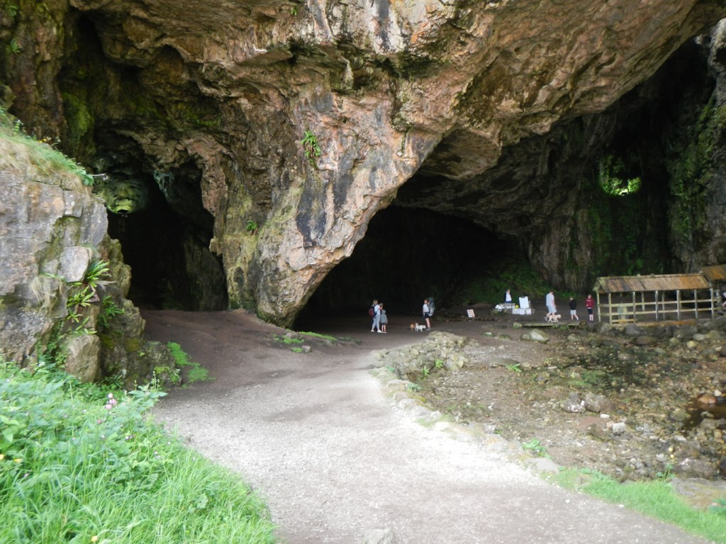
Main cave entrance 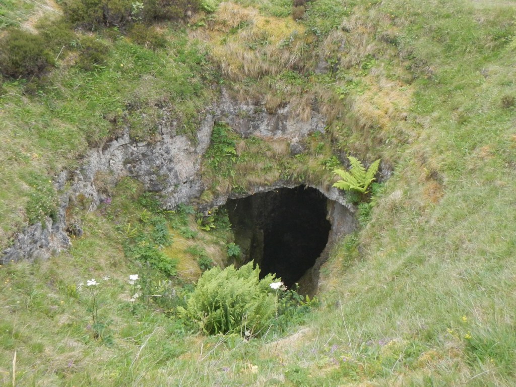
Collapsed roof of inner cave 
The “waterfall” cave
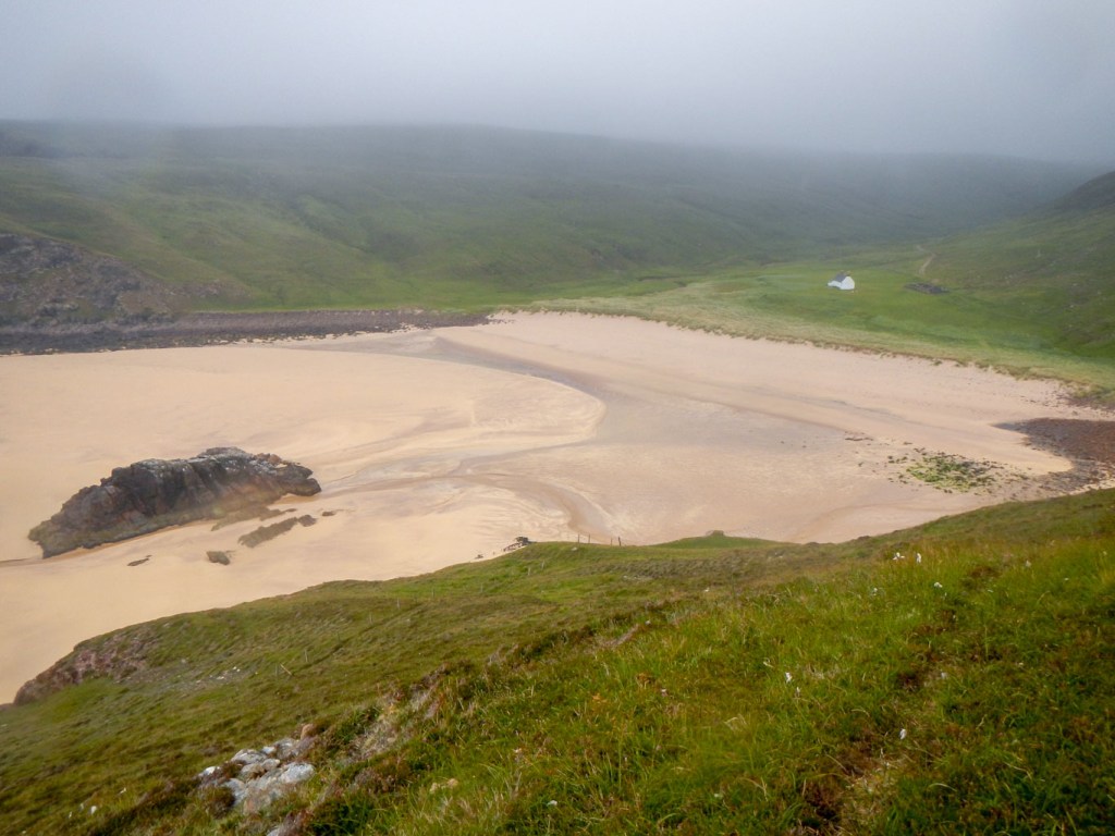
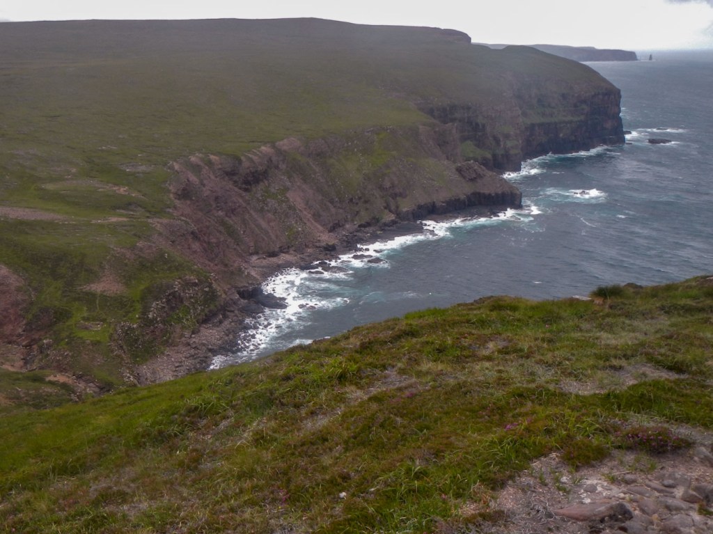
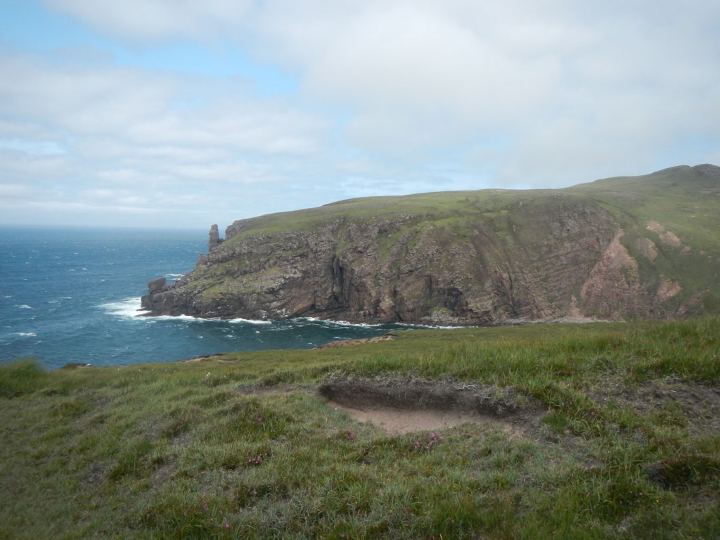
- Walk round Faraid Head and Kyle of Durness – done 13 July – I agreed to do this walk as there was a spare day and my husband thought that he could manage it despite tired legs. However I was astounded by the wonderful cliffs, huge areas of unspoilt dunes, enormous deserted beaches, as well as the seabirds including gannets, oystercatchers, guillemots and even puffins on the sea and flying past. Certainly this is not a walk to miss!

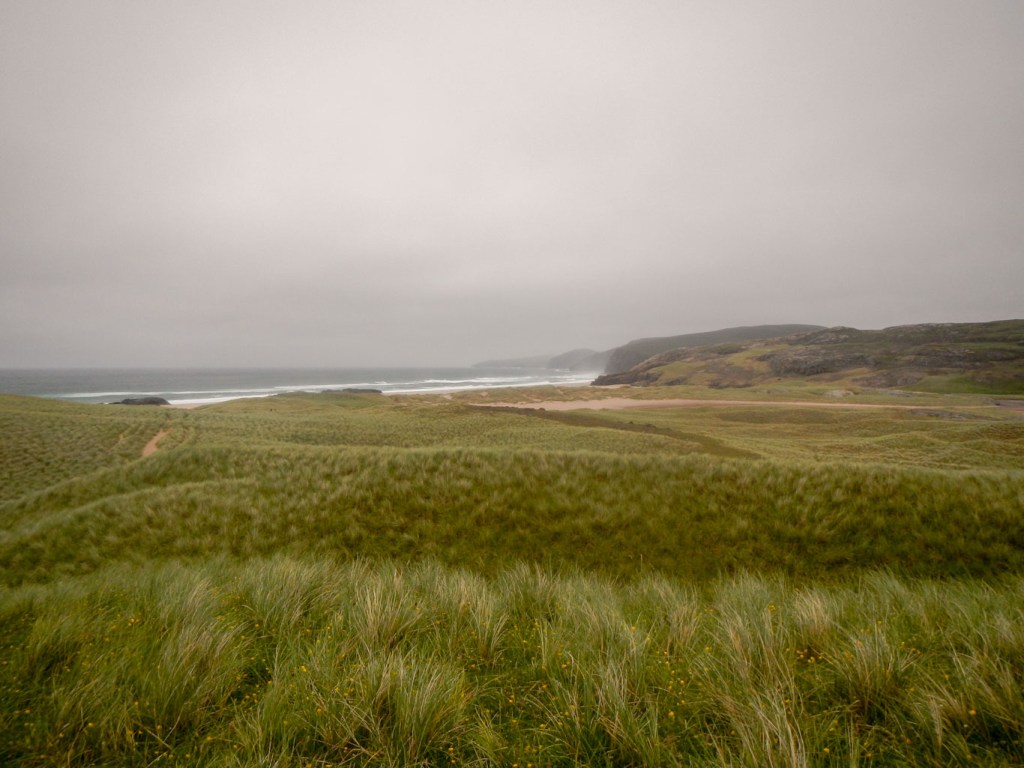
Sculptured dunes 
Immense dune area 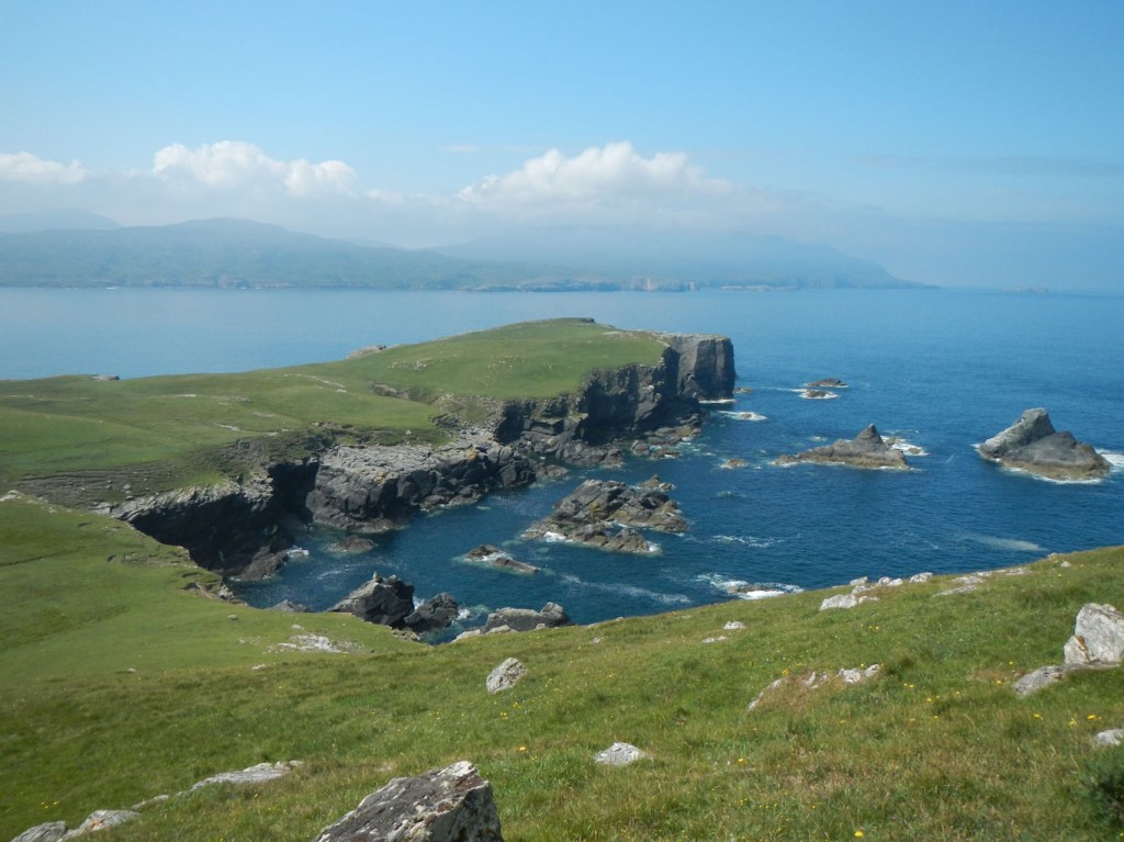
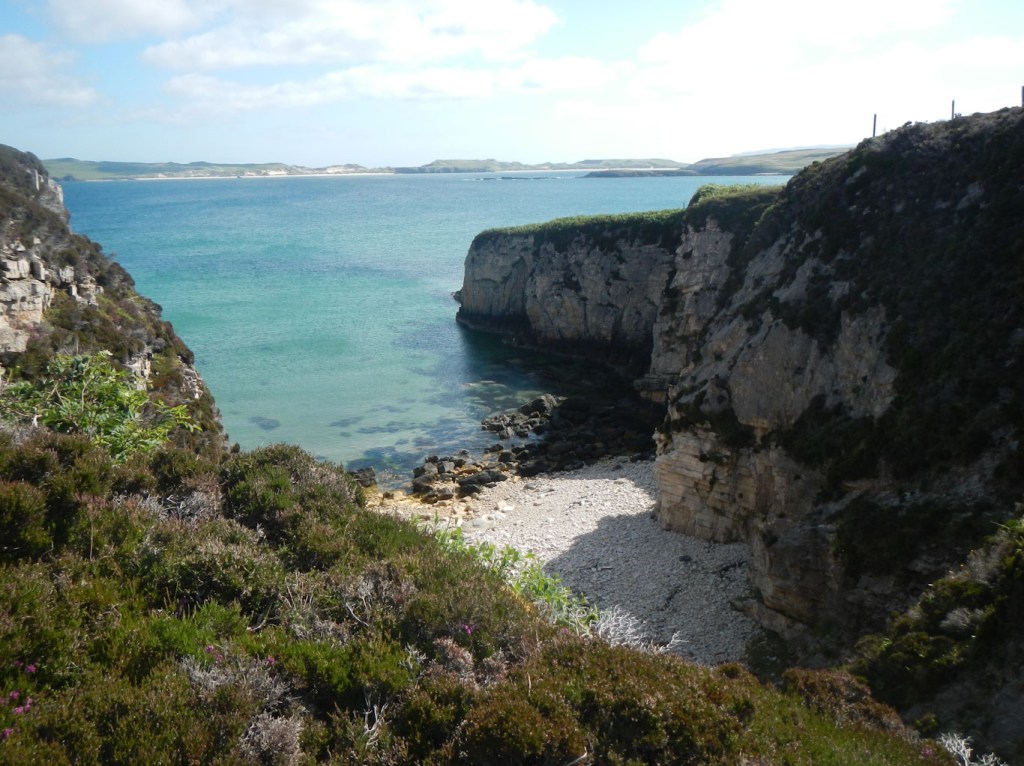
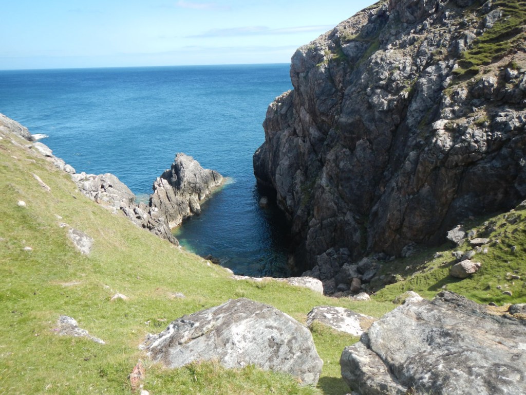
Inlets and cliffs 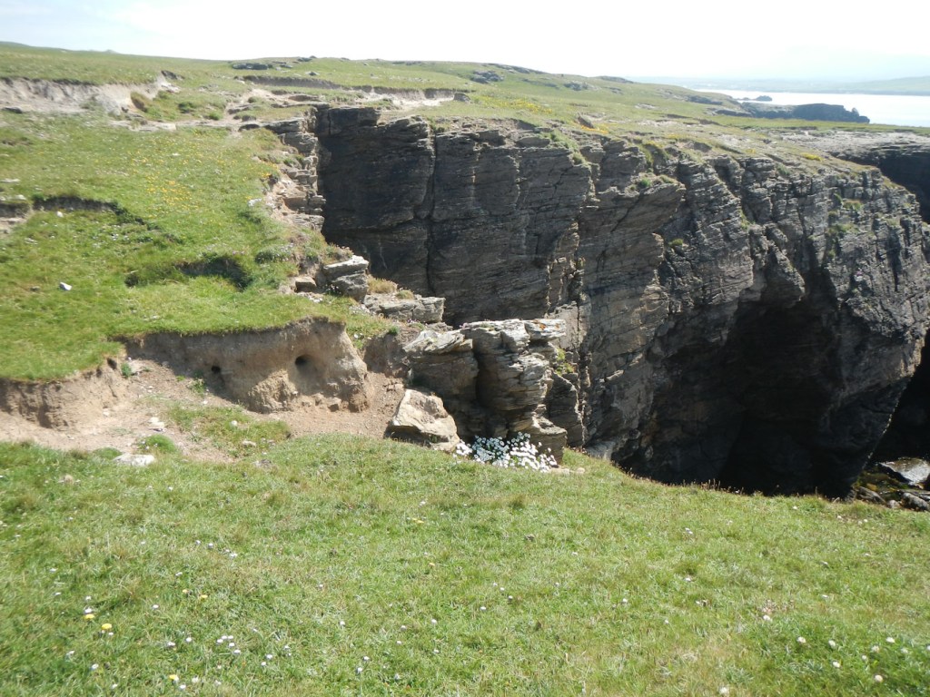
Cliff formations 
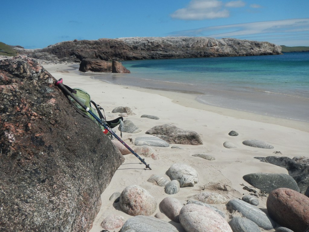
Rocky beaches 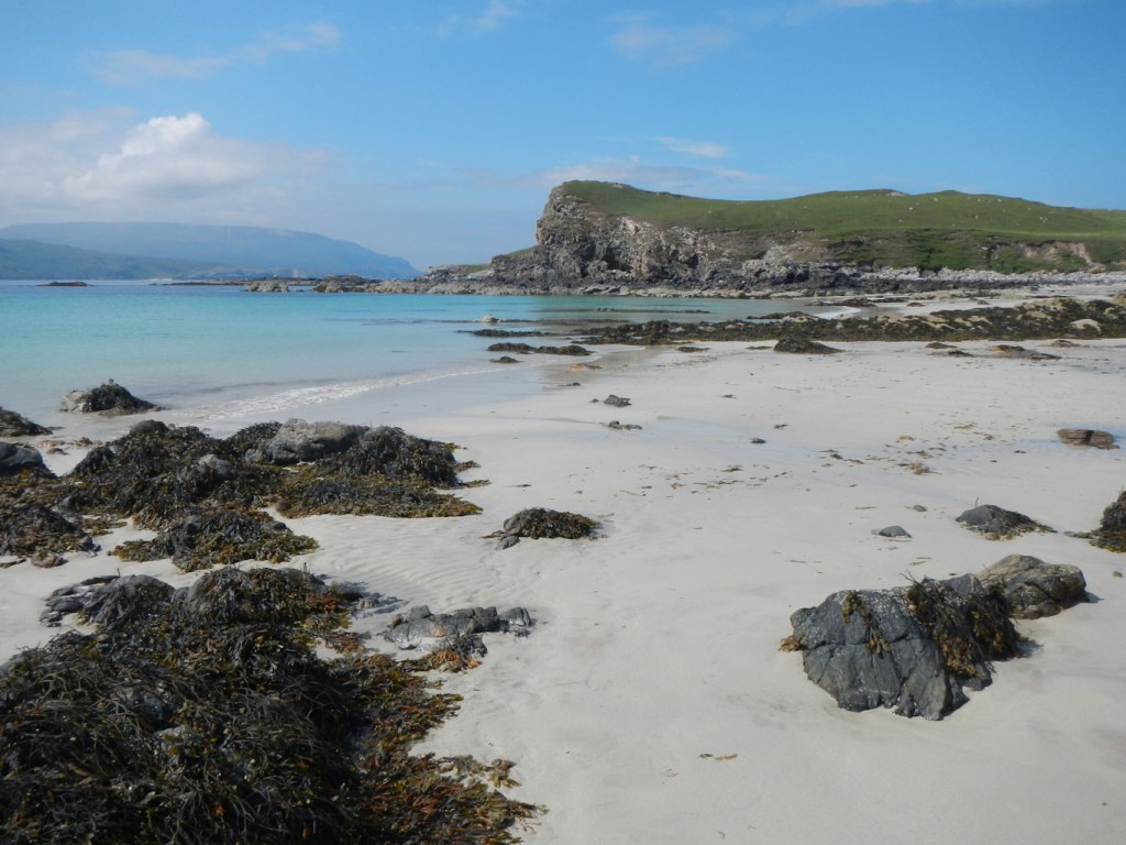
Beautiful beaches 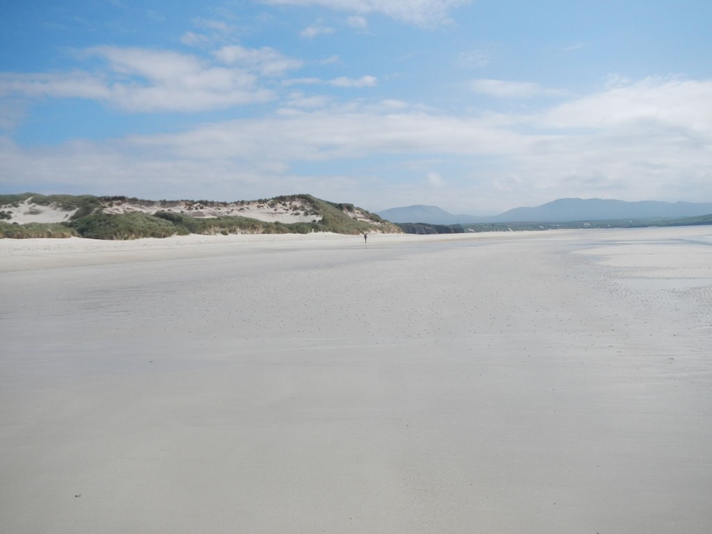
Vast areas of sand 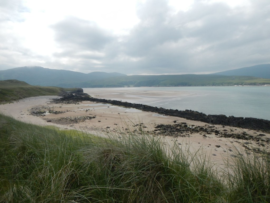
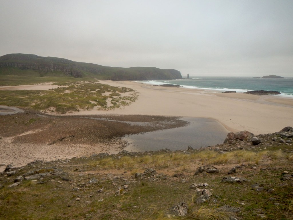
Sandy beaches and views towards Cape Wrath 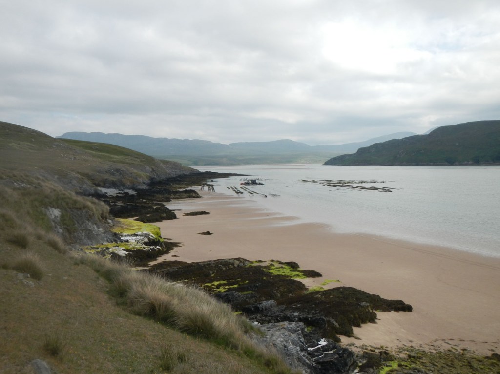
More sandy beaches
My real map 9 adventure began at 09.30am on 15 July, when I arrived at the ferry point on the Kyle of Durness ready to be transported over to the Cape Wrath peninsula. I couldn’t believe that the small boat with a little outboard motor was actually the ferry. The tidal currents were looking strong as the water was coming in rapidly over the sandy intertidal area.
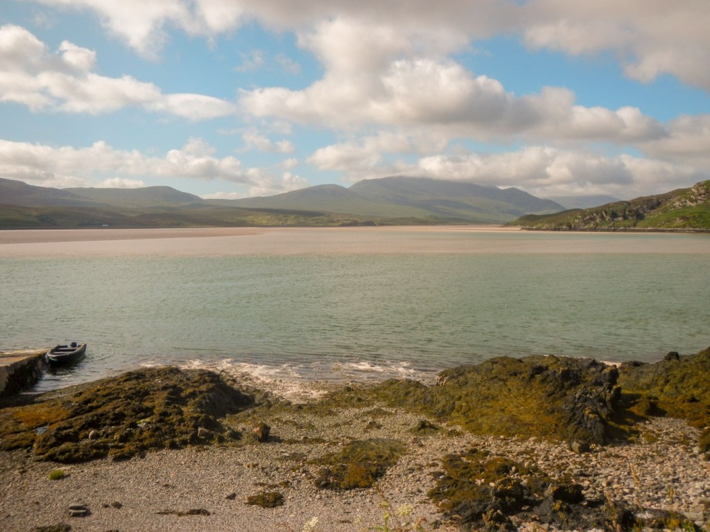
John, the ferryman signalled me to walk down the small slipway and onto the boat. I was the only passenger for the short journey across the estuary. It would have been even shorter but we were heading against tidal currents. John explained that he had been the ferryman for four years after taking over from his father who had provided the service for thirty-six years. He was anxious that I was aware that he would not be offering crossings for the next couple of days and I explained that my plan was to explore the area and walk out past Sandwood Bay on the other side of Cape Wrath. I told him that I was keen to spend time exploring having previously only visited the area briefly when I completed the Cape Wrath Trail from Fort William to Cape Wrath lighthouse.
A couple waiting on the other side helped me lift my loaded backpacking rucksack out of the boat and commented that it was heavy but of course easier to carry over the hills once on my back. They were on holiday in a cottage on that side and travelling back with all their rubbish as there is no disposal facility on the peninsula. Almost immediately the ferry left and I was alone to begin my expedition, entirely free until my planned meeting with my husband in two days time somewhere along the road between Blairmore and Kinlochbervie.
Initially I walked up the hill past a parked minibus, normally used to transport visitors from the ferry to Cape Wrath lighthouse; journeys are not being offered at that time until Covid rules relaxed. I was keen to leave the potholed road and walk close to the shoreline, so I turned off over some fields early on, only to return to the road soon after and notice some people with large cameras standing on the bit of road that I had just bypassed. These were the last people that I would see until nearly forty-eight hours later.

I soon turned off the road again, crossing a footbridge and did not see the road again at all until the next day. The shoreline consists of a plethora of entirely unspoilt beaches, geos, headlands and stacks. The going was slow as there isn’t really any proper path, although there are sheep tracks and, at times, a faint path as if other people had occasionally followed the route. Looking inland, I saw two very shy deer.


I sat on a beach to eat lunch. Of course I had the entire beach to myself. I could still see Faraid Head over the sea. This was to be my last point with mobile phone signal until near the end of the expedition almost two days later.
I had reached the military range area. Most of Cape Wrath is within the range and so access is only possible when there is no firing. Fortunately there was no firing at all during July. I crossed large areas of desolate coastal moorland, noting occasional old military vehicles with the ground surrounding them pockmarked with craters from previous exercises. I was careful not to touch any metal debris as notices warn about possible risk of explosion.
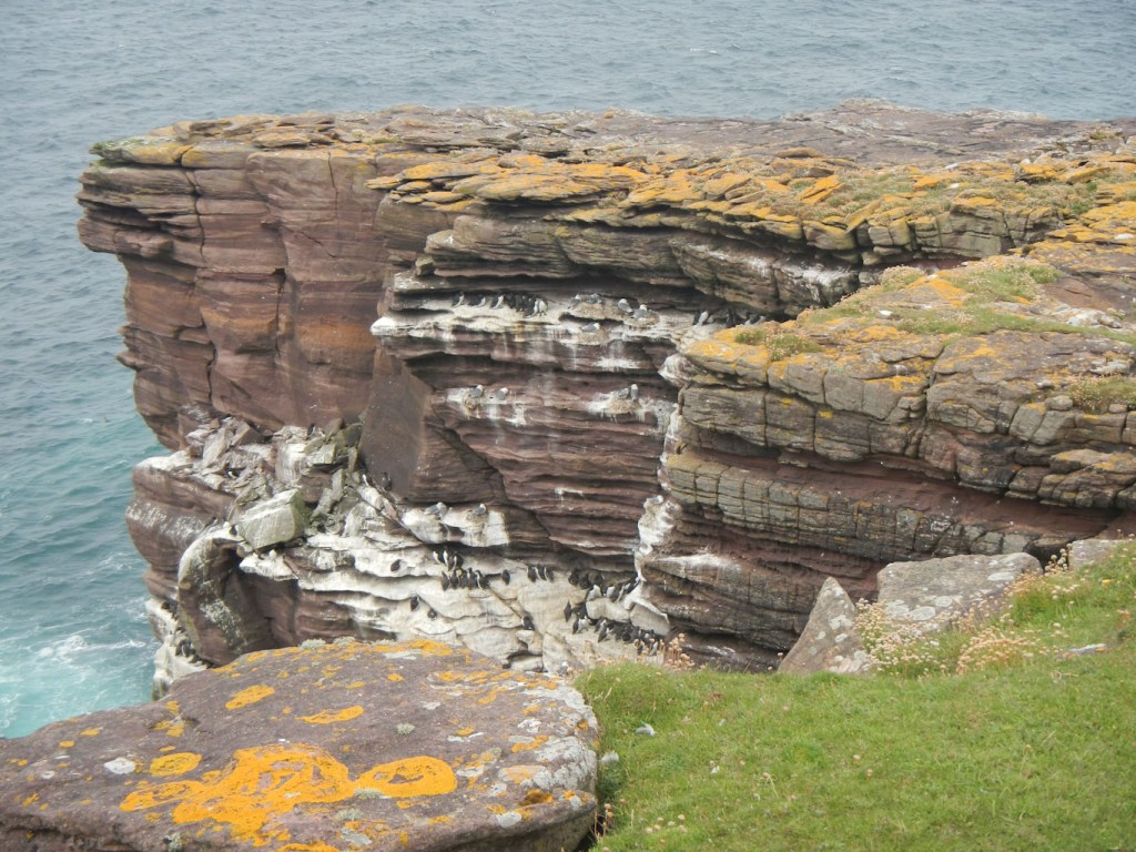
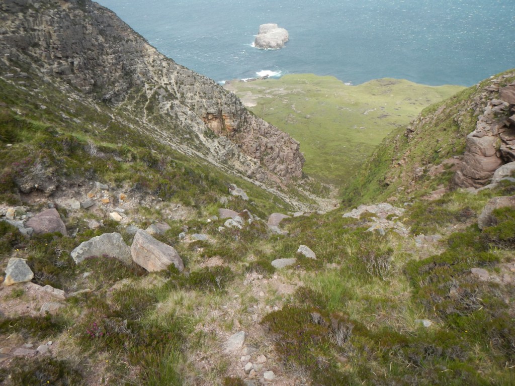
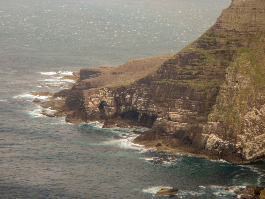
I proceeded further and arrived at an area with cliffs both below and above me, separated by a relatively flat area of a few hundred metres. I saw more awesome coastal scenery and a few waterfalls as streams from the moor descended over steep rocks to the sea. I saw three deer and then a whole herd – too many to count. I also started to see more seabirds until I reached a place where I couldn’t follow the coast any further as the cliffs above me towered up and descended to sea level.

At this spot, I could see nesting black cormorants. I also saw some puffins but no evidence of burrows here. A couple of great skuas flew over, no doubt terrorising the other seabirds.
I had to back track, but not completely back to where the high cliffs began as I spotted a gully that was almost dry due to the recent low rainfall. I was able to climb this and reach the flatter area above the cliffs (about 270m). The wind appeared to have increased again.
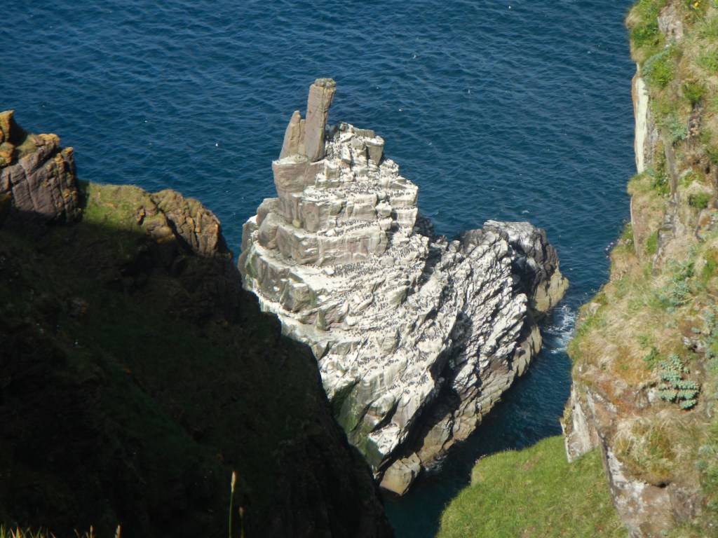
Almost immediately, I descended again to around 170m above sea level, following the undulating cliff edge (not too close in the windy conditions). There were birds everywhere: flying puffins, birds on the sea, nesting cormorants and, I think, kittiwakes as well as lots of fulmars. I even spotted a natural arch with birds flying through it.

I descended to sea level again at Kearvaig, where there is a bothy. It was almost 6pm (my climb up the gully had been time consuming with a full backpack). I opted to pitch my tent in a sheltered area next to the dunes and close to a convenient stream descending off the moor. This was a convenient water supply.
Kearvaig bay 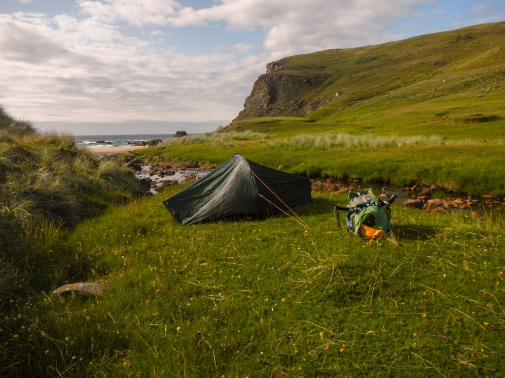
Campsite by stream and overlooking sea
After a brew up and dinner, I explored the area. I visited the bothy, but there was no one there so I had the huge beach to myself. I spotted some puffins with burrows high on a cliff above the beach, oystercatchers on the lower rocks, black cormorants on a stack and a flock of fulmars. I could see a natural arch on a distant headland in the direction of the lighthouse. As the evening continued, the tide rolled in, I saw deer on the hill and I watched the sun set over the sea. I even wondered whether after this camp, Sandwood Bay, which is widely acclaimed as a top wild camp site, would be an anti-climax!
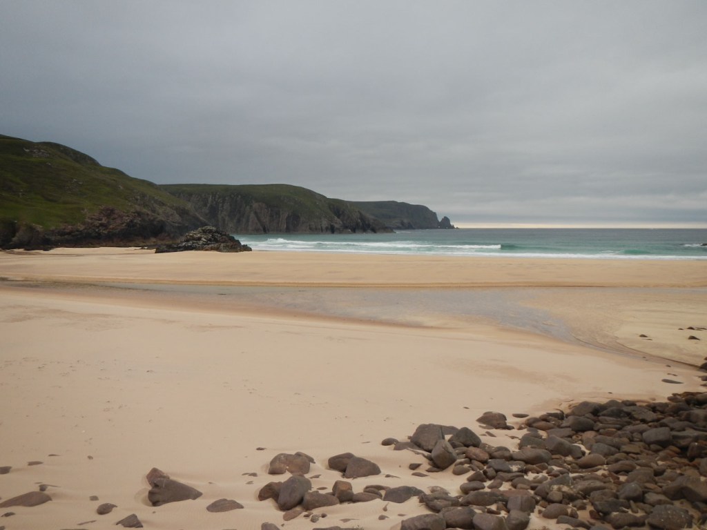
Deserted Kearvaig Beach 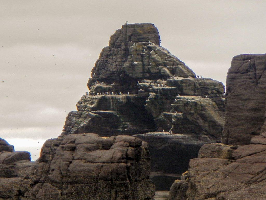
Cormorants on a stack near the beach 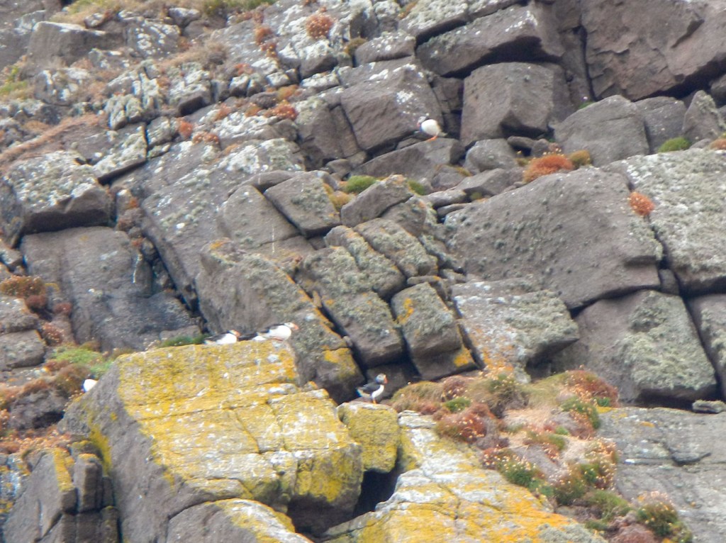
Puffins on the cliffs 
Sunset over the sea
By walking round the coastline, I had given myself a longer and much more arduous walk than if I had followed the road. Initially I had envisaged reaching the lighthouse on day 1. However I knew that the walk from the lighthouse to Sandwood Bay, where I wanted to camp the next night, should only take a half day, so I still had sufficient time.
Unfortunately the weather changed overnight. Of course I had no access to an up to date forecast so did not know what was predicted. Visibility had worsened and the wind was much stronger.
I crossed the Kearvaig River and climbed up what was, for this area, a distinct path on to the cliffs. I battled with a cross wind, eventually descending to sea level again at an old jetty. From there I climbed to the cliff top level by following the side road up to the “main” Cape Wrath road.

View from cliff top 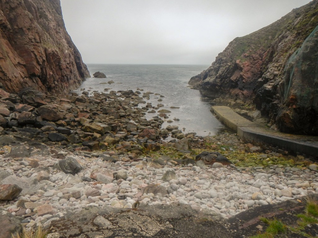
The old jetty
I could have followed the road to the lighthouse but instead opted to head for the coastline again, passing some interesting rock formations, many stacks and a natural arch. I saw more deer; so many sightings that it was no longer even noteworthy!
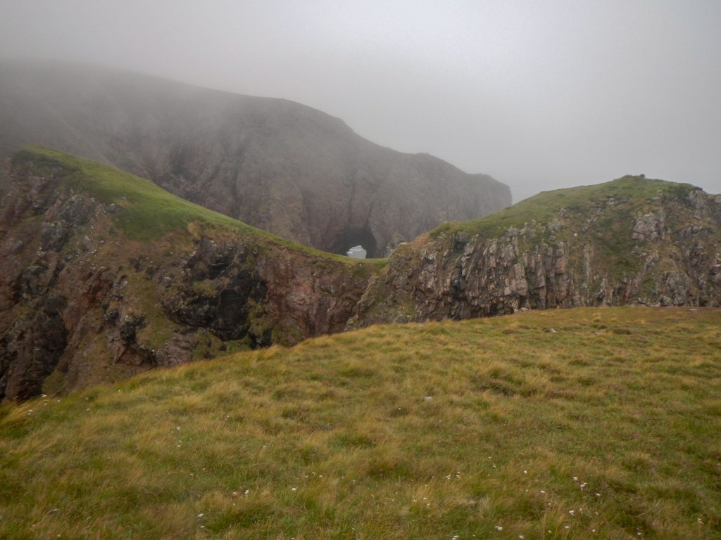
The visibility was becoming worse and the wind seemed even stronger. I arrived at some disused lighthouse out buildings but couldn’t find the lighthouse! In the end I resorted to using my Satmap for the first time on this expedition, to enable me to navigate to the lighthouse. It was only a few metres away!
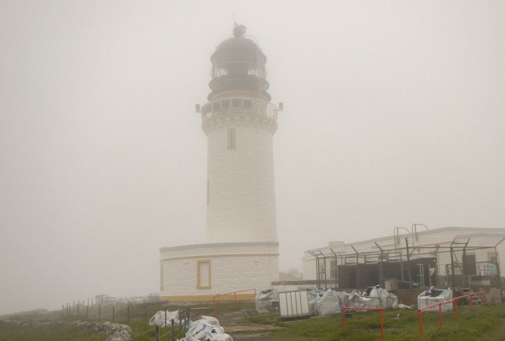
The weather was steadily deteriorating and there was some rain. I realised that my route to Sandwood Bay would be almost entirely walking against the strong and gusting winds. I hoped that I would be strong enough to walk into such strong winds. The door to the Ozone Café near the lighthouse was unlocked. I was unable to attract the attention of John Ure, the occupant here, when I rang the bell. I didn’t hear his dog either which I remember from last time so maybe he was having a break prior to the resumption of the minibus service. So I sat in the café, taking refuge from the elements and ate food from my rucksack – my first lunch of the day. Incidentally all this walking with rucksacks does use a lot of calories and I actually lost weight during the four weeks that I was on the Southern Upland Way and in North West Scotland. Sheltered from the elements, I plotted some key points to help me navigate on my Satmap for a route to Sandwood Bay in case the wind and visibility didn’t improve.
In fact I was fortunate that the peak of the rain seemed to be whilst I was sitting in the café. I stepped outside and carefully secured the door then headed down the road to the point where it seemed sensible to turn off and push my way against the wind across open moorland.
The weather went on improving – at least the rain stopped and the visibility was better. The strong wind persisted though with some phenomenal gusts, one of which knocked me off my feet. There was some respite with areas marginally sheltered and I was able to make steady but slow progress. With improvement in visibility, I ignored my previously plotted points on the Satmap and took a line closer to the scenic rocky coastline (but well away from cliff edges). I ate my second lunch sitting in a sheltered position in the valley formed by a small stream.
There is a tricky steeply sided valley to cross near the range boundary but fortunately this was fairly sheltered and I climbed across without incident.
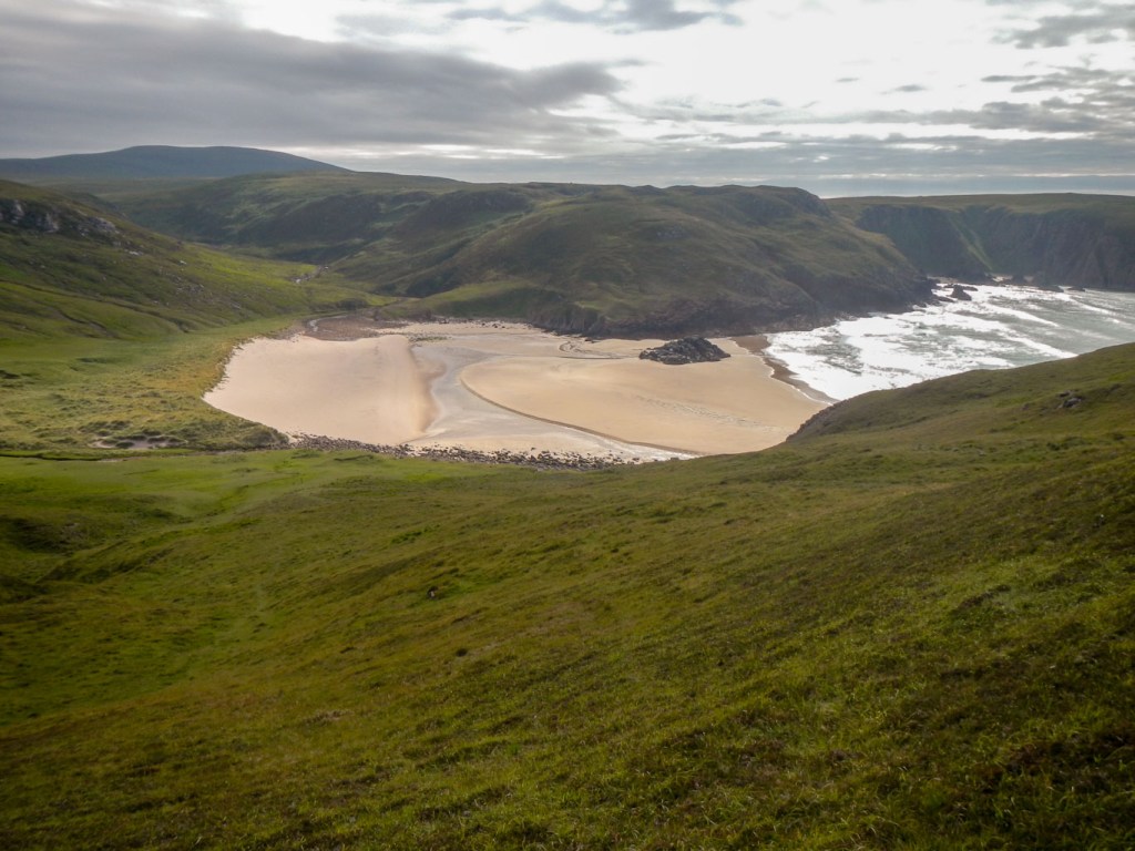
I topped up my water bottles from Strath Challeach, almost at Sandwood Bay. I was keen to camp near water as I only had two litres of water bottle volume in total. This is enough for my two meals but I would need more for my walk the next day.
Hence I camped in what is probably the less popular area. Anyone walking from the opposite more usual direction to camp and return would have to cross the Sandwood loch outflow to get there. I found a relatively sheltered spot by the side of a rather trickling stream, opting to double chlorinate the water from there, use it for cooking and hot drinks so it was boiled too and save one of my litres from the previous stream for drinking cold.

There was no-one else at all in the vicinity. Having arrived at 4pm, I enjoyed a long relaxed evening, wandering round the cliff and dune area and down to the beach then sheltering in my tent away from the wind looking out at views of the sea and watching the tide come in.
The sole was starting to come off my boot (and these were my spare pair as the uppers on my main pair had already split a few days earlier following the Suilven walk). Anyway I was sure they would last for what would be mainly a walk along a track and road next morning.
It was a windy night, but my tent survived. Each time I woke I heard waves breaking on the shore. My alarm was set at 05:00am to ensure I reached the road around 09:00am, the very earliest that my husband could be there. I stayed in my tent out of the wind to eat breakfast, just sticking my head out to reach my stove where water was heating for my porridge and coffee.
I knew that at the current state of tide I would definitely have to cross the Sandwood Loch outlet above the tidal level so walked over the cliffs. From there I walked across the soft sand on the main part of Sandwood Beach. I spotted only 4-5 tents in this normally popular camping spot. Soon I reached the path and then the track. There were superb views of the bay as I climbed the hill. Two men with less heavy looking rucksacks overtook me – these were the first people I had seen since soon after my arrival on Cape Wrath peninsula almost forty-eight hours earlier. Some walkers were already heading towards me from the road four miles away even so early in the morning.
I turned on my phone and soon entered an area where there was some reception as I heard lots of pinging sounds. I had multiple messages from my husband. He was planning to meet me at the previously arranged time and area. However, it had indeed been windy – the gales had led to every tent bar one on the Durness campsite either being blown down or prophylactically taken down. My husband had returned from a walk the previous lunch time to find that the Vango and one other tent were the only remaining pitched tents on the site. The forty-two year old Vango had survived apart from two broken poles so clearly withstood more than all the other tents except one. A piece of “trim” had been blown off the car roof. Some other campers had kindly helped him to take the tent down. He did have my old Terra Nova Laser 1 backpacking tent in the car but didn’t know how to pitch it having never done so before and not keen to try in a gale.
He had managed to contact Douglas at the Crask Inn and stay there overnight. Unfortunately this added a hundred mile round trip to collect me rather than a ten mile or less diversion on the way home.
I continued to walk into the wind and reached the road. Sure enough after walking for a mile or so on the road I saw a familiar looking car heading towards me. My Cape Wrath adventure was over!
