22 June – 4 July 2021
Coming hot on the heels of my Isle of Mull and Kintyre adventures, not to mention my Brownsea expedition, as well as some work commitments, planning time was at a premium and so a National Trail with mainly wild camping seemed an ideal solution. However what I hadn’t appreciated was that the Southern Upland Way (SUW) is probably the most remote of all the National Trails with spectacular scenery at every stage. In addition, probably due to the remoteness of some parts of the trail and the difficulty in organising accommodation at reasonable intervals on all sections, it also appears to be one of the lesser walked. Although the trail passes through and near huge windfarms and large forestry plantations, this does little to detract from the glorious isolation and sense of space in the dramatic landscapes which unfold along the route. It was overall a very much more exciting and interesting expedition than I had expected. In addition, this is border country with interesting historical artefacts dating from prehistoric times, Roman remains, classic drove tracks, memorials relating to the Killing Times of the seventeenth century when the “Covenanters” who objected to Episcopalian interference in their worship were mercilessly persecuted, as well as the historic industrial lead mining landscape at Wanlockhead, in peak production during the nineteenth century.

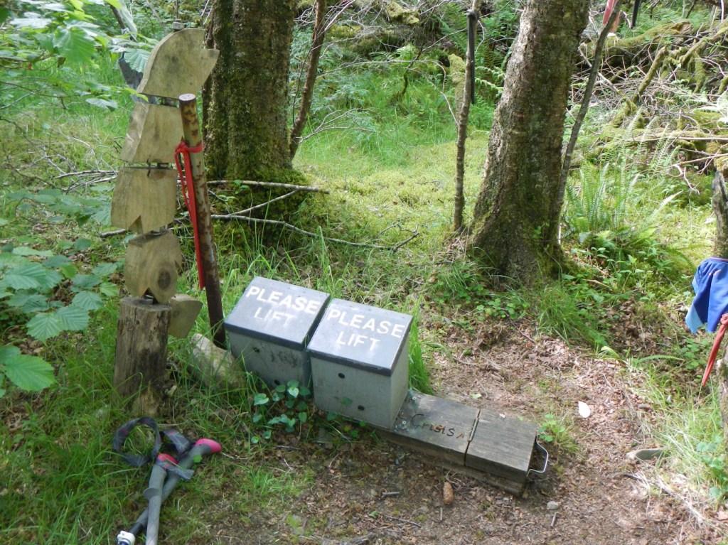
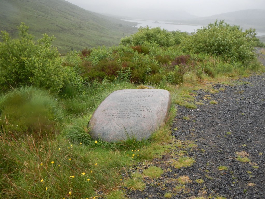
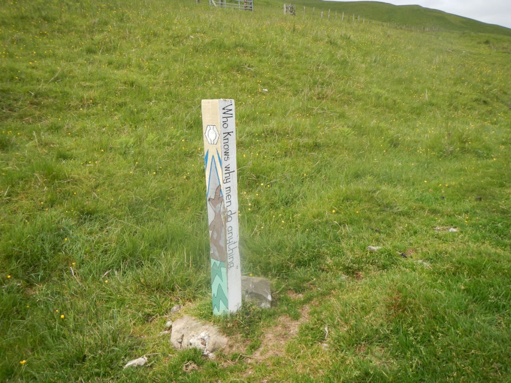
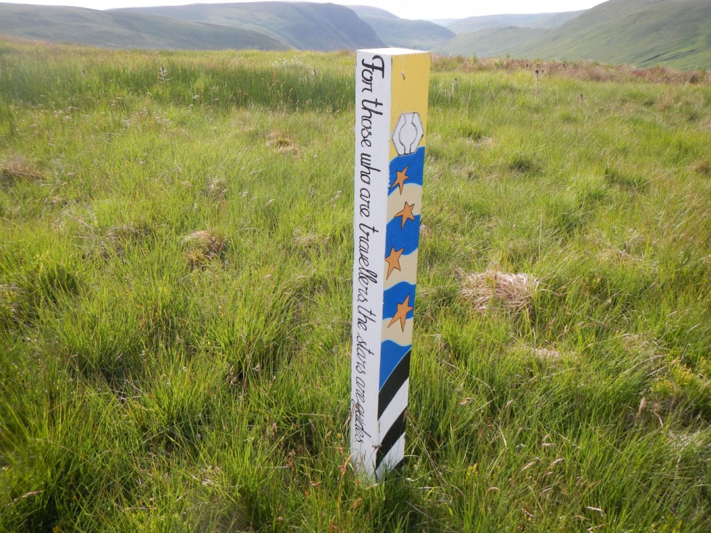
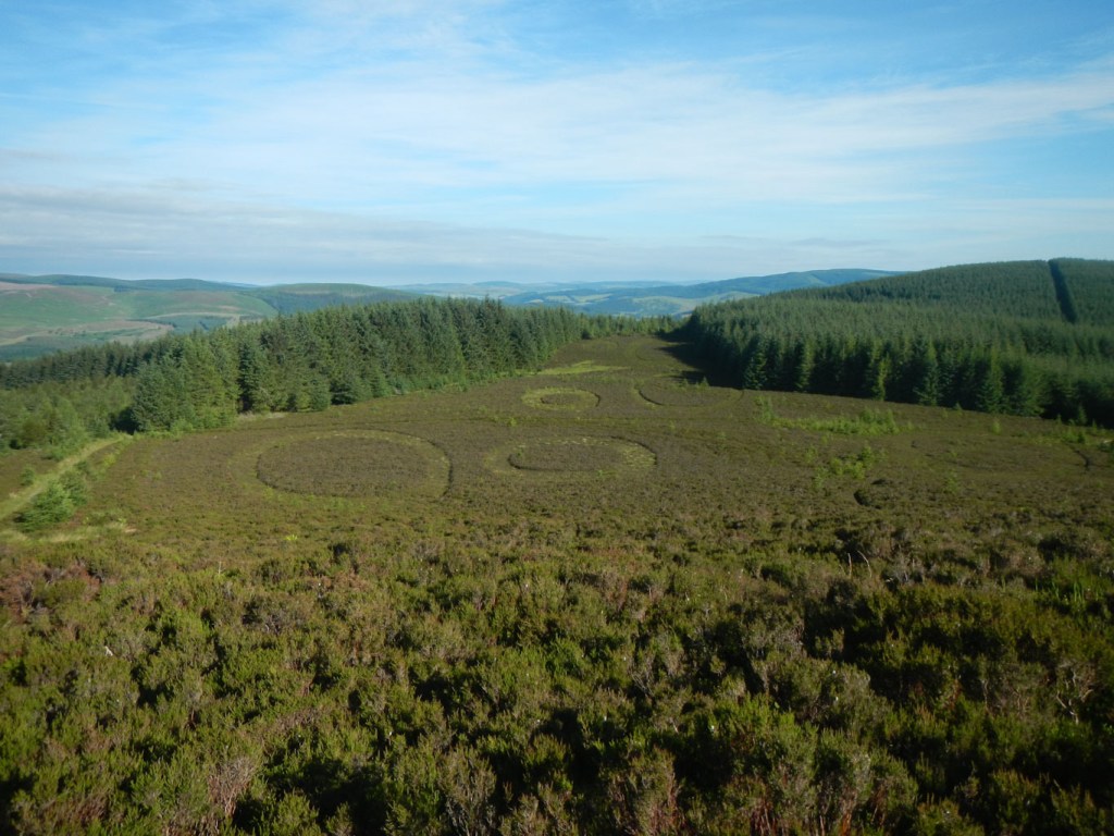
An interesting feature of the route is the opportunity to discover special mementoes – “the hoard”. At thirteen remote places on the SUW there is a “kist” to be found. This is a small box containing specially minted “coins” engraved with images representing some aspect of the archaeology, history or wildlife of the hiding place area. In my rush to organise the expedition, I had omitted reading introductions in my guide book and so these “kists” were an interesting surprise. It is possible to find out the approximate locations which makes the search easier – in fact as I was just generally on the lookout but did not know where to concentrate my efforts, I only found five of the treasures. I know that Anna from Kendal, who I met on the trail, found twelve (had it not been for some cattle on the path distracting her, would probably have found all thirteen).

I travelled to Stranraer the day before I started, staying there overnight, then caught the almost empty early morning bus the few miles to the start point at the picturesque coastal town of Portpatrick on the west coast of the Rhins Peninsula with its horseshoe shaped bay and small harbour. Armed with my Cicerone Guide to the SUW and my Harvey’s SUW map in addition to my fully loaded backpacking rucksack, weighing up to 18kg depending on food and water supplies, my adventures were about to commence.
Map 82 adventure:
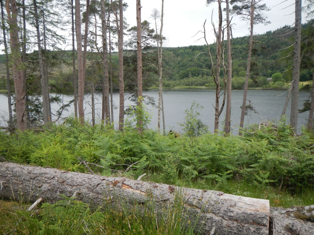
I set off walking on a glorious warm summer day, quite unlike the relatively cool rainy weather in Exeter the previous day. Enjoying such good weather in Scotland, while the rest of the UK was cooler and rainy is certainly unexpected. The walk began with a wonderful stretch of rocky coastal path before turning inland. I even saw a couple of deer.
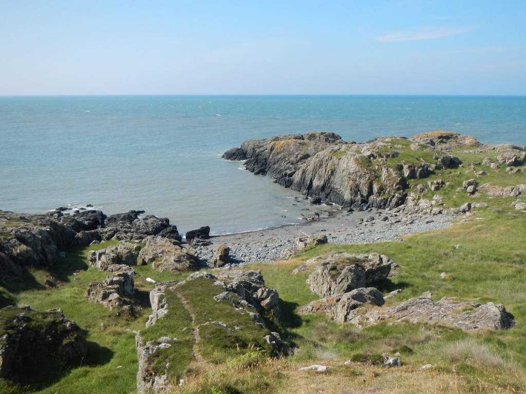
The main excitement of the day was discovering two “kists” and collecting the coins. They were both quite obvious and I even thought that I might find them all if it was this easy! However this early success did not continue and I only found three more on the entire journey.

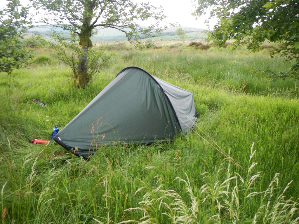
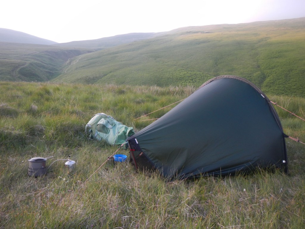
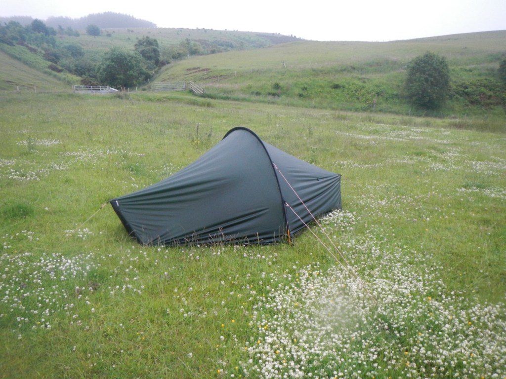
I had a few encounters with cows, taking avoiding diversions initially just after turning inland on a minor road and subsequently towards the end of the day near the Water of Luce. The dry conditions meant that the streams on the desolate moorland of Kilhern Moss, where I had planned to camp were dry in places. However I found a pleasant camping spot on the moor, taking care that there were no cattle in the vicinity.

Unfortunately I awoke to discover that the weather had changed – it was raining with poor visibility. However I was still able to find and identify the unmarked chambered cairns – the Caves of Kilhern – on a short diversion from the main route.

Map 76 adventure:
My route passed through a large windfarm complete with warning notices not to walk through during electric storms and to beware of ice and snow sliding off the blades. Although it was rainy with poor views, fortunately there were no forecast thunderstorms and it certainly wasn’t icy.
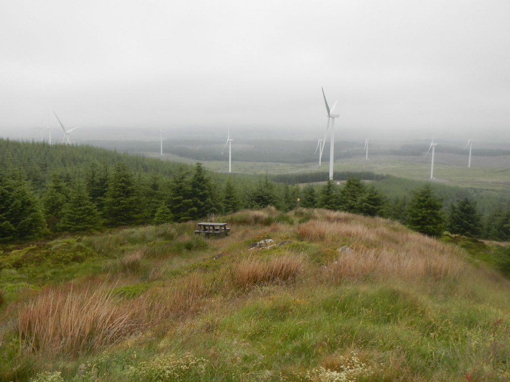
I met a worker completing path maintenance deep in the wood and he explained that the path had been gravelled at the time that the windfarm was built. This made for uncomfortable walking but at least it wasn’t boggy.
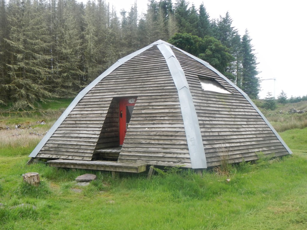
In a clearing in the wood, I discovered the amazing Beehive bothy structure just in time for lunch. This provided welcome respite from the midges and from the rain.
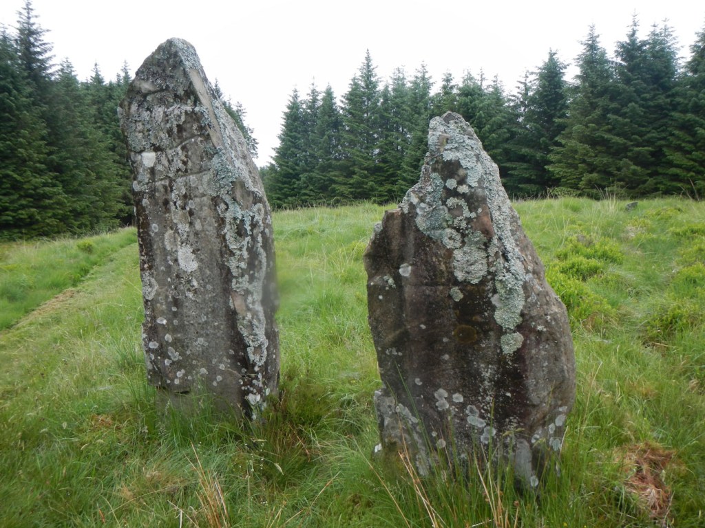
Shortly after lunch I passed the Laggangarn Standing Stones, dating from about 4,000 years ago but with the addition of Christian cross markings probably made in the eighth century.
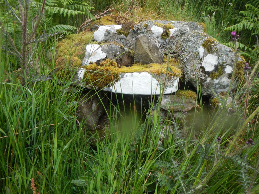
I subsequently made the short diversion to the “Wells of the Rees” – dome like dry stone structures built over tiny springs.
The diversion to the grave of Alexander Linn a Covenanter from New Luce who was shot on the spot in 1685, seemed a step too far, as I was getting tired and still had quite a way to go to reach the woods near Bargrennan where I had planned to camp.
Map 77 adventure:
I spent a long time on this map – a camping night near Bargrennan, a further camping night south of Loch Dee, a night at the Clachan Inn in St John’s Town of Dalry and a night camping on the hillside above Polgown before finally moving to Map 71 while completing the ascent and subsequent descent to Sanquhar.

Finding a place to camp in the woods above the River Cree was difficult. I was fortunate to find, after a long day, a reasonably flat spot sufficiently clear of vegetation just beyond the old wall where the path turned away from the river.


Waking the next morning, the weather was dry and sunny so I enjoyed walking alongside the picturesque River Minnoch and Water of Trool. This was a wonderful path with stinning views of trees, water and mountains but unfortunately signs soon advised crossing the high footbridge across the Trool in order to avoid forestry work related path closures. I followed the road as advised. In retrospect I re-joined the main path again too soon near the old Caldon’s campsite. However I enjoyed a magnificent walk above the south side of Loch Trool and, having got so far, continued when there were notices advising path closure.
Unfortunately as I walked above Loch Trool, the clouds and rain arrived. I had planned to camp near the White Laggan Bothy above Loch Dee, but was put off by the warning that as it is car accessible it can get taken over by drinking parties. I walked on and camped on some rough ground by the side of Green Burn, still fairly close to Loch Dee. I was glad to be in the dry of my tent as it poured with rain soon after I arrived. Midges were at their most troublesome yet and I realised that some were hitching a free lift trapped inside my tent all day although appearing to die in the process. However in the relative sanctuary of my tent I continued to read Patrick Leigh Fermor’s erudite account of his early 1930s journey across Europe, where, in my reading, he had reached Transylvania (Between the Woods and the Water).
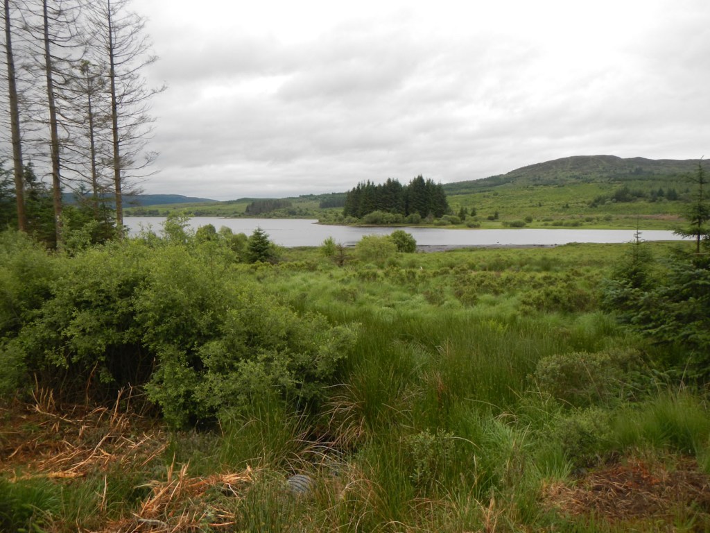
Runic stone and Loch Dee 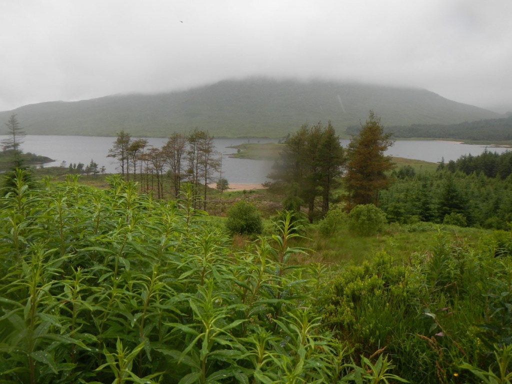
Loch Dee
The night was dry and I was up early the next morning as I thought that rain was forecast for later in the day. I had no phone or internet reception so was unable to check. In fact amazingly there was no rain for the next eight days!
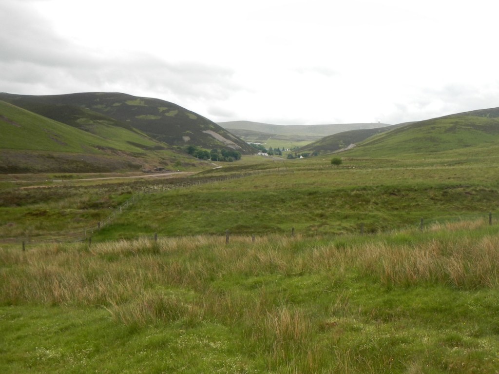
Chatteringshaws Loch was just as scenic as those preceding.
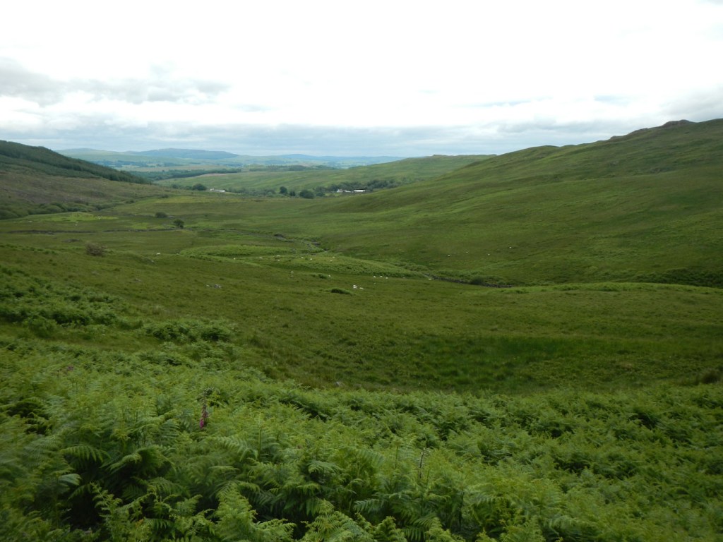
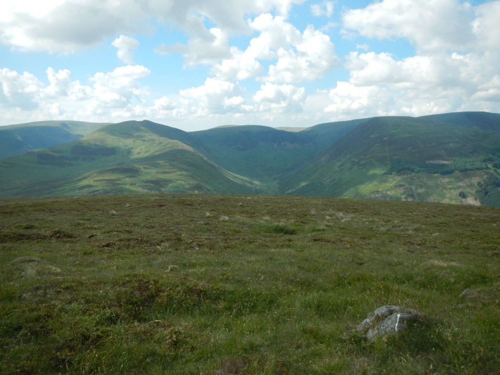
Climbing over Shield Rig, on the edge of the remote Rhinns of Kells, there was an incredible feeling of space, air and remoteness that was to become a familiar sensation during the next sections of the walk.
I reached a minor country lane where the farmers were busy moving sheep. All was well until, as I was eating lunch sitting at the edge of an unfenced field, some sheep appeared over the hill. On seeing me they took fright but fortunately the experienced dog and rather surprised farmer (who did not know I was there) managed to control the situation. Embarrassed at having disturbed his farming work, I apologised but he was equally apologetic about disturbing me.
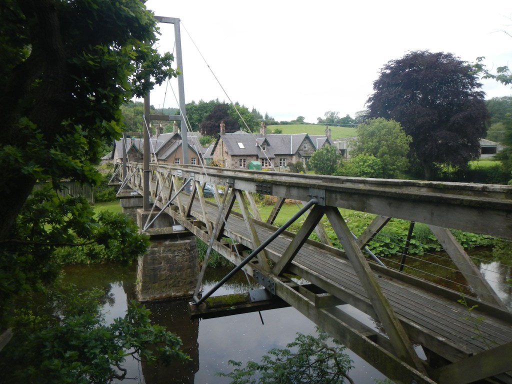
I reached St John’s Town of Dalry early following my prompt start. The view of the town from the hill was magnificent. Crossing a large suspension footbridge, I reached the church and went to look at the Covenanters’ Tomb in the churchyard. I was delighted to be able to book in early to the Clachan Inn and have lots of time to enjoy not one but two luxurious soaks in the bath, wash some clothes, buy some provisions and even wander round the town, including finding the seat at the top of the steep main street where St John the Baptist reputedly sat and rested.
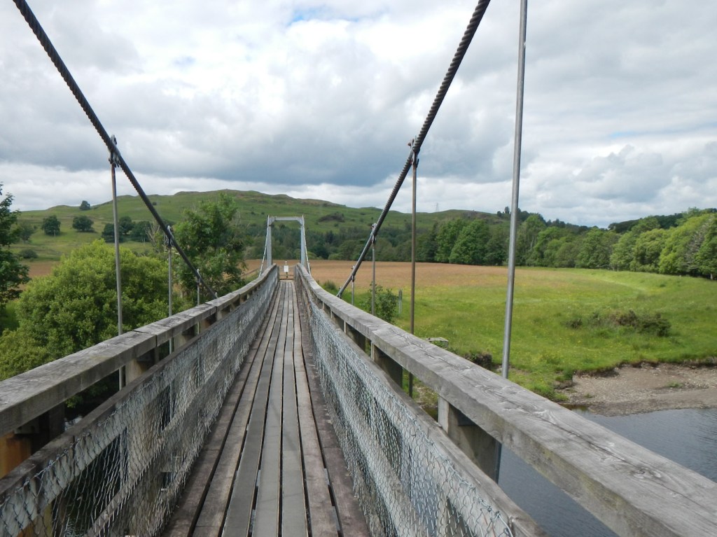
Suspension Bridge 
John the Baptist sat here! 
The Clachan Inn – welcome luxury after three camping nights
Next day, I was soon away from the town and met no-one all day – amazing on such a fantastic range of hills on a beautifully dry and sunny summer Saturday. This was the best day of the walk so far – including splendid open views and sightings of red kites.
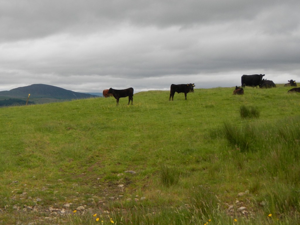
Cattle on the path best given a wide berth 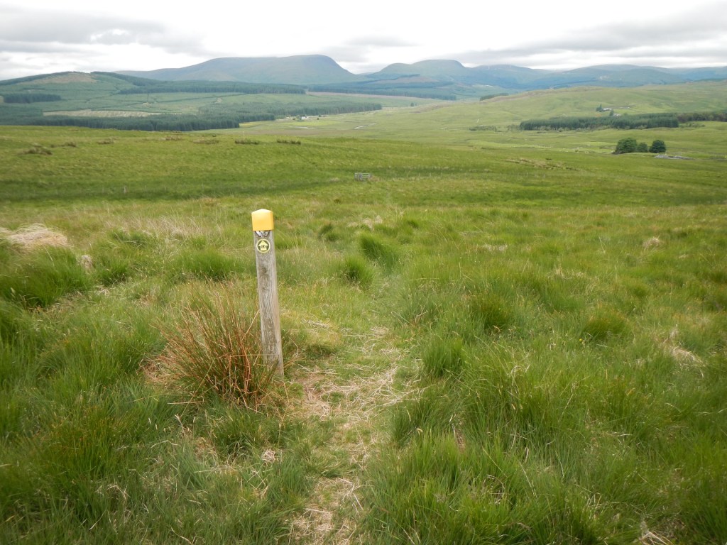
Open landscapes
If I had to pick a highlight that day, it would be suddenly reaching the summit of Benbrack, complete with the huge sandstone arch created by local artist, Andy Goldsworthy. From the trig point, looking through this arch, I could see directly through the arch, the second one on Colt Hill 2.5km away.

Eventually the path descended from the hills into woodland and I saw another martyrs’ stone commemorating murdered Covenanters who were shot locally and “followed Christ to martyrdom”.

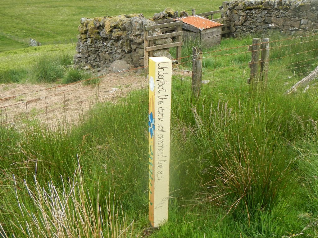
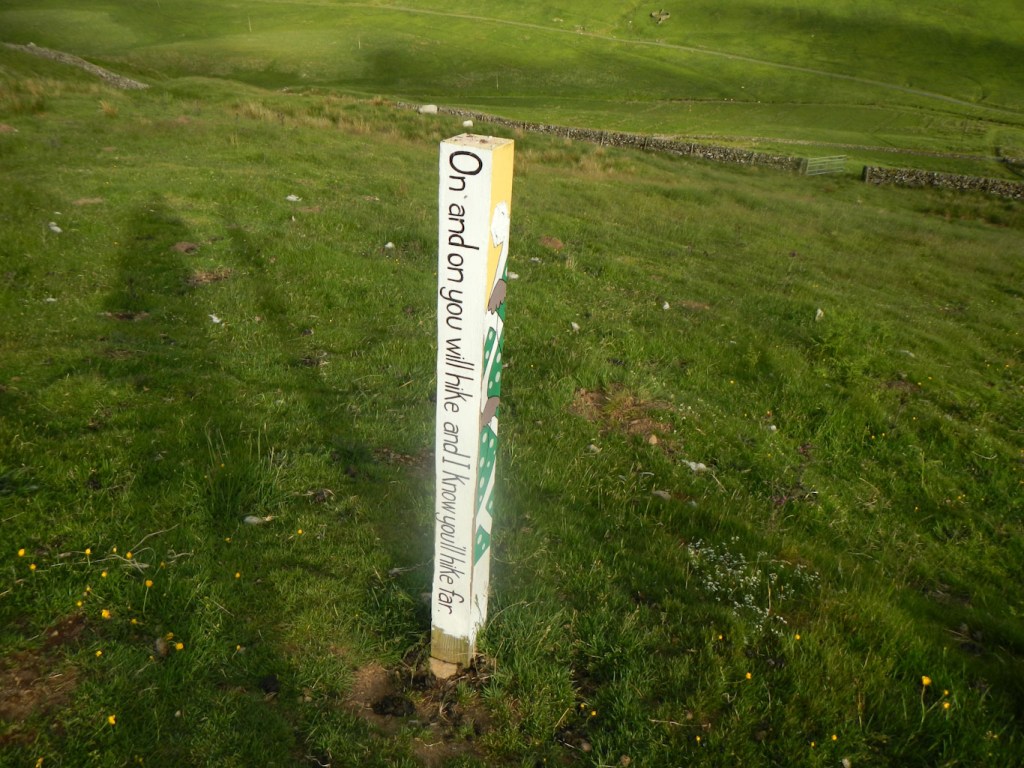
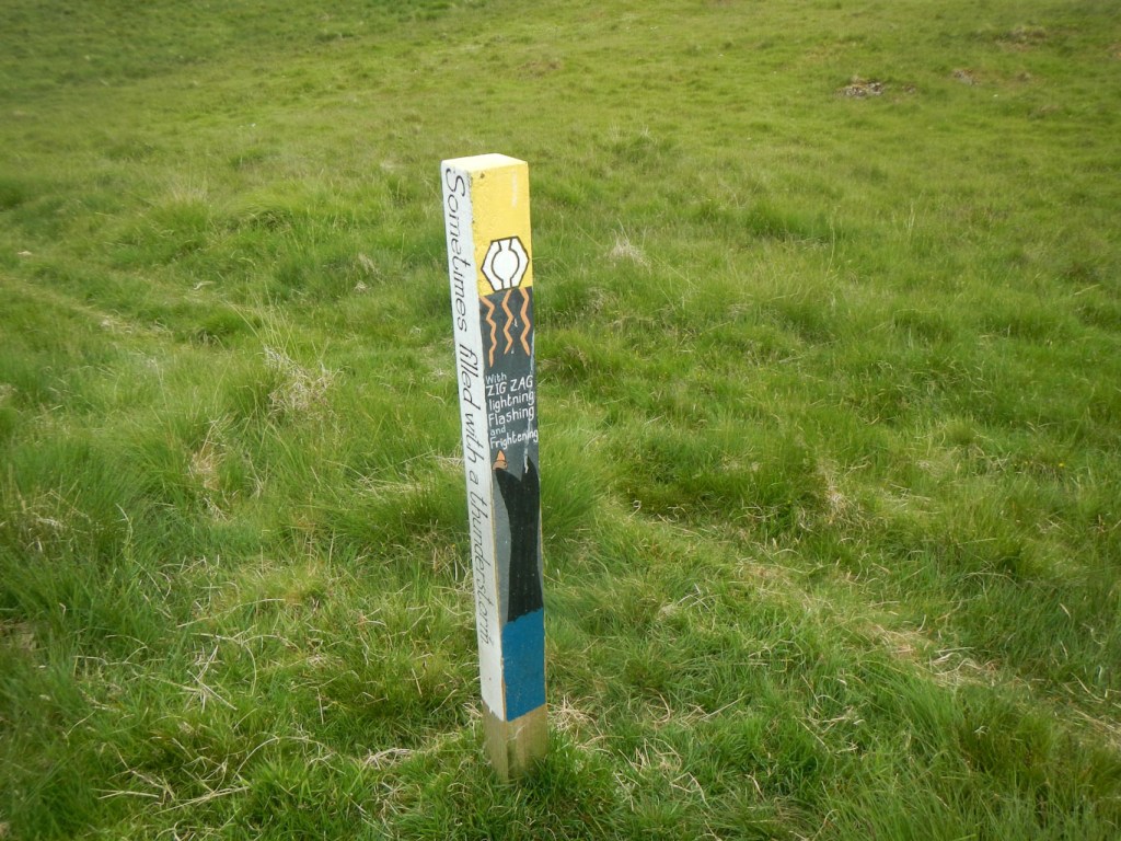
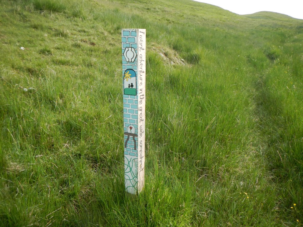
I reached the Polskeoch Bothy but knew I had a long walk planned the next day so walked on past Polskeoch Farm and Polgown, finding a superb camping place high above Polskeoch Burn, close to one of its tributaries. A notable feature here and in the next few kilometres was that the frequent way marker posts had been very professionally decorated seemingly by local primary schoolchildren no doubt helped by their teacher. The pictures and words certainly boosted my morale.


Map 71 adventure:
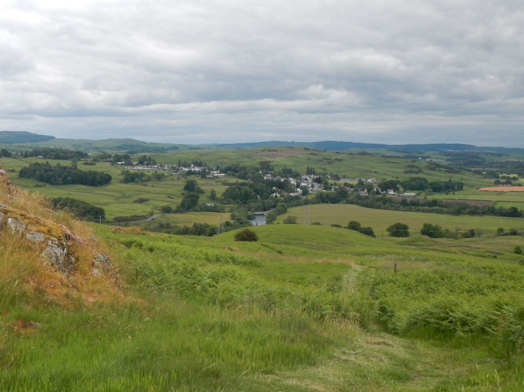
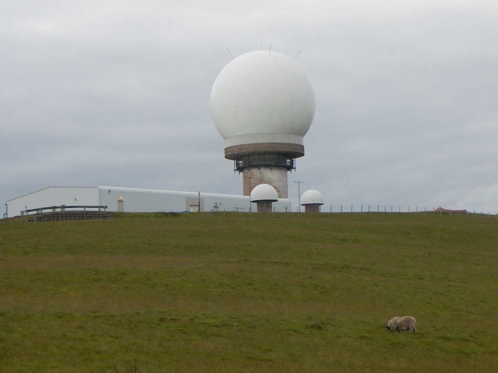
The highlight on this section has to be the walk from Sanquhar to Wanlockhead over lofty rolling hills prior to the descent into Wanlockhead. The initial views back to Sanquhar and the hills beyond are stunning. There follows an undulating trek across open moorland before a path downhill to Wanlockhead, which is Scotland’s highest village. There are multiple old mine workings, equipment and spoil heaps. Unfortunately I paid only a fleeting visit as my objective for the day was further on.
Approach to Wanlockhead 
Old lead workings
Map 78 adventure:
At the time, at the end of a long day, the climb up Lowther Hill seemed never ending. This was compounded by it being a hot day and the fact that I had avoided refilling my water bottle from a stream near Wanlockhead in case I got lead poisoning. Many of the streams on Lowther Hill were dry. However I reached the summit eventually and soon after that thankfully I found a trickle of water.
I had planned to camp next to Potrenick Burn just after leaving the short stretch along the A702. However in the end I reached the dip between Comb Head and Laght Hill, decided that my weary legs were good for no more climbs that day so descended towards Potrenick Burn to camp next to a tributary. The ground would probably normally have been too boggy but it was so dry….. It was a lovely spot but sadly the midges thought so too.

I decided not to stay with the midges for breakfast so climbed Laght Hill, where I was delighted to discover my third kist and retrieved a coin. As I ate breakfast high on the hill but past the summit, Gavin and Anna from Kendal passed by. They had seen my entry in the visitor book at the beehive bothy and we had met the previous day on the trail. However they had opted to spend the night camping at the garden of the Inn at Wanlockhead and had made a very early start to get to Beattock in time for Gavin to catch public transport back to Kendal for work the following day.
Kist found before breakfast 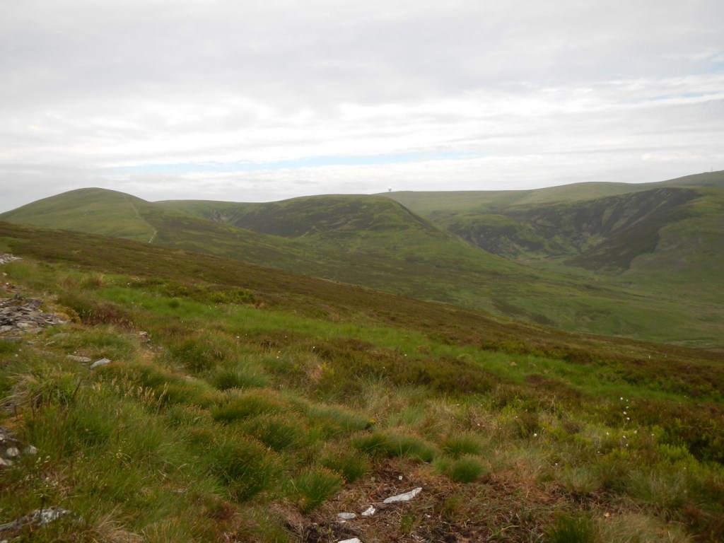
A great view while eating breakfast
The place where I had planned to camp but been too tired to reach looked very pleasant but I am sure would also have been full of midges.
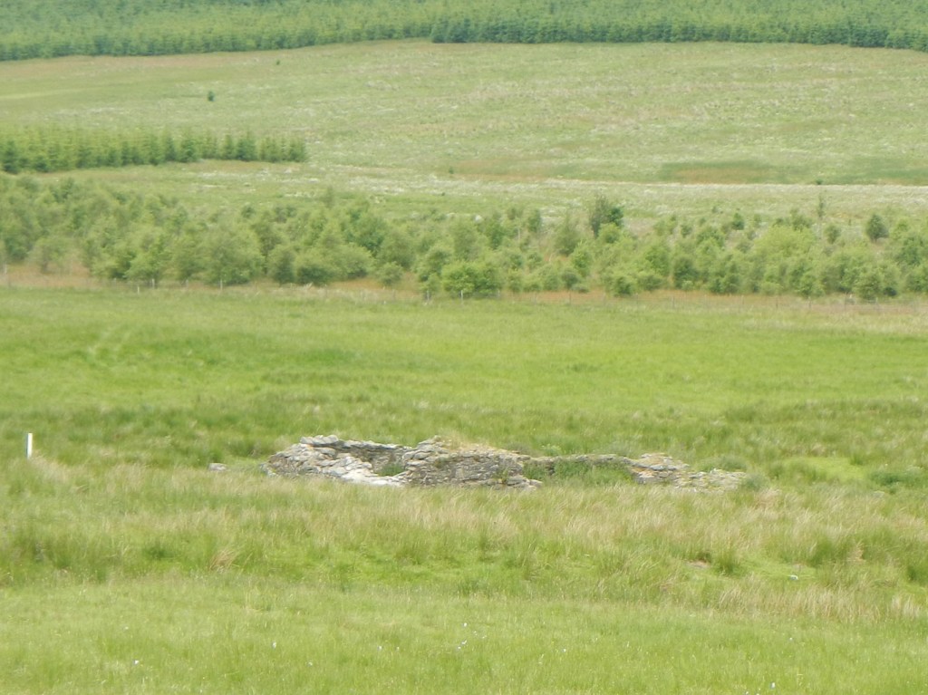
Remains of Bastle House (fortified farmhouse) 
Half-way! 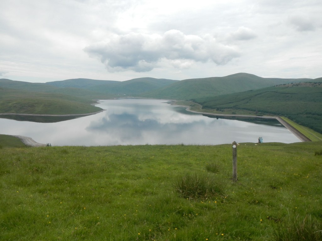
Daer Reservoir
The route passed close to a prehistoric stone circle and the remains of a fortified farmhouse before reaching the dam of the Daer reservoir and climbing high above it before passing along forest tracks and a small lane to Beattock from where I walked to my planned hotel stop at Moffat.
Map 79 adventure:
What a pity that Gavin had to go home as I would rate this the best day of the entire walk.
After walking through an interesting old deciduous woodland, intriguingly passing a notice “Persons pass through the wood at their own risk” there is an ascent to a marvellous viewpoint at Croft Head. I sat on the bench in the sweltering sunshine enjoying the view and Anna walking up from where she had stayed at Beattock overtook me.
Soon after that, with Anna still in sight, we both found another kist with coins in the box. Well, to be honest, Anna found it and gave me a really large clue!
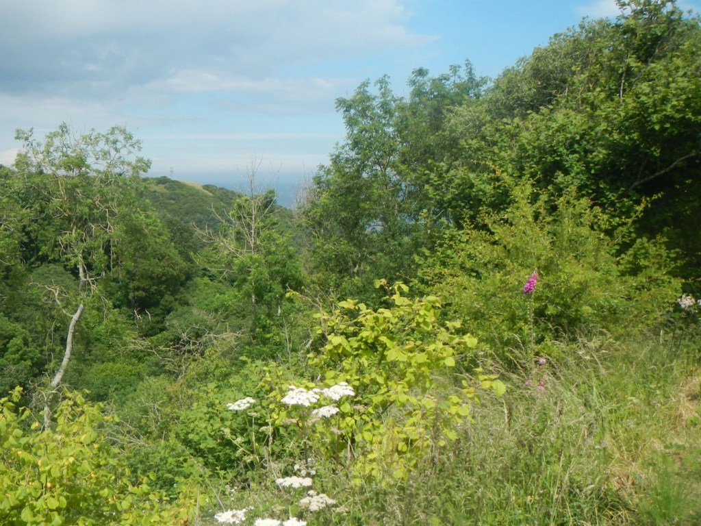
There is a quiet metalled road to follow down the Ettrick Valley for 9km soon after passing abandoned buildings at Potburn. Following an idea in the Cicerone Guide, I opted to turn off the waymarked trail and follow an unofficial high route, particularly given the excellent weather conditions with brilliant visibility. This was actually my favourite part of the entire walk. Having become accustomed to the comfort of frequent way markers confirming progress, it was somewhat daunting to be at high level on an unfamiliar moor. However with the help of my map and compass I climbed over Bught Hill and reached the high ridge at Bodesbeck Law. Having reached the ridge, it was possible to see that fences guided the way and it was merely a case of keeping track of how far I had walked along the ridge. The lack of a path in places and all the tussocks meant it was hard going at times, although nothing worse than the Dartmoor terrain to which I am accustomed. Views were superb and I could see hills going on in layer after layer towards the horizon, sometimes encompassing the entire 360 degrees of the panorama.


Towards the end, I also enjoyed splendid views of St. Mary’s Loch, where I would be heading the next day. Of course it took me considerably longer than the road walk would have done because of the large amount of ascent and descent but, in the perfect weather conditions, I was extremely pleased to have taken this option.

Eventually I reached the final summit at Peniestone Knowe, the culmination of my glorious ridge walk. I was drawn by a footpath sign that I could see in the valley but, in fact, this was a sign for the path to Ettrick Kirk and not a SUW sign. Fortunately I realised quickly that I should not be going up out of the valley and I headed back downhill towards my water supply for the night from Scabcleuch Burn.
I found a wonderful place to camp high above the burn and pitched my tent, tired but very happy after such an awesome day of perfect hill walking.
Map 73 adventure:
The next day, part way along the southern shore of St Mary’s Loch, I was on map 73. The loch, which is the largest natural loch in the Borders and Lothian Region, is beautiful.
Climbing away from the east end of the loch, I came across the partially ruined Dryhope Tower, built for defensive purposes in the fourteenth century. I diverted from the path across a field to visit it and climb to the top using the steel staircase inside. The reward was magnificent views of the loch – the weather once more being sunny and warm with clear skies.

The route went over yet more hills with views and down to Traquair.

I planned to camp above Traquair but was anxious about a water supply. After an abortive attempt to pitch my tent in an area where I decided there was too much undergrowth although there was a small flowing stream, I descended marginally and camped on long grass in what I think was the grounds from where the Minch Moor Bothy was removed.
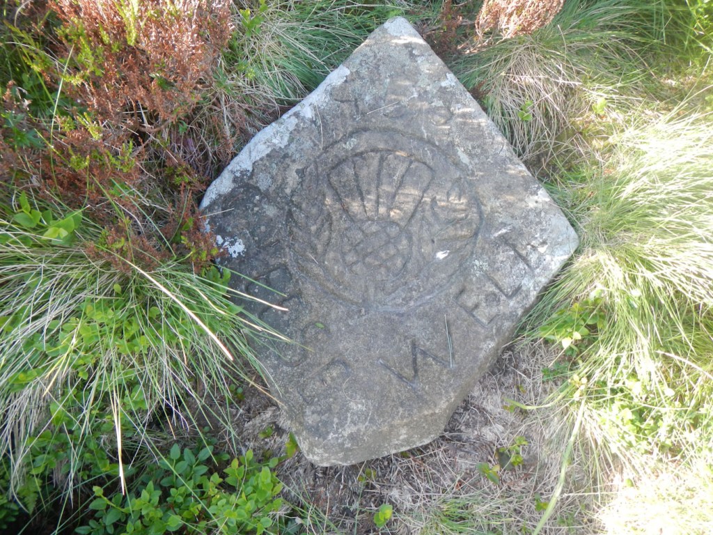
The next day was dry and sunny again. Climbing to the Cheese Well Spring, I was slightly disappointed that I had not thought the evening before about camping near this small spring. There was a lovely patch of short grass……
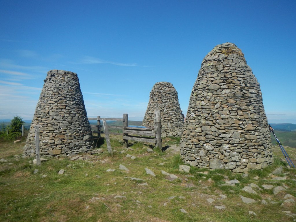
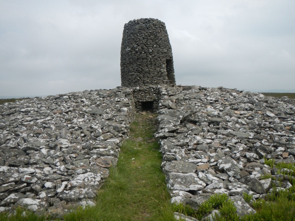
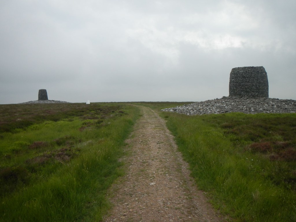
I didn’t take the optional diversion to the summit of the moor as I went there previously on my End to End walk when I walked over these hills in the opposite direction. The route here follows an ancient drove road. It is a superb airy track in its upper parts. Clearly lots of other people thought so too and there was quite a meeting at the highpoint of the Three Brethren named after the three huge stone cairns crowning the summit.
Having descended to the River Tweed, the weather seemed to get hotter and hotter – not that we should complain. Unfortunately I managed to miss a turning in Galashiels but was able to regain the route without backtracking. I’m not sure that it’s a good idea to have to walk past the sewage farm particularly on such a hot day (this was after I was back on the proper route). However in the end I arrived at Melrose where it was so hot that people were swimming in the river. I stayed in a hotel. After a rest and a lovely dinner at a nearby Italian restaurant, I had gained sufficient energy to wander round the town looking at the Abbey and the spectacular old chain footbridge over the Tweed, which I would be crossing the next day before following the line of Dere Street (an old Roman road most of the way to Lauder.
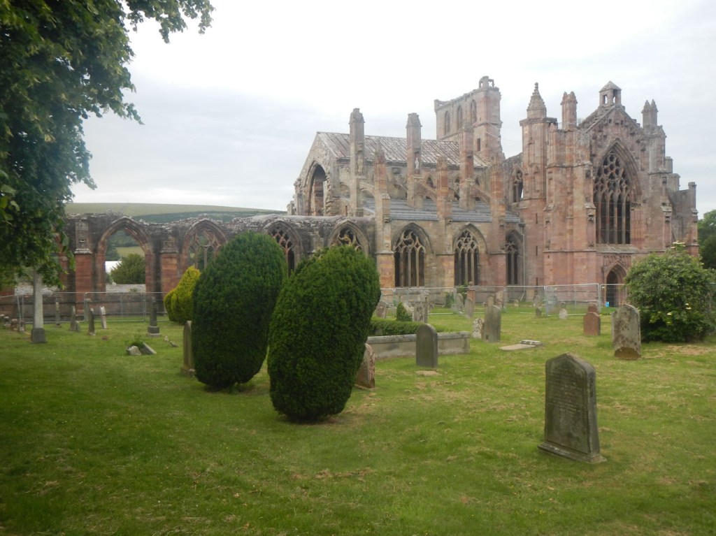
Melrose Abbey 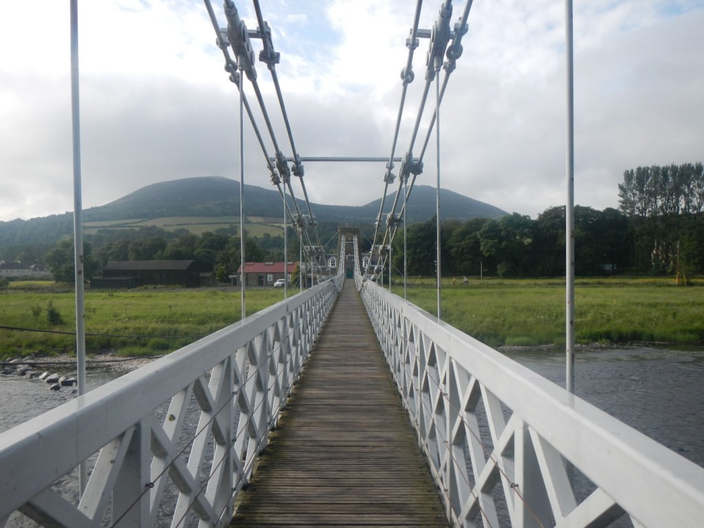
Chain Footbridge over River Tweed 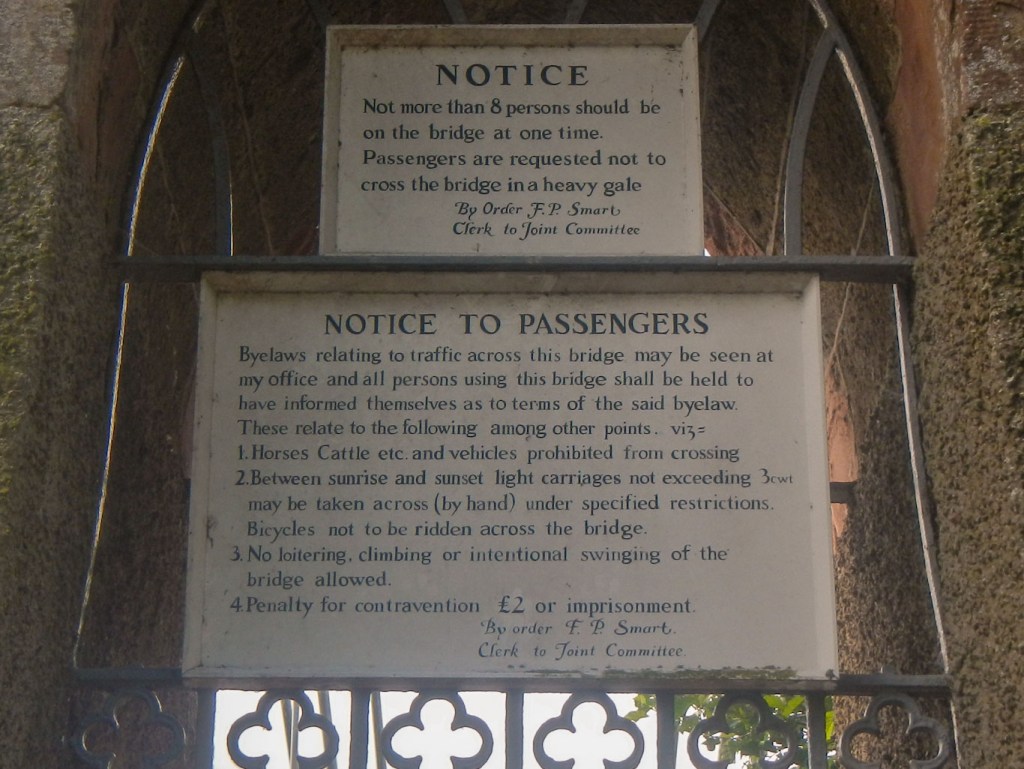
Byelaws for the footbridge
Map 74 adventure:
I crossed on to map 74 in the afternoon. The forecast of thundery storms made me rethink my decision to camp high on the Lammermuir Hills near Twin Law. Having reached the rather featureless moor and passed the last habitation at Braidshawrig, I followed a fence line off route in a northerly direction to camp in the valley next to Easter Burn. This was fortuitous as, soon after I had cooked and eaten my meal, the heavens opened with several claps of thunder and a couple of lightning flashes. One of the lightning flashes was disconcertingly close to the thunder so I was certainly relieved to be in a valley. However the storm only lasted for two hours.

Sadly the weather was dull and the visibility much poorer the next day. I regained the path towards Twin Laws and was delighted to discover a kist, albeit with very grubby coins inside it, just before the final climb to the summit. I saw the kist after I had passed it as I climbed over a stile. Actually I thought it might be an odd sort of bird box and nearly didn’t open it!

Sadly I didn’t get a view of the sea from the summit. However at the second cairn, there was a logbook. Anna had already been there and camped the night near the summit (in the electric storm!). She was planning to finish with a long day so she could get to Berwick on Saturday, avoiding the problem of travel from Cockburnspath on a Sunday when there is no bus. She had left a mobile number in the book for me to contact so we might meet in Berwick on Monday after my completion.

The rain started again as I reached Watch Water Reservoir. Perversely, I had to use my compass in the afternoon to navigate farmland where the route went straight across a ploughed field and the visibility remained poor. I found a place to camp between Ellenford Bridge and Abbey St Bathans just on to map 67, setting me up ready for the final day.
Map 67:
I thought that I had found another kist but on closer inspection it was an outside sauna (I think).

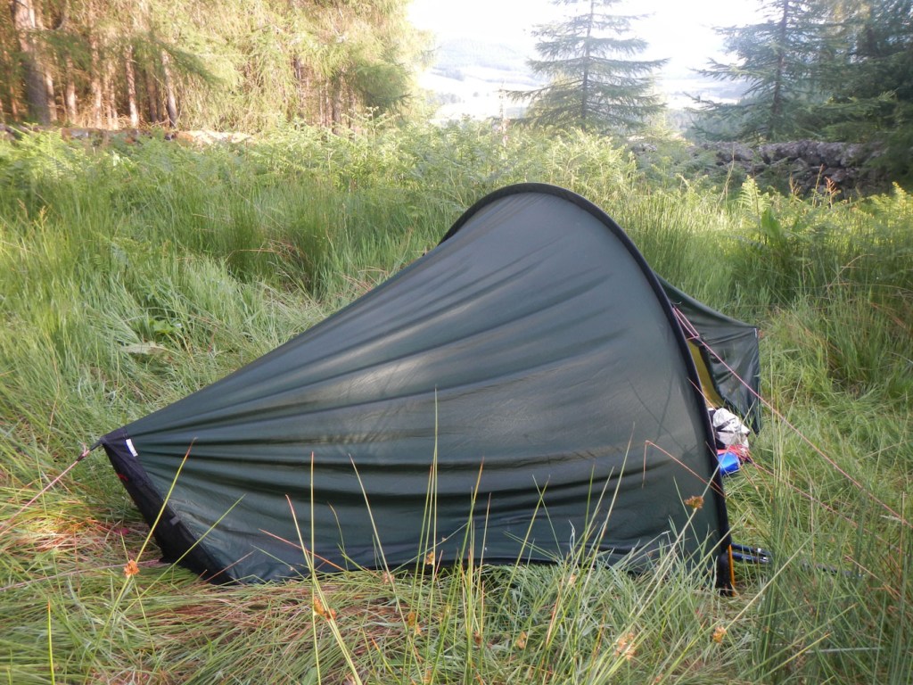
I had planned to camp on the land just before reaching the Pease Bay Caravan Park (they don’t take campers). However it was all too overgrown. I bought an ice cream from the shop at the caravan park and the assistant kindly filled my water bottles. I noted that I could get food there later if needed as the restaurant open to all with take away too.
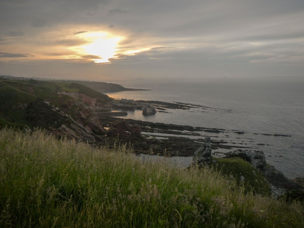
I left the caravan park to walk along the cliff path towards Cockburnspath and saw a small grassy area next to the landward side of the path, just big enough for my small tent. I could camp there later but with it being near the path would pitch the tent later and leave early in the morning.
There were superb coastal views once the caravan park was behind me. It was very hot and I felt tired in the heat despite it being a relatively short walking day. The path turned away from the coast and led to Cockburnspath.
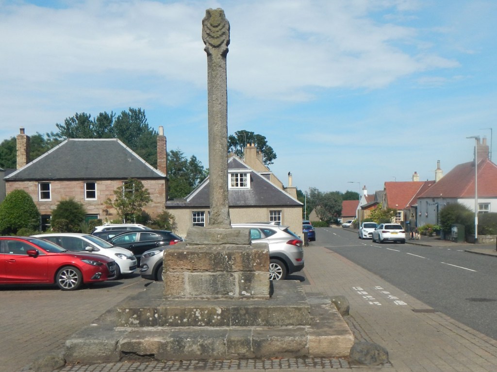
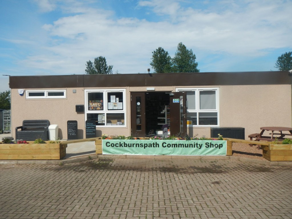
Reaching the Mercat Cross was a bit of an anti-climax but I noticed a sign to a community shop. This turned out to have only opened four weeks earlier following closure of the village shop after the owner died over a year previously. It is amazingly well stocked including lots of local items but I really didn’t need any provisions at this stage, especially as it would be more to carry. However I was pleased to buy a cold drink and another ice cream (Scottish tablet flavour). The extremely kind volunteer shop assistant even gave me a free cup of coffee when she realised that I had just completed the SUW – my completion no longer seemed an anti-climax! The website is Copath & Cove Shop Project (copathandcove.org) and I definitely recommend anyone passing through to visit this amazing enterprise.
I felt happy and made my way back to the coast, where I walked to somewhere that is amazing. However what this is I will leave as an exercise for anyone else who walks this path and am not even including any pictures. I also enjoyed a long chat with a man walking his dog and a lady in her garden – it was lovely to talk about past exploits and future plans as well as chatting about some travel books we had read and enjoyed.

I walked back towards the Caravan Park to buy my meal, passing the spot I had earmarked to camp. Before I reached the caravan park, I changed my mind and walked back to the camping spot. The path seemed empty of people and I didn’t want to spoil the magic of the evening by visiting a noisy restaurant. A man walked past with his dog and I apologised about being so near to the path. The views later that evening were awesome and I enjoyed them in solitude after eating my meal cooked on my stove. It poured with rain in the night but I was snug and dry in my tent (Edinburgh was flooded!).
By the morning, the rain had more or less stopped. I enjoyed the views again, really not able to get enough of them. I walked to the bus stop and met another very friendly local man and we chatted about adventures new and old. The dog walker from the previous evening also passed me and checked that I had survived ok overnight (evidently it had rained a lot!). However, he was also apologetic about the lack of amenities such as overnight accommodation in the village for walkers. I am impressed by the friendly folk in Cockburnspath and the feeling that this is still a living community with amazing potential. It was really an amazing and memorable end to my walk.
I did meet Anna in Berwick and we shared our experiences of this superb adventure over coffee, cake and lunch.
