22 November 2020
Today I decided to head for the north part of the moor, thinking that Sunday could be busy and that this part of the moor is likely to be less popular. The weather forecast wasn’t too bad, but that part of the moor seems to get a lot of rain; also it is high and the tors are often shrouded in cloud and mist.
I parked at Meldon Reservoir – where there is a charge, but it’s actually good value at £2 for a full day and contributes a little back to the Dartmoor National Park.
The reflections of the moor in the reservoir are often stunning – today was no exception. I crossed the dam and followed the footpath round the south shore of the reservoir before walking uphill more steeply to Black Tor, below which a couple of ponies were grazing. The visibility wasn’t great but improved as I headed parallel to the river to Lints Tor. I saw the range boundary posts, but already knew that none of the ranges had any firing planned today. Visibility improved but it started to rain. Initially I just covered my rucksack with its rainproof cover and put on my waterproof jacket – I was already wearing gaiters which come into their own crossing Dartmoor bogs . There was a bit of this around some tributaries of the West Okement and then a scramble up the slope to Lints Tor.
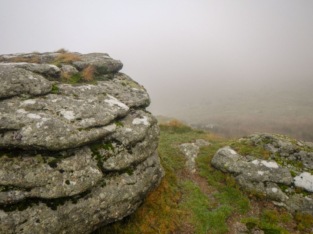
Black Tor 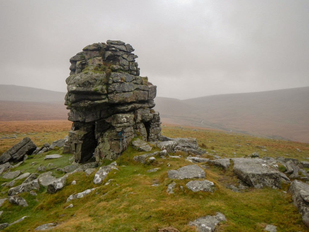
Lints Tor 
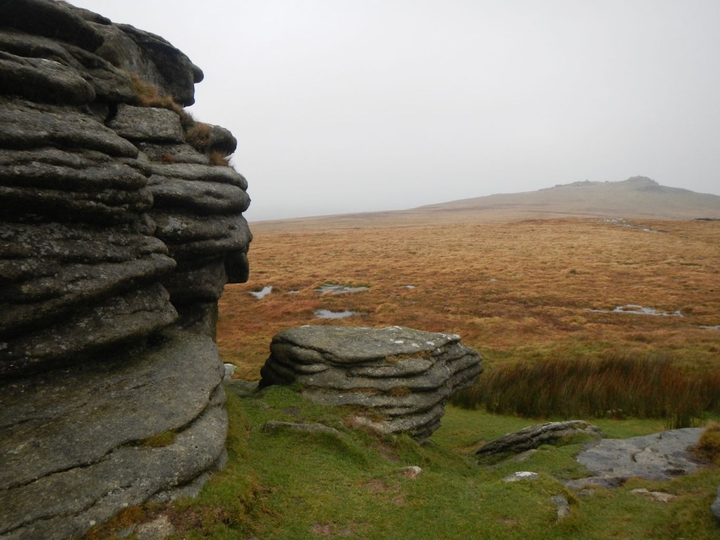
Dinger Tor
Next I headed down from Lints Tor crossing the same streams as on the ascent but further up their course before making my way steadily uphill across moorland to Dinger Tor. This was when the rain became heavier so I succumbed to putting on waterproof trousers before continuing downhill on a clear track.
After a turn off I saw two walkers ahead of me who I think had approached from along the track running east of the high ground of Yes Tor and High Willhays. Soon after that a couple of runners overtook. At the next track junction, I spotted the walkers turning right towards Okement Hill. As I had made good time, I was tempted to extend my planned route and do the same – potentially even trying to find the Cranmere Pool Letter Box. However, I decided against it as I had logged my route with my husband and it would be embarrassing and even potentially dangerous to divert (just in case I had an accident and would not be easily discoverable well off my intended route).
I turned left and soon saw East Mill Tor to the right – the rocks strung out along the hill top ridge. After walking along the line of granite outcrops, I descended back to the track, which had become quite busy. Through not checking my route again, I mistakenly crossed the bridge over Black-a-ven Brook. Having realised, I wasn’t keen to turn back, just in case one of the other walkers decided they were going to “help” as they thought I looked lost. My plotted route did cross the brook from the other side further down at a ford, after visiting Hart Tor on the other side. I knew I had plenty of time so decided to continue then cross the ford to the tor before doubling back.

Having reached the ford across some boggy ground, it looked as if it wasn’t easily passable on foot when there was this much water around. Fortunately I found a narrow bit just up stream and was able to step across (just about). The area next to Hart Tor was an unmarked but well-used car park. The rain had stopped so I removed my waterproof trousers and then proceeded back the way I had come. Crossing the brook was easy this time as I knew exactly where I could jump over. A family group was looking at the ford and one of the young children was paddling in her wellies. Hopefully she decided not to wade across as I’m sure the water would have come over the top and into her boots.
I reached the track I had previously left and kept going almost perpendicular to it to Rowtor. This tor comprises a scattered area of relatively small outcrops. It seemed to be a popular lunch spot for families as well as a playground for the children running round and scrambling on the rocks. However there was plenty of space and a lot of seat-like stones so I decided to break for lunch too.
West Mill Tor seemed best approached off the track to its east side as the track ascended and it meant I omitted a rocky scramble from an area that was being used as a further car park. Making my way up the track, I saw an ex colleague with his wife and dog – or more accurately he saw me as I was about to pass by with a customary “Hi”. Like me, they were surprised at the popularity of the area, especially on such a showery day – but of course during this Covid19 “lockdown” month, outdoor “exercise” is just about the only activity which can be undertaken as a family outing. They had already been up to Yes Tor which was the general direction I was heading now.
Soon after meeting them, I left the track and made for the clear rocky outcrop of West Mill Tor, also spotting a faint path direct from there to the summit of Yes Tor. However, I had to deviate slightly from that to take in Little Tor. The sun had come out and the views improving.
As I climbed steadily to Yes Tor, it clouded over and the visibility was worsening. I quickened my pace, keen to summit Yes Tor while there was still some good view remaining. Nearly every time I have been on the Yes Tor – High Willhays ridge, the highest area in Dartmoor, there has been no view worth speaking of. I know the views should be good, as I have been on Dunkery beacon (high point of Exmoor) and seen Yes Tor on the distant horizon. At the summit today, there was a lot that could be seen but not as far as Exmoor. There were a few people around the summit of Yes Tor, but I didn’t see anyone as I continued to Hampster Tor (which I had previously thought was part of High Willhays) and to High Willhays itself.
Hampster Tor 
High Willhays
From High Willhays, which was my final tor for the day, there is no clear path down the west side. However there are multiple paths made by livestock and walkers, so I followed these and finally reached Meldon Reservoir, crossing the dam again to the car park. A good day’s walking and eleven more tors in the bag!
