20 November 2020
Today I dragged my husband along. Having failed to be allowed to go to Norway due to Covid 19 and then also not being allowed to go to Norfolk, we are on holiday at home. The weather was intermittently rainy although it was reasonably warm and not very windy, so actually very reasonable for Dartmoor in November. The best weather seemed to be forecast for the east part of the moor and where we went is about as far to the east as you can go.
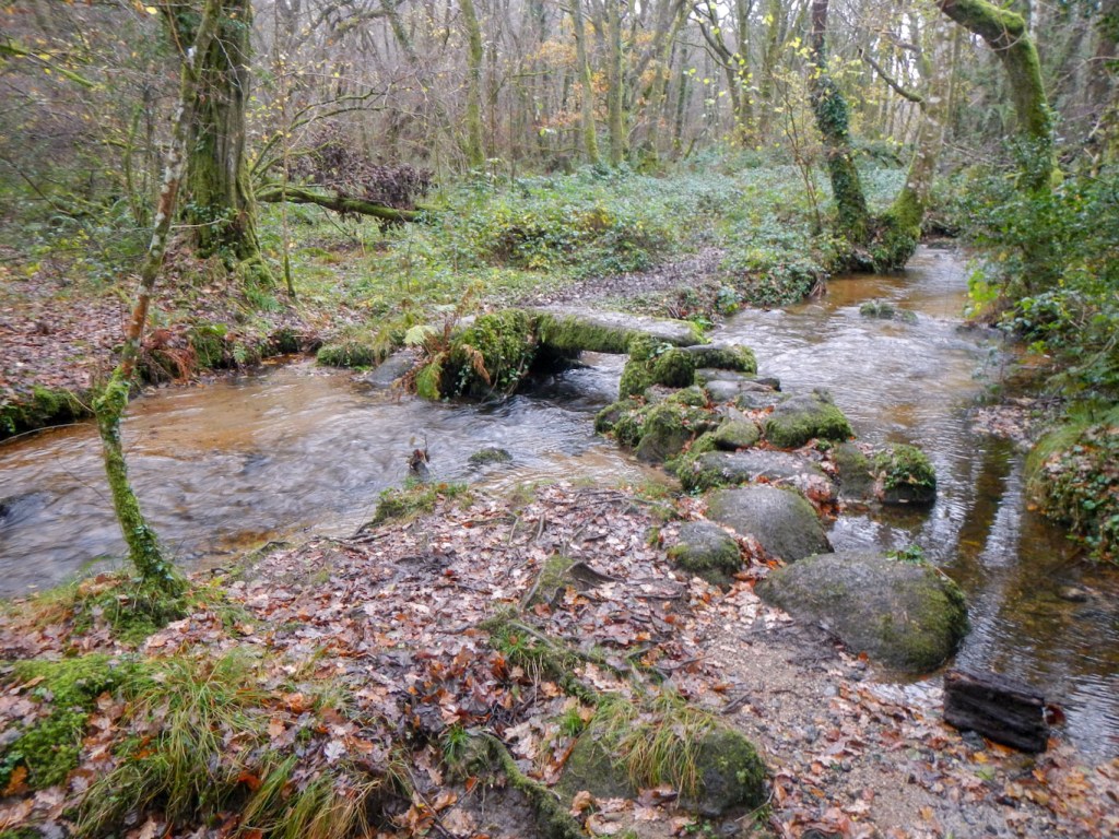
We parked in a small off road car park in the south east corner of Trendlebere Down. Our first objective was Becky Falls reached along a track through the woods, crossing by bridge to the north of Becky Brook. The path was carpeted with oak leaves. The track turned into a path. Sadly we were unable to access the main part of the falls as they are in private grounds and closed at the moment. However we did get some views of the stream dropping steeply through the woods. We also spotted a small clapper bridge crossing the stream. It was disappointing that we couldn’t get to the falls themselves, as I had planned this diversion to appease my husband who was (and indeed remains) unconvinced of the joys of hunting for “piles of rocks” or “giant pebbles”.
We reached the road at the strung out settlement of Freeland, passing the Kestor Inn and noting that it is the HQ of the MCC – we assume Manaton Cricket Club (rather than Marylebone Cricket Club). Incidentally it was built from the stone of Kestor Tor, so actually it should be that if I touched the wall I would have bagged another tor!
We walked on along the quiet road to reach Manaton with its distinctive church, currently with some works being carried out on the outside. We spotted the pitch of the aforementioned MCC. The route passed through the churchyard, exiting near a standing stone. There was a clear path all the way to Manaton Rocks, the first tor for the day bagged (given the Kestor Inn doesn’t count). After stopping for a drink and some chocolate near the rocks, we descended to an even narrower road. Fortunately we didn’t meet any traffic on it. At a corner we turned off down a track, crossing the River Bovey over Foxworthy Bridge. There was an interesting house roofed mainly with very old looking thatch and distinctive for its arched window.
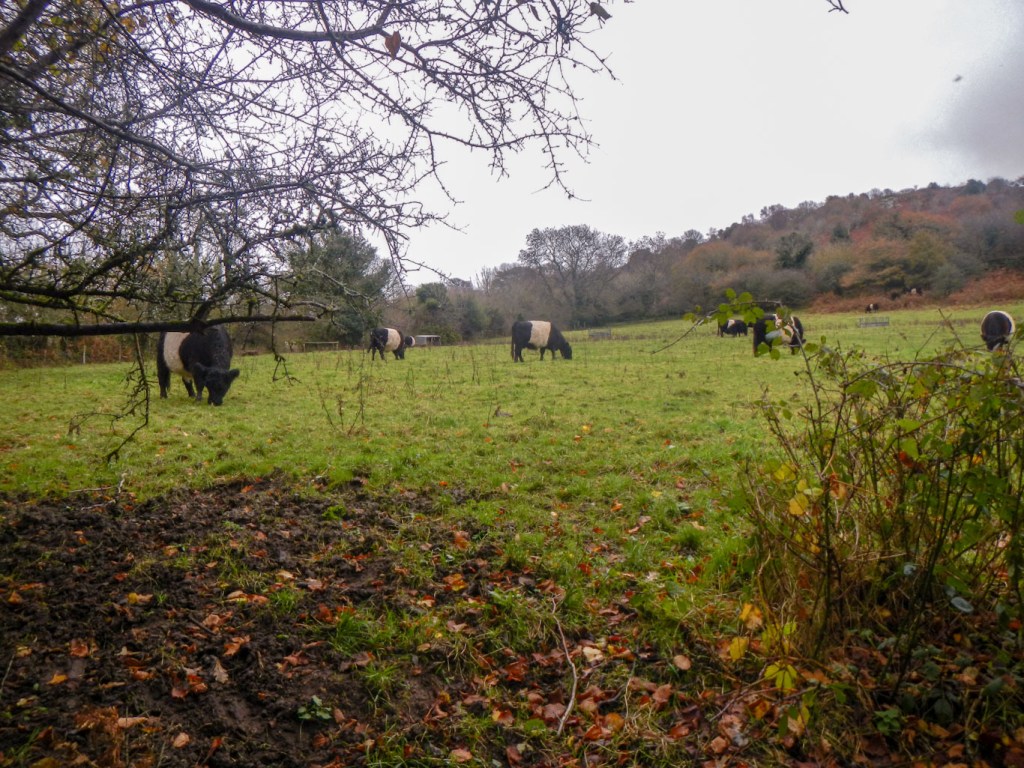
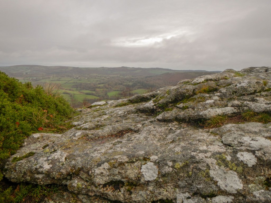
The path ascended steadily. We stopped to look at some Belted Galloway cattle in a field, including a cow suckling a calf. Soon after this we took a right turn to pass a farm and follow the path through a gate into a field, where there was a further example of Belted Galloway cattle. Fortunately the path kept close to the field boundary so there was an adequate escape route, but this wasn’t needed anyway as the animal showed no interest in us. Soon we reached some open moorland, and Hunter’s Tor, which was a good but windy vantage point. A hill fort is marked on the map just to the other side of the path from the tor.
It was a pleasant airy path, but I had my eyes set on reaching Foxworthy Tor. This meant a foray down a pathless slope, the rough, stony ground covered with bracken and small bushes. After a false alarm when we saw some stones which may have been the tor, we found what we thought was almost certainly the tor. We stopped in its shelter to eat lunch.
Raven’s Tor has a grid reference only 200m away, but the steep slope of the land and the vegetation meant that reaching it looked nigh on impossible – or at the best very time consuming. My husband was particularly keen to climb back up the hill to the nice grassy path rather than try to go 200m down a steep hillside with no path. I decided not to push my luck and in fact would admit that the path on the ridge was very pleasant.
Soon we were in the vicinity of Harton Chest (the next tor) and I spotted a reasonable path off the main path which seemed to descend to the right spot. My husband stayed put while I descended to a view point at the top of the tor and then descended further to the base of the rocks. There was a sort of path here which seemed to go the right way for Raven’s Tor – sadly I couldn’t take it as it would have taken too long to leave my husband waiting. When I returned to him with the news, he firmly told me that we weren’t going to it today – but as I now know the route I could try it another day.
He was still moaning about random piles of stones as we walked on the footpath through the woods in the area of Lustleigh Cleave, eventually deciding that one of the many rock formations was actually Sharpitor.
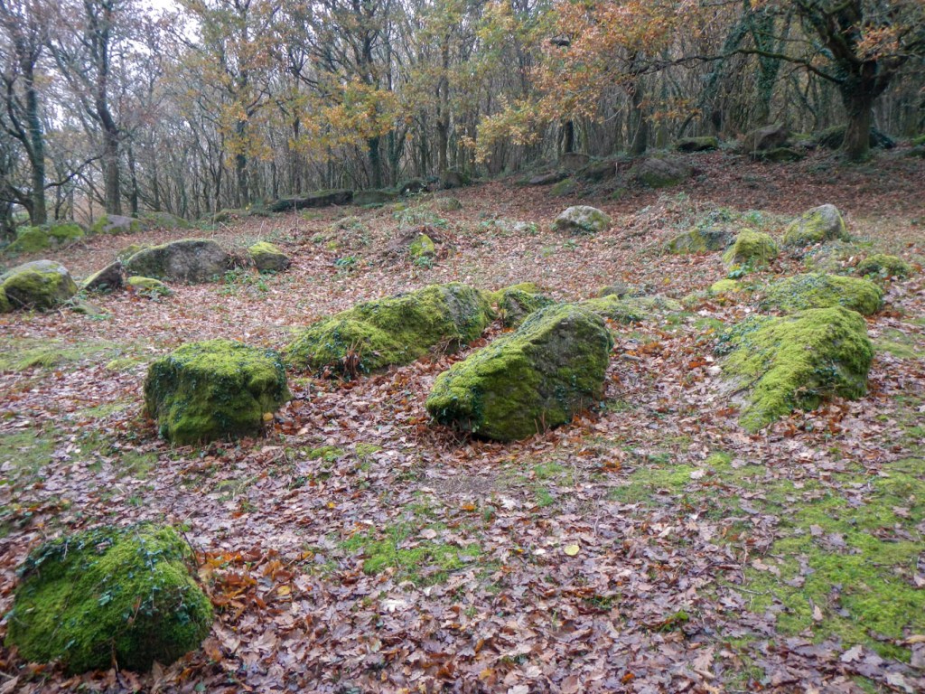
Soon after that the path went past / through some ancient Hut Circles – marked on the map and obvious on the ground. There were a few groups of walkers in this part of the woods. The paths were distinct but muddy. it looked as though the best way to get to Gradner rocks was actually by following a path around to them rather than taking a “short cut”. Once we reached the River Bovey near a bridge, my husband decided to cross and go back along the track to the car. I made my way up the hill to Gradner Rocks before going back down to the river to follow the route my husband had taken.
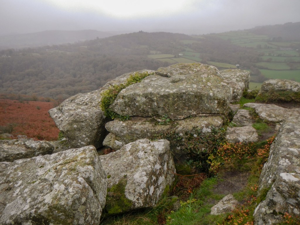
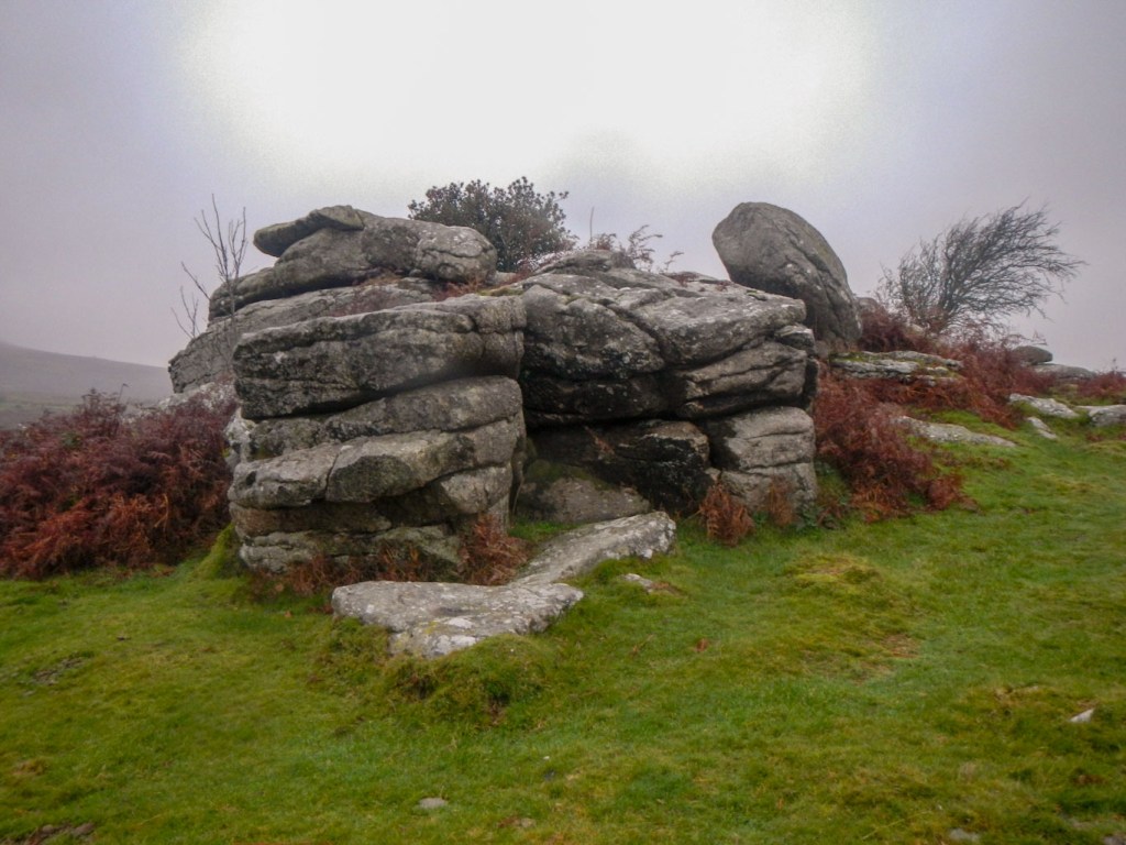
Having arrived at the car the good news was that it was deemed that there was time before dark to drive up to the Haytor / Saddle Tor area for me to make a quick out and back solo foray to Bag Tor. I hadn’t quite had time to walk there on 12 November and it isn’t really on any route that I would be likely to take in the near future. It was much more windy on the higher exposed moor and also foggy in parts. However, having reached Bag Tor along the straightforward footpath from the road, I was able to appreciate it as an excellent viewpoint towards the more popular Haytor. The more lofty Rippon Tor to the west across the moor was shrouded in cloud.
We drove home with seven more tors “in the bag” for me and well over my half century with fifty five (fifty four legal) in total.
