26 Aug 2020 to 18 Sept 2020
Amazingly, my correspondence with Alpine Exploratory, who organised my accommodation and provided me with advice, route cards and maps between Sargans and Montreux, shows that I started to make enquiries about my walk at the end of September 2019. At that time I thought that corona viruses were a group of the myriad of virus types causing self-limiting upper respiratory tract infections. I guess most people of my generation would also remember Corona as the carbonated soft drink delivered by the “Corona lorry” with the accompanying adverts – “Every bubble’s passed its FIZZical”.
Anyway in the intervening months, life has changed globally and it was a miracle that this walk could take place at all. Within just over twenty four hours of me touching down in Zurich, the announcement was made by the government in England that in view of Covid19 Switzerland was removed from the list of countries to which it was considered safe to travel, although having arrived it was acceptable to stay. A quarantine of fourteen days isolation at home was mandated on return. I had already packed a “quarantine” bag at home enabling me to isolate from the rest of the household on return in the event of quarantine being imposed. However I had not expected it to happen quite that quickly and I had a hope that the situation might change during my time in Switzerland and that it would be a “corridor” country again by the time of my return. No such luck!
My husband had travelled out to Switzerland with me and had booked a hotel in Engelberg, where I would be meeting him for a night and day, just over a week into my walk. He was due to return to England almost two weeks before me and his quarantine would be almost complete by the time of my return.
LIECHTENSTEIN EXTENSION
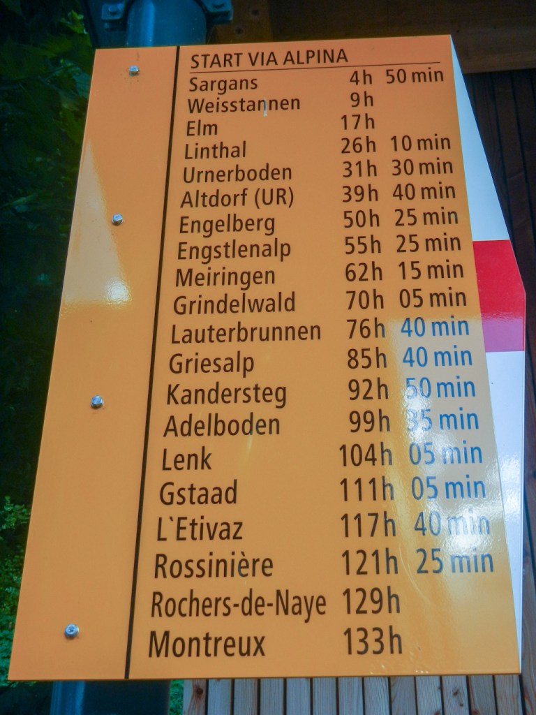
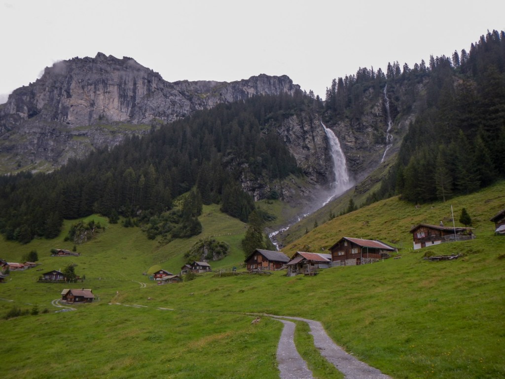
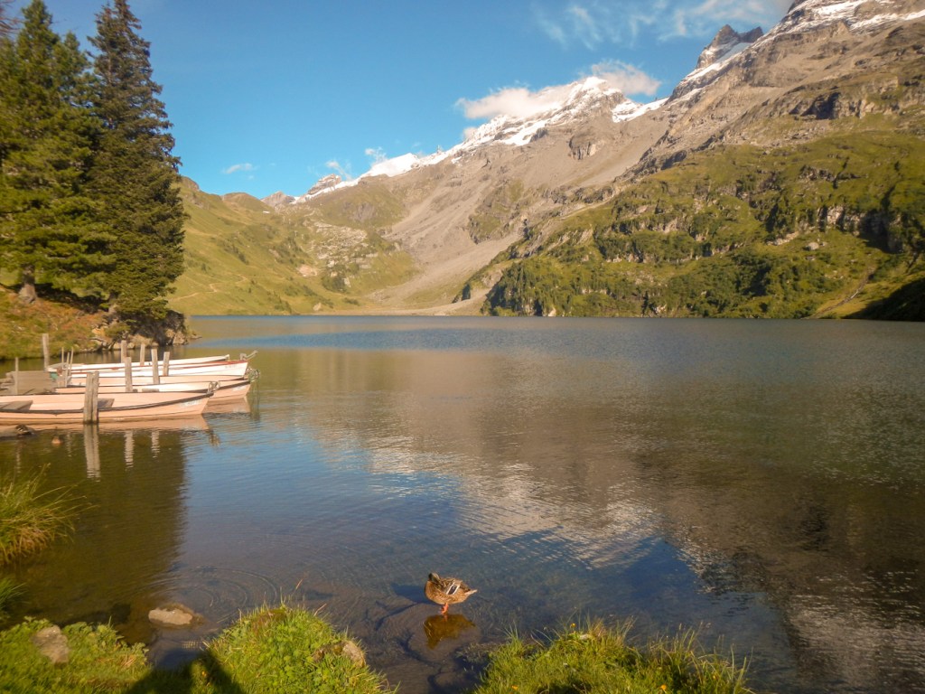
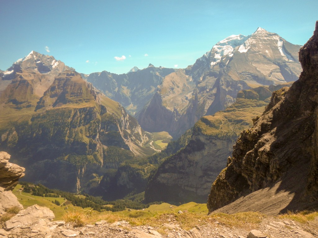
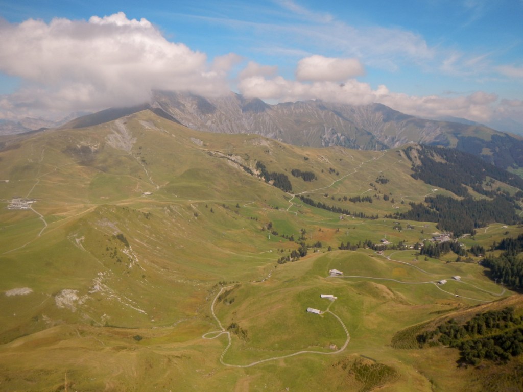
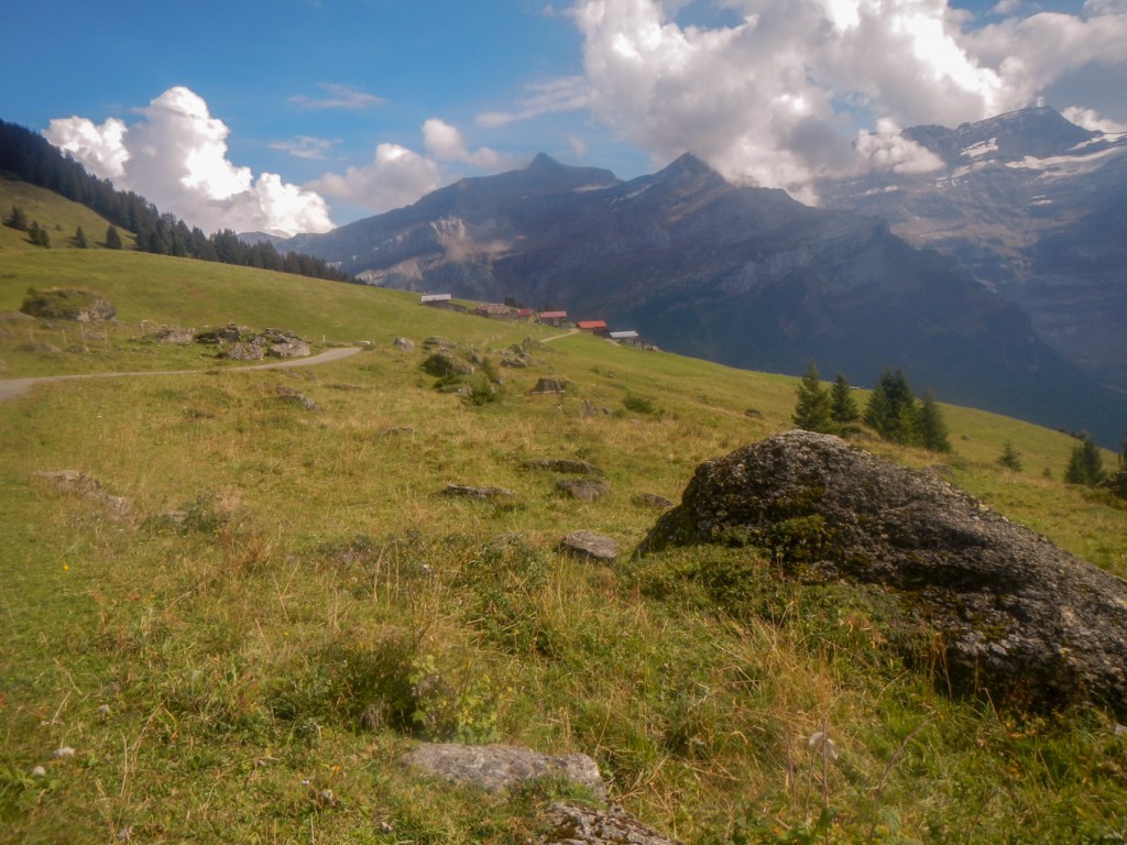
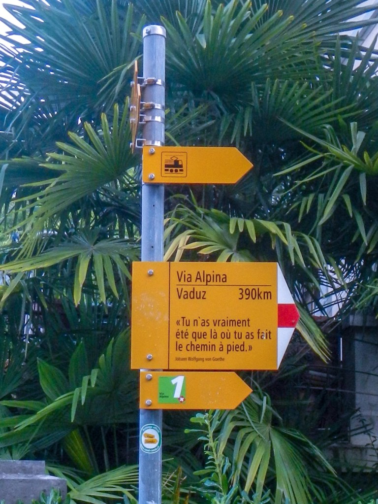
My journey started in Liechtenstein, an extension I organised myself. The weather was warm and sunny – a perfect start. I acclimatised by walking from my hotel in Triesenberg to the capital Vaduz (where I saw the sign telling me it was 133 walking hours from there to Montreux) and back on arrival the first afternoon. That was when I realised what an affluent place it is – I guess that the rich Swiss have a Liechtenstein bank account in the way that rich people elsewhere might have a Swiss bank account. Apparently Liechtenstein has more registered companies than people! It is also the World’s largest manufacturer of false teeth! There seem to be no small houses and no small cars – I even saw a “Thunderbird” car – twice.
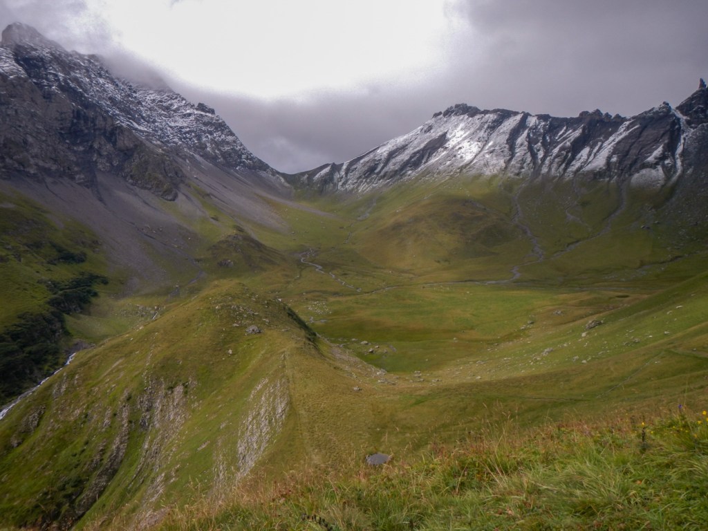
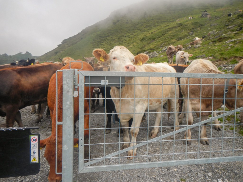
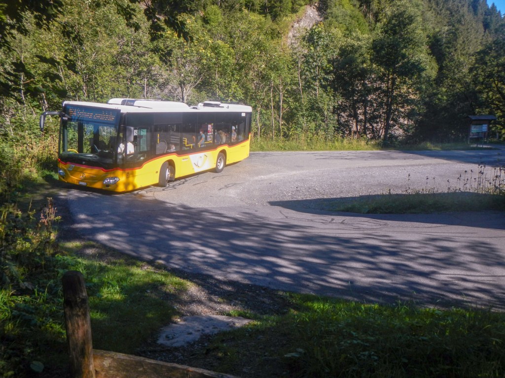
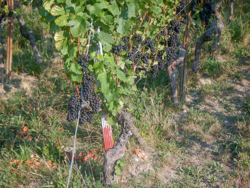
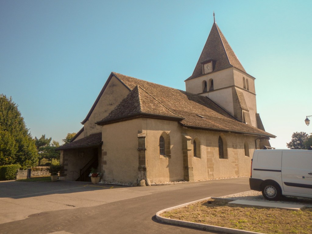
Next morning I caught a bus (face masks mandatory of course) to Steg. This is actually the start of the European Via Alpina red route and so the first 5km to Gaflei isn’t part of the Swiss route. All a bit confusing and even more so with the realisation that the Swiss route starts in Liechtenstein which is definitely a different country. Anyway I enjoyed the walk to Gaflei in sunny, warm weather with clear views over the Rhine and towards the mountains where I would be spending the next few days. It was a pleasant undulating trek although it also included an encounter with cows on the path. At least their tinkling bells (how do they put up with that every time they move their heads?) give early warning. It was my first of many detours around cattle.
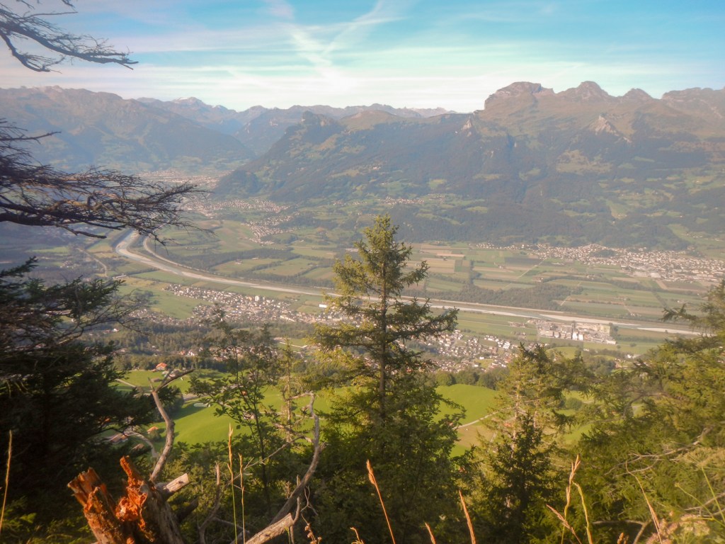
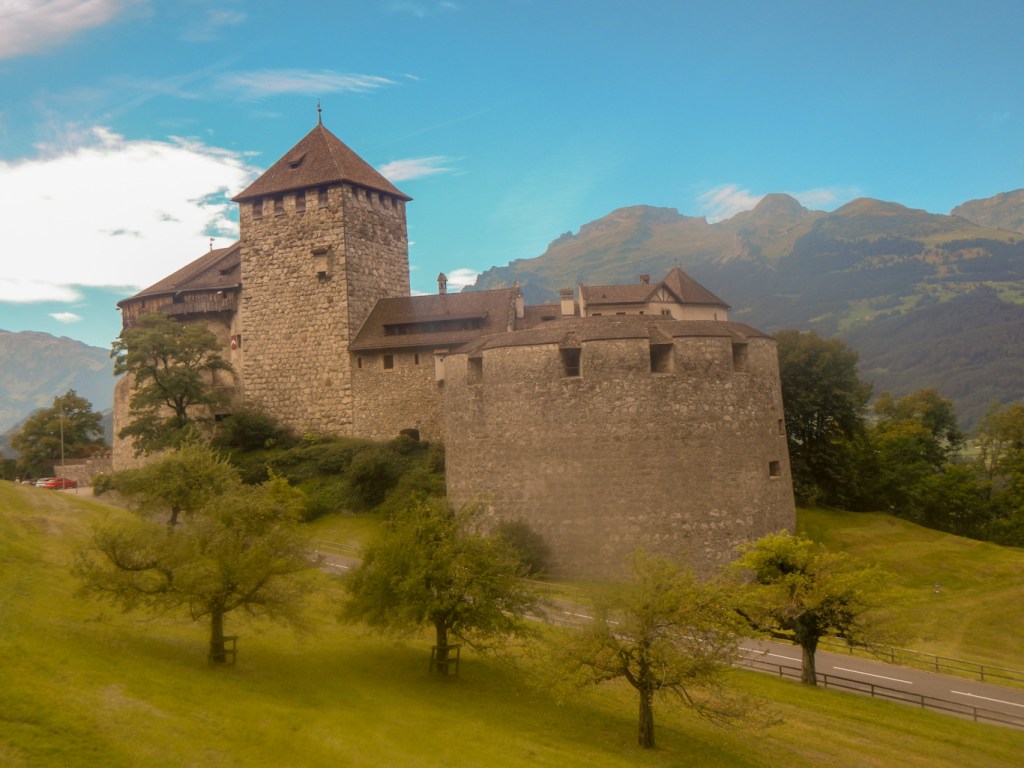
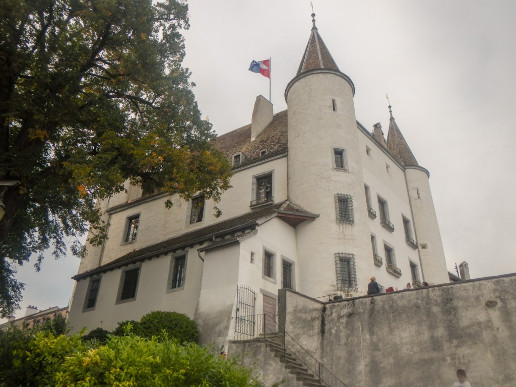
I climbed up the large tower at the viewpoint to gain an even more stunning view across the enormous expanse of the Rhine Valley to the mountains beyond. The descent to Wildschloss, a ruined castle was mainly in woodland. However at the castle there were good views. There was further descent in woodland but on tracks, eventually to emerge almost in Vaduz near the prominent and unruined castle. I had seen this impressive castle the previous day on my walk to Vaduz – it is the official residence of the Liechtenstein Royal Family.
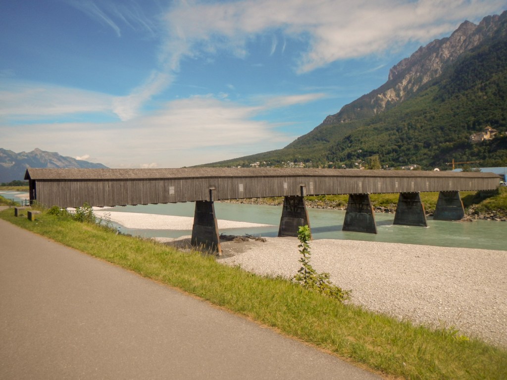
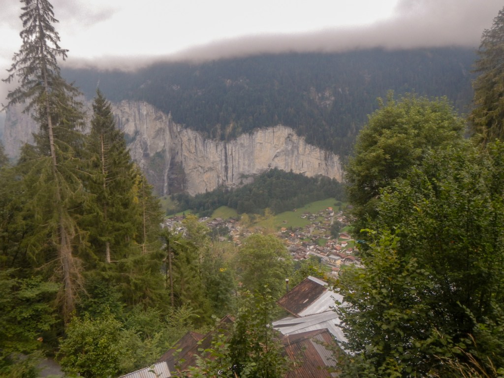
I traversed Vaduz to arrive at the Rhine footbridge. This is the only surviving wooden Rhine footbridge. Halfway through the structure, I crossed the border into Switzerland.
The initial trek in Switzerland was on tarmac across the Rhine Valley but the afternoon became more interesting as I walked uphill on paths and through a swathe of rural Switzerland – small rural communities and yet another ruined castle. The afternoon was hot and I stopped for an ice cream and drink at a cafe which appeared to be the meeting place for the local elderly inhabitants. More and more of them seemed to be just passing by and the chairs around my table were gradually removed to their table.
Soon I was near Sargans, passing the castle and church before descending to the town. I had to return to Liechtenstein by bus. I had planned to spend time looking at the museum in Vaduz and taking two days to walk to Sargans. However the presence of Covid19 and the excellent weather meant that I wanted to spend my time outside.
ASCENT OF GONZAN

Next morning, I caught the bus back to Sargans and spent my “free” day on an amazing walk ascending to the mountain Gonzan (1829m) with sensational views of Sargans and the surrounding countryside. I had more encounters with cows. Even the horses in the fields were wearing bells round their necks. After lunch at the summit of Gonzan, I realised that I had time to make it almost a circular walk. I was able to take a high level footpath round to the top cable car station at Tschuggen and descend on a mountain path across open fields and then through a wood down to Mels. The beauty of this was that my overnight accommodation booked by Alpine Exploratory was at Mels and so saved me walking a very tedious looking route alongside the railway line from Sargans to Mels. I reflected that perhaps the Sargans to Mels route for the Via Alpina would better go via Gonzen and Tschuggen. Alpine Exploratory do suggest alternatives, but not anything needing an entire extra day!
Sadly as I descended and as forecast the skies became more and more black and the inevitable downpour which was to last for two days began. I managed the remote access reception at the hotel at Mels. Alpine Exploratory had booked me a fabulous well equipped room – there was even a coffee machine. The bad news was that they had also sent me an e mail about weather warnings for the weekend and the risk of the conditions being unsuitable for parts of the walk with the potential need to use the transport option alternatives on the route cards.
MELS TO WEISSTANNEN
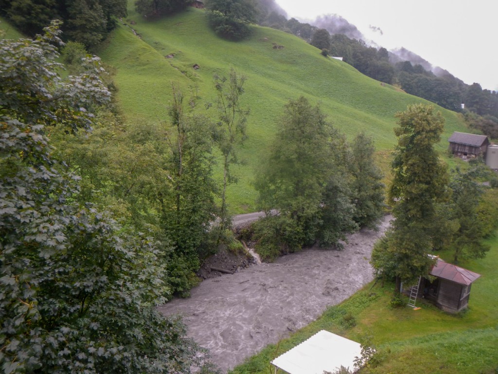
The first day actually looked straightforward on easy paths although essentially just to get me in position to tackle the first big mountain pass the next day. I was delighted to see some deer after only walking about 2-3km and there were some impressive waterfalls but the rain became heavier and heavier with occasional flashes of lightning and thunder claps. I arrived at Weisstannen just after lunchtime wet and bedraggled. Thankfully the staff at Hotel Gemse were happy for me to book in and settle in my room straight away and I was able to dry out from my short and easy but wet walk.
From my room I had intermittent views of the hillside when there were gaps in the cloud with water pouring down into the raging torrent of the River Seez below. As I was on the second floor, I wasn’t worried about being flooded.
It was still pouring with rain the next morning. The hotel owner was discussing something with some other guests but my German isn’t good enough to be able to follow their conversation. In fact I’m pleased in retrospect as I think it might have been something to do with it not being a good idea to attempt the pass.
FOOPASS IN A THUNDER STORM
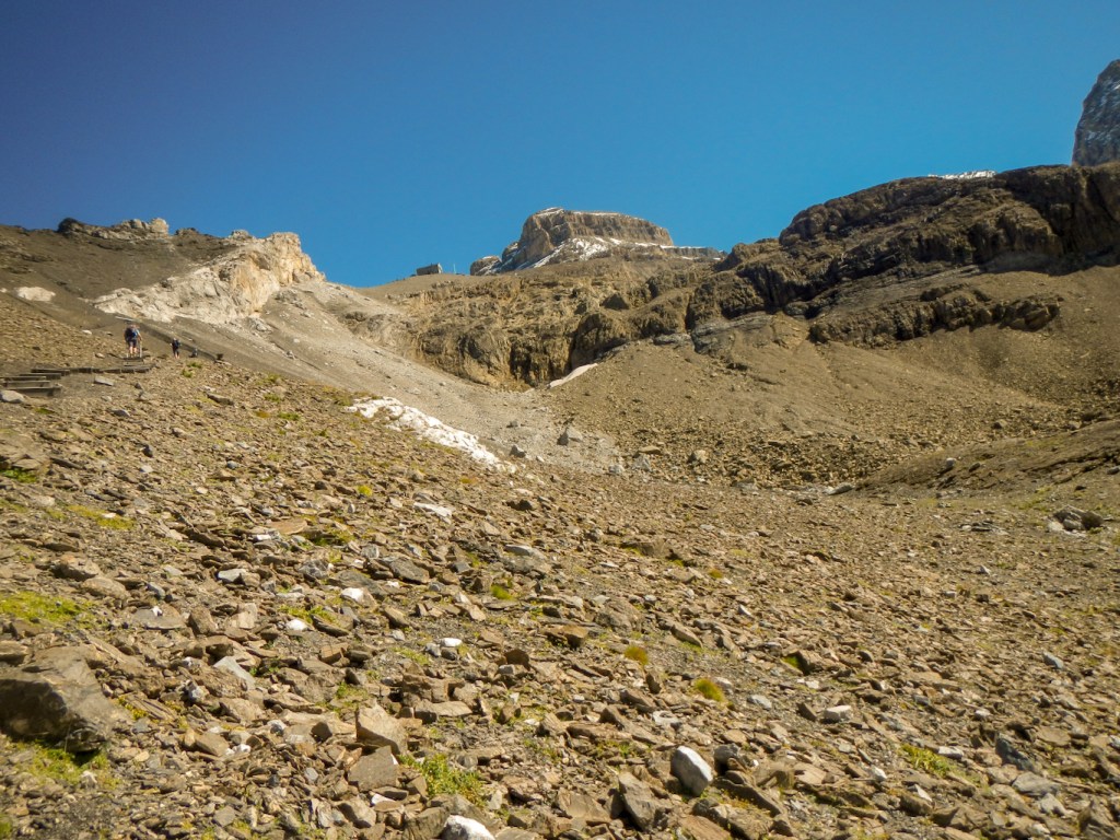
I decided to forgo the scenic path walk virtually parallel to the road and follow the road all the way up to Untersass (7km) as I would have seen very little in terms of views and it would make the first part of the day quicker, leaving more time for the more difficult paths where there is no road option. I also thought, rightly, that the road (essentially a dead end serving small remote communities) wouldn’t be busy on a wet Sunday morning. Apart from seeing a loose bull (with a ring in his nose) very close to the road (and the torrential rain) my walk was uneventful. Eventually I turned off the road and almost immediately discovered the perils of following signs saying VA1 as I realised that I was heading back to Weisstannen. This was quickly corrected!
The ascent began in earnest. I stopped for a quick rest and just at that time, the only other walker I saw all day passed me, muttering something about needing to hurry because of storms. I could see that in better conditions it would have been a fine walk up the valley with excellent views over to the other side. Eventually I was pleased to reach Fooalp and see the farm building. There was nowhere to shelter so I proceeded on.
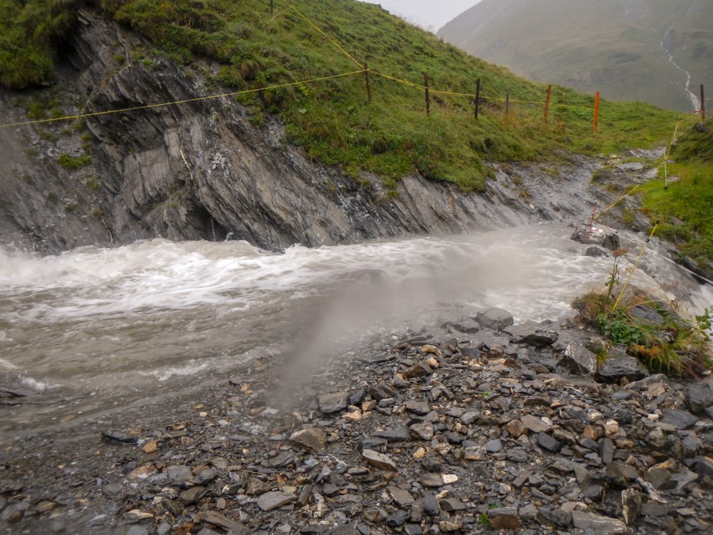
In front of me there was a wide torrent of water and beyond it I could see a footpath sign. There was no bridge and I wondered whether I really needed to cross the stream – I wasn’t sure whether it was possible. Perusal of my route card confirmed “cross the stream to the south side” and my compass confirmed that indeed this was the south side of the building. With the aid of trekking poles to test the depth and force of the water flow, I managed to cross the stream, ensuring I had chosen a point well above where it went steeply down. It was easier than I had thought it would be but certainly not something I would want to do unless I was sure that it was the correct route.
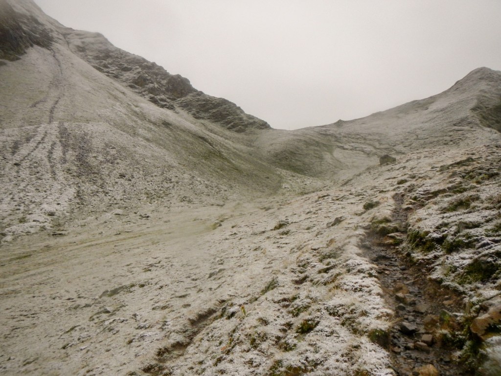
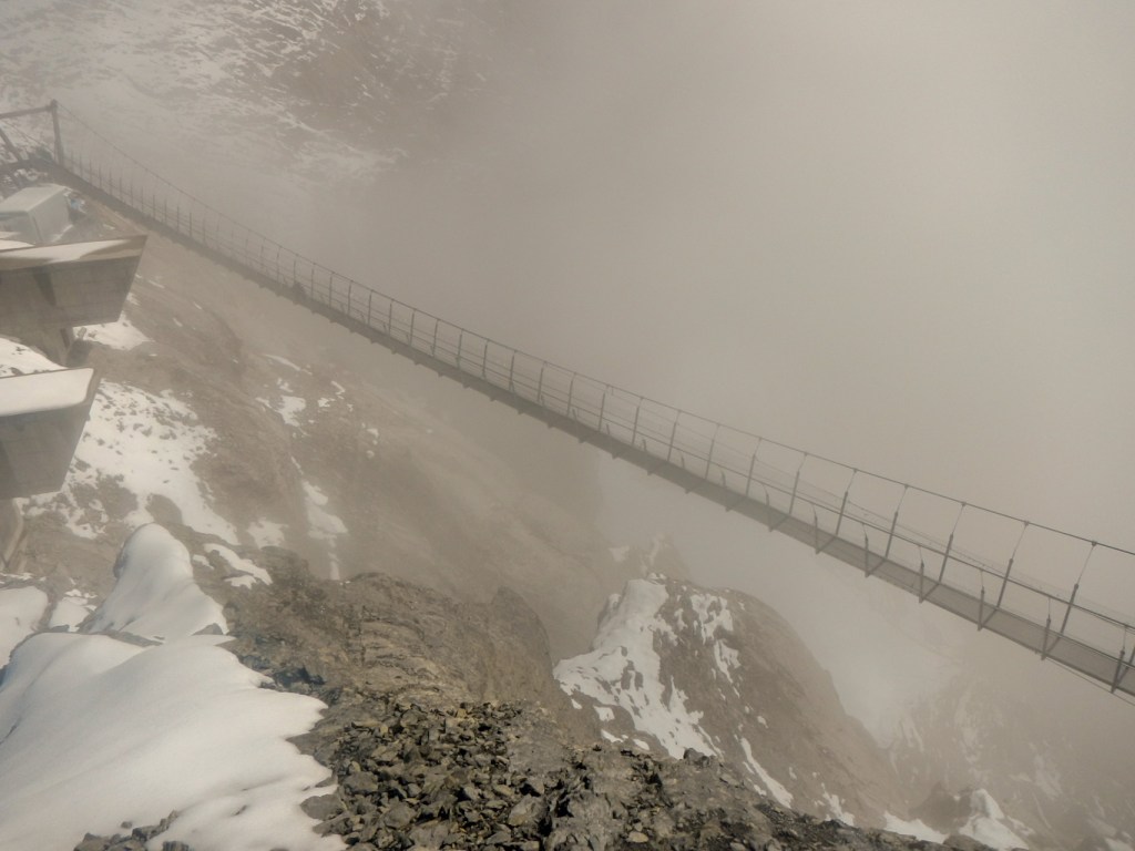
The climb continued with the path route well defined. The rain turned to sleet and then snow. There was a thin covering of snow only and the path itself was mainly clear. However there was some thunder rumbling in the distance. By the time I arrived at the pass, the lightning flashes were disconcertingly close to the thunder claps and I’m convinced that one thunder clap preceded the lightning flash. I noted that the path off the pass was easy to walk – an earth slope – and so I was able to descend rapidly to relative safety. It was at that point that I realised that my rucksack cover was coated with a layer of frozen snow.
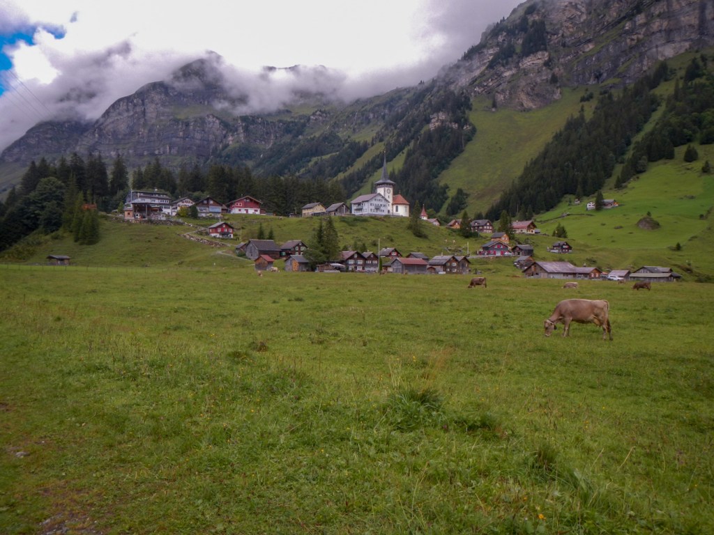
As I made the long descent to Elm, I saw an enormous number of powerful waterfalls and I’m not sure how many of them are usually there and how many had formed due to the torrential and persistent rainfall. The very pleasant lady who answered my call when I arrived at Gasthaus Segnes was astounded that I had crossed Foopass (“well you’re here now so that’s fine”). Fortunately there was a brilliant drying room and there was even a special boot drying contraption with warm lengths of metal so the boots just went upside down with the metal inside the boot. I had a superb room with views of the village church and the mountains.
The rain stopped! I wandered round the village discovering various interesting features – houses including the Suworowhaus where a Russian general stayed in 1799 on his retreat from some Napoleonic battles, the old railway station and some preserved rolling stock, multiple fountains, the mineral water factory, a closed supermarket, a closed outdoor shop and eventually a restaurant where I managed to buy a well-earned pizza after all that exercise.
WICHLENMATT AND RICHETLIPASS
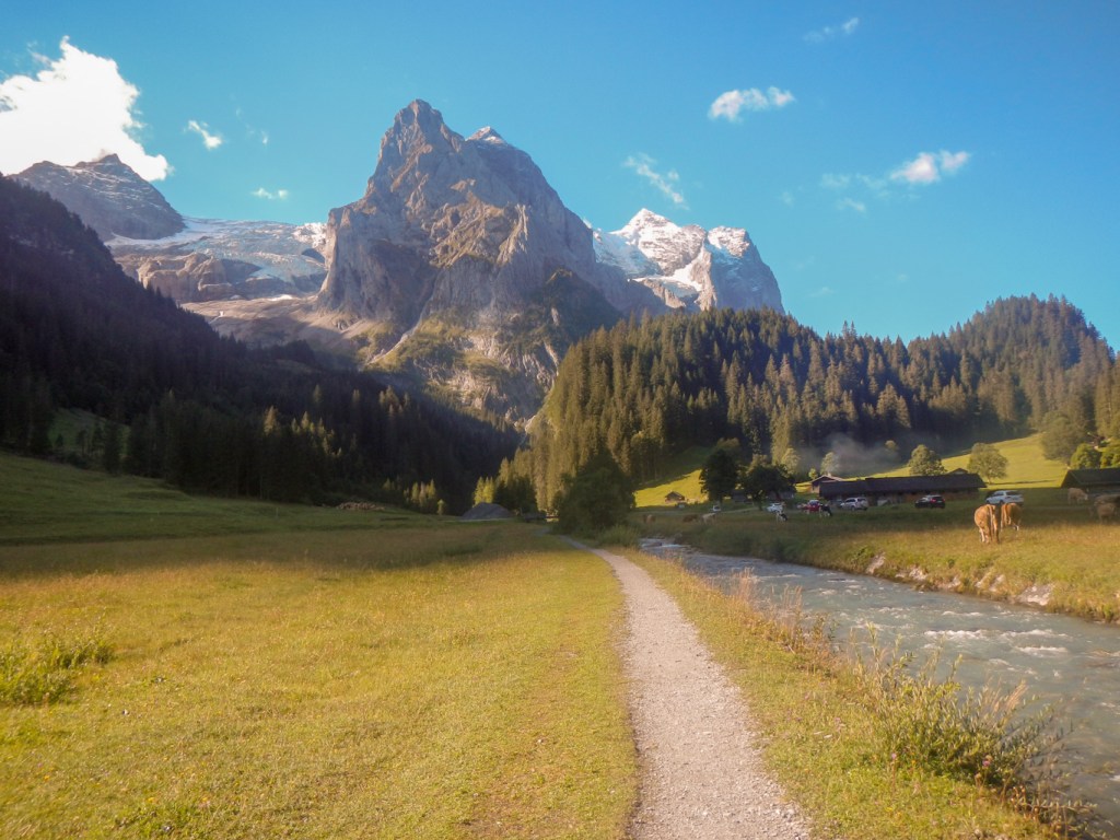
Next day was dry! Having seen the VA1 sign next to my hotel. I took that route. It wasn’t until I had been walking for sometime that I realised I wasn’t following the route suggested by Alpine Exploratory and so had added an extra kilometre to my day. Anyway, I met a pleasant French (and English) speaking couple from somewhere near Laussanne and saw my first (of many) marmots. I stopped for a drink at a ski hut / cafe where the warden warned me about possible snow on the pass. It was a long climb up to the col at Wichlenmatt (2160m). It was warm and sunny with no snow so I ate my lunch gazing at amazing views and listening to the distant tinkle of cow bells from the alp below. It just needed the low tones of an Alphorn to complete the scene. What a contrast from my hurried traverse of Foopass the previous day in a thunderstorm with snow.
Sadly there was no zip slide about to appear to take me across the intervening alp to Richetlipass. I finished my lunch and descended to the alp, spending some time photographing a fox that I saw there. I passed a lot of cows and then climbed steeply to Richetlipass, where there were a few patches of snow still near the path. Unfortunately cloud obscured much of the view.
It was a long descent to Linthal. I passed an unlocked refuge hut and further down I met a young cow farmer. He was using binoculars to search out his cows. His skin was weathered and brown from being out on the alps for long hours. We spoke in a mixture of German and English and he explained to me about taking the cows down to the valleys for winter – “no one comes up here in the winter because there are so many avalanches”.
After a long day and an even longer next day in prospect, I was pleased to get to Linthal. I was even more pleased to find my hotel easily. Unfortunately it was all locked up, there was a recorded message on the telephone line and I didn’t have the necessary code for the “automatic” reception to work. Then it started raining! A phone call to Alpine Exploratory sorted it all out – they booked a back up hotel for me only a matter of hundreds of metres away but in the meantime managed to extract the code. I was in! It was all a bit odd and I saw no-one else throughout my stay. Perhaps I was the only person staying. However Alpine Exploratory also managed to organise an early purely self service breakfast so I could leave at first light the next morning having eaten a meal. I left a “thanks” note for the hotel (along with my key of course) – probably the first written German I had attempted since my “O” level exam in 1978.
KLAUSENPASS – A 38KM DAY!
I had chosen to put two stages into one day as when I had booked there was no option to stay at Klausenpass and the suggested solution was to spend two nights at Altdorf, catching the Postbus from Klausenpass the first day and back up again the next day to resume the walk. I had a long distance for one day but both stages are listed as easier and the overall height gain and loss over both stages added together similar to other individual stages. In fact the Alpine Exploratory route is different from the new VA1 route as it shortcuts a corner.
Hence next morning, I had to have the courage to walk in the opposite direction to the signed VA1. I even got my compass out to confirm as the Routecard told me to turn right (south) from the station but I actually had to turn left because I arrived facing the station! Soon I was climbing multiple zig-zags on a well built old trade path (and feeling sorry for the mules who had to carry loads up it).
Eventually I arrived at a wide high valley and some relatively flat walking with several scattered settlements, fine views and of course the inevitable cattle on which I kept a wary eye and took some detours to avoid. The ones that look up and then calmly start eating again seem fine but the ones that continue to stare and don’t go back to feeding look ominous. However it is the ones that start raucous mooing or start walking (or worse trotting) that I make particular efforts to give a wide berth and keep close to field boundaries that I would be able to cross in an “emergency”.
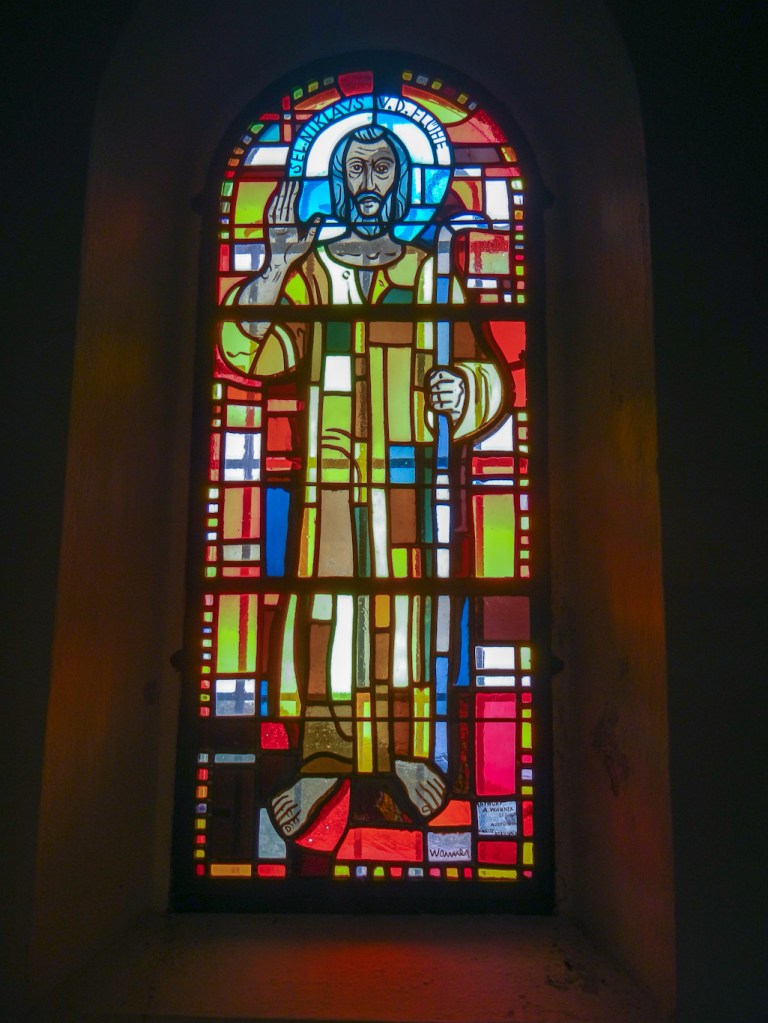
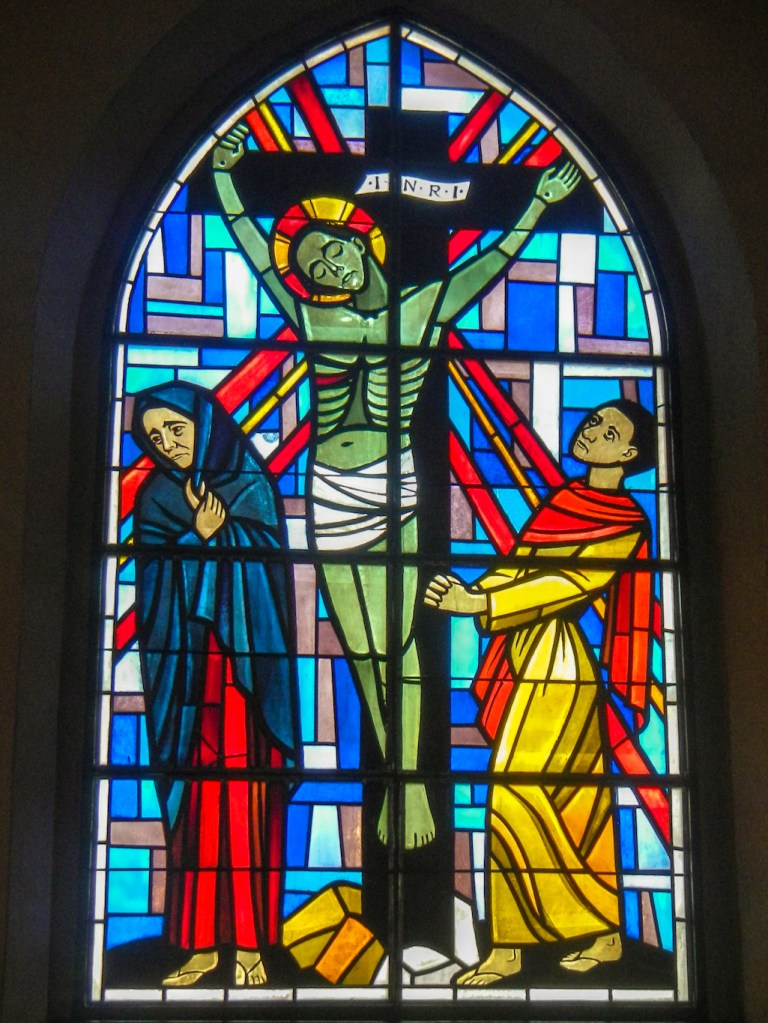
There was a good path up the steep hill to Klausenpass, although mainly in sight of the road. I heard the strident horn of the Postbus announcing its presence to oncoming vehicles as it swung around the multiple hair pin bends. I thought I was there but it was a false “summit” and I had to descend on the road before ascending further. After the deserted grassy passes I had crossed the previous day, it seemed a bit of an anti climax to emerge on a big car park and pass a couple of nondescript souvenir shops. However after passing these, there was a small chapel with some interesting modern looking brightly coloured stained glass windows and I took refuge in there for a few minutes. Emerging from the chapel, I realised that actually the pass was a fine viewpoint.
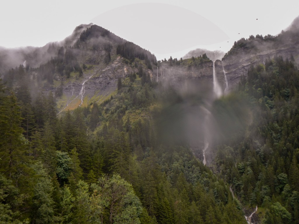
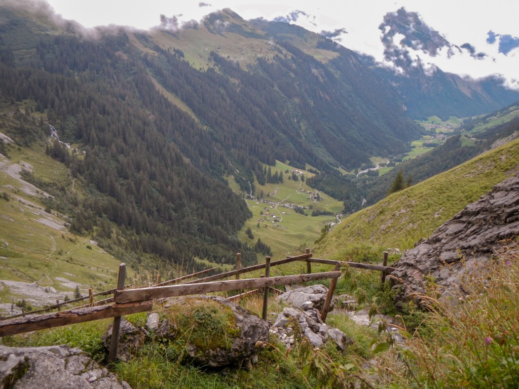
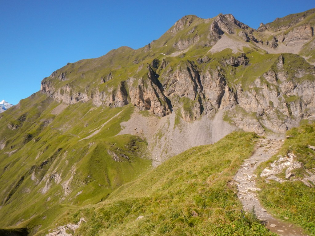
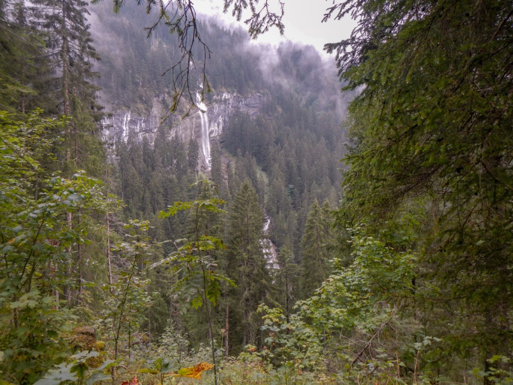
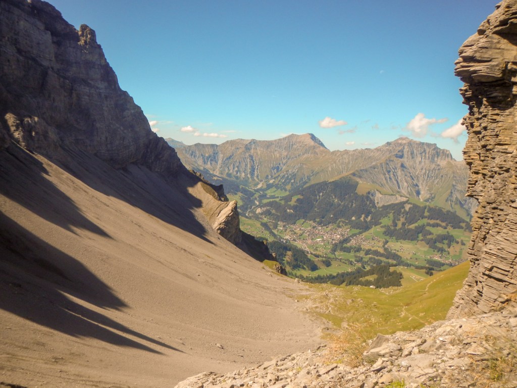
I was aware that I had a further 21.5km to cover, albeit mainly downhill. This was also not part of the main VA1. It all started easily enough but suddenly after passing some farm buildings there was a massive steep drop with a loose gravelly and fairly exposed zigzag path. It took me a very long time to descend, but there were amazing views down the valley. Later there were also amazing views up the valley and, what I thought, impressive waterfalls. However when I eventually arrived at Asch, I realised what an impressive waterfall does look like. The Stauben Waterfall is HUGE. A sentence on the route card reminding walkers to “note the huge flow” suggests that some people could miss it – but I’m not sure how, unless the visibility was really poor.
The rest of my very long day did indeed seem to be an extremely long way. There were lots of fine mountain views and it was mainly downhill. Eventually I arrived at Burglen, the birthplace of William Tell, who, for the Swiss nation, symbolises the struggle for political and individual freedom. According to the legend based in the early fourteenth century he defied Austrian authority, was forced to shoot an apple from his son’s head, was arrested for threatening the governor’s life, saved the same governor’s life en route to prison, escaped, and ultimately killed the governor in an ambush. It’s an amazing tale and celebrated with statues, a dedicated chapel adjacent to the parish church and the inevitable modern day trail with sign boards sponsored by local businesses. Helpfully there is an English translation on each sign and the story unfolded all the way to my destination in Altdorf, where there is another William Tell Statue in its named square. It was a story that kept me entertained at the end of a very long walking day.
A “BLACK 4” GRADE DAY
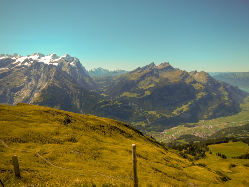
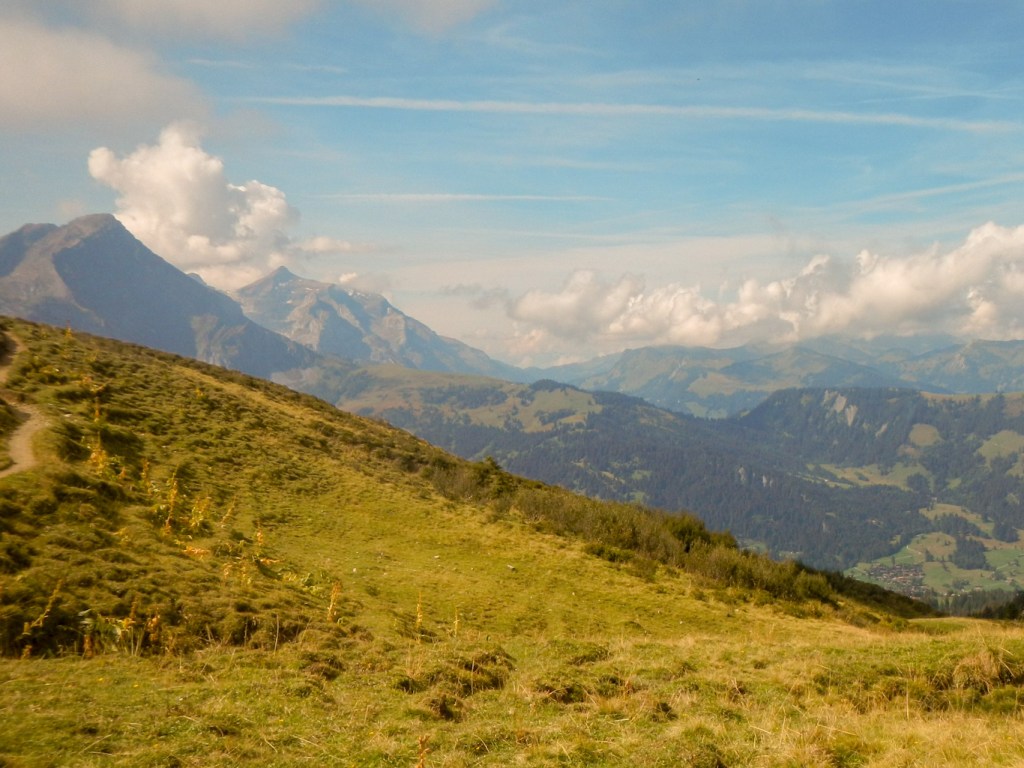
The next day was also long and the Routecard stated that it was a “harder” day. There was an initial “hiccup” as I followed the signed route and then “lost” the signs. I returned to the start and following the Alpine Exploratory routecard instructions instead, I was soon crossing the valley bottom ready to climb up to Brusti. As I climbed, a southern extension of Lake Lucerne came into view – I hadn’t realised until then that I was so near the lake.
Unfortunately there were also increasing views of clouds. I met a retired Swiss couple as I made my way on the generally well marked path towards Surenenpass. They reassured me that the path is good but they had turned back because they didn’t want to walk all the way there with the prospect of poor views. They should have been touring England – specifically Devon, Cornwall and Oxford – but Covid19 had put paid to their plans so they were walking near their home. All rather ironic given that I had travelled there from Devon. I kept hearing the piercing alarm call of marmots and made the occasional sighting but on other occasions it was too late and they had already disappeared into their burrows.
I was fooled by the small knoll at 2,073m, thinking as I aimed for it that it was the pass – however I actually had to climb further to 2,292m. The path was rocky in parts and skirted the base of some precarious looking cliffs – I didn’t stop on that bit. Eventually I clambered on to the pass and to my amazement there was a mountain bike – clearly it had come up from the other side as there is no reasonable way that a bicycle could be brought on the route I had just climbed. Even better, the clouds had partially cleared so there was something to see after all.

The path down was wide and soon became a track. The bicycle I had seen earlier passed me and the cyclist stopped for a brief chat. Further down I saw cattle all over the path and it was soon apparent that they were being herded down the hill. Somehow I landed up in the midst of the herd. Fortunately for me the cyclist had stopped for refreshments at the farm and I was relieved to see him approaching on his red bike. I let him pass me and then walked in his wake. It became even worse as all the cattle stopped at a closed gate – between us we managed to ease a passage through and get to the other side of the gate without any cattle getting through.
The way was easy but long and persistently downhill; hard on the knees coming after a stiff upward climb earlier in the day. I overtook a couple carrying day rucksacks. It started raining and I stopped to put the cover over my rucksack. The walk-in to Engelberg seemed to go on for ever and I didn’t feel I was getting there quickly enough. I had told my husband (who was staying at the same hotel where I was booked) that I hoped to arrive around 6pm and he had booked a table for dinner at 19.30 at a nearby restaurant. In the end I arrived at precisely 6pm to a warm welcome from my husband who called from a hotel balcony.
I was booked in efficiently by the owner and discovered that I had a much better room than I had expected two rooms away from my husband. I showered and sorted some surplus maps and dirty clothes to hand to my husband in return for some clean apparel. He had offered me 1kg of space in his luggage. He also passed on some snacks for lunches that he thought he wouldn’t need as he only had a couple of days left there. We achieved all this in an acceptably socially distant way, although not at the prescribed two metres and we did sit facing each other both at dinner and at breakfast the next morning. It was the best breakfast of the trip so far.
DETOUR TO TITLIS
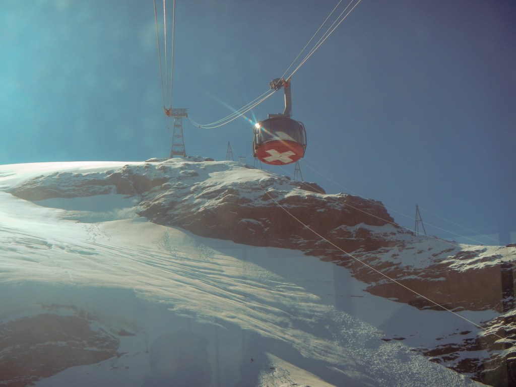
I set off to walk to the Bergstation for the cable car at Truebsee and my husband followed in the cable car (actually he overtook me) after he had bought tickets for us both to go to Titlis. It was a shorter walk for me that day and there was time to do this as a side expedition. My husband even showed the ticket lady at Engelberg my Guest card and got the appropriate discount for me!
We met at Truebsee and were soon in the Titlis Express Gondelbahn and then the amazing Titlis Rotair which turns round through 360 degrees with spectacular views during the transit to the Titlis Bergstation. At the top the views were stunning – true there was some cloud but it cleared every few minutes. We crossed the bridge on the cliff walk, taking the obligatory photos to prove we were there. We then had an equally scenic return journey to Truebsee.
My husband decided to walk with me to Jochpass (2km with 440m ascent) where we had a coffee together before he returned on the cable car and I walked on to Engstlenalp with a steep descent and then an easy mile or two past what seemed to be “Marmot City”.
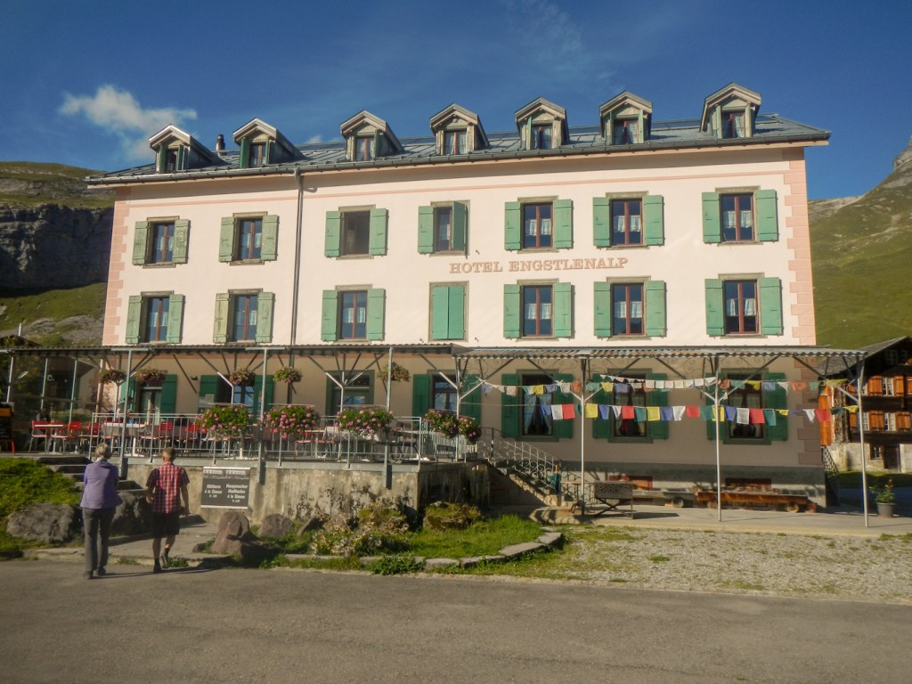
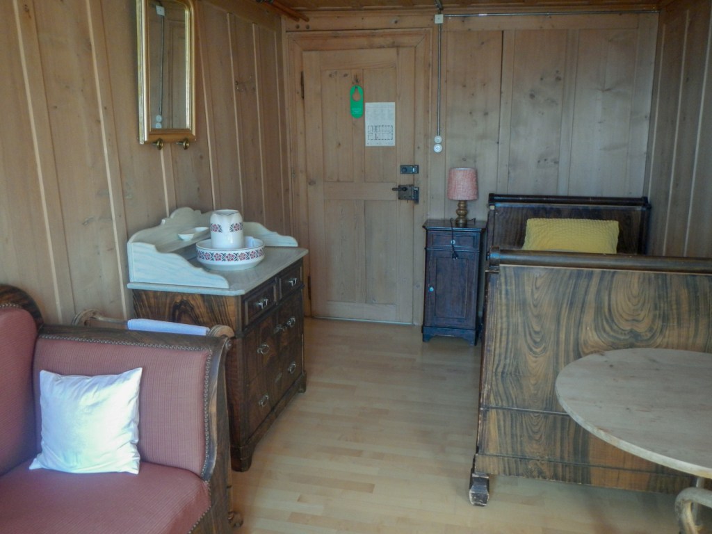
The traditional Victorian hotel is an amazing place with very traditionally furnished rooms – although all mod cons as well. I booked in and then strolled down to the lake to sit and write my postcards in an atmospheric setting. I sat opposite an elderly Swiss walker for my evening meal – he was surprised that English people knew about this hotel – but I explained that actually it had all been arranged through Alpine Exploratory. It was certainly a very different type of place to stay and I wouldn’t have missed it, although I’m sure the bed wasn’t good for my back.
In the morning I saw from my window a young girl of no more than seven or so, confidently herding cattle. Although she will know which are docile…..
PLANPRATTEN – SUNNY WEATHER AND A VIA ALPINA HIGHLIGHT
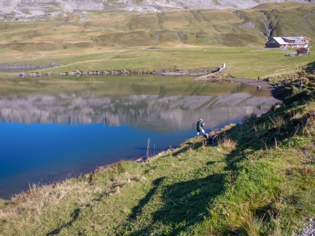
It was a beautiful day with a clear blue sky and there was no doubt that the route to do was that via Planpratten as the exposed areas would be as easy as they could ever be. I decided to have a relaxed time and take the route at leisure to enjoy the stunning scenery. hence having arrived at Tannalp with its small church, I stopped for a drink at the hotel. The views to there on to the valley below were stunning. I was surprised to see a road train arrive at the hotel disgorging a number of passengers and taking on board a solitary walker with a big rucksack. The route continued to be scenic passing a lake with fishermen and then climbing more steeply to a viewpoint at Balmeregghorn (2255m). The view to the north was of a lake and large modern looking hotel complex; the Gental valley remained in view to the south.
The path to Planplatten was high but undulating with magnificent views. It was a pity that it was so crowded though – a function of the near perfect weather conditions and the fact that this mountain is accessible by a multi section cable car and gondola from Meiringen. The high level walk with views of multiple snow topped mountains continued with a couple more viewpoints in the ensuing 500m before dropping off the ridge and descending towards Meiringen.
It was a long way down and the path seemed to be just the wrong angle to make it all feel extremely tiring. I stopped for a rest on the route of a children’s activity walk feeling totally exhausted. Eventually when I arrived at Reuti with only 2.5km to go but still 470m descent, I bought an ice lolly to try to cool down a bit. I was pleased to reach Meiringen, pass all the Sherlock Holmes tourist features and arrive at my hotel. Unsurprisingly given that this town is the birthplace of the meringue, there were some mini meringues in my room in addition to the customary bottle of spa water.
MEIRINGEN TO GRINDELWALD
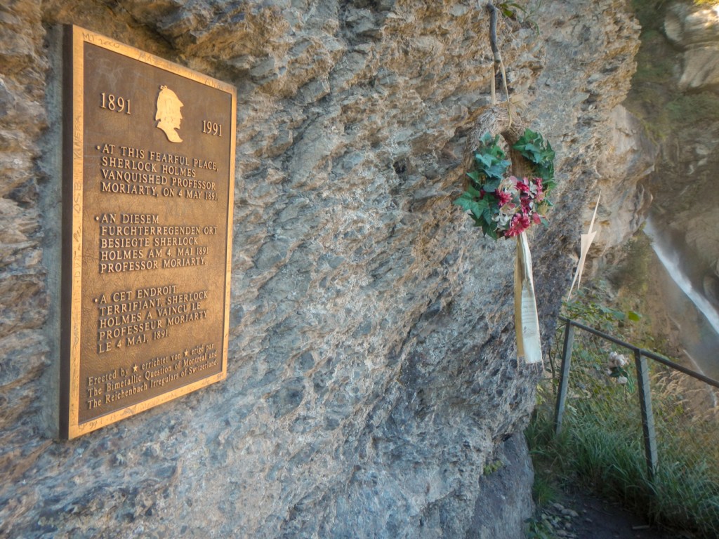
I woke to another dry day and was soon out of Meiringen and heading for the Reichenbach Falls where I visited the spectacular viewpoint for the waterfalls and memorial to Professor Moriarty the fictional enemy of Sherlock Holmes.
The path continued to ascend, keeping fairly close to a road where there were many cyclists and electrically assisted cyclists as well as cars and the Postbus all heading for the same objective – the pass at Grosse Scheidegg. I overtook a Swiss couple as they were taking photographs; however they were carrying less weight in their rucksacks and as I had expected they soon caught me and I stood aside to let them overtake.
I realised that I would get to Grosse Scheidegg at about 1pm and actually had plenty of time to stop for a meal at the restaurant, and then I would have my lunch bread and cheese in the evening. I was in the queue for an outside table immediately behind the couple I had seen previously. They invited me to join them which seemed a good plan. Markus and Gayle were wonderful company and we actually discovered a lot of common ground in our conversation and our reasons for enjoying active hobbies. Gayle even had exactly the same trekking poles as mine – but I advised her not to take mine in error as one of mine snapped and is repaired with Duck Tape. It was a temporary repair but that was three years ago….. I enjoyed my rosti and the brilliant company but all too soon we were settling our bill and leaving.
I had toyed with the idea of taking the balcony path to First and then descending to Grindlewald. If I was not a purist, this would have been a great option as I could have eased my descent with the cable car from First. However I knew that I would regret this as “cheating” and I wasn’t keen on undertaking additional descent (the ascent being less pressure on the limbs does not worry me). Particularly having spent time on a leisurely lunch, I opted for the standard route. Nonetheless there were plenty of views of the high mountain range including the Wetterhorn. I kept seeing a fascinatingly inaccessible looking building perched on the mountain and learned that it was a SAC hut. I caught Markus and Gayle and we walked the last bit together, dodging the trottibikes being ridden down the hill by young people with varying proficiency.
I was pleased to book in and discover that I would be able to make an early start the next day as I was due to cover two of the Alpine Exploratory stages and reach Murren in a day. Even though it was a Sunday, it would be possible to have breakfast at 06:30am. I walked down into Grindelwald village which I know having stayed there in the past. It all looked much as I remembered it except that the BOB trains were modernised with a fresh new livery and there was a brand new sports centre. Despite Covid19, it was bustling and busy and there was even a band playing near the supermarket.
OCCASIONAL VIEWS IN JUNGFRAU REGION
The weather next morning looked good and I set off downhill initially to the valley then a relentless climb on narrow roads and tracks with views back over Grindewald and the Wetterhorn. I passed a small field and spotted some goats. I saw Markus and Gayle but overtook them for a change as they were finding the hill heavy going. I was fortunate to be early enough to see some fine views of the infamous north face of the Eiger.

Sadly by the time I arrived at Kleine Scheidegg, everywhere was shrouded in cloud. Virtually the whole descent to Wengen was in cloud which was a pity as there would have been fine views. Some runners were ascending, on the 9km run from Lauterbrunnen to Kleine Scheidegg (Jungfrau Marathon supporters’ run) which can be completed solo with chip timing. What a contrast from that day in September 2006, sunny and warm and the course thronged with supporters, bell ringers, Alp horns and even a bag pipe player when I completed the Jungfrau Marathon. It’s so sad that all such events have been cancelled this year although positive that alternatives are offered, demonstrating our resilience in the face of adversity.
I actually had good views as I descended from Wengen to Lauterbrunnen and I remembered how difficult that part of the Marathon running uphill had seemed in 2006. Rain started in earnest as I ascended the valley on the other side to walk towards Murren. However there were dramatic waterfalls. A path diversion was confusing so late in the day and in such inclement weather and I spent some time working out which way to go when I reached the railway station at Mittelberg. Fortunately I made the right choice and was soon in Murren which was wet and almost deserted.
The large hotel (Hotel Jungfrau) seemed to be virtually empty and check-in was “remote” due to Covid (normally 24 hour). The hotel information leaflet told me that heating is on every day of the year – not that day though as I couldn’t get the heated drying rail in the shower room to heat up at all. I visited the restaurant briefly to look at the menu but it wasn’t anything I fancied so despite the rain I ventured out and ate pasta at a very pleasant restaurant opposite the railway station (Eiger Guesthouse). Breakfast was advertised in the hotel information from 07:00am but actually was from 08:00 due to Covid19.
SEFINAFURGGA PASS AND AN OLD POST BUS
At breakfast, I met probably the only other occupants of this 60 bedroomed hotel, who happened to be a couple also booked through Alpine Exploratory. I had actually “caught up” with Robert and Lisa, keen ultrarunners from the North of England as they had started at Sargans two days before I had been there. Incidentally that’s the only “catching” I did as they walked much more quickly than me, admittedly only with day rucksacks as they had opted for luggage transfer. They would also have chosen to eat breakfast earlier too. We had a hard day ahead of us (black 3 on the Alpine Exploratory system) with poor weather conditions.
The views were sadly non-existent – a pity as this part of the walk had many comments on the route card about fine views. We independently decided to forsake the especially scenic Alpine Exploratory alternative and take the somewhat shorter main signposted route via Spilboden. They left ahead of me having found they could get into breakfast at quarter to eight (I hadn’t gone back down until eight). I met a Swiss couple also on the VA1 as I was walking to Rotstockhutte and we walked together past a herd of somewhat frisky cattle accompanied by a bull.
Rotstockhutte proved to be a popular refreshment stop. Lisa and Robert were just leaving as I arrived in close proximity to the young Swiss couple – a self employed graphic designer and a primary school teacher but both taking an extended break from work. I enjoyed eating a piece of cheesecake (as recommended by Lisa) with my coffee and left before the Swiss couple.
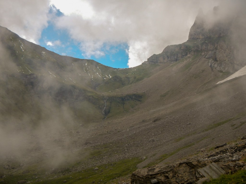
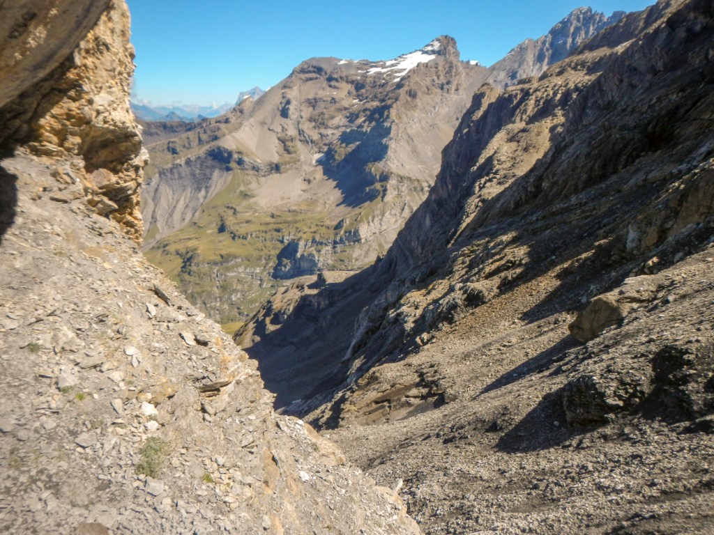
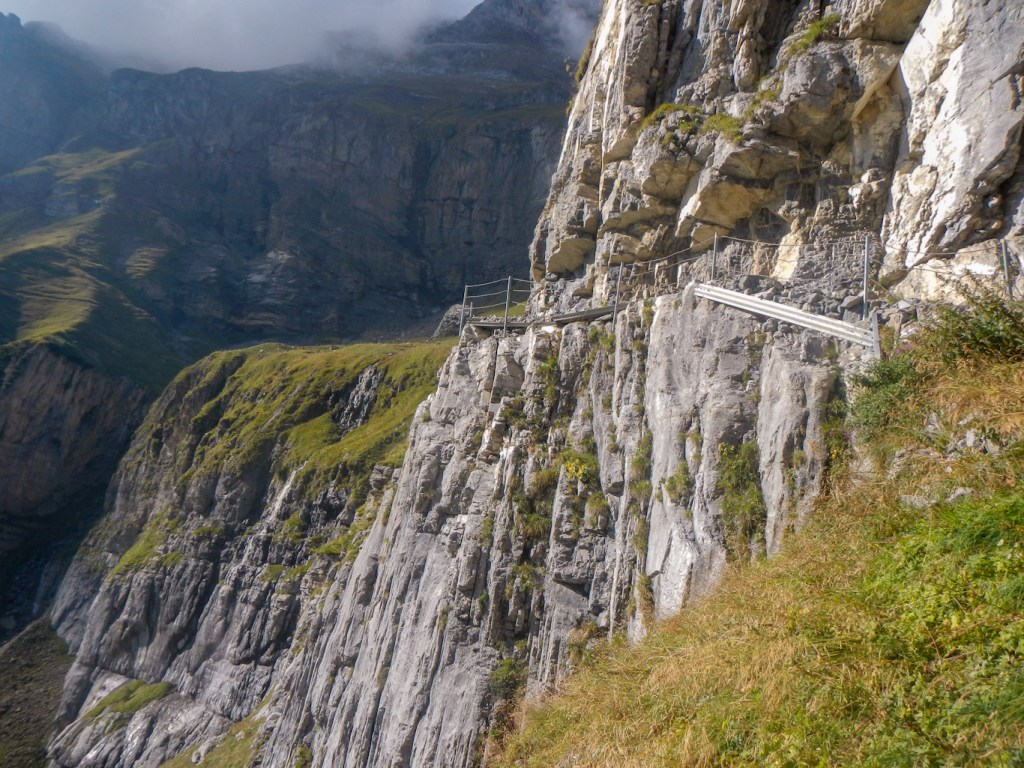
There were occasional breaks in the cloud but mainly visibility was poor. it was a difficult climb up to Sefinafurgga, with fixed ropes in places. 2612m was the highest point of the walk so far. The route card mentioned the view to Griesalp being revealed but of course it wasn’t! Instead there were an endless number of steep and frequently narrow steps descending the scree and a handrail that was only helpful in parts. I descended extremely slowly and cautiously. It could have been worse – it wasn’t snowing. I could hear the Swiss couple approaching behind me and was anxious about slowing them down – to overtake would have been impossible. Eventually I couldn’t see any more steps ahead of me – just the downward scree. It was terrifying and felt even worse as I knew that I was being watched by a couple who were doubtless much more sure footed and confident than me. Somehow I missed the fact that the path turned sharply to the left at that point and I attempted to continue ahead. As I realised my mistake, the Swiss couple caught up and I managed to get back on to the path.

I, of course, invited them to overtake as I continued to creep slowly down the path. They decided to wait for me and invited me to continue to descend with them owing to the adverse weather. I was reluctant as I am aware that I am a slow and cautious descender but they insisted. The path was well marked but it was easy for the person leading to miss the next marked boulder as indeed I had done at the end of the steps. In fact they did it a couple of times so I was relieved to note that this is so easily done. It was interesting to talk to them about differences in life between Switzerland and the UK. They told me about the Swiss National Service system for all male Swiss although the man explained that he had fractured his humerus in a skiing accident and so had completed community service in a role designing public information posters. The concept of National Service and the fact that even in the 21st century this only applies to males was as alien to me as the concept of the UK NHS to them – they wondered how it is possible to stop people wasting NHS time with no incentive to self care and thought it was unfair that a rich healthy person would pay so much more towards health than a less affluent person.
In conversation, the descent down the now less steep terrain went quickly. They turned off to reach their accommodation at Bundalp (saved some descent and ascent overall for them) and I continued down the track and road to Griesalp.
Apart from walking straight past the hotel and then turning back again, this went without incident and I booked into my room, oblivious to the fact that when Robert and Lisa had arrived they had been told that the bookings had been cancelled. This problem had all been sorted out by Alpine Exploratory for them and also for me. It was an extremely nice room with a good view onto the road and the bad weather meant that I had arrived relatively early. Markus and Gayle who I had met before were also at the same hotel.
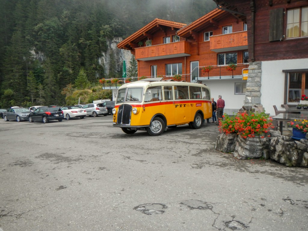
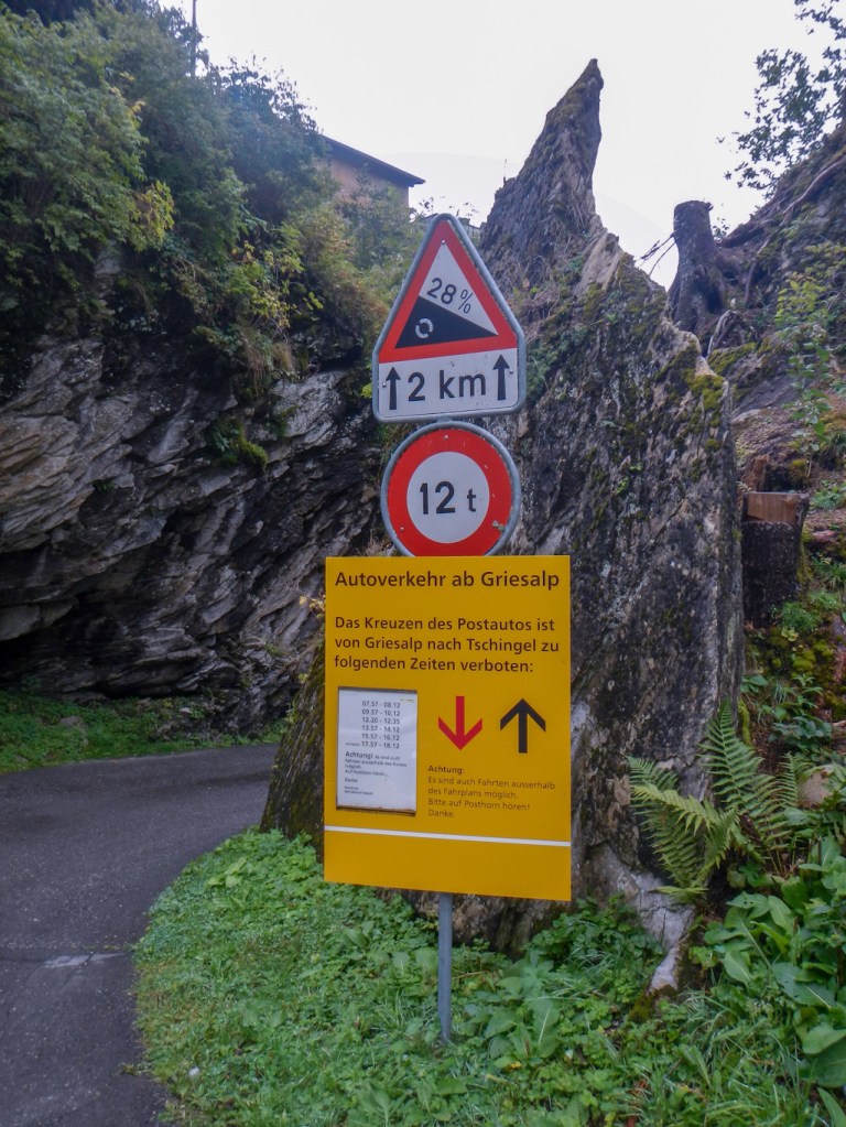
I decided to go out and explore the road out of Griesalp as the onward path doesn’t go that way and it is the steepest road for any scheduled postbus route in the whole of Europe (28%). I thought I had missed the last postbus journey of the day but, as I walked, I heard the unmistakeable sound of the post bus horn. I was extremely fortunate as this was a 1946 restored vintage postbus (the specific one that had done this route in the past) and the staff at the hotel had never known it to visit before. The very kind and proud driver who had restored the bus slowed down on the hill as he went back down the gorge later just so that I could get some photos of the most dramatic part. There were also some big and dramatic waterfalls in the area.
Next morning I saw a fox as I looked out of the window but was too late with my camera. Breakfast wasn’t until 8am and already the first day trippers had arrived on the postbus.
HOHTURLI AND BLUMLISALPHUTTE – HIGH POINT
The weather was a complete contrast from the previous day – hot and sunny. The distance to the high point at Hohturli was only 5.5km but it involved 1400m ascent. The walk is graded by Alpine Exploratory as Black 4. It took me from around 09:00am to almost 12:30pm to get to Hohturli. The last bit was up steep steps but in these warm dry conditions there was less difficulty.

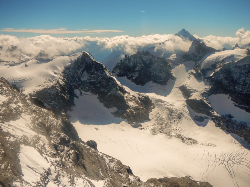
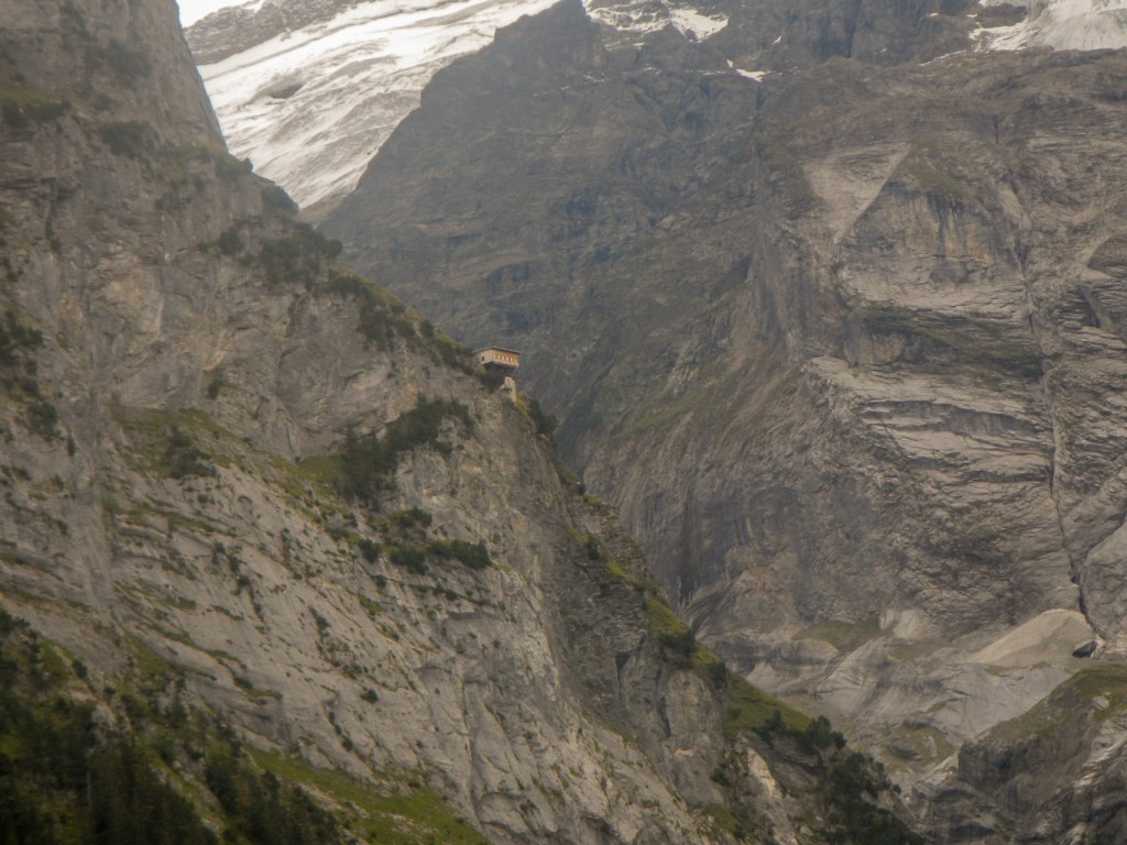
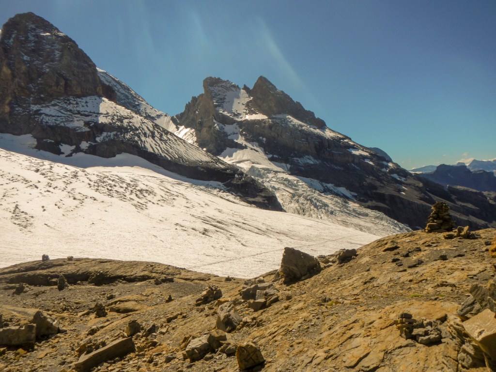
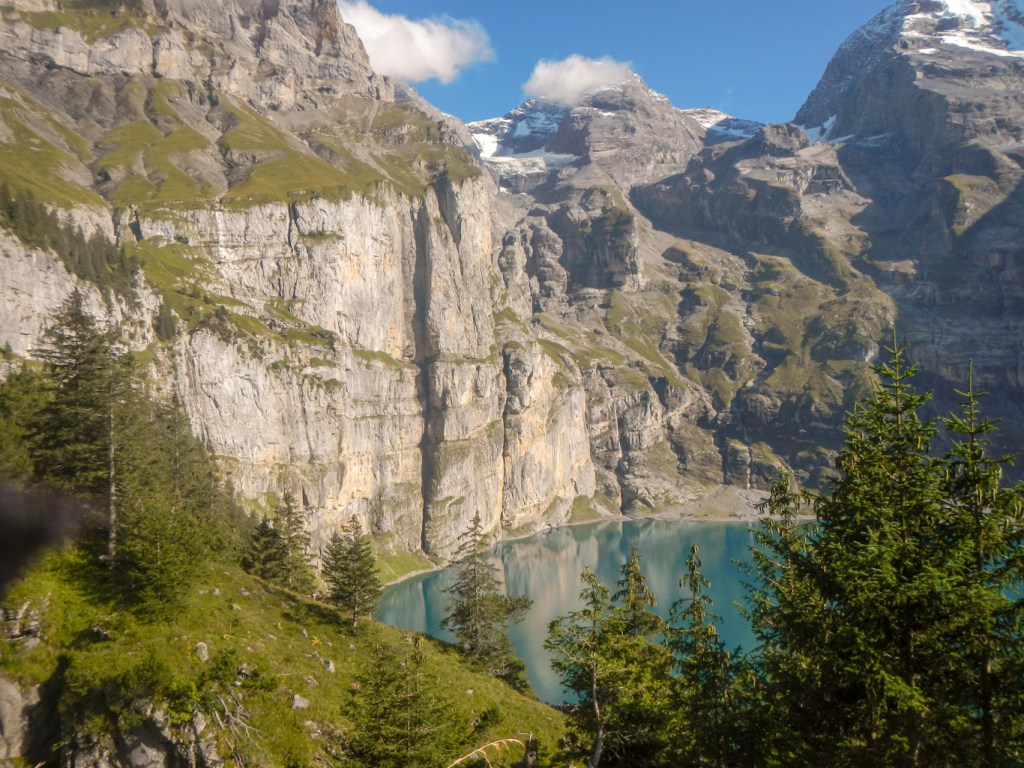
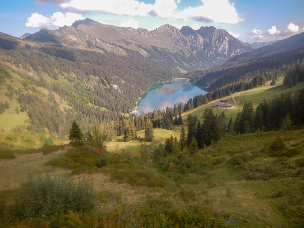
Once at Hohturli I could see the very tempting SAC Blumlisalphutte (2,834m). This would be the highest point I would reach so given the excellent weather and visibility I made the ten minute detour. Of course I stopped for a drink as well as walking along the path towards the glacier. Markus and Gayle were there and reported that Lisa and Robert had already been and gone.

The descent was similarly slow down stony scree and rock which was hard on the feet and knees but with superb views of the glacier. At long last I arrived at Oeschinensee, still in excellent hot weather with amazing views, Of course in these conditions, running out of water was a problem and I bought another drink as I passed the hotel at the end of Oeschinensee. I met people who were descending from another hut and they warned me about the last cable car down to Kandersteg. However it didn’t matter as I walked down the road from the lake and the path where the road had been diverted following landslides.
Eventually I arrived in Kandersteg at my hotel at around 18.45. Again there were closure related difficulties, I couldn’t get through on the phone and Alpine Exploratory helped me out yet again. My hotel was closed for meals on Tuesdays. Having stayed at Kandersteg in the past I had recollection of a cafe at the railway station. I was really fortunate to be just in time to eat the menu of the day – it was incredibly good value and all served very efficiently as they closed at 8pm. Most of the rest of Kandersteg appeared to have “closed down” apart from a very expensive looking hotel. Indeed it was expensive as Lisa and Robert had discovered….
BUNDERCHRINDE AND ADELBODEN
Next morning the weather was good again! I was early to breakfast which was just as well as a group of motor bike riders who didn’t seem to be staying there arrived and decimated the breakfast buffet! I wouldn’t have ventured for any more food after that as I would have worried about Covid. I went to Co-op to buy my lunch provisions and discovered a young English speaking South African who was volunteering at the Kandersteg Scout Centre but had a day off and was planning to travel by public transport. He had forgotten his mask and masks were only for sale in bulk at Co-op so I offered him two disposable masks from my remaining vast supply. I had expected to need masks much more in hotels and shops but this had not been the case yet. He was overjoyed – his potential wasted day had been saved. The little good turn made me feel happy for several hours! I also saw Robert and Lisa who had opted for a more luxurious combination of hotels than I had done – although to be honest many days we were at the same hotel. We walked together until the path steepened and I wanted to slow down. I explained to them about the Scout site in Kandersteg (which we walked through) and the Guide site (Our Chalet) in Adelboden.
The slopes became steep (black 3 and medium today). I was overtaken by an elderly man running up the hill. Almost at the pass, I met a French couple – the lady was an even more cautious descender than me. The views were excellent. Once more I was tricked by thinking I was near the pass but the top was false. However by lunchtime I was at 2385m (Bunderchrinde) and enjoying excellent views towards Adelboden. The pass was unsurprisingly a popular lunch spot.
After lunch, it was almost downhill all the way with a steep scree path initially. Nearing Adelboden, I saw the sign to “Our Chalet” but having visited it once before I did not feel the need to look at it again. There was a steep uphill at the end to reach Adelboden. I saw a helicopter ambulance to land ambulance transfer as I neared the village.
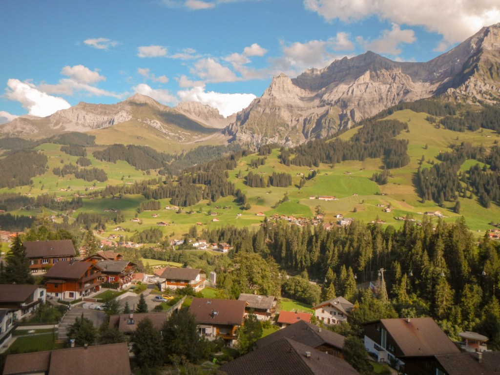
My hotel Waldhaus-Huldi was at the far end of the village. It seemed a long way. The welcome was without equal – I was told that I was just in time for afternoon tea, shown quickly to my amazingly spacious room with balcony and told that I could go to the lounge near reception for complimentary tea and cake. I could even see the notch of Bunderschrinde from the balcony. Later when I asked the receptionist which building it was I also discovered that I could see “Our Chalet”. After drinking a few cups of different Twinings teas and eating several cakes, I wandered round the village and decided to buy some provisions to eat sitting on my balcony rather than going out for a meal. I also decided to deposit my shopping in the hotel and walk forty minutes up the hill to the west of Adelboden to a prominent viewpoint. There was a flag and large binoculars for free public use as well as a photograph naming all the features of note, so I stayed there for longer than I had intended picking out all the features in Adelboden and over the mountains beyond. I realised that it would be getting dark and so I rushed off back down the hill, actually finding a short cut on the route back to the village.
MORE MOUNTAINS AND WATERFALLS
The weather was warm and sunny again the next morning! At breakfast masks were provided. I discovered that the Swiss couple I had walked with on that wet and foggy day from Sefinafurgga were at the same hotel.
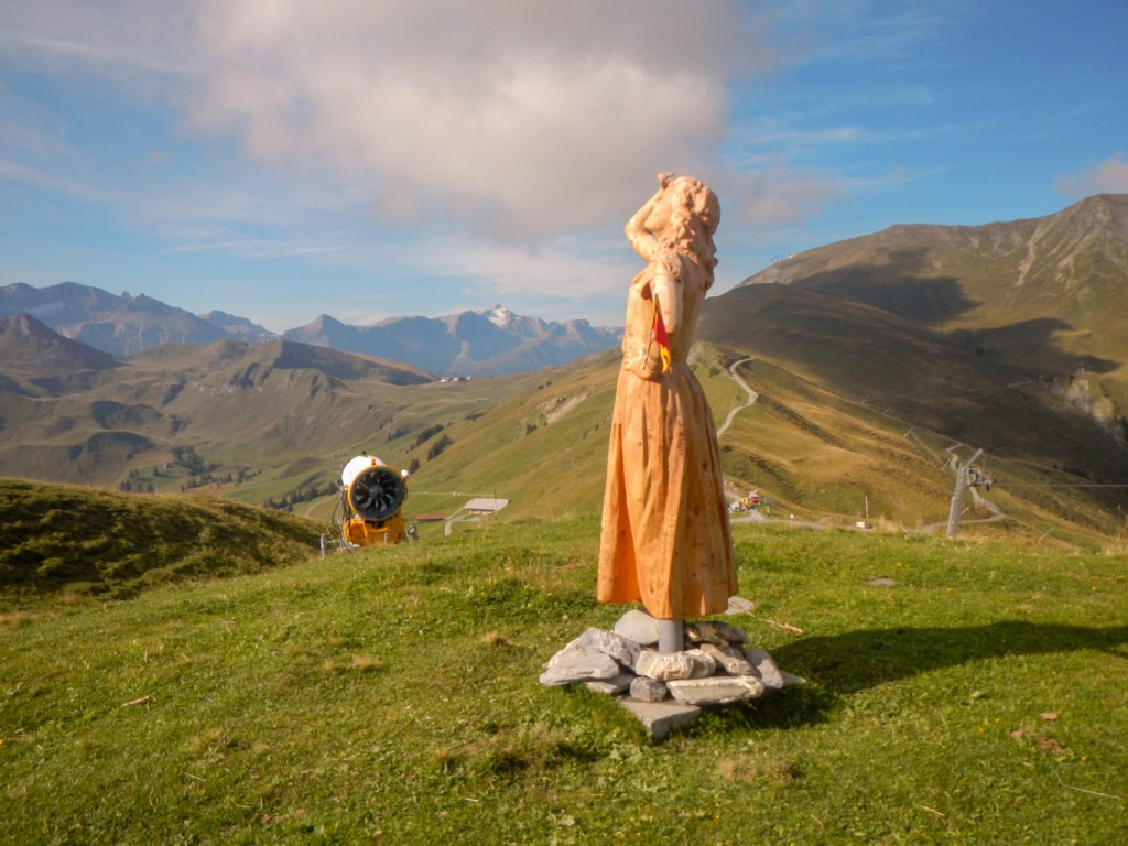
Alpine Exploratory recommended a different route to the main VA1 turning off the signposted route about 2km out of Adelboden. As it was such good weather and I was sure the views would be better, I opted for this slightly longer route with significantly more ascent. It was definitely worth doing. It meant that I climbed to the scenic top station of the Sillerenbuhl cable car – an amazing view point including two wooden sculptures of maidens marvelling at the views.
From Sillerenbuhl Berg Station I followed an easy path along a high level route with just a relatively small descent and ascent to Hahnenmoospass. The way led along a flower trail with labelled pictures of the various Alpine flowers as well as plenty of real life examples. As I came nearer to the pass I noticed a large bird of prey which I managed to photograph before it soared away. There were also many men flying model aircraft at the pass, but the bird was definitely not a glider (I have rechecked my photos).
The weather remained dry and clear so I took the longer route again from Hahnenmoospass to the saddle of Bummeregrat. I decided to take the detour to climb a further 140m to the tempting small summit of Rageboldshore. The views were superb. I ate my lunch there whilst an elderly Swiss man proceeded to take a 360 panoramic film using the camera on his phone together with audio as he recited the names of the mountains in the entire panorama. I explained that I was planning to walk on to Simmefalle and then Lenk so he pointed out exactly where I would be walking.
I returned to the pass and took the route to the waterfalls. It seemed to be a very long way as the descent was steep in places but eventually I arrived at the enormous gorge. The path down the gorge was an easy downhill track and there were many other walkers. At the viewpoint the full power of the falls was evident and it was a case of walking along as far as you dared without getting too wet. There was a second viewpoint near the restaurant and cafe in the valley floor.

After eating an ice cream there, I trudged along a riverside footpath the remaining three miles or so to Lenk. I got confused by the roadworks at the cross roads in Lenk and turned the wrong way. Having arrived at a level crossing, I consulted the map and realised that I had gone straight on instead of turning left. It looked as though the weather was about to worsen so I had been fortunate. As I approached my hotel, I saw Robert and Lisa who were at a different hotel but had already been there for hours. However they had followed the main route so missed Sillerenbuhl top station, Bummeregrat, Rageboldshore and the Simmefalle, which had all been highlights of my day.
My hotel stay was mixed – I was given a larger room but it took a long time to book in and after my long day I was keen to get to my room. It was a lovely surprise to have a bath rather than a shower. However next morning on booking out the receptionist was unhappy that the bill was to be paid by invoicing Alpine Exploratory. I was keen not to hang around as I knew that the weather forecast was for potential electric storms later in the day. Of course with the hour difference in time the Alpine Exploratory help line wasn’t open yet. However fortunately I managed to leave promising that I would ask Alpine Exploratory to call the hotel later to sort it out. Naturally as ever, Alpine Exploratory smoothed it all over as soon as I phoned them – nothing ever seems to be beyond their ability to organise!
LENK TO GSTEIG – A MIXED BAG OF WEATHER
I followed the signed route from Lenk past a really long snake made of painted pebbles. The route went under a piece of polythene tape which in retrospect I think meant that the path I had already ascended was closed – but I’m not sure why. Then I ascended past the Wallbach Falls over metal and rock staircases and emerging in a meadow. Some Swiss walkers I had seen before passed coming directly up the meadow as I had a rest and wondered how I had come that way as their app had said that the path was closed!
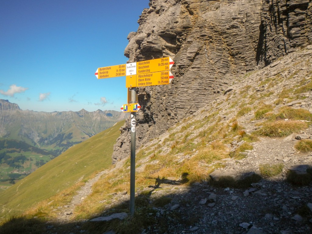
Eventually I arrived at Trutslibergpass (2038m), another good viewpoint and I could see the lower pass at Chrine which I would get to later. Confusingly, there was a path marked to Lauenen, a village I had to pass through later. However both my route card and the VA1 sign pointed towards heading to Turli, which also afforded good views.
The main descent of the day followed to the scenic village of Lauenen, where I bought an ice cream at the shop. I was accosted by a young Swiss girl on a bicycle. I couldn’t understand what she was saying and tried to explain in German that she should go away and play – I was concerned regarding both social distancing and safeguarding! Eventually I was saved by a pleasant elderly Swiss couple who spoke sufficient English and French / German to send the child away.
It was a steep climb to Chrine having already had one climb in the morning. Sadly the forecast rain arrived so I hurried over the pass and down the other side to Gsteig.
Arriving at the hotel in torrential rain, I had the usual problem of trying to gain entry. I had arrived fairly early due to the bad weather. This ended up being solved by the second phone call of the day to Alpine Exploratory. They were unsurprised as Robert and Lisa had already had the same problem. However this meant that they had the main front door code already to get me into the dry. The owner returned from shopping a few minutes later anyway. It was an amazing place with many interesting artefacts and old posters etc. in frames on the walls. My room had a good view over the main street. Like the stairways and communal areas it was all very tastefully refurbished with wood panelling. Above all there was a coffee machine with generous supplies. The rain continued so it was positive to be able to remain in the hotel for the evening meal, which I spent chatting to Lisa and Robert albeit socially distanced at a different table.
The next day the weather had improved. I realised that I hadn’t looked at the village at all so went out before breakfast to wander up and down the street and look around the interesting 15th century church with many Bible passages painted on to the walls.
INTO THE FRENCH SPEAKING AREA
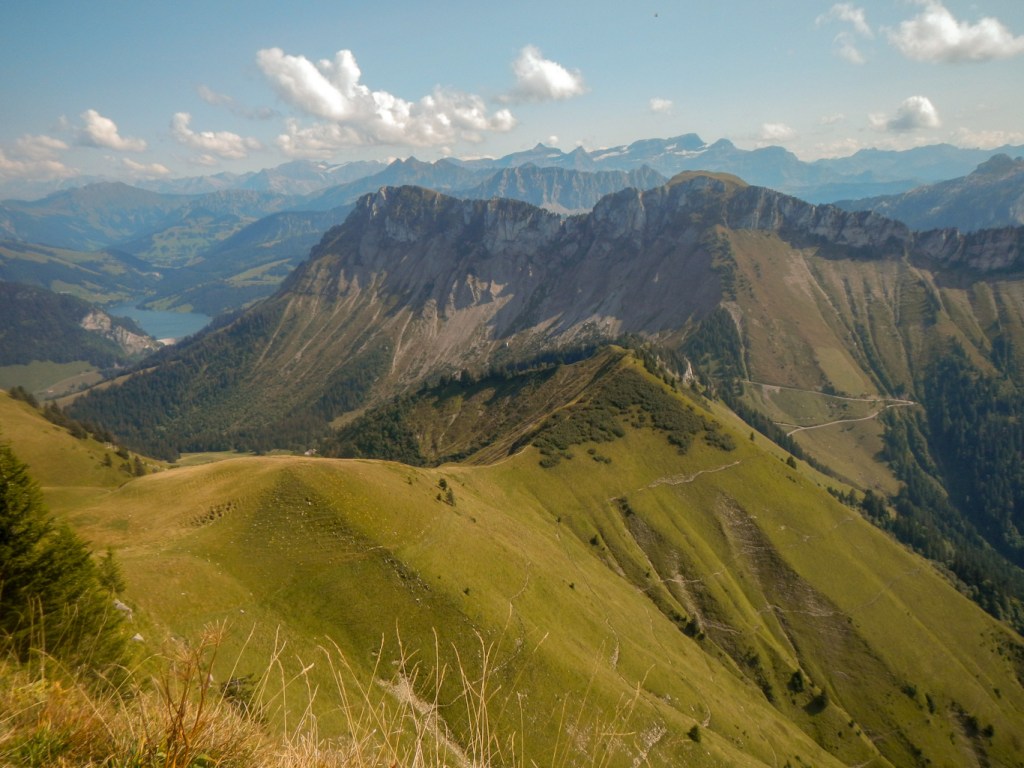
It was amazing to think that I had almost reached the end of the Alpine Pass part of my route, with only two remaining days. This was a long day with multiple passes and fine views but also a day for dodging and distancing past multiple herds of cows. The first col that I reached was Blattipass where there was a phenomenal view back to the east. It was then a case of fine views all the way over mountains and a lake to Col des Anderets (high point of the day at 2030m), where I ate lunch. This area was quite busy with walkers.
From Col des Anderets, there was a descent to La Marneche. I had hoped to buy a drink here but everything was closed despite there being many walkers. On my way there I had noticed what looked to be a fine hillside traverse on the other side of the valley. I thought it looked like a lovely path to follow but in fact, it will teach me to be careful about what I wish as in fact it was the path that I would be following. It was somewhat harder walking than it looked, especially as there were cattle on parts of the path. I came off the path at this point, crawling under a fence and creeping laboriously along the steep hillside with the cows looking mystified occupying the path on the other side of the fence. the views were excellent but it was all very tiring. The 7.5km to Cherseule seemed never-ending.
Once at Cherseule, with only 4.5km of track and lane to go, I finished the last of my water. I was confident at that stage having eked out my supplies. I was carrying purifying tablets but was anxious about using stream water given the high number of cattle.
Wrongly, I had thought that Col des Moses was more or less an isolated hotel. However a village has grown up here, including many extremely modern looking chalets. One was particularly notable for being glass fronted. These homes must be worth a fortune! I was pleased to reach the comfortable hotel and have a rest.
TO VIA ALPINA END!
I hadn’t taken any rest days and really my only easy day was the walk near the beginning after my Liechtenstein add-on when I walked from Mells to Weisstannen in the pouring rain. The walk from Engelberg had been relatively short but I had spent much of the rest of the day on my feet during the side excursion to Titlis. I was also carrying all my things for the expedition. As such, this final day on the VA1 walking 32.5km was somewhat daunting. The ascent was less at 960m but I am a cautious descender and find descent mentally and physically tiring. The descent on this day was 2065m.
Alpine Exploratory recommend a route which gives the best of both final day options included in the Cicerone guide. It goes to the Col de Chaude but then carries on to Rochers de Naye. The Cicerone Guide route from Col des Moses is 4.5km shorter with around 450m less ascent and descent but omits Rochers de Naye. To do this would have been disappointing.
Fortunately the weather was dry and clear. I made an early start which was just as well as I still didn’t arrive at my hotel in Montreux until less than thirty minutes before sunset. It was also my 59th birthday so I was keen to ensure the day was a good one.
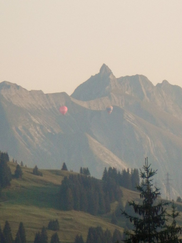
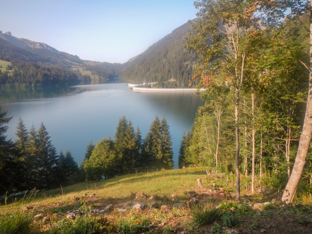
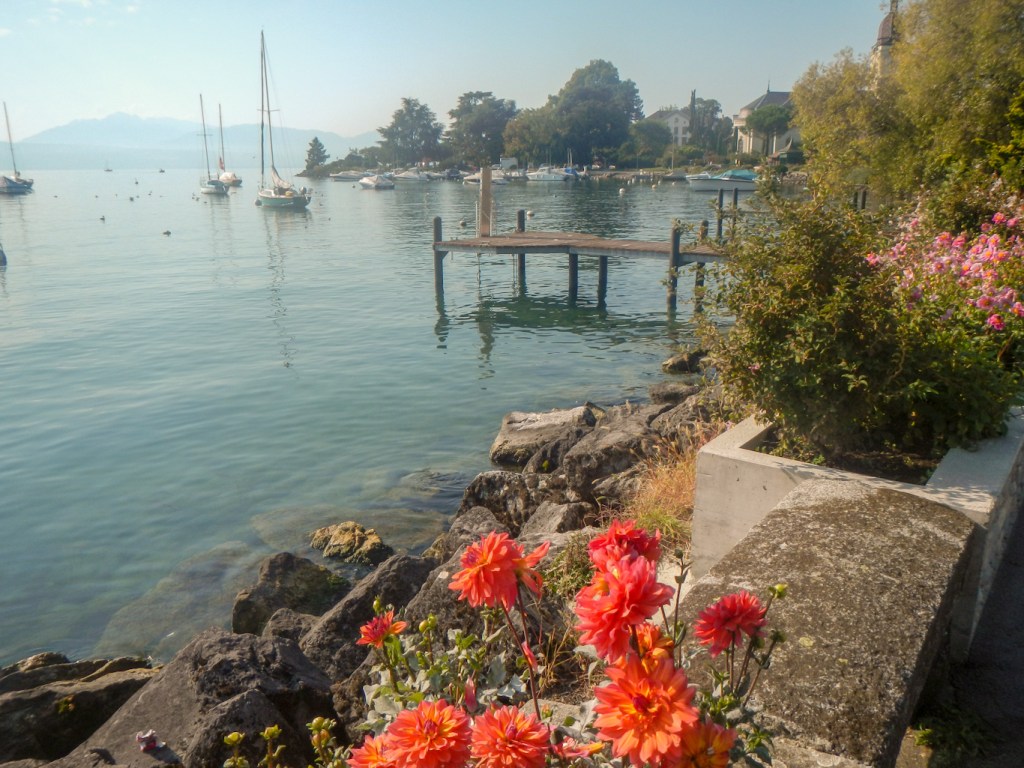
A car boot sale was setting up opposite the hotel but I wasn’t tempted by any of the artefacts for sale as it would have been even more to carry. There were at least four hot air balloons in the distance, making the most of the fine and relatively windless conditions. Early on after leaving the hotel, I had to divert to dodge past some cows but otherwise the walk to the gorge and then to the Lac de l’Hougrin was unremarkable. It was Sunday and there seemed to be many local people out fishing on the lake. The dam is HUGE.
After all that relatively flat walking, there came the uphill bit to Col de Chaude with the first views of Lake Geneva (Lac Leman). I took the turning to Rochers de Naye. This was quite a difficult rocky path. I found a spot to stop for lunch just off the path. My stop was notable for various people walking past including two female students from China who had just arrived in Switzerland to do their Master’s degrees. They were very pleased to meet someone who spoke such good English! Mainly they wanted to know how to get off the mountain and to the nearest railway station so I directed them to the road. Presumably they had travelled to Rochers de Naye on the rack railway and had walked from there, but they were almost at the road at Col de Chaude.
Lunch over, I started walking again. The path included traverses of electric fences – I’m not sure how the students from China had managed this. I misjudged one and got my only electric shock of the entire expedition. There were excellent views and the weather remained dry and clear.
Rochers de Naye was very busy. Of course most of the people had travelled up on the train. I decided not to visit the Alpine garden but I did climb up to the viewpoint and bought a couple of drinks at the cafe. It was a tremendous viewpoint and I spent just over an hour in the area.


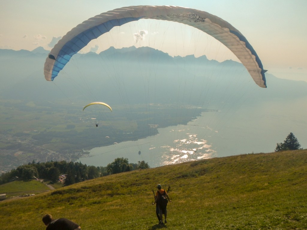
The downward path was tricky in places (even the so-called easy route). As usual I descended carefully, but also was slow in order to continue to appreciate the views. Four kilometres or so downhill took me well over an hour and then I stopped at another viewpoint to look at some paragliders taking off on the hillside.
The path from here was much easier and so I walked more quickly. Eventually I reached Glion – only 3km to go. My route card suggested descending the Sentier de la Telegraphe – reputably 1,055 steps. I did try to keep count and including all the steps at the very end after the sign I think that 1,055 was a fairly accurate count. My legs were like jelly after all that downhill on top of the ups and downs and distance over the day.
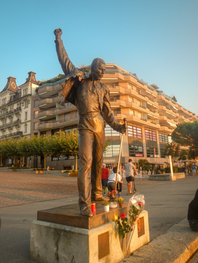
I’m not sure that I took the optimal route through Montreux but I think I took the most direct route to the lake, reaching it near the casino and then turning right towards the main jetty. There were many people wandering along the Lake-side promenade and lots of cyclists too. I suspect I looked incongruous walking along with my heavy rucksack. I discovered and photographed the Freddie Mercury statue before I even found my hotel. Robert had told me to look out for the statue so I wasn’t surprised to see it, although it wasn’t something I had known about beforehand.
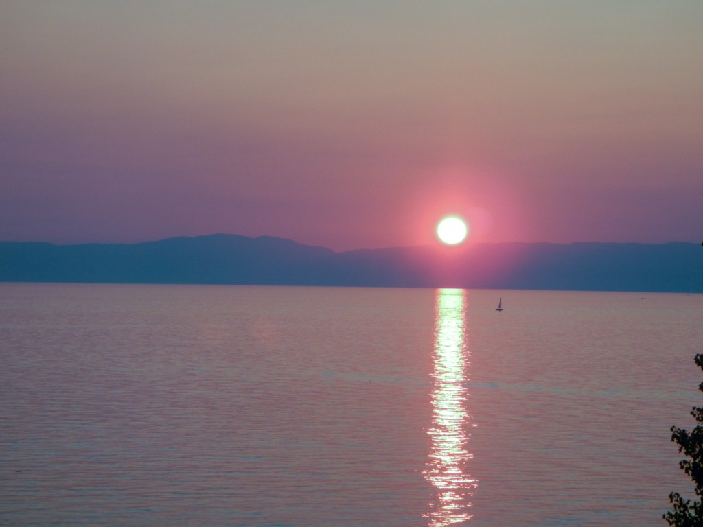
However I was nearly at my destination and the clock on my camera shows that I was in my hotel room looking over the lake from the third (or was it fourth?) floor and taking photographs of the glorious sunset over Lake Geneva only twenty minutes after being at the Freddie Mercury statue. I was really fortunate to arrive just in time to see the sun set from this unique vantage point directly behind the main ferry jetty in Montreux. My husband phoned my mobile (birthday call) just at the point of sunset and I had to keep putting the phone down to take another shot of the rapidly disappearing sun.

I was very hungry after all the walking, but needn’t have worried. There were plenty of places to eat. I found a pleasant table outside looking over the lake where I enjoyed a pizza and beer, watching multitudes of people walking past in the pleasant late summer evening.
ON TO GENEVA
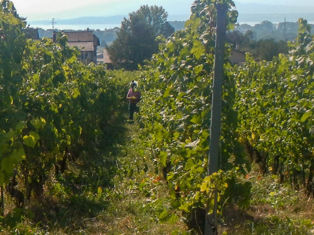
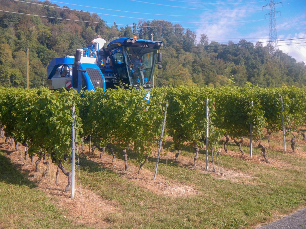
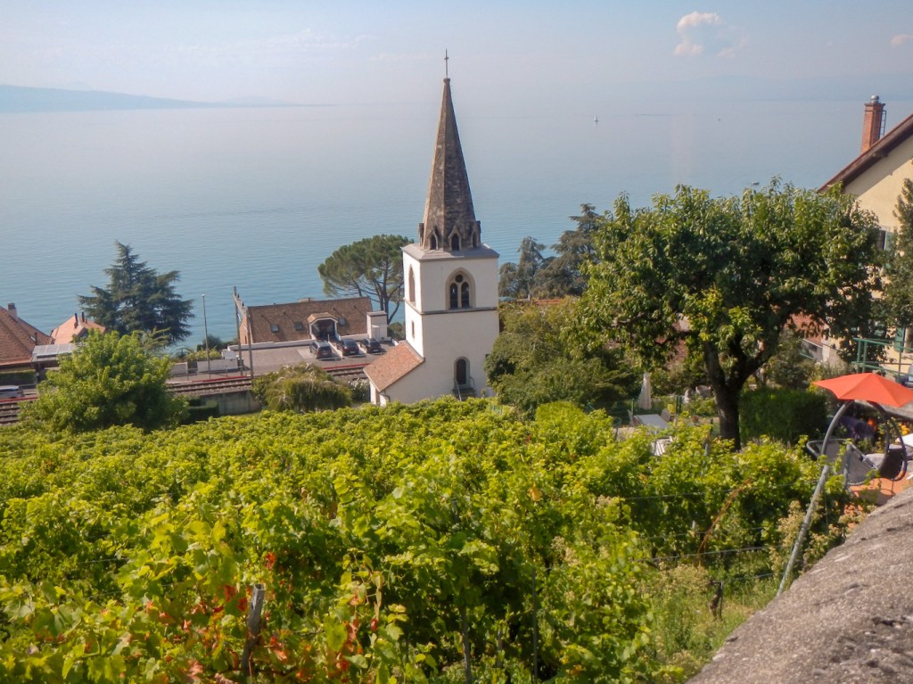
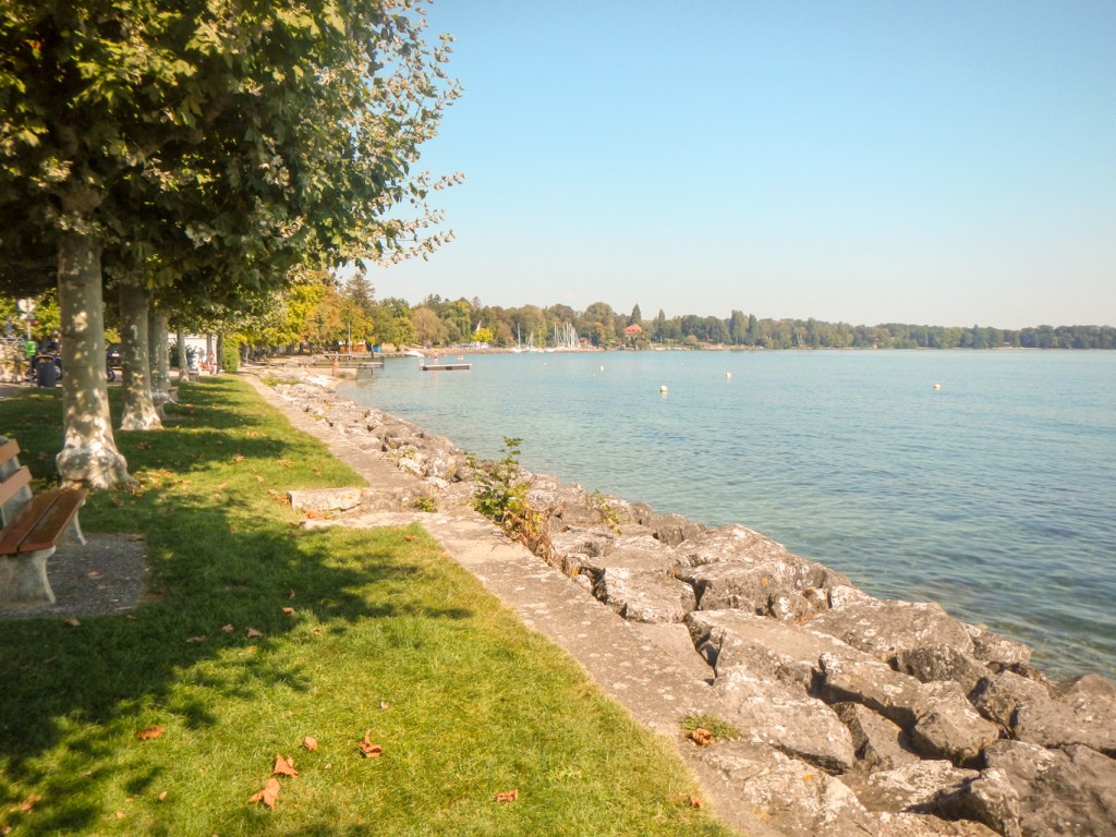
This wasn’t quite the end of my walk though as I had booked myself to continue walking for a further four days following the northern (Swiss) shore of Lake Geneva, all the way to Geneva. This mainly followed the Swiss footpaths 70, 3 and 4. It was an entirely different type of walking to the previous eighteen days being through more populated parts of Switzerland. Instead of muddy and stony mountain paths and tracks, most of it was on surfaced walkways near the lake and tracks and lanes past vineyards laden with grapes and through villages dominated by huge wine chateaux.
I saw grapes being harvested by workers manually bunch by bunch but also by the grape equivalent of combine harvesters.
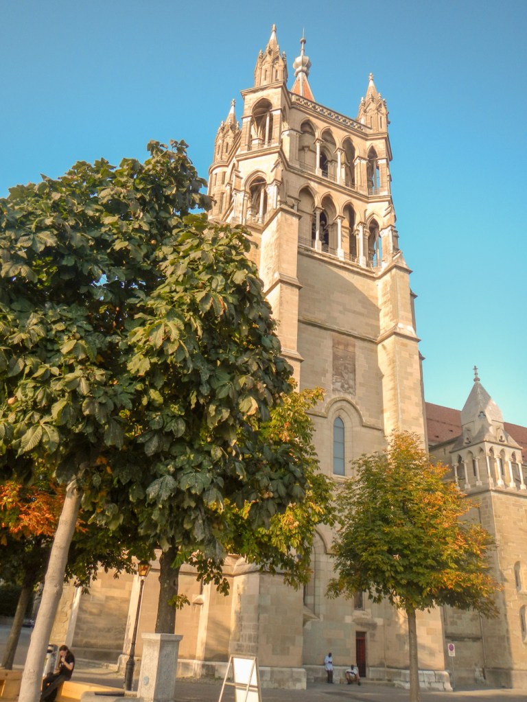
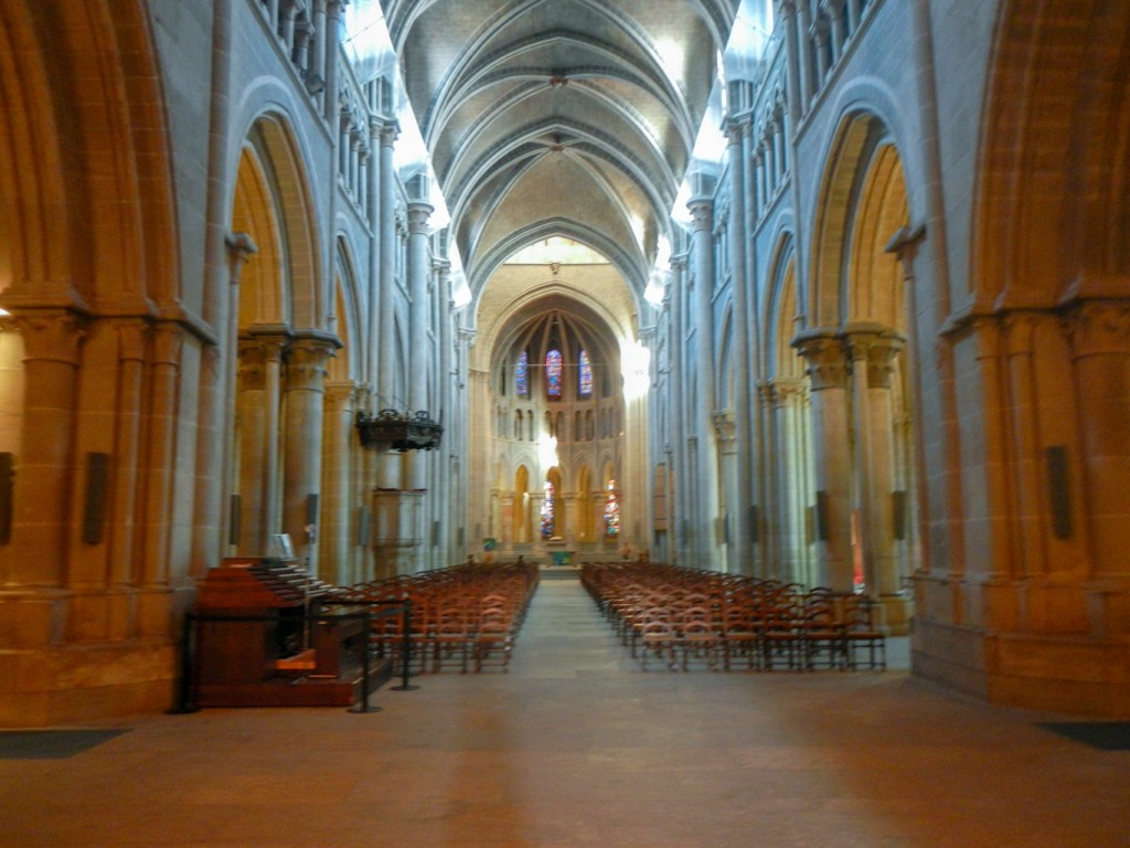
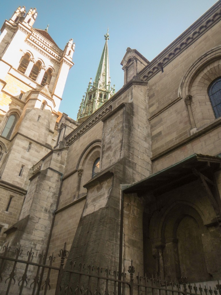
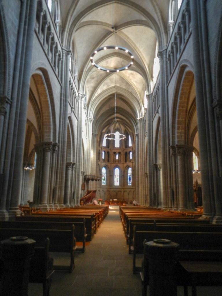
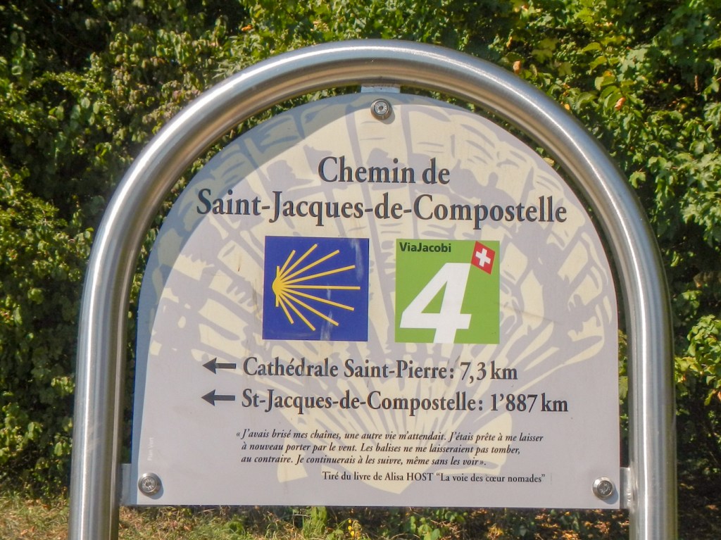
I visited many small churches with bright stained glass windows as well as the huge cathedral in Lausanne, reputedly the finest example of a Gothic cathedral in Switzerland, and the Cathedral of St Pierre at the top of the old town Geneva. In fact I discovered that part of my walk from Lausanne to Geneva was along the Swiss Way of St James which links up to a Camino route to Santiago de Compostela.
I passed beaches and bathing places on the lake, impressive floral garden displays, sports centres and the Olympic centre and museum at Lausanne. I saw the massive security protected mansions of the affluent population living on the lakeside. The largest mansions appeared to have ground going right to the waterfront and so the path diverted to the road behind whilst some of the houses had a public footpath sandwiched between their garden boundary and their private slipway.


I even passed a chocolate factory in Versoix, about six miles from Geneva, where I bought luxurious boxes of short-dated expensive chocolate at less than a third of the usual retail price. As a result I had to try to walk in the shade for the last six miles to Geneva so the chocolate didn’t melt!
I covered much more distance per day during these last four days due to the nature of the walking. Each evening I had booked to stay near the centre of an interesting town or city. Unfortunately Covid19 meant that the hotel receptions sometimes had shorter opening hours, so for example after arriving fairly early I had to carry my heavy rucksack all round Nyon until 6pm.
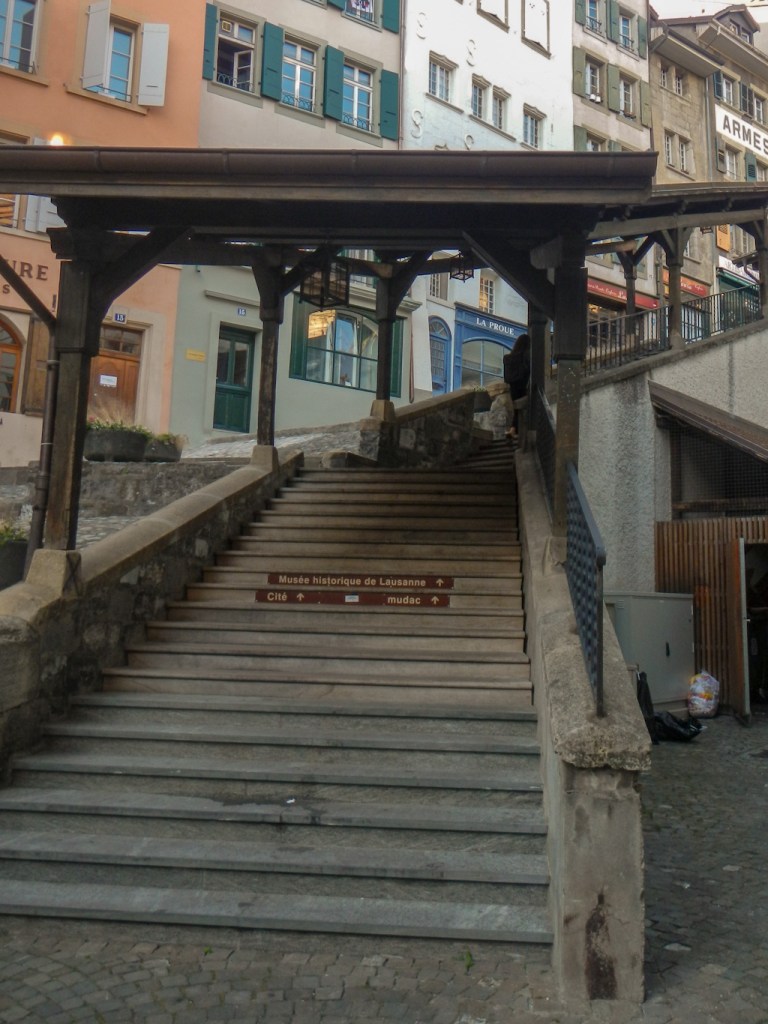
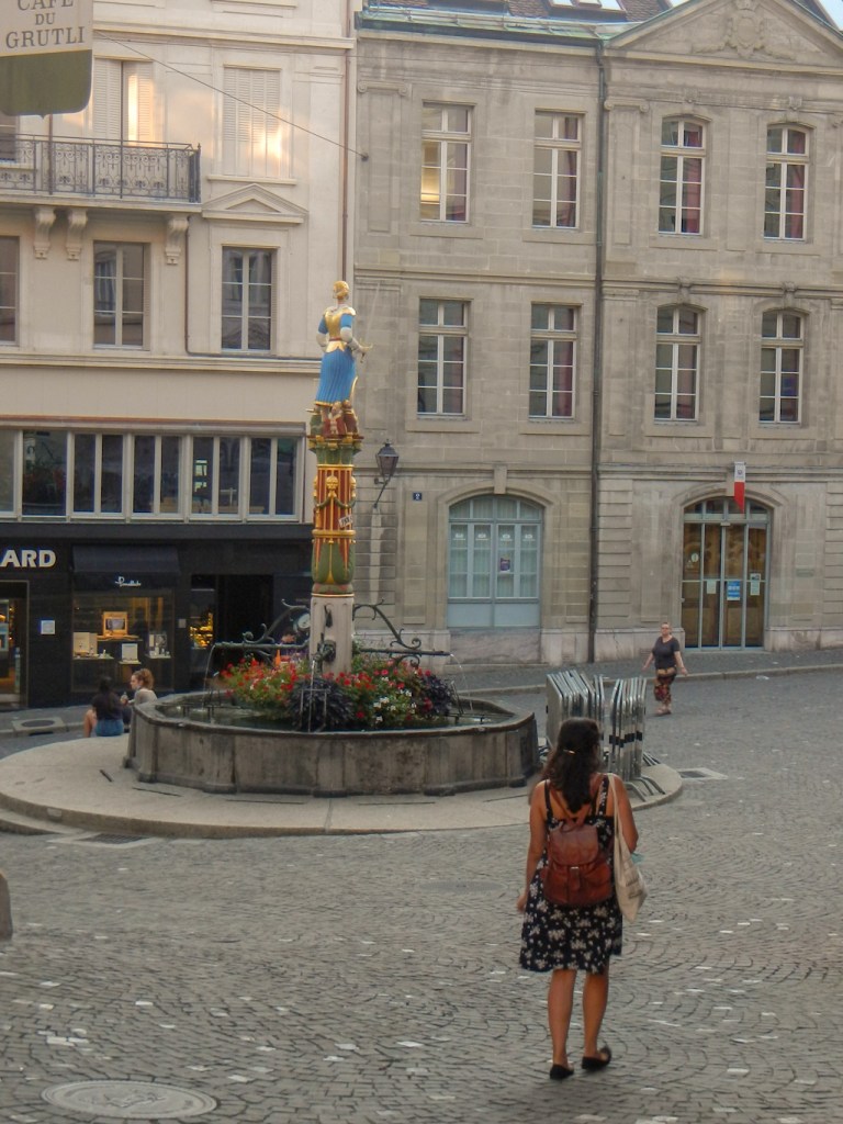
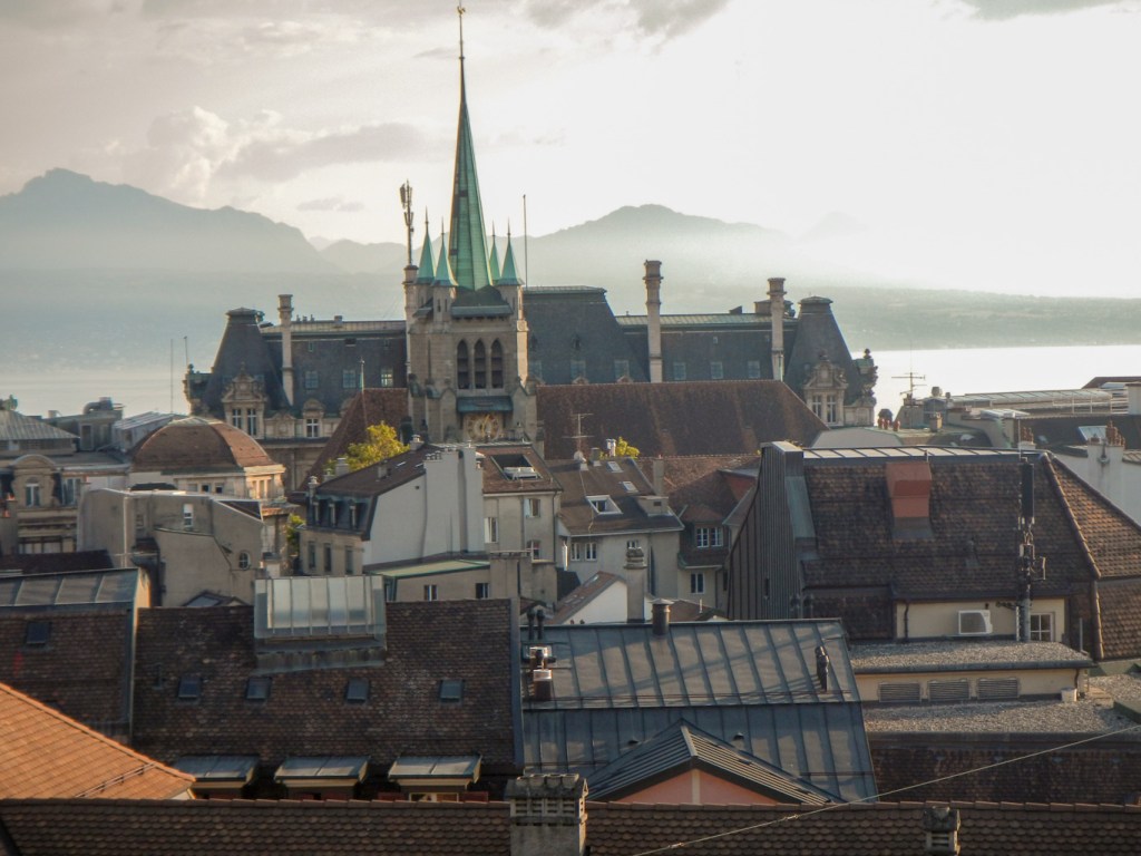
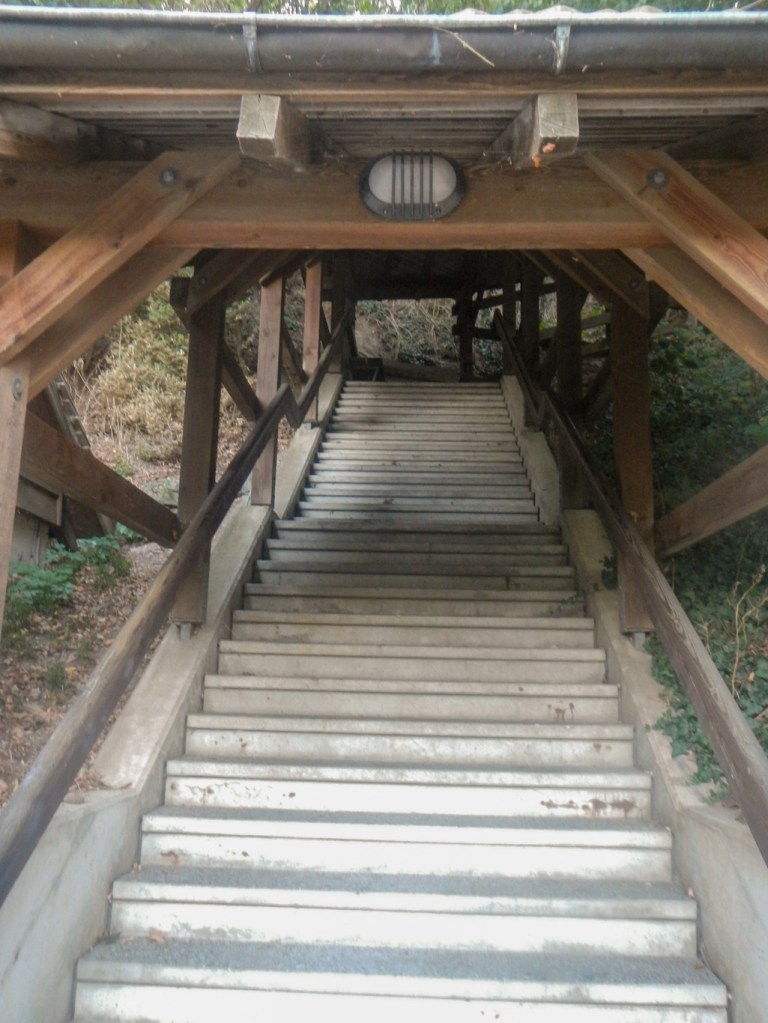
My first stop after Montreux was a hotel in the historic Place de la Palud in Lausanne. It was a challenging uphill walk from the lake at the end of the day and a long trek back down next morning. However my room overlooked the imposing eighteenth century town hall. I was also able to hear the famous clock as it played music each hour (only up to 7pm) although I couldn’t see the hourly animations from my room. I visited the impressive cathedral and saw the nearby Bishop’s Palace but didn’t go back up to hear the night watchman calling the hours between 10pm and 2am. I descended the wooden covered stairway (Escaliers du Marche) from the Cathedral down almost to my hotel.

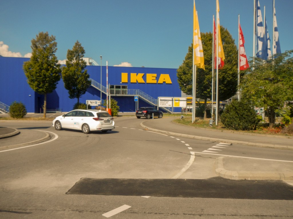
At Aubonne, I stayed in the old town adjacent to the market hall. I spent the late afternoon wandering round the old town and up to the imposing chateau with distant views over the lake. The major surprise was that between the lake and the town there is a modern out of town shopping centre including IKEA – I don’t know whether my IKEA family card would have worked there and anyway I didn’t have it with me so I wasn’t tempted to visit for a free coffee. Aubonne also had an interesting looking bike shop with very expensive looking bikes.

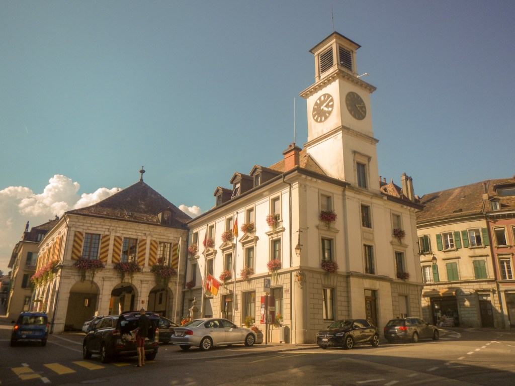
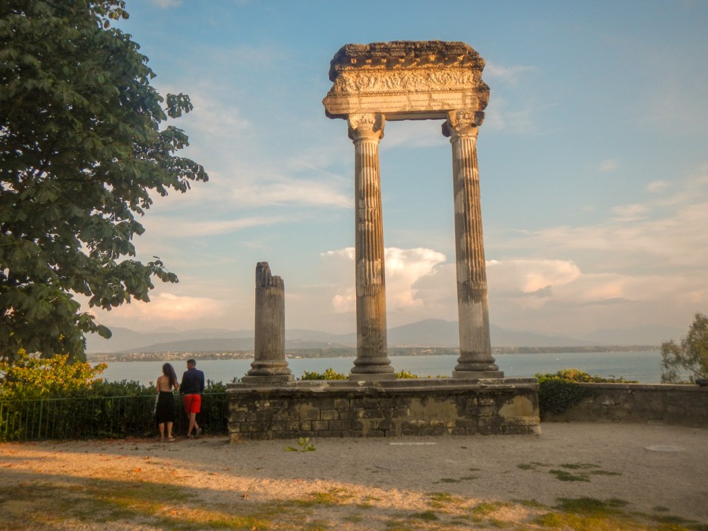
The next night, I spent at Nyon. This was a large town stretching from the lakeside and up the hill. There was a lot to look at including a large castle, a mediaeval gateway to the town, a twelfth century church with interesting stained glass and a 13th century wall painting depicting a Pentecostal scene, Roman columns and an eighteenth century sundial. There were as usual lavish and well watered floral displays in the hillside park linking the lakeside part to the higher part of the town. I stayed at a hotel in the market square dating back to the sixteenth century.
My final night in Geneva was spent at the modern hostel, where I managed to swap to a room for exclusive use by paying an additional fee. After all Geneva was one of the Covid hot spots in Switzerland and I didn’t want to take any additional risks. After walking all the way to the Old Town on the other side of the lake and walking back following my arrival in late afternoon, I realised that my card for free transport included the public ferries on the lake. Hence in the evening I crossed over by ferry to enjoy pizza sitting outside just down from the old town. It was becoming dark as I embarked on my return journey. From there I strolled on to the Plage with the lighthouse at its tip and was delighted to see the famous Jet d’Eau fountain across the water lit up in red. A memorable final evening.

Unfortunately my trek across Switzerland had ended. However I enjoyed a superb cloudless flight back to Heathrow and then my last taste of life outside the house and garden before quarantine as I travelled back to Exeter. The time away was definitely worth the need to quarantine.
I spent the next two weeks camping in the garden with minimal house access and running a half marathon round the garden for fourteen consecutive days. Thanks to wi-fi and remote access I was even able to do all my work apart from a few shifts in the first week which needed to be face to face and before the lap top was set up. Fortunately it only rained a bit. I ran more miles that fortnight than I have ever run in any previous two week period, raising over £1000 for Whizz-Kidz: https://www.justgiving.com/fundraising/drkathrynshore-mrshough
This was boosted by a phone interview on BBC Radio Devon and an article in the local on-line and hard copy newspapers. Hence the adventure didn’t really end until two weeks after I was back home.
