My destination on Wednesday 5th August was Lulworth Cove where I arrived at 10.00am having had a somewhat lengthened journey. This was due to various tractors, poor visibility in the fog but also because I missed a turning off the A35 and took a longer route. There appeared to be a lack of signposts to Lulworth. However this had not stopped hundreds of cars already parked in the enormous and high tariff car park, the people clearly managing to navigate accurately (or use a sat nav). I had my ten one pound coins all ready to feed the ticket machine, but this was high tech and only accepted phone or card payments. After studying the instructions, I managed to book in safely and realised I would have to remember to book out when I left later in the day.
I was keen to escape this crowded area and pleased to see that most visitors seemed to be drifting round the shops and cafes, heading for the beach or climbing in a long procession up the steep hill towards Durdle Door. My plan was to follow the route less travelled over the Lulworth Ranges and visit the “forgotten” village. This area is only open over holiday periods and most weekends – the rest of the year it is used as an army range.
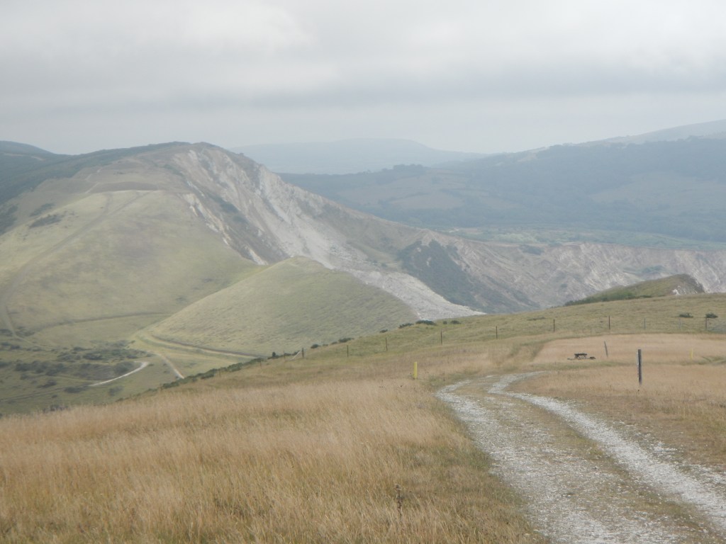
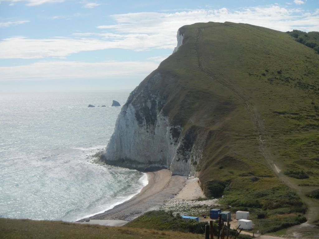
My map showed a path ascending from near the beach. I wandered round in a circle as there was clearly no way up at that point. Eventually after faithfully following “Acorn” signs (it’s part of the South West Coast Path) and ending up back where I had started I realised that there was a diversion which meant walking further up the road and then turning off. I stayed two metres behind a couple of women ambling slowly up the initial bit of footpath but they soon gave way and I was striding up the steep slope. I made a decision to tackle the path up to the high point of Bindon Hill and return later via the fossilised forest (when the tide would be further out). Bindon Hill is one of the many Iron Age sites in this area, although not a true hill fort.
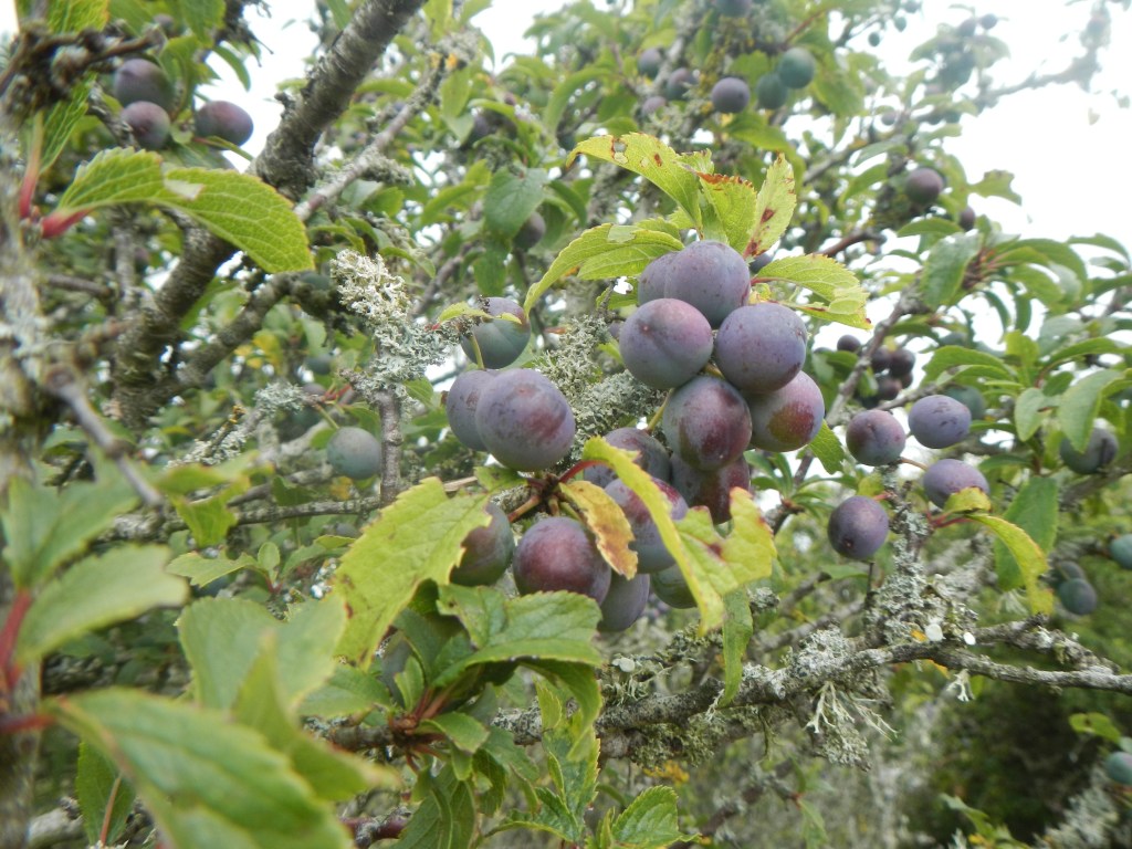
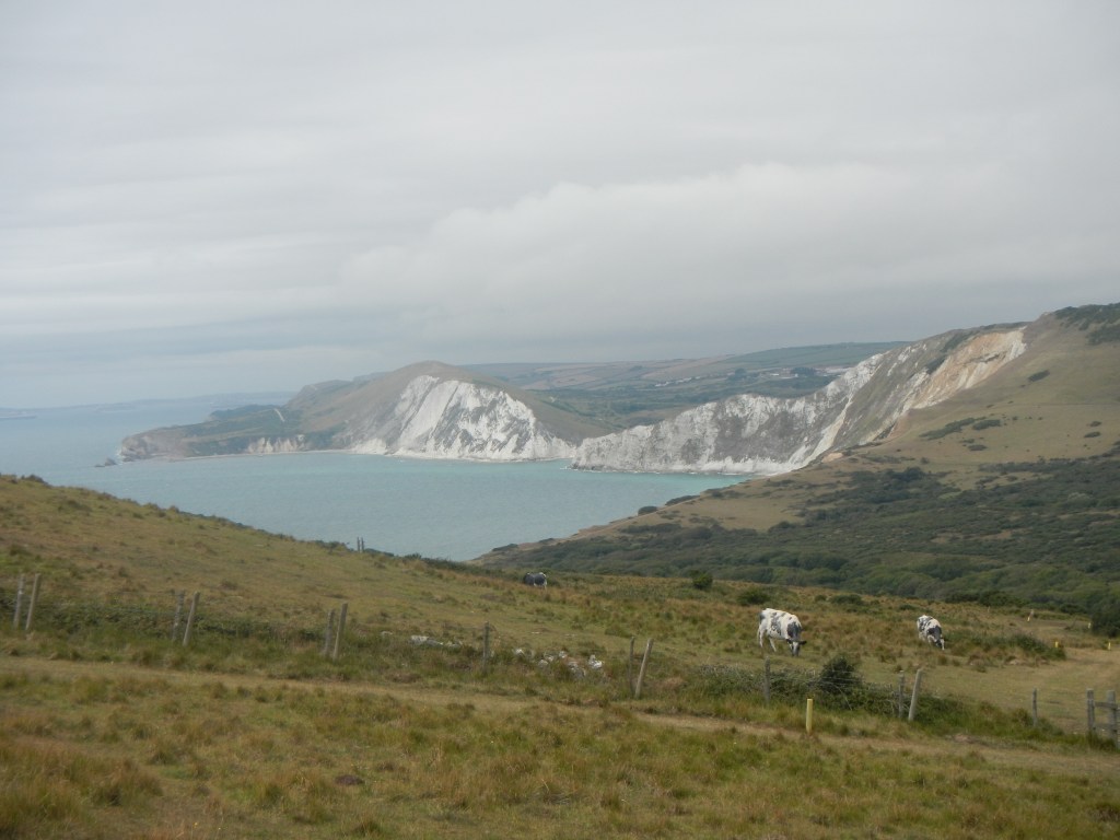
The fact that this is an army range used for live firing much of the time, means that even when access is allowed it is restricted to a small number of paths which are all clearly marked with yellow posts. However apart from the occasional “targets” and the views of the large Lulworth Camp barracks, the scenery is largely unspoilt. Cattle and sheep were grazing – hopefully they are moved away during “exercises”. Ironically the army presence means that wild flowers can thrive, there were a variety of butterflies to see and some pockets of ancient woodland, including ash, beech and oak trees as well as hawthorn, blackberry brambles and sloe bushes. I am sure that I remember reading that had the Army not taken over the land in 1943 then modern farming methods would have altered things and features of historical interest such as remnants of strip farmed areas would have been lost.
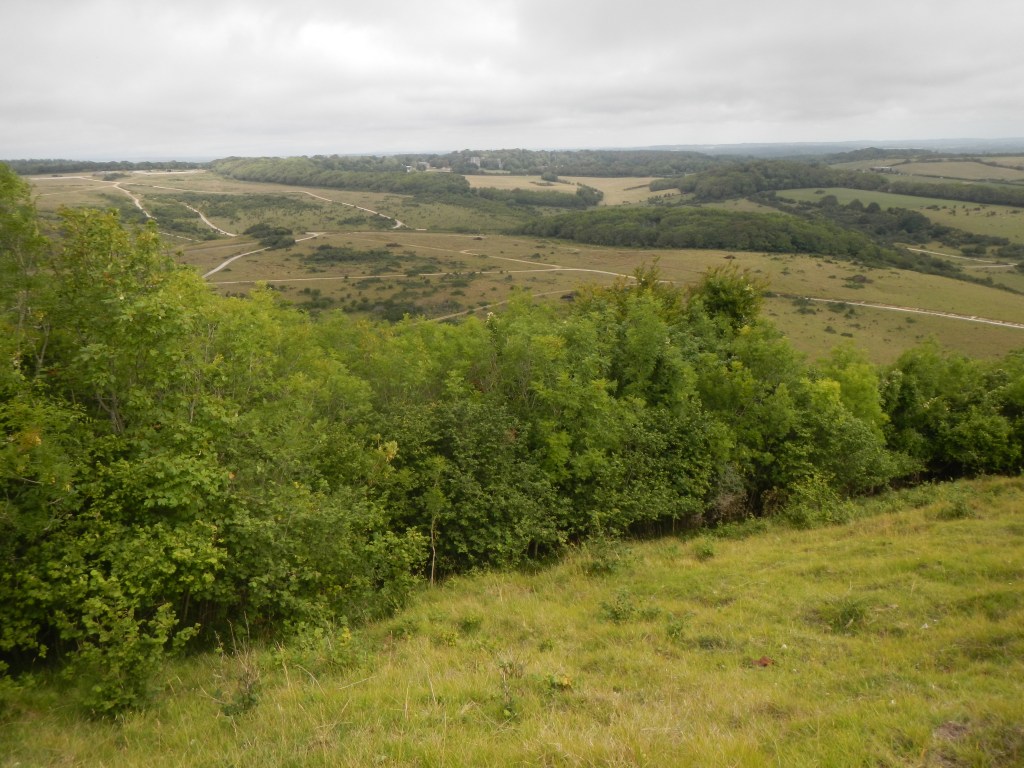
Views from the ridge were far ranging – seaward it was possible to see the coastal cliffs and also across to Portland. I was surprised to see what I initially thought were huge cross channel ferries coming out of Weymouth. In fact I discovered later that these were luxury cruise ships including the Queen Mary and the Queen Victoria moored in sheltered waters due to the current restrictions on cruises because of the Covid19 pandemic.
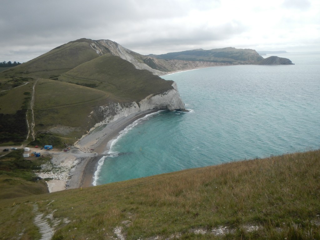
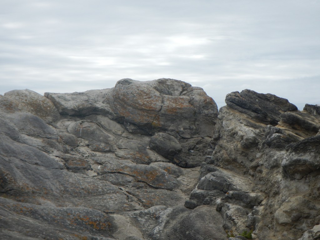
The path continued and I reached the cliffs above Mupe Bay before a steep descent to Arish Mell, where there were some men working near the beach. Almost immediately there was a steep ascent to Flower’s Barrow which is a genuine Iron Age Hill Fort, clearly recognisable as such by its deep concentric ditches and banks.
This is a real roller coaster of a path and, unsurprisingly, is classified as “severe” (the most strenuous category) by the South West Coast Path Association. Hence from Flower’s Barrow the route descended again almost to sea level at Worbarrow Bay. Suddenly there were more people. owing to a level walk from a car park a mile distant. However they were mainly making for the beach. I decided to take a short diversion (with another steep uphill) on to the otherwise deserted Worbarrow Tout, where there was a further impressive view point.
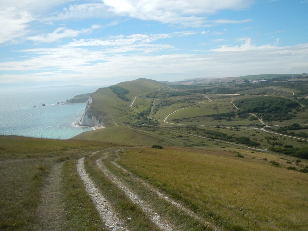
From there I descended again back to the main path and a further uphill before some relatively flat coastline walking. The coastline changed suddenly from the white chalk cliffs of the Lulworth area to the black oil bearing shales of Kimmeridge. I took the route towards Kimmeridge village maintaining much of the height I had gained. There were few people apart from a couple struggling to get their bikes over a stile (actually bikes aren’t permitted but I held my tongue).
I didn’t go all the way to Kimmeridge village as there was a path that turned off just after I left the range, passing through a farm with campsite. The earlier sunny weather seemed to have ended and there were a lot of clouds. I re-entered the range, going past some deserted farm buildings before reaching a small lane (meeting the cyclists I had seen before who were still off their bikes and pushing) that went down to Tyneham.
I was fortunate as the sun was out again and the threat of rain seemed to have passed. Due to Covid19 restrictions, the church, school and farm, which are usually open during the day when the range walks are open, were all closed. However it was still possible to wander round the village. The villagers were ordered to leave in December 1943 with twenty eight days notice given. The devastation that these people living in such a remote agricultural community must have experienced at this time seems unimaginable. It certainly makes me reflect that the changes in lifestyle that I am experiencing due to the Covid19 pandemic are trivial in comparison. They believed that one day they would return to their beloved village and home, leaving a poignant notice stuck on the church door:
“Please treat the church and houses with care. We have given up our homes, where many of us have lived for generations, to help win the war to keep men free. We will return one day and thank you for treating the village kindly.”
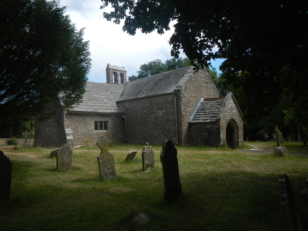
Sadly they have never been able to return as the land has continued to be an important army training area.
The website about Tyneham (http://www.tynehamopc.org.uk/) and surrounding area is extremely interesting. It also contains a lot of information about the other farms and dwellings in the area which were evacuated, remain entirely “off limits” to the public and even more “forgotten”.
The village with its adjacent car park was busy with tourists but the track up to Whiteway Hill only a few yards from the village was almost deserted. I was soon back in solitude at a vantage point on the ridge climbing to the trig point at 185m above sea level. There were dramatic views both seaward and to Lulworth Castle with the church adjacent to the castle clearly visible.
Soon I was back at Flower’s Barrow and had to retrace part of my morning route down to Arish Mell and then almost immediately the long steep climb almost to the summit of Bindon Hill. At that point I turned off my earlier route and took the turning following the coast path steeply downhill along what was at times a rather precarious path.
I detoured off to look at the Fossil Forest, undeterred by the notice warning of 97 steps down (and up). This area is the petrified remains of a cypress forest growing in a swamp on the edge of a warm lagoon in the Jurassic period.
From here, having climbed back up the 97 steps, I walked out on the cliff at the east side of Lulworth Cove, marvelling at the shape of this cove – almost a circle. Having taken in the views, I walked on and discovered that I could descend to the beach and walk round to the road rather than needing to ascend the hill yet again.
I walked back to my car, now covered in a layer of chalk blown up by the wind. Yes, I did remember to “check out” of the car park which was rather less full than when I had arrived.
I was fortunate – it hadn’t rained all day, although I discovered there had been heavy rain in Exeter. It did rain on the drive home – accomplished somewhat more quickly than the morning journey as I started by following signs to Dorchester. I was also lucky to have been able to get there and park – this weekend people have been turned away with car parks full even early in the day. Clearly it is adequately signposted!
