On Tuesday 14th July, I was fortunate enough to have a whole weekday free with no meeting and no work booked for the day or evening. The weather forecast was dull with possible showers but certainly nothing to spoil a good walk. When I walked the South West Coast Path in 2010, I took the official Coast Path route between North Hill and Bossington Hill rather than what is advertised as the slightly longer and more challenging “Rugged Cliff Top Path”. My reasoning is that it was raining, the ground was slippery and I had only just started my trek. Moreover my first day was a walk of around twenty miles all the way to Lynmouth and it being the end of October daylight was relatively limited. Hence returning to walk the less travelled way was unfinished business. I also wanted to incorporate the coast walk with a climb to Exmoor’s highest point at Dunkery Beacon.
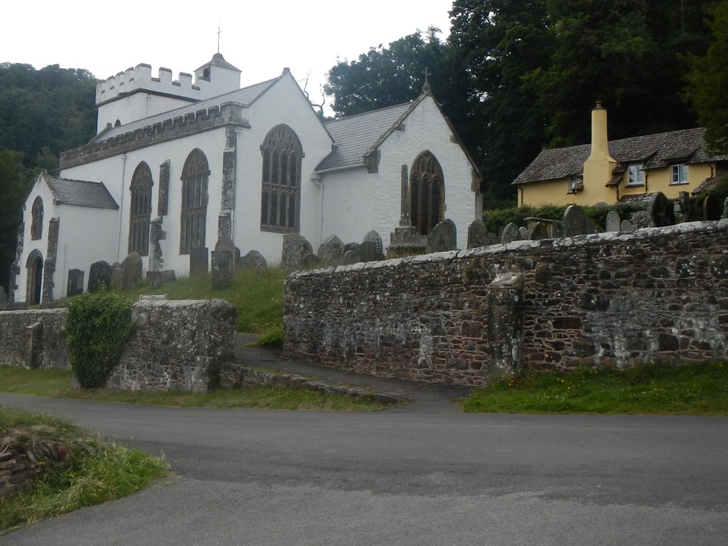
After much deliberation, I decided to start my trek from the picturesque village of Selworthy with its iconic whitewashed mediaeval church. Fortunately the small National Trust car park still had spaces. As I arrived, a group of four walkers were just setting off on their expedition. The light rain had stopped and the weather appeared to be brightening and set to improve as the day went on so I decided to walk clockwise, leaving the higher ground at Dunkery Beacon for the afternoon when the views might be better.
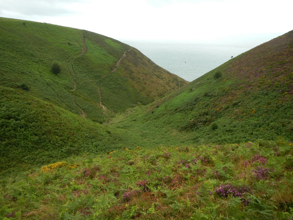
My first target was Selworthy Beacon. By the time I climbed there, the visibility was already improving and the view stretched far over Exmoor. I descended on the official coast path to the west end of the rugged path. The path is well defined and although exposed in places it is certainly not precipitous and is easy to walk. There was plenty to see with a profusion of plants including purple heather and foxgloves, some yellow gorse starting to flower, red berries on rowan trees and lots of green grass and bracken. As I walked on round the coast line down into combes and back up again I had excellent views across the Bristol Channel to the coast of South Wales. Ahead of me I could see the distinctive outlines of Flat Holm and Steep Holm (I can vouch for the trip to Steep Holm – an amazing day out, travelling by rib boat). I could hear the constant white noise of the waves on the shore below the steep cliffs, the intermittent song of birds and the rustle of wind on the vegetation. I could smell the distinctive scent of the bracken, a reminder that this is moorland at the coast. I could feel the gentle breeze in my hair. I was even able to pick a few bilberries, savouring their distinctive sharpness in my mouth. It was indeed an experience to be treasured involving all five senses.
All too soon, I found myself at the east end of the rugged path and making my way up towards North Hill, passing a few sleek and muscular brown Exmoor ponies.

Exmoor pony 
View over Minehead
My path led inland on a mixture of footpaths, tracks and minor roads. This included an extremely overgrown green road, the entrance to it barely visible between two high field hedges. There were clear views across the moor to the high point at Dunkery Beacon. My route followed a minor road for just over two miles. However there was barely any traffic and I occupied my time looking at the impressive old trees lining the route – a mix of species including oak, ash, beech and birch as well as hedges with hawthorn, wild roses, blackberries and hazel.
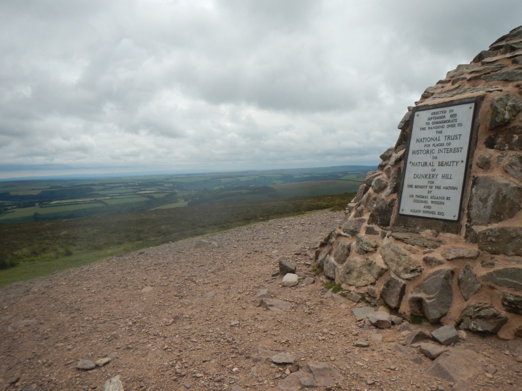
A footpath followed crossing a cricket pitch and, rather incongruously, a field where planes must be able to land (well there was a wind sock). Soon I was walking through a small area of mixed woodland before climbing up a stony track towards Dunkery Beacon. I stood at the edge as a mountain biker bounced down the hill on a tortuous trajectory trying to avoid the biggest boulders. I passed more ponies and had views across to the coast. It was definitely windy at the top. With the aid of the panorama viewpoint plaque, I was able to see Yes Tor on Dartmoor – amazing considering that when I was on Yes Tor itself a few weeks ago, I could barely see the Tor in the cloud. I was also able to see the white church at Selworthy close to where I had parked my car.
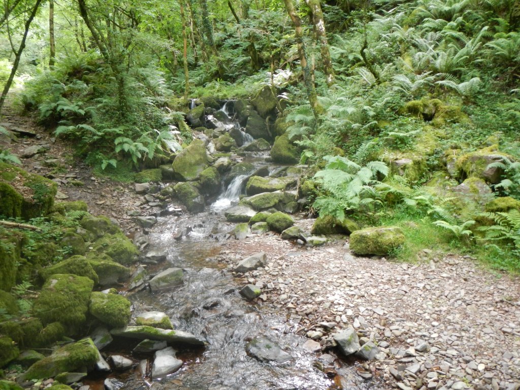
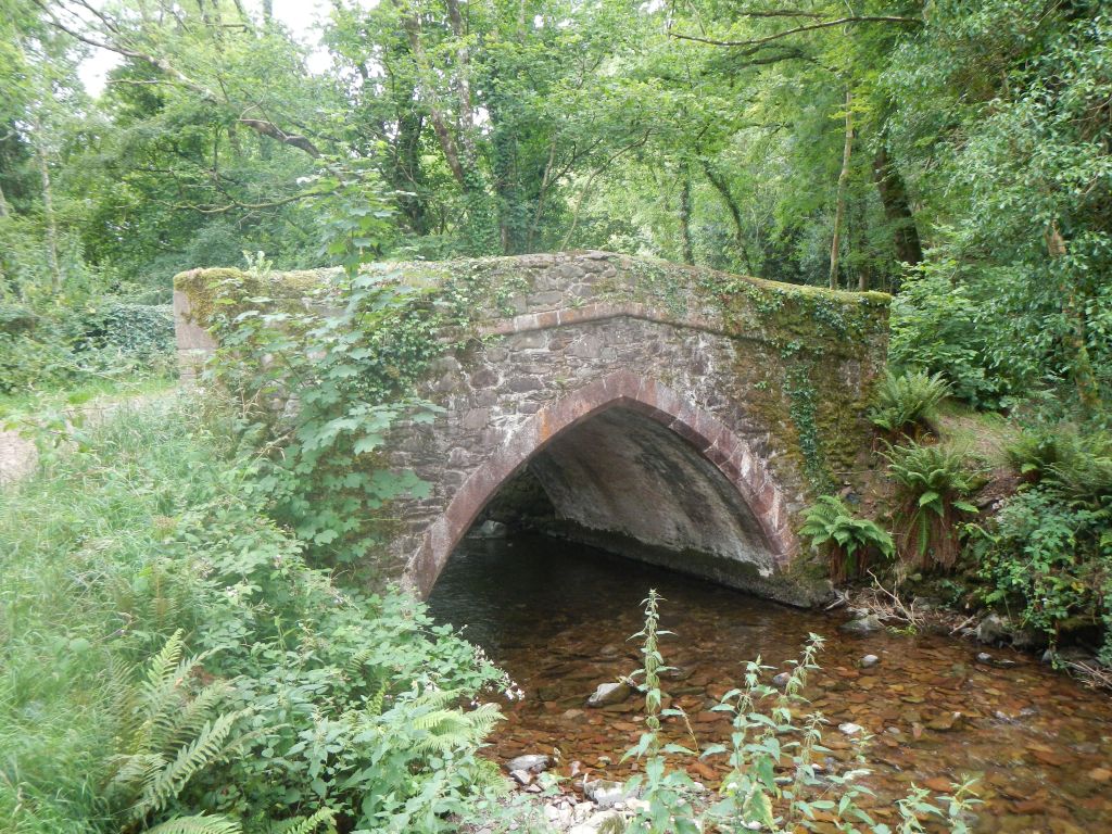
The descent was steep but easy and I had soon left the open moor to reach the southern extremity of Horner Woods. I found a clear stream-side path which kept crossing from one bank to the other of East Water and Horner Water. Amazingly all the crossings had footbridges even though it was easily possible to ford the shallow stony bedded stream wearing walking boots. This was interesting mixed woodland. Eventually the path turned into a track before going over an ancient packhorse bridge and reaching the road.
I walked on the road through the village and saw a sign pointing along what had looked like an insignificant footpath on the map. I realised that it would lead in exactly the right direction for me. It crossed a few fields with some fine looking “specimen” trees – very much a country estate which indeed this land had been prior to it being donated to the National Trust – before emerging on the A39 opposite the short length of minor road back to Selworthy.
I arrived back at my car just as the rain started. This was fortunate for me having enjoyed a walk completely in the dry. The only other car in the car park was occupied by a couple from South London taking a few days holiday and they had impulsively left the main road to take a quick look at the village.
This was an excellent twenty mile walk through interesting terrain where the moor indeed meets the sea. In addition, I had at last walked the “Rugged Cliff Top Path”.
