This walk of almost twenty miles undertaken on Sunday 12th July, includes incredibly varied terrain – coast, countryside, picturesque villages, wetlands as well as passing an Iron Age hill fort The main reason that I chose this adventure is because of the unique path through the Undercliff National Nature Reserve between Axe Bridge Golf Club and Lyme Regis. However the return part of my walk by a more inland route also turned out to be of interest.
I started with a stroll along the Seaton sea front, thronged with people unloading kayaks, paddleboards and other beach equipment from their cars. However after crossing the River Axe and passing the harbour, it became much less crowded and there was a steep climb over the golf course with magnificent views back past Seaton towards towering white chalk cliffs.
At the turn off to the Undercliff path, the notice warns that there is an arduous walk ahead which may take 3.5-4 hours with no way out except at either end. Having walked the path at different times of year, including after a fresh snow fall, this notice continues to excite me. I also realise that the walk is never precisely the same as new landslides are common – in fact a subsidiary notice warns of fresh landslips. My first two traverses, including the one in snow, were actually in part on a completely different route. Storms in the winter of 2013-14 leading to a major landslip, resulted in closure of the path until the spring of 2016. There were fears that the path might not be re-opened. A significant feature of the new path is that it crosses “Goat Island” which was previously off the path and not generally accessible.
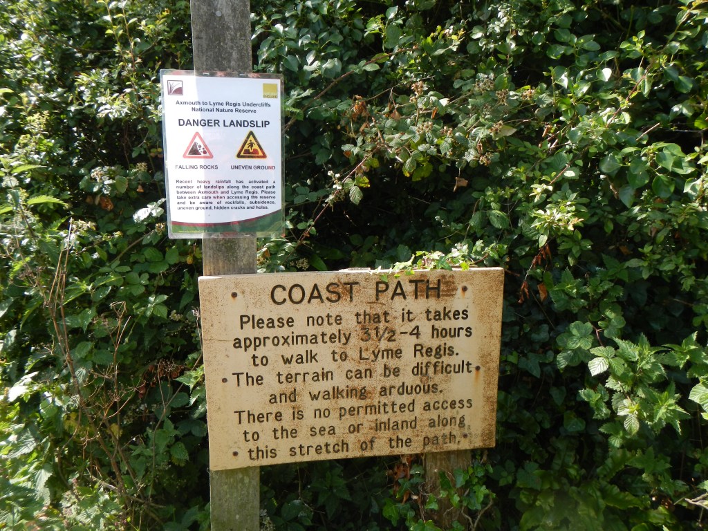
Warning notice 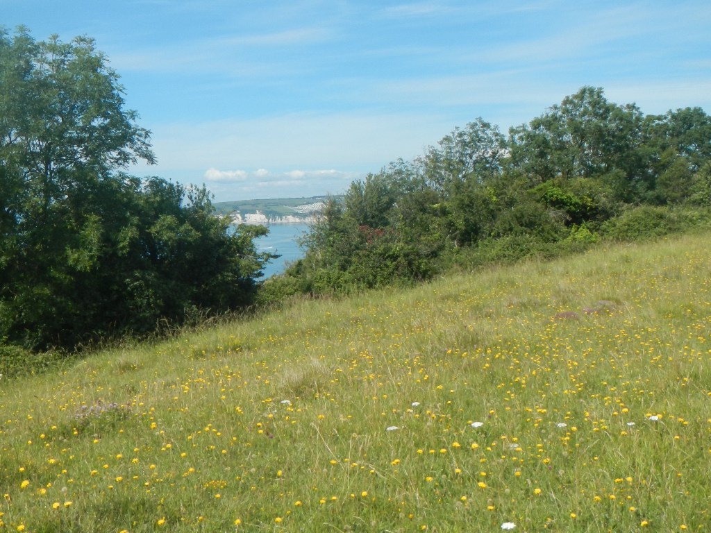
Goat Island 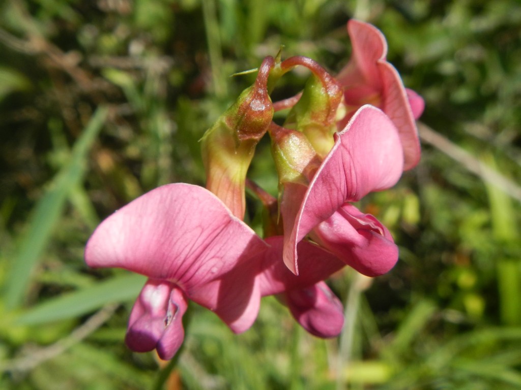
Wild orchid 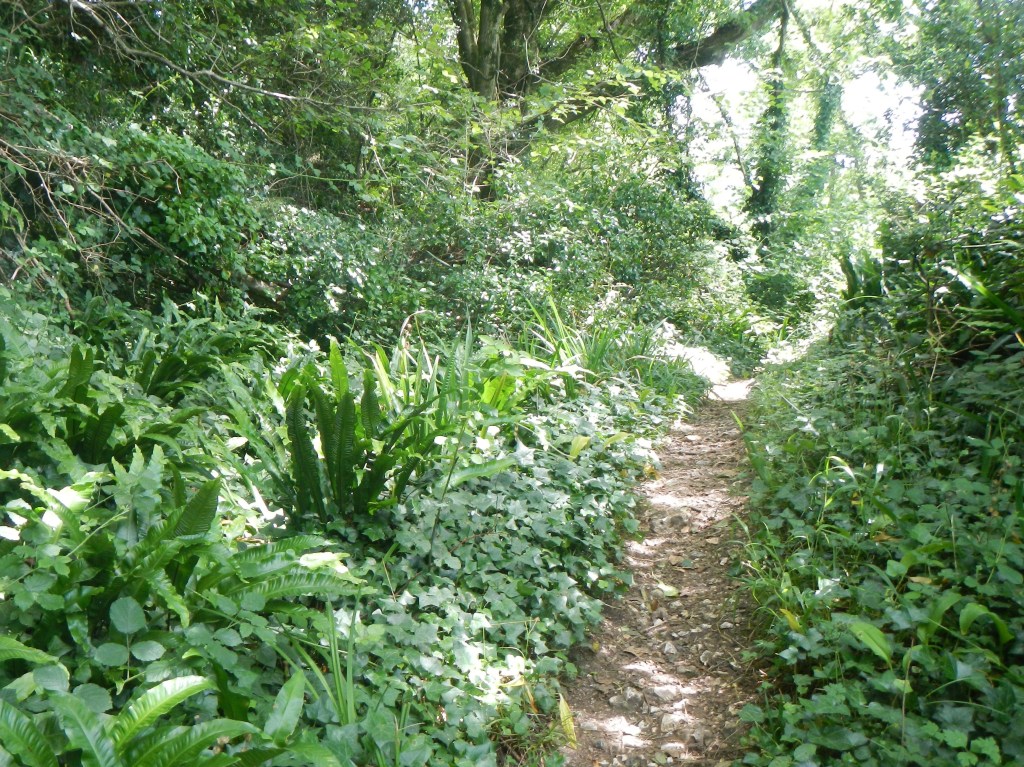
Path through the wilderness 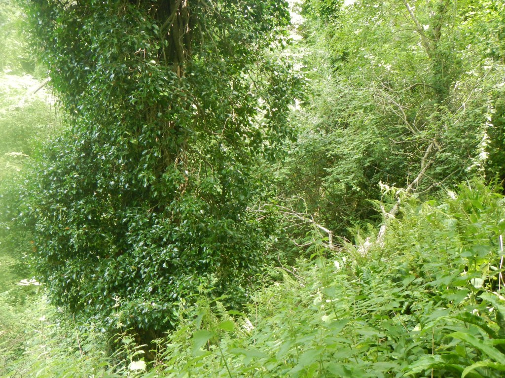
Dense green vegetation 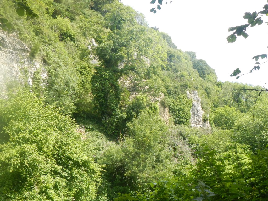
Towering unstable cliffs 
Rock pinnacles
Formation of “Goat Island” followed a major landslip in Christmas 1839. A large block of land was completely isolated from its neighbouring fields but remained flat and retained its crop of wheat and turnips. The “Island” became a tourist attraction attracting paddle steamers full of curious visitors – even Queen Victoria came to observe the scene from her Royal Yacht. Nowadays it is managed as an area of chalk grassland, raked every year to provide conditions for a range of rare plants and insects including orchids and the common blue butterfly.
Most of the rest of the path passes through a spectacular wilderness. Landslips create open ground which becomes colonised by grassland and scrub before becoming a natural woodland. The path is very clear and there is no need for a map except to judge how far you have walked along the route. The vegetation off the path is mainly very thick, the dense undergrowth hiding sheer drops, mudflows and deep fissures. Off the path there is the constant threat of rock fall from unstable cliff edges. Foliage in all shades of green predominates. There are multiple uprooted trees, the result of landslips. The silence is broken only by bird song, rustling of leaves in the wind and the occasional walker or runner passing along the path. Shafts of sunlight pass through the tree canopy and occasionally there is a also a break in the trees with a glimpse of the sea. Towards the land side, huge towering cliffs and pinnacles are sometimes visible. At times the pungent scent of wild garlic is wafted on the air.
Partway along the route, I discovered a short diversion to look at an early nineteenth century sheep wash. Sheep were washed before shearing as this increased the value of the fleece. The information board explains that, before the great landslip of 1839, much of the area was pasture with open fields and the woodland has grown up since then.
Soon I was walking down the hill into Lyme Regis. I had planned to walk along the Cobb (the scenic sea front). Unfortunately it appeared that a vast number of people had decided to visit Lyme Regis – well it was a lovely sunny, warm Sunday lunch time. I realised almost immediately that in our “new normal” this was not a sensible place to walk. Social distancing was impossible. I was surprised by how frightened and vulnerable I felt and yet how all these other people were content to wander in the melee. Less than a year ago, I am sure that I would have accepted this crowd as normal. I almost ran up the nearest hill to escape the masses.
It didn’t take long to get away from all those people wandering randomly in different directions. I found a fairly direct way on to a footpath following the shady banks of the River Lim, the path morphing seamlessly into the East Devon Way (or perhaps the Lim Trail was also the East Devon Way). In any case that was the path that I had intended to walk out of Lyme Regis so I was back on my route. The path was a bit more busy than the Undercliff, but not unreasonably crowded. It went past lots of big and expensive looking houses with large and well tended gardens. Soon I was at Uplyme, where there was a cricket match in progress – they haven’t wasted anytime starting their season following some relaxation of the Covid19 regulations. The path followed part of the boundary of the outfield and went in front of the club house.
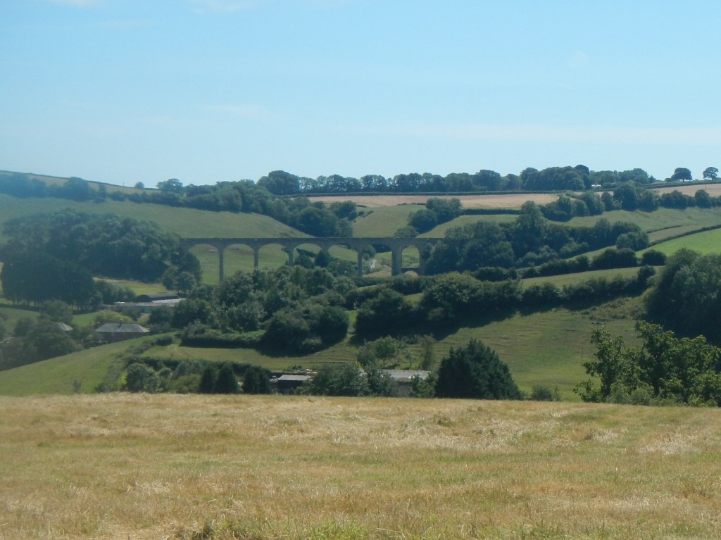
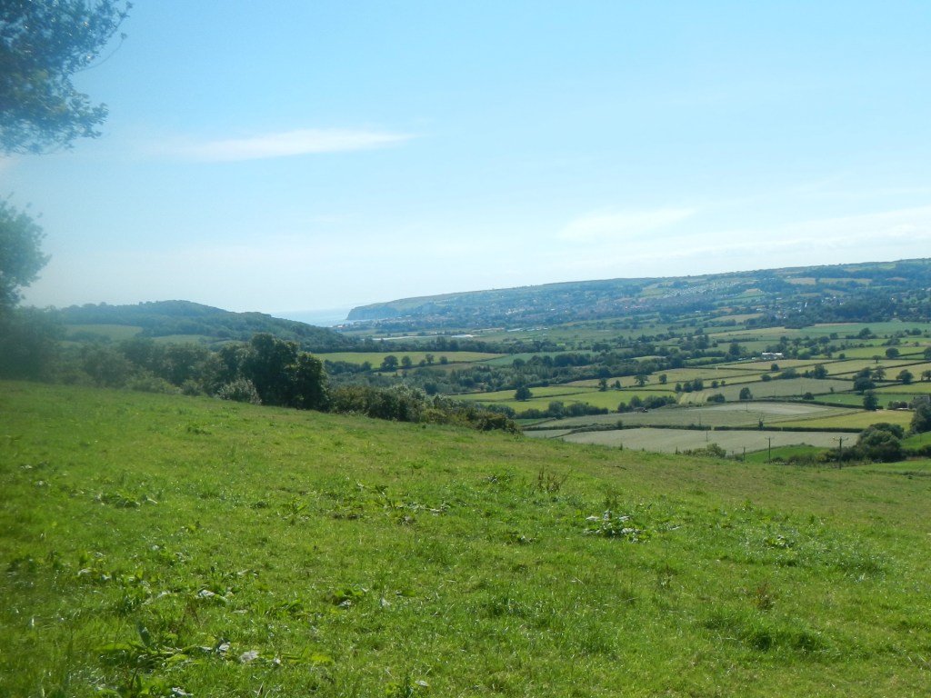
After Uplyme, the path was much quieter. The route followed a mixture of footpaths and quiet lanes with views to the south, including a small viaduct – which turns out to be on the railway line between Axminster and Lyme Regis that closed in 1965. After a lot of uphill, the path descended before rising even more steeply to Musbury Hill Fort. The steep hill of course provided a natural defence, but there are still large ditches in place. From here there was an excellent view down to the Axe Valley and my destination in Seaton.
View from lower part of Musbury Hill Fort 
Musbury Church
I descended down an equally steep hill to the picturesque village of Musbury with its parish church. Having crossed the busy “A” road, the path I was following appeared to go through a back garden before passing through a gate into a field where two cows, both looking interested in meeting occasional walkers, were lying very close to the path. I looked at my map and realised I could instead follow a road and reach a path along the banks of the River Axe. The thought of backtracking through someone’s garden was less concerning than of walking past two cows.
Soon I reached Colyford and from here I followed the minor road to Seaton before turning off along a footpath through the wetlands and hence back to my car.

