25 May 2013: 18km. Started 09:00. Arrived 15:00.
My alarm on my watch was set for 06:00 but I missed it and overslept until 06:40. There had been no rain but a very heavy dew. I took out some of the flysheet pegs to let the tent flap in the gentle breeze. The tent dried nicely as I prepared breakfast and chatted to the friendly caravanners who passed my tent on their way to walk their dogs on the footpath. It was sunny, cloudless and becoming warm. It was very easy to strew my stuff on the grass and pack my rucksack.
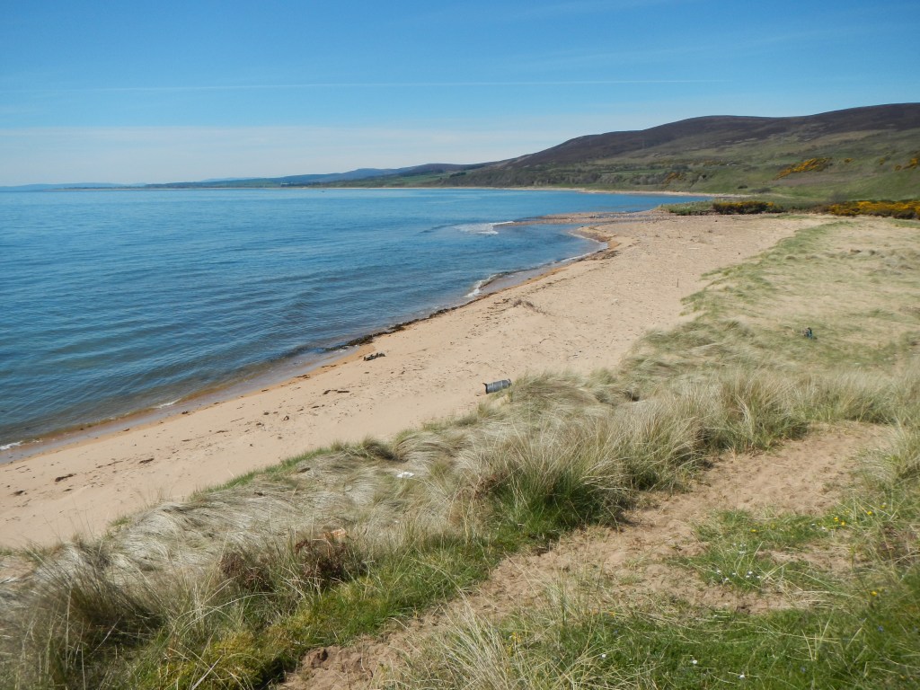
I wasn’t keen on the A9 and hoped that the path by the foreshore would continue so I could follow it. The coastal scenery was awesome – golden sand, clean looking pebbles, dune cliffs and all below a cloud free blue sky. I walked on a mixture of foreshore and bordering fields. In places there were rabbit burrows and so many rabbits that I was concerned about stepping on one. I saw lots of oyster catchers and Arctic terns. Sadly there soon wasn’t a path and I was scrambling over rocks as well as crossing barbed wire fences. This was difficult with my heavy backpack. I even had a couple of spells when I trespassed on to the railway line chippings where I maintained a high level of alertness listening out for trains.
At Lothbeg there was a river to cross and I got wet feet fording it. I recovered by taking an early lunch break at 11:30am, finishing the Cheddar cheese that I’d been carrying since Milngavie! However that wasn’t my oldest food – I still had oat cakes from Middleton-in-Teesdale way back in England on the Pennine Way.
After lunch, I gave up on the footpath and cut across some field paths on to the A9. However after only a few hundred metres, I saw from my map that for little extra distance I could spend some time on a lane parallel to the main road. I turned up and walked along a pleasant quiet lane with views of the sea and scattered houses plus the hamlet of Lothmore. Sadly one of the local population reminiscent of Victor Meldrew took exception to my diversion which was on a metalled road coloured yellow on the Ordnance Survey map. “Why have you come up here, not stopped on the main road? Now it’s the silly time of the year with droves of cyclists, people being pushed on beds, people in costumes etc. etc. and now someone coming past my house. Who told you to come up here?” I explained that I had seen the road myself on the map and realised that it took me off the A9 for a short distance so was more pleasant to walk along and that nobody had told me to walk along it. There was really no response he could make to that!
It did not put me off looking for alternative routes. Hence after another few hundred metres on the main road I took another diversion along a minor road. This one actually culminated in a footpath where a deer crashed through the undergrowth. The path was clearly not well used and went straight through some gorse bushes before opening up. I reached the main road yet again – there was a pavement through Portgower and then a road works area (culvert repairs). Pedestrians were meant to phone a mobile number for assistance through the area but there was only a voice mail when I tried. I walked through (it was Saturday afternoon so predictably there was no work going on). It was actually much easier than usual as part of the road was coned off for the repairs so I had my own safe area to walk along. As I approached Helmsdale, I turned off to keep away from the main road, heading towards Gartymore and West Helmsdale. There were good views over Helmsdale Harbour.
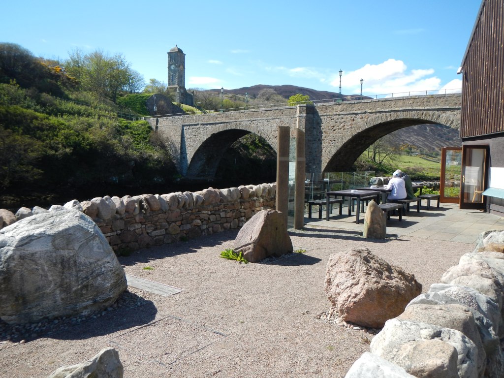
As I was so early arriving (only 3pm) I explored Helmsdale and then visited “Timespan” – a museum and café by the Telford Bridge. I had coffee and cake sitting outside overlooking the river.
The youth hostel was excellent with a warden who seemed to be genuinely interested in what every visitor was doing. There were several cyclists who were gearing up for their final push to John O’Groats the next day, but I was the only end to end walker staying that night. The warden recommended a camp site at Dunbeath and I noted that the sign in the town indicated 15 miles to Dunbeath.
