23 April 2013: 34km. Started 08:15. Arrived 18:15.
A prompt breakfast enabled an early start for this relatively long day. In terms of my overall journey, disappointingly it did not get me further north. However it was definitely a high spot for dramatic scenery.
I turned on to the path after crossing the bridge just outside the town. I would be following the River Tees for much of the day.
I had only been walking for about a mile when I saw Peter and Liz. Liz had her boot and sock off as she thought she had a blister on her heel. There was no blister but she had an extremely tender Achilles tendon. Sadly I think that was the end of her walk (and I think Peter didn’t want to proceed on alone). I felt very sorry for them having walked so far, but an inflamed Achilles could certainly not be ignored and would only get worse if she continued to walk.
The riverside walk was scenic, passing magnificent waterfalls – first Low Force and then High Force. There were two stone sheep sculptures as well as real sheep. Soon after High Force the land becomes more open and the path follows the river in a more westerly (and southerly) direction. I warily crossed a field with warnings about a bull – fortunately no bull seen. It was a path that was hard, narrow, rocky and stony in parts until I reached the third impressive waterfall of the day. Having made my way over boulders and stones along a narrow path, I had to take an exposed route up the rock alongside the waterfall. I met a couple near the top who explained that we were fortunate that the snow had cleared – they reported needing crampons on Scafell two weeks previously.
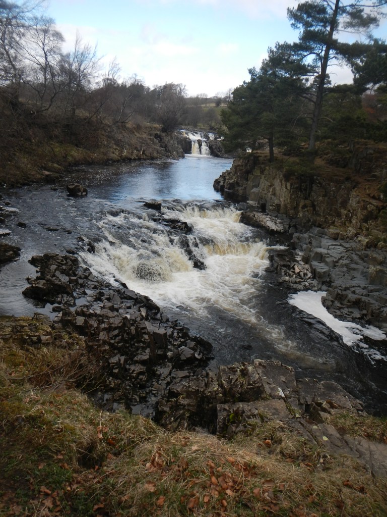
Low Force 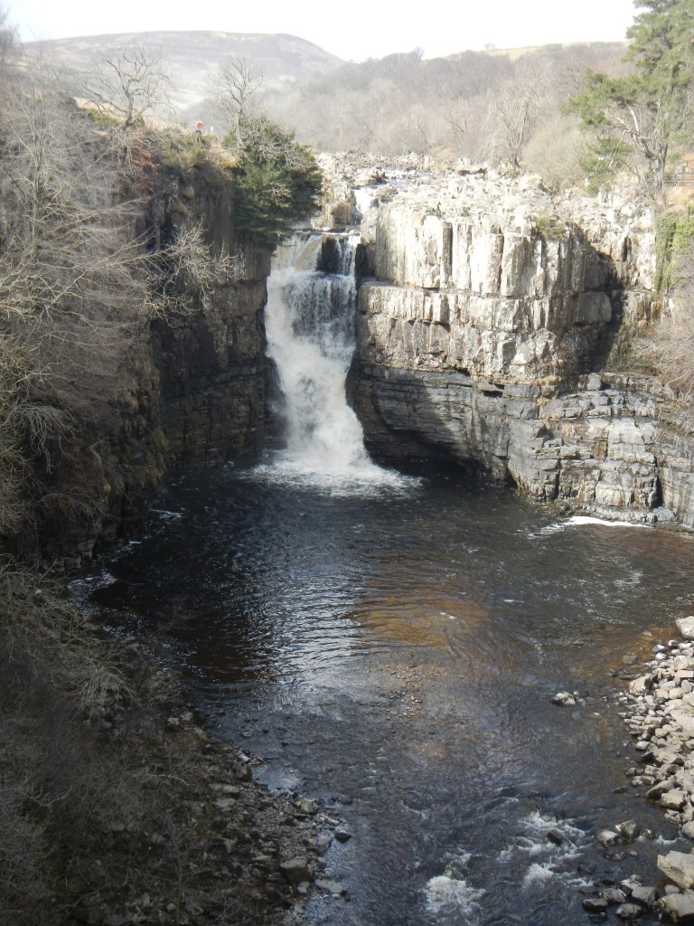
High Force 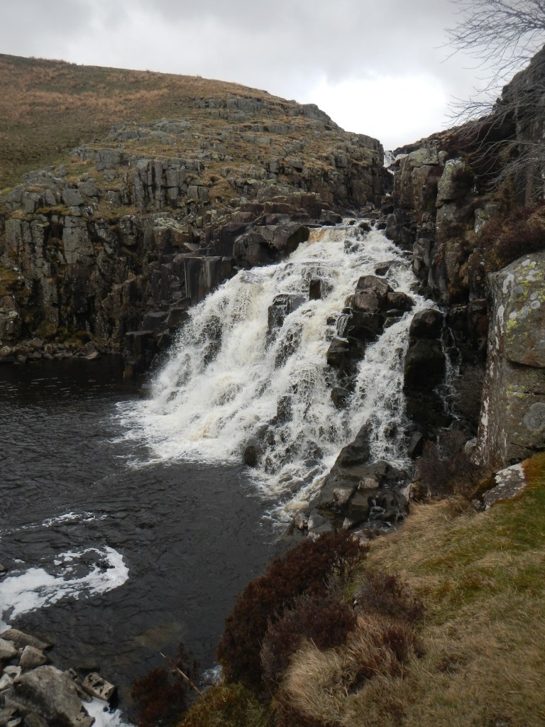
Cauldron Snout
That was the point of leaving the River Tees. There followed a hard walk into the wind passing near a military training area. I saw multiple warning notices although my route did not actually go into the area.
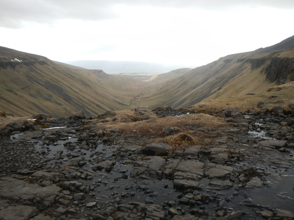
Next was one of the highlights of my entire walk. At one instant I seemed to be trekking over fairly featureless moor and the next moment an amazing vista opened up. This is High Cup. Like the impressive waterfalls earlier on, this dramatic feature arises due to the enormous sheet of dolerite called the Whin Sill forced into the limestone bedrock under immense pressure in a molten state about 295 million years ago.

The path onward was precipitous in places, but the views were impressive. I was lucky with the weather. After the first difficult parts there was a distinct track and then road downhill all the way to the attractive village of Dufton. This is centred round a village green, which features an ornate red coloured water pump. Tom’s boots were already at the youth hostel when I arrived. It had been a long and tiring day but through magnificent scenery.
